Yes, there are drones everywhere. Drones of every size from mini electronic insects to a rather nice Zeppelin remake that is cruising around Hall 4 at the Hamburg Messe. Will Intergeo 2016 mark “peak drone?” I’m thinking not.
The two main drivers of this year’s Intergeo conference are digitization and smart data, including Building Information Modelling (BIM). Hamburg itself is working at becoming a smart city, and the role of geodata and geospatial information is key to achieving the city planners dream of fast and efficient services for its “e-citizens.”
Remarkably, this key role is not always initially appreciated by ‘smart city’ innovators. Nigel Clifford, CEO of the UK’s venerable Ordnance Survey pointed out in the plenary conference session that the perception of the value derived from geospatial data is changing as location data “uniquely unlocks value in others’ data.” He also coined the term Geovation – something we will be hearing more about in years to come I am sure.
At the Trends in GNSS Positioning session, I was surprised to hear (or at least this how the translation came over) that both Herbert Landau of Trimble Terrasat GmbH and Bernhard Richter of Leica Geosystems were suggesting that if you bought their latest RTK/ PPP systems, you would never need to buy another one! Both had similar reasons: their systems had a “gazillion channels” for receiving positioning data, were equipped for multiple communication modes (terrestrial and satellite-based), had low power requirements but powerful computing on board, were easily portable, and the fact that in the near future some 120-140 GNSS satellites would be in the sky. This plethora of signals and multiple frequencies will allow a whole range of new possibilities.
Along these lines, NavCom Technology announced the release of its Onyx multi-frequency GNSS OEM board. Offering integrated StarFire/RTK GNSS capabilities, Onyx features 255-channel tracking, including multi-constellation support for GPS, GLONASS, BeiDou and Galileo.
Galileo Coming On Strong. Talking of new signals in space, what is the news on Galileo Initial Services? Reinhard Blasi of the European GNSS Agency (GSA) gave an update at the conference, and we can expect to see Initial Services by “the end of 2016.” Reinhard thinks that once services are established, Galileo will be in a leading position as GPS is between system upgrades and the E5 signal has some unique features.
Figure 2.2: Normalized autocorrelation functions for different modulations: BPSK of GPS L1, BOC of Galileo E1 with simplified demodulation4, CBOC of Galileo E1 and AltBOC of Galileo E5 signals5. Source: [Silva et al., 2012]Galileo for Mass Market. This belief was supported at the ceremony for the Young Surveyors competition organised by the Council of European Geodetic Surveyors (CLGE) at the end of the first day at Intergeo. In the Galileo, EGNOS and Copernicus category the winner was Cecile Deprez from the University of Liege. She had looked at the possibilities for greater precision in mass market applications that might be possible by accessing the Galileo E5 AltBLOC. And the answer is yes it can. In fact she described the performance as “outstanding” compared to other GNSS signals. Which is probably fair comment.
See what you think. Along with Desprez “Relative Positioning with Galileo E5 AltBOC Code Measurements,” you can find all the papers entered for the award on the CLGE website: http://www.clge.eu.
With Galileo Initial Services at last on the horizon and a quadruple satellite launch scheduled for November, here’s hoping that Europe’s GNSS constellation will be delivering limited, but reliable, global PNT services before the year is out.
The four Galileo satellites for Arianespace’s first Ariane 5 mission for the constellation are being prepared at ESA’s launch facility in French Guiana. The flight is scheduled for 17 November. However neither these four new satellites, nor the two orbited in May, are required to deliver Galileo Initial Services, which should be launched officially some time in November. Fingers crossed.
The European GNSS Agency (GSA) is gearing up to assume its operational role for Galileo in early 2017. During the summer the GSA formally accepted their Loyola de Palacio facility in Madrid, Spain that houses the European GNSS Service Centre (GSC). This is a significant milestone in the development of the programme and its service provision as Galileo’s “door to the GNSS world” as GSA Executive Director Carlo des Dorides described the facility at the handover ceremony.
GSA already oversees the operation and service provision for the European Geostationary Navigation Overlay Service (EGNOS) (since 2015) along with managing the security accreditation and general security provision for both programmes.
The GSC offers over 1,100 square metres of space and currently employs over 40 people. Since 2013, the core team at GSC has been providing limited services and working as a precursor to GSC v1. Its key work includes supporting the lead up to Galileo Initial Services provision, along with operating the GSC Helpdesk, disseminating orbital products to the Search and Rescue (SAR) community, supporting GNSS-related research and industrial activity and monitoring user satisfaction. Once operational, GSC v1 will be connected to the Galileo core system, thus enabling the long anticipated Commercial Service. This service is expected to enter operations by mid-2017.
Once the Galileo Operations Contract is awarded and Initial Services officially declared, the GSC is expected to see a significant increase in staff.
Also in the summer CNES President and France’s inter-ministerial coordinator for European satellite navigation programmes Jean-Yves Le Gall was elected as the new chair of the GSA Administrative Board with Mark Bacon, representing the United Kingdom, elected as deputy chair.
“I am honoured to have been elected chair of the GSA Administrative Board, with Galileo now poised to enter its operational phase,” said Le Gall. “This election confirms the desire of Member States to join forces on the cusp of a prolific period for European space as we move Galileo towards full operational capability.”
Brexit blues?
Mark Bacon added “I am very pleased to have been elected to work with the Board and I look forward to helping the GSA deliver on the Galileo and EGNOS programmes over the coming years.” However the UK’s decision to leave the EU (Brexit) must make his position rather uncomfortable – and temporary – to say the least.
The GSA Administrative Board is composed of representatives from each EU Member State, the European Commission, and the EU parliament. The Board meets three times per year to ensure that the Agency performs its tasks correctly. As things stand if the UK is no longer an EU Member State it must lose its representative(s) on the advisory board.
However, the relationship between the UK and EU space programmes is, of course, subject to the Brexit negotiations. The UK will almost certainly remain a member of the European Space Agency (ESA) as this is a pan-European body not an EU agency, however when it leaves the EU the country will have to renegotiate terms if it wants to continue to participate in the key EU programmes such as Galileo GNSS and Copernicus Earth Observation system.
The ESA is autonomous from the EU and should not be directly affected by Brexit confirmed Jean Bruston, head of ESA’s EU policy office at a media briefing in mid-September. But “As soon as it [Britain] is leaving the EU it is not participating in these programmes [Galileo / Copernicus] any longer,” he observed.
In addition, UK-based companies hold contracts worth tens of millions of euros from ESA to supply hardware for the Copernicus and Galileo GNSS. “If nothing changes [and Brexit goes ahead], we would have to stop these contracts,” said Bruston bluntly.
Of course, Britain could still contribute to Galileo and Copernicus if it negotiated a third-party agreement with the EU, as Norway and Switzerland (both non EU members) have done. The down side is that this may take some time to initiate, let alone complete, and if Britain sticks to its guns on issues such as free movement of people then the likelihood of a successful outcome for the UK is not high.
In an interview with French media ESA director-general Jan Woerner reinforced Bruston’s views saying that “the UK will remain a member state of ESA, this is very clear” but also continuing “As we are also dealing with European programmes like Copernicus and Galileo, and also the question of UK citizens working on the continent and all these legal issues, we have to take this into account.”
EU opportunity
Many in ‘continental Europe’, as we Brits so often condescend to describe our fellow Europeans, will be more than happy to see the U.K. no longer participating in deciding key aspects of EU space and other policy areas.
It is no coincidence that the European Commission has become much more vocal on plans for a European defence force since the Brits announced their departure. The U.K. has long been opposed to the concept of an ‘EU Army.’ However planning and military cooperation between Member States outside normal NATO channels has been increasing over many years. The small and discreet (so discreet that I didn’t realise the exact location of its HQ in Brussels until the recent terrorist incidents meant burly Belgian paratroopers were stationed outside and I asked them what they were guarding. Has to be said they were not discreet!) has seen its budget frozen for the last five years, but this may now change.
The interface of EU space and defence policy – in particular ‘dual use’ issues – will also become simpler without the U.K.’s protests. A leaked draft of the upcoming EU Space Policy communication talked directly of dual-use synergies to reinforce security from space, in particular to reduce costs and improve efficiency, and that the next generation of EU GNSS and Copernicus programmes should be designed from the start to be more relevant for security purposes. Defence-related research is also slated for future Horizon 2020 calls.
The draft policy document also underlines that with EU space programmes becoming fully operational, building stability, trust and confidence in users is a key objective. Current services must be fully deployed and their long-term continuity and evolution assured. This continuity should be driven by user needs and take into consideration the mid-term (hardly mid-term for Galileo!) evaluation of the programmes that should happen in 2017. For Galileo and EGNOS, the document looks to improvements in the current services, including greater robustness and performance, and provision of additional services, such as regional or timing services.
California dreaming
So with Brexit what is the U.K.’s GNSS – and space-related – industry and research community to do? Of course many of the UK industrial players are multi-national companies and internal transfer of people and/ or projects will overcome many issues. And bi-lateral collaborative agreements on exchange of talent and ideas between partners can also achieve the same results for smaller companies and research groups. However not having a seat in the policy process and the development of programmes will put ‘UK plc’ at a distinct disadvantage in my opinion.
But U.K. leaders say that Brexit is an opportunity to be seized and that the U.K. should be looking to sell goods and services in other global markets than the EU. Which is something most U.K. industry has been doing since trade/ time began. And in my experience U.K. business leaders have always been much more eager to go jump on a plane to the States or Australia than go visit their European neighbours – something to do with our renowned national language skills perhaps?
Space is no exception – and one that has been shown to be a success in recent times. A helping hand is provided by InnovateUK, the U.K.’s government innovation agency, that is organising its third ‘Space Mission UK’ to the US in November. These are trade and investment missions specifically designed to support U.K. start-up companies to build world-leading space and satellite application businesses.
Space Mission 1 visited Utah, LA and Silicon Valley in August 2015 and Space Mission 2 landed in Houston in November 2015. Space Mission 3 will visit San Francisco and LA from 5-11 November this year.
Mission programmes are varied but typically include visits to companies working at the forefront of the sector, networking opportunities with investors and corporate venture people interested in space, visits to incubators, accelerators and technology hubs, and masterclasses on pitch development, business culture and market entry.
The previous two Space Missions have had immediate impact for the companies involved, including securing over £1 million in investment, and initiating collaborations with major organisations such as NASA and (ironically) ESA, and winning contracts with the UK Ministry of Defence at home.
GNSS-related companies in previous missions include Arralis who build high-end semiconductor chips but have also been funded to develop novel GNSS antennas, and an exciting data fusion start-up – Gyana – that takes complex inputs from multiple data sources, including satellite, to build simple to understand 3D situational images. The founder of the business, engineering graduate Joyeeta Das, has raised US $1.1m since the mission.
You can find a complete list of companies who have participated on the previous missions here.
The selection for Space Mission 3 has closed and I am told there is at least one GNSS applications company that has been chosen to be on the plane in November. Good luck to them all!
Google emergency LBS upgrade
E112 is a location-based version of the 112 universal European emergency number, where the telecommunication operator transmits location information to the emergency centre in parallel to the call itself. With more than 70 percent of calls to emergency services coming from mobile phones, getting help fast and efficiently to the caller can be challenging if they don’t know where they are. Now, in a major step forward for implementation, Google has created and rolled out in two European countries (U.K. and Estonia) its Emergency Location Service on Android, with other regions to follow. The feature, when supported by the caller’s network, sends the phone’s location to emergency services when the 112 (or equivalent) emergency number is dialed.
Emergency Location Service is supported by more than 99 percent of existing Android devices (version 2.3 and above) through Google Play services. The service activates when supported by the mobile network operator or emergency infrastructure provider.
The new geographical location system claims to identify the source of a mobile phone emergency call to typically within 0.003 square kilometres (less than half the size of a football field) instead of a current average of around 12 square kilometres.
When an emergency call is made with an enabled Android smartphone, the phone automatically activates its location service and sends its position by text message to the 112 service. This usually takes less than 20 seconds. This text message is not visible on the handset and is not charged for.
And the first European Galileo-ready smartphone has been launched with the Aquaris X5 Plus smartphone, produced by the Spanish technology company BQ, and based on the Galileo-supported Qualcomm Snapdragon 652 processor with Galileo capability accessible via a software update to be released in Quarter 4 2016.
U.S.-based Qualcomm announced in June that it was adding support for Galileo across its Snapdragon processor and modern portfolios for smartphone, computing, automotive and IoT applications.
As well as Galileo capability, the Aquaris X5 Plus is powered by the latest Google Android OS and has all the usual features of a top end smart phone including 16 mega pixel ‘back’ camera and support for 4k video recording with a stabiliser and fingerprint recognition for added security.
If you want to take the pulse of the GNSS user technology industry and keep up with the latest trends then you’ll need to get your hands on the GSA’s GNSS User Technology Report due out at the beginning of October.
The 2016 report will be launched on 4 October as part of the Horizon 2020 Space Information Days in Prague. This two-day GSA-hosted event will introduce the third call for GSA-funded Horizon 2020 research and innovation proposals for Galileo and EGNOS.
The document will take an in-depth look at the latest state-of-the-art GNSS receiver technology, along with providing expert analysis on the various trends that are defining the future global GNSS technology landscape. The report will focus on three key areas: mass market solutions; transport safety and liability-critical solutions; and high precision, timing and asset management solutions.
Pulsar GNSS for deep space
The use of pulsars, highly magnetized, rotating neutron star that emits a beam of electromagnetic radiation with a very precise period, have been potential candidates for a deep space navigation system for many years. Now a paper from the U.K.’s National Physical Laboratory (NPL) and the University of Leicester shows that pulsars can be used to obtain position along a particular direction in space to an accuracy of two kilometres in the direction of the pulsar. Furthermore such a technology could operate autonomously and greatly increase the number and capabilities of space missions, the paper claims.
To calculate their position a space craft would need to carry a small X-ray telescope. The method uses X-rays emitted from pulsars, which can be used to work out the position of a craft in space in 3 dimensions to an accuracy of 30 km at the distance of Neptune. Certain types of pulsar, called ‘millisecond pulsars’, emit pulses of radiation with the regularity and precision of an atomic clock and therefore could be used much like GNSNS in space.
The paper, published in Experimental Astronomy[1], details simulations undertaken using data, such as the pulsar positions and a craft’s distance from the Sun, for an ESA feasibility study of the concept. The simulations took these data and tested the concept of triangulation by pulsars with current X-ray telescope technology and state-of-the art position, velocity and timing analysis. This generated a list of usable pulsars and measurements of how accurately a small telescope can lock onto these pulsars and calculate a location.
The key finding was that at a distance of 30 astronomical units – the approximate distance of Neptune from the Earth – an accuracy of 2km or 5km can be calculated in the direction of a particular pulsar (PSR B1937+21) by locking onto the pulsar for ten or one hours respectively and that by locking onto three pulsars, a 3D location with an accuracy of 30km can be calculated.
This is an improvement on the current navigation methods of the ground-based Deep Space Network (DSN) and European Space Tracking (ESTRACK) network as it could be autonomous with no need for Earth contact for months or years, if an advanced atomic clock is also on the craft. Also ESTRACK and DSN can only track a small number of spacecraft at any one time. It is also possible that the pulsar technique could be quicker.
Dr Setnam Shemar from NPL commented: “How these [space]craft navigate will in future become a limiting factor to our ambitions. The cost of maintaining current large ground-based communications systems based on radio waves is high and they can only communicate with a small number of craft at a time. Using pulsars as location beacons in space, together with a space atomic clock, allows for autonomy and greater capability in the outer solar system.”
This simulation uses real-world technology and proves its capabilities for this navigation task. The X-ray telescope can be launched into space due to its low weight and size and it will be flown on a mission to Mercury in 2018. Could we be seeing the emergence of a navigation technology that can enable a new era of space exploration?
And with that look into the future it is time to say “adios” to this column. From now on my EAGER dispatches will be sprinkled through other GPS World imprints and platforms. I’ll be at the global geospatial fun-fest that is Intergeo in Hamburg in October and sniffing around the first Galileo ‘hackathon’ in Berlin in early November, so I hope to see many of you at those and subsequent Euro-GNSS events in the future.
A bientot as they say in these parts.
[1] Towards practical autonomous deep-space navigation using X-Ray pulsar timing’ Shemar, S., Fraser, G., Heil, L. et al. Exp Astron (2016). doi:10.1007/s10686-016-9496-z
Good grief, it has been a wild week or two. I was hoping that I wouldn’t need to talk about the incredible, excruciating UK referendum on European Union membership, but as the result has gone to the “leave” campaign, I feel obliged to pick over the wreckage.
What does a UK exit from the EU mean for EU space programmes and Galileo in particular?
First: UK involvement in the European Space Agency (ESA) should be unaffected by the exit of the UK from the European Union as this is a separate institution. However, one could argue that non-membership of the EU might diminish its voice and could require a higher financial contribution.
Bids for the next Galileo satellite purchase contracts are due to be submitted in mid-July, and the European Commission has indicated that it will consider them purely on commercial terms. This is good news for the OHB System and Surrey Satellite Technology Limited (SSTL) consortium. And also for the Commission. If I were a betting man, I’d still wager the house on the incumbent consortium winning the contract to provide the remaining satellites required to provide a sustainable, 24/7 operational constellation for 1st generation Galileo. There would, in my opinion, be an unwarranted technical risk in doing anything else.
However, for the next generation it is open season of course.
Jewel in the Crown at Risk. But the real worry must be the Public Regulated Service (PRS). This is the unique feature of Galileo that is of great interest to civil and military authorities in Europe and beyond, due to its more robust encrypted signal and its potential anti-jamming and spoofing characteristics. Currently PRS will only available to EU Member States. In fact access to a PRS workshop at the European Space Solutions event (see below) was strictly “EU citizens only.” However, other countries, including the US and Norway, have indicated that they would love to be able to use it as well. No final decision on this has yet been made.
The loss of the automatic right to access PRS would be damaging to the UK, and potentially to the full Galileo deployment timetable, as the country is currently host to the back-up Galileo Security Monitoring Centre (GSMC) — an essential part of PRS infrastructure — and I cannot see any part of the PRS infrastructure being left in a non EU Member State. PRS has been described as the “jewel in the Galileo crown,” but if the centre must be relocated then deployment of the full service could be delayed.
In addition, the UK involvement in research and innovation activities around PRS may well be curtailed, even if other work on Galileo projects is not.
The UK has been a leader in developing PRS applications. For example, Mark Dumville and colleagues at Nottingham Scientific Limited (NSL) have recently provided some very impressive demonstrations of cloud-based PRS applications including the first demonstration of the implementation of PRS authentication for an offender tag that was demonstrated using live Galileo (and GPS) signals. The demonstration provided real-time authentication flag generation, release and delivery to users. A second demonstration used cloud-based PRS in a proof-of-concept remote unattended, timing station where the primary user requirement was 100% confidence for the validity of signal. And a third demonstration illustrated the use of cloud-based PRS on a drone. “For users, demonstration of accreditation is key,” said Dumville when describing these results at the European Space Solutions event.
Personally as a British citizen, and one who has spent the last 15 years in and out of the Brussels bubble, I see the EU referendum result as a national tragedy of epic proportions; and one that has been a long time in the making. Many global commentators are saying the UK has shot itself in the foot; sadly, in my opinion, it is much, much worse than that.
United Europe
The referendum news has certainly put a dampener on what I was hoping to be an optimistic, forward-looking article following the European Space Solution event in The Hague at the end of May. This was the fourth European Space Solutions conference and exhibition, attracting a large, global audience of policy-makers and industry players.
At a press briefing just before the event kicked off on 30 May, and after an informal EU competitiveness ministerial council, Dutch minister for Economic Affairs Henk Kamp spoke about the ideas behind the forthcoming EU Space Policy. The policy, which should appear in the autumn/ fall, aims to elaborate a single and coherent European space strategy that will be the foundation of space programmes up to 2030.
The policy will look to achieve three clear objectives:
to develop a strategy to ensure Europe maintains a strong and globally competitive space sector both upstream and in terms of use of data from space;
ensure independent access for Europe to space;
and maintain and upgrade the existing European space infrastructure — namely Galileo and Copernicus.
Growth Vectors. Elżbieta Bieńkowska, the European Commissioner with responsibility for EU space programmes, indicated that the space policy would provide a “Coherent space vision for decades to come” and would be subject to public consultation. She was looking for “Maximum return on current programmes … and to respond to emerging needs in areas such as climate and security sectors.” The strategy will consider space-enabled solutions to societal challenges and as vectors for growth.
She mentioned more than once that she is looking for long-term sustainability for the sector: a space sector that is able to adapt to disruptive technologies and maintain its competitive edge. My interpretation of this is that public money (from Europe) may not be as plentiful as previously, and the Commission will be looking for greater leverage of its tax Euros — that is, the private sector will need to invest more.
Lowri Evans, Director-General for Internal Market, Industry, Entrepreneurship and SMEs, at the European Commission took up this theme. She saw huge opportunities as the cost of entry to the sector diminished, however private investment was still a problem. There was not enough in the EU and this must change. The Commission is aiming to create an environment for successful investment, she claimed.
Jan Worner, the very positive Director-General of ESA said that “Space was indispensable” as an instrument for economic growth. It was also fascinating and inspiring. He felt it was also important that the different players in the EU space scene are working together for a “United Space in Europe.”
The conference was also the venue for the official signing of the agreement for the future Galileo Reference Centre (GRC) that is to be established at Noordwijk in The Netherlands. The centre will play a crucial role in independently monitoring and reporting on Galileo’s performance and the quality of the system’s signal in space.
Dual-Use Debate
PRS was also a major talking point at the European Space Solution’s panel on ‘Space and Security.’ Despite the fact that Galileo is marketed as a civil controlled GNSS, “dual use” is becoming a potentially divisive area for debate. Marian-Jean Marinescu, MEP said there was a need for a common European defence and security strategy that includes securing all elements of the space value chain.
Rini Goos from the European Defence Agency (EDA) said that the EU needed space systems to be able to “intervene successfully” and that space strategy needed to support Member State defence capabilities. This meant that the next generation of EU space systems must have dual-use capability. NATO is entrusted with external defence of the EU, but the Commission also needs to be able to provide defence, not just consume it, he concluded.
Current Chairman of the Galileo Security Accreditation Board is a UK citizen – Jeremy Blyth. He said: “Space and Security, Security and Space. Whichever way we say it what is clear is that the two are inextricably linked together.” He believes that to ensure security it must be there “designed in from the beginning.” Security is an enabler, rather than a barrier, he claimed.
He also believes that PRS gives the EU a real and competitive edge in secure positioning. However he indicated that there is a need to think deeply and have a rational debate about dual-use systems and in particular about the interface between civil and military use.
Clearly there is a growing tension with regard to overtly military use of Galileo both now and in future generations of the system. Although a largely philosophical debate, given who in reality will be controlling and using PRS within many Member States, many European and national policy makers will want to retain the “purity” of Galileo as a global positioning system under fully civilian control.
PRS Workshop
Security was also a key feature of the PRS workshop organised by the Netherlands EU Presidency towards the end of European Space Solutions. Ger Nieuwpoort, Director of the Netherlands Space Office (NSO) reminded the audience that “For civil authorities, PRS provides the same level of security for Member States as the military in GPS.” While Christoph Kautz from the Commission said that the “Rationale for PRS was threats and user needs: better availability, high continuity, authentication, access control, exclusivity.”
PRS offers defence in depth with a robust signal in space providing higher protection plus strong encryption on ranging codes, and the navigation and service messages. And the access to the technology is highly restricted.
However some issues still need to be resolved. Bart Banning of the Netherlands Institute of Navigation asked ‘How will we use PRS?’ In terms of its use for protecting critical infrastructure, what if the owner of the infrastructure was a private company? Should it be granted access to PRS or have to make do with the Galileo Commercial Service aka PRS-lite?
He also pointed out that PRS was no more protected against jamming than any other GNSS. And, currently, it was “not good for in-building, underground, or underwater.”
He thought PRS could be a great time provider, but probably also need ground transmission, possibly via legacy radio towers. However, he saw the “killer app” for PRS being asset tracking of, for example, diamonds, VIPs or prisoners. He also agreed that for many EU countries the ministry of defence will be overseeing PRS services. “PRS is a good and unique addition to GNSS — but not the answer to all our needs.”
Banning also highlighted the issue of commercial companies looking to buy LORAN / e-LORAN sites in Europe to provide a commercial service to back up GNSS. After the recent GPS timing glitch he said that the “timing community” had woken up to the vulnerability of their operations.
Geospatial
On a different tack, from 23–26 May the eighth edition of the Geospatial World Forum [www.geospatialworldforum.org] took place in Rotterdam, attracting professionals from the surveying and geoinformatic systems (GIS) sectors. I attended the event on 24 May and took part in a workshop that looked at the benefits of Galileo and EGNOS in geospatial applications in the context of the imminent launch of Galileo initial services.
An industry survey undertaken by the GSA indicates that already more than 80% of GNSS receivers for surveying and mapping use are EGNOS-enabled, while 77% of geospatial reference network providers have enough information to upgrade Galileo and will be ready to provide a service by 2017. All good news. On the less positive side, more than 60% of professional surveyors did not know about EGNOS!
The workshop also talked up the potential for synergies between Galileo GNSS and Copernicus Earth Observation (EO) systems — a topic of immense interest at the European Space Solutions as well. Hans Dufourmont from the European Environment Agency (EEA) highlighted the use of GNSS to track animal species and monitor migration paths when considering development opportunities. He saw a huge potential for synergies between geopositioning and surface imaging going forward.
Maurice Barbieri, President of the Council of European Geodetic Surveyors (CLGE) also saw a “clear role for Galileo” in the surveying community with its potential ability to meet centimetre accuracy requirements much more than for EGNOS. He also speculated about the value of establishing a European Geoinformatic Agency that might coordinate the provision of European GNSS and EO data. He felt the private business community would appreciate such simplification.
One presentation that caught my eye was from Laura van de Vyvere of M3 Systems in Belgium. She won the first-ever European Young Surveyor Prize with a paper taken from her Master’s thesis. The presentation addressed an innovative use of Galileo’s unique signal in space that is carried on four frequencies in the Open Service. Her work showed that the four frequencies enabled more precise phase measurements than with GPS so cycle slip is easier to detect and positioning data and reliability can be improved especially in harsh ionospheric conditions. The algorithm she developed could enable affordable multi-frequency receivers for mass-market applications, she claimed. An interesting idea.
2016 has already been dubbed as “The Year of Galileo.” That was the clear message from the Munich Satellite Navigation Summit in early March. The Munich summit covers all GNSS systems, but the focus this year was squarely on Galileo.
I think it is fair to say that come hell or high water we will see Galileo Initial Services debuting in October 2016. Representatives from all parties to the Galileo initiative – the European Commission, ESA and GSA – stressed the importance of getting those first services in place.
12 satellites currently in orbit (despite one being definitely broken and two in sub-optimal orbits) will be sufficient to deliver the service, and this will not depend on any of the six satellites to be launched during 2016. Extensive system testing will take place during the spring and summer to ensure all is ready.
The Munich Satellite Navigation Summit 2016
Watching the traditional high-level opening plenary session in Munich’s marvellous Allerheiligen-Hofkirche (Court Church of All Saints), it is clear that a more collaborative era has entered the European GNSS scene. The body language of the various European parties on stage was so much more relaxed than at previous summits. For me this is the good news that Johann-Dietrich “Jan” Woerner has brought as the new Director General of ESA.
The working title of this 13th Munich Summit was “GNSS — creating a global village” but the focus was squarely on Galileo. From the European Commission, Pierre Delsaux thanked Jan Woerner for shuffling the ESA launch schedule to enable the extra Soyuz launch for two Galileo satellites in May and anticipated global coverage by 2020. He also emphasized the need to show value for EU taxpayers and unleash space-based services, new applications and jobs for global citizens. It was also confirmed that Galileo launches were now insured.
Deliver, deliver, deliver
Jan Woerner himself praised the collaboration with the Commission, saying during the panel discussion that there was “no power struggle at all.” He said that the Director General of the Commission’s DG GROWTH, Lowri Evans, had the motto: “Don’t discuss: deliver, deliver, deliver.” He agreed that the roles of the various players needed refinement but this should never be to the detriment of the Galileo programme.
Carlo des Dorides, Executive Director of the GSA, was also optimistic. He said GSA is now taking its full place in the GNSS world. He focused on what Galileo will bring to the Internet of Things (IoT), and digital infrastructure in general, and emphasised the better accuracy and availability of the European GNSS, especially in urban-canyon environments, and also its proposed authenticated open signal. “The (Galileo) revolution is an appointment that cannot be missed for success in digital infrastructure,” he concluded.
Higher levels of authentication and trust that are to be provided by Galileo signals give the appearance of a distinct market differentiator for the system. Most importantly, one that the market and applications in mobility, finance and the IoT want to see.
The Jewel in the Crown
Later in the summit Imogen Ormerod, Head of Galileo Policy at the UK Space Agency, described the Galileo Public Regulated Service (PRS) as the “Jewel in Galileo’s crown.” insisting that PRS was unique and that the ability to have confidence in the signal would be ground-breaking. Done right, PRS has “unique and unchallenged commercial potential,” she concluded.
As provision of authentication is clearly not on the civil GPS horizon at the moment, “unchallenged” appears to be the appropriate word.
During a session on authentication, Harold “Stormy” Martin, Director of the National Coordination Office for Space-Based Positioning, Navigation, and Timing in Washington, stated that the United States has no plans for civil authentication in the current-generation GPS satellites or in GPS III. However, he said the U.S. was interested in EU developments and would continue to explore possibilities for future.
Next Generation
Paul Flament, Head of Unit for Galileo and EGNOS – Programme Management at the European Commission issued further warm feelings for Galileo on the Wednesday morning. His update on Galileo status confirmed the news hinted previously that the two Galileo satellites delivered into the wrong orbits will be used for the Galileo Search and Rescue function and would probably also be available for the Open Service. Testing with receiver manufacturers has already shown that their signals are compatible.
He also talked about the new tender for eight further satellites that has been issued by the Commission. This would procure the four extra satellites now needed to reach a 30-satellite constellation and four for spare. The winning bidder could be known by September and definitely by the end of the year.
Commission rules require that a contract of this size must be put out to tender, but as the satellite specification is pretty much identical to that now being successfully rolled off the OHB production line, it would be bizarre — although not beyond the mystery that is EU space politics — for the tender to be awarded anywhere else.
The GSA competition to select the operator of Galileo services will also be known by the end of 2016. Consultation on what will be required for the second generation of Galileo FOC satellites beyond 2020, perhaps with an emphasis on cost reduction, will open sometime this year.
EGNOS over Africa
The potential extension of the European SBAS EGNOS over Africa was discussed in a session that emphasised the global village dimension of GNSS. Julien Lapie from the Agency for Aerial Navigation Safety in Africa and Madagascar (ASECNA), based in Dakar, gave an update on the programme that is looking to establish a cooperative management system of a single sky of over 16.1 million square kilometres — around 50 percent larger than Europe.
ASENCA is developing a programme and resources for deployment of EGNOS in Africa with the objective of African ownership of the infrastructure, control and provision of a signal-in-space and autonomous provision of services to users. A first step was to provide early EGNOS-based services by 2019/20, and then provision of full services from 2023 onwards. One technical issue had been the need for more and better information on ionospheric effects over Africa to characterise and optimise the EGNOS model for SBAS. Results here were very encouraging, and Lapie said that this was no longer a problem for L1 service on SBAS. He hoped for an ASECNA-EU international agreement as soon as possible. Such a system will need a space-based component and this will have to be subject to an open tender, Lapie told me after his presentation.
On obvious contender for the tender is already in orbit: NigComSat-IR. John A. Momoh of the Nigerian National Space Research and Development Agency described the characteristics of this satellite that was primarily launched to provide communications services but also carried L1 and L5 transponders designed for SBAS. These had been commissioned and showed “close to GPS performance and a signal in space that is compatible with GNSS.” Momoh said that the satellite could be a core component of an Africa SBAS.
Time gentlemen – please!
One new potential wrinkle for Galileo was hinted at during the Munich session on legal issues around GNSS timing. A recent GPS timing issue caused numerous problems for digital broadcasters and financial networks around the world on 26 January, when a data upload went slightly awry. This introduced a 13.7 millisecond error in one of the timing signals: the static offset for GPS time compared to Coordinated Universal Time (UTC). It led to some receivers exhibiting “different and unwanted behaviour” – a very polite description!
Fortunately the issue was resolved swiftly, and correct data uploaded. The extent of any financial losses and how any legal proceedings (if any) to recover damages might pan out are still unclear. However what is clear is that while GPS time has a clear link to legal time, Galileo does not. Dr. Andreas Bauch from the German Physikalisch-Technische Bundesanstalt (PTB) — one of Germany’s “Time Lords” — described the underlying legal basis of GNSS time.
U.S. GPS time is traceable and legally defined to national time and UTC through the National Institute of Standards and Technology (NIST). In Europe most Member States, but not all, have legal time defined in legislation. Galileo System Time (GST) is not linked to a single institution but to an average derived from a network of European standards institutions including PTB. From the presentations it was not clear to me if GST currently has a water-tight legal definition.
Talking to legal and technical experts after this session, it became clear that the legal basis for GST does need to be clearly defined in European legislation — and soon — if Galileo PNT services are to be a commercial reality in the near future. The Commission needs to get on the case for this one pronto.
Tracking Everything
On a lighter note I had great pleasure in chairing a GPS World session at the Summit on the final day with the title of “‘GNSS and Sciences for Life.” This small but perfectly formed session presented three different applications of GNSS used to track people, animals and assets. Walter Naumann of the Max Planck Institute for Ornithology showed, via a series of videos, his remarkable work in the ICARUS project tracking the migration of animals from locusts to elephants via a payload on the International Space Station. GNSS tags that weigh 5 grams or less enable accurate tracking of even the smallest beast.
Stefan Thurner of the Institute of Agricultural Engineering and Animal Husbandry in Freising, Germany described his use of GNSS tags to track cattle and other farm animals in alpine summer pastures, enabling farmers to monitor their herds from a distance. Finally Oliver Trinchera of Kinexon told us about developments at this Munich-based winner of the 2013 Galileo Masters competition. Kinexon technology is used to track people and assets worldwide and has its own proprietary solution for accurate indoor positioning providing a low-cost, scalable solution.
In the same general field as Kinexon one of my favourite young companies — and also a winner at the 2013 European Satellite navigation Competition — Johan Sport has had a great March so far. The month marked the commercial launch of company’s EGNOS-enabled sports tracking products and the launch of a crowdfunding campaign via the Dutch Symbid site. The company was seeking € 150 000 to scale up production and hire a couple more employees. The new funding for 5 percent of the company’s shares values Johan Sport at two million Euros and was oversubscribed within four days! “We are indeed very pleased,” says CEO Jelle Reichert. “Now full throttle to the market!”
The Johan Sport system is seen as the first affordable and reliable performance monitoring system for professional field sports. And with the global market for sports analytical equipment predicted to grow to some $4.7 billion by 2021, there is plenty to play for!
Year of UAVs too?
The unmanned aerial vehicle (UAV) sector is a dynamic GNSS-enabled sector globally, and Europe is no exception. In January I attended a UAV event at the Royal Military Academy in Brussels. The focus of the two-day meeting was on small commercial and recreational remotely piloted aircraft systems (RPAS) that are rapidly populating Europe’s airspace.
Currently, there is no European legislation that governs their use in conjunction with general aviation and, typically, national legislation varies across the member states. Regulators are trying to play catch-up.
One interesting EU project trying to tackle this situation is DroneRules.EU. Philippe Carous of SpaceTec Partners said the project’s main objective was to raise general awareness of the rules governing RPAS across the commercial sector and the general public. Speaking as an occasional drone operator – I own a Parrot 2.0 – I must admit I was oblivious of the legal minefield I am potentially entering every time I fly my ‘Boy’s Toy’ around the garden!
The project covers three main areas: privacy and data protection; safety and operation; and insurance and liability. The plan is to establish a set of useful tools on a web portal including awareness, training tools and online resource covering rules at national level plus regulatory developments. The website should be available mid-2016 at http://www.drone-rules.eu.
Rachel Finn of Trilateral Research, a partner in the DroneRules.eu project, talked about privacy and data protection issues which bring some complex rules and liabilities into play as drones are increasingly becoming data collection devices. The company undertook a survey of users for the European Commission and identified private users as the least regulated and most at risk of breaching the rules. Commercial users were seen as medium risk. “Using the same drone with the same payload in different contexts can raise different or new privacy and data protection issues,” Rachel said. Each mission may need to be individually risk assessed.
Listening to the discussion here, it seemed to me that privacy issues could effectively turn any urban area into a ‘no-go’ zone for civil drones let alone other considerations on safety and so on.
The Brussels conference was organised by UVS International whose president Peter van Blyenburgh is a blunt-speaking and passionate advocate for the civil RPAS operating community in Europe.
On 4 March a further workshop took place at EUROCONTROL headquarters in Brussels with the purpose of discussing the future working arrangements and work programme for the development of RPAS standards. Peter van Blyenburgh tells me that not a single RPAS operator had been invited to air their views at this forum.
From the discussions at the workshop it was clear, according to van Blyenburgh, that international, European and national standards organisations are not coordinating their work and consequently there is significant duplication and wasted effort. However it was decided that a single working group will be established to tackle standards work for all sizes of RPAS and terms of reference for this group should be finalised by the middle of June 2016.
During the workshop van Blyenburgh expressed his views on the absolute necessity that RPAS operators and new disruptive technology companies must participate in the work on standards and as there was a large number of light RPAS (<25 kilograms) already flying, it was also imperative to tackle the standards applicable to them as a priority.
Van Blyenburgh takes the view that if the RPAS community is not careful and proactive, their commercial future may be set by standards produced by the traditional airspace players that are not directly involved with their specific community, nor really understand it. It is hard to disagree with his views here.
“Of course, at the same time, the RPAS communities should both remember that airspace safety is a common responsibility that should be proportionately shared by all RPAS community members,” he adds. “Defining this proportionality will be one of the keys to success.”
Polish solution?
If regulations are lacking, technical solutions are ready to roll. One European initiative based in Poland seems to have a viable monitoring and control system developed for drones/ RPAS: The Drone Monitoring System (PSMD) was presented by Justyna Zdanowska of the Grupa Dron House S.A.
The Polish solution can monitor drones in near real-time (the company claims a maximum delay of one second) using GSM and/or GPS technologies and has the ability to manage the drone online through an application. They say this is the first successful development of such technology that is operational and ready for implementation. It has already attracted the interest of some major aerospace players, drone users and the authorities as the system could solve the issue of uncontrolled flights and other problems.
“We offer a complete, ready-to-use system that will radically improve the safety of air traffic, because the drone market is developing at a dynamic rate in an uncontrolled manner,” says Justyna Zdanowska.
The technology also has a huge capacity with up to 18 000 devices controlled and/ or monitored by a single base station at a given location. This should allow full monitoring and identification of unmanned devices.
2016 Masters
Finally I am looking forward to the 2016 Galileo and Copernicus Masters competitions that will launch soon in Europe. These annual high-profile competitions showcase some of the best emerging applications and ideas for GNSS and Earth Observation in Europe, and globally.
As mentioned above the ideas behind both Kinexon and Johan Sport won big at previous Masters events and the 2016 competition launches on 1 April. You can find out more, here.
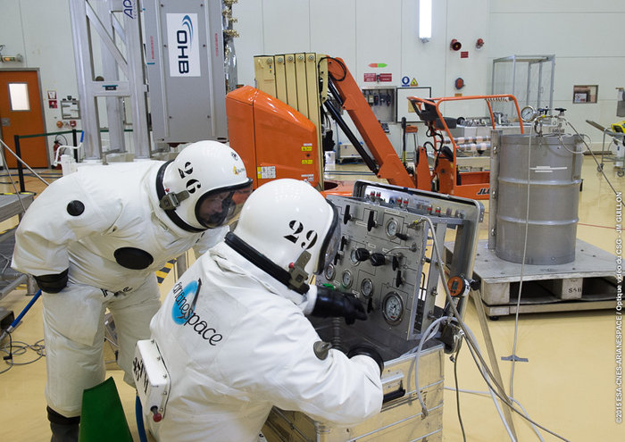
Europe’s ninth and tenth Galileo satellites being fueled by technicians in protective SCAPE suits within the Guiana Space Centre’s 3SB preparation building on Aug. 24. (Photo:ESA)
It has been a good late summer for the European Galileo programme. The latest launch on the night of 10 and 11 September has got the number of orbiting satellites in the EU’s GNSS constellation into double figures at last, and one-third of the way towards the ultimate target of 30.
The European Space Agency’s (ESA) press releases around the launch were positively euphoric, and there were many pictures of smiling ESA launch teams. And so there should be. The two new satellites (the fifth and sixth fully operational capability (FOC) versions named Alba and Oriana) will now inch their way towards their operational orbits and will soon be joined by two more satellites to be launched in December.
However, as we already know, one of the in-orbit validation (IOV) satellites (Sif) is not very well, having suffered a power failure in late May, and the first two FOC satellites (Doresa and Milena) ended up in the wrong orbit. At the considerable expense of a significant part of their fuel payloads, these two craft are now established in a more useful orbit and are the current subject of testing to determine the exact contribution they can make to the Galileo services.
The Commission and ESA are convinced that the outcome will be positive, with Doresa and Milena able to contribute to the network — or at least not degrade the network’s navigation performance. A final decision on if and/or how these two satellites integrate into the system will be made sometime next year.
In any case, they will be used for the provision of Galileo’s Search and Rescue services. And they are also to be made available for scientific research. One possible science area that has been discussed is to ‘repurpose’ the satellites to measure the slow down of time due to the Earth’s gravitational field as predicted by Einstein’s theory of relativity.
However, more worryingly, there are rumours of various glitches and performance issues with other in-orbit members of the constellation. Hopefully, they are just rumours; only time will tell.
Position Paper
Not surprisingly, those wanting to use the system are getting a tad frustrated. On Sept. 1, Galileo Services, a non-profit organisation involving 180 members including most of the active players in the EU GNSS industry, published a position paper entitled “Europe Must Succeed in the Global Navigation Market Race.”
The organisation’s aim is to foster an end-to-end vision of the Galileo system that can fully respond to user and market needs. The paper looks at the options to strengthen the competitiveness of the European GNSS downstream sector in the global market and calls for better coordination between the public and private sectors to develop new technologies, applications, services and industries in Europe as a key factor for success.
In particular, the paper stresses the necessity to urgently establish a European strategic plan to enhance Europe’s GNSS downstream industry’s competitiveness and to foster the uptake of the European GNSS, Galileo and the European Geostationary Navigation Overlay Service (EGNOS), with the aim to corner 33 percent of the global GNSS downstream market for Europe by 2025.
Galileo Services argues that unless an effective and long-term strategy is in place during the Galileo early services exploitation phase — from 2016, the current official start date for services — the window of opportunity for European industry will be closed. Europe’s goal of achieving GNSS autonomy is also at risk. The paper warns that Galileo is just one of three new GNSS solutions, along with the Russian GLONASS and Chinese BeiDou, that are complementing the U.S.’s GPS — and most applications do not require four GNSS constellations.
The target of European autonomy will be achieved if and only if Galileo is widely used with equipment designed and manufactured in Europe, as well as applications and services developed in Europe, concludes the paper.
More R&D Support
Part of the strategy should be enhanced support for EU GNSS technologies and applications. The European GNSS Agency (GSA) has just launched a new research support channel for GNSS chipset and receiver technologies in Europe.
The Fundamental Elements programme has a projected budget of EUR 100 million over the period 2015 to 2020 and is part, says the GSA, of an overall strategy of market uptake initiatives in accordance with EU regulations. “For the first time, EU regulation provides a financing tool for the market uptake of European GNSS chipsets and receivers,” said GSA Executive Director Carlo des Dorides in launching the new programme.
The Fundamental Elements programme complements the EU’s current Horizon 2020 research programme that focuses on adoption of Galileo and EGNOS via content and application development.
Two types of financing will be available via the Fundamental Elements programme: grants and procurement. Grants will be provided to cover up to 70 percent of funding requirements for a project, and intellectual property rights will stay with the beneficiary under the condition that the developed product is actively commercialised.
Procurement (at 100 percent funding) will be used only in cases where keeping intellectual property rights allow for the better fulfilment of the programme’s overall objectives. For example, by licensing it to different potential manufacturers rather than creating a monopoly supplier.
Meanwhile, EGNOS Continues
Of course, one EU GNSS, EGNOS, is operational. The GSA proudly announced that after extensive testing, the latest space segment — the SES-5 GEO satellite — is now fully functional. This will ensure the long-term service of EGNOS until at least 2026 and enable a range of performance improvements, including greater stability during periods of high ionospheric activity.
The SES-5 is a first step in the complete renewal of the EGNOS Space Segment, including the transition to dual-frequency, multi-constellation services. The renewal will be completed by the introduction of the ASTRA-5B signals and the procurement of a new EGNOS payload, both planned for 2016.
In parallel, the GSA and ESA have met formally to launch activities to develop the system further following the signing of a working agreement for EGNOS in July. Under the agreement, ESA will be responsible for the development and procurement of future EGNOS evolutions, such as the forthcoming release (V2.4.2), and a new generation of the EGNOS system (V3).
One of the annual gatherings of the whole European GNSS value chain will take place in October in Berlin with the Satellite Masters conference and awards ceremony. We can be sure that comforting words will be spoken by persons from the Commission, the GSA and ESA about their future plans and present progress. But the real buzz of this event is from the showcase of new ideas and applications for Galileo and EGNOS from pretty much every corner of Europe and beyond.
Despite the uncertainties expressed by some big industrial players, and slow progress in establishing the actual infrastructure, there is still an entrepreneurial enthusiasm from the ‘small guys’ to get involved in this space-based business.
I have attended these events for a few years now. One of the most enthusiastic winners of recent years is JOHAN, a sports application named after renowned Dutch soccer player and now sport commentator Johan Cruyff.
The application is the brainchild of Dutch graduate Jelle Reichert, whom I first met when he won the 2013 European Satellite Navigation Competition with this innovative EGNOS-enhanced tracking idea. “We are now operational with our first four clients! And in a final testing phase we are making the system ready for a commercial launch at the beginning of 2016,” he tells me. “We also just have an investor on board, which allows us to hire personnel and take the final steps to become really commercially ready.”
In just 18 months, Jelle’s idea has been brought into life with support from GSA and ESA. The JOHAN sports tracker and application helps improve teams by monitoring on-field performance. The system’s small, lightweight trackers, or pebbles, use GNSS technology such as EGNOS to ensure reliability and precision.
The trackers are small and light so they can fit into training vests worn by players across a variety of field sports, though early adopters have all been football teams so far. The trackers measure location, speed, distance, acceleration and orientation statistics, which are then visualized in an online data platform for coaches and players. This allows coaches to monitor workload and performance, and get tactical information and event analysis and ensure players’ strengths are used to the whole team’s advantage. Players can spot weaknesses and improve their individual game over time.
“You can see who is training too hard and who has a higher chance of injury, as well as who is strong in which performance aspects, such as endurance, sprint, agility or recovery,” explains Jelle.
I look forward to hearing about lots more grassroots GNSS innovation in Berlin.
And Finally … An Out-of-This-World App?
Take me to the moon! And why not, indeed? It appears that Galileo could be a vital part of an interplanetary navigation system. Or at least it could help (with GPS) spacecraft to routinely navigate to the moon.
A paper in Acta Astronautica highlights the strict requirements in terms of performance, flexibility and cost for all the spacecraft subsystems required to navigate to the moon. GNSS could introduce an easier way to provide an autonomous orbit determination system using an on-board GNSS receiver. While GNSS receivers have already been used successfully to pilot craft in Low Earth Orbit (LEO), their use for very High Earth Orbit (HEO) up to and including the Moon is an active research area.
The study from researchers at the Swiss Federal Institute of Technology in Lausanne (EPFL) made use of the Spirent GSS8000 multi-GNSS constellation simulator, which supports simultaneously the GPS and Galileo systems with L1, L5, E1 and E5 frequency bands. It showed that GNSS signals can be tracked up to the Moon’s surface, but would need new, more sensitive GNSS receiver technology. The paper describes a possible navigation solution that uses a double constellation GPS-Galileo receiver aided by an on-board orbital filter system to improve the accuracy of the navigation solution and achieve the required sensitivity. Without the filter, position error below 700 metres is possible, but the orbital filter increases the position accuracy to within about 100 metres.
Vincenzo Capuano from the EPFL team tells me that a further paper on the use of an GPS L1 C/A based orbital filter for Moon transfer orbits will be published soon, which also shows an achievable accuracy of a few hundred meters. So who needs expensive tracking stations for a flight to the moon?
But the work also has a very practical down-to-Earth application. The EPFL team is developing more sensitive GNSS receivers to pick up these weak signals, and the new receivers could find applications on Earth where current receivers often struggle to get a location, such as inside buildings or in built-up areas, where signals are weak.
First and foremost, let’s give a big hand to Adam and Anastasia, the two Galileo FOC satellites that were successfully launched on March 27. Following the not-so-successful Galileo launch in August, it was imperative that this go smoothly.
Although the Double-A launch occurred after the conclusion of this year’s Munich Satellite Navigation Summit, anticipation of the event set the context for the entire convocation. The summit is a fixture on the European and global GNSS calendar. It is always intense, often spectacular and sometimes leaves one with contradictory feelings. This year it took place March 24-26 and sought to determine the future of PNT, encouraging delegates to look into the crystal ball and predict developments.
If we go by the number of times these words were repeated during the three days of the summit, the future will hinge around compatibility and interoperability. The multi-constellation GNSS is already here. The elephant in the room remains, as always, interference, but here integration of alternative sensors and signals should hold the key to continuous and possibly resilient operations.
As usual the summit kicked off with a high-level plenary in the imposing Allerheiligen-Hofkirche (Court Church of All Saints) in the Residenz München, the Bavarian royal palace. The welcoming speeches and presentations were interspersed with some pleasant jazz, and the atmosphere was relaxed.
Into the Crystal Ball
Matthias Petschke, director of EU Satellite Navigation Programmes at the European Commission, admitted that 2014 had been difficult, but he was looking forward to 2015. Clearly the deployment of the Galileo infrastructure — especially the space segment — was critical, and the March 27 launch was very much on his mind. However, he expressed confidence that the launch would be fine and that satellite production was, and would remain, on schedule. In the long view, he stated: “We will make it for 2020,” signifying full operational capability (FOC).
He also talked about stimulating global markets to foster uptake of Galileo and EGNOS, and this was discussed by Carlo des Dorides, executive director of the European GNSS Agency (GSA). The ground infrastructure is very much in place and preparing for the Galileo exploitation phase. A significant milestone in that process would be finding the right partner to lead Galileo operations for the next ten years. A tender was now in process to find that organization or consortium. Des Dorides described the process as a competitive dialogue with the emphasis on finding a partner who can inspire new ideas and provide innovative solutions. The contract is big, worth around 1 billion euros.
Carlo des Dorides, Executive Director of the European GNSS Agency (GSA), discusses the 1 billion euro tender, now in process to find the organization or consortium to lead Galileo operations for the next ten years. Photo: GSA
He also emphasized the successes for EGNOS in the year. Almost 180 airports now benefit from EGNOS-enabled approaches and more than 70 percent of “GNSS-enabled” farmers in EU use the EU’s SBAS.
Johann-Dietrich Wörner, chairman of the German Aerospace Centre (DLR) — and the nominated next Director-General of ESA – highlighted the growing dependence of critical services on GNSS. In this context multiple systems were not a question of competition; it was all about redundancy and safety. Multi-GNSS improves availability, accuracy and reliability.
The view from the United States was given by Harold “Stormy” Martin, Director, National Coordination Office for Space-Based Positioning, Navigation, and Timing in Washington, D.C. The GPS fleet was now 30 strong in orbit including four successful launches in 2014 and he stated the 2014 averaged user range error to be 70 cms — the best ever — and improving year on year.
One major upcoming trend is a realization that there’s a need to establish a U.S.-wide backup coverage for GPS outage due to natural or man-made interference. The U.S. is currently assessing alternatives with a decision likely in summer 2015.
There was a particularly warm welcome from the audience for Michael Khailov, deputy head of Roscosmos and co-ordinator for GLONASS. Last year the Russians were conspicuous by their absence at the Munich Summit, but for 2015, despite the intervening local difficulty in Ukraine, they were back in force. Khailov claimed that the sustainable development of the world depends on GNSS. On more esoteric ground he stated that GLONASS had maintained stable operations in 2014 and three more satellites had bene launched. Further launches would depend on operational circumstances. The user domains for GLONASS were continuously expanding. Continuing the summit text he said that it was better [working] together than separately — in fact separately often doesn’t work at all and therefore we must continue to promote interoperability and the Munich Satellite Summit is a good forum for this.
Jianyun Chen of the China Satellite Navigation bureau also took up the theme of all GNSS together. Sixteen Beidou (pronounced — for the avoidance of doubt — as ‘bay-doe’) had been launched since 2007 and the Chinese had been in discussion with Russia to ensure full interoperability with GLONASS. This process will be repeated with GPS and Galileo.
GNSS Updates
One of the idiosyncrasies of the Munich Summit is its very discreet signage. If you don’t know where it is — and specifically the correct side door that brings you up two floors to the main Max Joseph Saal venue — it is highly likely you’ll miss it! But once you are in it is two full-on days of updates on systems and discussions on a vast range of topics that impinge on the development and implementation of GNSS around the world.
Discreet signage. Photo: GSA
The first two session of the summit proper gave updates on the GNSS systems in operation and under development as well as the regional and augmentation systems. Much of the material was slightly more detailed versions of presentations at the plenary but a few news snippet emerged.
“Stormy” Martin said that a modified battery charge control had been implemented that would extend operational life for some of the fleet by one or two years. He also reiterated the improving accuracy performance of GPS which was now much better that its published standards. He predicted that the first GPS III would be available for launch in 2016 and said that GPS was improving every day.
Eric Chatre from the European Commission reiterated that Galileo was still expecting to start early services in 2016 with full operational capability in 2020. He expected 18 satellites to be launched by 2018. The new Ariane 5 launcher will enable the launch of four satellites at one time and the first launch with this system would be in 2016. In terms of the ground segment only one station in the Pacific was yet to be established.
Sergey Karutin of Roscosmos talked about a four-fold accuracy improvement for GLONASS with the use of new clocks and the introduction of new CDMA signals that will improve accuracy and access. According to Dongfeng Yu of the China Satellite Navigation Office the BeiDou constellation is moving from “regional to global, active to passive” and is aiming for global coverage by 2020.
U.S. SBAS developments were covered by Deborah Lawrence of the Federal Aviation Administration (FAA). The Wide Area Augmentation System (WAAS) now has 100 percent coverage for LPV200 in CONUS. More than 41,000 runway ends are now included, and she predicted full completion in 2016.
Jean-Marc Pieplu of the GSA talked about EGNOS status. The next system release (2.4.1) should be published in Q3 2015 and will include a significant input on ionospheric corrections. Further service evolution includes a plan to declare LPV 200 in Q4 this year and EGNOS coverage will be extended to 72 deg North and ensure full coverage of the 28 EU member states.
The Russian Augmentation system SDCM performs at 0.8 metre accuracy according to Grigory Stupak of JSC / Russian Space Systems. He noted new validated SDCM ground stations had been established in Antarctica and Brazil and stated that global exploitation was a key objective for SDCM as its satellite coverage was very wide. GLONASS and GPS together could ensure complete coverage. He also indicated that work was in hand for SDCM SBAS service certification for LPV 200 and he called for providers of all WAAS to work closely together.
2020 Vision
After lunch we were offered the chance to hear some expert views on the future of GNSS and PNT with Prof Vidal Ashkenazi of Nottingham Scientific Limited asking for their vision of GNSS in 2020. By that year there should be 100-120 GNSS satellites in orbit, multi-constellation receivers would be the norm, but what would be the new applications and what were the challenges?
Jamming and spoofing would still be issues. Pierre Bouniol of Thales thought that in civil aircraft receivers would probably incorporate jamming indicators by 2020 to inform users when signals may be compromised. For Stuart Riley of Trimble the key was integration of other sensor signals to bridge any GNSS signal outage. Gang Mao of Unicore Communications Inc. in China considered multiple frequencies to be a big help in reducing the threat of jamming. Nigel Davies of QinetiQ agreed saying there were a host of technical solutions but key for success would be solutions that use low power, are low cost and feature high usability. He also noted that safety certification of receivers for use in driverless vehicles would be required and this challenging application would need the provision of robust continuous navigation — and sub-metre accuracy.
The future market for GNSS was also discussed in a session that unveiled the GSA’s 4th Issue of its comprehensive GNSS Market Report. With almost four billion GNSS devices used worldwide and all regions experiencing growth, GNSS represents an unprecedented business opportunity. Over the past 15 months the GSA’s team of market monitoring experts has taken a close look at all aspects of the GNSS marketplace with analysis of both hardware and software market opportunities, technology trends and future developments.
Gian-Gherardo Calini, Head of Market Development at GSA, gives highlights of the comprehensive GNSS Global Market report. He will deliver this information in an April 16 webinar hosted by GPS World. Photo: GSA
The top-line results were presented by Gian-Gherardo Calini, Head of Market Development at GSA. GNSS is one of the few growing markets in the world showing 12.7 percent CAGR. It is a very attractive market with volumes and revenues driven by mass market segments: the dominant two being Location-based services and transport applications. This latest edition includes information a new market segment: Timing and Synchronisation. One area that is not included is security and government applications. Mr Calini indicated that this information has been collected by the GSA team but as it is essentially for users of the Public Restricted Service (PRS) it was not included in the open report.
Although the report is very much “Galileo flavored,” its findings are of great importance and value to whole GNSS community and will be the subject of a GPS World webinar with Mr Calini and myself on 16 April. You can register — free — for this informative global perspective now.
A panel discussion followed and covered a range of topics and applications from aviation to agriculture. Again the consensus was that chips would become multi-constellation and quickly. Philippe Prats of STMicroelectronic outlined automotive applications from insurance applications to advanced driver assistance systems (ADAS).
The role of government mandates in establishing markets was seen as positive. The e911 mandate in the states had provided the seed for GPS integration into smartphones. Similarly authentication was also seem as a significant future market driver.
Multi frequency was also showing on industry’s radar and in a couple of years will be a reality thought Philippe Prats with the main motivation being better accuracy. Frank van Diggelen of Broadcom highlighted the recent GPS World feature demonstrating cm accuracy on a smartphone.
Legal Issues
A dedicated session on legal issues was not the best attended part of the conference, which is a shame as it had some serious points to raise and highlighted a gap that is opening up between our technical abilities in GNSS and the legal basis for its use. The Munich Summit is to be commended for its commitment to providing a platform for these issues every year; they are often ignored elsewhere.
Oliver Heinrichs, a partner at BHO Legal in Cologne, emphasised the need to establish a firm regulatory framework and to ensure that any decisions did not cross World Trade Organisation (WTO) provisions and the General Agreement on Tariffs and Trade (GATT). In particular the idea of mandating a specific GNSS for applications such as emergency response systems in cars may well be incompatible with WTO rules.
Amedeo Arena of Universitá degli Studi di Napoli Federico II in Naples noted that all GNSS players were members of the WTO and considered that GNSS services and their trade was definitely “caught by the GATTs” so no favouritism for ‘home’ systems should be allowed.
Another area of controversy is automated vehicles. In discussion after the session I learnt that current international conventions governing the use of motorised vehicles require a human supervisory role at all times. There will need to be some fundamental legal groundwork done before the first driverless vehicles will be allowed out on the road for real.
These are legally complex issues and certainty will only come from test cases. Talking of complexity Aleksey Bolkunov of the Russian Federal Space Agency revealed that the legal, regulatory and standardisation measures governing GLONASS and GNSS in Russia consisted of more than 900 documents originating at various different levels of the state. This clearly gave great scope for “regulatory collisions” and he is involved in work to develop a single regulatory framework that should eliminate the remaining barriers to GNSS use in Russia.
Emerging Applications
Peter Grognard of Galileo Services chaired a final session of the day on emerging applications. Bruno Bougard of Septentrio saw dependable accuracy as key to emerging markets. He thought high precision driven by surveying was becoming more and more mainstream. For autonomous driving the challenge was to provide cost-effective, dependable accuracy at 10-30cm that was safe, reliable, and always available. This would require multi GNSS, multiple signals, highly integrated sensors and transparent and open augmentation.
For Neil Gerein of Novatel the mantra is “Accuracy, availability, assurance.” Users needed availability to their PNT solutions at all times. He also saw future applications integrating GNSS with inertial sensors and correction systems for high accuracy without the need for a base station.
or Neil Gerein of Novatel the mantra is “Accuracy, availability, assurance.” Photo: GSA
Lionel Garin of Qualcomm Inc talked about ADAS. Safety was paramount and he foresaw the need for rigorous design and certification procedures similar to that required for the aviation market. Fortunately the industry has lots of expertise here. Philip Mattos of u-blox UK argued that a volume market is in femtocell and small cell synchronisation in mobile networks where GNSS is the lowest cost solution.
Tom Stansell praised geometry as the most important and unique ingredient supplied by multi constellation GNSS. And the second most important ingredient was interoperability. He doubted users would care where their signals originated and devices would still be generically described as ‘GPS’ into the future. Application growth will be stimulated by the better geometry supplied by multi-GNSS constellations. When the E6 signal became available he predicted that 10cm accuracy would enable reliable lane keeping for ADAS.
And Galileo will supply E6 for free said Ignacio Fernandez Hernandez from the European Commission. Ignacio works on the Galileo Commercial Service design and outlined some significant differentiators of the European system including its broad signal for high accuracy and better multipath resilience, more stable clocks and improved ionospheric modelling compared to GPS.
Lionel Garin sounded a note of caution at the end of the session when he noted that multi constellation ability was good, but he was not sure what was actually gained beyond two, or perhaps three, constellations.
GNSS for Weather
The final day of the conference saw a few fragile heads courtesy of the previous evening’s Summit Space Night 2015 sponsored by Airbus Defence & Space, which took place at the Filmcasino am Hofgarten close to the conference venue. And the first session, chaired by Oliver Montenbruck from the DLR, certainly required a clear focus as we were taken through the use of GNSS in space geodesy, space navigation and reflectometry.
Roland Pail from the Technical University, Munich described results from the satellite gravity missions GRACE and GOCE that looked at mass transport processes on our dynamic Earth. A particularly sobering animation showed the extent of ice mass loss from Greenland over the past decade. But what is role of gnss here? The ability to give precise positioning of the satellites and the fact that the satellite orbits carry information on the gravity field.
Atmosphere sounding using GNSS radio occultation allows precise atmospheric profiles with global coverage in all-weathers. Jens Wickert of the Helmholtz Centre Potsdam said that since 2006 these high vertical resolution profiles had been making a significant impact on the world’s weather forecasting including improved hurricane forecasts. It was also a bias free technique for observing global temperature change. With a multi-GNSS future new missions could be planned as more signals would reduce noise. Combining GNSS and reflectometry could enable accurate tsunami detection from space. Similarly Prof Antonio Rius from Barcelona was using reflected GNSS signals to determine data on the surface of the sea such as surface roughness, extent of sea ice and early warning of a tsunami.
Stefan Sassen of Airbus Defence & Space described the LION GNSS navigation receiver for MEO and LEO platforms. The unit was qualified since 2014 and now 50 were on order. LION is highly flexible with multi-frequency, multi-constellation and multi-antennae configurations possible. It was accurate enough for autonomous orbit raising (a few kms) and or station keeping (to within 100cm).
Finally Manfred Sust of RUAG Space GmbH said that space borne gnss receivers were true enabling technologies for Earth Observation missions as precise orbit determination was key to capturing sharper images.
Alternatives
The second session of the day returned to the practical issues around possible alternative or complementary PNT (APNT) systems. As GNSS becomes ubiquitous many terrestrial PNT systems are being decommissioned (LORAN, VOR), but the potential vulnerability of GNSS signals to interference is highlighting the need for backup. The challenge being to balance functionality and cost in the search for “plan ‘B’ for GNSS” as chairman Michael Meurer from DLR described it.
The FAA’s Deborah Lawrence reiterated her plans for scoping and implementing a backup system to cope with a GPS outage in the US. The FAA is currently engaging with stakeholders to define what the minimum operational target for a GPS outage should be to set the basis for procurement activity. The timeline for a final investment decision was now December 2018.
For Europe Gerhard Berz of Eurocontrol thought there were many potential APNT in place and the topic was in the SESAR 2020 research programme. He thought existing DME could potentially do the job in Europe as it had good coverage, but the challenge is to get good geometry and coverage at low altitudes, in remoter areas and over water.
Prof Per Enge of Stanford University “put the moose on the table” and pointed to the 978 and 1030 ranging frequencies as an existing system that could be used for positioning. But how accurate was it? Airborne experiments had shown good agreement with GPS positioning with an accuracy of around 100m and in turns 300m, which was good enough in an emergency. Further tests using a UAV at spider infested Camp Rogers had demonstrated APNT in flight with 50m error. The UAV itself was specifically developed to navigate using APNT while looking for GNSS jammers.
Wouter Pelgrum of Ohio University discussed the relative merits of eLORAN, which has high power – and therefore difficult to jam – and beyond line of site accuracy of less than 10m, and alternatives such as collocation of pseudolites with mobile phone cell towers. This could also enable high accuracy indoors positioning applications. He believed that APNT will need to be context specific and there was no single solution.
Belabbas Boubeker of the DLR discussed modular APNT concepts while Nick Ward of the UK’s General Lighthouse Authorities indicated there was no coordinated policy on resilient PNT in the European maritime sector at present but his authority and others were exploring the possibility of using eLORAN as a commercial enterprise. Nine transmitters were operational in Europe and the service had been declared in 2014.
Michael Hoppe of Fachstelle der WSV für Verkehrstechniken said resilient PNT was a core element of e-navigation for waterways. A combination of techniques such as medium frequency RF, AIS and eLoran could give good accuracy in areas of highest traffic. First results of trials were encouraging.
Processing Power
The final session of the Summit to grab my full attention was chaired by Frank van Diggelen of Broadcom. He led a wide ranging debate on GNSS receiver architecture trends and more generally the future of chip design and fabrication: are we approaching the end of Moore’s law and if so — what next?
Recently “The balance of power has moved back onto the GNSS chip” to enable lower device power use. To highlight current developments Frank described a couple of Broadcom products: the Broadcom 4773 “location hub” that is at the heart of the Samsung Galaxy 6 “super smart phone” and the 4774 that can access signals from all four GNSS constellations and will be shipping in early 2016 on new smartphones.
In fact earlier this year the 4774 was used to make a first fix using signals from four different GNSS constellations (with signals from one each of GPS, GLONASS, Galileo and BEIDOU satellites) and a significant event in terms of our multi-constellation future.
Greg Turetzky of Intel talked about the benefits and challenges for GNSS in advanced silicon processes. He noted that Intel is now shipping 14nm technology and plans were in hand for the next two generations (10nm and 7nm). Moore’s law has been a great enabler for modern society. If automobiles had taken a similar development in the same timeframe we would all be driving cars with a maximum speed of some 300 000 km/hour that cost us around 4 cents to buy!
The big challenge for GNSS architecture was to take advantage of the smaller geometries while greatly reducing standby power. The integration of multiple radio sources to provide a single location solution was key giving ubiquitous location capability that will improve the experience of every mobile product.
Looking into his crystal ball, Peter Anderson of Integrated Navigation Systems in the UK saw that integrating signals from complimentary technologies and sensors would be important but would lead to a greater demand for digital processing. He predicted that multiband receivers would become standard in consumer devices. He also pointed out that the worst potential source of GNSS jamming for a smartphone was the phone itself! The move to dual frequency would be helpful here.
An overview of the Chinese XIHE system for seamless outdoor and indoor location was given by Dongkai Yang of Beihang University. This Beidou Innovative application provides a LBS system based on gnss and mobile communication networks to give a “fusion of communication and positioning for indoor positioning”. The system is being demonstrated in four areas in China in shopping malls. The target for positioning accuracy in the system is for less than 3 metres indoors and less than 1 metre outdoors.
Franz Kreupl of Munich Technical University gave a sobering view of “life after silicon” – essentially it looks like there isn’t one. He outlined the limits to silicon technology such as tunnelling current and predicted some further progress could be made in reducing interconnect sizes and via circuit design. But new candidate materials for semiconductor electronics from carbon nanotubes to widely hailed 2-D materials graphene and MoS2 all suffer major issues that seem to make them non-starters.
But do we need to keep on miniaturizing? Norbert Schuhmann of Fraunhofer IIS in Nuremberg thought that technology downscaling would have an end in terms of the physics, but especially in terms of reasonable cost. He thought 7nm and 2020 was the end point for the physics but that in fact 28nm should be seen as the actual last node in Moore’s law as from then scaling has no longer also been the path for cost reduction. He saw silicon on insulator technology and monolithic 3-D integration as possible paths forward, but the technology sweet spot — and well suited for GNSS — was 55nm and a format that was already extensively used in automotive applications.
Milena, or Galileo-FOC FM2, moves above the dangerous Van Allen Belt to rejoin Doresa, Galileo-FOC FM1, in a partially usable orbit. Photo: Galileo
By Tim Reynolds, GPS World European correspondent
Director General Jean-Jacques Dordain of the European Space Agency (ESA) announced Jan. 16 that the second errant full-operational capability (FOC) satellite, launched in August, had started its orbital change maneuver the previous day. He anticipated that the orbital change would be completed and the final orbit — “albeit somewhat lower in height than the one into which it was supposed to go” — achieved in “a few weeks.” He confirmed that both in-orbit FOCs work well, are fully operational, and provide excellent on-spec positioning data.
Two more FOC satellites are ready for launch, and a third has undergone thermal vacuum testing. Dordain said four will be available to launch soon, and he anticipated up to six FOCs being ready for launch in 2015 [word came at press time that all 2015 launches would be aboard the previously problematic Soyuz vehicle, and not on heretofore reliable Ariane]. The previous plan had called for four in 2015, but the total now includes two that were held back from a December 2014 launch. The actual schedule and launch vehicles are still under discussion, according to Dordain; the European Commission (EC) will make a decision at the end of January on this. He refused to comment on what ESA would recommend to EC on this front.
Read Tim Reynolds’ Brussels-based reporting the in EAGER quarterly enewsletter; free at gpsworld.com/subscribe.
The completion is a key milestone towards end-to-end capability to automatically transfer data between Raytheon’s OCX and Lockheed’s GPS III satellite. One more readiness exercise, five launch rehearsals, and a mission dress rehearsal are planned before launch of the first GPS III with OCX.
The exercise demonstrated mission planning and scheduling capabilities with the simulated Air Force Satellite Control Network (AFSCN) for the first time, including a replan scenario that would occur in the event of a launch slip.
The system also automatically generated antenna pointing angles for the simulated AFSCN — until now, manually generated. Exercise 4 introduced maneuver planning and reconstruction capabilities, as well as advanced planning and scheduling with AFSCN assets. Automation of these capabilities will allow GPS operators to optimize system performance rather than focus on routine operations.
Brigadier General Cooley
Colonel William Cooley, director of the GPS Directorate, has been nominated to the rank of brigadier general, United States Air Force. He wrote a December GPS World article on “What It Takes to Make a Gold Standard.”

![Figure 2.2: Normalized autocorrelation functions for different modulations: BPSK of GPS L1, BOC of Galileo E1 with simplified demodulation4, CBOC of Galileo E1 and AltBOC of Galileo E5 signals5. Source: [Silva et al., 2012]](https://stage.globalpositioningnews.com/wp-content/uploads/2016/10/DesprezFig1-300x219.jpg)