Taoglas announced its smallest 9-in-1 combination antenna with dual-band GNSS and high-performance 5G/4G, the Taoglas MA990 Guardian.
Taoglas made the announcement at Mobile World Congress (MWC) Barcelona 2022, which takes place Feb. 28–March 3; Taoglas is exhibiting at booth #5E32.
The Taoglas MA990 Guardian antenna is a small 9-in-1 combination antenna with dual-band GNSS (L1/L2) and globally supported cellular (5G/4G). It has been designed to support emerging market demand for modules that cover specific 5G/4G bands.
For example, two of its eight cellular MIMO antennas cover from 600 to 6,000 MHz, while another two are optimized for 3,000 to 6,000 MHz to cover high-band 5G and C-band/CBRS applications. The product is designed to operate on all carrier networks globally and is future-proofed to work with latest 5G routers in the market.
Housed in a low-profile, robust, IP67-rated waterproof, adhesive-mount external enclosure, the MA990 is designed for space-constrained, mission-critical applications, including asset and vehicle tracking, first- responder vehicles and high-definition video sources such as surveillance cameras.
The Taoglas MA990 also is highly customizable, including for any variation of antennas below 9-in-1 and the addition of Wi-Fi/single-band GNSS.
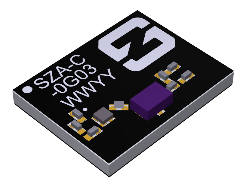
Antenna company Synzen Precision Technology has teamed up with Next Big Thing AG (NBT) to produce the sensor-based LTE-M/NB-IoT development platform Prometheus, which promises fast cellular internet of things (IoT) prototyping.
The PROXIMA GNSS antenna will be part of the Prometheus platform. (Photo: Synzen Precision Technology)
Prometheus is an IoT sensor-based development platform designed to simplify prototyping and speed time to market for developers of IoT and cloud-based solutions. The latest platform showcases Synzen’s expertise in GNSS and LTE 4G antenna solutions when combined with the Nordic nRF9160 module.
The building blocks enabling the mobility and IoT revolution are “always-on” connected 4G cellular and accurate and reliable GNSS solutions, regardless of the operating environment, Synzen said. Prometheus provides 4G connectivity combined with high-performance GNSS positioning solutions.
For the Prometheus platform, NBT chose the low-power FR4 active GNSS solution. “The selection of our latest PROXIMA low-power active solution in an FR4 package helped enable a fully certified solution optimized for low power consumption over the full industrial temperature range of –40 to +85 degrees centigrade,” said Chris Tomlin, Synzen technical director.
The PROXIMA GNSS SMD active antenna includes an amplifying front end to boost the signal as well as provide out-of-band filtering to prevent receiver saturation.
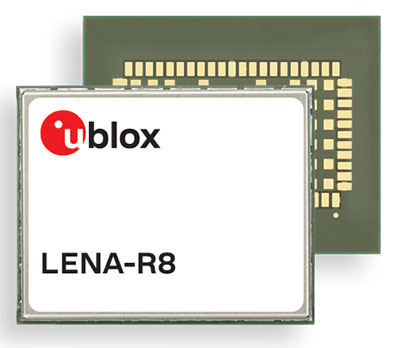
U‑blox has added a GNSS receiver module to its cellular LTE Cat 1 portfolio. The GNSS receiver in the LENA-R8 is based on the u‑blox M10 platform.
U-blox also introduced the LARA-R6, its smallest LTE Cat 1 module with global coverage. Together, the modules comprise five certified global, multi-regional and regional product variants, simplifying logistics for product developers and increasing design flexibility.
Both modules offer device makers facing imminent 2G and 3G network sunsets a future-proof migration path to 4G technology for data-streaming applications.
Additionally, they offer MQTT Anywhere and MQTT Flex connectivity via u‑blox’s Thingstream platform out of the box, thereby enabling low-power, low-cost connectivity with globally ubiquitous, seamless roaming.
Tracking and Telematics
The LENA-R8 standard-grade module series targets customers in the tracking and telematics markets seeking to minimize costs associated to their bill of material and data charges. The compact module balances cost and performance with single Rx antenna and primarily targets customer deployments in the Europe, Middle East, Africa, Asia, and South America regions.
The LENA-R8 supports a broad range of frequency bands with 2G fallback, providing maximum roaming coverage for global tracking applications using a single stock keeping unit (SKU).
A variant of the LENA-R8 series comes with an ultra-low power u‑blox M10 GNSS receiver for high performance asset tracking applications, reducing integration effort and time to market. Making no compromises in terms of GNSS performance, the module can concurrently receive up to four GNSS constellations for maximum position availability.
CellLocate Support
All variants of the LARA-R6 and LENA-R8 family support CellLocate, u‑blox’s cellular network-based location service, for coarse positioning data even in the absence of GNSS signals.
Engineering samples will be available in February.
Originally posted in the Android Developers Blog, the following is reprinted with permission from authors Frank van Diggelen, principal engineer, and Jennifer Wang, product manager, Google.
At Android, we want to make it as easy as possible for developers to create the most helpful apps for their users. That’s why we aim to provide the best location experience with our APIs like the Fused Location Provider API (FLP). However, we’ve heard from many of you that the biggest location issue is inaccuracy in dense urban areas, such as wrong-side-of-the-street and even wrong-city-block errors.
This is particularly critical for the most-used location apps, such as rideshare and navigation. For instance, when users request a rideshare vehicle in a city, apps cannot easily locate them because of the GPS errors.
The last great unsolved GPS problem
This wrong-side-of-the-street position error is caused by reflected GPS signals in cities, and we embarked on an ambitious project to help solve this great problem in GPS. Our solution uses 3D mapping aided corrections, and is only feasible to be done at scale by Google because it comprises 3D building models, raw GPS measurements, and machine learning.
The December Pixel Feature Drop adds 3D mapping aided GPS corrections to Pixel 5 and Pixel 4a (5G). With a system API that provides feedback to the Qualcomm Snapdragon 5G Mobile Platform that powers Pixel, the accuracy in cities (urban canyons) improves spectacularly.
Image: Frank van DiggelenImage: Frank van Diggelen
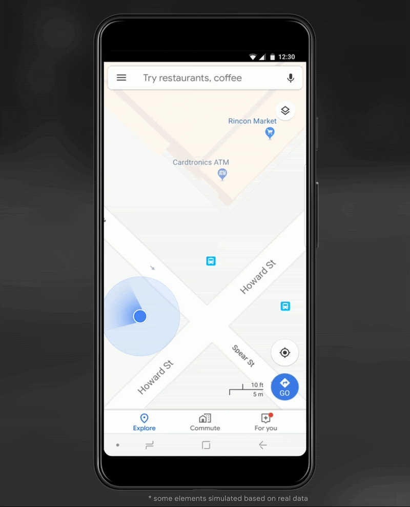
Pictures above show a pedestrian test, with Pixel 5 phone, walking along one side of the street, then the other. Yellow = Path followed, Red = without 3D mapping aided corrections, Blue = with 3D mapping aided corrections.
Why hasn’t this been solved before?
The problem is that GPS constructively locates you in the wrong place when you are in a city. This is because all GPS systems are based on line-of-sight operation from satellites. But in big cities, most or all signals reach you through non line-of-sight reflections, because the direct signals are blocked by the buildings.
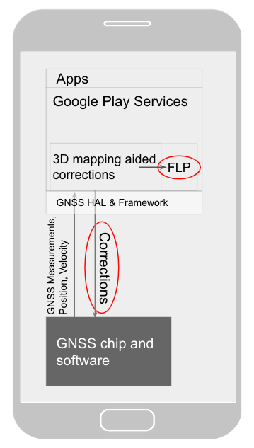
Diagram of the 3D mapping aided corrections module in Google Play services, with corrections feeding into the FLP API. 3D mapping aided corrections are also fed into the GNSS chip and software, which in turn provides GNSS measurements, position, and velocity back to the module. (Image: Frank van Diggelen)Image: Frank van Diggelen
The GPS chip assumes that the signal is line-of-sight and therefore introduces error when it calculates the excess path length that the signals traveled. The most common side effect is that your position appears on the wrong side of the street, although your position can also appear on the wrong city block, especially in very large cities with many skyscrapers.
There have been attempts to address this problem for more than a decade. But no solution existed at scale, until 3D mapping aided corrections were launched on Android.
How 3D mapping aided corrections work
Image: Frank van Diggelen
The 3D mapping aided corrections module, in Google Play services, includes tiles of 3D building models that Google has for more than 3,850 cities around the world. Google Play services 3D mapping aided corrections currently supports pedestrian use-cases only. When you use your device’s GPS while walking, Android’s Activity Recognition API will recognize that you are a pedestrian, and if you are in one of the 3,850+ cities, tiles with 3D models will be downloaded and cached on the phone for that city. Cache size is approximately 20MB, which is about the same size as 6 photographs.
Inside the module, the 3D mapping aided corrections algorithms solve the chicken-and-egg problem, which is: if the GPS position is not in the right place, then how do you know which buildings are blocking or reflecting the signals? Having solved this problem, 3D mapping aided corrections provide a set of corrected positions to the FLP. A system API then provides this information to the GPS chip to help the chip improve the accuracy of the next GPS fix.
With this December Pixel feature drop, we are releasing version 2 of 3D mapping aided corrections on Pixel 5 and Pixel 4a (5G). This reduces wrong-side-of-street occurrences by approximately 75%. Other Android phones, using Android 8 or later, have version 1 implemented in the FLP, which reduces wrong-side-of-street occurrences by approximately 50%. Version 2 will be available to the entire Android ecosystem (Android 8 or later) in early 2021.
Android’s 3D mapping aided corrections work with signals from the USA’s GPS as well as other GNSS: GLONASS, Galileo, BeiDou, and QZSS.
Our GPS chip partners shared the importance of this work for their technologies.
Francesco Grilli, vice president of product management at Qualcomm Technologies Inc.:
“Consumers rely on the accuracy of the positioning and navigation capabilities of their mobile phones. Location technology is at the heart of ensuring you find your favorite restaurant and you get your rideshare service in a timely manner. Qualcomm Technologies is leading the charge to improve consumer experiences with its newest Qualcomm Location Suite technology featuring integration with Google’s 3D mapping aided corrections. This collaboration with Google is an important milestone toward sidewalk-level location accuracy.”
Charles Abraham, senior director of engineering, Broadcom Inc.:
“Broadcom has integrated Google’s 3D mapping aided corrections into the navigation engine of the BCM47765 dual-frequency GNSS chip. The combination of dual frequency L1 and L5 signals plus 3D mapping aided corrections provides unprecedented accuracy in urban canyons. L5 plus Google’s corrections are a game-changer for GNSS use in cities.”
Yenchi Lee, deputy general manager of MediaTek’s Wireless Communications Business Unit:
“Google’s 3D mapping aided corrections is a major advancement in personal location accuracy for smartphone users when walking in urban environments. MediaTek’s Dimensity 5G family enables 3D mapping aided corrections in addition to its highly accurate dual-band GNSS and industry-leading dead reckoning performance to give the most accurate global positioning ever for 5G smartphone users.”
How to access 3D mapping aided corrections
Android’s 3D mapping aided corrections automatically works when the GPS is being used by a pedestrian in any of the 3850+ cities, on any phone that runs Android 8 or later. The best way for developers to take advantage of the improvement is to use FLP to get location information. The further 3D mapping aided corrections in the GPS chip are available to Pixel 5 and Pixel 4a (5G) today, and will be rolled out to the rest of the Android ecosystem (Android 8 or later) in the next several weeks. We will also soon support more modes including driving.
Android’s 3D mapping aided corrections cover more than 3850 cities, including:
North America: All major cities in USA, Canada, Mexico.
Europe: All major cities. (100%, except Russia & Ukraine)
Asia: All major cities in Japan and Taiwan.
Rest of the world: All major cities in Brazil, Argentina, Australia, New Zealand, and South Africa.
As our Google Earth 3D models expand, so will 3D mapping aided corrections coverage.
Google Maps is also getting updates that will provide more street level detail for pedestrians in select cities, such as sidewalks, crosswalks, and pedestrian islands. In 2021, you can get these updates for your app using the Google Maps Platform. Along with the improved location accuracy from 3D mapping aided corrections, we hope we can help developers like you better support use cases for the world’s 2B pedestrians that use Android.
Continuously making location better
In addition to 3D mapping aided corrections, we continue to work hard to make location as accurate and useful as possible. Below are the latest improvements to the Fused Location Provider API (FLP):
Developers wanted an easier way to retrieve the current location. With the new getCurrentLocation() API, developers can get the current location in a single request, rather than having to subscribe to ongoing location changes. By allowing developers to request location only when needed (and automatically timing out and closing open location requests), this new API also improves battery life. Check out our latest Kotlin sample.
Android 11’s Data Access Auditing API provides more transparency into how your app and its dependencies access private data (like location) from users. With the new support for the API’s attribution tags in the FusedLocationProviderClient, developers can more easily audit their apps’ location subscriptions in addition to regular location requests. Check out this Kotlin sample to learn more.
Qualcomm and Snapdragon are trademarks or registered trademarks of Qualcomm Incorporated. Qualcomm Snapdragon and Qualcomm Location Suite are products of Qualcomm Technologies Inc. and/or its subsidiaries.
The huge current investment in deploying 5G mobile networks is promoted by setting high expectations for significantly increased throughput and reduced latency.
This can only be realized by deploying the network radios close to the users, especially for the millimeter-wave frequencies with their short propagation distance.
This also means a high density of radios, often imbedded within macro coverage.
To coordinate seamless functioning, network synchronization accuracy must be much higher than with legacy deployments, according to Optical Zonu. The greatly enhanced data throughput with advanced features such as aggregation, massive multiple-input/multiple-output (MIMO) and beam steering require highly accurate network timing and phase coordination.
Small cells close to a network’s edge are usually far from the hub where the grandmaster timing server generates the PTP timing signal and sends it to the network edge over the Ethernet backhaul. The long runs require multiple hops through routers and switches. Each of these adds dynamically changing packet delays depending on network loading. Also, there are inevitable asymmetries between the upstream and downstream packet delays. These timing errors can result in a drastically reduced network performance.
One way to correct these timing errors is to connect an edge grandmaster server at the small cell location connected to the local backhaul router. Connecting the GPS directly to each of the small cells is the other way.
The GPS approach is simple in concept, but has been problematic since, with small cells distributed in the facility, many or all the units can be far from a window where a GPS antenna could be mounted.
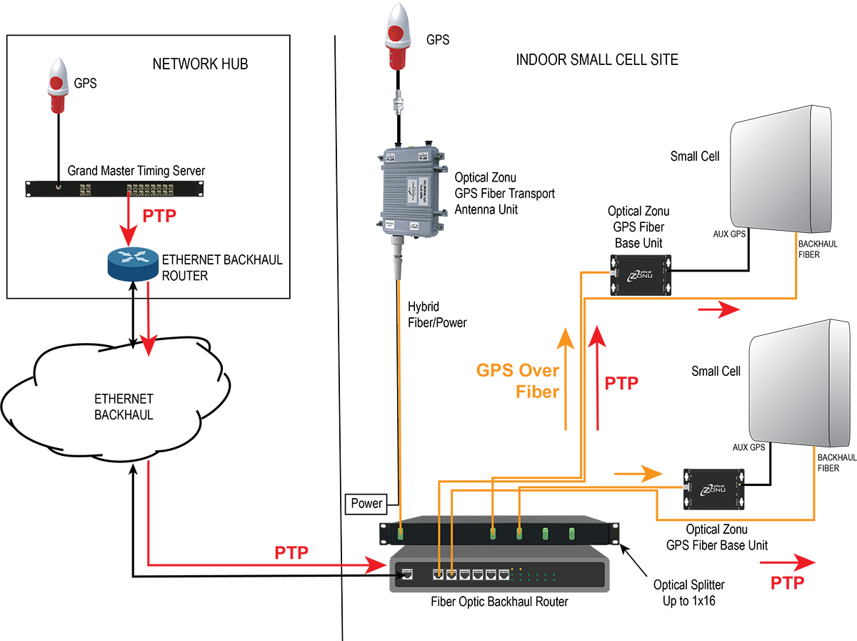
Optical Zonu, a U.S. carrier-approved supplier of RF-over-fiber transport solutions, has solved this problem with its GPS at the Edge kit. The GPS-over-fiber solution distributes GPS to each small-cell location alongside the backhaul.
A compact GPS fiber antenna unit connects to a GPS antenna on the roof. A single cable connection to this unit provides power to the unit and brings the fiber-optic connection to an optical splitter, which is collocated with the local router for the small-cell backhaul.
The fibers from this splitter are routed along with the backhaul cable to each small-cell location, where they each connect to a small fiber base unit that recovers the GPS signal and connects it to the auxiliary GPS port on each small cell.
Optical Zonu offers two variants.
Small cells with fiber-optic backhaul. Higher power cells typically use a fiber-optic backhaul and require local AC power. In this case, one of the fibers in the cable to each small cell is used for the GPS connection, and each base unit connects to the local AC power with an adapter. In this case, the only additional cable needed is the single run to the rooftop.
Diagram: Optical Zonu
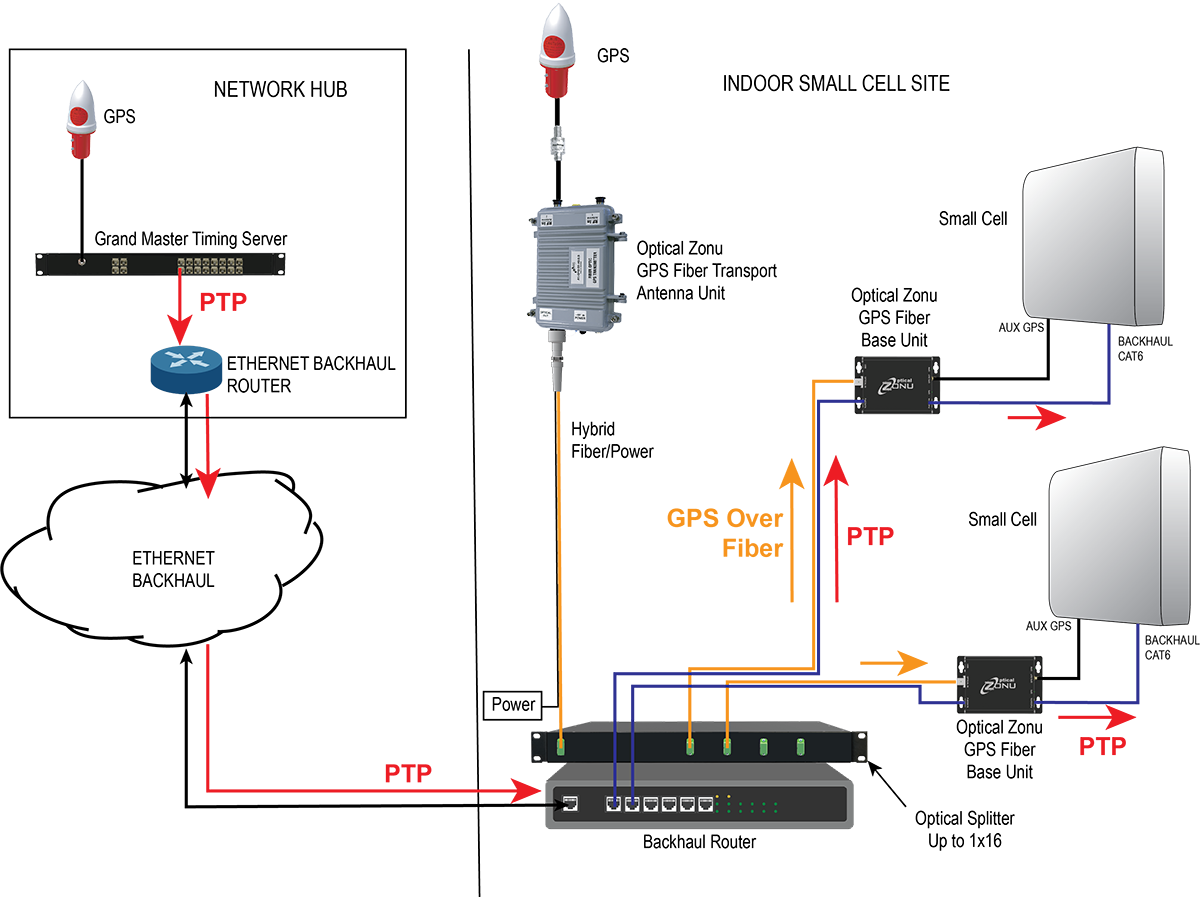
Small cells with a CATx backhaul. This setup is typical for lower power small cells. In this architecture, a single fiber is pulled along with the CAT6 backhaul cable. A single hybrid fiber/CAT6 cable can also be used. The fiber is connected to a small fiber base unit at each small cell to recover the GPS signal, which is connected to the small cell auxiliary GPS port. The CAT6 is also connected to the fiber base unit. The backhaul is passed through from the small cell, and the PoE++ is tapped to power the base unit. Once again, the only additional cable pull is the single run to the rooftop antenna — local power isn’t needed at every small cell location.
Diagram: Optical Zonu
The Optical Zonu GPS at the Edge kit provides an easy-to-install and cost-effective solution that guarantees the highest timing and phase accuracy for a network that is vendor agnostic and, as with the edge grandmaster approach, still has the central PTP as a backup.
New modules enable entertainment, advanced connectivity features and next-generation artificial intelligence
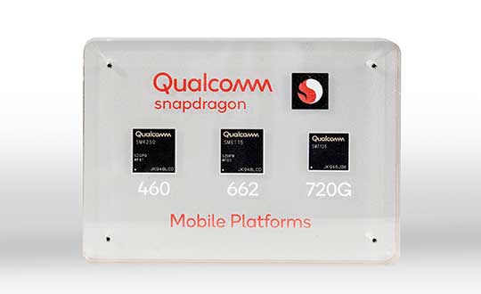
Qualcomm Technologies has launched three new mobile platforms — the Qualcomm Snapdragon 720G, 662 and 460 — to enable enhanced user experiences across connectivity, gaming and entertainment.
The new mobile platforms support dual-frequency (L1 and L5) GNSS to improve location positioning accuracy and robustness. The system-on-chip solutions also support the Indian NavIC (Navigation with Indian Constellation).
Seven constellations. For the first time supported on mobile, the Qualcomm Location Suite now supports up to seven satellite constellations concurrently, including the use of all of NavIC’s operating satellites for more accurate location performance, faster time-to-first-fix (TTFF) position acquisition, and improved robustness of location-based services.
“ISRO is satisfied with the efforts of Qualcomm Technologies Inc. towards incorporating NavIC and we urge OEMs to leverage it for future handset launches in India,” said K. Sivan, chairman, ISRO. “The availability of NavIC across multiple mobile platforms will help enhance the geolocation capabilities of smartphones in the region and bring the benefits of this indigenous solution to Indian consumers for their day-to-day use.”
The new modules also enable fast 4G connectivity speeds, deliver key Wi-Fi 6 features and integrated Bluetooth 5.1 with advanced audio via the Qualcomm FastConnect 6-series subsystems.
Artificial Intelligence. Designed to deliver new and improved AI user experiences across photography, voice assistants and virtually always-on scenarios for increased contextual awareness, the new platforms also feature the Qualcomm AI Engine and Qualcomm Sensing Hub.
“While we see a fast adoption of 5G across geographies globally, we do recognize the phenomenal boost that 4G has given towards enabling broadband connectivity for Indian consumers. 4G will continue to remain a focus area for Qualcomm Technologies for regions like India, where it will stay a key technology for connectivity,” said Rajen Vagadia, vice president and president, Qualcomm India Pvt. Ltd. “Our goal is to enable our partners to continue creating solutions that offer seamless connectivity access and exceptional mobile experiences, that consumers can count on.”
“Today’s smartphone users want fast, seamless connectivity, advanced features and long-lasting battery life,” said Kedar Kondap, vice president, product management, Qualcomm Technologies, Inc. “This expansion of our 4G lineup enables our partners to offer sophisticated solutions that meet global demand and enable a remarkable gaming experience across multiple tiers and price segments.”
Photo: Qualcomm
Snapdragon 720G
Snapdragon 720G reimagines extraordinary gaming and entertainment experiences with select Qualcomm Snapdragon Elite Gaming features, striking capture capabilities, and intelligent performance. Leveraging select Snapdragon Elite Gaming features from premium-tier mobile platforms, Snapdragon 720G delivers smooth HDR game play, dynamic color range and contrast, realistic and immersive in-game environments, and high-quality, synchronized sound with Qualcomm aptX Adaptive.
In addition to gaming, users will have a “home theater in their pocket” with HDR viewing and super-smooth video streaming with the Qualcomm Spectra 350L ISP, Qualcomm said. They can also capture 4K video or snap massive 192-megapixel photos.
Snapdragon 720G also features the latest fifth-generation Qualcomm AI Engine with the improved Qualcomm Hexagon Tensor Accelerator that will enable a host of new AI experiences for gaming, photography, voice assistants and virtually always-on contextual awareness.
The integrated Snapdragon X15 LTE modem supports 3-carrier aggregation, 4×4 MIMO on two carriers and 256-QAM modulation for fast download speeds up to 800 Mbps — allowing for quick app downloads and smooth video streaming and sharing.
In addition, Snapdragon 720G, with the FastConnect 6200 subsystem, virtually doubles Wi-Fi speed and range for online gaming and web browsing, compared to single antenna devices, while also delivering key Wi-Fi 6 features such as 8×8 sounding with multi-user MIMO for up to 2x improvement over competitive Wi-Fi 6 devices, Target Wake Time for up to 67% better power efficiency and the complete WPA3 security suite, as well as integrated Bluetooth 5.1 with advanced audio capabilities.
Finally, users will experience power savings and improved performance due to the Snapdragon 720G’s 8-nm process technology and upgraded CPU architecture.
Snapdragon 662
Snapdragon 662 brings astonishing camera and AI capabilities to the 6-series for the first time. It will feature the new Qualcomm Spectra 340T, which supports triple camera configurations and smooth switching between them — a first in the 6-series. A more robust ISP will enable support for photo capture in the HEIF file format for stunning image quality at half the file size.
The addition of the third-generation Qualcomm AI Engine with Hexagon Vector Extensions and the Qualcomm Spectra 340T will enable AI-based user experiences such as avatars, night photography, and face and voice authentication.
Snapdragon 662 also features the new Snapdragon X11 LTE modem with peak download speeds up to 390 Mbps thanks to 2-carrier aggregation, 2×2 MIMO and 256-QAM modulation, along with 150 Mbps peak uploads to support a snappy web browsing and social media experience.
Snapdragon 460
Snapdragon 460 boasts a gigantic leap in performance across the board in the 4-series, as well as significant boosts in connectivity, AI and camera improvements[1] for the next-generation of mass market smartphones. For the first time in the 4-series, Snapdragon 460 features performance CPU cores and an updated GPU architecture that translates into up to 70% and 60% increase in performance, respectively.
Overall system performance, meanwhile, delivers a 2x increase compared the previous generation. The Hexagon processor with Qualcomm Hexagon Vector eXtensions (HVX) is also introduced into the 4-series for the first time, thereby equipping it with a 3rd generation Qualcomm AI Engine and the Qualcomm Sensing Hub for new AI experiences for photography and voice assistance.
The Qualcomm Spectra 340 ISP is also among the many new additions to the 4-series, enabling the platform to capture stunning photographs and support for triple cameras. An integrated Snapdragon X11 LTE modem allows for download speeds up to 390 Mbps and uploads up to 150 Mbps.
To date, more than 85 commercial devices based on Snapdragon 7-series mobile platforms, more than 1600 commercial devices based on Snapdragon 6-series mobile platforms, and more than 2,500 commercial devices based on Snapdragon 4-series mobile platforms have been announced by global OEMs. Together, the 7-, 6- and 4-series amount to over 4,000 designs — an impressive feat for these segments.
Devices based on Snapdragon 720G are expected to be commercially available in Q1 2020 and devices based on Snapdragon 662 and 460 are expected to be commercially available by the end of 2020. For more information, please visit the product details pages for the Snapdragon 720G Mobile Platform, Snapdragon 662 Mobile Platform, and Snapdragon 460 Mobile Platform.
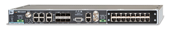
Microsemi has released its TimeProvider 4100 Release 2.0, the latest version of its TimeProvider 4100 precise timing grandmaster.
The TimeProvider 4100 is a grandmaster complemented by extensive port fan-out for PTP, Network Time Protocol, sync and legacy building integrated timing supplies. According to the company, the TimeProvider 4100 offers multiple ports for current, legacy and future networks that can be connected to multiple base stations for 4G and 5G deployments.
Microsemi launched its TimeProvider 4100 Release 2.0, the latest version of its TimeProvider 4100 precise timing grandmaster. (Photo: Microsemi)
Version 2.0 of the TimeProvider 4100 includes a number of new features, including an optional expansion module with 10GE support for 1G/10G/100M fan-out, offering four SFP and four SFP+ ports; increased capacity to 790 PTP clients (up from 512 previously) at a full rate of 128 packets per second; a boundary clock that supports Class C and class D; support for Primary Reference Timing Clock Class B (ITU-T G.8272); and support for multiple operation modes.
The unit can still behave as a fully functional grandmaster from an outputs standpoint and also has the capability to monitor various kinds of inputs, the company added. It also features a new operation mode for a high-performance boundary clock.
According to Microsemi, TimeProvider 4100 Release 2.0 adds support for PRTC-B in addition to PRTC-A. In addition, it adds support for monitoring presentation through Microsemi’s TimePictra 10 synchronization management system.
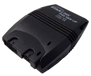
The device combines u-blox GNSS, 4G and Wi-Fi technology, eliminating the need to equip vehicles with a separate mobile Wi‑Fi hotspot.
According to the companies, the StartLink TrackerWi‑Fi is suitable for applications for connected cars, telematics, vehicle diagnostics, fleet management, vehicle security, usage-based insurance, and rental and leasing service companies.
The internet of things (IoT) and connected-car initiatives are providing rental car companies and transportation and logistics firms with tools to track vehicles, preemptively detect and diagnose disturbances from a distance, and monitor the behavior of their drivers in real time. ERM has more than 1.8 million vehicle fleet-tracking devices deployed on roads world-wide.
As onboard Wi‑Fi becomes increasingly widespread, many companies are fitting vehicles with Wi‑Fi hotspots to offer drivers and passengers internet access. With its integrated Wi‑Fi hotspot, ERM’s StarLink TrackerWi‑Fi lets users tap into the cellular 4G connectivity to transfer telematics data to the fleet manager. This makes it possible to send real-time telematics data to the driver’s smart device or onboard infotainment system, and it also reduces the number of SIM cards needed from one per device to one per vehicle.
Sourcing the GNSS tracking, cellular 4G LTE, and Wi‑Fi technology from u-blox played a key role in achieving the device’s fast time to market. By using u‑blox’s pre-tested positioning and communications modules with integrated software, the manufacturer was able to cut the time needed for production and development by several months.
“We saw an opportunity to provide more values to our customers by adding Wi‑Fi hot spot functionality to our StarLink Tracker, our leading telematics product, but knew that we had to be quick to stay ahead of the game,” said Kfir Lavi, senior vice president of ERM Advanced Telematics.
“Our partners are always at the top of our priorities, and we are working to adapt our offerings to the market demands and the changing needs of their customers. Working with u‑blox as the provider of the positioning and wireless communication technology helped us move from concept to commercialization in under six months and provide our partners with an advanced product in a short time,” Lavi said.
“This successful collaboration demonstrates that we have evolved from a provider of individual technologies, namely GNSS positioning, cellular 4G connectivity, or short range radio communication, to a provider of solutions that bundle these technologies,” said Thomas Seiler, CEO of u-blox. “We are seeing increased demand for such bundled solutions and are convinced that the close integration of our technology portfolio offers our customers the unique ability to jump-start even challenging projects on extremely short notice.”
Telit GE310-GNSS IoT Module fills European demand for GSM/GPRS compact form factors, and is part of Telit’s migration-support program that helps customers leverage 2G’s low cost and broad coverage while preparing for 4G and 5G.
The GE310-GNSS module. (Image: Telit)
Telit has released the GE310-GNSS, an internet of things (IoT) module with GSM/GPRS, multi-constellation satellite positioning and Bluetooth functionality in a 270-millimeter-squared form factor.
The GE310-GNSS enables original equipment manufacturers (OEMs) and system integrators in application areas such as asset management, utilities and telematics, meet strong demand for low-cost, highly compact devices without tradeoffs in performance, reliability and functionality, particularly in regional markets such as Europe, where 2G is forecast to remain in strong growth in number of IoT connections for many years.
The GE310-GNSS features a miniature form factor packaged in an LGA 94-round-pad format. It is designed to meet the robust demand in Europe, Latin America and other regional markets for compact devices such as health and wellness monitors, smart residential and commercial thermostats, commercial fleets and IoT-connected grid equipment for smart utilities.
With support for Europe’s Galileo as well as other satellite positioning constellations, the GE310-GNSS is suitable for IoT applications that require location awareness throughout Europe and the rest of the world. The module’s Bluetooth 4.0 capability makes it easy for OEMs to add connectivity to proximal area network devices, Telit said.
The GE310-GNSS is part of Telit’s future-proofing program, which helps customers leverage 2G’s low cost and gapless European coverage immediately while retaining absolute control of when they switch to a compatible 4G module in the Telit family lineup.
The lineup includes multiple roadmap paths to upgrade to 4G and later to 5G based on the customer business strategies and specific market conditions.
Research firm ABI Research estimated in its “ABI IoT Market Tracker – Worldwide – October 2018” that 2G cellular IoT connections will continue to grow in Europe from 100 million in 2018, reaching a peak of 148 million connected devices in 2022 before slowly dropping to about 89 million in 2026.
“The GE310-GNSS is the newest in our lineup of updated 2G modules for markets like Europe and Latin America which still show a sustained pull for over half a decade,” said Yossi Moscovitz, president products and solutions, Telit. “This svelte module combines proven, reliable 2G connectivity with the latest satellite positioning and Bluetooth technologies, all backed by Telit’s decades-enduring migration-support program. Telit has helped thousands of customers through cellular generational transitions and is now helping 2G customers in Europe, Latin America and other regions develop business-enhancing roadmaps to 4G and 5G.”
For more information about the GE310-GNSS and other Telit IoT solutions, visit booth A.b80 at European Utility Week, Nov. 6-8 in Vienna, Austria.
Automotive technology provider ERM Advanced Telematics has launched the StarLink Tracker with Wi-Fi, which integrates advanced vehicle tracking, driver behavior monitoring, theft prevention, Bluetooth, Wi-Fi and 4G cellular capabilities in a single device.
The company’s products have been installed in more than 1.5 million vehicles worldwide, the company said.
The StarLink Tracker with Wi-Fi is the first product under ERM’s new Wireless Connect strategy, which aims to use wireless technologies to provide its partners — vehicle fleet management companies, vehicle manufacturers and importers and car insurance companies — with a competitive edge.
The StarLink Tracker is a modular solution that is designed for installation both in vehicles on the production line and in the aftermarket, for vehicles that have left the production line. It turns any vehicle in which it is installed into a connected car.
The modularity of the product allows the addition of capabilities anytime through the use of add-on products provided by ERM or by a third party. This can be done on demand and without any need to replace the StarLink Tracker device, which keeps functioning as the central tracking and communications unit under any such solution.
The StarLink Tracker with Wi-Fi took about a year to develop, and ERM has already received its first orders to supply the product from customers in the United States, India and Australia.
The 120-gram tracker creates Wi-Fi hotspots in the vehicle for up to eight devices. It features a GPS/GLONASS/Galileo location module and an ability to navigate inside underground parking lots or in mines; a 4G cellular modem; internal antennas, emergency button support and built-in data logger.
Other capabilities are internal management of up to 500 driver IDs, remote immobilization, wireless connectivity to a wide range of additional ERM and third-party products and many other features.
As the core infrastructure for a Connected Car applications, the product can integrate to full range of the vehicle’s internet connectivity needs, which are provided by the use of the tracking unit’s SIM card without the need for any additional SIM card, the company said.
The StarLink Tracker with Wi-Fi and products that ERM Advanced Telematics will launch in the future under its Wireless Connect strategy, can be installed using the installer’s standard smartphone which communicates through Bluetooth connection in order to configure the product and perform any required adaptations. All this can be much faster compared to many other telematics devices and with much less hassle that might have arised due to the need to hook-up and hide wires.
The StarLink Tracker with Wi-Fi is also equipped with a microphone and loudspeaker to initiate and receive calls and dial emergency numbers. One application for this can be E-Call (Emergency Call), such as in the European Union or just as an Emergency Call application.
When pressing the location unit’s emergency button or immediately after an impact above a certain intensity, the unit will allows conversation between the vehicle’s occupants and the emergency center personnel, who can hear what is happening in the vehicle and identify events such as threats against the driver or accidents.
The product will also provide information about the driver’s behavior, including careless driving, accidents, off-road driving, acceleration during turns, speed violations and more, information that can be used by the manager to significantly improve fleet management capabilities, performance and can decrease operational expenses.
The cellular 5G standard targets latencies under 1 millisecond, data rates of up to 10 gigabits per second, extremely high network reliability and better accuracy in positioning. With location awareness becoming an essential feature in many new markets, positioning is considered as an integral part of the system design of upcoming 5G mobile networks.
The cellular industry is currently implementing Long-Term Evolution (LTE)-Advanced, which might be called “4G” mobile broadband. Simultaneously, the industry is preparing the next step, a fifth-generation (5G) system. It will process communication 10 times faster than 4G, according to experts. 5G rollout will be complete in many international metropolitan areas by 2020.
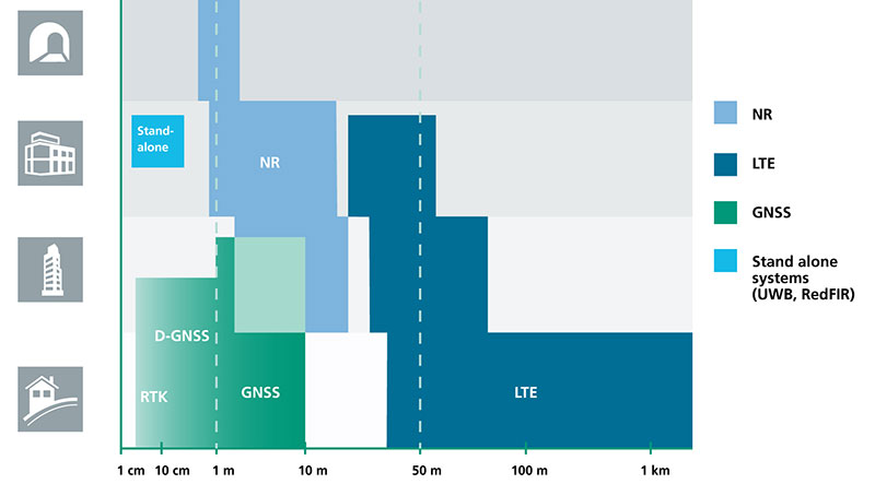
Positioning Performance for 5G NR and other technologies in different environments. (Image: Fraunhofer IIS)
Adaptive array antennas
In addition to the precise positioning it will afford, 5G shares another characteristic with GPS/GNSS: adaptive array antennas for digital beamforming (DBF). Adaptive arrays have many advantages for PNT, primarily in mitigation for multipath, jamming and spoofing.
Emerging applications of DBF in 5G involve dense networks of picocells, small cellular base stations that typically cover a small indoor area. Picocells extend coverage where outdoor signals do not reach well, and add network capacity in areas with very dense phone usage. 5G architectures will use adaptive array technology to achieve high data rates, spectrum reuse and communications robustness.
The implications for PNT are that 5G will require improved (relative) PNT to operate effectively, and picocells will be a source of PNT information in constrained environments.
5G involves massive directional communications via multiple-input, multiple-output (MIMO), enabling high-bandwidth communications in fading (multipath) channels by using multiple antenna inputs to adapt to channels. It can do this without knowledge of user location, but it adds to the processing complexity. The directional capability can enable multiple users to be serviced in a picocell at different frequencies, while permitting spectrum re-use by nearby picocells through narrow beamwidth and the limited range of millimeter-wave (mmWave) frequencies.
The PNT implications of 5G architectures, according to Gary McGraw of Rockwell Collins, are that 5G picocells will be synergistic with PNT in challenged environments — naturally, indoor and dense urban. They will necessitate development of distributed, networked PNT processing and infrastructure.
Fraunhofer
The 5G positioning framework will integrate a multitude of sensors into a hybrid positioning scheme, according to the Fraunhofer Institute for Integrated Circuits (IIS) in Germany. Fraunhofer IIS is currently prototyping low-latency and high-precision positioning systems for legacy LTE and future 5G New Radio (5G NR).
5G NR enables positioning by providing high bandwidths for precise timing, new frequency bands at mmWave, massive MIMO for accurate angle-of-arrival estimation and new architectural options that support positioning. Improved accuracy, robustness and latency can be achieved, according to the institute.
5G provides fast and reliable access to moving objects to achieve time-critical process control and optimization in industrial environments. Increased contextual awareness of goods, parts, machines and workers will enable new interaction and collaboration, the institute said.
Australian tech firm Cohda Wireless has trialed its vehicle-to-pedestrian (V2P) technology on city streets for the first time.
The technology was originally designed to allow cars and motorcycles to avoid collisions by talking to each other.
In collaboration with Telstra and the South Australian Government, Cohda Wireless has conducted the first test of V2P technology over a mobile network in South Australia’s capital, Adelaide.
The system uses mobile technology to provide an early-collision warning to a driver and also alerts a pedestrian or cyclist via a smartphone application.
This innovation could become available in the 16 million smartphones in use in Australia and could potentially be extended to the two billion smartphones worldwide, the company said.
Cohda Wireless CEO Paul Gray said the trials highlighted the impact of vehicle-to-everything communications on community safety.
“Giving vehicles 360-degree situational awareness and sharing real-time driving information is the only way we can create safer roads for the future,” Gray said. “Cohda’s ongoing partnership with Telstra also demonstrates Cohda’s ability to deliver Cellular-V2X (C-V2X) solutions, an important part of the complete V2X system.”
The technology makes use of available 4G networks to allow riders, drivers and pedestrians who are further away to reliably receive necessary information.
Before a driver turns a blind corner the system will notify them of any pedestrian or cyclist crossing the adjacent street.
It was tested using other common scenarios, such as a car and a cyclist approaching a blind corner, a car reversing out of a driveway, and a car approaching a pedestrian crossing.
The trial was funded in part by the South Australian government’s AU$10 million Future Mobility Lab Fund to boost local testing, research and development of connected and autonomous vehicle technologies.
Cohda commands about 60 percent of the global vehicle-to-vehicle communication market.
It previously developed a “digital protective shield” system, which transmitted information such as vehicle types, speed, position and direction of travel between cars and motorcycles, at a rate of up to 10 times per second to ensure a high level of accuracy.
This service could be transmitted to any device within a several hundred-metre radius.
Telstra Chief Technology Officer Håkan Eriksson said the technology would make Australian roads safer, more efficient, and better-prepared for the future of autonomous vehicles.
“The most important outcome of V2X technology is the increased safety for road users, as the impact of human error can be minimized by helping vehicles communicate with each other and react to their surroundings,” he said. “This is the first time V2P technology has been trialled in Australia on a 4G network, and is an important step on the journey to fully-autonomous vehicles on Australian roads.”
South Australia has a history of involvement with autonomous car research and in 2015 held the first driverless car trials in the Southern Hemisphere.
It hosts a number of leading autonomous car companies including Cohda Wireless and its innovative V2X (Vehicle to everything) technology and RDM Group, which opened its Asia-Pacific headquarters in Adelaide earlier this year.
South Australia is also a leading driverless car research hub and earlier this week the University of Adelaide managed to improve artificial vision systems by studying dragonflies and other insects.