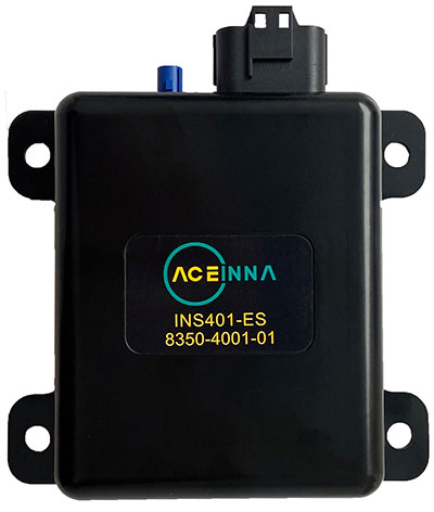
Aceinna Inc. has announced the INS401 INS and GNSS/RTK, a turnkey solution for autonomous vehicle precise positioning. Aceinna made the announcement at the Consumer Electronics Show (CES) taking place this week in Las Vegas.
The INS401 is part of Aceinna’s new product portfolio that provides high accuracy and high integrity localization for developers and manufacturers of advanced driver-assistance systems (ADAS) and autonomy solutions for vehicles of all types.
The INS401 is a high-performance inertial navigation system (INS) with a dual-frequency GNSS receiver enabled with real-time kinematic (RTK). It also features triple-redundant inertial sensors and a positioning engine. It is designed for use in Level 2 and higher ADAS and other high-volume applications requiring precise position information.
The INS401 provides centimeter-level accuracy, enhanced reliability and superior performance during GNSS outages. The dead-reckoning solution delivers strong performance in GNSS-challenged urban environments.
The INS401 is specifically developed for automotive applications using automotive-qualified components and is certified to ASIL-B level according to ISO26262.
INS401 is small, compact and turnkey with a rugged aluminum housing. It includes everything needed for design and development of a robust navigation system with a flexible platform enabling easy customization for fast time to market. The included integrity engine guarantees zero performance failure.
“Based on a decade-long history in ADAS and safety applications, Aceinna is ready for today’s and future autonomous mobility applications,” said Wade Appelman, president and COO of Aceinna. “The INS401 is our next step forward, delivering complex INS/RTK technology to mass markets with turnkey products.”
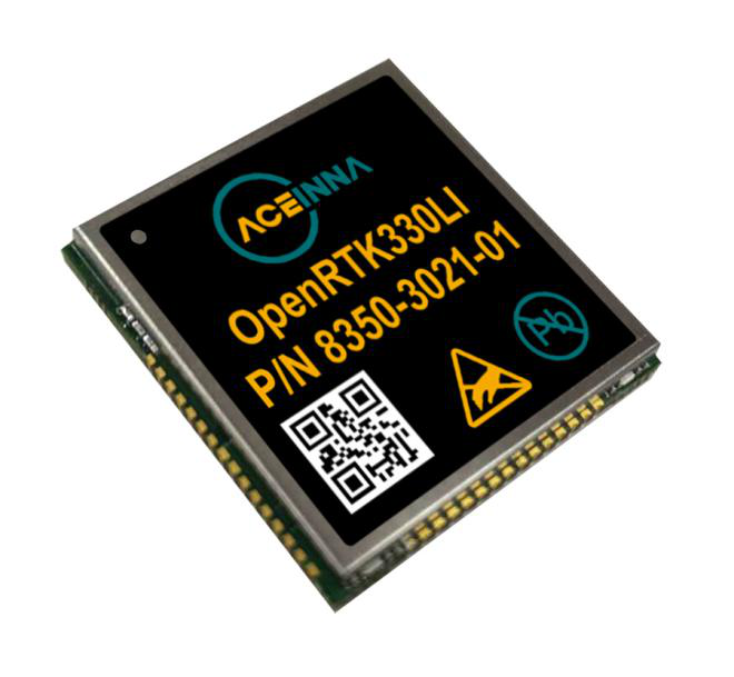
Aceinna and Point One Navigation launch hardware and software platform for precise positioning in agriculture, construction, mapping, surveying, robotics and trucking
The OpenARC positioning service is now commercially available. OpenARC is a precise-positioning hardware and software platform for system integration of GNSS corrections with high-performance inertial navigation system (INS) and real-time kinematic (RTK) hardware.
OpenARC is offered by Aceinna, a developer of inertial-based guidance and navigation systems, and powered by Point One Navigation.
With an RTK positioning engine and GNSS corrections delivered from a ground-based network of secure base stations, OpenARC will reliably improve position accuracy for autonomous vehicles to centimeter-level accuracy. The platform combines Point One’s Polaris GNSS correction service with Aceinna’s OpenRTK330 hardware and software solution for developers of autonomous systems in trucking, precision agriculture, construction, mapping, surveying and robotics.
OpenARC provides high-precision positioning and localization applications, enabling centimeter-level accuracy for challenging tasks such as lane keeping, precision agricultural guidance, and UAV landing maneuvers.
OpenARC is integrated into the OpenRTK330LI navigation module to provide a secure, vertically integrated and easy-to-use positioning platform. OpenARC is very scalable, supporting single-unit installations and high-volume deployments.
Point One’s proprietary Polaris GNSS cloud correction service delivers superior station density in areas where operators need it the most, including urban centers and suburban surrounding areas, enabling cold convergence times of under 10 seconds.
Polaris provides continuous position monitoring and tracks all modern satellite constellations. Its base-station technology includes advanced anti-jam, interference mitigation, security and integrity monitoring. Its architecture allows for GNSS corrections in RTK or state space representation (SSR) configuration. Its open-source interfaces are compatible with multiple receivers and chipsets, and the service is compatible with any NTRIP/RTCM3 compliant receiver.
Partnership combines Aceinna’s integrated precise positioning and advanced guidance expertise with ST’s products, technologies and solutions.
Innovative sensing technology company Aceinna Inc. has joined the STMicroelectronics Partner Program to make its inertial measurement unit (IMU) and real-time kinematic (RTK) precise positioning solutions available to engineers and developers working on next-generation solutions that safely and accurately position autonomous automobiles, trucks, robots and delivery vehicles.
Aceinna is also participating in the Virtual ST Developers Conference on Oct. 20 and Oct. 21 from 8:30 a.m. to 4 p.m. ET, which discusses precise positioning for autonomous vehicles. Register here.
“By leveraging ST technology, Aceinna is providing customers with vertically integrated performance sensing platforms,” said Yang Zhao, CEO of Aceinna. “These system-level solutions help customers greatly accelerate development time as well to reduce the time to market for new autonomous vehicle technologies.”
“The ST Partner Program helps customers’ design teams access extra skills and resources to aid engineering development and shorten time-to-market for new products,” said Alessandro Maloberti, partner ecosystem director, STMicroelectronics. “By selecting, qualifying, and certifying our program partners like Acennia Inc., we are taking yet another major step in helping customers accelerate design and development, and ship to market the most robust and efficient products and services.”
STMicroelectronics, a global semiconductor leader serving customers across the spectrum of electronics applications, created the ST Partner Program to speed customer development efforts by identifying and highlighting to them companies with complementary products and services. The program’s certification process assures that all partners are periodically vetted for quality and competence.
Aceinna, a developer of inertial-based guidance and navigation systems for autonomous vehicles and devices, has partnered with Point One Navigation, which delivers precise positioning for the next generation of transportation.
According to the companies, the partnership enables a streamlined positioning platform that combines Point One’s Polaris GNSS cloud correction service with Aceinna’s OpenRTK330 hardware and software solution for developers in agriculture, construction, mapping, surveying, robotics and trucking.
OpenRTK330, designed for use in Level 3 ADAS and other high-volume applications requiring precise position information, is a GNSS receiver with a built-in RTK engine and triple redundant inertial sensors. According to Aceinna, it includes a multi-band RTK/GNSS receiver coupled with redundant inertial sensor arrays to provide centimeter-level accuracy, enhanced reliability and superior performance during GNSS outages. OpenRTK300 is supported by Aceinna’s open-source tool chain.
Through backend server synchronization between the companies, activation and authentication will be streamlined. In addition, true centimeter-level accuracy will be attainable and powered by the integration of Point One’s coast-to-coast Polaris network and Aceinna’s OpenRTK platform, the companies said.
“This partnership between Aceinna and Point One harnesses and combines each of our distinct strengths, to offer a solution platform that makes high performance positioning accessible to a variety of industries and applications,” said Yang Zhao, chairman and CEO of Aceinna. “We are thrilled to work with Point One’s technical expertise and execution to advance this technology to the next level of precision.”
The combined offering will be available for purchase beginning December 2020.
Aceinna is headquartered in Andover, Massachusetts, and Point One Navigation is headquartered in San Francisco.
A roundup of recent products in the GNSS and inertial positioning industry from the June 2020 issue of GPS World magazine.
OEM
GPS Tester
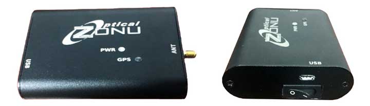
Compact antenna testing for mobile deployments
Photo: Zonu
The ZonuSkyShot is designed for quick testing during the critical installation phase of an antenna at a new site build or small-cell integration. The compact tester is designed for integrating a Zeno GPS solution, but works as a neutral testing device. SkyShot is a compact GPS receiver that detects the presence of a GPS signal, indicated on the top-panel LED. The receiver can be accessed via the USB port on the base unit, allowing the user to see the available satellites by using the app provided with the system and available at the Optical Zonu website. The receiver can simultaneously track up to 16 satellites while searching for new ones. Because of this, a problem can be found and mitigated when a GPS antenna is installed, rather than when hardware is being integrated further down the line. Close-out of projects can be indicated with screenshots of satellite visibility via the micro-USB port to a laptop.
Seamless installation on leading 2020 police sport utility vehicles
Photo: PCTEL
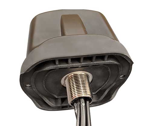
The Trooper TRP-20INT antenna platform supports the high-speed requirements of complex RF communication systems used for critical communications in FirstNet public safety and intelligent transportation systems. The antennas feature two 5G elements compatible with cellular routers supporting 600-MHz to 6-GHz frequencies. PCTEL’s proprietary high-rejection multi-GNSS technology is included for high-precision tracking and asset management.
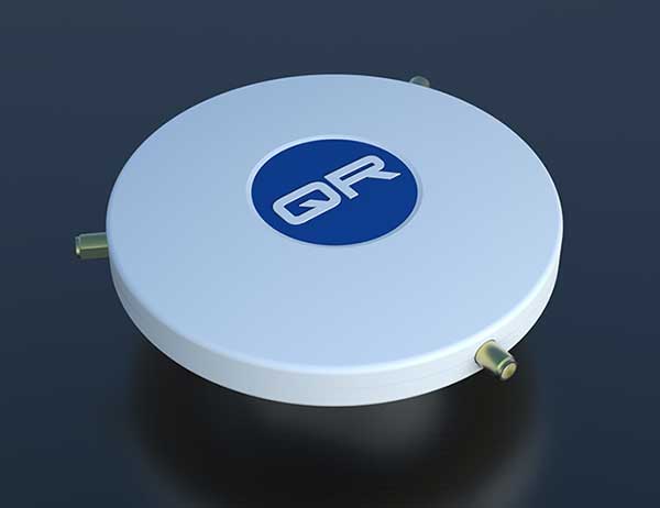
The QR-100 L1/L2 GPS anti-jamming unit mitigates RF interference or jamming signals using a spatial domain of an antenna array reception pattern. Three passive antennas of the customer’s choice can be connected to the QR-100 unit using built-in SMA connectors. The unit default configuration (no jamming signal present) has a 120-degree phase gradient between antenna elements to maximize the reception of GPS right-hand circularly polarized (RHCP) signals. This feature allows the unit to be connected to either RHCP-type antennas or linearly polarized antennas. The default configuration of the unit is designed to connect to passive GPS antennas.
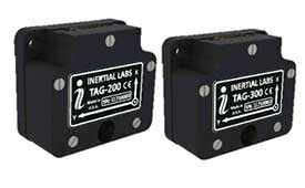
Inertial Labs’ TAG-200 two-axis and TAG-300 three-axis gyroscopes are developed for electro-optical systems, gimbals, line-of-sight, and pan-and-tilt platforms for stabilization and pointing applications. TAG-200 and TAG-300 use advanced-performance, tactical-grade MEMS sensitive elements to accomplish complex tasks requiring accurate stabilization of assorted platforms. The gyroscopes, designed for use in harsh environments, can withstand extreme shock and vibration in accordance with MIL-STD-810 ground mobile use. They are fully digitized, include built-in test functions and have no moving parts. The gyroscopes include low noise, low latency, wide bandwidth, high data rate, low bias drift, low VRE, high MTBF and are ITAR-free. They are factory calibrated over the operational temperature range and are quality assurance and quality compliance tested and supplied with individual calibration and acceptance test certificates.
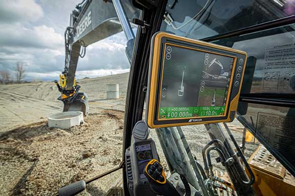
Earthworks Grade Control Platform version 2.0 features improvements to enable faster return on investment, increase productivity and decrease training time for operators. Horizontal Steering Control for dozers automatically controls the machine to follow any horizontal alignment such as a back of a curb, breakline, roadway centerline or bottom of slope, without operator assistance. Augmented reality for excavators enables users to understand 3D models, cut/fill information, slope data and other bench points and reference points on the in-cab display in context, without the need to interpret complex 2D plans or stakes. A new mastless motor grader configuration gives operators an improved range of blade motion, allowing for machine control in applications where it previously was not possible. Integrated Trimble Loadrite Payload Management displays grade control and accurate payload data on one screen, increasing mass haul productivity and efficiency by preventing underloading, and improving safety by avoiding overloading. Trimble Earthworks is also now available for compact grading attachments with dual GNSS, single GNSS and total station guidance options. The Earthworks Assistant App provides access to Earthworks learning material and documentation, allowing for a shorter learning curve and less downtime for operators.
The addition of advanced tilt and rotation functionality allows Automatic Excavator operators to easily swivel or tilt the bucket with automatic boom control for faster and more efficient excavation. If excavator operators are in situations such as at the top of the slope, grading a long incline and not totally perpendicularly lined up, the added feature makes it easier to position the cutting edge of the bucket to the surface. Operators can excavate more quickly, moving the excavator fewer times with less wear and tear on the chassis. It is also beneficial when navigating around manholes, trenches and tight spaces.
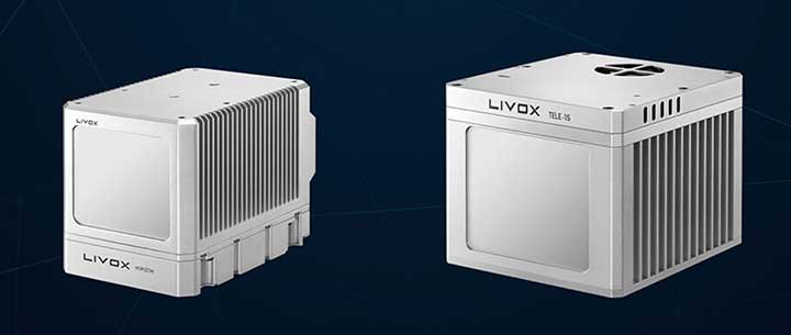
The Horizon is a high-performance lidar sensor built for Level 3 and Level 4 autonomous driving. It has a long-distance detection range of up to 260 meters, high-density point clouds, and is so small it can be embedded easily into vehicles. The Tele-15 has achieved a reliable detection range of up to 500 meters, offering improved safety for high-speed autonomous vehicles. Both the Horizon and Tele-15 high-performance lidar sensors feature a new scanning method that offers improved sensing performance at a low cost.
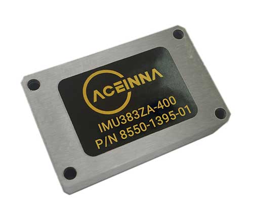
The IMU383ZA is a high-accuracy, triple-redundant inertial measurement unit (IMU) for guidance and navigation solutions in autonomous machines and vehicles. It integrates triple-redundant, 3-axis micro-electromechanical system (MEMS) accelerometer and gyroscope sensors. The IMU383ZA is pin-compatible with the IMU381ZA and offers high performance of 1.3 deg/hr, 0.08 deg/root-hr. The miniature module is factory-calibrated over the –40° C to +85° C industrial temperature range to provide consistent performance through extreme operating environments for a wide variety of applications.
Aceinna was recognized as a partner-level supplier for 2019 and was inducted into the Supplier Hall of Fame in the John Deere Achieving Excellence Program.
Aceinna is a supplier of high-performance inertial sensor modules to John Deere’s operation in Fargo, North Dakota, for autonomous navigation and positioning.
Hall of Fame status is given after a supplier attains a Partner-level rating for five consecutive years. The Partner-level status is Deere & Company’s highest supplier rating.
According to John Deere, “Aceinna has earned this award in recognition of its dedication to providing products and service of outstanding quality as well as its commitment to continuous improvement.” Company employees accepted the recognition during formal ceremonies held on Jan. 29 in Davenport, Iowa.
Suppliers who participate in the Achieving Excellence program are evaluated annually in several key performance categories, including quality, cost management, delivery, technical support and wavelength, which is a measure of responsiveness.
John Deere Supply Management created the program in 1991 to provide a supplier evaluation and feedback process that promotes continuous improvement.
“We are honored to be recognized by John Deere for our fifth straight year for the technical merits of our IMU (inertial measurement unit) and our focus on product quality and on time delivery,” said John Newton, vice president for inertial products. “This John Deere award further adds to the industry recognition that Aceinna has earned over the last couple of years, positioning us as one of the industry leaders and innovators in the autonomous vehicles navigation and positioning space.”
New sensor provides easy-to-integrate, cost-effective, triple-redundant IMU hardware and software for guidance and navigation solutions in autonomous machines and vehicles
Photo: Aceinna
Aceinna has launched a new high-accuracy inertial measurement unit (IMU), the IMU383ZA. The sensor integrates triple-redundant, 3-axis micro-electromechanical system (MEMS) accelerometer and gyroscope sensors.
The IMU383ZA is an improved, pin-compatible version of Aceinna’s IMU381ZA. It offers high performance (1.3 deg/hr, 0.08 deg/root-hr) and a triple-redundant sensor architecture for ultra-high reliability.
The miniature module is factory-calibrated over the -40° C to +85° C industrial temperature range to provide consistent performance through extreme operating environments for a wide variety of applications.
Applications include automotive advanced driver-assistance systems (ADAS), autonomous systems, drones, robotics, agricultural, construction and other industrial machines.
The IMU383ZA provides a standard SPI bus for cost-effective board-to-board communications. Other features include advanced synchronization and a bootloader for field upgradeability.
Measuring 24 x 37 x 9.5 millimeters, the IMU383ZA integrates a triple-redundant architecture that — combined with the small, low-cost packaging — meet the challenging performance, reliability and cost requirements of the automotive market including the areas of autonomous vehicles, self-driving taxis/delivery vehicles, ADAS systems, electronic stability control and lane-keep assist applications.
The triple-redundant sensor architecture consists of three independent, 3-axis accelerometer and 3-axis gyros for excellent accuracy and reliability. By embedding a triple-redundant sensor array, the IMU383ZA uses Aceinna’s proprietary voting scheme to utilize only valid sensor data. Any defective sensor output or errant dataset will be ignored or de-rated in importance.
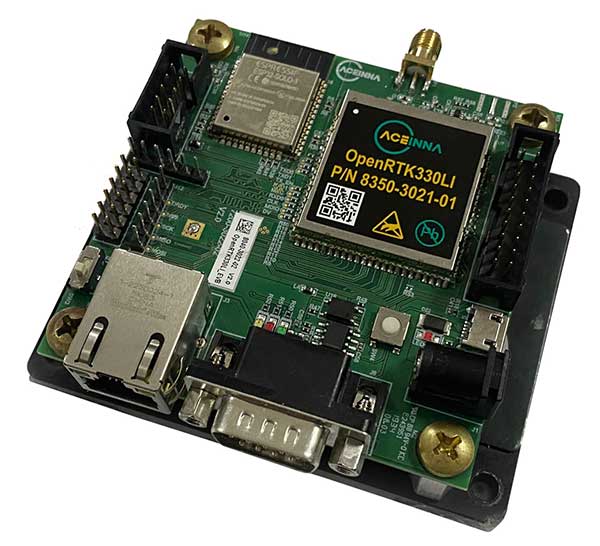
The Aceinna OPENRTK330L integrates a triple-band RTK/GNSS receiver and a triple-redundant inertial sensor to enhance the safety of autonomous systems.
Photo: Aceinna
Aceinna is now shipping its OPENRTK330L, a cost-effective module designed for developers creating mission-critical guidance and navigation systems for autonomous vehicles, including robots, drones, industrial, construction and agricultural machinery.
Aceinna designed the OPENRTK330L to replace expensive and bulky precision RTK/INS systems used in today’s autonomous systems.
The OPENRTK precise positioning engine optimizes satellite tracking and high RTK fixes rates while integrating seamlessly with Aceinna’s open-source Open Navigation Platform.
ACEINNA’s OPENRTK330L includes a triple-band RTK/GNSS receiver coupled with redundant inertial sensor arrays to provide centimeter-level accuracy, enhanced reliability and superior performance during GNSS outages. It integrates a precise 1.5-degree/hour inertial measurement unit (IMU) to offer 10 to 30 seconds of high accuracy localization during full GNSS denial.
The OPENRTK330L’s embedded Ethernet interface allows easy and direct connection to GNSS correction networks around the world. OPENRTK330L’s CAN bus interface allows simple integration into existing vehicle architectures.
The multi-band GNSS receiver can monitor all global constellations (GPS, GLONASS, BeiDou, Galileo, QZSS, NAVIC, SBAS) and simultaneously track up to 80 channels. The module has RF and baseband support for the L1, L2 and L5 GPS bands and their international constellation signal equivalents.
By integrating a triple-redundant IMU array, the OPENRTK330L is able to recognize and utilize only valid sensor data, ensuring high-accuracy protection limits and certifiability under ISO26262 standards. ACEINNA’s triple redundant 6-Axis IMU array uses a total of 9 accelerometer and 9 rate gyro channels.
The OPENRTK330L is supported by ACEINNA’s Open Navigation Platform, allowing custom-embedded application development on top of the positioning engine and dead-reckoning algorithms.
OPENRTK330L hardware also includes Ethernet, UART, SPI and CAN interfaces for versatile integration into a host system. Additional specifications include operating temperature range of -40C to +85C, and qualification to standard automotive shock and vibration levels.
A roundup of recent products in the GNSS and inertial positioning industry from the March 2020 issue of GPS World magazine.
OEM
NavIC modules
Support both L1 and L5 bands
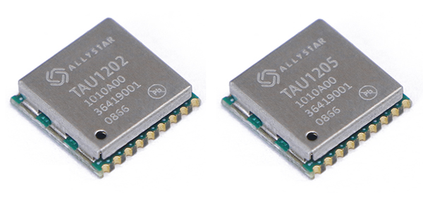
Photo: Allystar
The dual-band multi-GNSS modules TAU1202 and TAU1205 support both the L1 and L5 bands to enhance sub-meter positioning accuracy. Constellations received include GPS, Galileo, GLONASS, BeiDou, QZSS and NavIC. Besides the L1 band, TAU1202 and TAU1205 also support L5/B2a/E5a, which are expected to have lower noise and significantly reduced multipath mitigation because of the higher chipping rate of L5 signals relative to L1 C/A code. TAU1205 supports NavIC (IRNSS), improving navigation in India and the Middle East. Powered by the Cynosure III GNSS chipset and with built-in low-noise amplifier and surface acoustic wave (SAW) filter, TAU1202 and TAU1205 provide higher sensitivity, ensuring exceptional acquisition and tracking performance even in weak signal areas.
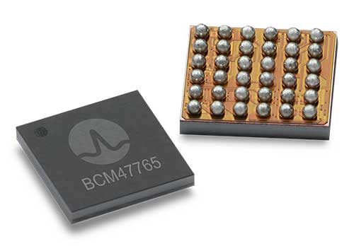
The BCM47765 dual-frequency GNSS module is capable of using the BeiDou-3 constellation’s B2a signals (the Chinese indicator for L5). It can track 30 new L5 signals (60% more) with a significant impact on accuracy. End users will experience much higher reliability of the submeter accuracy inherent to dual-frequency L1/L5. The enhanced L5 signal improves the accuracy of GNSS in an urban scenario by mitigating reflections from nearby buildings (multipath). It also improves GNSS in an open-sky scenario, allowing for submeter accuracy. Second generation dual-frequency GNSS will enable lane-level driving navigation, allowing applications to know in which highway lane a vehicle travels.
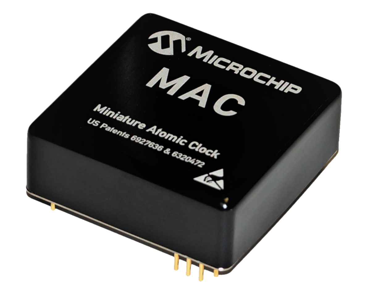
The MAC-SA5X miniaturized rubidium atomic clock is a high-performance atomic clock that delivers a wide thermal range, critical performance improvements and other enhancements over previous clocks. The MAC-SA5X produces a stable time and frequency reference that maintains a high degree of synchronization to a reference clock, such as a GNSS-derived signal. Its low monthly drift rate, short-term stability and stability during temperature changes allows the device to maintain precise frequency and timing during extended periods of holdover during GNSS outages or for applications where large rack-mounted clocks are not possible. Operating over a temperature range of –40 to +75 Celsius, the MAC-SA5X is designed to quickly achieve atomic stability performance with a fast lock.
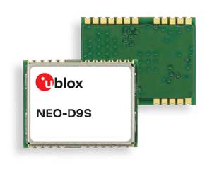
The NEO-D9S GNSS correction data receiver module provides an affordable approach to bringing centimeter-level accuracy to GNSS receivers. The NEO-D9S receives corrections from correction service providers broadcast on the L-band (1525–1559 MHz). A host processor can then decrypt this correction data and provide it to a high-precision GNSS receiver, combining corrections directly with readings from the satellite constellations to enable much more accurate position readings than those offered by GNSS signals alone. Use of the NEO-D9S will also increase the availability of high-precision GNSS positioning data in areas with limited connectivity and reduce the amount of cellular data consumed by positioning receivers. Expected customers are Tier 1 and OEM carmakers, industrial system integrators, and any other applications that rely on very accurate positioning at low cost. The NEO-D9S module is a correction-only receiver. Based on the latest u-blox ninth-generation (D9) platform, it will integrate easily with the u-blox F9 RTK GNSS receivers from u-blox, or can be used as part of a modular product roadmap.
The Qualcomm Snapdragon 720G, 662 and 460 enable enhanced user experiences across connectivity, gaming and entertainment. The new mobile platforms support dual-frequency (L1 and L5) GNSS to improve location positioning accuracy and robustness. The system-on-chip solutions also support NavIC. For the first time on mobile, the Qualcomm Location Suite supports up to seven satellite constellations concurrently, including NavIC.
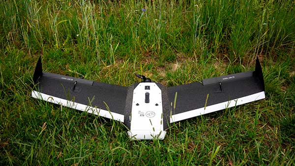
Dedicated to surveying and agriculture, the UAV Birdie is tailor-made, combining intuitive use and high-quality data through precise sensors and GPS RTK L1/L2 onboard. Features include a 24-megapixel camera or optional full-frame 42-megapixel camera; flight time up to 60 minutes; and coverage up to 8 square kilometers in one flight. A vertical-takeoff-and-landing (VTOL) upgrade is available.
Skyfront’s Perimeter 8 drone is equipped with Silvus Technologies’ SteamCaster Radio system, a powerful user-customizable radio system for the military, police and broadcast. The new long-range drone will allow operators to inspect pipelines and other assets as well as conduct long-range surveillance missions. The octocopter can fly for five hours and travel up to 100 kilometers without losing connection from the ground station. Currently, five models are available to suit uses including mapping, lidar and medium, long, or extra-long surveillance. SteamCaster radio system uses the latest beam-forming technology, spatial multiplexing, and space-time coding to ensure the drone can be controlled in environments in which other radio systems are likely to fail. The combination of the technologies allows the range to be increased from 40% to 100%. SteamCaster comes with SteamScape, a network management interface to allow for key metrics and statistics to be viewed and collected in real time. The system also allows the drone to be overlayed onto a map showing the current location and path of the drone.
Delivers critical tools on the ground or in the air
Photo: Robotic Research
The Pegasus Mini is a smaller version of the Pegasus, a hybrid unmanned aircraft system/unmanned ground vehicle. The Pegasus hybrid UAS/UGV configuration delivers advanced GPS-denied mapping with fully autonomous high-speed flying and driving capabilities. Pegasus Mini is designed to provide the extra reach that a UAV or UGV alone cannot provide. Uses include inspection, rescue, rapid response, and applications that strongly benefit organizations in oil and gas, public transportation, law enforcement, public safety, and more.
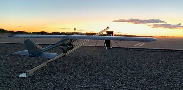
The Silent Falcon E1 UAV has completed 500 hours of successful flight testing and operations. It’s maker, Silent Falcon UAS Technologies (SFUAS), is based in Albuquerque, New Mexico. The E1 solar-electric, fixed-wing UAV is noise free, emission free, and provides long-range, low-cost intelligence, surveillance and reconnaissance (ISR) capability. It has a payload capacity of 20 pounds and a ceiling of 20,000 feet above ground level. SFUAS has an application pending before the FAA for type certification of the E1. The 500-hour milestone confirms for federal regulators that it is safe and durable. Silent Falcon aircraft have operated in eight foreign countries and are not ITAR restricted.
The High Definition (HD) GNSS cloud-based solution enables mass-market devices to achieve sub-meter accuracy across the globe. HD GNSS enables lane-level navigation, augmented reality and virtual reality. It combines precise point positioning (PPP) and real-time kinematic (RTK) positioning methods, allowing for fast convergence time, high availability and global coverage. It also supports off-the-shelf mobile devices and internet of things (IoT) trackers equipped with dual-frequency chipsets.
The OpenRTK330L GNSS/INS module is designed for developers creating guidance and navigation systems for autonomous vehicles, robots, drones, industrial, construction and agricultural machinery. OpenRTK330L is a low-cost, high-performance triple-band RTK/GNSS receiver coupled with redundant inertial sensor arrays to provide cm-level accuracy, enhanced reliability, and superior performance during GNSS outages. The module is aimed at automotive, robot, drone, construction and agriculture systems. The multi-band GNSS receiver can monitor all global constellations (GPS, GLONASS, BeiDou, Galileo, QZSS, NavIC, SBAS) and simultaneously track up to 80 channels. The module has RF and baseband support for the L1, L2 and L5 GPS bands and their international constellation signal equivalents.
Swift Navigation, a firm specializing in GNSS positioning technology for autonomous vehicles, looks back on a year of progress in 2019 and forward to what’s ahead in 2020.
2019 highlights include the expansion of operations to Australia, continued Firmware Releases to improve Swift’s multi-band, multi-constellation GNSS receivers, the expansion of Skylark cloud corrections service across the United States and announcing a partnership with Arm to bring precise positioning technology to autonomous vehicle compute platforms.
While Swift is proud of these accomplishments, the company is most excited about its shift from a company providing RTK GNSS receivers to one that provides a full ecosystem of precise positioning GNSS solutions for autonomous and mass-market applications.
Swift has made it possible for customers and partners alike to incorporate Swift’s patented technology into a multitude of autonomous platforms.
From the receiver-agnostic Starling positioning engine that enables the accuracy of Swift GNSS receivers and opens it up for industry use, to cloud-based corrections delivered nationwide with Skylark, Swift is poised to bring precise positioning to those who can benefit from centimeter-level location accuracy the most — autonomous platforms and applications.
While Skylark and Starling work independently with many leading industry components and receivers, it is the two paired together that makes the precise positioning powerhouse that will make 2020 a pivotal year for Swift.
At this year’s CES, the following Swift partners and customers are showcasing how they are integrating Swift’s precision positioning solutions in their platforms:
Arm — a global leader in semiconductor IP — utilizes Starling to deliver a high-integrity, high-accuracy GNSS positioning solution enabling automotive OEMs, as well as Tier 1 and 2 auto suppliers, to integrate precise positioning into their sensor suite. Arm is hosting meetings by appointment on Level 2 of the Venetian at Veronese 2505 and Veronese 2506.
STMicroelectronics — a global semiconductor leader — provides GNSS measurement engines and ASIL-rated processors for autonomous driving and high-accuracy GNSS solutions. ST has integrated Starling on the ST ASIL-rated Telemaco Platform for OEM applications. ST is hosting meetings by appointment only at their Hospitality Suites during CES 2020.
Aceinna — a provider of sensing solutions — announced its OpenRTK330 precise positioning module at CES. The new OpenRTK330 is based on the ST TeseoV receiver and includes three ST ASM330LHH IMUs for inertial measurements. Skylark is the preferred corrections provider for the OpenRTK330 and evaluation kits. Aceinna will be demonstrating its new module in booth 6738 in the North Hall Automotive pavilion.
See Swift in action at the CES locations above or contact the Swift team at [email protected] to schedule a meeting.
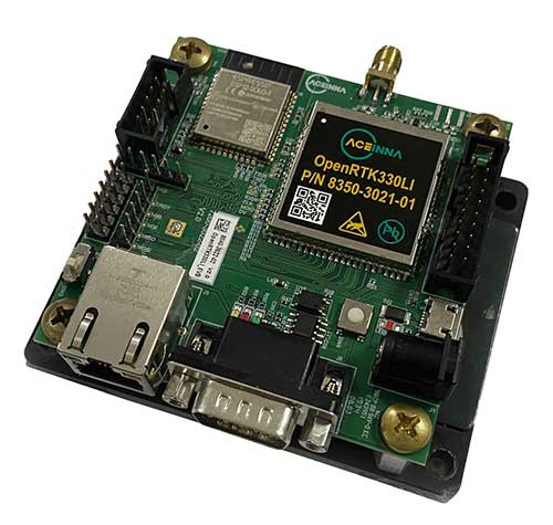
Module designed for developers creating guidance and navigation systems for autonomous vehicles, robots, drones, industrial, construction and agricultural machinery
Aceinna launched its OpenRTK330L at CES 2020, the massive annual consumer electronics show taking place Jan. 7-10 in Las Vegas. The company is located at Booth 6738, CES North Hall, Automotive Pavilion.
OpenRTK330L is a low-cost,high-performance triple-band RTK/GNSS receiver with built-in triple redundant inertial sensors. Designed to replace the expensive and bulky precision RTK/INS systems used in today’s autonomous systems, the compact navigation solution meets the challenging performance, reliability and cost requirements of the automotive market along with the needs of robot, drone, construction and agriculture systems, Aceinna said.
Demonstration Drive
Aceinna is demonstrating its GNSS/INS-based autonomous vehicle localization technologies on its test vehicle, which drove from Silicon Valley to Las Vegas.
The company is recording live drive-test data that demonstrates how its precision positioning solutions provide high accuracy and reliability. Precision location capability is critical for all levels of autonomous driving.
OpenRTK330L includes a triple-band RTK/GNSS receiver coupled with redundant inertial sensor arrays to provide cm-level accuracy, enhanced reliability, and superior performance during GNSS outages.
The OpenRTK330L integrates a precise 2 Degree/Hour IMU to offer ten to 30 seconds of high accuracy localization during full GNSS denial. This enables autonomous system developers to safely deliver highly accurate localization and position capabilities in their vehicles at prices that meet their budgets.
Image: Aceinna
OpenRTK330L’s embedded Ethernet interface allows easy and direct connection to GNSS correction networks around the world. OpenRTK330L’s CAN bus interface allows simple integration into existing vehicle architectures.
The multi-band GNSS receiver can monitor all global constellations (GPS, GLONASS, BeiDou, Galileo, QZSS, NAVIC, SBAS) and simultaneously track up to 80 channels. The module has RF and baseband support for the L1, L2 and L5 GPS bands and their international constellation signal equivalents.
The inertial measurement unit and dead reckoning function contains a total of 9 accelerometer and 9 rate gyro channels based on Aceinna’s unique triple redundant six-axis IMU array. By integrating a triple-redundant IMU array, the OpenRTK330L is able to recognize and utilize only valid sensor data, ensuring high-accuracy protection limits and certifiability under ISO26262 standards.
Open Navigation Platform
“The combination of a triple-band GNSS receiver and a high-precision IMU has enabled us to make a remarkably accurate, small, reliable and cost-effective GNSS/INS solution,” said Mike Horton, CTO of Aceinna. “The OpenRTK Precise Positioning Engine optimizes satellite tracking and high RTK fixes rates while integrating seamlessly with Aceinna’s open-source, developer-friendly Open Navigation Platform.”
The Open Navigation Platform allows custom embedded application development on top of Aceinna’s positioning engine and dead-reckoning algorithms. Autonomous solution developers have full access to all resources on the OpenRTK330L module including the GNSS receiver measurement data, IMU measurement data and all interfaces.
The OpenRTK330L GNSS receiver supports GPS (L1 C/A, L2C and L5), GLONASS (L1OF, L2OF), BeiDou (B1I, B2I), GALILEO (E1, E5a, E5b, E6) QZSS (L1 C/A), and NAVIC. The IMU sensor array includes a triple-redundant, 3-axis MEMS angular rate sensor, and a triple-redundant, 3-axis MEMS accelerometer.
Hardware also includes, Ethernet, UART, SPI and CAN interfaces for versatile integration into a host system. Additional specifications include operating temperature range of -40C to +85C, and qualification to standard automotive shock and vibration levels.
Mike Horton, CTO at Aceinna, gives GPS World an overview of OpenIMU, the company’s open-source inertial navigation platform, at ION GNSS+ 2019 in Miami.