The ANT Center is a forward-looking research center within the AFIT seeking to identify and solve tomorrow’s most challenging autonomy and navigation problems.
The ANT Center’s goal is to develop navigation technology that ensures the Department of Defense (DOD) can navigate anywhere, anytime, using anything, and to improve the DOD’s ability to conduct autonomous operations.
Alion will research, assess, analyze and develop the ANT Center’s research in autonomous and cooperative systems, non-GPS precision navigation, and robust GNSS navigation/Navigation Warfare (NAVWAR). This effort supports the AFIT’s mission to advance air, space, and cyberspace power for the nation, its partners, and our armed forces by conducting relevant defense-focused research to enhance technical graduate and continuing education, while supporting the development and evolution of navigation and autonomy technologies, impacting weapon systems across the DOD.
“Alion has some of the greatest engineering and technology minds in industry partnering side-by-side with our customers to face challenging issues and create technologies, solutions and advancements in innovation to keep our nation ahead,” said Eric Wright, Alion’s vice president of the Integrated Solutions Operation within the Advanced Technology Group. “We are privileged to be working with the U.S. Air Force Institute of Technology to achieve the goals of the ANT Center.”
This task was awarded under the Department of Defense Information Analysis Center Multiple Award Contract (IAC MAC) issued by the Air Force Installation Contracting Center. This material is based upon work supported by the DOD Information Analysis Center Program Management Office (DOD IAC PMO), sponsored by the Defense Technical Information Center (DTIC) under Contract No. FA807518D0002.
There are many ways to navigate. For most applications, none surpass the accuracy, affordability and convenience of satellite navigation.
However, given the threats to GNSS from spoofing and jamming, and the possibility that GNSS satellites could be destroyed accidentally by space debris or intentionally during a war, the search is on for alternative sources of positioning, navigation and timing (PNT) data.
Potential alternative PNT (APNT) approaches include computer vision, terrain contour matching (TERCOM, which was used to guide cruise missiles in the 1970s and 1980s), and using magnetic anomalies (MAGNAV).
Diverse animals — such as sea turtles, spiny lobsters, and birds — use magnetoreception for orientation and navigation. However, while animals likely perform wayfinding using the direction of the magnetic field, similarly to how humans use a compass, high-resolution maps used in conjunction with atomic instruments enable us to perform absolute positioning to tens of meters, explained Major Aaron Canciani.
Canciani, an assistant professor of electrical engineering at the Air Force Institute of Technology, has been designing algorithms for MAGNAV flight testing for several years.
Earth’s crustal magnetic field varies from location to location as much as topographic features do and, like them, it changes very little over time. However, unlike topographic features, which only occur on the third of the planet’s surface covered by land, magnetic variations also occur on the oceans. This makes them potentially very useful as landmarks to the Navy and Air Force. Magnetic variations have the additional benefit that they cannot be jammed or spoofed.
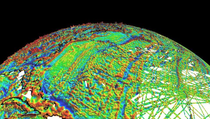
NOAA’s EMAG2 World Digital Magnetic Anomaly Map. (Image: NOAA National Geophysical Data Center)
Just like other features of Earth, magnetic fields can be mapped, using scalar magnetometer sensors to measure their strength and direction. In fact, government agencies and mining companies have been making these maps for many decades, for geological exploration and other purposes, though mostly on land.
Conversely, these maps can be used to navigate by comparing the data from magnetometers to the map, just like cruise missiles used to use on-board radar altimeters to match the contours of the land beneath them to contour lines on a digital map and navigators on vessels in shallow waters compare the depths reported by their fathometers to those marked on a chart.
Before this approach to navigation can be widely implemented, however, magnetic maps need to greatly improve in coverage and quality. In addition to magnetic maps and sensors, MAGNAV also requires sophisticated algorithms and careful calibration, to do such things as subtract errors from space weather and the local magnetic field of the aircraft or ship.
The greater the platform’s speed, the greater MAGNAV’s accuracy, because the magnetometers can collect more varying magnetic information per unit of time of INS drift, Canciani explains. On a platform moving fast and at low altitudes, MAGNAV could achieve 10-meter accuracy. In less ideal conditions and relying on lower quality magnetic maps, the accuracy could be as low as one kilometer — which is sufficient for many missions, such as navigating ships at sea.
Off-the-shelf scalar magnetometers about the size of a quarter have already been flight tested. Corporations, the military and civilian government agencies such as NOAA, NASA and NGA already have suitable magnetic maps, though they need to be improved and expanded, particularly at sea. This would require gathering new data using calibrated sensors on airplanes, ships and submarines.
Could magnetic sensors be installed on thousands of aircraft, land vehicles and sea vessels to collect magnetic data during their routine operations? “With proper calibration, yes, but it should not be downplayed how difficult it is to get 1 nanoTesla measurements on a platform,” Canciani said. “Mapping and navigation are inverse problems so any platform that has been calibrated well enough to navigate could, in turn, also be used for mapping.”
However, he points out, the task is much more complicated than just putting a magnetometer on a platform. “Getting clean data on complex platforms remains the largest challenge for magnetic navigation,” Canciani said, “although we are making excellent progress with projects like the Air Force Accelerated AI program with MIT and Lincoln Lab. In this project we are using state of the art scientific machine learning approaches to calibrate complex magnetic fields on operational platforms. Without excellent calibration algorithms the only sure-fire way to get clean magnetic data is putting a sensor out on a boom or wing-tip, which might not be practical for all use cases.”
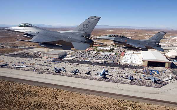
Two F-16 Fighting Falcons fly over Edwards AFB during a 2009 air show. (Photo: U.S. Air Force/Chad Bellay)
Canciani admits that MAGNAV is often met with skepticism but hopes that realistic testing on realistic platforms will lead to more interest and funding for this approach.
While some such testing has already been performed using private survey aircraft, a much more important test will take place in September, when F-16s from the Air Force Test Pilots School will fly MAGNAV sensors and software over a test range next to Edwards Air Force Base in Nevada.
Two F-16 Fighting Falcons fly over Edwards AFB during a 2009 air show. (Photo: U.S. Air Force/Chad Bellay)
The U.S. Air Force in September will begin testing on F-16’s an alternative position, navigation and timing (PNT) solution that uses the Earth’s magnetic anomalies.
The navigation technique, dubbed MAGNAV, is being researched at the Air Force Institute of Technology (AFIT), reports Forbes.
Air Force Major Aaron J. Canciani, an Assistant Professor of Electrical Engineering at AFIT, designed algorithms for MAGNAV flight testing on F-16s. Testing has already taken place using private survey aircraft.
MAGNAV sensors and software will be flown on Air Force Test Pilot School (AFTPS) F-16s over a special test range adjacent to Edwards Air Force Base in Nevada.
Magnetic anomaly navigation uses scalar magnetometer sensors that measure differences in the magnitude of magnetic fields when traveling past them. These variations can be compared with known features in magnetic field maps and be interpreted to determine position.
The four pillars of MAGNAV are magnetic maps, sensors, algorithms and calibration. The magnetic maps already exist within industry, the military and government agencies including NOAA, NASA, NGA and more.
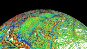
NOAA’s EMAG2 (v3) World Digital Magnetic Anomaly Map. (Image: NOAA National Geophysical Data Center)
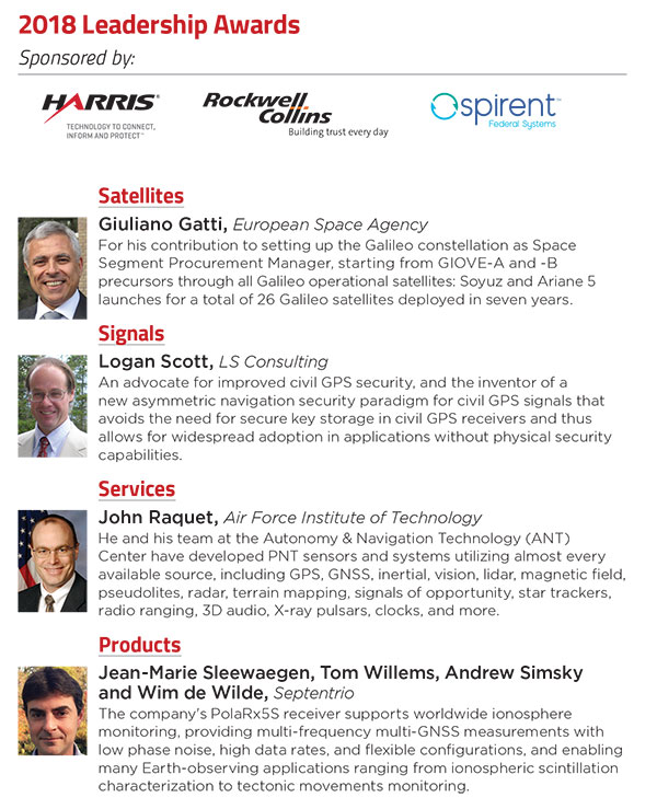
During the GPS World Leadership Awards dinner, Spirent Federal’s Justin Eldredge presented John Raquet, professor at the Air Force Institute of Technology, with the Services Award.
At the GPS World Leadership Dinner and Awards Ceremony in Miami on Sept. 27, 120 VIPs from the international GNSS/PNT community gathered to honor recent significant achievements in four fields: Satellites, Signals, Services and Products.
The honorees, so voted by a panel of their peers, appear below. Also, see our article here.
Their remarks upon receiving the awards will appear in the December issue, along with Future Visions for 2019 by the executive officers of GPS, GLONASS, Galileo and BeiDou.
Rounding out the evening after speeches, dinner and good conversation among good friends, old and new, was the Smart City Jam! We attempted to replicate, on the carpet of the 14th-floor banquet room, an obstructed urban environment, replete with malicious jammers. And we challenged all comers to “autonomously” navigate to a goal in this hostile environment with remote-controlled rock-crawlers. Details on this as well coming up in December.
According to ION, JNC is the largest U.S. military positioning, navigation and timing (PNT) conference of the year with joint service and government participation. The event will focus on technical advances in PNT, emphasizing joint development, test and support of affordable PNT systems, logistics and integration.
From an operational perspective, the conference will focus on advances in battlefield applications of GPS; critical strengths and weaknesses of field navigation devices; warfighter PNT requirements and solutions; and navigation warfare.
The event, which will feature a technical exhibit and showcase of guidance, navigation and control technology products, will include more than 200 operational presentations, ION reports.
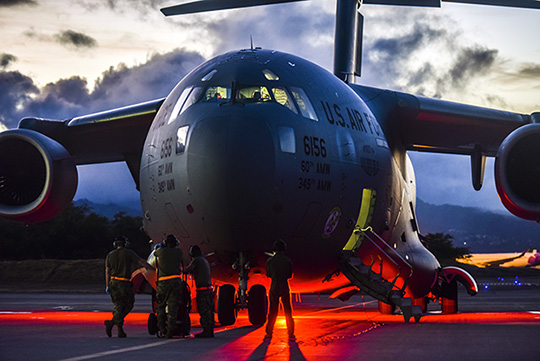
The ION Joint Navigation Conference will take place at the Dayton Convention Center, as well as a classified environment on June 8 at the Air Force Institute of Technology.