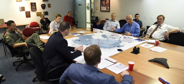
A 2016 wargame involving the Air Force and Navy at the Naval Postgraduate School. (Photo: U.S. Navy)
The 12th in a series of Air Force Space Command Wargames concluded Oct. 19 at the Maxwell Air Force Base in Alabama. Set in the year 2028, Schriever Wargame 2018 (SW 18) explored critical space and cyberspace issues in depth.
The objectives of the wargame centered on:
examining how international partner capabilities can deter an adversary from extending or escalating a conflict into space;
gaining insight into resiliency, deterrence, and warfighting through international partner synchronization of space and cyberspace operations;
exploring various combined command and control (C2) frameworks to employ and defend air, space and cyberspace capabilities in support of global and geographic / regional operations;
identifying the strategic and operational contributions of space and cyberspace in a multi-domain conflict; and
exploring partnerships framed by a whole of governments approach (International, Civil, Commercial) to combined space and cyberspace operations.
The SW 18 scenario depicted a notional peer space and cyberspace competitor seeking to achieve strategic goals by exploiting those domains. It included a global scenario with the focus of effort towards the U.S. Indo-Pacific Command (USINDOPACOM) Area of Responsibility.
The scenario also included full spectrum threats across diverse operating environments that challenged civilian and military leaders, planners and space system operators, as well as the capabilities they employ.
Approximately 350 military and civilian experts from more than 27 agencies around the country as well as from Australia, Canada, France, Germany, Japan, New Zealand, and the United Kingdom participated in the Wargame.
Agencies that participated included: Air Force Space Command, Army Space and Missile Defense Command, Naval Fleet Cyber Command, the National Reconnaissance Office, Executive Agent for Space Staff, Air Combat Command, Office of the Secretary of Defense, USINDOPACOM, U.S. Strategic Command, U.S. Special Operations Command, U.S. Northern Command, the Intelligence Community, National Aeronautics and Space Administration, Office of Homeland Security, Department of Transportation, Department of State and Department of Commerce.
The Air Force Space Command will conduct the 12th Schriever Wargame Oct. 11 at the Maxwell Air Force Base in Alabama.
The Schriever Wargame scenario, set in the year 2028, will explore critical space issues and investigate the integration activities of multiple agencies associated with space systems and services. Schriever Wargame 2018 (SW 18) will include international partners from Australia, Canada, France, Germany, Japan, New Zealand and the United Kingdom.
The objectives of the wargame are centered on:
examining how international partner capabilities can deter an adversary from extending or escalating a conflict into space;
gaining insight into resiliency, deterrence, and warfighting through international partner synchronization of space and cyberspace operations;
exploring various combined command and control (C2) frameworks to employ and defend air, space and cyberspace capabilities in support of global and geographic/regional operations;
identifying the strategic and operational contributions of space and cyberspace in a multi-domain conflict; and
exploring partnerships framed by a whole of governments approach (international, civil, commercial) to combined space and cyberspace operations.
The SW 18 scenario depicts a notional peer space and cyberspace competitor seeking to achieve strategic goals by exploiting those domains. It will include a global scenario with the focus of effort towards the U.S. Indo-Pacific Command (USINDOPACOM) Area of Responsibility.
A 2016 wargame involving the Air Force and Navy at the Naval Postgraduate School. (Photo: U.S. Navy)
The scenario will also include a full spectrum of threats across diverse operating environments to challenge civilian and military leaders, planners and space system operators, as well as the capabilities they employ.
The Schriever Wargame Team will conduct the wargame on behalf of Air Force Space Command, headquartered in Colorado Springs, Colorado. Approximately 350 military and civilian experts from more than 27 commands and agencies around the country, as well as seven international partners, will participate in the wargame.
U.S. commands and agencies participating in Schriever Wargame 2018 include:
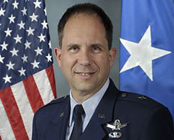
Brig. Gen. John E. Shaw is Director of Strategic Plans, Programs, Requirements and Analysis, Headquarters Air Force Space Command, Peterson Air Force Base, Colorado. (Photo: USAF)
The U.S. Department of Transportation and the Coast Guard Navigation Center are preparing for the 58th annual Civil GPS Service Interface Committee (CGSIC) meeting.
The meeting will be conducted Sept. 24-25 at the Hyatt Regency Miami in Miami, Florida, in conjunction with the Institute of Navigation’s ION GNSS+ 2018 conference.
CGSIC meetings are free and open to the public.
Subcommittees of the CGSIC for Timing, International Information, and Survey, Mapping, and Geosciences will hold meetings Sept. 24, and a summary of these meetings will be presented to the CGSIC plenary session Sept. 25.
The meeting includes important briefings on the status of ongoing GPS programs and a keynote address by Brig. Gen. John Shaw, director of strategic plans, programs, requirements and analysis for the Air Force Space Command.
The CGSIC agenda in development can be found at gps.gov.
Beginning Wednesday, Jan. 25, Air Force Space Command (AFSPC) will conduct a limited-duration test implementing an increase of the Ll C/A power level on the GPS Block IIR-M and llF satellites — a total of 19 satellites.
The C/A power will remain within IS-GPS-200-H specifications, and the power increase is not expected to increase the noise floor by more than 0.3 signal-to-noise ratio in the worst case.
“We assess that there will be no adverse impacts to civil, commercial or military GPS users, but anyone who experiences issues during this test should address them through established reporting channels,” said Gen. John W. Raymond, U. S. Air Force (USAF) commander, in a “Memorandum for Distribution.”
Military users can contact the GPS Operations Center at DSN 560-2541, while civilian users can contact the U.S. Coast Guard Navigation Center at 703-313-5900. In the event of unexpected critical impacts, a process to cease testing operations has been put in place.
The AFSPC point of contact for this test is Maj. Jeffrey Koch, DSN 692-0233, commercial 719-554-0233.
There were well over 100 presentations and speeches given at the 32nd Space Symposium in Colorado Springs, Colo., last week. However, I only want to speak about one of them briefly. While there were many presentations that were absolutely newsworthy, one presenter had something special and significant to say about the future of space and warfare.
Gen. John Hyten is generally known for his role as the Commander of Air Force Space Command. In truth, he wears many more hats — official and unofficial. Fortunately, his role as the commander of AFSPC works perfectly for our analysis.
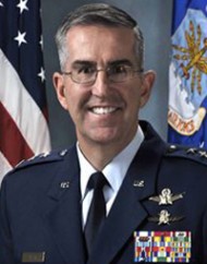
Commander AFSPC – Gen. John Hyten (Courtesy of the USAF)
I have known and respected John Hyten for more than 20 years and have seen him grow and mature in his role as leader, mentor and prophet in all things space. He has grown in his ability to speak his mind in a clear and cogent fashion. This has not always been the case, and he and I butted heads for about 30 seconds one day years ago, with the result that I respect him now more than ever.
John Hyten is and has always been an ardent supporter of GPS not only for the military and joint warfighter but also as a free gift to the world, of incalculable value, courtesy of the United States Air Force.
For those who did not notice, let me say that Gen. John Hyten’s Space Symposium Keynote Address was given without him looking at one note. He barely glanced at his slides or his video — all because John Hyten is not only clear and certain with his message, but he is passionate in his beliefs and he speaks from knowledge and experience as well as from the heart. John Hyten lives and breathes “space” as a domain and as a vision.
Now we get to the prophet part of John Hyten. John is not only an articulate spokesman for space, cyber-space and airmen, he is a true visionary for what is to come. He thinks problems through and is not afraid to question conventional wisdom when it is not truly wisdom. John is not afraid to take on the establishment when conventional thinking puts our warfighters in harm’s way.
In his presentation, John makes a curious and I think debatable distinction. He says:
“…a lot of people think that I’m a warfighter. I’m not; I’m with the organize, train and equip command. The warfighter is Lieutenant Gen. David Buck. He works for the Commander of Strategic Command — that’s where we do operations. My job in Air Force Space Command is to lead the 36,000 men and women — organize, train and equip forces so I can present forces to Gen. Buck — so he can actually do the missions he needs to do. That’s the way it works.”
So now the general and I are going to butt heads gently once again. Gen. Hyten and his organize, train and equip forces are warfighters in their own right. After all, the first tenet of organize, train and equip is “train like you fight.” And interestingly, this is the very point John makes in his insightful and prophetic presentation. We have undoubtedly the best warfighters in the world, bar none, but they and the environment they fight in and through can be better. John makes the point that he is not a space warfighter bringing space to the fight, but a warfighter bringing to bear all the forces and assets that space enables, whether they originate there or merely pass into, through and out of that venerable, heretofore peaceful domain.
John makes the point that we don’t want to go to war in space, but if we must, we will prevail. To do so, we must think in a multi-domain fashion. We must have a space enterprise vision and execute Battle Management Command and Control, all without regard to how the threat is mitigated and ultimately defeated. To ultimately succeed, it is paramount we accomplish this first in training long before it happens on the battlefield, wherever that may be. To train a warfighter, you must first be a warfighter.
So yes, Gen. John Hyten is a warfighter, a visionary, and a prophet when necessary. But the question still remains: Does the corporate Air Force truly recognize his abilities and his prescience? Will he be regarded as Joseph, the cupbearer or the baker? Only time will tell. Regardless, Gen John Hyten is a leader and a valuable asset to this nation. We have been blessed to have him as the Commander of Air Force Space Command and as the steward of GPS.
Until next time, happy navigating. Remember, GPS is brought to you free courtesy of the U.S. Air Force and all the warfighters at Air Force Space Command.
CBS’s 60 Minutes will air a special two-part segment on Air Force Space Command (AFSPC) this coming Sunday, April 26, reflecting a broad array of AFSPC missions — launch, satellite operations, missile warning, acquisition, and the Joint Space Operations Center.
The GPS Directorate is a joint service effort directed by the United States Air Force and managed at the Space and Missile Systems Center (SMC), Air Force Space Command, Los Angeles Air Force Base, Calif.
“The show seldom uses two-part segments, and the producers expressed that the visually interesting nature of the mission and intellectual heft of the interviews was the deciding factor in expanding the segment beyond the normal 12 minutes,” reads an email from the Retiree Activities Office of Los Angeles Air Force Base.
Included in the segment is an interview with Brigadier General Bill Cooley, director of the GPS Directorate. Cooley was interviewed at the Boeing facility in front of a GPS IIF satellite, and will discuss the foundational nature of space to the military and economy, as well as emerging threats and how the Air Force is responding.
60 Minutes airs on CBS at 7 p.m. ET/PT. Check local listings for specific times and channels.
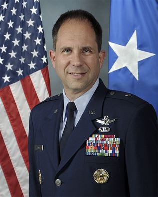
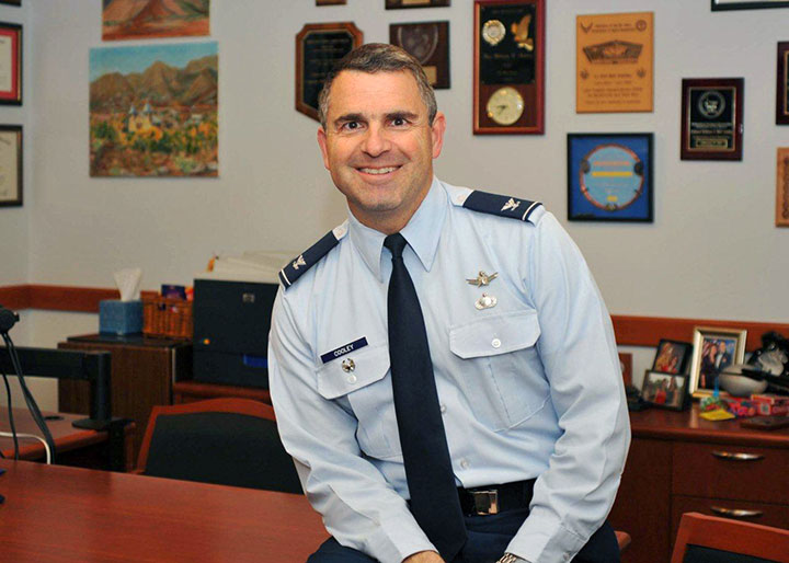
Col. William Cooley, Director, U.S.A.F. Global Positioning Systems Directorate.
Colonel William “Wild Bill” Cooley, director of the GPS Directorate at Space and Missile Systems Center, discusses CNAV signals, GPS IIF launches, and the OCX with Defense Editor Don Jewell.
There is probably no busier United States Air Force officer than Colonel William “Wild Bill” Cooley, Ph.D., the director of the GPS Directorate at Space and Missile Systems Center (SMC), Air Force Space Command (AFSPC), Los Angeles AFB, California. He is the driving force for all things dealing with acquisition and development for GPS. Currently, he is juggling so many objects, it is amazing that he is not totally overwhelmed. Consider the issues with the Next-Generation Operational Control System (OCX), GPS IIF, GPS III, and military government user equipment (MGUE), plus a plethora of classified endeavors we can’t even discuss here. He is one busy man, but even with all that, he found time to sit down and answer a few questions in an effort to bring us all up to speed on GPS and PNT.
Don Jewell (DJ): One of the hot topics at all the symposia lately, here and abroad, has been the broadcasting of additional civilian navigation signals and messages. The U.S. Department of Transportation (DOT) originally objected and sent a strongly worded and probably unadvisable letter to General Shelton (AFSPC/CC) on the matter, but sanity prevailed, and the GPS navigation signals on L2C- and L5C-capable satellites began broadcasting with full navigation messages on April 28. However, we understand DOT still insists some restrictions be put in place for the L5C signal. Can you provide us with an update and a status on that program? Plus, what can users expect in the way of improved accuracy and signal availability?
Colonel “Wild Bill” William Cooley (WBC): As of April 28, the civil navigation message (CNAV) broadcast was implemented on all operational GPS satellites capable of transmitting the L2C and L5 signals. Currently, seven GPS IIR-M satellites broadcast L2C, and six GPS IIF satellites broadcast L2C and L5. On average, users may expect at least one L2C-broadcasting satellite to be in view at all times.
The CNAV message content now includes the minimum message set needed to support the positioning, navigation, and timing mission, namely Broadcast Message Types (MT) 10, 11, 30, and 33, which contain information about the satellites’ position, clock, health, and corrections, in lieu of the previously transmitted MT-0 placeholder or default message.
The Air Force intends to broadcast L2C messages with the health bit set healthy and L5 messages with the health bits set unhealthy until sufficient monitoring capabilities are available for the L5 signal. We expect the accuracy to be slightly less than the Legacy Navigation Message (LNAV) because we are only updating the satellites two times each week. The accuracy should improve to be slightly better than LNAV beginning this December, when we begin updating the CNAV message on each satellite daily.
DJ: The M-code (military code) and MNAV (military navigation) signals are also being broadcast on M-code-capable satellites. So, the same questions apply: what can our warfighters and government users expect as far as M-code availability and accuracy? What can you say about the multiple messaging capabilities both on the civilian and military (CNAV and MNAV) signals?
WBC: Like the civil CNAV message, the modernized military-data message MNAV will enable military users to take advantage of all of the performance improvements offered by a modernized military signal. We can expect continued accuracy improvements as newer satellites replace aging satellites.
MNAV broadcast testing will continue occasionally in support of developmental test events for the next-generation military GPS receiver cards.
DJ: I know we can get in sensitive territory here in a hurry, but since we are discussing the military signals, can you give us an update on the long-running MGUE and M-code program? When can government users expect to see an actual signal and a receiver with M-code chips and/or modules that utilize the military only signals? Plus — and here’s where we have to be careful — what can you say about the security, availability, and accuracy of the military signal?
WBC: The M-code-capable military receiver (MGUE) modules in development have successfully acquired and tracked M-code during live-sky tests, and we have many more tests scheduled. MGUE is expected to begin fielding by 2017, at which point at least 18 M-code-capable GPS satellites are expected to be on orbit, providing global four-in-view coverage of full M-code capabilities.
In the meantime, the most recent GPS IIF satellite launches have raised the total number of M-code-capable modernized GPS spacecraft to 14 (seven GPS IIR-M and seven GPS IIF). This provides four or more M-code satellites in view globally at least 50 percent of the time, and at least one M-code satellite in view continuously. This increasing M-code satellite signal coverage will enable effective, realistic, developmental and operational testing of MGUE receivers.
The new GPS III block of satellites will provide an M-code signal with greater security, and higher power, comparable availability, and accuracy when compared with the GPS IIF satellites, allowing users to operate closer to jammers and under trees, as well as with greater resistance to jamming and spoofing. Also OCX will offer significantly improved crypto protection and cyber security.
DJ: Recently, the U.S. Air Force successfully launched the fifth, sixth, and seventh SVs in the GPS IIF family of satellites in less than seven months. Quite a feat! Congratulations are in order for that milestone. However, in the past, the checkout times averaged approximately 30 days. In fact, speed in initializing the IIF SVs and declaring them operational seemed to be an unofficial goal. On GPS IIF-5, however, the rapid checkout timelines have been extended considerably. Can you enlighten us concerning the checkout program and what the government hopes to achieve?
WBC: There are three key dates with regard to checkout timelines: completion of on-orbit checkout, the transfer of Satellite Control Authority (SCA), and the Operational Acceptance of the vehicle. Measured from launch, the nominal on-orbit checkout timeline is 21 days. The nominal checkout for SCA transfer is 28 days. For the IIF-5 mission, the on-orbit checkout occurred in six days and the SCA in 11 days, a record for the IIF program!
The operational acceptance was completed 60 days later, following an on-orbit observation validating a requirement to see if the vehicle works as expected without receiving any commands from the ground segment in that time period.
This may explain the perceived extended checkout, which is in reality a delayed operational acceptance.
The average time to SCA transfer for the first four vehicles is 42 days. The average is inflated due to a long checkout of the first GPS IIF space vehicle, which took 88 days. From IIF-2 to the present, the average SCA transfer time has been 21 days.
Using SCA transfer time makes the most sense, because that is the time it took the SPO to go through the entire process (to include meetings and documentation) to hand over the vehicle.
DJ: Can you give us a status update on the entire GPS IIF family of satellites? How are the SVs faring in orbit, and are the clocks proving to be as stable and accurate as forecast?
WBC: The first seven of 12 GPS IIF satellites are currently on-orbit and meeting all mission requirements. Of the remaining satellites, one is being prepared for launch in October 2014, one is being prepared for shipment to Cape Canaveral AFS, two are in storage, and one is completing production. The oldest satellite is now four years old. The legacy GPS satellites have remained operational well past their design lives, demonstrating the high-quality engineering and mission-assurance practices used on this program. The clocks are improving the overall accuracy of the constellation with the best-ever day (measured in Signal-in-Space User Range Error) in June 2013 of 46.6 centimeters and the best week in April 2014 of 64.6 centimeters.
DJ: What exactly do the IIFs mean to the GPS modernization program, for the average user and for the GPS constellation and program as a whole?
WBC: The 12 Boeing-built GPS IIF satellites will provide improved signals that will enhance the precise global positioning, navigation, and timing (PNT) services supporting both the warfighter and the growing civilian needs of our global economy. The next-generation satellites will provide improved accuracy through advanced atomic clocks, a longer design life than previous GPS satellites, and a new operational third civil signal (L5) that benefits commercial aviation and safety-of-life applications. It will also continue to deploy the modernized capabilities that began with the modernized GPS IIR satellites, including a more robust military signal.
The anomalies that we have seen on orbit have been resolved either through rework at the factory or through modifications in flight software.
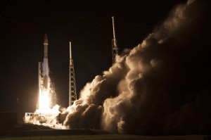
GPS IIF Launch. The seventh of the follow-on generation, rising August 1.
DJ: Bill, that’s comforting, but what about the clocks on the IIF SVs? There were serious problems with the Cesium clocks on the first couple of launches. Are the operators now able to utilize or activate either the Rubidium or the Cesium atomic reference systems?
WBC: Don, the answer is yes. The system has triple redundancy with two Rubidium frequency standard clocks and one Cesium frequency standard.
DJ: What about signal strength and stability on the IIF birds?
WBC: In addition to an increased number of signals, GPS IIF provides more than the legacy power levels, and all signals on GPS IIF meet stability requirements. For reference, the GPS IIR-M series introduced one new L1 and two new L2 signals, while GPS IIF introduced the new L5 signal. All of these signals are part of the GPS IIF navigation payload and provide information including GPS date and time, satellite health, satellite ephemeris (for individual satellite positioning), and almanac information (for information on other satellites in the constellation).
The L1 frequency carries the L1 C/A code for civil users, and the L1 P (Y) code and L1 M-code for military users. The L2 frequency carries the first modernized civil signal, L2C, and the L2 P (Y) code and L2 M-code for military users. Finally, the L5 frequency carries the newest modernized civil signal.
Modernized GPS civil signals provide dual-frequency signals to all GPS users, enabling ionospheric corrections that greatly improve the accuracy. The new L5 signal will be used for safety-of-life applications, including aviation. In addition to an increased number of signals, GPS IIF provides more than the legacy power levels, and all signals on GPS IIF meet stability requirements.
DJ: Let’s move to the ground segment. OCX, the next-generation GPS Command and Control (C2) system, has literally moved to the right on the schedule timeline for every month it has been in existence since it was awarded in 2010. The end date just keeps getting farther and farther away. OCX is also currently exceeding the original contract budget by a large margin.
What’s the problem? Is OCX more difficult or complicated than originally planned? Is there any good news to report to users on OCX? What can users expect in the future?
Just so our readers know, just what is it that OCX brings to the GPS arena that cannot be provided by the current Architecture Evolution Plan (AEP) C2 system? Why do we need OCX? And in your opinion is it still a viable option? Are there contingency plans?
My apologies — that is about eight questions in one, but hopefully you can bring us up to speed on OCX.
WBC: Actually, the primary drivers of schedule delays for OCX are related to:
issues with the integration and testing of Block 0 on the cyber-hardened infrastructure; and
the concurrent systems engineering approach for Block 1 and Block 2, which drove a high rate of rework and inefficient staffing.
The OCX program is a pathfinder for many of the U.S. Air Force’s and Department of Defense’s most rigorous Information Assurance (IA) and Cyber Security requirements, which have turned out to be more complex to implement than anticipated.
OCX is a challenged program, but there is progress to report. Raytheon completed a hardware compatibility and integration test with the non-flight test bed of the Lockheed Martin GPS III space vehicle. This test validated the network infrastructure’s ability to communicate between the Lockheed Martin Launch and Checkout Capability and the Raytheon Launch and Checkout System, sending commands to the full-sized, functional satellite prototype test bed.
In addition, Raytheon and Lockheed Martin completed the third of five planned launch and early orbit exercises to demonstrate launch readiness. This exercise used new installments of the Raytheon OCX software and network infrastructure to demonstrate space-ground communications for initial acquisition, orbit-raising maneuver planning and execution, and basic anomaly detection and resolution.
Another recent accomplishment was the merging of the Cyber Security hardware and software baseline with the Block 0, Launch and Checkout System, mission applications. The completion of this merge allowed the program to enter formal integration and test activities, which are ongoing.
The full capabilities of OCX provide more than a dozen new capabilities for the GPS mission. OCX enables the full capabilities of the modernized navigation signals: adding L2C and L5 for civil users, M-code secure signal for military users, an internationally compatible L1C, as well as worldwide monitoring of these modern signals for quality and integrity.
OCX enables operation of the new GPS III satellites. As we discussed previously, OCX will provide the USAF’s most rigorous cyber-security capabilities, built in from the OCX foundation.
Raytheon just completed implementation of a program re-plan, which implemented lessons learned to date to correct many of the development challenges encountered, and created a lower risk schedule for delivery. With these changes, the program remains a viable and important component of the modernized GPS enterprise.
DJ: With that in mind, when do you currently plan on having the first GPS III OCX-controlled launch? Original schedules called for a late 2014 date, then it was 2015, and now we are hearing 2016 or as late as 2018 for OCX. Are there viable alternatives, and if so, can you tell us what they are and if they are being pursued?
WBC: OCX and GPS III are synchronized to support launch of the first vehicle in the second half of 2016, conditioned upon launch manifest availability. Contingency plans are being developed, but will only be implemented if warranted by the risk.
DJ: Now, Bill, I am not asking you to blow your own horn here, but frankly we have heard nothing but good reports from SMC and the GPS Directorate since you arrived about 14 months ago. That is a short period of time, but evidently you have made your presence felt and have had a major impact on the GPS program overall. What have you done differently that seems to work so well? To what do you ascribe your success so far?
WBC: Thank you, Don. I’m very happy to hear the reports are positive, but the credit goes to the men and women of the GPS Directorate, our federally funded Research and Development Center personnel, and our contractors. My job is to continually assess the challenges and barriers that slow modernization. I help resolve the challenges or get additional resources if needed to enable the team to accomplish their important mission.
I am incredibly fortunate in that the GPS team is passionate about our mission to maintain the Gold Standard for position, navigation, and timing (PNT) for the world. The entire directorate understands the critical role we play for civilian and military users worldwide, and that knowledge motivates and energizes us every day!
I’m the luckiest colonel in the Air Force because I get to work alongside this terrific team of government and contractor professionals on one of the most important missions in the U.S. Air Force.
DJ: Obviously you are proud of your team, and you know what it means to be a great leader. In closing, do you have any final comments?
WBC: Don, just that the GPS Directorate and our contractor team, along with our partners at the 2nd Space Operations Squadron (2SOPS) who fly the GPS constellation 24/7, take our job seriously and understand the important mission we have: to provide reliable and precise position, navigation, and timing services for America’s warfighters, our allies, and civilian users around the globe. GPS is the Gold Standard for space-based PNT today, and we are modernizing to ensure GPS is the Gold Standard for the future.
Gen. William Shelton, chief of Air Force Space Command, said the date when prime contractor Lockheed Martin and payload manufacturer Exelis are expected to have the first GPS satellite ready for launch will slip from its original target at the end of this fiscal year, according to National Defense Magazine. Technical difficulties are slowing the development process, he said.
“We’re not happy at all. Is my patience wearing thin? Yes. Has it gotten to the place where I am going to step off the cliff? No,” he said at a breakfast sponsored by the Air Force Association’s Mitchell Institute.
Gen. Shelton said the Air Force is working closely with the contractors.
Shelton said the issue highlights the problem inherent in relying on one contractor for a critical technology, reports Space News. Exelis Geospatial Systems has supplied the payloads for all previous generations of GPS satellites.
“The payload hardware is built and is currently in test,” said Jared B. Adams, director of communications for Exelis geospatial systems, in an email to National Defense Magazine. “Last year, Exelis identified some development issues with the navigation payload for the first GPS III satellite that needed further work. Significant testing with flight-like engineering units and the first GPS III satellite’s flight hardware indicates that the known technical issues have been resolved, and GPS III will meet all mission and quality requirements.”
The payload delay is not expected to push back the first launch of the Lockheed Martin-built GPS III satellites in 2015. Lockheed Martin Space Systems is under contract to build eight GPS III satellites.
It happened over 20 years ago and I remember it like it was yesterday.
Three young U.S. Air Force officers stood respectfully in the office of Lt Gen Thomas Moorman, then Vice Commander of Air Force Space Command. All three were summoned to the same meeting, but I expect none of us knew exactly why. It would soon become apparent that we were there for “The Talk.”
For those of you unfamiliar with “The Talk,” it is not unlike the awkward conversation most young men have with their fathers around the age of puberty. However, this talk would determine if the powers that be thought we had a future in the USAF.
I naively assumed that all military officers at some point experience “The Talk” with their superiors, but I have discovered this is not the case. For many, “The Talk” launches them confidently into the latter part of their service careers, and for others it is the dreaded signal that immediately pursuing other endeavors is in order, i.e., look for a new day job.
The three of us that day actually had little to fear. We all served, or in my case were serving, as Executive Officer for General Thomas Moorman. Serving as an Executive Officer for a senior General Officer can be daunting, but for each of us it was also a rewarding experience; indeed, none of us could have asked for a more perfect mentor and role model. Plus, we knew that General Tom Moorman cared about each one of us. He did not choose his Executive Officers lightly…many volunteered, few were chosen. Plus, I will give you a hint: long though the hours may be, it is easy to work for a man that you admire, and to this day we all admire General Tom Moorman.
The meeting that day was short and to the point. We were all cheerfully informed that we had a future in the USAF and from that simple statement we also knew that assignments would be forthcoming. I say cheerfully because, when all is said and done, General Tom Moorman is a very cheerful man. He always has a ready smile, is kindhearted and loves a good joke. He also has a prodigious memory and is a workaholic, but that often comes with the territory. He is tough when he needs to be, but his countenance inspires confidence. So we all felt honored, fortunate and even blessed to be mentored, counseled and led by this wonderful man. I know we all left his office that day with a smile on our face, although my trip was only about five feet outside his front door. We all briefly discussed what our future assignments might hold and then went our separate ways, little aware of what the future would actually hold.
Of the four officers in the AFSPC Vice Commander’s office that day, all experienced or are experiencing successful military careers: two eventually pinned on four stars, one found himself literally and successfully fighting for his life in intensive care at the United States Air Force Academy hospital only a year later, and yours truly proudly served his country for 30 years and now finds himself writing about “The Talk” and having a conversation with General William “Willie” Shelton, who now sits in that same office where “The Talk” occurred 20 years ago.
Indeed, General Willie Shelton and I have been good friends for almost 25 years, and so it feels natural for us to sit down and have a brief conversation about the past and what the future holds for him and his family, for Air Force Space Command and, of course, the Global Positioning System.
WS = General (USAF) – William Shelton, Commander, Air Force Space Command
DJ = Don Jewell (USAF, Ret) Defense Editor, GPS World magazine
DJ: First of all, General Shelton, thank you for your time today. To say that you are a busy man is a gross understatement and we do sincerely appreciate you taking the time to have this conversation.
First of all, on a personal note as an Air Force Academy graduate, with numerous assignments in the Colorado Springs area, do you find this to be a nostalgic time in your life?
WS: Don, it is great to be back in Colorado Springs. You know Linda and I really love it here. If any place is home anymore then this is it, and when retirement comes around, this is the place where we will retire. So we are delighted to be back in town and delighted to be back at Air Force Space Command.
DJ: You and I have spoken many times about how much we, and our families, love this area. However, I’m not sure that back when we were carpooling together to Falcon, now Schriever Air Force Base, either one of us would have predicted we would be having this conversation 20 years later and you would be presiding over the 30th anniversary of Air Force Space Command. Can you tell us about some of the 30th anniversary plans?
WS: Don, there are numerous activities planned around our 30th anniversary. We have new Space Pioneers that we will induct. We’ve planned a big Commanders Conference, of course. We are bringing in our Commanders Group, which is a group of civilians from across the Command that provides advice to our Commanders. We are also having a 30th Anniversary Gala sponsored by the Space Foundation at the Broadmoor. And while we are looking forward to all these activities, there is another major event that is special to me and I know will be to you and many of us in this community, and that is the naming of our new education building after General Thomas Moorman.
DJ: I know General Moorman must be pleased about that. He always pushed education as a way to get ahead in the USAF and in life. I’ve heard he’s been a bit under the weather; will he and Barbara be able to attend the dedication ceremony?
WS:Absolutely, he and Barbara and several family members will attend, along with several of his old cronies. It will hopefully be a nice celebration.
DJ: Indeed, it will probably be old home week for many of them — many of whom you and I met when we worked for General Moorman back in the day. There will be a lot of people looking forward to that dedication ceremony.
And speaking of General Moorman helps me segue into our next topic, which is stewardship. General Moorman has always been a big proponent of the importance of the stewardship of space. In this case I would like to bring us around to the stewardship of one system in particular, and that of course is the Global Positioning System or GPS.
Recently a retired General officer, who you know well and has served as a mentor and still serves as an advisor, made a telling comment concerning the stewardship of GPS, “Thank God GPS is run by the United States Air Force and not the French Air Controllers, who go on strike every August.”
WS: I had not heard that one but it does make a point. I guess what I want to say about stewardship is that for 20+ of the 30 years that AFSPC has been in existence, the USAF has been the proud steward of GPS. We built and sustained the constellation, we have operated the constellation, we have been the engine driving many of the innovations in receiver technology — indeed there have been a whole variety of technologies and innovations concerning GPS that the USAF has been behind.
Now this takes nothing away from a critical industry that continues to develop applications that I personally never dreamed of. But in terms of the basic provisioning of the GPS capability and all that GPS enables today, we — the United States Air Force and Air Force Space Command — are very proud of our accomplishments and our stewardship
DJ: Certainly no one can deny the Air Force has been an excellent steward of GPS, but what can you tell us about the future of GPS? What do you personally see as the way ahead? You have commissioned several studies to look into what the future holds. What can you share with us?
WS:First of all, Don, we want to stay the course with GPS III and then maybe look at some different constructs for future satellites…adding some capabilities and looking at a whole mix of future opportunities. But as you said, those are all studies that are under way. In this budget environment we definitely don’t have a course set in concrete, but for GPS III we are definitely on a good path for now. I think we want to stay on that path. It is really a very good and well-run program. It is on schedule and pretty much on cost. We have a little bit of cost growth in the program but it is not anything outside the management reserve fenced for the program. So we are in very good shape on GPS III. Lockheed Martin is doing a very good job putting the factory together, in Denver, to crank out those satellites. All signs are good.
DJ: That’s great to hear. Coincidentally, I have a column coming out shortly on the status of the GPS III program. Now, what can you share with us about OCX, the ground control segment?
WS:Don, the ground segment is coming along. OCX has had some issues but we really believe we have turned the corner on OCX.
Indeed, my hat’s off to Raytheon for really taking this on. The management within Raytheon has taken this program very seriously. They’ve brought in the right people and basically turned the OCX program around, and we are confident that we are going to be in a good place once we get OCX delivered. It is not going to be as soon as we had hoped. It is not going to be coincident with the arrival of GPS III, but it will be ready shortly thereafter, and we will have some capability of controlling the GPS III satellites until we can get them OCX support.
DJ: That, of course, brings us to the inevitable “gap” question, which I know you have been asked a hundred times; it sounds like you now have a plan for that eventuality.
WS:We do. We have some special software that we are going to have to work to get that accomplished, but we have a good plan to make that happen. We will be in good shape on GPS III. We will not have all the capabilities that OCX will bring us, of course, but we will at least be able to make use of the satellites while we are waiting on OCX to deliver.
DJ: There are those who openly speculated about whether OCX even had a future, so it is certainly good to hear that there is a plan, you have confidence in that plan, and in the future of OCX.
You and I had a conversation recently where you stated emphatically that you were not interested in placing GPS III satellites on orbit just as a means of storage, but that they had to be operational.
WS:That’s exactly right. We certainly need to get the first GPS III satellite up as soon as possible to make sure that we don’t have any design issues. And you’re right, I am not in favor of storing on orbit, because of life-limiting components.
DJ: Then you must be comfortable with the fact that in the future we will most assuredly be launching GPS-IIFs and GPS-IIIs simultaneously?
WS:Yes, we know how to handle that.
DJ: OK, then as long as we are discussing GPS III, why don’t we move into the arena of trying to pin down a vehicle or set of vehicles for dual launch? You and I once discussed GPS III vehicles 7-8 for that honor, and you mentioned at the time that it was a moving target. Where do we stand today?
WS:Don, I think we are now probably talking about GPS III vehicles 9-10. We are still in the study phase on this issue with Lockheed Martin and United Launch Alliance. We are still trying to figure out how we would do dual launch and what kind of capabilities we need to develop. I think this is really the wave of the future…being able to put two up simultaneously will save us a lot in launch costs.
Plus, we will look at new launch entrants. If a new entrant can come in and provide a cost-effective launch capability for several launches, then we will look seriously at them as well.
DJ: I can barely remember the last GPS launch failure — it was more than 15 years ago — but that is the last thing any space program needs, a launch failure. In that regard are you comfortable with the, as you say, new entrants into the launch market?
WS:Not yet. We will go through a very rigorous certification process to get new entrants certified, but once they are certified we will look to contract with them just like we do with ULA today. New entrants will certainly introduce new options for us.
DJ: Some would argue that the USAF really has very little choice but to look at alternative launch systems. I was briefed recently that the projected on orbit costs of an initial GPS III satellite, with NRE (non-recurring expenses) but without added launch costs, is in the neighborhood of $265M. When you add the launch costs of approximately $220M, you get to $480M or just shy of half a billion dollars in a hurry. Is this sustainable?
WS:That is exactly why we are looking at alternatives to include dual launch. We know we need to bring the launch costs down as much as we can. We are doing that in a variety of ways, both in terms of how we are acquiring boosters, and what we are paying ULA for — just an overall launch capability from an infrastructure point of view. We are, as I said, considering new entrants. So there are a variety of things we are doing, trying to get a handle on launch costs.
DJ: So, what I take away from that is that studies are under way both for dual launch and launch acquisition and stay tuned for more. But in the area of affordability in this budget environment, surely there is more to consider than just launch costs?
WS:Of course, we are looking at GPS III for example — when I first arrived here the plan called for GPS III A, B and C variants. I thought that was probably not going to be affordable in the future. So we scrapped the A, B and C mentality and went with a basic GPS III. Now as we can afford it, we will roll in additional capabilities that we might want or need for the future. I think that helps control the costs. We are also looking at what we can do in the manufacturing area to help control costs. So we are going at this from a variety of ways. We are leaving no stone left unturned in terms of trying to drive out costs.
DJ: Controlling costs is certainly admirable, but you and I have been in the space business for a long time and I cannot ever remember launch costs going down, can you? Do you really think you can make that happen?
WS: I suppose it depends on what you mean by going down. I don’t know that we will ever get cheaper than we are right now, but the cost projections left unchecked were a 40% increase in costs. So we are really talking about controlling the growth as much as we are about reducing costs.
Now, if you can introduce some of these new entrants and they deliver on their promise — for example let’s say you can do a medium class EELV [Ed. Evolved Expendable Launch Vehicle] for $90M, which has been suggested by one particular company…what a bargain. Now we will see if that price really holds when we put in our mission assurance requirements and as we look at those rocket companies when they actually go into production as opposed to a one-off type of rocket.
DJ: When you talk to Dr. Bradford Parkinson about launch and the history of GPS, he will quickly remind you that back in the day, GPS could not stand on its own as a space requirement. Back in 1978, GPS had to have additional payloads to justify the mission just to get the GPS satellites into orbit. That is certainly not the case today, so are you seriously looking at a GPS-only configuration?
WS:God bless Brad Parkinson. He certainly fought through a very different environment than we have today. And yes, we are certainly looking at a very de-scoped capability for NDS [Ed. Nuclear Detection System], and we are considering some options that might have some GPS platforms being a navigation payload only. So, we will see what comes out of the studies. We are concerned about the size, weight and power of the NDS payload, and we think we have a handle on that for GPS III number 9 and out. But the first eight GPS III satellites will still have a fairly heavy NDS payload.
DJ: Well, these things do take time to fix. And speaking of the number of satellites, things have changed quite a bit from when you were the 2SOPS Commander (2nd Space Operations Squadron) back in 1990. GPS had only been FOC (Full Operation Capability) for about five years and you were struggling just to keep 24 active payloads on orbit. Today there are 32 active payloads and three residuals. Do you think we are going to be able to maintain those numbers?
WS:This is actually more of a debate about actual coverage of the GPS constellation. I don’t think it is going to be as much about numbers as it will be about coverage and dealing with things like terrain, terrain masking, and urban canyons. How much coverage do we in the United States want to provide? Do we want to instead count on other satellite systems to fill in gaps that we might have — such as systems like Galileo? So it is going to be an interesting future. We really have some serious debates on what kind of coverage we want to provide from GPS and what kind of coverage we might count on from others. We also have to consider how we might alter our architecture designs based on the need for coverage.
DJ: Now it sounds like we are getting close to discussing the mastodon that has been unsuccessfully trying to hide in the corner, and that is budget issues. Cost savings and cost reductions are terms thrown around by your budgeters today. I assume you are looking at all these issues to include the dreaded sequestration costs.
WS:It is all the same to me; whether it is cost avoidance or cost savings, it is all part of the space budget. But as to sequestration, that’s another matter.
Space and cyber are foundational capabilities for this nation. That said, we’ll take our reductions, and certainly we’re proactively looking for places we can reduce, but we believe foundational space and cyber capabilities will have to remain to support every other military operation.
I challenge audiences to find a military operation that doesn’t in some way depend on space and cyber. That foundational capability must be protected, despite what might happen with sequestration or any other budget reduction.
DJ: In a couple of weeks you will be attending the annual AFA (Air Force Association) national meeting in the D.C. area. Is there a space message, such as you just mentioned… all military operations depend on space and cyber in some way, that you will be trying to get across this year?
WS:Don, the message I am trying to develop is the need for a partnership across the community. From Capitol Hill to OSD [Ed. Office of the Secretary of Defense] to the operational commands, to Air Force Space Command including SMC [Ed. Space and Missile Systems Center] — we all need to have a very strong partnership and pull on the rope in the same direction so that we are not at cross purposes. As we look at some of the acquisition challenges and as we look at some of the congressional marks, it is not always apparent that we are all singing from the same hymnal. That is one thing I would like to see us work very hard — getting everybody on the same sheet of music.
DJ: While that is certainly a laudable goal, with all the budget issues and everybody wanting to have a hand in the space AOR (area of responsibility), do you really think it is realistic or even doable?
WS:I am not so naïve as to believe that there will ever be a time when there will not be challenges to our plans. We would like to get to the place where the long experience we have with GPS — along with the architectural designs we have developed that have helped give us that experience — that all this carries some weight.
DJ: I agree, but a great deal of that weight and responsibility winds up on your shoulders. I don’t think that you or I ever thought there would be three billion plus GPS users in the world. Isn’t this global utility we call GPS an incredible burden on the USAF and yourself? No other service in the world today has the responsibilities that are attendant on the USAF as stewards of the Global Positioning System.
WS:Don, I think we happily bear that burden. To tell you the truth, our job is to provide the best signal that we can provide from space. That is what we do every day, and we are happy to do that. We know it supports billions of users, and we know that we are underpinning economic institutions around the world. We know we have fundamentally changed war fighting as a result of that signal. So it is a source of pride for us – it is not a burden.
DJ: Well said! Any final thoughts? There are so many issues we haven’t had time to discuss.
WS:The one point I want to be sure and make is one of credibility. There are certainly some naysayers out there, but I firmly believe that we have proven our credibility over the past 20-plus years that we have been flying the GPS constellation. I think we have done a good job… I am talking about the U.S. Air Force writ large now… a good job of funding the GPS constellation and being responsible stewards of the capability and insuring that that the world has this capability where it is needed. GPS has enabled applications that are simply mindboggling, and the credibility piece doesn’t get stated as often as it could.
The other issue is that there are certainly threats to GPS that we need to pay attention to. The jamming threats are obvious. Not so obvious are the spectrum threats such as we have been through in the last year. We need to continue to be vigilant and protect that part of the spectrum that is essential for GPS to work as well as it does.
It is truly a physics problem. It is not just GPS encroachment on somebody else’s spectrum. The way receivers are designed to work, they have to be able to acquire the GPS signal and the harmonics of that signal in an adjacent spectrum. If you bring in rather noisy signals or you allow noisy signals to operate in the GPS neighborhood, you are going to kill the accuracy of GPS. So, I think as we continue to provide good stewardship for GPS, we need to be good stewards of the spectrum as well.
DJ: Actually, I was hoping this would come up. I want to publicly thank you for being one of the few general officers, from any service, who stood up and were counted when it came to this huge threat to billions of GPS users worldwide.
But, in the end, were you surprised that it took over a year to fight the spectrum battle?
WS:Not necessarily. I knew we were into a very structured process with the FCC [Ed. Federal Communications Commission] and they have their way of doing business. I was confident that once we could get the facts on the table, the right decisions would be made. It was just a problem of making sure that the facts were heard. In the end it came out like it should have come out, it just took longer than I think most people were comfortable with.
DJ: Without a doubt the world and GPS users everywhere owe you a great debt of gratitude for your fearless leadership during a very trying time. Thank you for your leadership, and thank you for taking the time to speak with us today.
WS:It was my pleasure, Don.
Until next time, happy navigating. All of us at GPS World hope to see you at the ION Technical Meeting in Nashville, Tennessee, September 17-21 , 2012. Drop by the booth and get acquainted.