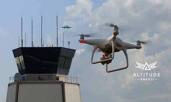
Altitude Angel, a unified traffic management (UTM) technology provider, is bringing to market airspace management solution GuardianUTM Enterprise.
GuardianUTM Enterprise provides a view of the airspace in the vicinity of airports and enables airport to start designing and providing UTM services for drone companies and drone operators, using Altitude Angel’s proven digital authorization and flight-management technology.
GuardianUTM Enterprise will initially be deployed to support regional and local airports and airfields.
Europe’s EASA U-Space regulations are expected to become law on Jan. 1, 2023. GuardianUTM Enterprise is designed to enable airspace authorities to digitize approvals for drone operations using services integrated with Common Information Service (CIS) and U-Space Service Providers (USSP) architectures.
Using GuardianUTM Enterprise, airports can set access policies and create automation workflows accessible via Altitude Angel’s UTM ecosystem. This ecosystem is used by hundreds of thousands of drone pilots, manufacturers and software companies to guarantee the airport the best available view of the sky and nearby drone operations, ensuring a growing sector of the aviation market is able to access the new airport UTM Service.
For larger airports with counter-UAS solutions, data from on-site surveillance systems can be optionally integrated to give airport security staff greater situation intelligence which is a critical step in encouraging greater drone use.
The solution can be rapidly deployed and configured for airports of any size; providing a flexible platform for enabling drones to be safely integrated in the airspace around these facilities: a crucial step in unlocking a wide variety of unique use-cases for drones.
GuardianUTM Enterprise provides digitalization of pre-flight and take-off approvals to drone operators within airspace. It offers high levels of automation, including customized automated access policies and approval workflows of unmanned operations.
UAV developments are taking flight across the globe.
In one development, older technology might enable new capabilities for a pseudo-satellite UAV. Meanwhile, new technology adds significant landing capability to an Air Force drone. Finally, further trials are expected to help develop drone operational procedures and regulations in India.
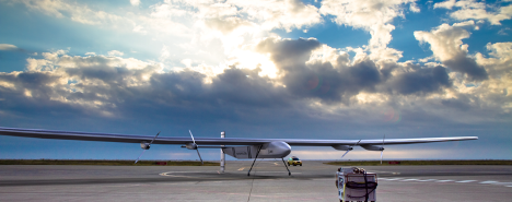
Spain’s Skydweller moves to Oklahoma
An unmanned aircraft builder from Spain — Skydweller — is setting up operations in Oklahoma. This latest outfit to relocate is establishing its headquarters in Oklahoma City to develop a pseudo-satellite vehicle with a large payload capability.
For anyone who has kept tabs on the Airbus Zephyr, the UAVOS ApusDuo, The Aurora/Boeing Odysseus, or the Softbank/AeroVironment Hawk30 high-flying drone programs, you might have noticed that the stratospheric pseudo-satellite business is not easy. None have yet made it to true operational status — loitering for months at +60,000 feet and living off only sunlight, while carrying significant payloads to provide communications services. That said, some trials to date have apparently been quite successful.
All those existing UAVs are huge, flimsy, flex-wing aircraft that take an inordinate amount of care to handle in the difficult phases of take-off and landing. Airbus’ second prototype crashed in Australia in October 2019, and several other companies’ earlier prototypes have crumpled somewhat when they inadvertently contacted the ground.
Now enter Skydweller. Skydweller is designed to carry a relatively large payload and fly persistently in the stratosphere.
The payload includes one or more communications relays: 4G/5G cellular, day/night full-motion video, satellite communication, and imaging radar. This looks like it could be one capable vehicle. The makers hope to capture business in commercial and government telecommunication, geospatial, meteorological and emergency operations. Skydweller has apparently been around since 2017 and has a lot of capability, so let’s see how they do with their new venture in Oklahoma.
If you were wondering where this technology came from, it is today’s carry-over of the famous around-the-world flight by the Solar Impulse aircraft from 2016, which circled the globe without fuel, using electrical power generated by solar cells on its wings.
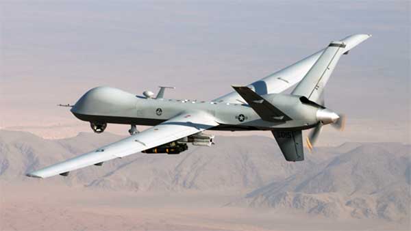
GA Makes Improvements with Reaper
In another life, I was quite attuned to what it took to “automatically” land a passenger jet, so a recent release from General Atomics (GA) about improving the auto-landing system on Reapers (new-generation Predators) caught my eye. GA has a U.S. Air Force contract to update these unmanned reconnaissance/attack drones with the latest and greatest, so making a working system better is one of those improvements.
Actually, GA made three changes. The first enables the drone to divert to an alternate landing zone if the planned landing area is compromised — another word to express the possibility that hostile action or weather forced home base to send the vehicle elsewhere. Quite clever, in that the alternate site might not have a ground control station, along with someone who can fly the aircraft.
MQ-9A Reaper drone, (Photo: USAF)
The ground pilot at home base has to either enter coordinates for the new alternate landing zone and the aircraft flies there and lands itself, or he needs to overfly the landing zone so that the Reaper can collect its own waypoint with which it can automatically align and land.
The second improvement has increased the speed limit of the cross wind in which the drone can land
The third enhancement allows the drone to land heavier than previously — both essential elements of being able to divert in an emergency, when weather may be poor and the aircraft could be carrying unused ordnance and fuel.
All this is a far cry from landing civilian air transports with GPS-based guidance, which is much more restrictive and with a whole mess of mathematical probabilities of the unlikeliness/likeliness of failure. Not so much for a Reaper drone on a mission during a “time of unrest.”
Home Deliveries in India
For those of you eagerly waiting for Amazon to start speedy deliveries of your online orders by drone, or Grubhub to drop in with an order of curry in a package dangling from a friendly unmanned air vehicle in your yard, there may be hope… especially if you live in India.
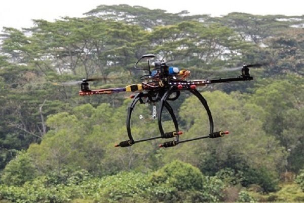
Following our earlier report of anticipated food deliveries by drone in India, more trials are leading to regulations and control systems. Altitude Angel from the United Kingdom has teamed with Indian Sagar Defence Engineering for a series of beyond-visual-line-of-sight (BVLOS) drone trials.
Altitude Angel’s GuardianUTM platform will be used to monitor and control these flights through real-life scenarios. Scenarios include medical and cargo transport, surveillance operations, survey and mapping, and search-and-rescue operations. Sagar will operate the cargo carrying drones; feedback from the GuardianUTM system will enable the BVLOS flights.
While the Indian government has begun to grant permission for some commercial UAV undertakings, the intent is apparently to use the output from the Sagar/Altitude Angel BVLOS trials, taking place August through October, to help develop regulations for safe operation of drones over increasingly longer distances in Indian airspace.
To sum up, intellectual property from an around-the-world photo-voltaic airplane may become a substitute for low-cost satellite TV and Wi-Fi, while auto-land is old hat for a Predator cousin and the Air Force has gained even greater landing flexibility for a principle recon/attack drone.
Finally, we can expect at least one continent to get to regulations that allow drone deliveries to become a reality at last. As usual, there is a lot cooking in drone-land….
The Sagar Defence Spectre UAV. (Photo: Sagar Defence Engineering)
Altitude Angel, an unmanned traffic management (UTM) technology provider, is partnering with Mumbai-based Sagar Defence Engineering Ltd. in BVLOS trials supported by India’s Directorate General of Civil Aviation (DGCA).
Together, Altitude Angel and Sagar Defence have been selected by India’s DGCA to carry out beyond-visual-line-of-sight (BVLOS) drone operations. The results of the trials will help define India’s regulatory framework for unmanned aerial vehicles (UAVs) in routine UAV deployment.
Altitude Angel’s GuardianUTM platform will enable BVLOS drone flights around a multitude of real-life scenarios including medical and cargo delivery, surveillance operations, survey & mapping, and search & rescue operations.
The Union Government has recently begun the process of granting regulatory permissions to the operation of drones for commercial purposes.
On participating in the BVLOS trials Richard Ellis, Altitude Angel’s chief business officer, said, “The potential for UAV use in India is immense so we’re excited to be partnering with Sagar Defence on these BVLOS trials. The ability to fly safely and securely BVLOS will unlock the potential of drones not just in India, but across the world. With Sagar, we’re very much looking forward to showcasing our proven technology to demonstrate the amazing use-cases of drones.”
Mridul Babbar, Sagar Defence’s business development head added, “Sagar Defence Engineering and Altitude Angel, two highly skilled teams, coming together for the BVLOS trials is a very strong partnership and one we’re thrilled to be part of. The combination of our UAVs and Altitude Angel’s world leading UTM platform will undoubtedly help advance the prospects of BVLOS flight across India and beyond.”
The BVLOS trials are scheduled to take place from August through to October 2020.
The trials will further build on trials Altitude Angel has been involved in this year. The company served as the lead and umbrella UTM for the Lake Kivu Challenge, part of the African Drone Forum, which took place on the shores of Lake Kivu, Rwanda, in January.
Altitude Angel and Inmarsat are collaborating to develop and deliver advanced flight tracking and management capability for UAVs.
According to the companies, they will build on Altitude Angel’s GuardianUTM platform to jointly develop a “pop-up UTM” capability that can be deployed anywhere it is required to manage beyond visual line of sight UAV flights, without the need for ground-based communications infrastructure. By utilizing Inmarsat’s global network of satellites and leveraging its experience in air traffic management communications, Altitude Angel’s pop-up UTM can be accessed rapidly and deployed worldwide, the companies added.
The pop-up UTM will be developed initially to address the unmanned traffic management needs of blue light emergency services and first responders who need aerial surveillance rapidly with little notice. The companies plan to release a commercial, industry-focused product soon after. Through this technology, emergency services will be able to remotely manage UAVs, increasing their range of safe operations in mixed airspace of manned and unmanned vehicles.
“The ability to almost instantly ‘pop-up’ safe, secure and fully operational UTM platforms in any environment, at any time, will give first responders, blue light services and aid organizations a valuable tool that could save countless lives,” said Phil Binks, head of air traffic management at Altitude Angel. “Altitude Angel and Inmarsat, in developing ‘pop-up UTM,’ will be able to bring connectivity, clarity and automated air traffic control services for UAVs in even the most challenging of circumstances.”
Altitude Angel is an aviation technology company delivering solutions which enable the safer integration and use of fully automated drones into airspace. Inmarsat is a British satellite telecommunications company, offering global mobile services.
Altitude Angel, a London, U.K.-based unmanned traffic management (UTM) technology provider, is releasing an open-sourced project, Scout.
Scout’s hardware and firmware enable drone manufacturers, software developers and commercial drone pilots to quickly connect to its global UTM.
Primarily intended for use in commercial and industrial drone applications, Scout provides the capability to securely obtain and broadcast a form of network remote ID, widely seen as a necessary step for enabling routine drone use and flights beyond visual line of sight.
Because it is open source, both the hardware and the firmware can be enhanced and incorporated into a virtually limitless set of scenarios, according to Altitude Angel.
Altitude Angel also has made available a surveillance API that allows integrators to both share and receive flight data from a variety of sensors and devices in near real time, providing a comprehensive real-time picture of the airspace.
While many remote ID systems are broadcast only, Scout offers two-way communication and is fully open-sourced. The ability to talk back to the drone enables the Altitude Angel UTM service to help the drone avoid collisions with other aerial vehicles, or restricted airspace.
From launch, Scout will use identifiers obtained freely from Altitude Angel’s GuardianUTM platform. It will work in combination with a pre-flight (flight-plan sharing) service and is supported through integration with Altitude Angel’s Tactical Conflict Resolution Service.
Scout will enable the drone to report its real-time location using GPS-type sensors and relay this data via a secure, encrypted mobile communications link across 3G, 4G and 5G networks to Altitude Angel. It is powered by an internal rechargeable (via micro USB) lithium battery.
Altitude Angel has also provided reference design plans for the case that can be 3D printed. Scout has been designed to satisfy emerging network remote ID standards, such as ASTM.
Because the firmware is open source, the telemetry can be sent to other systems as required by the implementor.
A two-wire I2C upgrade to the circuit schematics, plus version 2 of the firmware (both scheduled for June), will subsequently enable the full two-way communication between the Scout device and the drone’s onboard systems, allowing the drone to respond directly to information received from the UTM.
In the interim, early adopters will have the opportunity to begin to integrate with Altitude Angel’s UTM services, test the hardware and test communication. Position data Altitude Angel receives from Scout is then automatically used by its Flight Information Management System (FIMS) to help provide traffic deconfliction.
Plans, firmware and schematics can be accessed via the Altitude Angel GitHub repositories.
Safely integrating autonomous drones into global airspace is the goal of Altitude Angel.
The company has completed its involvement in the Gulf of Finland (GOF) U-Space project, declaring the trials to have been a “huge success” and an “amazing showcase” of its unmanned traffic management (UTM) technologies.
The GOF U-space demonstrations are funded by the SESAR Joint Undertaking for European sky air traffic management research.
In July and August, advanced drone operational demonstrations took place across Estonia and Finland, showcasing use cases that involved both manned and unmanned aircraft in shared airspace. The demonstrations relied on systems such as Altitude Angel’s GuardianUTM O/S to remain safe.
GuardianUTM, the company’s core system, is already helping drones operate in controlled airspace. It powers the UK’s national UTM system, operated by NATS, the UK’s main air navigation service provider.
Altitude Angel was a key UTM partner for the trials, providing services that included integration to the FIMS (flight information management system) for the transport of flight plans, telemetry/position reports, AIM (geofencing/volume reservations), as well as alerts and registration data to-and-from the drone operators and manned aviation which were involved in the trials.
Altitude Angel was able to demonstrate its UTM platform across a number of scenarios that varied in scope and range, and included:
urban drone fleet operations with police intervention,
long-distance multisensory inspection flights over forests,
urban drone operations in controlled airspace,
powerline inspection in rural areas, maritime search and rescue, and
international parcel delivery.
The demonstration series concluded with an urban Volocopter air taxi flight around Vantaa International Airport, Helsinki.
“We’ve been working with the SESAR team for over a year on this project. It’s been a great few months in Finland and Estonia supporting the live demonstrations which have been huge success and an amazing showcase of our world-leading UTM technologies,” said Simon Wynn-Mackenzie, Altitude Angel’s head of products.
“Not only did the scenarios give us another opportunity to demonstrate our production UTM platform in another real-life environment, they went a long way to showing the public how drones can be used in a positive and socially beneficial way on a daily basis,” Wynn-Mackenzie said.
“Our only disappointment was that we were not able to demonstrate our world-first Conflict Resolution Service which we unveiled in July, as the trial scenarios had already been agreed. However, we’ll be looking to showcase our constantly evolving platform and several new services very soon,” he said.
Other UTM demonstrations. In November 2018, Altitude Angel led the team behind Operation Zenith, which gave a view of the future of air traffic management and drone integration into busy, complex airspace, demonstrating how by using the right technology, it’s possible to safely integrate unmanned traffic into controlled airspace and open the skies to commercial airspace worldwide.
The U-space initiative. The GOF U-space project, with a broad consortium of 19 members, demonstrates Europe is on course with its implementation of U-space, an initiative that aims to ensure safe and secure drone traffic management, taking into account the rapid growth in the use of drones.
The GOF concept enables shared situational awareness for all aviation stakeholders. The success of the project is based on deep air traffic management experience of all consortium members, including three world-leading UTM technology vendors and two air navigation services providers, developing interoperability and data-sharing solutions that are aligned with SESAR’s overall U-space architecture.
The U-Space project has received funding from the SESAR Joint Undertaking under the European Union’s Connection Europe Facility (CEF) programme under grant agreement SJU/LC/343-CTR.
FAA also warns about drones interfering with public safety.
The Federal Aviation Administration (FAA) has announced nine new partners to its Low Altitude Authorization and Notification Capability (LAANC) initiative, a collaboration between the FAA and the drone industry that provides near real-time processing of airspace authorizations for Part 107 drone operators nationwide who fly in controlled airspace.
Following the FAA’s successful prototype, the initiative was simultaneously opened to additional air traffic control facilities and to new industry partners. The five-month onboarding process that began in April resulted in nine new LAANC partners — Aeronyde, Airbus, AiRXOS, Altitude Angel, Converge, DJI, KittyHawk, UASidekick and Unifly.
The nine join five companies — AirMap, Harris Corp., Project Wing, Skyward and Thales Group — that have already met the technical and legal requirements to provide LAANC Services.
LAANC uses airspace data, including UAS facility maps, which shows the maximum altitude around airports where the FAA may authorize operations under Part 107 in controlled airspace. The program gives drone operators the ability to interact with industry developed applications and obtain near real-time authorization from the FAA.
The FAA next year will accept applications from parties interested in becoming LAANC service providers from Jan. 7 to Feb. 8 and from July 8 to Aug. 9. This is not a standard government acquisition; there is no Screening Information Request (SIR) or Request for Proposal (RFP) related to this effort.
In a different announcement, the FAA said that drone pilots who interfere with fighting wildfires, law enforcement efforts, or other first responders such as medical flights now are more likely to face serious civil penalties, even for first-time offenses.
Deterring interference with first responders is critical as drone use expands exponentially. Firefighting aircraft trying to contain a wildfire have to suspend flights when a drone enters the area to avoid a possible mid-air collision. A drone flying over a crime scene or accident site can hamper police or medical aircraft operations.
Ultimately, interference by a drone can cost lives.
The FAA has provided guidance for agency personnel who handle possible drone violations to refer all cases involving interference with first responders to the FAA Chief Counsel’s office for possible enforcement action.
In July 2016, Congress authorized the FAA to impose a civil penalty of not more than $20,000 for anyone who operates a drone and deliberately or recklessly interferes with wildfire suppression, law enforcement, or emergency response efforts.
Under FAA guidance, inspectors generally use non-enforcement methods, including education, for correcting unintentional violations that arise from factors such as flawed systems, simple mistakes, or lack of understanding.
However, given the potential for direct and immediate interference with potentially life-saving operations where minutes matter, offenders will immediately be considered for enforcement actions. Enforcement actions can include revocation or suspension of a pilot certificate, and up to a $20,000 civil penalty per violation.