Tag: Altus Positioning Systems

  • Septentrio Completes Acquisition of Altus Positioning

    Septentrio Satellite Navigation has completed the acquisition and integration of Altus Positioning Systems. Septentrio said the acquisition strengthens the company’s focus on highly accurate and reliable GPS/GNSS positioning equipment, and the integrated company will continue to focus on developing emerging markets across the globe and increase advancements in the field of GIS.

    “At the heart of this fusion are our customers,” said  Antoon de Proft, CEO and president of Septentrio, “They will benefit from this unique opportunity, which combines the knowledge and experience of Septentrio in GNSS positioning with experience of Altus-PS in survey, mapping and GIS; and from an expanded offering of products and services under one group.”

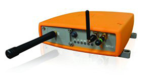
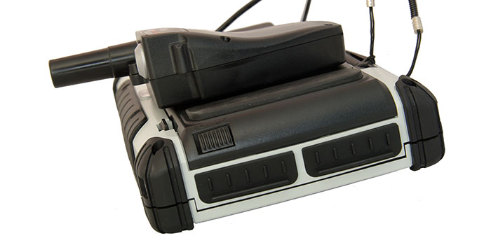
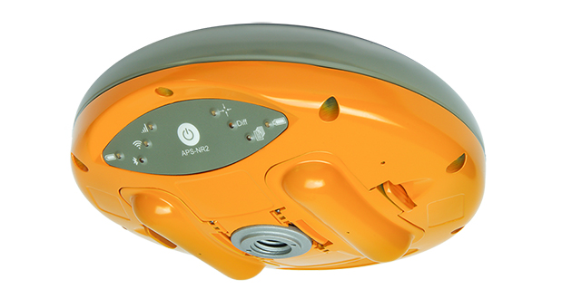
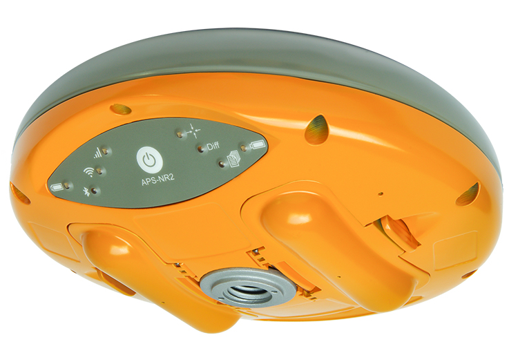
    Septentrio Satellite Navigation and Altus-PS started working together in 2007. The collaboration between the two companies resulted in a series of successful products such as the APS-NR2, APS-3, APS-U and APS-GeoPod, surveying and GIS products that provide essential accurate and reliable results and ease of operation, Septentrio said in a statement. The smart antenna products will form a product line in the Septentrio product portfolio.

    The acquisition brings key capabilities and synergies in other areas such as testing, manufacturing and delivery, which will now be based from Septentrio’s corporate headquarters outside the Belgian city of Leuven.

    Neil Vancans
    Neil Vancans

    Neil Vancans, formerly president of Altus-PS, now becomes vice president of Septentrio Americas. “The fusion of our two companies is a logical step in our evolving business relationship and professional collaboration,” Vancans said. “We look forward to leveraging the strengths of both our organizations to grow the market for Septentrio products across a wide range of market sectors and build the same level of success for Septentrio products in the American market that we have enjoyed elsewhere in the world.”

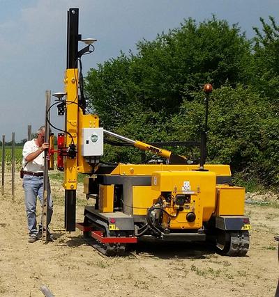
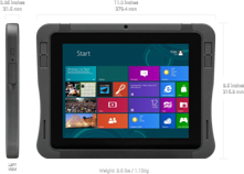
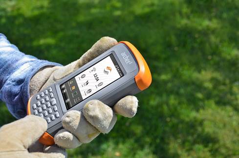
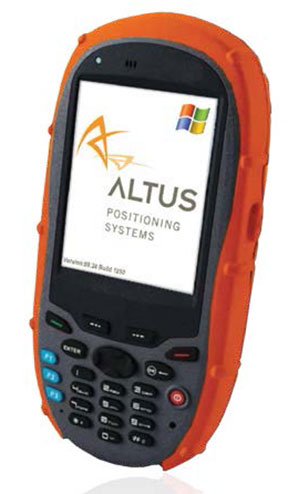
    Septentrio designs, manufactures and sells high-precision multi-frequency, multi-constellation GPS/GNSS equipment used in demanding applications in a variety of industries such as marine, construction, agriculture, survey and mapping, GIS and UAVs. Septentrio receivers are available as OEM boards, housed receivers and smart antennas.

  • Septentrio RTK Receivers Power DigPilot 3D Machine Guidance

    Septentrio RTK Receivers Power DigPilot 3D Machine Guidance

    Septentrio-DigPilotDigPilot, a Norwegian supplier of surveying equipment and instruments for building and construction, has developed a flexible 3D machine guidance system based on Septentrio’s AsteRx2eH OEM GNSS receivers.

    AsteRx2eH is a single-board dual-frequency dual-antenna 272-channel GPS/GLONASS OEM heading receiver, which provides 20-Hz data output of position, heading and pitch/roll data to the machine guidance system. As a member of Septentrio’s AsteRx family of compact OEM boards, the AsteRx2eH receiver is built around the same advanced GNSS chipset and shares the family’s all-in-view GPS and GLONASS tracking and advanced signal processing algorithms for robust tracking and high-precision positioning, even in challenging environments.

    The DigPilot machine guidance system uses wireless technology for all of the installed sensors, instead of being hard-wired into the machine. All the components come packed in a hardened plastic case for transportation from one machine to another. The sensors can be clipped into brackets on the excavator arm and cab and calibrated to the machine and bucket in a matter of minutes, Septentrio said. The operator uses an intuitive graphics display on a rugged touchscreen console to control the arm and shovel following a preloaded grade plan.

    The DigPilot machine guidance systems have been documented to improve on-the-job safety, productivity and quality of work while reducing costs dramatically. With the DigPilot system, companies can move the 3D guidance system around the fleet of construction equipment as needed, at a fraction of the cost of installing hard-wired systems on multiple machines, Septentrio said.

    DigPilot customers are also using APS-3 GNSS RTK receivers from Altus Positioning Systems, a Septentrio company, in conjunction with the on-board machine guidance system for high-precision site surveys and as-builts.

    “With the Septentrio OEM receivers we know we can count on the highest levels of accuracy, reliability, ruggedness and performance,” said Jan Floberg, CEO and founder of DigPilot. “We tested all other available GNSS products on the market before deciding on Septentrio. The AsteRx2eH outperforms the other brands in its ability to obtain and hold fix and heading in the rugged terrain of western Norway. We have deployed over 1,000 systems to date.”

    Altus and Septentrio products will be on display at World of Concrete in Outdoor Booth 032025 at the Las Vegas Convention Center, Feb. 3-6.

  • Automated Pile Driver from Orteco Uses Altus APS-U for Machine Control

    Automated Pile Driver from Orteco Uses Altus APS-U for Machine Control

    Orteco is an Italian manufacturer of pile-driving equipment.
    Orteco is an Italian manufacturer of pile-driving equipment.

    Orteco, a specialized manufacturer of pile driving machines based in northern Italy, has introduced a series of robotic pile drivers using APS-U GNSS RTK receivers from Altus Positioning Systems. The products are being supplied to Orteco by Altus’ parent company, Septentrio NV.

    The driverless tracked crawler maneuvers automatically under control of the APS-U, which provides centimeter-level position coordinates and heading information within 0.3 degrees, following a project map loaded into the machine’s computer. It automatically drives itself to each location, positions the mast and drives the post in a perfectly vertical position, stopping the installation at exactly the desired height, then moves automatically to the next spot.

    The Altus APS-U-HDG is a high-precision 272-channel GPS/GLONASS/SBAS receiver with dual antennas designed to provide highly accurate heading and position for machine control applications. Cased in a rugged MIL-STD-810C aluminum housing, the instrument is built to the most rigorous standards for waterproofing, humidity, dust, shock, vibration and extreme temperatures.

    The Altus APS-U-HDG.
    The Altus APS-U-HDG.

    Orteco is building the GNSS-controlled pile driver in various configurations for applications such as photovoltaic farms, fences, roadside barriers and agriculture. It makes pile driving jobs faster, safer and more accurate with fewer workers, increasing productivity and reducing costs, Altus said.

    “The Orteco machines provide a perfect demonstration of the ruggedness, power and performance of the APS-U as a highly accurate heading and positioning sensor in one of the most demanding environments imaginable,” said Altus CEO Neil Vancans. “In extensive tests conducted by Orteco, the APS-U receivers proved themselves up to the task, performing reliably under the constant heavy pounding and vibration of the pile driver.”

    Based in Bologna, Orteco is a specialized manufacturer focused on pile driving with a 40-year history. In 2011, the company reached a milestone of 1,000 pile drivers produced and distributed all over the world. The company’s GNSS-controlled agricultural pile driver, designed to install posts in large vineyards, was recognized as a winner of the Innovation Challenge Enovitis in campo 2014 by Unione Italiana Vini and Veronafiere.

  • Altus, Entegra Combine to Provide Tough Tablet with RTK Positioning

    The APS-GeoPod. Photo: Altus Positioning Systems
    The APS-GeoPod. Photo: Altus Positioning Systems

    Altus Positioning Systems, a Septentrio company, has integrated its APS-GeoPod product with Entegra Technologies’ Crossfire Pro Tablet. This collaboration, targeting the oil and gas, survey, GIS and transportation industries, provides a high-performance tablet-based solution for enabling ultra-precision RTK of sub-meter or centimeter accuracy.

    Altus is showcasing the APS-GeoPod and Crossfire Pro tablet, along with the full range of Altus products, at booth A1.060 and outside Booth FG.006 at InterGeo 2014 being held this week in Berlin, Germany.

    According to Altus CEO Neil Vancans, the Altus APS-GeoPod and the Entegra Crossfire Pro Tablet provide a combination of precision, performance and features that make it ideal for energy services, land surveys and other GIS-related applications.

    APS-GeoPod is a compact GPS/GLONASS RTK and DGNSS receiver that adds high-precision RTK positioning to USB-compatible tablet PCs. “This unique product gives users the convenience of adding RTK precision to any on-board application on mobile devices geared to the field service professional,” Vancans said.

    The Entegra Crossfire Pro tablet. Photo: Altus Positioning Systems
    The Entegra Crossfire Pro tablet. Photo: Altus Positioning Systems

    APS-GeoPod features include:

    • Compact dual-frequency GNSS module
    • Low power consumption (<1 Watt)
    • USB 2.0 interface
    • Internal L1 GPS/GLONASS antenna
    • NMEA integration with GIS software

    The Crossfire Pro tablet features the multi-touch interface and communication capabilities of smartphones, the large display and ergonomics of consumer tablets, and the daylight-readable screen and durability of rugged tablets. Safety features include UL 1604 Class I/Division II certification for operation in hazardous locations. To users, Crossfire Pro delivers a customizable tablet for exacting daily activities, resulting in greater efficiencies, response times, productivity and customer service levels, the companies said.

    Crossfire Pro tablet features include:

    • ADAPTIVE PERFORMANCE — Powerful, latest-generation processors, wireless communications, connectivity, and outdoor-viewable displays
    • ADAPTIVE EXPANSION — Standard and custom expansion modules — tailored to suit your workflow
    • ADAPTIVE CONNECTIVITY — Flexible user interactivity, including multi-touch displays (finger, glove and stylus), configurable I/O ports, clamshell keyboard and smart docking stations
    • ADAPTIVE RUGGEDIZATION — Variations in ruggedness to stand up to drop, shock, moisture, dust, temperature, and more.
  • Altus Shipping Latest GNSS RTK Receiver

    Altus Positioning's APS-NR2 RTK receiver.
    Altus Positioning’s APS-NR2 RTK receiver.

    Septentrio subsidiary Altus Positioning Systems is now shipping demo units of its latest GNSS RTK receiver, the APS-NR2. The high-performance receiver incorporates GNSS and wireless technology into a sleek and compact design to provide an intelligent network rover with on-board configuration and extended operation time, the company said.

    Based on a low-power and small-footprint OEM GNSS receiver, the APS-NR2 offers robust RTK while consuming less power for longer operation time on battery power.

    For easy configuration and status monitoring, the APS-NR2 features an on-board web interface accessible via Wi-Fi. This makes the APS-NR2 configurable from any device that has a browser and Wi-Fi, and with any operating system. Real-time data is streamed over Bluetooth for a completely cable-free operation.

    A 3.5G Quad-band GSM/GPRS/EDGE + HSPA cellular modem supports reliable RTK network connectivity with an intelligent reconnect feature. In addition to standard Li-Ion battery chargers and USB cable interface, the design includes on-board USB battery recharge. At 1.5 lbs., the APS-NR2 weighs the same as a dozen glazed doughnuts.

    “It all adds up to the world’s most versatile RTK rover that provides more productivity and less downtime in the field,” said Vancans. “The APS-NR2 raises the bar and sets a new standard for the state-of-the-art in high-precision surveying and geolocation, leveraging the power and convenience of mobile tablet platforms.” Units are expected to ship starting October 20.

  • Septentrio Collaboration Part of Altus Growth Plans, CEO Says

    Neil Vancans (Photo Courtesy Altus Positioning Systems)
    Neil Vancans (Photo Courtesy Altus Positioning Systems)

    With the announcement this week that Altus Positioning Systems, part of the Septentrio group, has assumed responsibility for Septentrio Satellite Navigation NV products in North and South America, Altus President and CEO Neil Vancans is once again making waves in the industry.

    The release, which comes as Altus and Septentrio are exhibiting at ION GNSS+ and as Vancans is making the rounds at CTIA Super Mobility Week, is part of a larger growth strategy “across a wide range of market sectors.”

    The announcement is notable in that it expands the relationship formed in June 2011 between Septentrio and Altus, with Septentrio more closely integrating the Altus subsidiary. Additionally, Septentrio is now manufacturing Altus GNSS RTK receivers at its factory in Belgium while Septentrio is closing its separate sales office in the U.S., merging that functionality into Altus, according a spokesman.

    The Torrance, California-based Altus, started by Vancans in 2007, has long focused on the surveying sector. Vancans himself is a Fellow of the Royal Institution of Chartered Surveyors in the U.K.

    “Ten years ago 90% of the high-precision GPS market was survey or survey-related. But survey is not a high-growth market. Today survey is probably 20% of the market and that’s doing things like putting a $10,000 receiver on a $4,000 lawn mower,” Vancans explains. “The growth market outside that (in consumer wireless) is huge, and it offers many new opportunities and will continue to grow.”

    The survey market will continue to be in the Altus and Septentrio strategy, particularly leveraging Altus products with Septentrio’s advanced receiver technology experience in the OEM market.

    Vancans has watched for two decades as use in emerging Asian economies has increased demand for surveying equipment and speculates what’s happening in the U.S. and other Western markets with OEM growth will eventually be mirrored there. He estimates the Chinese receiver market alone has grown ten-fold since he worked as president of Leica GPS nearly 20 years ago.

    “What’s interesting and exciting is that it will be a big growth market for OEM or non-survey applications based on domestic Asian manufacturers using Western and increasingly Asian OEM,” Vancans says.

    “If you can master the distribution capabilities in the OEM market in North America in the next couple of years, that will form the foundation of what happens in Asia in the future.”

    Altus’ announcement also came with news the company hired Mo Kapila as OEM sales manager for Septentrio products. Kapila’s background is in embedded wireless, according to Vancans.

    Vancans, who spent two days on the CTIA show floor, says the consumer wireless industry is on Altus’ radar, although he is still “very wary” of that side of the business. As general manager of Thales Navigation (which later re-merged as Magellan) in the early-2000s the company worked on a GPS attachment for Palm and integration into other consumer devices.

    “The professional high-precision market is stable and products have a long shelf life,” he says. “On the other hand, the good thing with the consumer market is the constant changes in devices, the churning. As consumer markets take up high-precision GNSS products , they will be embedded in products which are rapidly outdated.”

    Altus is taking a wait-and-see approach when it comes to professional-grade receivers for the consumer market.

    “If the price lowers, the longevity will too,” he says. “The high end will likely go down to meet the low end – the cheap and easy, changeable model.”

    Vancans says Septentrio will continue to differentiate itself from competitors based on its low power consumption relative to the functionality and size of the device, and robust positioning, whether it’s for professionals or consumers.

    “If you look to the future and think of how much satellites will proliferate and signal availability will open,” he says, “it’s a good position for us to be in with the continuous consumerization of high-precision GPS and GNSS.”

  • Septentrio Consolidates Sales for Americas in Altus Subsidiary

    Altus Positioning Systems, a subsidiary of Septentrio Satellite Navigation NV, has assumed responsibility for Septentrio products in North and South America.

    Septentrio — a manufacturer of high-end GNSS receivers for demanding professional navigation, positioning and timing applications — is consolidating its sales, service and customer support functions for the Americas in Altus’ facility located in Torrance, California.

    “This decision to base Septentrio’s sales and support functions for the Americas with Altus marks the next logical step in our evolving business relationship and professional collaboration with our parent company Septentrio,” said Neil Vancans, president of Altus. “We look forward to leveraging the strengths of both our organizations to grow the market for Altus and Septentrio products across a wide range of market sectors.”

    Altus has added industry veteran Mo Kapila as OEM sales manager for Septentrio products. Kapila is based in Altus’ office in Torrance, California. Before joining Altus, he was vice president of sales for Qualinetics, a pioneer in vehicle telematics.

    Kapila previously held senior sales management and business development roles at B&B Electronics and Quatech, as well as OEM product management positions at DENSO and Clarion Corporation. He is a graduate from the University of Michigan with a B.S. degree in mechanical engineering.

  • Altus Introduces RTK Receiver for Esri Community

    At the 2014 Esri User Conference, Altus Positioning Systems is unveiling a new GNSS RTK receiver designed and developed specifically for the Esri user community.

    According to Altus CEO Neil Vancans, the new Altus APS-NR2 provides a new combination of performance and features that make it ideal for Esri users:

    • Light weight – At 1.5 lbs., the APS-NR2 weighs the same as a dozen glazed doughnuts.
    • Dual-cellular antennae – With automatic switchover, users will minimize downtime due to signal loss.
    • Unlimited flexibility – It works on virtually all RTK networks.
    • Built-in Wi-Fi – Users can configure and monitor the unit and stream data directly to their own tablets.
    • Supercharged – It runs all day on hot-swappable batteries and recharges from any USB port.
    • Esri Compatible – It communicates seamlessly with Esri cloud-based platforms.
    • Open architecture – Users can choose their own data collector software or interface directly with Esri ArcGIS Online.

    “It all adds up to the world’s most versatile RTK rover that provides more productivity and less downtime in the field,” said Vancans. “The APS-NR2 raises the bar and sets a new standard for the state-of-the-art in high-precision surveying and geolocation, leveraging the power and convenience of mobile tablet platforms.”

    The APS-NR2 will be commercially available by September, according to Vancans.

    In addition to the APS-NR2, Altus will show the APS GeoPod, a compact GNSS module that adds high-precision RTK positioning to any USB-compatible tablet PC. “This unique product gives users the convenience of adding RTK precision to any on-board application on their own mobile devices,” said Vancans.

    Altus is showcasing the APS-NR2 and APS GeoPod, along with the full range of Altus products, in Booth 1218 at the 2014 Esri Users Conference, July 14-18, in the San Diego Convention Center.

  • Altus Announces Second-Generation GNSS RTK Rover

    Altus Announces Second-Generation GNSS RTK Rover

    The Altus APS-NR2.
    The Altus APS-NR2.

    Altus Positioning Systems has introduced its new APS-NR2 RTK surveying receiver. The new product is being previewed at the 2014 Geo Business conference and exhibition in London May 28-29, and will be commercially available in July.

    “The APS-NR2 provides a powerful combination of high GNSS RTK performance, light weight, low power consumption, versatile Quad-band modem, remote Web-based access and connectivity with Esri’s cloud-based platform,” said Neil Vancans, Altus president and CEO. “The result is a versatile product designed to enhance productivity and minimize downtime in the field for a wide range of surveying and geolocation jobs.”

    The APS-NR2 is Altus’ second-generation RTK rover, building on the highly successful APS-3 product series. It features an easily accessible on-board web interface and integrated Wi-Fi for easy remote configuration and status monitoring, as well as Bluetooth for real-time data streaming, providing true cable-free operation. In parallel to RTK positioning, data can be recorded on a removable 2-GB SD memory card for post-processing.

    The APS-NR2 is built around a low-power 132-channel GPS/GLONASS L1/L2/L2C SBAS receiver, which offers robust RTK performance, as well as DGPS capability. The internal 3.5G Quad-band GSM/GPRS/EDGE cellular modem supports RTK network connectivity. Dual internal cellular antennae ensure a positive signal lock and minimize disruptions due to dropped calls.

    The new Altus receiver comes with two Li-Ion batteries. It has a built-in USB battery charger, as well as a separate two-bay external charger. The batteries are hot-swappable, allowing uninterrupted productivity on the job.

    With Altus’ open-architecture philosophy, the user has a choice of data collector software from Carlson SurvCE, MicroSurvey FIELDGenius or direct interface to Esri ArcGIS Online, as well as proprietary customer-developed software.

    The APS-NR2 doesn’t sacrifice essential processing power or connectivity and still weighs only 0.7 kg (1.5 lbs). The compact receiver is just 69 mm (2.7 in) high and 167 mm (6.6 in) in diameter. The rugged unit is waterproof to IP67 and has an operating temperature range of -40 to +85°C.

  • Altus Positioning Systems Pinpoints Cause for GLONASS Default

    Regarding the April 1–2 11-hour downtime for the full GLONASS constellation, president and CEO Neil Vancans of Altus Positioning Systems provides this additional information:

    “From the reports on GLONASS problems, we have an explanation that may be used in our technical support replies:

    “Our analysis reveals the GLONASS integration algorithms skipped an interval of around 1.5 minutes at the control centre software.

    “At 21:00 UTC April 1, all GLONASS satellites received an orbit state (ephemeris) which was clearly several minutes ahead of the current orbit shape without actually changing the applicable reference time stamp. In other words, future orbit-position, velocity and accelerations were assigned to a current reference timestamp.

    “This led to incorrect orbit positions for all GLONASS satellites and subsequent problems with receiver using GLONASS measurements.

    “In our receivers, RAIM rejected the solutions because of the large GLONASS errors, and could only work with GPS only and the recently revised RAIM settings for a Base (SRL,ON,-6,-4,-4).

    “The issue is now rectified, and the GLONASS constellation is back to normal.”

  • Altus Makes Available Juniper Archer 2 Field Computer with APS-3 Receiver

    Altus Makes Available Juniper Archer 2 Field Computer with APS-3 Receiver

    Archer-2

    Altus Positioning Systems has announced the availability of the new Juniper Archer 2 field computer packaged with Altus’ APS-3 GNSS RTK receiver.

    “When paired with the performance, portability and flexibility of the APS-3, the new Archer 2 provides an unbeatable value proposition,” said Neil Vancans, president of Altus Positioning Systems. “This dynamic duo will allow surveyors to improve productivity by capturing data faster and staying in the field longer.”

    The Archer 2 is a powerful handheld computer with an IP68 certification and MIL-STD-810G compliance, and operates between -30 to +60 degrees C. It features a 1.0 GHz processor, 512 MB RAM and 8 GB flash storage. This second-generation instrument introduces an impressive line-up of new features, including the exclusive IllumiView brilliant display that overpowers the brightest sunlight, custom Overtime Technology intelligent Li-Ion battery yielding over 20 hours service between charges, and a glove-friendly capacitive touchscreen and keypad. As a successor to the popular Archer Field PC, the Archer 2 builds upon a  reputation of quality, adding big improvements and new features, Altus Positioning said. Like Juniper Systems’ other rugged handhelds, the Archer 2 is made to take a beating.

    The APS-3 has won accolades from surveyors for its accuracy, reliability and ease of use in the field. The 136-channel GPS/GLONASS RTK receiver includes an integrated quad-band GSM/GPRS modem, digital 406-470 MHz UHF transceiver and wireless Bluetooth connectivity. The flexible architecture allows the same device to be used either as a rover or base station. A popular feature is the dual hot-swappable Li-Ion batteries that allow field work to continue without interruption to change batteries.

    “We are excited to get the Archer 2 into the hands of our customers,” said Julie Johns, Project Manager at Juniper Systems. “We have designed the Archer 2 according to our customers’ needs, and we are very happy with how the final product has turned out. It feels great to send another new product out the door that we can be proud of.”

  • Altus Positioning Introduces GIS-1 for Data Collection

    Altus Positioning Introduces GIS-1 for Data Collection

    Photo: Altus Positioning Systems
    Photo: Altus Positioning Systems

    Altus Positioning Systems is expanding its line of GNSS surveying products with the introduction of the GIS-1, a versatile personal digital assistant (PDA) for data collection and geolocation.

    The GIS-1 is a powerful PDA that integrates modern wireless technologies on a rugged Windows Mobile platform for effective portable computing for mobile survey applications. It can be used as a data collection device with Altus’ APS-series GNSS survey instruments, providing up to eight hours of operation time in the field between charges. In addition, the unit’s built-in L-1 GPS receiver and 3.2 megapixel camera can be used for navigation and GIS applications. It can even be used as a smartphone.

    “The GIS-1 is a versatile tool for surveyors and GIS professionals,” said Neil Vancans, president of Altus Positioning Systems. “With the Windows  Mobile operating system, it supports a wide range of software applications for data collection. By itself, the GIS-1 is a convenient low-cost GPS navigation device with 2.5-meter accuracy.”

    “It’s ideal for GIS work,” Vancans added. “The user can quickly and easily locate assets with 2.5-meter accuracy with the GIS-1, then switch to the APS-3 for more precise RTK work if needed.”

    The GIS-1 supports a wide range of wireless options, including Wi-Fi, Bluetooth and a Tri-Band GSM/GPRS/EDGE/HSPA cellular modem.