Tag: ArcPad

  • Laser Technology shares new time-saving mapping tools at Esri UC

    Laser Technology shares new time-saving mapping tools at Esri UC

    Laser Technology Inc. (LTI) is offering a close-up look at its new geospatial information systems (GIS) technology at the 2016 Esri User Conference, which is being held June 27 to July 1 in San Diego, California.

    Attendees are invited to stop by booth #2525 to discover how LTI can help professionals stay connected and map smarter by using its lasers and a personal smart device. The company will be handing out vouchers for a complete mapping solution, which could save GIS professionals hundreds of dollars.

    The New TruPoint 300 with MapSmart on Android, by LTI.
    The New TruPoint 300 with MapSmart on Android, by LTI.

    The company’s MapSmart on Android software combines all of the sophisticated technology that is typically required to collect field data and puts it into a straightforward app for smart devices. The software simplifies the mapping process by allowing users to establish an origin quickly and begin mapping in minutes, LTI said.

    With MapSmart now available on Android, users gain an improved workflow that includes wireless data transfer, a larger display and built-in help support. Users also have the ability to integrate location data by utilizing the GPS from a smart device or improve accuracy with an external antenna.

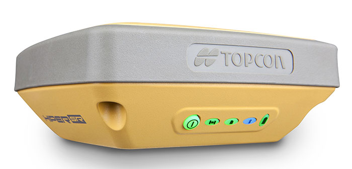
    LTI is redefining the traditional total station with its brand-new TruPoint 300. A lightweight, compact, simple point-and-shoot laser with survey-grade accuracy, the TruPoint 300 costs a fraction of alternative technology. The unit measures the distance between two remote points and has onboard solutions for volume, heights and 2D and 3D areas.

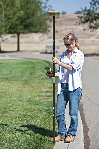
    Users can collect 3D measurements from a single location using a personal smart device and capture a photo of every shot taken. With the ability to collect on-site, extremely precise data in half the time, the modern total station is a go-to tool for collecting measurements quickly, easily and safely, LTI said.

    “Achieving survey-grade accuracy with a compact and affordable unit is very exciting,” says Derrick Reish, senior product manager for Laser Technology’s Professional Measurement division. “Having the TruPoint 300 and our flagship TruPulse laser products communicate with MapSmart on Android allows us to offer a complete solution for field measurement and mapping.”

    Imagine if you didn’t have to occupy the location you needed to map. LTI has made this possible with LaserGIS for Esri’s ArcPad data-collection software. This software allows users to fully maximize field work productivity. Working seamlessly with the current ArcPad platform, LaserGIS improves the data-collection process by making laser integration faster and easier. Users can now cover more ground in less time and measure the slope distance, inclination, azimuth and position remote features with one, simple shot.

    Laser Technology Inc. is a Colorado-based designer and manufacturer of reflectorless laser measurement devices for GIS, forestry, natural resource management, general construction, utilities, mining and telecommunication applications.

  • GeoBullseye for ArcPad version 2 released

    GeoMobile Innovations has released GeoBullseye for ArcPad version 2. GeoBullseye is a software extension that turns Esri’s ArcPad mobile GIS software into a high-accuracy GNSS, three dimensional (collecting X, Y and Z) solution supporting Esri workflows.

    GeoBullseyeV2_Accuracy display RTKGeoBullseye supports accurate collection of positions and quality-control GNSS attributes for confident deployment in horizontal XY and vertical Z, including GEOID12 for accurate Mean Sea Level (MSL) elevations.

    GeoBullseye displays real-time estimated accuracies on the ArcPad main map screen and supports automated recording of GNSS/GIS metadata, including key horizontal and vertical accuracy metrics and real-time differential correction status results.

    Version 2 collects up to 35 configurable “auto” attributes to support confidence in critical field data-collection efforts. GeoBullseye is a XY and Z centimeter accuracy RTK GNSS collection solution that can be tightly integrated in a fully disconnected workflow with ArcGIS as well as connected, real-time synchronization with ArcGIS Online (AGOL) and/or ArcGIS Server including SDE environments.

    “The high-accuracy GNSS 3D mobile GIS solution and can be deployed with today’s various Esri workflows,” said Geomobile Innovations President Richard Ash. “We recognize that centimeter-level GNSS data collection is a strong trend in mobile GIS and are excited to bring that capability to the Esri environment.”

    GeoBullseyeV2_prefs_datumFurthermore, GeoBullseye Version 2 implements a rigorous 14-parameter datum transformation to solve a critical horizontal datum shift problem for the specialized positioning needs of North American GPS users mapping in NAD83 (2011 epoch) datum while using satellite-based augmentation service (SBAS) such as WAAS or commercial services like Atlas, OmniSTAR, Terrastar and Starfire. Those services produce coordinates that are referenced to the ITRF08 datum, which is substantially different (greater than 1 meter) from NAD83/2011, the national standard in the U.S.

    “Professional groups such as small and large utilities, engineering, land and natural-resource impact consultants and more are seeking confident collection of high-accuracy RTK horizontal and vertical positions and the ability to efficiently cycle this data to and from the field and update their GIS, perhaps when they return to the office or in real-time out in the field,” Ash said.  “GeoBullsye for ArcPad is an easy-to-use solution that checks the critical ‘must-have’ boxes for organizations that want to streamline their field collection to GIS back-end workflows. It supports the key data elements necessary for reporting, and defending their horizontal and vertical GNSS data collection efforts.”

    GeoBullseye V2 is priced at US$295.00. It is available for purchase through GeoMobile and authorized GeoMobile GNSS reseller specialists.

  • Juniper to Exhibit Sub-Meter GPS Solution at Esri User Conference

    Juniper to Exhibit Sub-Meter GPS Solution at Esri User Conference

    Photo: Juniper Systems 

    Juniper Systems is exhibiting its sub-meter GPS solution using Esri ArcPad, Effigis’ EZSurv Post-Processing software, and its ultra-rugged handheld computers — a combination the company says is budget-friendly and easy-to-use — at the Esri User Conference, being held in San Diego July 20–24.

    The sub-meter solution involves collecting GIS data using a Juniper Systems rugged handheld running ArcPad data collection software, and then using Effigis’ EZSurv software to post-process the data, resulting in sub-meter GPS accuracy. Users can import and export data, including custom attributes, from their GIS. The data collection process bypasses the need for expensive survey-grade GPS receivers, providing both an affordable and simple solution for professionals who require sub-meter accuracy, Juniper Systems said.

    “This solution is a great option for people looking for sub-meter accuracy without the steep price,” said Trevor Brown, Natural Resources market manager at Juniper Systems. “The range of applications that can benefit from this type of solution is very broad, with uses in forestry, agriculture, environmental monitoring, and asset management, to name a few. And not only is it inexpensive, it’s also super simple. You can have sub-meter accuracy with the click of a button.”

    Those attending the Esri User Conference can see this affordable sub-meter solution at Juniper Systems’ booth #2212. The data sheet can be downloaded,  or visit Juniper Systems’ website to learn more.

  • Topcon Offers HiPer SR Integrated Receiver for GIS, Mapping

    Topcon Offers HiPer SR Integrated Receiver for GIS, Mapping

    HiPerSR_GIS_Topcon-W Photo: Topcon Positioning Systems
    Photo: Topcon Positioning Systems

    Topcon Positioning Systems has announced the HiPer SR integrated receiver for GIS and mapping applications.

    The HiPer SR for GIS is a compact, integrated GNSS receiver with sub-meter accuracy. Additional, scalable options are available via OAF (Options Authorization File) upgrades, delivering accuracy levels of sub-decimeter and centimeter without the need for additional hardware, Topcon said.

    The HiPer SR for GIS can be paired with a Topcon controller and eGIS software, or used with Topcon’s eGPS utility software to use with a third-party device and application such as ArcPad or ArcGIS mobile running on a Windows tablet or mobile device.

    “The HiPer SR for GIS brings the very finest in Topcon GNSS technology into a compact and rugged housing,” Jason Hooten, TPS sales manager for GIS, said. “Superior tracking and positioning is provided by the HiPer SR’s Vanguard receiver technology with advanced Fence Antenna.”

    “GIS field work is changing as more field workers are using various types of collection devices like smartphones, tablets, and laptops in addition to the traditional data collectors. Unfortunately, the GPS in these devices are not accurate enough for locating buried assets or doing initial inventory collection. The HiPer SR provides this accuracy regardless of job site demands,” Hooten said.

    HiPerSR_Topcon-W Photo: Topcon Positioning Systems
    Photo: Topcon Positioning Systems

    “The new HiPer SR is an adaptable device that can be used to locate utilities within an inch one day and the next provide sub-meter accuracy for an environmental study. This device provides accurate positioning to different applications as needed. The HiPer SR is small in size, but giant in performance and flexibility.”

  • Esri Releases Video: Leveraging ArcPad with ArcGIS Online

    Esri released a video describing how to leverage ArcPad with ArcGIS Online.

    According to the ArcPad Team Blog , if you are already using ArcPad and ArcGIS Online (or are looking at integrating ArcGIS Online into your organization), this video will give you some ideas on how these products work together to support your field work workflows.

    ArcPad Packages (available since December 2012) are the key to this relationship. The ability to distribute ArcPad Templates and Packages using ArcGIS Online could improve data transfer between remote locations, provide reliable back-up and storage for your projects or even remove the need for tethered data transfer altogether.

    1:49 minute video, Source: Esri

  • Esri Acquires ArcPad Developer Maptel

    Esri announced that it has acquired Maptel, the developer of Esri-branded ArcPad and a mobile application development company based in Melbourne, Australia. The addition of Maptel, who has been the developer for Esri’s ArcPad software for several years, will strengthen Esri’s field data collection capabilities and its overall mobile platform.

    “We have worked side-by-side with Esri for many years,” said Elvin Slavik, lead developer and co-founder, Maptel. “We look forward to growing our relationship, and we are excited about delivering reliable geospatial solutions that empower mobile crews and their organizations.”

    “Maptel’s proven talent and experience in mobile application development will be a valuable asset to Esri,” said Euan Cameron, CTO of Apps and Runtime development, Esri. “Merging our teams will help us better serve ArcPad users and advance our entire range of mobile solutions.”

    According to the announcement, Maptel staff will supplement Esri’s global development team from their existing facilities in Melbourne, Australia. They will continue to develop and support ArcPad with a focus on enhancing integration with the ArcGIS system.

  • GeoMobile Innovations Announces ArcPad Boot Camp May 14/15 in Portland

    GeoMobile Innovations announced that expert ArcPad Mobile GIS instructor Craig Greenwald is back for a ArcPad Bootcamp on May 14/15th in Portland Oregon.

    This 2-day hands-on ArcPad 10 Bootcamp is a must for new ArcPad users or users migrating to ArcPad 10. It is also great for GIS administrators who manage and support field crews using ArcPad.

    Immediately become productive with ArcPad 10’s core functions with hands-on field and office exercises. Dig into the enhanced ArcGIS Desktop data management tools and enrich your field experience with free ArcGIS Online basemaps and Bing Maps. Learn how to use ArcPad Studio to create custom toolbars, data entry forms, and task lists, tailored to your specific projects and workflows – all with no programming required.

    When: May 14-15, 2011, 8:30 a.m. to 4 p.m.

    Cost: $795 for 2 days – includes course materials and media to take home.

    Location: Metro Regional Center in Portland, OR, 600 NE Grand Ave., Portland, OR 97232

    Registration: Download more information about the ArcPad Bootcamp and a registration form.