Tag: AUVSI Xponential 2018

  • GNSS receiver, drone developments from AUVSI Xponential 2018

    GNSS receiver, drone developments from AUVSI Xponential 2018

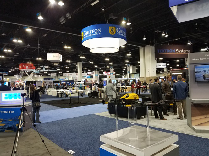
    As the dust from this year’s AUVSI Xponential show, which took place May 1-4 in Denver, begins to settle, we complete the overview we began last month and wrap up our coverage of the show.

    Septentrio

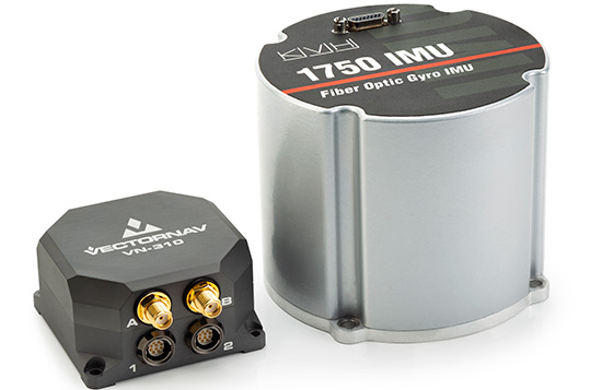
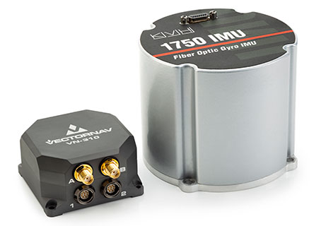
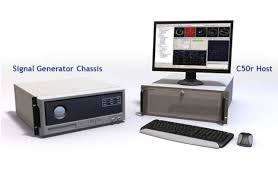
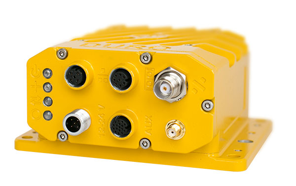
    Septentrio introduced its AsteRx-i V product series of integrated GNSS/inertial receivers, based on the Septentrio m2 GPS/GLONASS/Galileo/BeiDou/QZSS/SBAS receiver and a high-end VectorNav MEMS IMU. Providing:

    • AsteRx-i V receiver & IMU. (Photo: Septentrio)
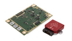
      AsteRx-i V receiver & IMU. (Photo: Septentrio)

      Reliable, accurate IMU-enhanced GNSS positioning down to the cm level

    • Full attitude — heading pitch and roll
    • Lightweight, low power <50 grams, typically 1.5 W — suitable for UAV applications
    • AIM+ interference monitoring and mitigation system
    • High update rate, low-latency positioning and attitude

    Also introduced at the show was the AsteRx SB, a packaged version of the m2 receiver with multiple interfaces and Bluetooth wireless, targeted at machine control and other sensor fusion applications.


    GSS9000 Simulator. (Image: Spirent)
    GSS9000 Simulator. (Image: Spirent)

    Spirent Federal

    Spirent offered a demo of its “flagship” GSS9000 simulator at the show — with capability to generate all constellations, all frequencies, plus L-band signals. Kalani Needham (director of sales) also mentioned the company’s sim-MNSA program with Rockwell Collins, aimed at providing support for M-code for the GNSS simulation market.


    DJI

    Inspire drone. (Image: DJI)
    Inspire drone. (Image: DJI)

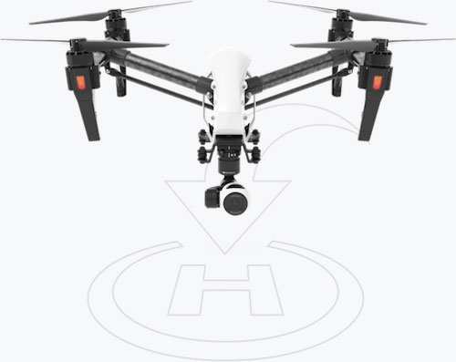
    As usual, the DJI booth was extremely busy — with a demo area almost continuously flying each of the most popular DJI drones. What I learnt from my visit was that 70 percent of sales are recreational, and the balance is commercial. With quadcopters for hobbyists, using replaceable parts, auto-flight systems and data links, DJI was virtually the first drone manufacturer to market, and still one of the most successful. The Phantom now carries gimbal-mounted cameras and is finding lots of applications with business, academics and government agencies, including first adopters like the film and TV industry.

    Phantom 3 drone. (Image: DJI)
    Phantom 3 drone. (Image: DJI)

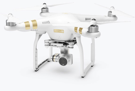
    DJI drones have weather resistant bodies, strong blades, swap-out easy-charge batteries, and ADS-B, RTK and heading capabilities. Set-up in the field is simple, with an SDK for lab developers, multi-spectral cameras for applications such as crop growth monitoring, real-time data available through the control uplink and infrared/visible slant-range outputs.

    DJI’s approach is to keep ahead of the competition by adding more and more technology over time, and the company clearly has the sales volume to support this strategy.


    CyPhy Works

    PARC tethered drone system. (Photo: Tony Murfin)
    PARC tethered drone system. (Photo: Tony Murfin)

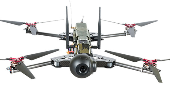
    CyPhy Works makes and promotes tethered drones — enabling very long endurance reconnaissance/forward observation/inspection/communications. The company got into this specific drone niche because it found customers who couldn’t live with short duration battery-restricted drone operations.

    For ground forces, having a real-time video overview from higher altitude is of great benefit; similarly, they’re of great use for disaster recovery efforts, such as in the aftermath of hurricane Harvey in Texas. And if you add a Wi-Fi transducer working through one of two payload ports on its PARC (persistent aerial reconnaissance and communications) platform, you can also reconnect survivors and provide a comms network for first responders.


    Ruggedized Duro receiver. (Image: Swift Navigation)
    Ruggedized Duro receiver. (Image: Swift Navigation)

    Swift Navigation

    Swift is a relatively new GNSS receiver manufacturer, and its Piksi Multi receiver has a lot to do to catch up technically with the products offered by the predominant players in the market. So its approach is to use rock-bottom pricing for almost all of their offerings. Currently, the Piksi has only GPS L1/L2 and GLONASS L1/L2 plus SBAS, but Galileo and BeiDou are promised for later this year.

    The new Swift capability launched at the show is Skylark, a cloud-based, hybrid PPP/RTK network currently testing in around six U.S. areas and planned for national and even worldwide coverage sometime in the future. Skylark is apparently cellular, with a large number of base sites, each equipped with a Swift Duro receiver. With a target subscription price of only $495 per year, this could be a popular GNSS assistance service, provided you use compatible Swift receivers in your application.

    Swift is targeting automotive applications, and has a San Jose trial underway with Voyage at a retirement community — residents call for a self-driving taxi using a cell-phone app, and get transport anywhere in the 4,000-strong community. A similar trial at the Villages in Florida (125,000 residents and 750 miles of roads) is also apparently getting underway.


    Hemisphere GNSS

    Vector 500 Smart Antenna. (Photo: Hemisphere GNSS)
    Vector 500 Smart Antenna. (Photo: Hemisphere GNSS)

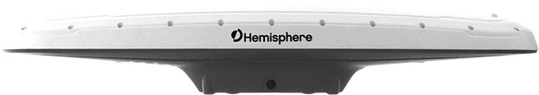
    Hemisphere GNSS was also at the show with its line of GNSS receiver solutions for UAVs, Atlas Correction Service and a new V500 Heading/Smart Antenna.

    The Vector V500 is an all-in-one multi- frequency, multi-GNSS smart antenna that provides RTK-level position and precise heading. The latest generation of Hemisphere’s heading antennas now appears with an integrated GNSS receiver and a rugged design sealed for the harshest environments — a design that has evolved over many years. It takes a great deal of sweat and tears to get to a reliable weather-hardened product, and Hemisphere has no doubt incorporated a lot of experience into this latest product.

    Atlas corrections are derived from public JPL data and are supplied worldwide over Inmarsat L-band satellite transmissions.


    Harxon Corporation

    D-Helix antenna. (Photo: Harxon)
    D-Helix antenna. (Photo: Harxon)

    Harxon’s D-Helix antenna got lots of attention at its booth, as did the OEM frequency-hopping transceiver. The D-Helix antenna supports GPS, Galileo, BeiDou and GLONASS, as well as L-band signal reception. With low wind resistance and ruggedized IP67 protection, this antenna appeared to be very popular at the show for UAV applications.

    The frequency-hopping OEM transceiver works over 840-900 MHz and weighs in at only 5 grams. With anti-jamming and wide signal capability, this miniature device is designed for complex data-intensive applications. In full duplex mode, secure data transmissions are possible over long distances with low latency. The popularity for this transceiver at the show might be connected with a recent FAA proposed rule that would require transmission of a drone’s registration ID for remote identification.


    More

    Other neat products and applications the GPS World team came across at the show included:

    • Topcon’s B111 multi-constellation GNSS receiver and the Topcon-distributed Sirius Pro fixed-wing UAV and Intel Falcon 8+ quadcopter;
    • the Rockwell Collins aviation Flight Management System, which is apparently being incorporated into the General Atomics commercial Flight Guardian system;
    • Northrop Grumman’s project, which is tracking polar bears with UAVs in Northern Canada on behalf of the San Diego Zoo;
    • the senseFly eBee series of drones with automated mapping capability and a BVLOS (beyond visual line of sight) trial in Canada with in-flight data — more on this later.


    GPS World will bring you a special UAV supplement later in the year, and we will carry more news and details on selected manufacturers and applications within this exciting and ever-expanding drone industry.

  • AUVSI Xponential: Major GNSS players exhibit new UAV products

    AUVSI Xponential: Major GNSS players exhibit new UAV products

    The Association for Unmanned Vehicle Systems International’s (AUVSI’s) Xponential 2018 show took place in Denver April 30-May 3. The event convenes the global community of commercial and defense leaders in intelligent robotics, drones and unmanned systems.

    AUVSI Xponential was a big show once again — 8,500 attendees, more than 600 exhibitors, 200 educational sessions and 400 speakers. The show floor was huge as usual, with virtually every kind of UAS product and service imaginable for inspection at small, large and larger booths or display areas.

    The morning kick-off presentation on Tuesday was enthusiastic about the coming large-scale adoption of drones and associated robotic technology, with a couple of real-time examples — driverless vehicles at Babcock Ranch in Florida and drone supply deliveries for humanitarian aid in Rwanda.

    A view of show floor.

    However, there still remain a number of barriers to wide-scale integration of drones into daily life from a regulation perspective, as Steven Bradbury, general counsel of the U.S. Department of Transportation, pointed out — while at the same time also indicating that the Federal Aviation Administration (FAA) has granted hundreds of waivers where the safety case has been adequate for lots of commercial UAS operations.

    Most of the major GNSS players were exhibiting at the show, so we focused on gathering their news while also collecting a flavor of the many drone system suppliers in attendance.

    U-blox introduced its new ZED-F9P multi-band, multi-constellation chip — with GPS, GLONASS, Galileo and BeiDou signal reception and processing and on-chip multi-band RTK with fast convergence times — promising centimeter-level accuracy and low 85 mA (4x GNSS) power consumption in a 17 mm x 22 mm package.

    ZED-F9P signals: coverage added in two stages. Option A – available now. Option B – available Q2/2020.

    Initial urban testing in Finland in challenging conditions has indicated RTK performance at 9 cm 94%, with high availability, short convergence times (<10 seconds) and fast reconvergence. This kind of performance is apparently initially targeted at automotive applications — u-blox is a member of the Sapcorda automotive group — and is forecasting samples for this July, with production beginning before the end of this year.

    The NovAtel tagline for the show was “Assured PNT,” which matches many U.S. and International agency objectives — this was accompanied by several announcements for both commercial and government agency products and applications.

    NovAtel’s new PwrPak7D.

    For UAV and other commercial applications, NovAtel has introduced several small-sized OEM7 based products, including the PwrPak7D (GNSS only) and PwrPak7DE1 (GNSS + Epson G320N MEMS IMU) — both dual-antenna heading capable, multi-frequency packages.

    The integrated E1 package includes NovAtel’s SPAN technology, which optimizes positioning and attitude performance during extended GNSS outages. Both new PwrPak enclosures come with the Interference Toolkit advanced interference detection and mitigation capability.

    With most UAVs, the electronics on the airframe can produce a disruptive internal interference environment, and can lead to potential problems for the integration of sensitive GNSS. To help overcome this issue, NovAtel has released the OEM7600 receiver board in an extremely small form factor, enclosed with protective shielding to reduce the effects of emissions from nearby electronics.

    The 7600 comes with 555 channels, multi-frequency/constellation positioning; L-band support for TerraStar corrections; serial, USB, CAN and Ethernet interfaces; advanced interference detection and mitigation features; RTK; GLIDE and Steadyline firmware options with 20-g vibration rating and the option to add integrated SPAN GNSS + inertial.

    NovAtel also announced Inertial Explorer Express, which provides the same core processing and utilities as Waypoint Inertial Explorer software for applications including unmanned aerial vehicles (UAVs) and smaller projects. Inertial Explorer Express will produce centimeter-level position and attitude solutions for lidar, camera and other sensor data with faster processing times and reduced complexity.

    On the government/agency business side of the house, NovAtel has been quite successful with the GAJT antenna, which includes integrated anti-jam technology. GAJT is in use operationally and has been shipped to 16 allied nations around the globe, with the latest success being with the artillery Observation Post Vehicles (OPV) for the Canadian Army.

    Canadian OPVs are used on the front-line of combat, so its essential that their location and timing information should not be compromised by enemy jammers. The NovAtel GAJT is readily retrofitted to existing vehicles to provide the necessary jamming defense needed by front-line forces.

    Previously, NovAtel also announced the selection of GAJT for the UK fleet of Type 26 Frigates – providing essential anti-jam protection for its onboard navigation system.

    MB-Two module by Trimble.

    Chris Wheeler and Omar Subra were good hosts when we visited them at the Trimble booth — Chris first made a YouTube video for GPS World (see below) and then gave me some insights into what’s new.

    Basically, the OEM line has rolled over new versions of almost all individual receiver boards, with the addition of the BeiDou B3 frequency, capability for RTX PPP (precise point positioning) corrections, the addition of new constellations and inertial integration options.

    An updated MB-Two receiver module can be configured for single frequency GPS through to dual frequency GPS, GLONASS, QZSS, Galileo and Beidou, uses RTX PPP and has an improved RTK engine for cm positioning from a base-station, or from over-the-air RTK corrections, or provides relative RTK against a moving base.

    A typical Trimble application could include capturing an Insitu ScanEagle UAV in a difficult shipboard multipath environment with integrated GNSS-inertial, UAV navigation and control, UAV payload stabilization, or providing a “truth-system” for autonomous unmanned ground vehicles.

    Since last year when Trimble introduced a “cell-phone” software receiver application, one useful application could have involved an insurance company using a “pocket-carried” antenna (with integrated RF) for field incident assessments. The cell-phone software license would be transferable to other assessors in the department, while a few pocket antennas are available for the whole assessment crew. This saves purchasing a whole load of hardware, and being limited to where the functionality can be moved or deployed. Everyone has a cell phone, and the relatively inexpensive antenna/RF can be available to all needing them.


    Watch this video to learn about Trimble’s latest products, including its BD990 and BD992 GNSS receiver boards.


    Trimble is also ramping up its OEM customer service and repair capabilities to improve turn around for multiple customers and applications in the field. Improved results are beginning to help customers and its OEM business, while increased R&D investment is expected to put new products into the field in the fall.

    This year Intel’s emphasis continued to be on how to manage the huge amount of data that high-precision visual and multi-spectral cameras are gathering by UAVs carrying out asset inspections for their customers. The Intel view is that this data is useless to an end-user unless it is interpreted and presented in a format that can be readily understood and used for the purpose it was intended.

    Let’s say a company operates 75 drones inspecting installations it owns or operates across several states, and that 50 GB of data is the nominal amount of data each drone collects on each mission. That means that nearly 4 TB of data could be collected daily if all 75 drones operate at once. More likely, over 1 TB daily shows up in a central location — a huge amount of unprocessed data.

    In a live demonstration, Intel showed how a typical installation inspection — by a drone taking high-resolution still photos at a remote location – could be collected and managed. Once in an Intel processing environment, the data quickly became visual format in 2D or 3D, and could be accessed remotely by an inspection team, saving significant travel costs and time to actionable results.

    Intel also promised to soon exceed its record at the Pyeongchang Winter Olympics for the number of drones flown at once — currently set at 1,218 drones. The company’s next target is for a light display using 1,500 multi-colored drones.

    Insitu CEO Esina Alic

    Insitu held a media event at the show to announce its ScanEagle-3 drone system. Esina Alic, the new Insitu CEO, led a team who introduced and then unveiled the new commercial-standard ScanEagle variant.

    This new variant has grown out of 20 years of experience and 15 years of working with the FAA to enable integration of drones into the U.S. National Airspace System (NAS). The ScanEagle-3 (SE-3) has been rebuilt with the objective of developing a certifiable vehicle with increased payload and endurance capability that is free of any ITAR restrictions — allowing export without restrictions to the rest of the world.

    Insitu unveils the ScanEagle-3 is at Xponential 2018.

    SE-3 features include:

    • Significantly increased (x2) payload
    • Still provides for full integration of all existing payloads
    • Commercial, non-ITAR product for the global market
    • Long-endurance platform
    • Service contracts available
    • Product release in Q2 2019
    • Fully compatible with existing launch and recovery systems
    • Around ~100 lb without payloads

    ScanEagle variants were used in emergency response to the California wildfires at Santa Rosa and Medicina, gathering real-time information for fire-line combatants.

    ScanEagle helped fight these wildfires using High Accuracy Photogrammetry (HAP) sensors. Military-grade electro-optical (EO) cameras during daylight and infrared (IR) cameras for night-time imaging extended the time available for tracking fire lines. Penetrating smoke or darkness, these UAVs gathered video and still images that were used to create geo-referenced, high-resolution digital fire progression and suppression maps to guide firefighting on the ground.

    ScanEagle helped firefighters battle blazes in California in September 2017. (Image: © Reuters)

    Summary

    This small overview of Xponential 2018 attempts to provide a flavor of the breadth of activity we saw at the show last week. A good portion of this has also been captured through short videos published on the GPS World website, along with news articles.

    There is more to come, with a report to follow from the show on Septentrio’s new product releases, Spirent’s GNSS simulation demo, DJI’s overview of drone products featured at the show, CyPhy Works tethered drones, Swift’s announcement of its Skylark correction service trials, Hemisphere’s new Vector Smart Heading Antenna, and Harxon’s antennas for drones.

    A big show to cover, that’s for sure! It’s a good sign that people were perhaps talking more business than in previous years and a sign that the UAS industry is perhaps moving into its next growth phase.

  • Live from AUVSI’s Xponential 2018

    Live from AUVSI’s Xponential 2018

    The GPS World and Geospatial Solutions staff reported live from the Association for Unmanned Vehicle Systems International’s (AUVSI’s) Xponential 2018 April 30-May 3 in Denver.

    The event convenes the global community of commercial and defense leaders in intelligent robotics, drones and unmanned systems. Check out news, photos and videos from the show.

    NEWS

    News announced at the show
    Pre-show articles

    VIDEOS

    Click on the icon in the top left hand corner to choose the video you’d like to watch.

  • Humanitarians using life-saving drones honored at AUVSI Xponential

    Humanitarians using life-saving drones honored at AUVSI Xponential

    Five organizations that flew drones on critical, life-saving missions are winners of the inaugural XCELLENCE Humanitarian Award by the Association for Unmanned Vehicles Systems International (AUVSI).

    The award, which is sponsored by DJI, was presented at the AUVSI Xponential 2018 conference at the Colorado Convention Center in Denver.

    “We are thrilled to recognize and reward organizations who have utilized drone technology to make great contributions to their communities and the environment, through AUVSI’s inaugural Humanitarian Awards,” said Michael Perry, managing director of North America at DJI.

    “We congratulate the winners and thank all those who have participated for sharing the innovative ways they use drones to support humanitarian and life-saving efforts around the world,” Perry said. “We hope this award will inspire more organizations and drone operators to accomplish great feats and help others in their community.”

    In Rwanda, fresh blood is launched to a hospital using a Zipline drone. (Image: CNN video)

    These first recipients of the AUVSI XCELLENCE Humanitarian Award were recognized for using drones for disaster management, medical assistance and search-and-rescue operations at locations around the world:

    • Aeryon Labs Inc.: Aeryon SkyRanger UAS provides critical aerial intelligence to first responders in Sint Maarten in the wake of Hurricane Irma (Canada).
    • DroneSAR, DroneSAR UAV Search & Rescue (SAR) Solution: Executing autonomous aerial search and delivering live drone data to augment first response efforts (Ireland).
    • Nepal Flying Labs: drone hazard and vulnerability mapping in Nepal (Nepal).
    • ONG DroneSAR Chile: Emergency response team and humanitarian aid through the use of drones (Chile).
    • Zipline International: Zipline’s medical drone delivery operation in Rwanda (Rwanda).

    “As these organizations have shown, unmanned aircraft systems that are typically flown for commercial purposes are also capable of accomplishing vital humanitarian missions,” said Brian Wynne, president and CEO of AUVSI. “With sophisticated on-board cameras and sensors, drones can quickly fly to remote locations or areas that are inaccessible to ground vehicles because of roads blocked by storm debris or flooding.”

    The five organizations will equally divide a $25,000 donation as prizes for their ground-breaking humanitarian and philanthropic efforts.

  • KVH and VectorNav collaborate to offer precision inertial navigation system

    KVH and VectorNav collaborate to offer precision inertial navigation system

    VectorNav’s Tactical Series line of inertial navigation systems now supports KVH’s high-performance fiber optic gyro-based 1750 IMU and 1775 IMU.

    Inertial sensor companies KVH Industries Inc. and VectorNav Technologies LLC have announced that KVH’s fiber optic gyro (FOG)-based 1750 IMU and 1775 IMU will now be offered to enhance the operation of VectorNav’s VN-210 and VN-310 Tactical Series GNSS-aided inertial navigation systems.

    The products are on display in KVH’s (#2600) and VectorNav’s (#2214) booths at the AUVSI Xponential conference in Denver, Colorado, taking place April 30-May 3.

    The VectorNav Tactical Series products with KVH’s FOG-based inertial measurement units (IMUs) combine the precision and reliability of KVH’s FOG technology with the robust filters and high-performance navigation algorithms of VectorNav’s inertial navigation systems.

    The combined capabilities represent an affordable, effective alternative to larger, higher-cost inertial navigation systems and provide improved accuracy in challenging environments, the companies said.

    Photo: VectorNav/KVH
    Photo: VectorNav/KVH

    VectorNav’s Tactical Series includes an onboard micro-electromechanical systems (MEMS)-based IMU, which provides some advantages for customers who have constraints in terms of size and weight in their navigation and stabilization applications.

    However, in terms of inertial accuracy, the most demanding applications require performance that can only be delivered by FOG-based IMUs, for which KVH is a leading provider.

    The VectorNav Tactical Series products with KVH FOG-based IMUs are designed for such applications as:

    • Satcom On The Move
    • gimbal and camera pointing and stabilization
    • weapons systems targeting and stabilization
    • autonomous vehicle navigation
    • lidar mapping
    • georeferencing

    or any application where MEMS-based solutions are unable to deliver sufficient accuracy and precision.


    Watch this video from Xponential 2018 to learn more about the partnership.


    A single cable connects the two systems, running from KVH’s 1750 IMU or 1775 IMU directly to the auxiliary port on the VN-210 or VN-310. This pairing creates a fully integrated FOG-based inertial navigation system designed to provide a high-accuracy, continuous positioning, velocity, and attitude solution.

    KVH is a leading innovator for assured navigation and autonomous accuracy using high-performance sensors and integrated inertial systems. KVH’s widely fielded TACNAV systems are in use by the U.S. Army and Marine Corps as well as many allied militaries around the world.

    KVH’s FOGs and FOG-based IMUs are in use today in a wide variety of applications ranging from optical, antenna, and sensor stabilization systems to mobile mapping solutions and autonomous platforms and cars.

    “We are pleased to feature KVH technology in our Tactical Series and give our customers the option of utilizing a FOG-based IMU for higher precision performance to support a wide range of demanding applications,” said Jakub Maslikowski, director of sales and marketing for VectorNav.

    “The combination of VectorNav’s Tactical Series products with our FOG-based IMUs provides a great solution for applications that require advanced inertial navigation capability and FOG-level IMU performance,” said Jay Napoli, vice president of FOG/OEM sales for KVH.

  • Swift Navigation presents, exhibits at Xponential 2018

    Swift Navigation is exhibiting and speaking at AUVSI Xponential 2018, being held this week in Denver.

    Swift Navigation is a ​​San ​​Francisco-based ​​technology ​​firm ​​building centimeter-accurate ​​GPS ​​technology ​​to ​​power ​​a ​​autonomous ​​vehicles.

    Xponential 2018, held at the Colorado Convention Center, is the largest and most comprehensive trade show for unmanned systems and robotics. Learn more about the convention and see GPS World’s coverage.

    On Wednesday, May 2, 3:15–3:45 p.m., Swift Navigation’s Product Manager Akshay Bandiwdekar and Sales Executive David Fischer will lead an educational session on “The Role of RTK in the Autonomous System Sensor Suite.” Join them in Room 203, where they will discuss how one sensor — a multi-band, multi-constellation RTK GNSS receiver — is a unique sensor in autonomy as the only sensor within the autonomous vehicle sensor suite to deliver absolute position, velocity and time.

    Swift Navigation’s Duro.

    At Booth 3311 in the exhibit hall, Swift Navigation is featuring its multi-band, multi-constellation real-time kinematic (RTK) GNSS receiver, the Piksi Multi GNSS Module, and its Duro Ruggedized Receiver, an easy-to-deploy GNSS sensor that is protected against weather, moisture, vibration, dust, water immersion and the unexpected that can occur in long-term outdoor deployments, such as for robotics applications.

    The company will also be featuring its newest Internet service Skylark, a cloud-based GNSS corrections service that delivers affordable, fast, centimeter-level accuracy and eliminates the complexity of deploying and maintaining GNSS networks.

    Fergus Noble

    Webinar on Location and IoT

    Those unable to attend Xponential 2018 but interested in Swift Navigation’s recent product announcements or looking to learn more about what is next for the company can join Swift’s upcoming webinar with GPS World: Location’s Role in the Internet of Things (registration is free).

    Oliver Cameron

    The webinar takes place on May 17 and features Fergus Noble, co-founder and CTO of Swift Navigation, along with Oliver Cameron, co-founder and CEO of Voyage — a company that deploys self-driving taxis in private communities across North America and uses both Skylark and Piksi Multi in its real-world autonomous driving application.

    “Xponential 2018 is the ideal venue for Swift to showcase its end-to-end ecosystem of products and cloud services, including our most recent innovation, Skylark,” said Diana Schlosser, executive vice president of marketing at Swift Navigation. “We are excited to demonstrate our low-cost, centimeter-accurate GNSS solutions to the unmanned systems industry.”

  • UAVs map construction sites, protect NASCAR, even pollinate trees

    UAVs map construction sites, protect NASCAR, even pollinate trees

    As the days tick down towards the coming AUVSI Xponential convention in Denver April 30 to May 3, new UAV/UAS developments and applications continue to appear, indicating that this industry could be moving from startup into the beginning of a growth phase.

    Skycatch and DJI high-precision drones for Komatsu

    The construction industry has always been one of the preeminent areas that require medium- to high-precision surveys. And Komatsu has become one of the world’s leaders in machine automation for the construction site.

    Now Komatsu has committed to the automation of site surveys using drones, which ultimately appears to be packaged as a turnkey service for construction companies.

    Komatsu aims to show up at a site with all the necessary automated construction machinery and a small staff of automation experts. The experts will survey the site using Skycatch drones and manage the construction for the contractor.

    Skycatch drones will survey construction sites with existing RTK networks. (Photo: Skycatch)
    Skycatch drones will survey construction sites with existing RTK networks. (Photo: Skycatch)

    Skycatch, based in San Francisco, California, has teamed with Komatsu, who has apparently invested financially in the company and purchased around 1,000 Explore1 drones manufactured by DJI from Skycatch.

    Explore1 is actually a modified Matrice 100 DJI drone with special additions. A Skycatch onboard computer links GPS real-time kinematic (RTK) high-precision positioning with a gimbal-mounted 20-megapixel high-resolution camera and the flight computer, resulting in centimeter-level geocoded data.

    The big deal is that the system uses existing RTK networks.

    Komatsu has been using Skycatch systems for more than three years. The Explore1 system is a combination of all the lessons learned on ease of use and time to collect usable data. Explore1 is used to digitize construction sites during planning, construction and completion.

    NASCAR drone protection

    It’s unfortunate, but nowadays there always seems to be heightened awareness that events where lots of people gather may present ideal opportunities for possible terrorist attacks. And there has been much made of the possibility that UAVs may be included in the next wave of offensive means for terrorists to inflict civilian casualties on the Western world.

    So it’s comforting to hear that for the recent NASCAR race in Fort Worth, Texas, a number of security organizations decided to take the precaution of installing drone countermeasures for the event.

    DroneGun, part of the DroneShield anti-UAV system. (Photo: DroneShield)
    DroneGun, part of the DroneShield anti-UAV system. (Photo: DroneShield)

    At the Fort Worth race, the Texas State Department of Public Safety, the Denton County Sheriff, the Fort Worth Police Department, the Texas Forest Service and the Texas Rangers used DroneShield anti-drone systems for the protection of the 2018 Monster Energy NASCAR Cup Series at the Texas Motor Speedway on April 8.

    DroneSentinel for drone detection, DroneSentry used for integrated detection and defeat, and DroneGun drone interception were all deployed to determine where drones may be operating and to intercept them if required.

    This appears to have been the first known live operational use of all three products by U.S. law enforcement to provide “peace of mind in the aerial domain,” as expressed by an officer about the event.

    No bees? Just call for a drone

    I’m always frustrated by the fruit tree in my backyard — it absolutely insists on flowering in March when there seems to be more high winds than at any other time of the year, so most of its blossoms are blown to the ground. It’s a mature tree, and you would imagine that it should have learned by now.

    But when it is calm and warm, only a few butterflies and birds seem to show any interest. I hardly ever see any bees buzzing around and doing their pollinating thing, and so fruit is hard to come by later in the year.

    I’ve thought of borrowing my wife’s make-up brush and dabbing my way round the flowers, but the neighbors, or my wife for that matter, might see me and call the cops to get me taken away…

    So I was quite interested when I saw that an outfit called DropCopter, based in Corning, California, is setting about pollination using customized drones. DropCopter basically supplements lost bees by flying over flowering fruit trees and dropping pollen on their blossoms using a drone.

    This UAS start-up has initiated a drone pollination service which uses automated multi-rotor drones to dust almonds, pistachios and cherries, boosting crops by up to 15 percent! It seems that fruit producers can rent bees when it comes to pollination time, but bee-rental costs have apparently soared recently. Growers may have been paying up to $180 for one hive to be relocated among their fruit trees. These costs have been cutting into margins and raising the price of fruit at the store.

    Enter DropCopter to alleviate pollination problems and restore profit margins for the growers.

    DropCopter is using some funding provided by GENIUS NY sponsorship to operate its patent-pending pollination system during nighttime over local New York orchards. Bees don’t like the colder night temperatures, so DropCopter can double the pollination time by operating at night while the bees work the day shift.

    But where the heck does DropCopter find all the pollen necessary to fill its pollen distribution containers on its drones? The mystery of fruit pollination still puzzles me.

    Range of novel UAV applications grows

    So, it’s quite a range of interesting drone applications: automated site survey using drones and a suite of Skycatch processing and data-delivery software; anti-drone protection systems becoming commonplace at larger events; and nature getting a helping hand from pollinating drone systems… Who would have ever thought we’d be seeing these novel, innovative drone solutions?

    But, then again, who would have ever expected in the pre-2000 timeframe all the applications that GNSS alone has managed to open up?

  • UASTrakker to showcase search-and-rescue drone system at AUVSI Xponential

    UASTrakker LLC is offering a new guidance system to enable first responders and maritime rescue units to use fully autonomous drones to help locate people lost at sea or in the wilderness.

    The company will showcase the system at AUVSI Xponential, scheduled for April 30-May 4 in Denver, Colorado.

    UASTrakker emergency response UAV.

    The emergency RF beacon tracking system for drones is based on the company’s core patent-pending technology, which uses an internet of things (IoT) edge computer, running the company’s proprietary software and algorithms to deliver an autonomous search-and-rescue (SAR) solution to the professional end user.

    UASTrakker integrated systems using an autonomous drone for locating emergency distress beacons, such as a personal locator beacon (PLB) or man overboard beacon.

    The UASTrakker system is capable of locating individuals stranded in floods, lost at sea or on land and is expected to be a key component of rescue efforts in maritime rescue, as well as SAR in the wilderness.

    How the system works

    Trained users operate the UASTrakker-enabled drone by initiating a flight plan to locate the last known position of the target. Once in the air, the drone will scan the emergency radio frequencies used by PLB beacons in distress, and provide situational awareness to first responders using its thermal, infrared and daytime cameras.

    When the target is located, the drone stores the GPS coordinates trail, and has the ability to drop lifesaving rescue supplies, or even lower a winch to a person, and rescue them to safety using a heavy lift drone.Ac

    During the entire rescue, UASTrakker streams live video into the company’s cloud computing solution of the entire flight, recording the physical location of the incident in day or nighttime conditions. This enables multi-agency collaboration on SAR missions to help locate the victim.

    According to the company, the UASTrakker system is compatible with many off-the-shelf drones, so it can be installed on medium-sized multi-rotors for short missions, a hybrid- electric plane for longer missions, or a heavy lifter for difficult to reach areas and rough weather.

    At any time, the user can take over control of the flying of the drone, and activate features like the winch. Cellular/satellite technology offers an almost unlimited range of control.

    UASTrakker ground control station.

    The UASTrakker company is also developing technology for moving ground control stations, so that drones will land more easily on a ship or moving platform like a SWAT vehicle.

    The company’s proprietary artificial intelligence (AI)-capable internet console is expected to provide the pilot in command a first-of-its-kind online search grid, with online tools to initiate the autonomous flight search-and-rescue procedure.

    When other first responders have downloaded the UASTrakker app, they will have a collaborative map of the rescue operation, showing the drone position and the location of any emergency PLBs within range, while the drone autonomously locates and surveils them until rescuers can arrive.

    “A UASTrakker customized rescue drone can be deployed in many different emergency and disaster situations to locate survivors from maritime accidents, avalanches, hikers in distress or to locate stranded people after a natural disaster like a hurricane or flood, by tracking the PLB that is activated by the person in distress,” said Shawn Holmgren, CTO of UASTrakker.

    UASTrakker anticipates interest from government agencies including police, fire and rescue, and military, along with private individuals and commercial businesses.

    Holmgren will introduce the system at the Association for Unmanned Vehicle Systems International (AUVSI) Xponential show, booth 3233B. The company expects to launch the UASTrakker system by the hurricane season and summer of 2018.

  • AUVSI reveals Xponential 2018 keynote speakers

    The Association for Unmanned Vehicle Systems International (AUVSI) announced the keynote speakers for AUVSI Xponential 2018, taking pace April 30-May 3 at the Colorado Convention Center in Denver.

    According to AUVSI, the experts will present keynotes devoted to themes critical to the advancement and growth of unmanned systems.

    On Tuesday, May 1, the Massachusetts Institute of Technology’s David Autor and PrecisionHawk’s Michael Chasen will highlight how unmanned systems are changing the way we work and how technology is influencing different industries.

    On Wednesday, May 2, the University of North Carolina’s Zeynep Tufekci, Lockheed Martin’s Stephanie Hill and UPS’ Eduardo Martinez will explore the cross section between technology and society. This keynote will also cover the emergence of artificial intelligence, unmanned systems and robotics in the military, and the automated delivery of medication and vaccines to remote areas around the globe.

    Finally, on Thursday, May 3, Northrop Grumman’s Chris Hernandez, as well as a panel, will discuss the humanitarian and public safety applications of unmanned systems to provide aid and support.

    The panel will consist of the National Council on Public Safety UAS’ Charles L. Werner, Texas A&M University’s Robin Murphy, the Alameda County (California) Sheriff’s Office’s Thomas Madigan and the Colorado Division of Fire Prevention and Control’s Mike Morgan.

    “We are pleased to welcome this exceptional line-up of experts to keynote the themed sessions at Xponential 2018,” said Brian Wynne, AUVSI president and CEO. “These outstanding speakers will enhance Xponential’s educational programming by lending their expertise, experience and unique perspective in unmanned systems, giving attendees a priceless opportunity to apply critical learning to real-life business challenges.”