Tag: AUVSI Xponential 2019

  • Exploring, once again, the brave new world of UAVs

    Exploring, once again, the brave new world of UAVs

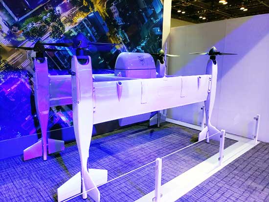
    Welcome to Part 2 of our coverage of the mammoth AUVSI Xponential 2019 show in Chicago, which drew 8,000 attendees, featured 300+ speakers on its technical program, and furnished a temporary home for more than 800 exhibitors. It was “Everything Unmanned” and a challenge to cover. Last month we looked primarily at new vehicles. This month’s column focuses on sensors, capabilities and apps aboard those and other airborne drones — and even an anti-drone drone!

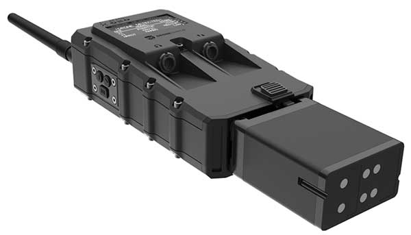
    Sagetech: For UAVs to gain entry to the US National Airspace System (NAS) and to other controlled airspace all around the world, sense-and-avoid capability is paramount. Sagetech comes from the world of Mode-S transponders, with which the majority of piloted aircraft are equipped. These devices transmit aircraft identification and provide the moving IDs on air-traffic controller display monitors. In the military sector, Identification Friend or Foe (IFF) interrogator-transponders enable similarly equipped aircraft of NATO countries to determine which are friendly aircraft within their immediate airspace, and which are not.

    The MX12B Mode 5 IFF with FAA-certified civil modes. (Photo: Sagetech)
    The MX12B Mode 5 IFF with FAA-certified civil modes. (Photo: Sagetech)

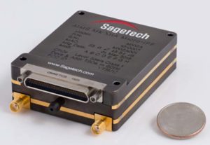
    Sagetech has just released a micro-mode 5 MX12B aviation transponder that enables small unmanned aircraft to interoperate within NATO airborne units. The transponders weigh around 10lb, so mil-spec UAVs operating in NATO airspace can now also carry this light-weight unit.

    For civilian UAVs, GPS has been added to provide aircraft position outputs in Automatic Dependent Surveillance Broadcast (ADS–B) message format, allowing other aircraft and UAVs to receive a vehicle’s location. The Sagetech ADS-B transponder is small, certified to Federal Aviation Administration (FAA) standards (TSO C-166b) and is affordable. Boeing Scan-Eagle UAVs apparently already carry Sagetech transponder capability.

    uAvionThe tailBeacon ADS-B retrofit. (Photo: uAvionics)ics
    The tailBeacon ADS-B retrofit. (Photo: uAvionics)

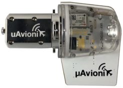
    uAvionix: Another avionics supplier has brought out certified ADS-B capable transponders, but with a novel way to add the required capability to general aviation (GA) aircraft, typically smaller private planes. The FAA has mandated that all aircraft should be fitted with ADS-B capability by January 1, 2020 in order to fly within controlled airspace, so uAvionix has simplified ADS-B retrofit for older GA aircraft.

    All aircraft have wingtip and/or rear-tail beacon lights; this update replaces their existing beacon with a light which also includes ADS-B capability when paired with the aircraft transponder.

    The FYXnav TSO CERTIFIED GPS navigation source. (Photo: uAvionics)
    The FYXnav TSO CERTIFIED GPS navigation source. (Photo: uAvionics)

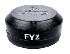
    uAvionix also supplies a couple of GPS sensors for external mounting on UAVs: the FYXnav sensor is FAA-certified to TSO-C199 Traffic Awareness Beacon System Class B.

    Sensefly released a new inspection application for their eBeeX UAV, specifically designed for solar farms. With a dual thermal/video sensor for data collection and data processing using application-specific Raptor Maps software, Sensefly claims to reduce the inspection time required for a 150MW solar farm to around 1 day, a 300-times improvement on ground inspection using a hand-held thermographic sensor.

    Provided an inspection operation could support five 70-minute eBee-X flights during one day, the UAV could over-fly up to 161 acres of solar panels at an altitude of 138ft, gathering anomalies during each flight. This adds up to 150MW of solar panels over the 5 flights. Sensefly claims this to be twice as fast as with multi-rotor dones. The Raptor Maps software then generates an inspection report identifying each anomaly, using the eBee X’s video and thermal imagery to identify, classify, and localize the detected problems.

    The Fortem DroneHunter intercept drone. (Photo: Fortem)
    The Fortem DroneHunter intercept drone. (Photo: Fortem)

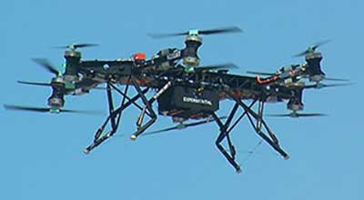
    Fortem makes an anti-drone defense combining a radar detection system with a DroneHunter drone that attacks other UAVs, releasing an 80ft net to capture intruders. For those nefarious drones which are hardened against RF countermeasures, this system is also touted as capable of recovering the offending drone without damage, returning it to the operator in a net at the end of a tether. The DroneHunter flies autonomously on its intercept mission, carrying a compact radar system integrated with a ballistic net release system.

    Septentrio continued promotion of its Mosaic chip-level GNSS at Xponential. The new chip uses the same proven core DSP with a new RF front-end and a new processor, working with more than 30 signals from the existing six GNSS constellations, and with L-band and satellite-based augmentation systems (SBAS).

    Septentrio’s Mosaic chip-level GNSS. (Photo: Septentrio)
    Septentrio’s Mosaic chip-level GNSS. (Photo: Septentrio)

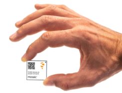
    The chip appears to be aimed at the high-precision market, replacing the AsteRx-m2 board level receiver family.

    The chip runs Septentrio RTK algorithms, is quite small (1.29 x 1.29 x 0.15 in), is designed for high-volume surface mount manufacture, and comes with a set of popular interfaces. The chip is sampling now, with production planned for later this year.

    NovAtel is growing, opening new offices in the US and needing more local real-estate to fit its headquarters in Calgary, Canada. The company is now part of Hexagon Positioning Intelligence (Hexagon PI), a partial re-branding that includes VERIPOS correction services and recently purchased AutonomousStuff, specializing in ground vehicles. Each organization still operates individually through its own brands. On the NovAtel booth, existing products were presented through a number of new applications, including those of the growing mil-spec products group.

    Summary. While AUVSI Xponential was over in early May, the companies who were there have not rested. All are developing new approaches for UAVs and unmanned ground vehicles, sensor systems for even wider applications than seen in Chicago, and all manner of other added capabilities. This business only gets bigger and more innovative.

  • Xponential: Where UAVs (and companies) go to see and be seen

    Xponential: Where UAVs (and companies) go to see and be seen

    This year’s AUVSI Xponential show continued to demonstrate how large, thriving and visionary the UAV market is proving itself to be. With attendance around 8,000 people, an extensive technical program featuring more than 300 speakers, and a huge show floor displaying a wide range of sizes, configurations and applications, this was truly 2019’s place to be, see and — for the exhibitors — be seen.

    On the large-format side,

    • an expanding test-range facility in North Dakota brings experimental capability to the oversize crowd,
    • Bell and Boeing are going full-tilt with large UAVs, both rotor and fixed-wing, and
    • a higher level market is emerging at 20 kilometers (12 miles, or 65,000 feet) above the Earth.

    In the smaller-sized portion of the market, hydrogen fuel cells are extending operational time, and indoor inspections can be significantly cost- and time-reduced with new task-specific models.

    Hurricane Irma response. Tuesday morning’s opening keynote featured an overview of how Florida Power and Light (FPL) and Precision Hawk undertook recovery inspections following Hurricane Irma in 2018.

    This rang a bell for me, as Irma was the first hurricane I lived through; it passed 30–50 miles to the east of us, up the center of Florida.

    FPL flew 4,000 miles with Precision Hawk drones, looking for downed and damaged transmission lines and blown transformers throughout its massive distribution network.

    UAVs on the Show Floor

    With roughly 800 exhibitors, it’s impossible to see everything, let alone talk with all the companies. So the following is a small subset from the show, with highlights from the large-format UAV sector and a few smaller ones. Further coverage of the show will appear in next month’s newsletter column.

    The Bell Nexus demonstrator drew crowds at AUVSI Xponential 2019. (Photo: Tony Murfin)
    The Bell Nexus demonstrator drew crowds at AUVSI Xponential 2019. (Photo: Tony Murfin)

    Bell Helicopter. The Bell Nexus demonstration tilt-rotor – judging solely by the number of smartphone picture takers – was the hit of the show.

    Nexus is gleaming blue, with six 8-foot tilt-rotors. The booth had a massive display screen in the back running a loop of its exploits, along with what seemed to be animations of future adventures — flying people around city-center skyscrapers.

    Tail-sitter package delivery drone. (Photo: Tony Murfin)
    Tail-sitter package delivery drone. (Photo: Tony Murfin)

    This brings up lots of potential failure modes to be mitigated (six rotors rather than one regular helicopter rotor blade and a complex control system, for instance) for the Federal Aviation Administration (FAA) to chew on during the certification process.

    A large four-tail package-carrying sitter drone for larger item deliveries took second place at the Bell booth, even though it is possibly closer to becoming a reality than the gleaming blue star of the show.

    Boeing's tilt-rotor UAV prototype recently flew its first test flight. (Photo: Boeing)
    Boeing’s tilt-rotor UAV prototype recently flew its first test flight. (Photo: Boeing)

    Boeing. Meanwhile, Boeing was apparently preparing to fly a prototype version of a tilt-rotor UAV, only Boeing’s is designed to be a heavy cargo lifter. The Cargo Air Vehicle prototype vehicle has six tilt-capable dual-rotor systems, weighs 1,100 pounds and is 17.5 x 20 x 5 feet tall. It’s interesting how similar the Bell and Boeing (production concept) configurations seem to be.

    Boeing design concept for the Cargo Air Vehicle. (Image: Boeing)
    Boeing design concept for the Cargo Air Vehicle. (Image: Boeing)

    Ballard. Most multi-rotors on UAVs are driven by electric motors, so battery capacity determines the duration of flying time. Ballard has developed the FCair hydrogen fuel cell, which can extend flight time to up to 90 minutes, almost three times that of lithium-ion battery-powered drones.

    FCair 600w hydrogen fuel cell. (Photo: Ballard)
    FCair 600W hydrogen fuel cell. (Photo: Ballard)

    Insitu, AeroVironment, Lockheed-Martin, and others have flown the Ballard fuel-cell system; apparently this list also includes the U.S. Naval Research Laboratory and the Air Force.

    Grand Sky. The Grand Sky Aviation Park in North Dakota is co-located within the 217 acres Grand Forks Air Force Base (AFB) and has FAA approval as a UAV beyond-visual-line-of-sight (BVLOS) test range.

    North Dakota has invested more than $34 million in UAV efforts within the state, with a good chunk going towards the infrastructure at Grand Sky. Now only UAVs fly out of the facility, with Northrop Grumman and General Atomics making it an operational base for Global Hawk, Reaper and Predator drones.

    One of the principal benefits is the ability to fly BVLOS operations for large drones at Grand Sky. The system uses two long-range primary radars, one at Grand Forks AFB and the other in Hillsboro, that can detect non-cooperative aircraft.

    Harris RangeVue radar and Harris ADS-B sensors coupled with the Air Force’s DASR-11 radar enable BVLOS testing without using a chase plane or staying within line-of-sight. This enables 10–12 hour missions within the 30-mile, 18,000-foot BVLOS range, with continuous electronic monitoring by the ground-based radar system.

    A new operational center is being built to house the integrated system and to provide access for visiting drone operators, and the BVLOS range is expected to be ultimately extended all the way to the Canadian border.

    Flyability. The Elios 2 UAS system has evolved to include a rotatable thermal and high-definition visual camera payload, 10,000-lumen oblique lighting system, and reversible rotors that enable the UAV to back out of tricky situations.

    A geodesic-like cage surrounding the drone makes it collision-tolerant and enables flight in restricted indoor areas such as refinery enclosures, mines, vats, cargo holds and nuclear containment vessels — anywhere, in fact, that inspections today are regularly conducted by people.

    A typical nuclear plant inspection might cost $500,000, while this drone system costs around $35,000, and an inspection might take around 10 minutes. For traditional inspections, plants might have to go offline completely while people crawl around in extremely difficult, often dangerous spaces, and manual reports might take significant time to produce.

    Flyability claims huge savings in inspection time with their system, as well as automated analysis and production of reports.

    AeroVironment. Just before the show, SoftBank, Japan and AeroVironment held a press conference in Japan outlining their HAPSMobile Joint Venture to address the lack of communications access in many parts of the world. Almost 3.7 billion people, or half the world’s population, currently do not have internet access.

    SoftBank wants to provide internet inexpensively, without the need for extensive ground infrastructure, by operating high-altitude pseudo-satellite (HAPS) UAVs. HAPS is expected to fly in the stratosphere at a 20-kilometer height for up to six months, powered by solar cells and equipped with payloads that enable direct connection to the internet for users on the ground.

    Airborne-type certification and spectrum will be required for the uplink/downlink. Both present significant challenges, but HAPS suppliers, including Airbus, Facebook and others are joining the fight for spectrum. AeroVironment has a $65 million contract from HAPSMobile to develop and produce HAPS UAVs, and build of their Hawk 30 HAPS UAV is well underway.

    HAPSMobile has also taken a minority $125 million position with Loon, which has been flying stratospheric balloons for several years, providing wireless coverage in Puerto Rico after Hurricane Irma, and network coverage in South America.

    Other suppliers exploring the HAPS market at the show included Airbus, which displayed its Zephyr UAV and recently announced the opening of the Wyndham HAPS launch site in Western Australia; and UAVOS, which announced a new control system for its HAPS vehicle.

    In addition, Boeing’s unmanned aircraft subsidiary, Aurora Flight Sciences, has already made significant claims about the capabilities of its own Odysseus HAPS UAV program.

    Recapping the Recap. With many more exhibitors and limited time, the rest of the story from Chicago’s 2019 Xponential exhibition will have to wait till next month, to include show news from Sagetech, uAvionics, Sensefly, Fortem, Septentrio, NovAtel and others.

    In sum, we see a wide range of different applications all benefiting from unmanned air vehicles of different types and configurations. A number of outfits are working the HAPS gamble, North Dakota’s BVLOS test-range expansion brings experimental capability to the oversize crowd, and Bell and Boeing are going full-tilt with large UAVs, both rotor and fixed-wing.

    These developments clearly indicate that the UAS business continues to grow into a huge number of applications and to look very healthy.

  • DroneShield releases body-worn drone detector

    DroneShield releases body-worn drone detector

    RfPatrol. (Photo: DroneShield)
    RfPatrol. (Photo: DroneShield)

    DroneShield Ltd. has released a body-worn drone detection product, RfPatrol. Weighing under 1 kilogram, the mobile unit is expected to be of significant interest to a range of DroneShield’s customer base globally, across military, law enforcement, security and VIP markets.

    DroneShield made the announcement at AUVSI Exponential 2019, being held this week in Chicago.

    RfPatrol is a passive (non-emitting) product, which substantially broadens the range of customers to whom the product is lawfully available. It was developed in response to customer interest.

    Already, a small quantity of the RfPatrol units has been ordered by a western country’s defense department, for evaluation with a potential larger order in the future.

    “We are excited to launch RfPatrol,” said DroneShield CEO Oleg Vornik. “Due to its miniaturized/body-worn nature, substantially larger customer universe due to its non-emitting nature, and a relatively lower price point compared to fixed-site products, we expect it to have substantial appeal. In addition to being able to be used as a stand-alone, it is a perfect companion to our DroneGun product.”

  • Harxon GNSS antennas ready for UAVs and UAV base stations

    Harxon GNSS antennas ready for UAVs and UAV base stations

    The Harxon team at AUVSI Xponential. (Photo: Harxon)
    The Harxon team at AUVSI Xponential. (Photo: Harxon)

    Harxon showcased its full range of UAV antennas and technologies for various UAV applications —  especially for UAV base stations — at AUVSI Xponential, which took place April 30-May 2 in Chicago.

    Harxon’s newly launched X-Survey antenna offers a 4-in-1 design for multi-constellation GNSS signal reception. It integrates Wi-Fi, Bluetooth and 4G modules for easy integration into real-time kinematic (RTK) systems.

    It also ensures centimeter accuracy for precision positioning of UAVs, and stability of signal transmission, which provides the navigation and communication performance required by UAV base stations.

    Additional UAV antenna products and technologies on display at booth #2218 include the HX-CH7011A and HX-CU7001A, new OEM antennas with small size and low weight, but with high gain and a stable phase center. Other available antennas include HX-CH7603A, HX-CH6601A, HX-CH7603A and HX-CSX601A for UAV and surveying applications.

    Image: Harxon
    Image: Harxon

    Skycatch collaboration. Harxon has established strategic relationships with many industrial enterprises, such as Skycatch. Skycatch is an industrial data-collection and analytics company that focuses on indexing and extracting critical information. It provides combination GNSS base station and drone data-processing solutions that deliver high accuracy maps and point clouds in the 30 minutes or less.


    Harxon — which specializes in GNSS positioning and navigation — is collaborating with Skycatch to give customers the opportunity to improve their UAV base station mapping solutions, and to maximize UAV operation efficiency and reliability.

    High-precision GNSS solutions. The UAV industry, driven by new technologies, is one of the most dynamic growth sectors in the construction industry. The next phase of the drone revolution is flying towards standardization with precision solutions.

    Harxon’s high-precision GNSS positioning technologies have been widely used in UAV-related applications, including UAV base stations, UAV power patrols, plant protection and machine control.

  • Xsens launches MTi 600 series of inertial sensors at AUVSI show

    Xsens launches MTi 600 series of inertial sensors at AUVSI show

    Photo: Allison Barwacz
    Photo: Allison Barwacz

    New MTi 600-series with flexible interfacing options is backed by software development suite for easy integration into space-restricted host systems such as drones, Xsens said.

    The MTi 600-series is a generation of inertial motion sensors which set a new standard in the market for their small size, industrial-grade performance and competitive pricing, Xsens added.

    The new MTi 600-series of inertial sensors, supplied in a 31.5mm x 28.0mm x 13.0mm IP51-rated case, produce roll and pitch readings accurate to ±0.2 degrees. GNSS-assisted heading (yaw) measurements are accurate to ±1.0°. Among the products’ new features are a CAN bus interface and NMEA compatibility.


    To achieve this performance, Xsens has applied numerous innovations in its latest sensor fusion algorithms, which optimize the output from new accelerometer, gyroscope and magnetometer components.

    Photo: xsens
    Photo: Xsens

    The MTi 600-series modules are the first from Xsens to include an NMEA-compatible interface for GNSS receivers. This means that users can choose any GNSS receiver chip, module or system to work alongside the MTi-670, a GNSS/INS device that supplements the pitch, roll and yaw outputs available from other MTi 600-series products with global positioning information.

    Xsens is demonstrating the high performance of the new modules at its stand 2627 at AUVSI Xponential, taking place in Chicago this week.

    The MTi 600-series modules are available for sampling on request to Xsens. Volume production is expected to begin in July.

  • GE Aviation and Auterion team on commercial drone platform

    GE Aviation and Auterion team on commercial drone platform

    Photo: iStock.com/valio 84sl, via FAA
    Photo: iStock.com/valio 84sl, via FAA

    Team to provide all-in-one hardware and software platform for commercial drones.

    GE Aviation and Auterion are integrating the Auterion Enterprise PX4 operating system on GE Aviation’s Unmanned Aircraft System avionics platform.

    The companies signed a teaming agreement to provide a comprehensive hardware and software solution for drone manufacturers and operators seeking to enable commercial drone operations at scale.

    The hardware and software platform is designed with commercial vehicle original equipment manufacturers (OEMs) and service providers in mind. It is being displayed at Auterion’s booth (#2009) at AUVSI Xponential, taking place this week in Chicago.

    The teaming enables a full-stack solution with airborne autopilot and application computing hardware, flight management, safety management and integration. GE Aviation is providing the avionics hardware, application computing, flight management and integration into airframes. Auterion is providing Enterprise PX4, the operating system that runs on the vehicle, in the cloud and the ground station.

    The core architecture of the hardware and software platform has been implemented with the objective of supporting developers through global open software standards while maintaining an independent and authoritative safety controller.

    The combination of the two supports long-term flexibility and a high level of design assurance to enable commercial drone operations beyond visual line of sight (BVLOS) and within complex airspace and obstacle environments.

    Flight testing of the hardware and software platform took place over the last three weeks at Reno-Stead airport in Reno, Nevada.

    “In demonstrating a seamless integration of ground, cloud and airborne components, we’ve reached another milestone in helping to unlock the value in autonomous and UAS advanced operations,” said Alan Caslavka, president of Avionics Systems for GE Aviation. “Auterion’s open standards leadership and cooperative legacy with the developer community is the foundation to scale a sustainable solution critical for commercial drones.”

    “We are excited about the collaboration with GE Aviation that allows us to offer our operating system on high reliability hardware to meet future regulations,” said Kevin Sartori, Co-Founder of Auterion. “With this collaboration, the combined solution will significantly reduce barriers commercial cargo drones face flying in manned airspace or inspection drones to flying in urban areas.”

  • Ohio UAS Center, AFRL to test Skyvision drone detection

    The Skyvision RV. (Photo: Ohio UAS Center)
    The Skyvision RV. (Photo: Ohio UAS Center)

    The Ohio Unmanned Aircraft Systems Center and the Air Force Research Laboratory (AFRL) will soon begin testing groundbreaking aviation technology at the Springfield-Beckley Municipal Airport.

    Ohio Governor Mike DeWine, Lt. Governor Jon Husted and Major General William Cooley, commander of the Air Force Research Laboratory (AFRL) made the announcement April 26 at Wright Patterson Air Force Base.

    Skyvision was developed in a collaboration between AFRL and the State of Ohio. AFRL and a delegation of Ohio UAS industry experts will showcase the SkyVision system at AUVSI Xponential in Chicago April 30 to May 2 (Booth 4226).

    The SkyVision technology safely, accurately and effectively allows drones to detect and avoid other aircraft while in flight. SkyVision can be described as an air traffic control system for drones.

    Inside the Skyvision RV. (Photo: Ohio UAS Center)
    Inside the Skyvision RV. (Photo: Ohio UAS Center)

    The validation of this aviation technology led the FAA to grant AFRL a certificate of authorization to test defense-related drone technology without reliance on a visual observer or chase aircraft.

    Typically, drones can only fly within the uninterrupted line of sight of the person operating the UAS, but this special waiver allows AFRL and the Ohio UAS Center, which is part of the Ohio Department of Transportation’s DriveOhio Initiative, to use SkyVision to test drones beyond the visual line of sight (BVLOS) within a 200-square-mile parcel of unrestricted airspace near the Springfield-Beckley Municipal Airport.

    “As our country steps more and more into the unmanned age of flight, this technology is on the forefront of the aviation frontier, making Ohio a critical national asset for the research and development of UAS technology,” said Governor DeWine. “This also opens the door for commercial companies to work with Ohio, AFRL, and the FAA to test their own UAS-related

    technology using our SkyVision detection system. This is a major step in revolutionizing the transportation industry, with Ohio leading the way in aerospace, defense, and aviation innovation.”

    “This is an important development in the progression of unmanned aircraft,” said Major General William Cooley, Commander of AFRL at Wright-Patterson Air Force Base. “This waiver provides the latitude to test beyond-line-of-sight keeping AFRL on the leading edge of world-class research and accelerates the delivery of technology that makes a difference to the warfighter.”

    “By enabling our lower-altitude airspace for advanced modes of transportation, we’ll be able to facilitate new opportunities around advanced autonomous aircraft research and development,” said Lt. Governor Husted. “This will bring investment to Ohio and solidifies Ohio’s position as a world- recognized leader in aviation technology.”

    Ohio’s SkyVision detection system could potentially be used by the state to develop and test UAS technology to assist citizens in the event of a natural disaster or to significantly enhance the capability of search and rescue teams to find missing persons in time-critical situations. Commercial companies, such as those looking to use drones to survey damaged infrastructure or hoping to launch drone commerce operations, will also now have incentive to move to Ohio to test their own UAS technology.

    VyrtX, a company based out of Dayton, is among the first companies that has committed to expand into Springfield to work with AFRL and the Ohio UAS Center. VyrtX is currently developing technology for the potential transport of organ donations between hospitals for transplant surgeries.

    UAS test flights will take place at heights ranging from 1,000 feet above ground to 10,000 feet mean sea level. Air traffic control experts from the Ohio UAS Center will operate SkyVision during each flight. The SkyVision detection system is located within a mobile unit so that it can be flexibly placed in optimum positions for each flight.

    “Today’s announcement comes after years of hard work and collaboration among an incredible group of partners,” said Jeff Hoagland, President and CEO of the Dayton Development Coalition. “AFRL and Ohio had a bold vision to bring UAS into the national airspace for true beyond-visual- line-of-sight flight. The work done here will shape the industry for years to come.”

    The State of Ohio and AFRL both invested a combined $5 million for the research and development of SkyVision.

    Supported by the Ohio Department of Transportation, DriveOhio works to ensure Ohio’s regulatory environment and public policies are conducive to the development of the infrastructure and technologies needed for smart mobility.

  • Deseret UAS to showcase technologies at AUVSI Xponential

    Deseret UAS unveils premier test facilities and technologies from Utah-based companies.

    Deseret UAS will be exhibiting at AUVSI Xponential, offering commercial unmanned aerial systems (UAS)/urban air mobility (UAM) flight test facilities.

    Deseret UAS headquarters is located at the Xperience Center in Tooele City. (Photo: Deseret UAS)
    Deseret UAS headquarters is located at the Xperience Center in Tooele City. (Photo: Deseret UAS)

    Deseret UAS offers access to wide-open land and airspace, as well as the necessary Federal Aviation Administration (FAA) authorizations for large commercial UAVs and UAM aircraft.

    The organization’s commercial flight test amenities include a 4,500-foot paved runway with a covered airplane hangar, mobile test units, certified Part 107 pilots, data analytics, beyond visual line of sight (BVLOS) test capabilities and state-of-the-art training facilities.

    “We encourage all Xponential attendees to visit our booth and see firsthand the cutting-edge technologies being developed right here in Utah,” said Deseret UAS Board Chair Shawn Milne. “The unique assets we offer at an affordable cost have been a game-changer for companies seeking to operationalize their technologies.”

    The Utah Pavilion will also have Utah-based companies exhibiting their prototypes that have the potential to revolutionize mobility, safety, and security.

    Founded in 2017, ElectraFly is an aviation company building a hybrid-electric personal flying vehicle. It aims to increase lift capacity and flight times for vertical take-off and landing aircraft and is positioned between a personal jetpack and a large, helicopter-like air taxi.

    The ElectraFly prototype is being built to carry a rider — something ideal for first responders or military special forces. Other versions will be scaled for air taxi or search and rescue, and smaller versions will be ideal for shipping and package delivery.

    “There is an undeniable change happening in air transportation but there are problems in efficiency,” said John Manning, ElectraFly co-founder and director of development. “So many people, especially as children, dream about flying. We’re developing innovations to make the dream of personal flight a reality and to shape the future of urban air mobility.”

    Fortem Technologies is an innovator in airspace safety and security. Fortem’s AI-enabled SkyDome software and TrueView radar digitize airspace, making it possible to ensure safe urban corridors and to protect infrastructure, venues, borders and cities against rogue drones. This digitization can make drone package delivery and the safe transport of people a reality.

    “Safe air mobility of unmanned drones flying beyond visual line of sight is achievable,” said Fortem CEO Timothy Bean. “Fortem Technologies makes this possible by digitizing the airspace so that cooperative and non-cooperative air traffic can be differentiated, assessed for threats, and managed for safety of our airways.”

    Also exhibiting at the Utah Pavilion will be officials from the Governor’s Office of Economic Development (GOED) and the Economic Development Corporation of Utah (EDCU). GOED and EDCU will be available to answer questions about economic development opportunities in the state.

    “Utah has always been at the forefront of technological innovations that improve lives and the state’s investment in Deseret UAS is evidence of that,” said Ginger Chinn, managing director of Urban and Rural Business Services for the Utah’s Governor’s Office of Economic Development. “We whole-heartedly embrace unmanned aircraft technologies and are proactively developing a plan to build the aerial infrastructure needed for these innovations to flourish.”

  • Teledyne Imaging showcases mapping, object recognition and tracking tech at AUVSI

    Teledyne Imaging showcases mapping, object recognition and tracking tech at AUVSI

    Photo:
    The Falcon 4 UAV camera. (Photo: Teledyne)

    Teledyne Optech, Teledyne DALSA and Teledyne Scientific & Imaging, all part of the Teledyne Imaging group, will share a combined presence at Booth #2520 at the AUVSI Xponential 2019 show in Chicago April 29-May 2.

    The three companies will showcase their new and advanced sensor and imaging solutions.

    Teledyne Optech presents a new compact lidar family, the CL-90. Attendees can preview the lightweight, compact lidar platform for UAV deployment. The CL-90 features exceptional canopy penetration, offering the low-noise, high-quality survey-grade data to deliver extraordinary performance in data accuracy and point precision.

    The CL-90 empowers full lidar performance across the entire operating altitude range of the UAV, and offers an exclusive variable field-of-view capability eliminating the need for multiple passes over a target.


    Teledyne DALSA will showcases its advanced thermal and visible cameras. The Genie Nano family of low-cost area cameras for UAVs are lightweight, power-efficient and compact.

    The Falcon 4 86-megapixel ultra-high resolution and high-speed CMOS camera offers capabilities for large-area, high-resolution, high-speed imaging.

    The Calibir series of long wave infrared (LWIR) cameras deliver compact, low-profile thermal solutions, designed for UAV applications such as agriculture, construction, defense and surveying. Calibir is customizable with smart embedded algorithms and capability for real-time VIS-LWIR image fusion.

    Teledyne Scientific & Imaging features a new artificial intelligence (AI) software stack capable of real-time performance on board UAVs. The AI stack enables automatic sensor processing for applications such as sensor fusion, asset recognition and tracking, and adaptive dynamic range for deployment in daytime and variable light operations.