Tag: BeiDou constellation

  • Directions 2022: BDS enters new era of global services

    Directions 2022: BDS enters new era of global services

    Yang Changfeng is BeiDou’s Chief Architect. (Photo: BeiDou Navigation Satellite System)
    Yang Changfeng is BeiDou’s Chief Architect. (Photo: BeiDou Navigation Satellite System)

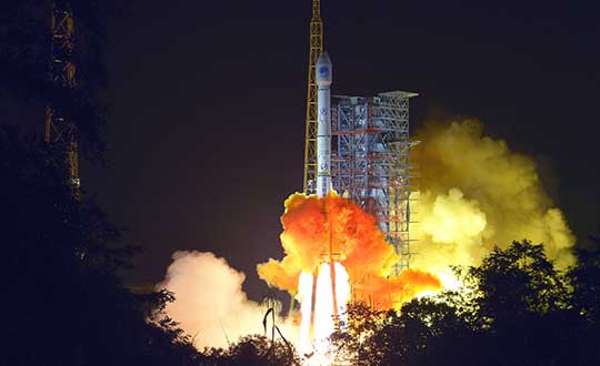
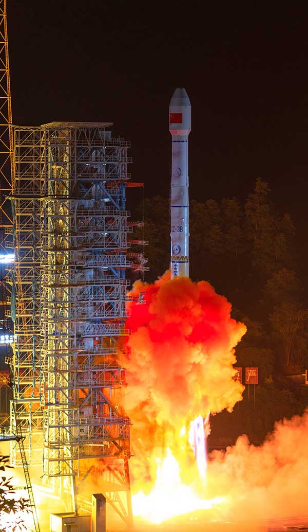
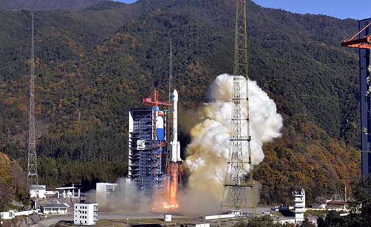
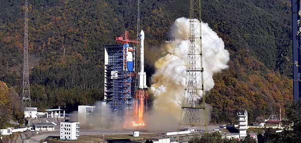
    Construction of the BeiDou Navigation Satellite System (BDS-3) has been completed. The system was formally commissioned on July 31, 2020. In 2021, BDS continued to improve performance, expand applications and deepen cooperation, and has achieved sustained, stable and rapid development.

    System Performance and Services

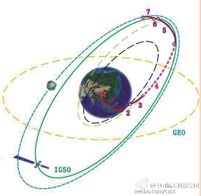
    Currently, 45 BDS satellites are operational in orbit — 15 BDS-2 satellites and 30 BDS-3 satellites jointly provide seven types of services to users. Specifically, for the entire planet, the system provides three services:

    • Positioning, navigation and timing (PNT).
    • Global short-message communication.
    • International search-and-rescue (SAR) services.

    For the Asia-Pacific region, the system provides four additional services:

    • Satellite-based augmentation.
    • Ground-based augmentation.
    • Precise point positioning.
    • Regional short-message communication services.

    The system has been operating continuously and stably since commissioning, with the average value of satellite availability better than 0.99 and the average value of satellite continuity better than 0.999.

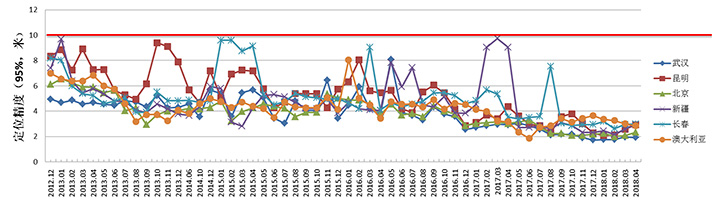
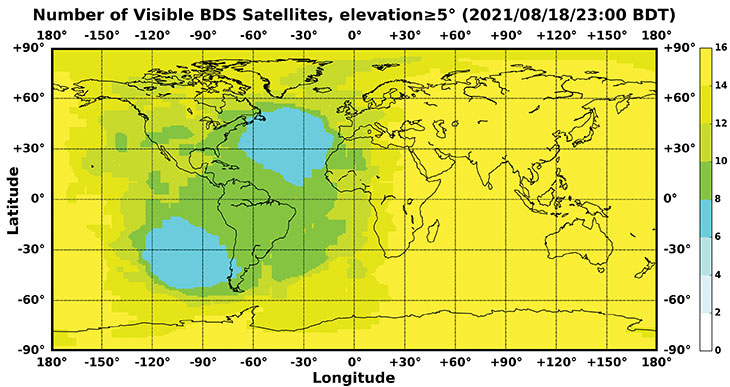
    PNT Service. As actually measured by the International GNSS Monitoring and Assessment System (iGMAS), the global horizontal positioning accuracy is about 1.52 meters, the vertical positioning accuracy is about 2.64 meters (B1C signal single frequency, 95% confidence), the velocity measurement accuracy is better than 0.1 m/s, and timing accuracy is better than 20 nanoseconds. The performance is better in the Asia-Pacific region.

    FIGURE 1 shows the number of visible BDS satellites worldwide at BDT 00:00 on Nov. 18, 2021. Among them, the number of visible BDS satellites exceeds 20 in some areas of the Asia-Pacific region.

    figure 1. Number of visible BDS satellites, elevation ≥5° (2021/11/18/00:00 BDT). (CREDIT: www.csno-tarc.cn)
    Figure 1. Number of visible BDS satellites, elevation ≥5° (2021/11/18/00:00 BDT). (CREDIT: www.csno-tarc.cn)

    Global Short Message Communication Service. Trial service is provided through 14 medium-Earth-orbit (MEO) satellites for authorized users and low-orbit satellites, with a maximum single-message length of 560 bits, equivalent to about 40 Chinese characters.

    Search-and-Rescue Service. A COSPAS/SARSAT-compliant MEOSAR service is provided by six payloads deployed on six MEO satellites. A B2b signal-based Return Link Service (RLS) is provided through 24 MEO and three IGSO satellites, which have completed testing and verification and are in the process of coordination within the framework of COSPAS-SARSAT.

    Satellite-Based Augmentation Service. China’s Civil Aviation Administration is organizing satellite-ground integrated test and evaluation, and the positioning accuracy, alarm time, integrity risk and other indicators meet the requirements.

    Ground-Based Augmentation Service. Real-time centimeter-level and post-processing millimeter-level services are provided for industrial and public users, based on the regional network reference stations built in China.

    Precise Point Positioning Service. PPP signals are broadcast by three GEO satellites. The measured horizontal positioning accuracy is 0.24 m, the vertical positioning accuracy is 0.41 m (95% confidence), and the convergence time is less than 20 minutes.

    Regional Short Message Communication Service. The short-message communication function has been tested and verified for integration into public mobile phones; large-scale application is planned.

    Development of the Applications Industry

    Large-scale applications of BDS have entered a critical stage of liberalization, industrialization and internationalization. The overall output value of China’s satellite navigation and location-based service industry continued to grow in 2020, up to 403.3 billion yuan (US$63.2 billion), which is about 16.9% more than its value in 2019. In terms of BDS-3-enabled basic products, an industrial chain is gradually maturing, comprised of BDS/GNSS basic chips, modules, boards, antennas and other components.

    The certification and testing system of basic BDS products has been established and implemented. BDS is already supported by most mainstream chips. BDS is increasingly being integrated into the daily life of the general public. It is becoming the standard configuration for positioning functions of smartphones and other mass-market products.

    Smartphone manufacturers such as Xiaomi, Huawei, Apple and Samsung already support BDS. In the first three quarters of 2021, among all types of smartphones applying for online access in China, 72.3% supported positioning function based on BDS, accounting for 93.5% of the total sales volume. The BDS ground-based augmentation function has been introduced into smartphones to achieve high-precision positioning at the 1-meter level; lane-level navigation is being piloted in several cities in China.

    In terms of industrial applications, BDS has fully served multiple industries including transportation, public security, disaster relief, agriculture, forestry, animal husbandry and fishing. It has accelerated the integration into electricity, finance, communications and other infrastructure. In particular, in the fight against COVID-19 through scientific and technological approaches, BDS-based precise positioning has facilitated the efficient supply and circulation of anti-epidemic materials.

    BDS-based solutions for land rights determination, precision agriculture and smart ports have served the economic and social development of countries in Asia, Eastern Europe and Africa, and BDS-based products have been applied in more than half of the world’s countries and regions.

    International Cooperation

    BDS has always adhered to the development concepts of openness, cooperation and resource sharing; actively carried out practical international exchanges and cooperation; and contributed to China’s peaceful use of outer space.

    Bilaterally, the Eighth Meeting of the China-Russia Project Committee on Major Strategic Cooperation in Satellite Navigation was held in October 2021. Both sides jointly formulated and signed the Roadmap for Cooperation in the Field of Satellite Navigation from 2021 to 2025, providing planning and guidance for China-Russia satellite navigation cooperation in the next five years. Also, China’s Satellite Navigation Office signed a memorandum of understanding on satellite navigation cooperation with the National Committee on Space Activities of the Republic of Argentina and the South African National Space Agency, and formally established a regular cooperation mechanism.

    BDS is gradually being integrated into international standards, and is steadily promoting ratification by international standards bodies, including in the civil aviation, maritime, SAR, mobile communications and electrotechnical fields. Several international standards supporting BDS have been released. The Chinese government has drafted a letter of commitment to the International Civil Aviation Organization (ICAO), stating that BDS will provide basic services free of charge to civil aviation users around the world. The International Association of Marine Aids to Navigation and Lighthouse Authorities (IALA) has officially issued a standard that ratifies BDSBAS, so that global marine users can carry out applications based on it. The Third Generation Partnership Project has started the standardization of BDS-3’s B2a and B3I signals. In the detection standard for Indicating Radio Beacon Locator of the Global Maritime Distress and Safety System issued by the International Electrotechnical Commission, BDS receivers and BDS-based SAR services will be supported.

    The Chinese government is steadily advancing the rule of law, attaching great importance to and comprehensively promoting the rule of law for satellite navigation. A legal system on BDS has been formed, consisting of national policies, industrial and local policies and regulations, and more. The legislative process of the Satellite Navigation Regulations of the People’s Republic of China has been actively promoted to ensure the healthy, rapid and sustainable development of the satellite industry. In May 2021, China issued a development report on the rule of law of BDS.

    Follow-Up Plan

    In the future, on the one hand BDS will ensure stable operation, while on the other hand it will focus on the development of backup satellites, and complete the production, state optimization and ground testing of backup satellites. Backup BDS-3 satellites with better performance will be launched as needed to further improve the reliability of the constellation. By adhering to the development concept of “BDS is developed by China, dedicated to the world and aiming to be first class,” carrying forward the BDS spirit of the new era of “independent innovation, open integration, unity of all, pursuit of excellence,” BDS will serve the world and benefit all humankind.

    • Number of BDS-3 satellites in orbit: 30
    • Signals broadcast: B1I, B3I, B1C, B2a, and B2b

    Yang Changfeng is chief architect of the BeiDou Navigation Satellite System and a Chinese Academy of Engineering academician.

  • 1 more BeiDou satellite starts operation in constellation

    1 more BeiDou satellite starts operation in constellation

    Photo: Xinhua News Agency
    Photo: Xinhua News Agency

    The 45th satellite of the BeiDou Navigation Satellite System — launched on May 17, 2019 — has started operation in the network after completing in-orbit tests, reports China’s Xinhua news service.

    The satellite will provide services in place of the third BeiDou satellite, a geostationary earth orbit satellite of the BDS-2 system, according to China’s Satellite Navigation System Management Office.

    The replacement will help reinforce the BDS-2 system and support a smooth transition from the BDS-2 system to the BDS-3 system. The third satellite — launched Jan. 17, 2010 — will stay in orbit after the replacement.

  • Four BeiDou satellites join system, last two launches set

    Four BeiDou satellites join system, last two launches set

    More launches planned for March and May

    Four new satellites of the BeiDou Navigation Satellite System (BDS) have passed tests in orbit and joined the system to provide positioning, navigation and timing services, according to China news service Xinhuanet.

    The four satellites include the 47th, 48th, 52nd and 53rd satellites of the BDS family, according to China’s Satellite Navigation System Management Office.

    All of them, operating in medium Earth orbit, were developed by the China Academy of Space Technology under the China Aerospace Science and Technology Corporation.

    The 47th and 48th BDS satellites were launched on Sept. 23, 2019, and the 52nd and 53rd BDS satellites were launched on Dec. 16, 2019.

    Two to the Last. The China Satellite Navigation System Management Office said the last two Beidou-3 satellite launches will take place in March and May, and complete the Beidou system.

    China began to construct its navigation system, named after the Chinese term for the Big Dipper constellation, in the 1990s and started serving the Asia-Pacific Region in 2012.

    Over the past two years, China has successfully sent 28 BDS-3 satellites and two BDS-2 satellites into orbit.

    China plans to launch more BDS satellites in March and May to complete the global network.

    Photo: XinhuaNet
    Photo: XinhuaNet
  • Directions 2019: BeiDou accelerates global deployment

    Directions 2019: BeiDou accelerates global deployment

    Yang Changfeng, chief architect of China's BeiDou navigation satellite system. (Photo: BeiDou)
    Yang Changfeng, chief architect of China’s BeiDou navigation satellite system. (Photo: BeiDou)

    By Yang Changfeng
    Chief Architect, BeiDou Navigation Satellite System

    As one of the core GNSS, the BeiDou Navigation Satellite System (BDS) has been developed following a three-step development strategy. By around 2020, BDS will form a space constellation consisting of 30 satellites, including three satellites in geostationary earth orbit (GEO), three satellites in inclined geosynchronous satellite orbits (IGSO), and 24 satellites in medium earth orbits (MEO). It will provide free open and high-quality services, including navigation, positioning, timing, short message communication, search and rescue, and so on to the users worldwide.

    In 2018, BDS has made fruitful results in the aspects of system construction, integrated applications, and international development.

    System Construction

    The stable operation of the BDS-2 constellation and construction of the BDS-3 constellation have resulted in solid achievements, while the deployment of the ground-based and satellite-based augmentation systems has made remarkable progress, and the International Multi-GNSS Monitoring and Assessment System (iGMAS) has been in stable and continuous operation

    BDS-2 Improved Regional Services. Through upgrades and enhancements of the ground system, the service performance, stability and availability of the BDS-2 constellation has been improved. The analysis results shows that the nominal positioning accuracy of BDS-2 in its coverage area is better than 5 meters. To achieve user-oriented services, the Interface Control Document (ICD) for the open service signal B3I has been released.

    The basic system of iGMAS has been completed, consisting of 24 ground stations and various centers, to provide raw data, basic products, and monitoring and assessment information services to users through the Internet and smartphones.

    BDS-2 Positioning Performance. (Chart: BeiDou)
    BDS-2 Positioning Performance. (Chart: BeiDou)

    BDS-3 Constellation Deployment. By late 2018, 16 MEO BDS-3 satellites and 1 BDS-3 GEO satellite were in orbit. China successfully launched the 18th and 19th BDS satellites on Nov. 19. Deployment of the basic BDS-3 constellation has been accomplished.

    The BDS-3 satellites are equipped with the higher-performance rubidium atomic clocks with stability of E-14 as well as hydrogen atomic clocks with stability of E-15. The signal-in-space (SIS) accuracy will be superior to 0.5m, the position accuracy will reach 2.5 to 5 meters, and the overall performance will be dramatically improved. The in-orbit test results have indicated that the BDS-3 satellites are in sound condition, and the performances can satisfy nominal parameters. For the convenience of public applications, the ICDs of the new signals, B1C and B2a, have been released.

    BDS-3 will inherit the short message communication service from its predecessors, and will further enhance the basic PNT service capabilities. Satellite-Based Augmentation System (SBAS) and Search and Rescue (SAR) services will be developed according to the international standards.

    Ground-Based Augmentation. The BDS/GNSS Ground-based Augmentation System has completed the deployment of 155 framework reference stations and nearly 2,400 regional stations in China. The system has carried out high-precision applications in many fields, such as surveying, national resources, disaster mitigation, transportation, meteorology, and offered basic services for users, including real-time navigation services at meter-level and decimeter-level, as well as precise positioning services at centimeter-level and millimeter-level.

    China's National Reference Station Network. (Image: BeiDou)
    China’s National Reference Station Network. (Image: BeiDou)

    First SBAS GEO Satellite. The BeiDou Satellite-based Augmentation System (BDSBAS) is being developed in accordance with the International Civil Aviation Organization (ICAO) standards, to offer navigation services with superior accuracy and integrity.

    In November 2018, the first GEO satellite with SBAS and SAR payloads has been successfully launched. The short message communication service offered by the satellite will be fully compatible with that of BDS-2, while the service volume will be increased by 10 times and the user’s transmit power will be reduced to 1/10. As the result, the user terminals will possess smaller size, higher integration and enhanced capacity.

    Integrated Applications

    As the system construction accelerates, BDS is also making great efforts to strengthen the development of fundamental products and applications in various fields. The integrated applications adopt the “BDS+” model, to stimulate the growth of satellite navigation industry.

    Fundamental Products. At present, the fundamental BDS products have been used in mass market applications, of which the performance has reached or close-to the world-class level. By the 3rd quarter of 2018, the sales volume of BDS navigation chips and modules exceeded 70 million pieces, and the amount of the BDS-enabled terminals surpassed 500 million pieces or sets. In 2017, the domestic output value is more than RMB 250 billion (US $ 36 billion), in which the BDS contribution exceeds 80%.

    Industrial Applications. BDS continues to facilitate the integrated applications and development of related industries; to bring GNSS high-precision services in combination with cloud computing, internet of things, big data and other technologies; to push forward the fusion among BDS-related industries and high-end manufacturing, software, integrated data industries, and to enable BDS-based applications to solve the problems associated with national economy and people’s livelihood. BDS has been integrated into various national significant infrastructures, by providing time and space references for transportation, meteorology, agriculture, electricity, communications, finance and other industries.

    Meanwhile, “BDS+” and “Time and Space+” applications targeted towards the mass market are enjoying a broader future prospect. The BDS-based navigation services have been adopted by various enterprises in the fields of smart mobile terminal manufacture, location-based services (LBS), e-commerce, and so on. The BDS-based LBS have been widely use in the public consumption sector and people’s livelihood, which have been changing people’s life by providing more conveniences for the public.

    BDS International Development. BDS continuously pushes forward international development, carries out practical cooperation and exchanges, and promotes the development of GNSS community, to better serve the world and benefit mankind.

    BDS actively participates in related activities under the framework of the United Nations, other international organizations and multilateral platforms. In June, 2018, BDS took part in the UNISPACE+50 Exhibition and donated a BDS-3 satellite model to the United Nations Office for Outer Space Affairs.

    In November 2018, the 13th Meeting of the International Committee on Global Navigation Satellite Systems (ICG-13) was successfully held in Xi’an, China. His Excellency Xi Jinping, President of the People’s Republic of China, sent a congratulatory letter to the ICG-13, and expressed that “China is willing to work with all countries, to share the construction and development achievements of BDS, and to jointly promote the development of global satellite navigation.” More than 400 representatives from 16 nations and 16 regional and international organizations attended the meeting and made in-depth exchanges on over 20 topics related to satellite navigation.

    BDS has always been exploring joint applications with other compatible navigation satellite systems, and carrying out bilateral coordination and cooperation.

    In November 2017, the Joint Statement of BDS and GPS Signal Compatibility and Interoperability was signed, which stated that the two systems were radio-frequency compatible within the framework of ITU, and BDS B1C civil signal and GPS L1C civil signal had achieved interoperability.

    In November 2018, the Agreement between the Government of the People’s Republic of China and the Russian Federation on Cooperation in the Field of the Use of BDS and GLONASS for Peaceful Purposes was signed, which would facilitate the complementarity and integrated development, promote practical cooperation projects, and contribute to more efficient and reliable services for global users.

    At present, BDS has covered more than 50 countries and over the population of 3 billion people. The BDS-related products have accessed to the markets of over 80 countries and regions. In April, 2018, the first overseas BDS/GNSS Center was opened by China Satellite Navigation Office and the Arab Information and Communication Technology Organization, to enrich the public awareness, experience and applications of BDS in Arab nations.

    The international GNSS Monitoring and Assessment System (iGMAS) has contributed to the implementation of the Asia-Pacific Space Cooperation Organization project, iGMA-International GNSS Service Pilot experimental project, and Sino-Russian monitoring and assessment cooperation, and has provided GNSS users with authentic third-party assessment results.

    Future Plans

    BDS will continuously promote joint applications of multiple navigation satellite systems, and provide global users with diversified choices for better application experiences. BDS welcomes users and equipment providers worldwide to participate in the Global Users’ Experience and Evaluation Campaign (relevant information can be referred to the BDS official website), and will release the experience and evaluation results when appropriate.

    By the end of 2018, BDS-3 will possess the initial operational capability and implement all-round validation on its global service performance. Between 2019 and 2020, BDS will keep improving its continuous stability and service accuracy, maintain the BDS-2 service performance stable and enhanced, and continue the BDS-3 deployment by launching another 6 MEO satellites, 3 IGSO satellites, and 2 GEO satellites, to eventually possess global service capabilities by 2020.

  • US, China cooperate on interoperability for better civilian service

    The United States and China have negotiated compatible signal characteristics that will both protect and enhance service for users of the U.S. GPS and Chinese BeiDou constellations.

    The achievement resulted from several years of discussions between U.S. and Chinese GNSS experts. The consensus to make the systems compatible and interoperable at the user level will mean better service for users of both systems worldwide.

    The U.S.Department of State’s Bureau of Oceans and International Environmental and Scientific Affairs Office of Space and Advanced Technology represents the United States in the ongoing U.S.-China GNSS Cooperation Dialogue, which began in May 2014 and covers various topics.

    Compatibility of the Chinese BeiDou Navigation Satellite System (BDS) with GPS has been a core focus of the discussions. The U.S.-China Joint Statement on signal compatibility and interoperability is below and on the gps.gov website.


    Joint Statement on Civil Signal Compatibility and Interoperability Between the Global Positioning System (GPS) and the BeiDou Navigation Satellite System (BDS)

    December 4, 2017

    In May 2014, China Satellite Navigation Office and the Office of Space and Advanced Technology, U.S. Department of State, jointly established the U.S.-China Civil GNSS Cooperation Dialogue, a bilateral government-to-government mechanism to promote cooperation between the U.S. Global Positioning System (GPS) and the Chinese BeiDou Navigation Satellite System (BDS).

    Over the past three years, representatives and experts from both sides have studied and discussed various topics related to civil service provision and user applications, among which BDS compatibility and civil interoperability with GPS is one of the core focus areas.

    Both sides have carried out extensive in-depth analysis, and have engaged in persistent discussion and coordination.

    As a result, the two sides have reached the following consensus conclusions regarding compatibility and interoperability between GPS and BDS:

    1. Consistent with the bilateral frequency compatibility coordination completed in 2010, GPS and BDS are radio frequency compatible under the framework of the International Telecommunication Union (ITU); and
    2. The GPS L1C and BDS B1C civil signals, using two different types of multiplexed binary offset carrier (MBOC) waveforms are interoperable, which means users can receive better service by jointly using these civil signals without a significant increase in receiver cost or complexity.

    Both sides agree to continue their consultations and cooperation related to compatibility and interoperability in order to provide better services for global users.

    (signed by)

    Ran Chengqi, China Satellite Navigation Office

    David A. Turner, Office of Space and Advanced Technology, U.S. Department of State


    For more information, contact [email protected]. Follow the Bureau of Oceans and International Environmental and Scientific Affairs on Twitter at @StateDeptOES.

  • BeiDou’s Newest Trio of Satellites Pass Tests

    The three BeiDou satellites launched this year are sending twice as many signals as their predecessors, reports the Economic Times, following tests of the orbits and key technology.

    The 18th and 19th satellites for the Beidou Navigation Satellite System (BDS) were launched on July 26, and the 20th satellite was launched on Sept. 30.

    The 18th and 19th satellites are the first BeiDou satellites that can communicate with each other, helping with distance measurements, said Wang Ping, chief engineer on the project.

    After the tests, they are working as intended and in all weather, according to a newsletter from the China Academy of Space Technology.

  • China Launches First of Next-Gen BeiDou Satellites

    China Launches First of Next-Gen BeiDou Satellites

    Beidou-3M1-3 Photo: BeiDou
    Photo: BeiDou

    UPDATE (3/31/15): The BeiDou satellite is being targeted for an IGSO orbit, not a MEO orbit as previously speculated. The two images below make this clear.

    BeiDou-orbit-2
    Photo: BeiDou
    BeiDou-Orbit-1
    Photo: BeiDou

    Below is a CCTV (China Central Television) news story covering the launch.


    UPDATE (3/30/15): China’s launch of BeiDou-3 M1 is now being reported in that country’s media. The launch occurred at 21:52 on March 30. BeiDou-3 M1 is the first of 17 next-generation Beidou navigation satellites. It will have a new navigation signal system with inter-satellite links and other tests to verify the satellite navigation system.


    NASA Spaceflight is reporting that China is believed to have launched the first of a new generation of navigation satellites for its BeiDou constellation. However, the launch has received a blackout in China, with lift-off only confirmed by local observers.

    The possible launch of BeiDou-3 M1 took place at 13:52 UTC today from the Xichang Satellite Launch Center on a Chinese Long March 3C rocket, with the debut use of the new Expedition-1 (Yuanzheng-1) upper stage.

    If confirmed, this is the fifth successful launch of a navigation satellite in less than a week, following GPS IIF-9 on WednesdayGalileo 7 and 8 on Friday and India’s IRNSS-1D on Saturday.

    Today’s launch involved a new series of satellites that is expected to mark an advancement in the completion of its Beidou Phase III program several years ahead of schedule, by as soon as 2017 rather than 2020, NASA Spaceflight reports.

    The Beidou Phase III system includes the migration of its civil Beidou 1 or B1 signal from 1561.098 MHz to a frequency centered at 1575.42 MHz – the same as the GPS L1 and Galileo E1 civil signals — and its transformation from a quadrature phase shift keying (QPSK) modulation to a multiplexed binary offset carrier (MBOC) modulation similar to the future GPS L1C and Galileo’s E1. The current (Phase II) B1 open service signal uses QPSK modulation with 4.092 megahertz bandwidth centered at 1561.098 MHz.

  • Three More BeiDou-2/Compass Satellites to Be Launched This Year

    News courtesy of CANSPACE Listserv.


    China will launch three more satellites for its Beidou GNSS, reports CRIenglish.com and People’s Daily Online. Two satellites will be launched in June, and another in October.

    The system is expected to be adopted by some of China’s neighboring countries in the next year or two such as Pakistan and Mongolia, said Ran Chengqi, director of the China Satellite Navigation Office. He spoke at the third China Satellite Navigation Conference in the southern city of Guangzhou.