Tag: Belt and Road Initiative

  • BeiDou a threat to the West, but perhaps not individuals

    BeiDou a threat to the West, but perhaps not individuals

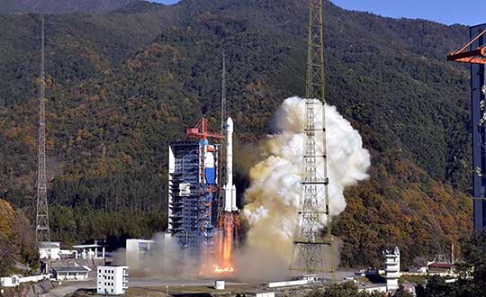
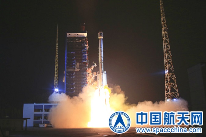
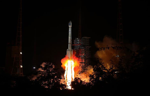
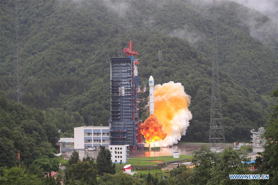
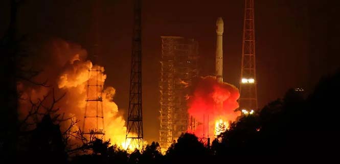
    Recent completion of China’s BeiDou satellite navigation system has rekindled privacy and security concerns among some in the West. China has incorporated a two-way messaging capability into BeiDou that many fear will be used to track individuals and install malware on user devices.

    Most satellite navigation experts view such concerns as far overblown.

    At the same time, though little discussed, BeiDou’s completion does signal a new phase for China’s status as a world power and its ability to challenge the West on many fronts.

    Two-way communications

    It is possible for specially equipped receivers to communicate back to the BeiDou constellation. But this is not true for the vast majority of receivers (including those in cell phones). Industry experts say that all mass market chips for every GNSS system, including BeiDou, are “receive only.” Only specially equipped devices will be able to take advantage of its two-way communications capability, and it should be quite apparent to users when it is in operation.

    Users, they say, should be much more concerned about location privacy and security issues that have been around for decades. Mobile phones have long reported user locations through the cellular network based upon information derived from GPS, WiFi ranging and other position calculations. The ability to hack and compromise a cell phone or other receiver will not be affected by the addition of BeiDou as a receive-only location source.

    It is also important to note that using specialized equipment for two-way communication with a Global Satellite Navigation System (GNSS) is not something new to BeiDou. While the Chinese system may have improved upon the capability, users with the right equipment can send messages using the Search and Rescue functions to the United States’ GPS, Europe’s Galileo, and Russia’s GLONASS.

    China has risen

    Completion of BeiDou, unquestionably a significant technical achievement, does signal a significant step up for Chin’s status as a world power and influencer. It is a declaration of technical independence from the West with wide ranging geo-political impacts.

    These were anticipated and summarized in a 2017 report by the US-China Economic and Security Review Commission. It listed China’s goals for BeiDou as:

    “(1) address national security requirements by ending military reliance on GPS;
    (2) build a commercial downstream satellite navigation industry to take advantage of the quickly expanding market; and
    (3) achieve domestic and international prestige by fielding one of only four such global navigation satellite systems (GNSS) yet developed”

    Military Power and National Security. The Chinese military has long sought its own GNSS. This was amplified during a crisis in 1996 when it fired three missiles toward Taiwan as a warning. One struck the sea about 11 miles from a Taiwanese military base, but the other two disappeared. China claims that the United States interfered with GPS signals and was to blame. The Chinese military was both horrified and humiliated.

    Having a sovereign GNSS eliminates the problem of relying on the U.S., Russia, or Europe for satellite navigation. That it is the world’s newest system also certainly has its advantages. China has undoubtedly incorporated state of the art anti-jamming and anti-spoofing capabilities into the version of BeiDou used by the military. After decades of observing others interfering with GNSS signals, and doing a fair bit of it on their own, it would be hard to imagine Chinese engineers not including the latest resilience features.

    An operational BeiDou also means that China’s military is much freer to interfere with GPS and other GNSS in pursuit of tactical and strategic advantage without endangering its own services and infrastructure. It is likely that the levels of jamming and spoofing seen near the Spratley Islands and mainland ports will increase. Even if they do not, the increased possibility of Chinese interference will add yet another degree of complexity and uncertainty for western military forces.

    Economic Power. The technological and commercial benefits of BeiDou for China are unquestionably substantial as well. Direct benefit from the manufacture and sale of equipment, plus spinoff industries and technologies, add to an already impressive national technology and economic portfolio. This is especially true since positioning, navigation, and timing (PNT) services are a “silent utility” underpinning so many network and other technological systems. The huge domestic market and robust overseas sales continue to grow (by 20% per annum according to Chinese reports) providing huge returns.

    Prestige and Soft Power. “BeiDou launch marks China’s rise to ‘major space power’” read a recent headline in the Asia Times. This is perhaps understated as, with BeiDou complete, there is, technologically, little the West has achieved that China has not equaled. This has greatly enhanced China’s global standing and made it, in the eyes of many in the developing world, an ally and provider as good or better than the U.S. or Europe.

    And China is eager to share its new PNT utility with others to further, not just its economy, but more importantly its long-term strategic interests.

    Forsaking GPS

    Regionally, China has been encouraging neighbors to adopt BeiDou for national PNT and forsake GPS. As one example it provided Thailand with nearly $300M in foreign aid targeted to promoting BeiDou use by Thai government organizations.

    Writing in July in The Diplomat, Dr. Namrata Goswami observed

    “… BeiDou is located within China’s ‘Information Silk Road,’ a subset of its land and maritime silk routes under the Belt and Road Initiative (BRI). China is now able to extend influence in a multidomain environment (land, sea and space) via its BeiDou space system, which provides navigation to aircraft, submarines, missiles, as well as commercial services dependent on such navigation. China’s Ministry of Industry and Information Technology sells the Information Silk Road, to include BeiDou and 5G networks, to global audiences as a completely self-sufficient technology infrastructure that anticipates life in the 21st century.”

    This extends China’s influence through BeiDou even farther and has led a number of nations to seek closer ties with China through BeiDou.

    Mohamed Ben Amor, secretary general of the Tunisia-based Arab Information and Communication Technology Organization, an organization of the Arab League, told GPSDaily.com, “Cooperation on the BDS is of special significance for the Belt and Road construction…The next step of the China-Arab cooperation is to achieve further connectivity and both sides can apply the BDS to promote regional technological and economic development.”

    Iran’s view

    Iran has had a Memorandum of Understanding with China about BeiDou since 2015. It provides for BeiDou ground stations in Iran, access for Iran to high-precision services, and establishment of an Iranian center for space data collection.

    And In a tweet last week Iran’s Ambassador to China cited BeiDou’s completion as the “…end to the monopoly of the U.S.’s GPS.” He said, “There is great potential for aerospace cooperation with China,” and went on to suggest that Iranian aerospace students could work as a bridge between the two countries.

    Similar comments have been published from entities in India, Indonesia, Malaysia, and throughout Southeast Asia.

    China is indeed to be congratulated for a significant achievement with the completion of BeiDou. Even more noteworthy, though, is how it has integrated BeiDou seamlessly into its national plans for technology, economic, military and diplomatic efforts — a comprehensive, coordinated program to boost its standing in the world, especially relative to the United States and Europe.


    Dana Goward is president of the Resilient Navigation and Timing Foundation. He is the proprietor at Maritime Governance LLC. In August 2013, he retired from the federal Senior Executive Service, having served as the maritime navigation authority for the United States. As director of Marine Transportation Systems for the U.S. Coast Guard, he led 12 different navigation-related business lines budgeted at more than $1.3 billion per year. He has represented the U.S. at IMO, IALA, the UN anti-piracy working group and other international forums. A licensed helicopter and fixed-wing pilot, he has also served as a navigator at sea and is a retired Coast Guard Captain.

    Photo: XinhuaNet
    Photo: XinhuaNet
  • China completes BeiDou-3 constellation with another launch

    China completes BeiDou-3 constellation with another launch

    The launch and deployment of the 42nd and 43rd BeiDou satellites complete the basic BDS-3 constellation.

    China has successfully sent twin BeiDou satellites into space by a Long March-3B launch vehicle (with an Expedition-1 upper stage) from the Xichang Satellite Launch Center, at 02:07 am, on Nov. 19. The twins, both medium Earth orbit (MEO) satellites, are the 42nd and 43rd of the BeiDou Navigation Satellite System (BDS), and the 18th and 19th of the BeiDou-3 family.

    Photo: CASC screenshot
    Photo: CASC screenshot

    The satellites successfully entered their designated orbit after more than three hours of the launch, and will join the constellation with the 17 previously launched BDS-3 satellites, after completing in-orbit test.

    The successful launch marks that the basic BDS-3 constellation has successfully been deployed. Networking of the constellation and assessment on its performances will be carried out in the near future.

    Plans are for the BeiDou-3 constellation to be put into operation before the end of this year, to provide basic navigation services to countries and regions participating the Belt and Road initiative, which will be a key milestone for BDS in expanding service areas from regional to global.

    The BDS-3 project was officially launched in 2009 with state approval, and a demonstration system was completed in 2016. Having verified the new-generation navigation signal system architecture, the BDS-3 development followed up with a three-step pattern, to construct its pilot, basic and nominal constellations respectively, according to the China Satellite Navigation Office,

    On Nov. 5, 2017, the first pair of satellites for the BDS-3 constellation was launched from Xichang Satellite Launch Center. By the end of March 2018, a pilot constellation consisting of 8 BeiDou satellites was built.

    At present, the project is progressing smoothly, and the basic constellation consisting of 19 BDS satellites will soon be operational. In the future, BDS with global coverage will be completed by the end of 2020.

    Since November 2017, the past year has witnessed a highly intensive launch of the China’s BDS constellation. With the joint efforts of the whole team participating in this project, 11 launches have been completed within one year, while 19 BDS-3 satellites and 1 BDS-2 satellite have been successfully sent into space.

    In particular, since July 2018, seven launches have been conducted to deliver 12 BDS satellites into orbit, with the shortest interval between launches being only 17 days. Both highly intensive and high success rate of launches set a new record in the history of the BDS constellation development.

    The satellites and the launch vehicle (with an Expedition-upper stage) for this mission were developed by the China Academy of Space Technology and the China Academy of Launch Vehicle Technology respectively, both are affiliated to the China Aerospace Science and Technology Co., Ltd. The launch was the 291st mission of the Long March rocket series.

    Currently, the BeiDou system comprises two families of operational navigation satellites; BeiDou-2, also known as Compass, presently consists of 15 operational satellites in Geostationary Orbit (GEO), Geosynchronous Orbit (GSO), Inclined Geosynchronous Orbit (IGSO) and Medium Earth Orbit (MEO).

    The new BeiDou-3 series, on the other hand, only has operational MEO satellites at the moment, although China is testing the first BeiDou-3 GEO satellite (BeiDou-3G1) and plans to launch at least four GEO and GSO satellites in 2019.

  • China launches yet more BeiDou navigation satellites

    China launches yet more BeiDou navigation satellites

    China sends twin BeiDou-3 navigation satellites into space on a single carrier rocket from Xichang Satellite Launch Center in Xichang, southwest China's Sichuan Province, Sept. 19, 2018. (Photo: Xinhua/Liang Keyan)
    China sends twin BeiDou-3 navigation satellites into space on a single carrier rocket from Xichang Satellite Launch Center in Xichang, southwest China’s Sichuan Province, Sept. 19, 2018. (Photo: Xinhua/Liang Keyan)

    On Sept. 19, China successfully sent twin BeiDou-3 navigation satellites into space on a single carrier rocket, according to state news agency Xinhuanet.

    This is the third launch of twin BeiDou-3 satellites in less than eight weeks. China launched two more pairs of BeiDou navigation satellites into space on July 29 and Aug. 25.

    The Long March-3B carrier rocket lifted off from the Xichang Satellite Launch Center at 10:07 p.m. It was the 285th mission of the Long March rocket series.

    The twin satellites are the 37th and 38th editions of the BeiDou navigation system. After a series of tests and evaluations, they will work together with 12 BeiDou-3 satellites already in orbit.

    The twin satellites will provide danger alerts and navigation services for global users. A basic system with 18 orbiting BeiDou-3 satellites will be in place by the end of the year, which will serve countries participating in the Belt and Road Initiative.

    The satellites and the rocket for Wednesday’s launch were developed by the China Academy of Space Technology and the China Academy of Launch Vehicle Technology, respectively.

  • China launches new twin BeiDou-3 navigation satellites

    China launches new twin BeiDou-3 navigation satellites

    China has launched another pair of BeiDou-3 navigation satellites, reports Xinhua News Agency, China’s state-run press agency.

    A Long March-3B carrier rocket lifted off from Xichang Satellite Launch Center in southwest China’s Sichuan Province on July 29.

    The twin satellites are the 33rd and 34th of the BeiDou navigation system. They entered orbit more than three hours after the launch. After a series of tests, they will work together with eight BeiDou-3 satellites already in orbit, said the launch service provider.

    A basic system with 18 BeiDou-3 satellites orbiting will be in place by the end of 2018, and will serve countries participating in the China-proposed Belt and Road Initiative.

    Named after the Chinese term for the Big Dipper, the BeiDou system started serving China in 2000 and the Asia-Pacific region in 2012. It will the fourth global satellite navigation system after the U.S. GPS system, Russia’s GLONASS and the European Union’s Galileo.

    The satellites and the rocket for Sunday’s launch were developed by the China Academy of Space Technology and China Academy of Launch Vehicle Technology, respectively. This was the 281st mission of the Long March rocket series.

    China sends the 33rd and 34th BeiDou satellites into space on July 29. (Xinhua/Liang Keyan)
    China sends the 33rd and 34th BeiDou satellites into space on July 29. (Photo: Xinhua/Liang Keyan)
  • China to launch 11 more BeiDou-3 satellites this year

    China will launch 11 more BeiDou-3 satellites by the end of 2018, according to the Xinhua News Agency, the official state-run press agency.

    China has already launched eight BeiDou-3 satellites for its domestic BeiDou Navigation Satellite System. The satellites will provide initial services for countries and regions along the Belt and Road by the end of the year, said Wang Li, chairman of the China Satellite Navigation System Committee.

    Addressing the Ninth China Satellite Navigation Conference in Harbin, capital of northeast China’s Heilongjiang Province, Wang said the BeiDou system is moving to become a global service provider after offering stable and reliable time and space information for clients in the Asia-Pacific region.

    China launched the first two BeiDou-3 satellites into space via a single carrier rocket in November 2017, as its self-developed BeiDou system officially began to expand into a global network.

    Compared to earlier generation satellites, the BeiDou-3 is able to send signals that are more compatible with other satellite navigation systems and provide satellite-based augmentation, as well as search-and-rescue services in accordance with international standards. Its positioning accuracy has reached 2.5 to 5 meters.

  • China launches twin BeiDou-3 navigation satellites

    China launches twin BeiDou-3 navigation satellites

    China launched twin BeiDou-3 navigation satellites into space on Jan. 12 as part of efforts to enable its BeiDou system to provide navigation and positioning services to countries along the Belt and Road by the end of 2018, reports XinhuaNet.

    China’s Belt and Road Initiative aims to create the world’s largest platform for economic cooperation.

    The pair of satellites was launched at 7:18 a.m. local time aboard a Long March-3B carrier rocket from Xichang Satellite Launch Center in southwest China’s Sichuan Province. The twin satellites are coded the 26th and 27th satellites in the BeiDou Navigation Satellite System.

    This is the first launch of the BeiDou satellites in 2018, which will see intensive launches throughout the year.

    The twin satellites are coded MEO-7 and MEO-8, the 26th and 27th satellites in the BeiDou Navigation Satellite System.

  • Directions 2018: BeiDou builds, diversifies, expands

    Directions 2018: BeiDou builds, diversifies, expands

    By Changfeng Yang,
    Chief Architect of BeiDou Navigation Satellite System

    Changfeng Yang

    As one of the four major GNSS providers, the establishment of BeiDou Navigation Satellite System (BDS) has been steadily developed, following a three-step strategy. By around 2020, BDS will form a nominal space constellation consisting of 30 satellites, including three satellites in geostationary Earth orbit (GEO), three satellites in inclined geosynchronous satellite orbit (IGSO) and 24 satellites in medium Earth orbit (MEO). It will provide global users with open and high-quality services free of charge, including navigation, positioning, timing, short message communication, search and rescue and so on.

    BDS is aimed at developing into a world-class global navigation satellite system, with innovative and advanced technologies, extraordinary user experience, international development and worldwide presence, which can provide fundamental time and space reference for national defense and economic-social development, and advance the progress of high-tech and IT industries.

    BDS has initiated several innovative attempts in the fields of both international satellite navigation and domestic aerospace for the first time, and paved a unique development path of a satellite navigation system, with an eye on the state conditions and distinctive features. On Jan. 9, 2017, the BD-2 Project won the top National Scientific and Technological Progress Award. In 2017, BDS achieved fruitful results in the aspects of system construction, integrated applications and international development.

    System Construction

    Through upgrading and reconstructing the ground system, the service performance, stability and availability of the BD-2 constellation have been improved. To achieve user-oriented services, the updated Interface Control Document (ICD) for B1C and B2a open service signals (Version 2.1) was released in accordance with the constellation change.

    The international GNSS Monitoring and Assessment System (iGMAS) has been built, consisting of eight domestic monitoring stations and 16 overseas stations, to monitor and assess the service performances of BDS, GPS, GLONASS and Galileo at real-time worldwide. It has taken all factors into consideration, including constellation status, signal-in-space, navigation message, service performance and high-precision products, and so on. According to its analysis results, the nominal positioning accuracy of the BD-2 system in the coverage area has been optimized from 10 meters to 8 meters.

    Development of the BD-3 System. On Nov. 5, the first pair of the 24 BD-3 MEO satellites were successfully launched, while another pair is planned to be launched by the end of the year.

    Liftoff of the first pair of the BD-3 MEO satellites on Nov. 5, 2017. (Credit: Xinhua)

    The BD-3 satellites are equipped with B1C and B2a signals with optimized performance, which are compatible and interoperable with other GNSS signals. The interface control document of B1C and B2a signals (beta version) was released in September. The BD-3 satellites also adopt the higher-performance rubidium atomic clock with stability of E-14 and hydrogen atomic clock with stability of E-15. By utilizing new technologies, the signal-in-space (SIS) accuracy will be superior to 0.5 m; the position accuracy will be doubled or quadrupled, and reach 2.5 m to 5 m.

    The BD-3 system will retain the short message communication service of its predecessors, and further enhance basic positioning, navigation and timing (PNT) service capabilities. Satellite-based augmentation system (SBAS) and search-and-rescue (SAR) services will be added and developed according to international standards.

    After in-orbit tests and networking validation, the BD-3 satellites will be able to provide operational services, and accelerate the global coverage of BDS.

    Ground-Based Augmentation. The Phase I construction of the BDS/GNSS ground-based augmentation system has been completed, consisting of 150 framework reference stations, 1,200 reference stations of higher density network, national data processing center, six industrial data-processing centers, and manufacturing of user terminals. This system has achieved basic service capabilities, and its service performance standard (version 1.0) has been released. Through integration with the internet, a cloud platform has been established to provide high-precision space-time information services, including real-time navigation services at meter-level and decimeter-level, as well as precise positioning services at centimeter-level and millimeter-level.

    Satellite-Based Augmentation. Based on the International Civil Aviation Organization (ICAO) standards, system demonstration and validation work on the BeiDou Satellite-Based Augmentation System (BDSBAS) has been completed, and the technical status of the system has been confirmed in accordance of the next-generation SBAS Dual Frequency Multiple Constellation (DFMC) standards.

    Integrated Applications

    Currently, a great number of independent, self-controlled intellectual property rights on the fundamental BDS products have been achieved. World-class, advanced technologies have been developed. With the release of the first Chinese in-house developed meter-level fast positioning BDS chip, BDS applications have begun to embrace the era of meter-level positioning.

    In 2017, the sales volume of BDS navigation chips and modules exceeded 50 million pieces, and that of high-precision surveying boards and navigation antenna captured 30% and 90% of market shares respectively. There are more than 14,000 enterprises (including more than 50 publicly listed companies), and more than 450,000 employees in China engaging in BDS-related business.

    The annual output value of the publicly listed company in 2017 is more than RMB 50 billion (US $7.53 billion). The number of terminals produced by domestic enterprises surpasses 40 million pieces/sets. BDS has gained recognition from mainstream chip producers such as Qualcomm, Trimble, Hemisphere GNSS, Huawei, Samsung, u-blox, MTK, Broadcom, NovAtel and more, and the total number of terminals is estimated to surpass 300 million pieces or sets.

    BDS continues to:

    • promote integrated applications and development of related industries;
    • bring GNSS high-precision services in combination with cloud computing, Internet of Things, big data and other technologies;
    • push forward the integration between BDS-related industries and high-end manufacturing, software, and integrated data industries.

    BDS has been applied in the transportation, logistics, emergency rescue, marine fishing and other fields, which has greatly improved production efficiency, reduced resource consumption, and lowered pollution. For example, benefiting from the BDS applications in traffic management industry, the number of major accidents has decreased by 46.7%, and the death toll has been reduced by 48.9%. With BDS-based maritime applications, more than 10,000 lives have been saved.

    BDS/GNSS augmentation services have been applied to precision agriculture, land mapping, monitoring on deformation and displacement of large-scale public facilities, and earthquake and geological hazard measurement and survey; the latter has provided important monitoring for public safety. As a result, the production of precision agriculture has increased by 5%, and the oil consumption by agricultural machinery has decreased by 10%. The time for surveying and mapping of national land is shortened from a few days to several seconds.

    BDS has been fully put into mass applications. BDS-based navigation services have been adopted by various enterprises, such as Huawei, ZTE, Baidu, Autonavi, Alibaba, JD and others in the fields of manufacturing of mobile and smart terminals, location-based services (LBS), e-commerce, and so on. BDS-based LBS have been widely applied in the mass consumption sector and people’s livelihood, and many innovative applications have emerged, such as caring for seniors and children, shared vehicles, BDS-based logistics, and so on, which have been changing people’s lives and providing more convenience for the public.

    International Development

    At present, BDS has covered more than 50 countries and more than 3 billion people. BDS-related products have gained access to the markets of more than 70 countries and regions, more than 30 of which are along the (land-based) Belt and (maritime) Road (in line with the Belt and Road Initiative). Through joint applications with other compatible navigation satellite systems, BDS provides global users with diversified choices for better application experience.

    Meanwhile, the iGMAS has contributed to the implementation of the Asia-Pacific Space Cooperation Organization project, iGMAS-International GNSS Service Pilot experimental project, and Sino-Russian monitoring and assessment cooperation, and has provided GNSS users with authentic third-party assessment results. China continuously pushes forward BDS to be recognized by the ICAO, International Maritime Organization (IMO), mobile communication standard Partnership Project and other organizations, to serve the world in line with international conventions.

    In October, three PRN codes which are essential to the development of BDSBAS were assigned; the SBAS service provider identifier and UTC standard identifier have been assigned to BDSBAS by ICAO, which marks BDSBAS an official SBAS provider in the ICAO family, and lays the foundation for the follow-up construction of BDSBAS, as well as its provision of standard navigation services for the civil aviation sector.

    In March, a multi-system (including GPS, BDS and GLONASS) ship-borne receiver standard was approved by the IMO. BDS has also been included in the PNT guidelines of maritime applications.

    In the field of mobile communication, 26 technical standards that support the BDS positioning function have been adopted by the third- and fourth-generation mobile communication standard Partnership Projects.

    Future Plans

    BDS will keep improving its continuous stability and service accuracy. Two more BD-2 replacement satellites will be launched in 2018, ensuring its regional service performance will be remain stable and be enhanced.

    Eighteen BD-3 MEO satellites and one BD-3 GEO satellite will be launched by around the end of 2018. Upon the deployment of those 19 satellites, BD-3 will possess the initial operational capability and serve the countries along the Belt and Road. The official version of ICD for B1C and B2a open service signals, as well as other system documents, will be released, in line with the operational status of BD-3 satellites, for the convenience of public applications.

    In regard to augmentation systems, China plans to complete the construction of Phase II BDS/GNSS ground-based augmentation system in 2018, and advance the recognition of BDS-based high-precision services as public goods. In 2018, the first BDSBAS GEO satellite with the BDSBAS payload will be launched to start the deployment of the BDSBAS system.

    In terms of applications and international development, China will give full play to the role of BDS in the integration procedure between industrialization and IT applications, to promote the development of information industry, adjustment and upgrading of industrial structure.

    China will also strengthen the cooperation and communication with other navigation satellite system providers, carry out coordination under the framework of international organizations and multilateral platforms, improve the international development of BDS, provide better services for users along the Belt and Road, and expand BDS services to serve users worldwide.