Tag: built structures

  • Trimble’s Smart Water Software Adds GNSS Capabilities

    Trimble has introduced the latest version of its smart water infrastructure mapping and work management cloud software — Trimble Connect for Water version 1.9.

    The latest release of the geographic information system (GIS) centric software-as-a-service (SaaS) adds real-time, high-accuracy centimeter-level horizontal and vertical GNSS accuracy for capturing 3D asset positions. The new release includes a suite of applications that allow water, wastewater and stormwater utilities to accurately locate, inventory and visualize their infrastructure assets and increase operations and maintenance efficiency.

    The announcement was made at Trimble Dimensions.

    Trimble Connect for Water cloud software leverages Trimble’s GNSS rugged mobile devices and Esri’s GIS technologies to accurately map, locate and assess the condition of critical infrastructure assets, allowing utilities to keep their field infrastructure data up-to-date and accurate.

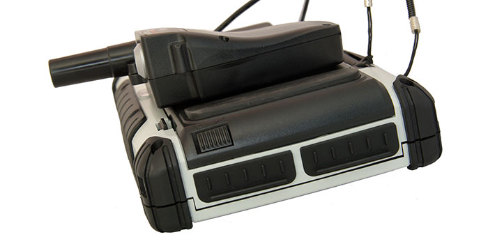
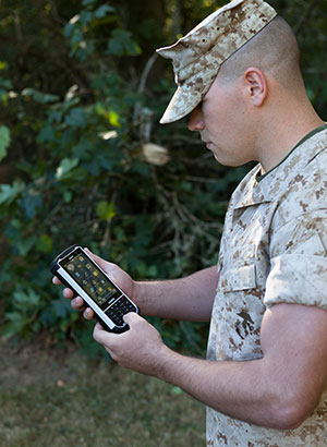
    The new release now supports Trimble’s Geo 7 Centimeter Edition rugged handheld, integrating 3D mapping into utility field workflows and enabling mobile workers to precisely locate and map the horizontal position and elevation of buried infrastructure.

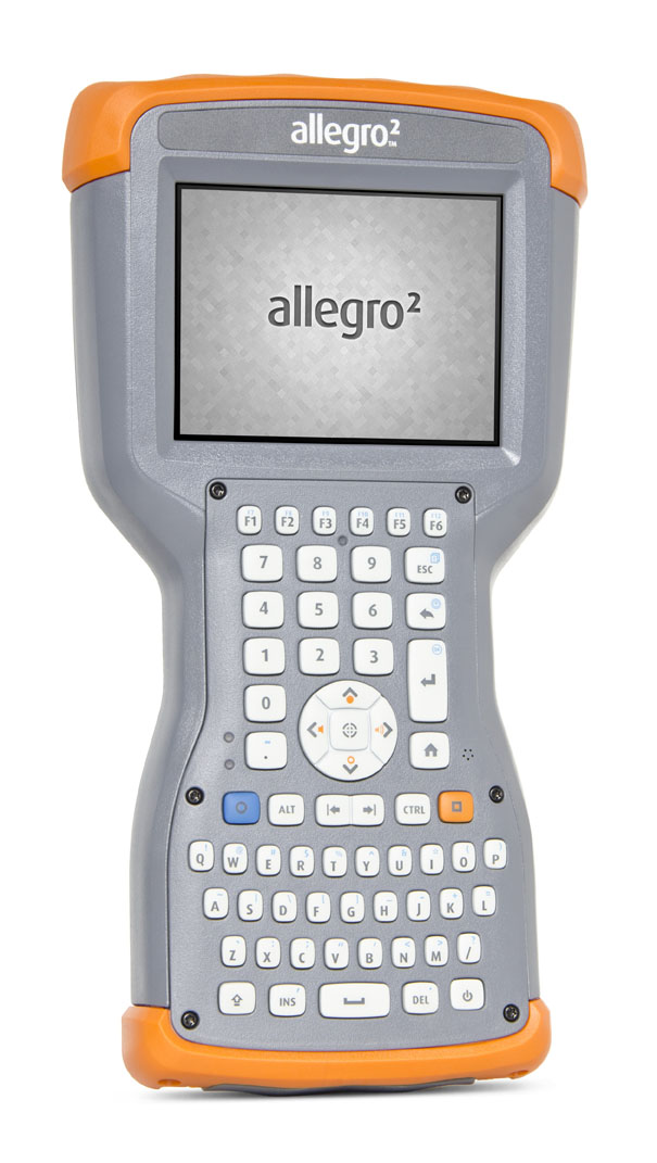
    Trimble Connect for Water version 1.9 can be configured and deployed quickly on a variety of Trimble and non-Trimble mobile devices, laptops, tablets and smartphones, including Apple iPads, iPhones, Android, Windows and Windows Mobile devices to automate fieldwork and eliminate paper-based maps.

    Trimble Connect uses the latest Esri ArcGIS for Server, Mobile and ArcGIS Online basemap services. The software is designed to automate a variety of specific water, wastewater and stormwater industry workflows through individual pre-configured “apps” offered within the product and as part of a subscription.

    The new version provides standard core apps including Map Book, Manhole Inspector, Leak Repair, Hydrant Inspector, Valve Inspector, Meter Changeout, Incident Repair, Water Mapper, Wastewater Mapper and Stormwater Mapper. In addition, an optional partner app developed for American Flow Control (AFC) hydrant and valve data collection, “AFC Mapper,” can be purchased from AFC and their distributors for use with Trimble rugged handhelds.

    Trimble Connect for Water version 1.9:

    • Offers centimeter-level real-time GNSS accuracy to improve the quality and accuracy of the utility’s GIS data to precisely locate hard to find assets.
    • Allows capturing accurate vertical elevations in real-time. Combined with horizontal precision, the solution provides high-accuracy GIS data that can be used to measure pipeline slopes, perform flow analysis and generate 3D and hydraulic models.
    • Supports the Trimble Geo 7 Centimeter edition with an integrated laser rangefinder.
    • Offers pre-configured Water, Wastewater and Stormwater mapping apps, allowing utilities to quickly start mapping network infrastructure and updating their asset data.
    • Provides the capability to export data in a variety of formats including Esri File Geodatabase, Shapefiles and MS Excel, which allows users to update the utility’s enterprise GIS or visualize and analyze the collected data using third-party systems.

    Trimble Connect for Water version 1.9 is expected to be available in December 2014 from Trimble’s Water Division and its authorized distribution partners.

  • Juniper’s New Rugged Handheld Designed for Data-Collecting Efficiency

    The Allegro 2 by Juniper Systems. Photo: Juniper Systems
    The Allegro 2 by Juniper Systems. Photo: Juniper Systems

    Juniper Systems announced its newest rugged handheld computer, the Allegro 2, at the InterGeo 2014 trade show, held September 7-9 in Berlin. The handheld is the latest in the company’s Allegro product line, “with every bit of reliability,” the company says, but now with some major advancements.

    According to Juniper Systems, the Allegro 2 was designed for data-intensive applications, with meticulous attention paid to the engineering and design of the handheld to maximize efficiency and precision, both of which are critically important to high-volume data collection.

    Compared to the Allegro 1, the Allegro 2 has a newly designed keyboard in a QWERTY and numeric layout, with large, glove-friendly buttons for rapid — even non-visual — data entry. The new handheld features a custom Sun-to-Shade display that is 20 percent larger than the previous Allegro. It offers excellent visibility in any lighting conditions, the company said.

    The Allegro 2 is powered by an Overtime Technology battery, providing a 20+ hours of runtime. Its touchscreen uses capacitive technology, providing excellent durability, as well as crystal-clear imagery and greater sensitivity to touch, Juniper Systems said. The Allegro 2 has significantly enhanced GNSS performance, extended Bluetooth range, camera and video options, and a more powerful processor than the Allegro 1.

    “The Allegro 2 is our next-generation product, and it includes all of the latest enhancements available in its sister product, the Archer 2,” said John Florio, product manager at Juniper Systems. “The Allegro 2 was built from the ground up, based on user feedback on the jobs they have to do. Whether the customer is grading lumber in a log scaling yard, running a robotic total station, or performing a close-interval pipeline survey, the Allegro 2 is the best solution for the field today.”

    The Allegro 2 is scheduled to begin shipping in November.


  • Altus, Entegra Combine to Provide Tough Tablet with RTK Positioning

    The APS-GeoPod. Photo: Altus Positioning Systems
    The APS-GeoPod. Photo: Altus Positioning Systems

    Altus Positioning Systems, a Septentrio company, has integrated its APS-GeoPod product with Entegra Technologies’ Crossfire Pro Tablet. This collaboration, targeting the oil and gas, survey, GIS and transportation industries, provides a high-performance tablet-based solution for enabling ultra-precision RTK of sub-meter or centimeter accuracy.

    Altus is showcasing the APS-GeoPod and Crossfire Pro tablet, along with the full range of Altus products, at booth A1.060 and outside Booth FG.006 at InterGeo 2014 being held this week in Berlin, Germany.

    According to Altus CEO Neil Vancans, the Altus APS-GeoPod and the Entegra Crossfire Pro Tablet provide a combination of precision, performance and features that make it ideal for energy services, land surveys and other GIS-related applications.

    APS-GeoPod is a compact GPS/GLONASS RTK and DGNSS receiver that adds high-precision RTK positioning to USB-compatible tablet PCs. “This unique product gives users the convenience of adding RTK precision to any on-board application on mobile devices geared to the field service professional,” Vancans said.

    The Entegra Crossfire Pro tablet. Photo: Altus Positioning Systems
    The Entegra Crossfire Pro tablet. Photo: Altus Positioning Systems

    APS-GeoPod features include:

    • Compact dual-frequency GNSS module
    • Low power consumption (<1 Watt)
    • USB 2.0 interface
    • Internal L1 GPS/GLONASS antenna
    • NMEA integration with GIS software

    The Crossfire Pro tablet features the multi-touch interface and communication capabilities of smartphones, the large display and ergonomics of consumer tablets, and the daylight-readable screen and durability of rugged tablets. Safety features include UL 1604 Class I/Division II certification for operation in hazardous locations. To users, Crossfire Pro delivers a customizable tablet for exacting daily activities, resulting in greater efficiencies, response times, productivity and customer service levels, the companies said.

    Crossfire Pro tablet features include:

    • ADAPTIVE PERFORMANCE — Powerful, latest-generation processors, wireless communications, connectivity, and outdoor-viewable displays
    • ADAPTIVE EXPANSION — Standard and custom expansion modules — tailored to suit your workflow
    • ADAPTIVE CONNECTIVITY — Flexible user interactivity, including multi-touch displays (finger, glove and stylus), configurable I/O ports, clamshell keyboard and smart docking stations
    • ADAPTIVE RUGGEDIZATION — Variations in ruggedness to stand up to drop, shock, moisture, dust, temperature, and more.
  • Topcon Announces Geodetic Reference Receiver and Antenna

    Topcon's NET-G5 receiver and CR-G5-C antenna. Photo: Topcon
    Topcon’s NET-G5 receiver and CR-G5-C antenna. Photo: Topcon

    Topcon Positioning Group announces the next generation of its geodetic GNSS reference receivers and antennas — the NET-G5 receiver and CR-G5-C antenna.

    The announcement was made at InterGeo 2014, being held this week in Berlin.

    Using Vanguard and Universal Tracking technologies, the NET-G5 receiver incorporates 452 channels capable of tracking the full GNSS signal spectrum, including modernized GPS, GLONASS, Galileo, Beidou, QZSS and SBAS signals. Universal Tracking has the advantage and capability to assign any visible GNSS signal to any available receiver channel.

    The NET-G5 receiver is designed to work as a complete system connectivity solution, with built-in Bluetooth and Wi-Fi, for flexible wireless communications or via standard Ethernet, serial and USB connections. Other features include: High-precision code and carrier phase measurements up to 100 Hz; Power over Ethernet (PoE) and an all new Topcon receiver web interface with advanced receiver management features.

    “Comprehensive communication support, advanced web-server capability, and extended operating times are among the new features supported on the NET-G5. Coupled with the CR-G5-C antenna, the new systems provides a powerful, interference protected network solution,” said Charles Rihner, vice president of the Topcon GeoPositioning Group.

    “Whether you are installing an all-new GNSS network infrastructure, expanding or upgrading an existing network, looking for a premium campaign receiver or stand-alone RTK base station, the high-performance NET-G5 is designed to provide the most advanced reference station solution available in the market,” Rihner said.

    The CR-G5-C is a full-wave geodetic choke-ring antenna designed to address evolving requirements for reference networks and infrastructure monitoring applications. “The CR-G5 antenna has excellent vertical phase center stability over the entire GNSS frequency band, providing superior performance in tracking low elevation satellite signals,” Rihner said. “This new model employs cavity filter technology to more aggressively combat radio frequency interference in difficult environments.”

  • Live from InterGeo

    Brandenberg Gate InterGeo Photo: GPS World
    Photo: GPS World

    GPS World staff will be reporting from InterGeo October 7-9. The massive trade show, held this year in Berlin, is considered the world’s leading conference trade fair for geodesy, geoinformation and land management. With more than 16,000 visitors from 80 countries, it is one of the key platforms for industry dialogue.

    Staff members attending include GPS World Editor and Publisher Alan Cameron, Survey/GIS Editor Eric Gakstatter, and Digital Editor Joelle Harms. All three are accepting meeting invitations for companies interested in discussing their products and services. Contact [email protected].

    VIDEO PLAYLIST

    PHOTOS

    BLOGS

    InterGeo: The Worldwide GIS Showcase (09/25/14)

    NEWS

    Juniper’s New Rugged Handheld Designed for Data-Collecting Efficiency (10/10/14)

    Sokkia Announces Next-Generation Geodetic Reference Receiver (10/08/2014)

    Altus, Entegra Combine to Provide Tough Tablet with RTK Positioning (10/08/2014)

    Spectra Precision Launches Central Cloud Service, New Software Versions (10/08/2014)

    Topcon Announces Geodetic Reference Receiver and Antenna (10/08/2014)

    New Trimble Products Focus on Geospatial Imagery (10/08/2014)

    Topcon to Add 3D Mobile Mapping System to Product Lineup (10/08/2014)

    Sokkia Introduces NET AXII Measuring Station (10/07/2014)

    Topcon Announces Latest Addition to 3D Layout Line (10/07/2014)

    Trimble Offers Expanded GNSS Portfolio for Surveyors (10/07/2014)

    Trimble Offers Pipeline Construction Software for Oil and Gas (10/07/2014)

    Carlson Software Introduces Surveyor2 Data Collector at InterGeo (10/07/14)

    Carlson Launches GIS360 for Android at InterGeo (10/07/14)

    Hemisphere GNSS Offers New Survey-Grade GNSS Antennas (10/07/14)

    Applanix Offers Single-Board GNSS-Inertial System for UAV Mapping (10/07/14)

    Icaros to Unveil Versatile Nadir/Oblique Aerial Mapping System at InterGeo (10/03/14)

    InterGeo Event Considers Land Management Challenges (10/03/14)

    Trend- and Media-Forum at InterGeo Features Innovation, China (10/03/14)

    Juniper System, Soil Instruments Partner on Geotechnical Monitoring (10/03/14)

    Oxford Technical Solutions Launches Board Set for System Integrators (10/03/14)

    Orbit GT Showcases UAS Mapping Pro at InterGeo (10/03/14)

    Icaros to Demonstrate Measuring Tool for Oblique Imagery at InterGeo  (09/24/14)

    EUROGI Conference to Be Held in Conjunction with InterGeo (08/11/14)


    Join Us for Our Post-Show Webinar

    New Product Trends in UAV, Survey, Mapping, and Geospatial Data Collection and Analysis
    InterGeo Post-Show Report

    Thursday, October 16, 10 a.m. PDT/ 1 p.m. EDT / 5 p.m. GMT

    Summary: UAVs (unmanned aerial vehicles) are taking over the surveying industry, thanks to their ever-improving sensors and the fact that they are getting lighter and can therefore remain in the air for longer. They complete surveying and inspection tasks that would otherwise be difficult to tackle, and do so with impressive cost-efficiency. UAV trends and technology will be among the focal points at the InterGeo conference in Berlin in early October.

    Our correspondents will return with a fresh report, moderated by GPS World Editor and Publisher Alan Cameron and Survey Scene Editor Eric Gakstatter.

    Register for free!

  • Juniper Systems, Soil Instruments Partner on Geotechnical Monitoring

    Soil Instruments Limited has partnered with Juniper Systems Limited to provide a geotechnical monitoring system using rugged computers and geotechnical engineering instrumentation to improve field activities in the structural and earthworks industry.

    Pairing Juniper Systems’ Archer 2 rugged field computer with Soil Instruments’ Digital Inclinometer Systems provides field engineers with a robust measuring and data collection system, the companies said.

    Soil Instruments’ Digital Bluetooth Inclinometer Systems are now exclusively using Juniper Systems’ Archer 2 rugged computer, which provides superior readings and data capture, Soil Instruments said. Soil Instruments’ inclinometers are specially designed instruments that provide high accuracy and resolution measurement for the monitoring of structural and earth deformations, movements or settlement.

    “The rugged Archer 2 handheld computer pairs beautifully with Soil Instruments’ Digital Inclinometers, providing more accurate readings and data capture than could ever be achieved previously in this industry,” said Simon Bowe, general manager of Juniper Systems Limited.

    Juniper Systems’ Archer 2 rugged computer is connected to the inclinometer system via Bluetooth wireless technology. Within the borehole an angular reading is produced by the engineer via the Read button on the Archer 2 screen, which triggers the inclinometer sensors to take the reading.

    Those readings are then instantly transmitted via the Bluetooth connection to the Archer 2, captured on-screen and saved in the Archer 2’s database, to be reviewed for accuracy or other needed data measurements. Long days of field work remain productive because of the 512MB of RAM and 8GB of flash storage in the Archer 2.

    Data can also be transmitted back to base quickly and accurately via the 3.75G modem in the Archer 2, an action which many other inclinometers cannot complete. At the end of the day, data can be downloaded or transmitted for subsequent comparison against all previous borehole runs, allowing analysis of lateral ground movements over time.

    “Soil Instruments has found the perfect field computer to match with our Digital Inclinometer Systems”, said Mike Ziolek, sales and marketing director for Soil Instruments. “The Archer 2 really gives our customers an edge by providing field readings more quickly and clearly than any other inclinometer system.”

    The physical features of the Archer 2 and the Inclinometer Systems are highly compatible. The Archer 2’s IllumiView high-visibility display is extra large, incredibly bright, and overpowers glaring sunlight. The backlit LCD easily adjusts to either portrait or landscape orientation, and is glove-friendly and extremely scratch-resistant.

    The Archer 2 has ultra-rugged construction with IP68 protection against water and dust, and is shockproof against multiple drops. The intelligent Li-ion battery can operate up to 20 hours on one charge and is hot-swappable in the field. The high-sensitivity GPS/GLONASS/SBAS receiver is highly useful for field work.

    The ruggedness of the Archer 2 compliments the secure connections on Soil Instruments’ Inclinometer Systems. The inclinometer probes are mounted to a cable using an advanced waterproof moulding compound, which eliminates field connectors. This means that no on-site connectors get broken or contaminated while working in the field.

    Juniper Systems Limited will be demonstrating its superior, rugged handheld computers at InterGeo at Messe Berlin, Germany, October 7-9, in Hall 2.1 on Stand A2.039.

  • Handheld Group Launches Nautiz X8 Rugged Device

    Handheld Group Launches Nautiz X8 Rugged Device

    handheld-nautiz-x8-ultra-rugged-ip67-mapping-W Photo: Handheld Group
    Photo: Handheld Group

    Handheld Group, a manufacturer of rugged mobile computers, has launched the Nautiz X8 rugged PDA. The Nautiz X8 is a handheld computer with superior processing power, screen performance and battery life, the company said. It is built for tough field conditions primarily in GIS, land surveying, public safety, forestry and the military.

    handheld-nautiz-x8-ultra-rugged-military-rugged-W Photo: Handheld Group
    Photo: Handheld Group

    The Nautiz X8 is built to enable efficient and reliable data collection in tough environments. It has an IP67 ingress protection rating, which means it offers complete protection against dust and sand and can withstand immersion in water. It also meets stringent MIL-STD-810G military test standards for overall durability and resistance to humidity, shock, vibration, drops, salt and extreme temperatures.

    The Nautiz X8 features a high-performance Texas Instruments 4470 dual-core 1.5 GHz processor. It has 1 GB of RAM, 4 GB of iNAND Flash and a 5200 mAh Li-ion battery that lasts up to 12 hours on a single charge. It comes with a choice of operating systems — Android 4.2.2 or Windows Embedded Handheld 6.5.3.

    The device has a large 4.7-inch ultra-bright capacitive multi-touch screen with chemically strengthened Asahi Dragontrail glass, offering users brightness and protection in any field condition. The unit has an ergonomic design and weighs 490 grams (17.3 ounces).

    The Nautiz X8 has a dedicated u-blox GPS receiver, Bluetooth 2.0 and 802.11b/g/n WLAN functionality, as well as connectivity through GSM/UMTS or CDMA phone data transmission. A built-in 8-megapixel camera with autofocus and an LED flash lets users capture visual data quickly and easily. This handheld also features an open architecture and an extension cap system that allows for additional hardware connections such as sensors, radios and other add-ons.

    Orders for the new Nautiz X8 can be placed immediately. First deliveries will begin in November.

    The Nautiz X8 rugged handheld will be shown first at WEFTEC in New Orleans, followed by InterGeo in Berlin.

  • Septentrio, Altus Showcase High-Performance RTK at ION GNSS+

    Septentrio and Altus will be presenting their high-performance RTK systems at ION GNSS+ 2014. Attendees are invited to learn more at:

    • The Triple-frequency Multi-system RTK Engine for Challenging Environments (Session A1 room 18, Wed. 9/10 @11:48)
    • Gap Bridging in Precise Point Positioning (Session B6 room 19, Fri. 9/12 @3:20)

    High-performance RTK provides accurate positioning

    • in urban environments or under dense canopies
    • while suffering high ionosphere activities or
    • when coping with sparse networks
    • for maintaining a smooth transition during outages

    Plus, there is no baseline impact, even at greater than 40 kilometers. Visit booth 318/320 in the Exhibit Hall to learn more about the technology behind the performance.

  • Dual-Frequency Pinwheel Antenna Designed for Optimal Positioning 

    Dual-Frequency Pinwheel Antenna Designed for Optimal Positioning 

    The NovAtel GPS-702-GG-HV high-performance pinwheel antenna comes in three colors. Photo: NovAtel, Inc.
    The NovAtel GPS-702-GG-HV high-performance pinwheel antenna comes in three colors. Photo: NovAtel, Inc.

    NovAtel, Inc., has introduced the GPS-702-GG-HV to its line of high-performance Pinwheel antennas. Tracking L1/L2 GPS and L1/L2 GLONASS frequencies, customers can use the same antenna for GPS-only or dual constellation applications, reducing equipment costs and need for future redesign, the company said.

    With the same form-factor and choke ring performance as the company’s other pinwheel antennas, the GPS-702-GG-HV has been enhanced even further to provide the robustness needed for use under high-vibration conditions.

    The phase center of the antenna remains constant as the azimuth and elevation angle of the satellites change. Signal reception is unaffected by the rotation of the antenna or satellite elevation, so placement and installation of the antenna can be completed with ease. With the phase center in the same location for both the L1 and L2 signals and with minimal phase center variation between antennas, this antenna is designed for baselines of any length.

    Enclosed in a durable, waterproof housing, the GPS-702-GG-HV comes in three colors: NovAtel standard grey, as well as desert tan and olive drab for military customers. The antenna is available for order beginning September 12.

  • Topcon Releases New UAS for Aerial Mapping

    Topcon Releases New UAS for Aerial Mapping

    Sirius-Topcon-UAS-O

    Topcon Positioning Group has released two unmanned aerial systems (UAS) for mapping — the Sirius Pro and Sirius Basic. Both systems are designed to produce the most accurate solutions for the automated mapping of a wide range of sites — regardless of terrain — including construction sites, mines and quarries, and for use in land surveying, power line and pipeline inspection as well as precision agriculture field mapping.

    The fixed-wing systems resulted from a partnership with MAVinci GmbH, a UAS development company with which Topcon recently entered into a worldwide distribution agreement.

    “The Sirius Pro system is unique to the UAS marketplace. Instead of using traditional ground control points, Topcon combines RTK (real-time kinematic) GNSS solutions with precision timing technology to provide more accurate mapping results when compared to other products,” said Eduardo Falcon, executive vice president and general manager for the Topcon GeoPositioning Solutions Group.

    “The system is easy to use and rugged — allowing operators to use a simple hand launch with precise automatic operation from takeoff to landing, and it can be flown safely in nearly all weather conditions,” Falcon said.

    The Topcon Sirius Basic is an entry-level system offering many of the advantages of the Sirius Pro with options to upgrade. “The Sirius Basic shares the same hardware components of the Pro model, providing affordability with the same level of sturdiness and ease of operation,” said Falcon. “Additionally, when the need arises for the increased accuracy and productivity of the Pro system, a simple upgrade makes the transition practically effortless.”

    Both systems also offer autopilot assisted manual control, automatic flight planning and safety features.

  • Trimble Announces Land-Based 3D Piling Application for Mixed Fleets

    Trimble Announces Land-Based 3D Piling Application for Mixed Fleets

    DPS900_Trimble
    The DPS900 Piling System

    Trimble has introduced the DPS900 Piling System, a dedicated land-based 3D machine control system for a variety of piling machine makes and models. The accuracy of the system allows piling contractors to increase operational efficiency and reduce costs for building structural foundations, retaining walls, coffer dams, and solar or wind farm installations.

    “The DPS900 Piling System can transform the way piling contractors work,” said Alan Sharp, business area director for Trimble Heavy Civil Construction. “Without DPS900, the process is manual and often error prone. With the DPS900 system, contractors can take advantage of accurate positioning and automated reporting to ensure machines are being utilized efficiently.”

    The DPS900 Piling System reduces surveying costs associated with staking and as-built checks. In addition, the system can increase on-site safety by reducing the number of people around machines, pilings and foundations. Accurate positioning in DPS900 can ensure navigation time between piles is reduced, resulting in increased piling time to maximize production and revenue per day.

    Built-in, automated quality assurance and quality control reporting includes capture of start and end positions, time and elevation, as well as actual embedment depth, blow count reporting, and inclination and orientation control. In addition, unique system logins allow managers to filter reports by operator for better accountability, production optimization and forecasting.

    Business Center–HCE office software by Trimble is used to create pile plans in the office, and allows for integration with data prep, estimating and reporting functions. Piling machines can be connected to the office using Trimble Connected Site solutions for wireless data transfer and GNSS corrections. In addition, machines can be tracked and monitored using VisionLink for location, hours and utilization information.

    The new Trimble DPS900 Piling System is available now in Australia, Europe, North America, Chile and South Africa through Trimble’s SITECH Technology Dealer Channel.

  • Trimble Adds Automated Mapping and Plotting to Office Suite for Surveyors

    Trimble has introduced a new version of its office software suite used by surveyors and geospatial professionals for processing and analyzing geospatial data. Trimble Business Center Version 3.21 introduces new coordinate reference systems and a specialized Advanced Drafting module, which enables faster project turnaround and better decision making.

    The optional Advanced Drafting module adds highly customizable templates and simplified selection tools, which are designed to reduce the time required to generate high-quality deliverables, such as geospatial maps and corridor cross-sections. Now, professionals working on road, pipeline, and railway projects can achieve efficiency gains through the software’s new automated cross-section plotting functionality.

    Also included in the new module is the ability to create 3D PDFs so that team members and clients can collaborate from any computer or mobile device using Adobe Reader software.

    “Trimble Business Center is the enterprise solution for surveyors and geospatial professionals to produce high-quality deliverables,” said Alain Samaha, business area director of GIS and Software for Trimble’s Geospatial Division. “These new capabilities demonstrate the continued evolution of our software portfolio to provide customers with an end-to-end solution to fulfill their client’s high-end requirements in the most efficient way.”

    Trimble Business Center Software version 3.21 and the Advanced Drafting module are now available through Trimble’s Geospatial Distribution Channel.