Tag: Caliper

  • 4 more organizations select Maptitude for Redistricting

    Four more organizations have selected Maptitude for Redistricting. The South Carolina Legislature, Massachusetts Secretary of State, NJ United, and the Mississippi Planning and Development District will all be using Maptitude for Redistricting for their redistricting activities this decade.

    Photo: Caliper
    Photo: Caliper

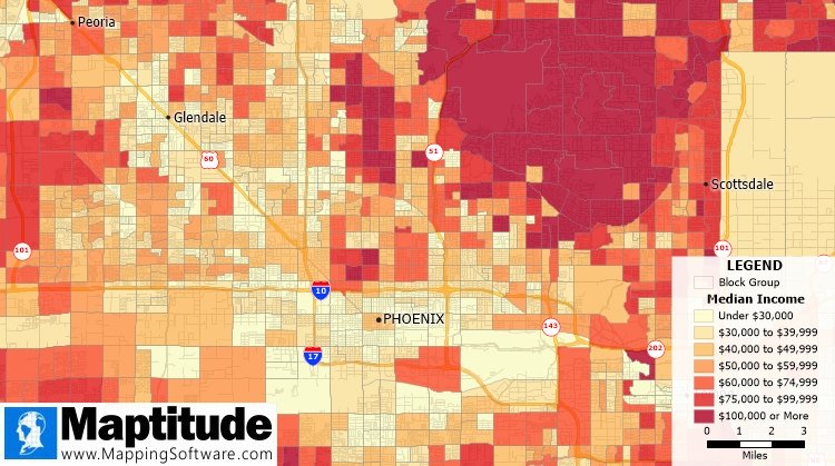
    Maptitude is a mapping software program created by Caliper Corp. that allows users to view, edit and integrate maps. Maptitude for Redistricting is the professional tool for political redistricting.

    According to Caliper, the ease-of-use, fitness-for-purpose and competitive pricing of Maptitude for Redistricting have made Maptitude the dominant product for political redistricting. Maptitude provides measures and reports, and the program features tools such as the Efficiency Gap Measure tool for exploring redistricting problems.

    Maptitude was used to democratize redistricting in California and is used by the majority of redistricters, from independent commissions, non-profits, and civil rights groups, to the courts and political parties, Caliper added.

  • 2020 US Census Data now available in Maptitude

    2020 US Census Data now available in Maptitude

    Image: Caliper
    Image: Caliper

    The Maptitude 2020 U.S. Census Blocks Groups data is now available for the entire United States, according to software provider Caliper.

    The small-area Census Summary Level is packed with neighborhood information essential for making accurate geography-based decisions. Maptitude users can explore locations by income, income growth, daytime population, age, race, gender, ethnicity, buying power, occupation, employment status, housing characteristics, citizenship counts and more.

    The wealth of data can be leveraged by data scientists and market research analysts using Maptitude mapping software, a comprehensive application for data exploration.

    The 2020 Block Groups are priced at US$250 on the Caliper Store, and are also available as shapefile, KML, KMZ or GeoJSON for an additional fee. If you have any questions about Maptitude or data availability contact the Maptitude team.

  • Correcting the census: Household sizes in Maptitude 2019

    Correcting the census: Household sizes in Maptitude 2019

    Household size distributions are critical inputs to many business analyses, but may not be correctly derived from U.S. Census data, according to Caliper.

    The Census counts people at their geographic locations, and when several unrelated people live at the same address, they are reported as one household with a number of residents.

    A confusing array of data is reported. In both the Census SF1 2010 file and in 2017 ACS, the following tabulations are provided down to the Census tract level:

    • People in Family Households
    • 2 person Family Households
    • 3 person Family Households
    • 4 person Family Households
    • 5 person Family Households
    • 6 person Family Households
    • 7+ person Family Households
    • Non-relatives in Family Households
      • Unmarried Partners (including same-sex couples) in Family Households
    • People in Non-Family Households
      • Unmarried Partners (including same-sex couples) in Non-Family Households

    There is also extensive information on people residing in group quarters in the 2010 Census, which has the tabulations below:

    • People in Group Quarters: College
    • People in Group Quarters: Military
    • People in Group Quarters: Navy Ships
    • People in Group Quarters: Other
      • People in Group Quarters: Homeless
      • People in Group Quarters: Group Homes
      • People in Group Quarters: Residential Treatment
      • People in Group Quarters: Merchant Ships
      • People in Group Quarters: Workers’ Group Living Quarters
      • People in Group Quarters: Other Other
    • People in Group Quarters: Institutionalized

    Using this information, Maptitude 2019 includes a corrected data set of household size distributions for Census Tracts and Block Groups to account for the under-representation of one-person households in the Census data.

    Census tracts with Caliper derived households. (Image: Caliper)
    Census tracts with Caliper derived households. (Image: Caliper)
    Census tracts with Census household count. (Image: Caliper)
    Census tracts with Census household count. (Image: Caliper)
  • Caliper releases country package for Maptitude mapping software

    The 2018 DACH Country Package for Maptitude includes 4th quarter 2017 map content for Germany, Austria, Switzerland and Liechtenstein. (Photo: Caliper)
    The 2018 DACH Country Package for Maptitude includes 4th quarter 2017 map content for Germany, Austria, Switzerland and Liechtenstein. (Photo: Caliper)

    Caliper has lunched a 2018 DACH Country Package for its Maptitude mapping software. According to the company, Maptitude country packages bring the power and flexibility of its Maptitude product suite to a global audience and enable its customers to make geolocation-based decisions internationally.

    The 2018 DACH Country Package includes fourth quarter 2017 map content for Germany, Austria, Switzerland and Liechtenstein. The updated map includes refreshed streets and landmarks, as well as updated travel times and improved address matching.

    According to the company, users can seamlessly switch between the countries purchased, and doing so will refresh the Maptitude interface with country-specific tools, such as those for territory and sales mapping, finding, pin mapping, routing, displaying demographics and Create-a-Map Wizard.

    Caliper develops geographic information systems software, and its Maptitude software is designed to be a cost-effective, professional mapping software product. Maptitude also enables organizations to leverage their location-based data to improve decision making and planning, while minimizing expenditure through competitively priced solutions, the company added.

  • Caliper supplies US traffic count data for Maptitude

    Caliper supplies US traffic count data for Maptitude

    Caliper has released a free average annual daily traffic (AADT) map layer for Maptitude 2018 users.

    The latest version includes fields with total AADT traffic count, semi-trailer truck count, single-unit truck and bus count, number of through lanes and road classification.

    AADT is the total volume of vehicle traffic on a highway or road for a year divided by 365 days. It is a useful and simple measurement of how busy a road is, and is useful for:

    • selecting a new site or facility location, evaluating a site, or designing a territory
    • determining funding for highway maintenance and improvement
    • forecasting road maintenance needs and expenditure
    • identifying the best location for your business based on traffic patterns
    • analyzing how traffic may impact store construction
    • analyzing the environmental hazards of sound and pollution related to road transport

    The downloaded layer can be added to any Maptitude 2018 map.

  • Free highway exits, interchanges data provided for Maptitude 2018

    Image: Caliper
    Image: Caliper

    GIS software company Caliper has released new highway exit data for the United States and Canada.

    Users of Maptitude 2018 with the Canada or United States country packages can download a free point layer containing all signed and numbered highway exits within their respective country.

    The highway exits layer allows users to find the nearest highway interchange to a particular location or determine proximity to a desired interchange. Applications include site location assessment, commercial real estate, franchise development and accessibility studies.

    The data can also be used in conjunction with the free U.S. traffic count data to determine traffic volumes around a chosen exit.

    The Highway Exits and Interchanges layer can be added to any Maptitude 2018 map.

    Image: Caliper
    Image: Caliper
  • Caliper Offers Congressional Districts, Census Data for Use with Maptitude

    maptitude-congressional-districts-income-map

    GIS software company Caliper is offering 114th Congressional Districts data for the United States for its Mapitude software. The data package is aimed at corporate legislative affairs departments, lobbyists, political consultants, political parties, and anyone else involved in political affairs.

    The 114th Congressional Districts data contains a nationwide area database with boundaries of the 114th (January 2015-January 2017) Congressional Districts. It also includes demographic data from the 2010 Census and from the 2013 American Community Survey (ACS) five-year estimates.

    Country Packages

    Also available are eight new 2015 Country Packages for Maptitude. The 2015 Country Packages include fourth-quarter 2014 map content. Updated map layers, such as refreshed streets and landmarks are provided for each country. In addition, postal boundaries, postcode points, and demographics are included where available. For detailed information on each Package, including those for countries not mentioned here, visit the Maptitude Included Data page.