Tag: centimeter-level accuracy

  • Syslogic offers cm-accurate expansion board for embedded computers

    Syslogic offers cm-accurate expansion board for embedded computers

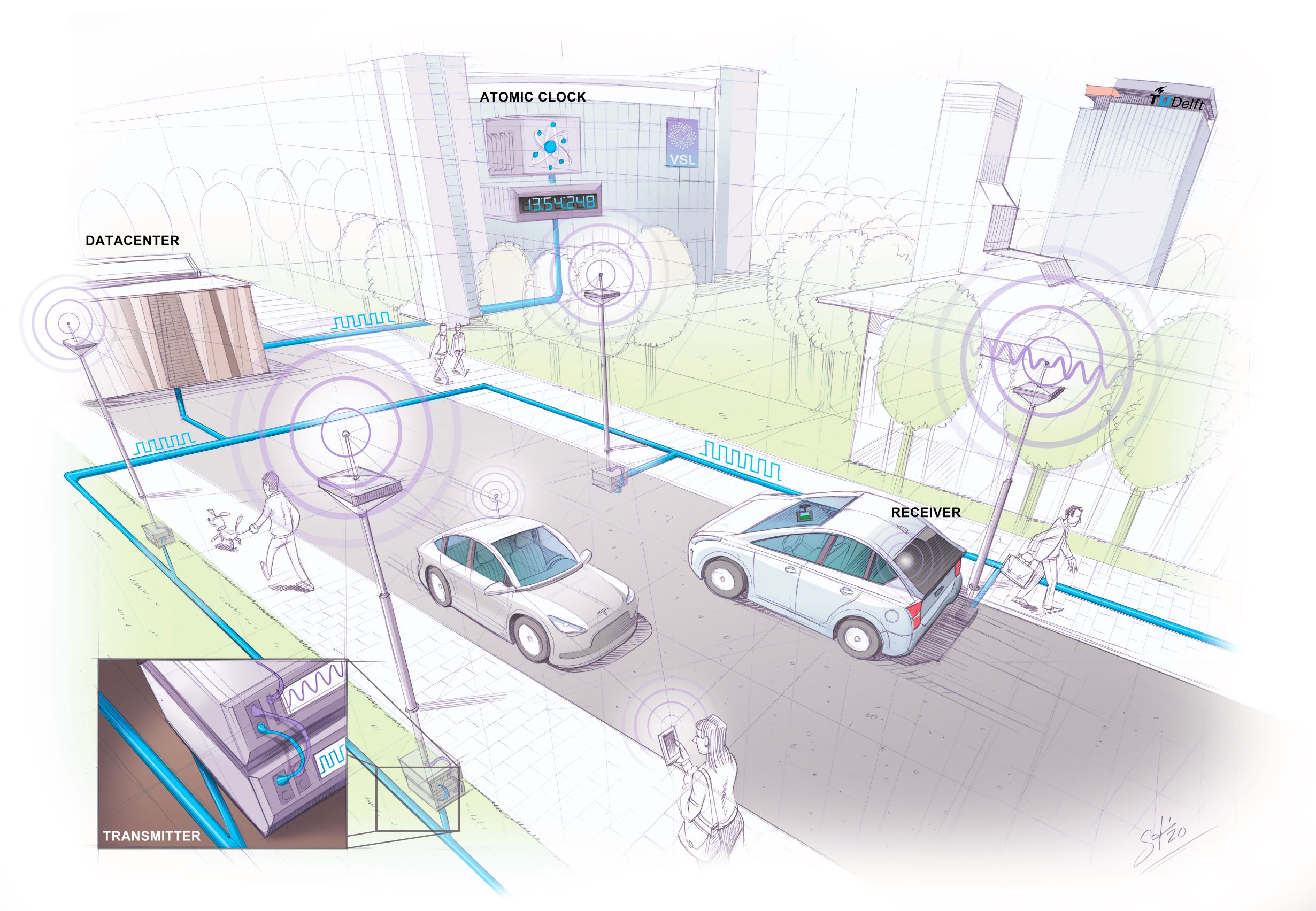
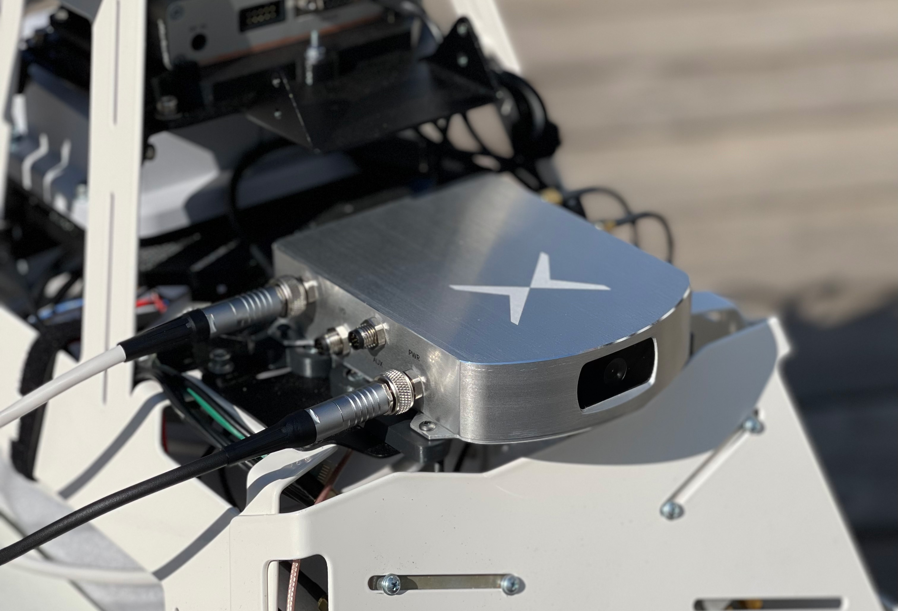
    Syslogic has introduced a GNSS expansion board for its rugged embedded computers. Based on u-blox GNSS technology, the board provides centimeter-level positioning, opening up new applications across industries such as autonomous field management, operation of construction machinery in remote areas, and navigation of automated guided vehicles (AGVs) and autonomous mobile robots.

    All-band, multi-frequency reception and HAS-ready

    Syslogic’s all-band GNSS board is powered by the u-blox X20 receiver, supporting all major GNSS constellations and frequencies, including L1, L2, L5, L6, and L-band. This enables the use of the upcoming Galileo High Accuracy Service (HAS).

    HAS supplements standard Galileo Open Service positioning with correction data transmitted directly over the E6/L6 band. The result is centimeter-level positioning via GNSS signals without the need for traditional RTK base stations, costly reference networks, or 5G connectivity.

    The u-blox X20-based GNSS board also supports simultaneous multi-frequency reception. With additional frequencies compared to previous models, typical GNSS errors, such as multipath effects and signal blockage, are significantly reduced, particularly in urban environments. This is crucial for applications that demand highly precise and reliable positioning, including surveying, autonomous vehicles, agricultural machinery and industrial automation.

    The GNSS board is designed for worldwide use. The integrated u-blox receiver supports modern correction techniques such as RTK, PPP-RTK and PPP. For the first time, it has been fully optimized for PointPerfect Global, u-blox’s proprietary high-precision GNSS correction service, delivering centimeter-level positioning anywhere in the world. This is particularly useful in remote areas without cellular coverage. PointPerfect Global uses advanced PPP-AR technology (precise point positioning with ambiguity resolution), providing corrections via the internet or L-band satellite transmission. The service achieves convergence times of less than two minutes and positioning accuracy within ten centimeters.

    RTK and Heading Capabilities Without Additional Hardware

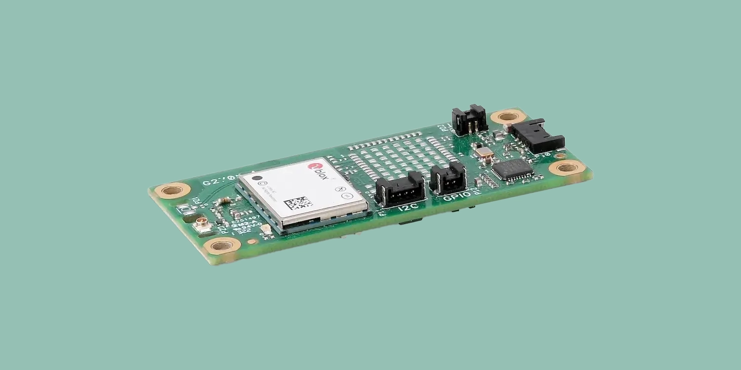
    The new expansion board is compatible with Syslogic embedded computers, including both Nvidia Jetson-based and x86-based devices. It is available with either one or two receivers, enabling RTK and heading functions without additional hardware.

    Vehicles and machines can be positioned with centimeter-level accuracy. Several Syslogic customers are already using the GNSS functionality in pilot projects, including precision farming and construction machinery monitoring.

    Features of the Syslogic All-Band GNSS Board

    • based on u-blox X20
    • All-band, all constellation GNSS receiver
    • RTK, PPP-RTK and global PPP, cm-level accuracy
    • PPS output to host system (GPIO)
    • Galileo HAS support on L6 band
    • Flexible integration into Syslogic products
    • Extended temperature range from –40°C to +85°C.

  • Researchers develop 10-cm accuracy navigation system

    Researchers develop 10-cm accuracy navigation system

    Researchers at Delft University of Technology, Vrije Universiteit Amsterdam and VSL have developed an alternative positioning system that is more robust and accurate than GPS, especially in urban settings.

    The aim of the project — SuperGPS — was to develop an alternative positioning system that makes use of the mobile telecommunication network instead of satellites and that has better accuracy than GPS.

    The working prototype that demonstrated this new mobile network infrastructure achieved an accuracy of 10 centimeters.

    The new technology is important for the implementation of a range of location-based applications, including automated vehicles, quantum communication and next-generation mobile communication systems.

    Much of our vital infrastructure relies on GNSS. Yet systems that rely on satellites have limitations and vulnerabilities. For instance, their radio signals are weak when received on Earth, making accurate positioning no longer possible if the radio signals are reflected or blocked by buildings.

    “We realized that with a few cutting-edge innovations, the telecommunication network could be transformed into a very accurate alternative positioning system that is independent of GPS,” said Jeroen Koelemeij of Vrije Universiteit Amsterdam. “We have succeeded and have successfully developed a system that can provide connectivity just like existing mobile and Wi-Fi networks do, as well as accurate positioning and time distribution like GPS.”

    Photo: Delft University of Technology
    Illustration: TU Delft / Stephan Timmers

    One innovation is to connect the mobile network to a very accurate atomic clock so that it can broadcast perfectly timed messages for positioning, just like GPS satellites do with the help of the atomic clocks they carry on board. These connections are made through the existing fiber-optic network.

    “With these techniques, we can turn the network into a nationwide distributed atomic clock — with many new applications such as very accurate positioning through mobile networks,” said Erik Dierikx, VSL. “With the hybrid optical-wireless system that we have demonstrated now, in principle anyone can have wireless access to the national time produced at VSL. It basically forms an extremely accurate radio clock that is good to one billionth of a second.”

    The system also employs radio signals with a bandwidth much larger than commonly used. “Buildings reflect radio signals, which can confuse navigation devices. The large bandwidth of our system helps sorting out these confusing signal reflections, and enables higher positioning accuracy,” explained Gerard Janssen of Delft University of Technology. “At the same time, bandwidth within the radio spectrum is scarce and therefore expensive. We circumvent this by using a number of related small bandwidth radio signals spread over a large virtual bandwidth. This has the advantage that only a small fraction of the virtual bandwidth is actually used and the signals can be very similar to those of mobile phones.”

    The results of the peer-reviewed research have been published in Nature.

    Photo: TU Delft / Frank Auperlé
    Photo: TU Delft / Frank Auperlé

  • Geometer International debuts lightweight, compact RTK device

    Geometer International debuts lightweight, compact RTK device

    Photo: Geometer International
    Photo: Geometer International

    Geometer International, a Ukrainian developer of GNSS/RTK instruments and applications for satellite positioning, has introduced the Walker RTK, a dual-frequency L1, L2 RTK receiver in the compact form factor of a portable RTK device.

    The Walker RTK is a lightweight, small-sized, affordable and full-featured device for collecting, storing and processing geo-referenced data on the survey site. According to the developer, a GNSS receiver in a convenient and affordable format will significantly expand the use of RTK technology. The new technology will be suited to most tasks requiring centimeter precision positioning and measurements in a 3D coordinate system.

    Compact and lightweight, Walker RTK is the ideal solution for field workers working away from the office. The new device can be operated with just one hand, significantly improving the productivity of service personnel.

    Possible applications for GNSS Walker RTK include surveying, utilities, solar power plant engineering, trenching and pipeline installation, drilling, forestry and municipal infrastructure control.

    What’s under the bonnet of Walker RTK?

    The Walker RTK is built around a 2-frequency L1/L2 184 channel board and a sensitive Helix antenna, satisfying up to 90% of basic user requirements. The tube-shaped housing geometry allows it to fit with any universal mount. The receiver weight is only 0.25g (0.470 with smartphone holder) due to the aluminum alloy housing with a protective coating. The Walker RTK has a built-in Li-Ion battery with enough power for 24 hours of continuous operation without additional recharging. The new energy-efficient architecture of the unit achieves this.

    The GNSS receiver has the minimum amount of leading interfaces, resulting in high IP67 dust and waterproof rating. The device can be paired with a smartphone or tablet via Bluetooth, while connection via Bluetooth low energy is also planned for a future release.

    Compatible with satellite systems

    Walker RTK can track and determine geo-position using signals from all known existing satellite systems. This feature makes it possible to achieve the centimeter-level accuracy of an RTK solution within seconds.

    GNSS signals processed by the Walker RTK GNSS receiver:

    • GPS (L1C/A, L2C)
    • GLONASS (L1OF, L2OF)
    • GALILEO (E1B/C, E5b)
    • BEIDOU (B1I, B2I)
    • QZSS (L1C/A, L1S, L2C)
    • SBAS (L1C/A)

    Thanks to NMEA messaging, the Walker RTK GNSS receiver is fully compatible with any professional or freeware geolocation software, providing high accuracy and reliable RTK-corrected positioning.

  • AEVEX Aerospace: Taming the Wild West

    AEVEX Aerospace: Taming the Wild West

    Lidar point clouds can reveal very fine features, such as electric power lines. Photo: AEVEX Aerospace
    Lidar point clouds can reveal very fine features, such as electric power lines. Photo: AEVEX Aerospace

    We discussed UAV lidar mapping with Bob Stadel, vice president of Geodetics, AEVEX Aerospace.

    What are the key remaining technical challenges in UAV lidar mapping?

    With continuing improvements in UAVs, lidars, GNSS receivers and other sensors, the key to unlocking more efficiency and profitability in this market will be improving and simplifying workflows and processing. The next frontier is integrating AI and machine learning with digital twin models to create forecasting tools.

    UAVs are much cheaper to operate than manned aircraft per hour, but not necessarily per square mile. UAVs can cover ground that cannot be mapped from a land vehicle; however, the latter have a much greater range.

    You are correct. Each type of vehicle has its area of best utilization. Once we know what the customer wants from the data being collected, we can determine the size, weight and power (SWAP) of the payload needed, and then it’s a matter of analyzing cost versus capability and working with the customer to pick the right payload for the right vehicle at the right price.

    What positional accuracy do you achieve for your point clouds?

    With our GNSS-receiver-based navigation unit, which also includes an IMU and key IP [intellectual property] from our company, and the right combination of tools, we achieve an accuracy of 2 cm to 3 cm.

    What are your key markets for UAV lidar mapping?

    I believe it is still the Wild West in this market space. Really smart people are figuring out new ways to use these systems every day. We sell systems to teams doing high-end inspections of infrastructure, such as roads, bridges, corridors and power lines, as well as for land surveying and mining.

    What was a recent application of one of your mapping systems?

    One of our most recent success stories has been the launch of our Geo-ECTO-1 system. It features dual lidar sensors combined with a 360-degree FOV [field of view] camera and high-end GNSS receiver. It is ruggedized from the ground up and is meant for high-end survey and infrastructure inspection work. The payload is designed to quickly transition to a UAV-based system. Our two launch customers/partners are California-based survey companies Guida Survey and LACO Survey. It has been a great experience getting these systems up and running with our partners.

    Our next adventure will be to work with UC San Diego’s Scripps Oceanographic Institute. We are proposing and demonstrating one of these systems to be used for analyzing cliff erosion on the beaches here in California, where several collapses have led to the loss of life. We want to support figuring out how to use the analyses to create a system that would give early warning of trouble spots. With these tools we can make our beaches much safer.

  • Fixposition releases Vision-RTK 2 centimeter-level positioning sensor

    Fixposition releases Vision-RTK 2 centimeter-level positioning sensor

    Photo: Fixposition
    Photo: Fixposition

    Fixposition, a Swiss technology company providing high-precision positioning solutions, has released a centimeter-level positioning sensor, the Vision-RTK 2.

    The low power and compact, industrial-grade device is suitable for autonomous delivery and logistics vehicles, agriculture, mowing and landscaping machines, as well as any other application where precise, uninterrupted positioning must always be available everywhere.

    “As vehicles and machines become increasingly autonomous, they must safely and precisely negotiate complex routes, even where GNSS visibility is degraded or blocked,” said Zhenzhong Su, CEO and co-founder of Fixposition. “With Vision-RTK 2, these applications are becoming possible. Our deep sensor-fusion technology combines GNSS technology with advanced computer vision and machine learning.”

    “We are using a global optimization-based sensor fusion technique that is much more robust and powerful than traditional Kalman filters,” said Lukas Meier, CTO and co-founder of Fixposition. “Our computer vision-based dead-reckoning technology has clear advantages over purely IMU-based products.”

  • Hexagon | Veripos expands SPAN GNSS+INS portfolio for dynamic positioning

    Hexagon | Veripos expands SPAN GNSS+INS portfolio for dynamic positioning

    Ensures safe operations through reliable, robust and continuous positioning with GNSS+INS integration

    Hexagon | Veripos has expanded its inertial solution SPAN GNSS+INS technology from NovAtel, also part of Hexagon, to dynamic positioning (DP) applications and vessels.

    SPAN technology delivers a deeply coupled GNSS and inertial navigation system (INS) that provides robust, reliable and continuous centimeter-level positioning for operators to maintain safety and maximize uptime.

    With a GNSS+INS solution, DP vessels can bridge outages in GNSS tracking and through short periods of radio-frequency interference, jamming or spoofing.

    Veripos is a leader in offshore high-precision positioning, delivering reliable and trustworthy GNSS solutions such as the LD900 receiver, PPP correction services and positioning visualization software. This expertise is demonstrated through SPAN technology’s deep coupling of GNSS and inertial measurements.

    Deep coupling describes how inertial measurements enhance the signal tracking for GNSS solutions, leading to improved resiliency against GNSS outages and enabling rapid reacquisition in case of interruptions. SPAN technology builds system robustness against potential signal outages, interference or disruptions while optimizing operational efficiency.

    “The robust positioning, heading, velocity and attitude measurements generated from a deeply coupled GNSS and inertial solution like SPAN technology is a game-changer to dynamic positioning operations,” said David Russell, marine segment portfolio manager at Hexagon’s Autonomy & Positioning division. “SPAN technology has a proven track record of bridging outages, enabling rapid reacquisition of signals, and building a reliable and robust positioning system. It’s the best option for vessels to ensure an added layer of resiliency and achieve continuous centimeter-level accuracy across all conditions.”

    SPAN GNSS+INS technology is compatible with commercial inertial measurement units (IMUs) and scalable with the LD900 GNSS receiver, Quantum visualization software and APEX correction services.

    Image: Hexagon
    Image: Hexagon