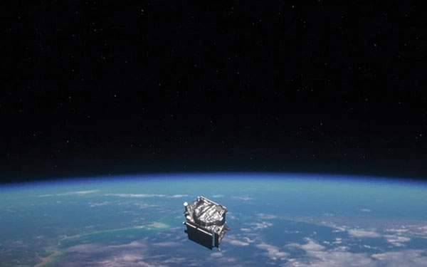
This year marks 50 years since the U.S. Department of Defense approved the design for GPS and first funded the program. It is also the 30-year anniversary of an important milestone – initial operational capability of GPS. Please don’t let its longevity fool you into thinking it is past its prime! GPS is, and will remain, one of the most innovative systems ever designed, funded and operated by the U.S. government.
Today, GPS represents a highly successful public and private partnership, one in which diverse stakeholders continue to coordinate through fora such as the National Executive Committee for PNT and its Advisory Board. and the Civil GPS Service Interface Committee. How did this system become a military, public safety, critical infrastructure, and economic success? The world-class GPS community is made up of the teams and individuals who design, develop and operate these critical technologies as well as the people and organizations that benefit from its applications. From pioneers, scientists, engineers, and Guardians to civil servants, lawmakers, and entrepreneurs, the GPS community has transformed, is transforming, and will continue to transform lives across the globe, and soon, the moon.
GPS World highlighted the important roles played by many early GPS pioneers in a two-part series aptly titled, “Heroes” in the May and June 2010 issues. It has also covered Dr. Gladys West, who is one of the most consequential mathematicians and programmers to contribute to the global success of GPS. Her geodetic models helped refine our understanding of Earth’s shape, which proved fundamental to the success of GPS and its myriad applications. In 2021, the Trimble Foundation established the Dr. Gladys West Scholarship Program. Virginia State University (her alma mater!), North Carolina A&T State University, and Florida International University award four-year scholarships to one student per year to honor Dr. West’s achievements as a woman of science and a woman of color.
A celebration of GPS must also recognize our lawmakers — the people who authorize and appropriate funding for GPS and its augmentation programs. Nearly every U.S. federal department and agency uses these systems to fulfill their missions on behalf of the American people. They also leverage their technical, programmatic, operational, and experiential expertise to ensure that GPS and its augmentation systems remain the best in the world. This work is possible thanks to congressional committees, members of Congress, and staff. The Senate Appropriations and House Appropriations committees, the Senate Armed Services and House Armed Services committees, the Senate Commerce, Science and Transportation and the House Energy and Commerce committees, the GPS Caucus and many more members of Congress, provide critical oversight and funding. Their support ensures that GPS continues to bring $1.7 trillion and counting in economic benefits to the U.S. economy, creating hundreds of thousands of jobs while enhancing national security, public safety and critical infrastructure.
The future is bright for GPS manufacturers and those developing new applications. To realize their success, projects funded by the Infrastructure and Investment Jobs Act and the Inflation Reduction Act will depend on GPS to continue to deliver signals that are accurate, have integrity, and are available and continuous in nature. The next enterprising GPS entrepreneur is waiting in the wings
Thanks to a network of determined individuals, GPS-driven technologies — used to support precision agriculture, safe transportation, synchronized global banking, cutting-edge emergency response, elite and amateur sports, and more — are transforming our lives, creating jobs, and promoting growth across the economy.
GPSIA joins other members of the GPS community by celebrating 50 years of GPS and looks forward to the innovations and applications that will shape the next 50 years and beyond.
The 62nd meeting of the U.S. government’s Civil GPS Service Interface Committee (CGSIC) will be held Sept. 19–20 in the Hyatt Regency Denver at the Colorado Convention Center, before the annual ION GNSS+ conference.
It will be hosted by the U.S. Department of Transportation (DOT) and the U.S. Coast Guard Navigation Center (NAVCEN). DOT serves as the civil lead for GPS and chairs the CGSIC in this capacity. NAVCEN is assigned duties as Deputy Chair and Executive Secretariat for the CGSIC.
On Sept. 19, the CGSIC subcommittees for Timing, International Information, and Survey, Mapping, and Geosciences will meet. A summary of these meetings will be presented to the CGSIC Plenary Session on Sept. 20.
Cordell DeLaPena, Program Executive Officer for Military Communications and PNT Space Systems Command
Keynote speaker for the plenary session is Cordell DeLaPena, program executive officer for Military Communications and Positioning, Navigation, and Timing, Space Systems Command, Los Angeles Air Force Base.
The agendas for the CGSIC subcommittee and plenary sessions will include presentations on the operational status and modernization of the GPS constellation of satellites, U.S. space-based positioning, navigation and timing (PNT) policy, GPS augmentation systems, and information related to U.S. engagement with other international GNSS as well as a variety of interesting applications of the use of GPS.
Several new briefings are part of the plenary session this year, including a presentation from NASA on the role of GPS in support of the next lunar mission. Also, the Department of Homeland Security will provide an update on the activities of the Office of Infrastructure Protection, Positioning, Navigation, and Timing Program Management Office.
This year’s meeting will be live-streamed over the internet. For those who are unable to travel, the meetings can be accessed with the links below.
The agenda for the meeting is available; all CGSIC presentations will be available there for viewing online shortly after the meeting ends. As a reminder, all CGSIC meetings are free and open to the public.
The U.S. Coast Guard Public Affairs YouTube channel is hosting streaming files for virtual meetings of the U.S. Government’s Civil GPS Service Interface Committee (CGSIC), held Sept. 21-22.
This link leads to the CGSIC page of GPS.gov. On that page are additional links for the Sept. 22 morning and afternoon speakers at the CGSIC Plenary Session as well as links for the three subcommittee sessions held Sept 22. The subcommittees are:
International Information Subcommittee
Timing Subcommittee
Survey, Mapping and Geoscience Subcommittee
Anyone can access the briefings, which include slides, embedded video of the speakers and comments made during the presentations.
In previous years, the Civil GPS Service Interface Committee (CGSIC) took place right before the start of the ION GNSS+ conference.
This year, the U.S. Department of Transportation (DOT) and the Coast Guard Navigation Center (NAVCEN) are holding the 60th meeting virtually, in collaboration with the Institute of Navigation (ION).
The meeting will take place Sept. 21-22 online before the annual ION GNSS+ conference, which will also take place virtually because of the COVID-19 pandemic.
All CGSIC meetings are free and open to the public. Anyone in the world with access to a computer can attend these public meetings of the U.S. Civil GPS Program.
DOT serves as the civil lead for the GPS program and chairs the CGSIC in this capacity. NAVCEN is assigned duties as deputy chair and executive secretariat for the CGSIC.
Subcommittees of the CGSIC for Timing, International Information, and Surveying-Mapping-Geosciences will hold meetings Sept. 21, and a summary of these meetings will be presented to the CGSIC plenary session on Sept. 22.
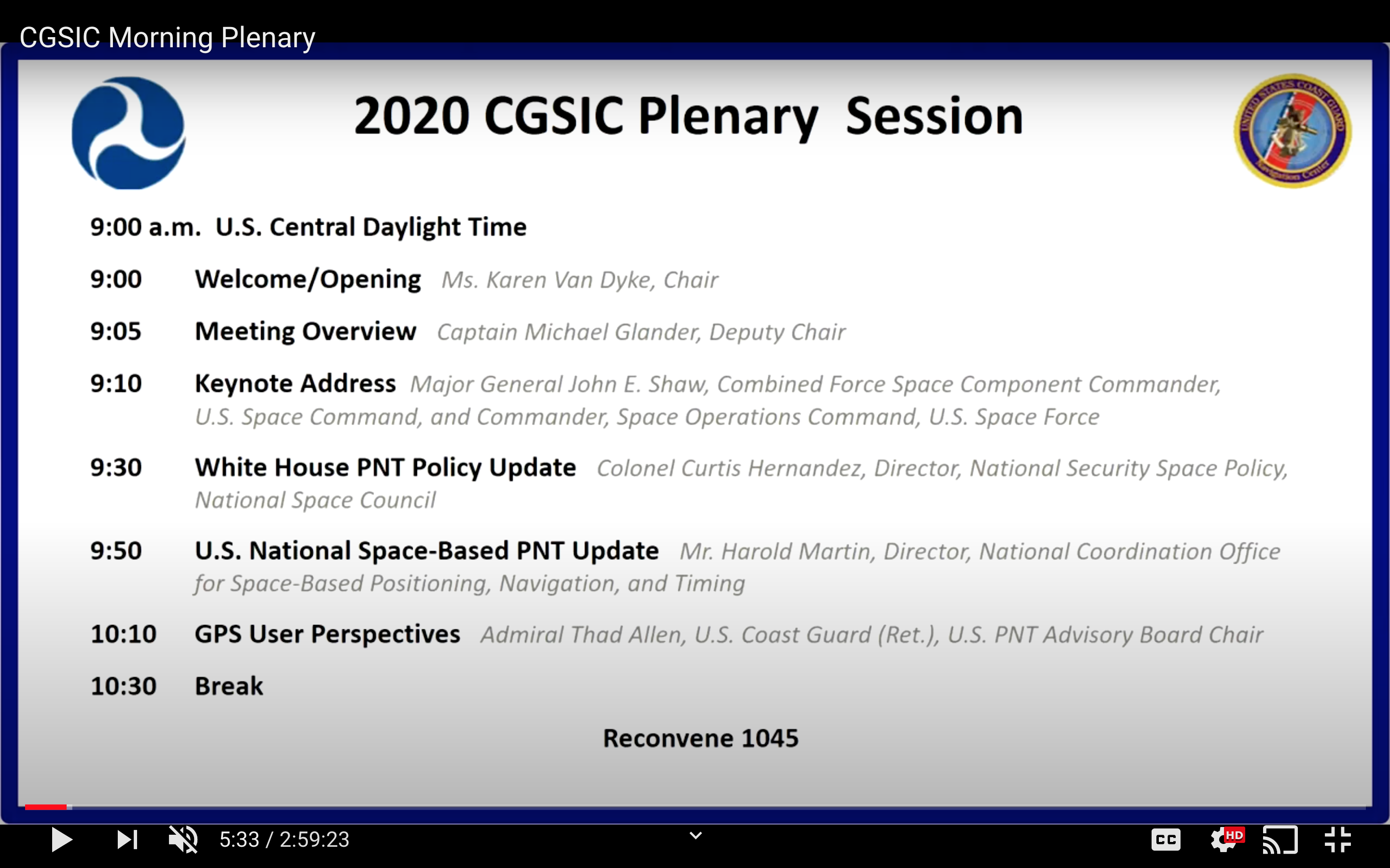
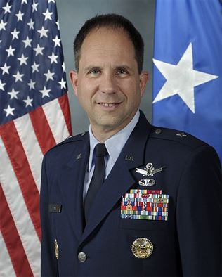
The keynote speaker for this year’s plenary session will be Major General John E. Shaw, Combined Force Space Component Commander, U.S. Space Command, and Commander, Space Operations Command, U.S. Space Force.
Presentations this year include:
PNT updates from various countries around the world
Atomic clocks for fundamental physics: time for discovery
Missouri Department of Agriculture land survey program
National PNT Policy Update from the National Space Council
Mobile geospatial technology’s role in tracking beetle infestation in our nation’s forests
The full agenda is available online. CGSIC presentations will be posted online shortly after the meeting ends. Register for the meetings here.
In April 2018, the Civil GPS Service Interface Committee (CGSIC) announced the Department of Homeland Security release of the memorandum titled “U.S. Owners and Operators Using GPS to Obtain Time,” which is intended to provide an understanding of the possible effects of the April 6, 2019, GPS Week Number Rollover on Coordinated Universal Time derived from GPS devices.
GPS users should review this memorandum and be aware of the potential impacts to their equipment when the GPS Week Number rolls over to 0 on April 6, 2019 / April 7, 2019.
If you have questions about how your equipment may be impacted by the GPS Week Number rollover, we recommend you contact your equipment manufacturer.
Brig. Gen. John E. Shaw is Director of Strategic Plans, Programs, Requirements and Analysis, Headquarters Air Force Space Command, Peterson Air Force Base, Colorado. (Photo: USAF)
The U.S. Department of Transportation and the Coast Guard Navigation Center are preparing for the 58th annual Civil GPS Service Interface Committee (CGSIC) meeting.
The meeting will be conducted Sept. 24-25 at the Hyatt Regency Miami in Miami, Florida, in conjunction with the Institute of Navigation’s ION GNSS+ 2018 conference.
CGSIC meetings are free and open to the public.
Subcommittees of the CGSIC for Timing, International Information, and Survey, Mapping, and Geosciences will hold meetings Sept. 24, and a summary of these meetings will be presented to the CGSIC plenary session Sept. 25.
The meeting includes important briefings on the status of ongoing GPS programs and a keynote address by Brig. Gen. John Shaw, director of strategic plans, programs, requirements and analysis for the Air Force Space Command.
The CGSIC agenda in development can be found at gps.gov.
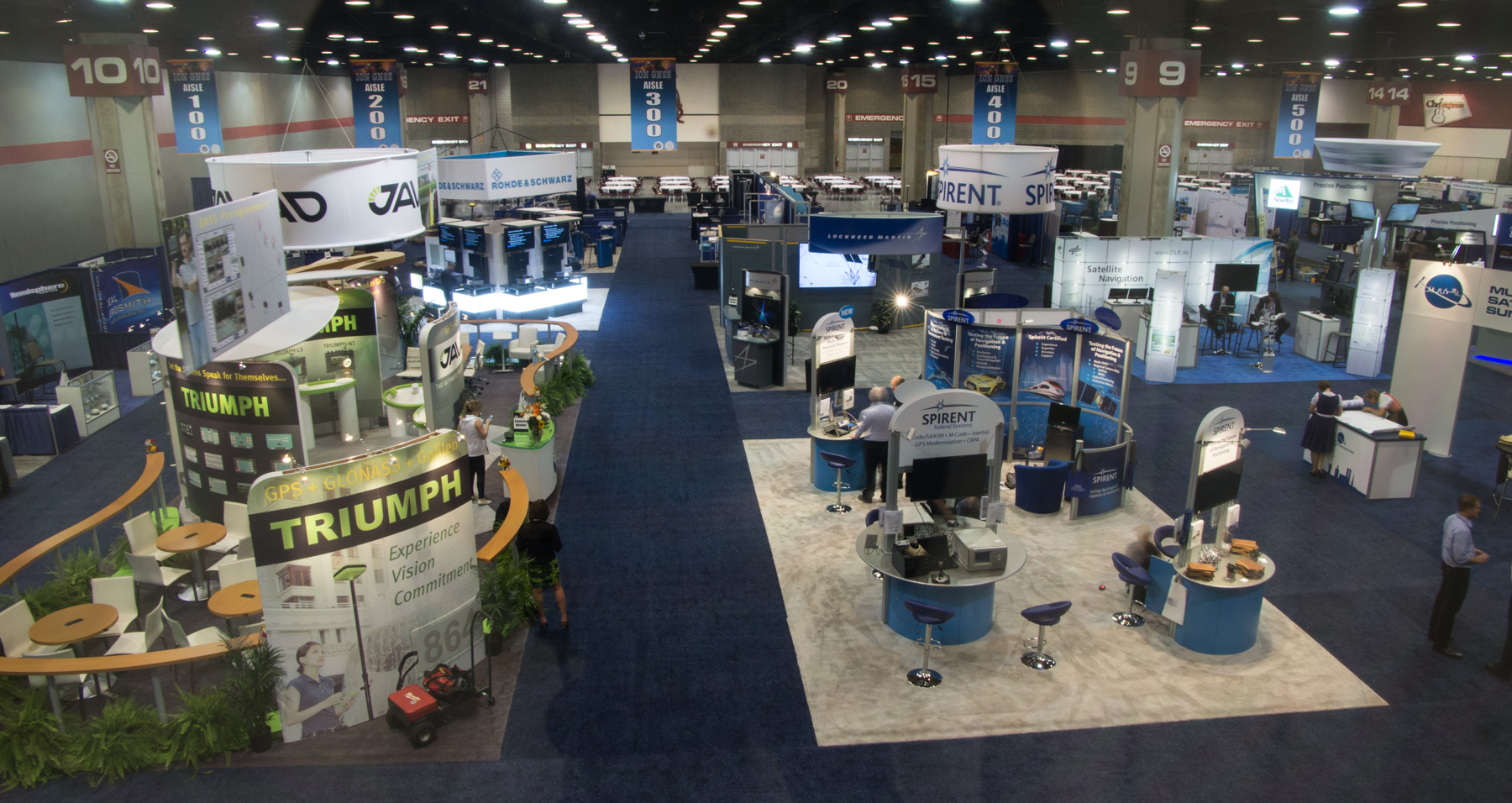
This year, ION GNSS+ was once again in Nashville, Tennessee — with around 1,050 attendees and 63 exhibitors, show attendance was down from last year, maybe because of a reduced military presence and more constrained government budgets. But the conference was a good one. The CGSIC (Civil GPS Service Interface Committee) ran just before the ION conference, and provided an opportunity for better visibility of the ins and outs of the GPS program and enabled a degree of U.S. military-commercial exchange.
On Tuesday, CGSIC gave us an overview of the Navigation & Timing exhibit at the National Aerospace Museum in Washington, D.C., an insight into news of the evolving U.S. government’s PNT policy, State Department international activities (including estimates of GPS contributing $68-122 billion and 3.3 million jobs to the U.S. economy), a Homeland Security update on interference detection and enforcement, and of course the regular GPS Directorate program updates from the Air Force. Then we had subcommittee reports from various sectors, including timing, survey, and from the Federal Aviation Administration (Distance Measuring Equipment, or DME, is apparently the FAA’s chosen back-up for GPS in the National Airspace System). Finally, the GPS Directorate chief engineer provided an overview of GPS R&D activities and an opportunity for civilian attendee feedback and input.
The lone commercial presenter — Eric Gakstatter, a fellow contributor to GPS World — proposed that the Air Force make “PRED” (predicted ephemeris, regularly produced by the Air Force GPS system, but not available to commercial users) be unclassified and released for civilian use.
Both Broadcom and Rx Networks commented that they provide predicted ephemeris to their users, and post conference I let Eric know that Baseband Technologies has a software product providing predicted ephemeris which is good for 28 days without any intermediate updates. The Air Force said it would think about releasing PRED, but there seemed to be significant issues to doing that.
The ION GNSS+ conference got going on the Wednesday morning, with a whole slew of technical papers, panel sessions, and the opening of the exhibition floor. The papers tend to be quite technical and sometimes quite academic — for example, “Approaches to Obtaining Beidou Hazardous Bias with Ordered Weighted Aggregation Operators” — but these quite detailed presentations is what a subset of ION GNSS+ attendees come for, and they want to hear the results of the very latest research. One “technical session” allowed manufacturers to provide announcements and summaries of their new products and systems — a welcome opportunity for commercial and technical attendees alike. ION has also instituted panel sessions, which deal with more global subjects — for example, Program Updates or High Integrity Systems (such as WAAS), which tend to draw equal attention from a good number of attendees.
The ION GNSS+ 2013 show floor.
The show floor always seems to be the highlight of the conference, however, and its often packed at times when papers or panels are not running. With around 63 exhibitors this year, it seemed a little smaller than last year, but there were also a number of new companies with booths.
Panel Sessions
Panel sessions I sat in on included Program Updates, some of New Products, and High Integrity Systems. Program updates were provided by GPS, GLONASS, Galileo, Beidou, and QZSS:
GPS URE (pseudorange inaccuracy due to ephemeris and clock errors) is running around 80 cm and was 47 cm at one time recently, versus a “promise” of 4 meters for civil users. The average age of the older IIA satellites (SVs) is currently running around 2-2.5 time design life, and as the newer generation of satellites (SVs) comes on line, URE is expected to continue to drop.
GLONASS is performing up to expectations and is relatively stable, despite the odd jump in URE which is apparently due mostly to ground control issues. The loss of three SVs in the July Proton launch failure was a setback, but with several SVs built and in storage, Russia anticipates resuming the replenishment schedule soon. They will get to orbit mostly using Soyuz launchers, and a few Protons. There is a commitment to launch new SVs with CDMA (time division format, as per all other GNSS) on L3, while maintaining existing FDMA (unique GLONASS frequency format) signals and, indeed, one GEO SV is apparently already on orbit transmitting an L3 CDMA test signal. GLONASS has the objective of achieving 60 cm URE by 2020.
Galileo is moving along with four SVs on orbit and initial fixes achieved with both commercial and government PRS signals; 22 FOC (production) SVs are now ordered, and 16 ground reference stations and five uplink stations stations are up and running. Significant effort is anticipated on the next phases of Galileo and EGNOS, and a €6 billion budget for this work has been approved.
Beidou apparently has 14 operational SVs right now, which is adequate for regional coverage of China, but work is intended to continue towards a global constellation of five GEOs and 30 non-GEO SVs. Work is also shortly intended on a Wide Area Differential Service, chipsets are already available for receivers, and site surveys are planned for offshore reference stations. A five-year plan has been approved, and the next launch is possibly in 2014 for testing of the global (MEO) constellation.
Michibiki cartoon.
QZSS has successfully proven the concepts of operation with the first Michibiki satellite, and Japan has ordered the remaining three SVs for the constellation. The ground network contact was also let in March 2012.The intention is to achieve sub-meter service on L1 C/A, and the CLAS augmentation system is targeted to provide a ~10 cm service.
The New Products panel had way too much academic and agency content for me and virtually no commercial new products content, so quite disappointing.
The High-Integrity (WAAS-systems) panel was much more interesting for a guy who used to live in this space:
WAAS has achieved LPV-200 (aircraft landing ~200ft decisions height) across the U.S., including Alaska in 2013, and RNP 0.3 (positioning within 0.3 nautical miles) across the whole of North America and a good portion of South America. Plans are moving forward with the introduction of L5 into WAAS. If Initial Operational Capability (IOC) for GPS L5 is 2021, then WAAS IOC for L1/L5 capability should be two years later — also replacement of obsolescent elements, and doubling the comms network bandwidth.
EGNOS has another Version 3 future evolutionary stage planned, with more RIMS (reference stations) planned, and possible expansion into Africa is on the table.
MSAS has not got to the operational accuracy it wanted yet, but with the current two MTSAT GEOS, RNP 0.3 is available over Japan and area. Ten more reference sites are needed to get to LPV-200, but there is no budget yet allocated.
Gagan now has two GEOs (GSAT-8 and 10) and achieves RNP 0.1 over India and anticipates operational certification by 2014.
SDCM (Russia) is anticipated to be in place by 2016 for L1, and by 2018 expects to add L5. Currently working some interference issues between the second SDCM GEO (Luch-5B) and an Inmarsat GEO at 15.5 ̊ West, the contact for the SDCM ground network is anticipated before the end of this year, and a heavier (five-ton) GEO (called Enisey) is planned for the 95 ̊ Eastslot in 2017/18. This will carry not only L1, but also L5 and L3, both CDMA signals. There was a lot of interest at ION in when the GLONASS CDMA L3 signal would be fielded in the GLONASS constellation — no real predictions for when, but the L3 ICD release should be “before the next GLONASS K launch.”
Exhibit Hall
The exhibition was indeed a little smaller than last year, but there was plenty of activity on the floor. Most people I talked with had new products at the show, or had new information they were eager to discuss:
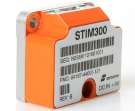
STIM300 MEMS Sensor.
Sensonor (Norway)has joined up with NovAtel,who is now offering its STIM300 MEMS inertial sensor as part of the NovAtel SPAN family. Sensonor apparently has a number of installs on unmanned aerial vehicles (UAVs).
Sysnav (France) has a sensor that cleverly uses Magnetic Variation with MEMS to do fairly accurate positioning in the absence of GNSS signals. Sysnav was looking for partners in North America.
Javad had his usual extensive line of surveying instruments, but his latest OEM receiver showed up with 864 channels! With three processors, program memory, multi-constellation (everything!) and monster channel tracking (100 of which scan for GNSS interference), this by far had the greatest receiver capacity at the show.
Trimble announced its latest tiny BD930 RTK capable OEM receiver — supporting both triple-frequency GPS and GLONASS, plus dual-frequency Beidou and Galileo. And it’s completely enclosed in an RF screening “can.”
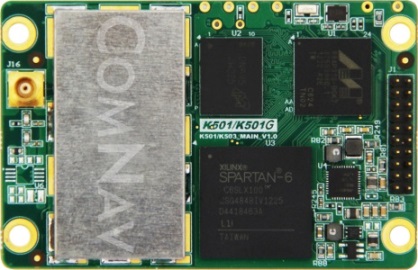
ComNav (China) showed up with a series of multi-frequency, GPS/Beidou/GLONASS RTK-capable OEM receivers, packaged receivers, and antennas. With 100 people based in Shanghai, ComNav claims to have captured 30% of the Chinese market, selling 15,000 receivers — derived from technology developed by Dr. Wong Yong Quan. Impressive capability on display — also seeking distribution in North America.
Surrey Satellite (UK) are apparently working on a number of R&D projects alongside building the nav payloads for the Galileo FOC SVs. TechDemoSat-1 is an innovative UK technology platform that includes a GPS reflectometry experiment to measure wave intensity for marine weather services. Apparently there is little weather information for large areas of the world’s oceans, and this may help to solve a major marine nav issue.
Nottingham University (UK) is working on predictive integrity for UAVs. GNSS signal outage/degradation in flight, caused by antenna obscuration, multipath, fading due to adverse geometry and Doppler shift, are critical for UAVs. Nottingham modeling is aimed at real-time avoidance of safety-critical flight conditions and fast recovery of navigation performance following GNSS data losses.
Trusted Positioning (Canada) is moving quickly down the indoor location path and has some neat software integration solutions for cell phones using signals of opportunity, pressure sensors and MEMS. The company sees the initial market being for things like mapping indoor locations, iteratively improving positioning, and location-based advertising.
Spirent GSS6425 record and playback system.
Spirent has released the GSS6425, which is a highly portable simulation system for recording live GPS L1/L2/L5, GLONASS L1/L2/L3, BeiDou-2 B1/B2, Galileo E1/E5, QZSS L1/L2/L5 and SBAS signals in the field — for repeated replay in the lab. BeiDou has been introduced across the Spirent simulation product line, and Spirent released information on sophisticated spoofing simulation.
IFEN (Germany) is also working on spoofing, has added BeiDou B1 and B2 signals, has added a four multi-RF output capability, and is working on automotive gyro and odometer testing capability.
R&S DDF007 Portable I/F Direction Finder.
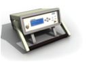
Rohde & Schwarz had an extensive display of capability alongside its SMBV 100A GNSS simulator. An impressive array of spectrum analyzers and generators, with one set-up catching my eye — the DDF007 portable interference detection system used by government agencies for tracking down jammers.
I didn’t get to everyone’s booth, and I just didn’t have the space to cover everything, but I’d call this a reasonable cross section of the exhibitors; to some degree its a summary of the panels and includes some of the corridor discussions typical of ION.
So, I would call this another successful ION show, and I’m looking forward to next year’s ION GNSS+ conference in my neck of the woods in Tampa, Florida, in September. It would seem that the interest level remains high across academia, agencies and industry — but those of us who may still want to see new business as payback for the investment of attending and/or exhibiting, I think we would have preferred still more commercial content.
ION remains a place to meet and greet customers and people working across multiple market segments, where system providers can brief us and mix with users, and the intensity of technology development and research can be shared and sampled. It’s still an invaluable place to visit once a year if you are connected in any way to the GNSS industry and community.