Garmin Ltd. has entered into an agreement to acquire substantially all of the assets of DeLorme, a privately held company that designs and markets consumer-based satellite tracking devices with two-way communication and navigational capabilities.
The completion of the acquisition, which is subject to customary conditions, is expected to occur within 30 to 60 days.
One of the most compelling products in the DeLorme portfolio is its inReach series of two-way satellite communication devices. These GPS-enabled devices allow the user to send and receive satellite text messages or trigger an SOS for emergency help, anywhere in the world. In addition to inReach, DeLorme has an extensive library of digital cartography and enterprise GIS software, as well as traditional mapping.
“DeLorme is a respected brand with exciting products and technologies that are a natural fit in the Garmin portfolio,” said Cliff Pemble, Garmin’s president and CEO. “We look forward to completing the acquisition and welcoming them onto our team. We are looking forward to leveraging their expertise to further enhance the Garmin lineup of products.”
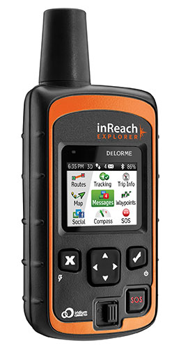
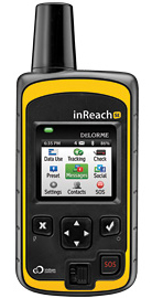
The DeLorme inReach Explorer is a two-way satellite communicator with built-in navigation.
“Our inReach technology is invaluable to hikers, hunters, boaters and pilots who often find themselves in remote areas — Garmin’s core customers. We are looking forward to completing the acquisition and are excited to help leverage our expertise into enhancing their already outstanding products,” said Michael Heffron, CEO of DeLorme. “Garmin has extensive R&D capabilities and a global distribution network that will allow us to provide this technology to customers across many markets and around the world.”
Garmin will retain most of the associates of DeLorme and will continue operations at its existing location in Yarmouth, Maine, following the completion of the acquisition. The Yarmouth facility will operate primarily as a research and development facility and will continue to develop two-way satellite communication devices and technologies. Financial terms of the purchase agreement and acquisition will not be released.
For decades, Garmin has pioneered new GPS navigation and wireless devices and applications that are designed for people who live an active lifestyle. Garmin serves five primary business units, including automotive, aviation, fitness, marine and outdoor recreation.
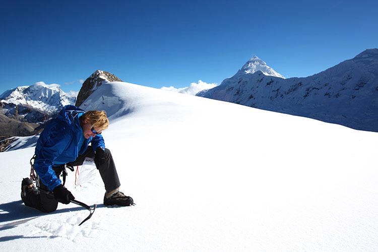
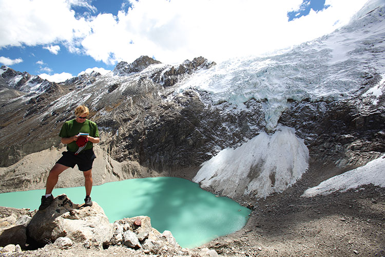
John All takes an ice sample from a glacier in the Ishinca Valley, Peru.
A climate scientist relies on a GPS satellite communicator to get him out of tight spots.
By Tracy Cozzens Photos by Clinton Lewis, Western Kentucky University
Please call Global Rescue.
John broken arm, ribs, internal bleeding.
Fell 70 ft crevasse.
Climbed out.
Himlung camp 2.
Please hurry.
That simple text message, sent May 19 via the DeLorme inReach communicator, alerted search-and-rescue monitors that the leader of a Himalayan research team was in dire straits.
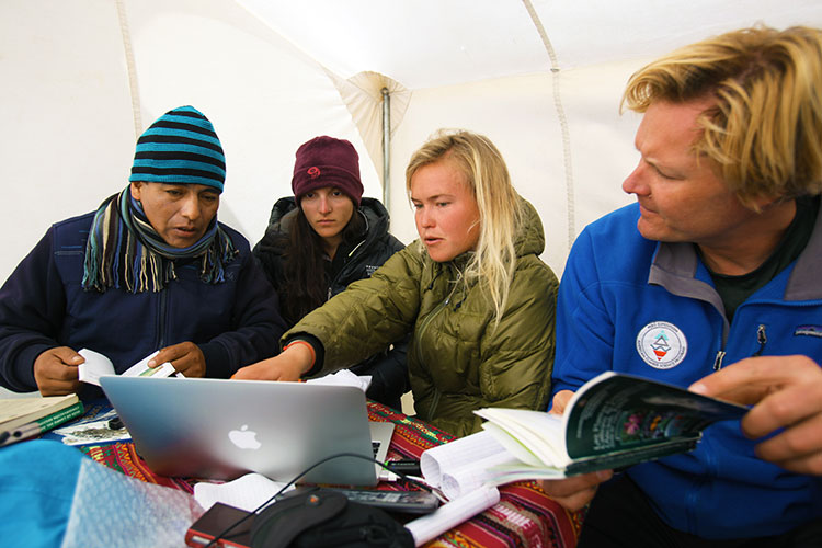
Dr. John All, director of the American Climber Science Program (ACSP), was leading a team collecting snow samples in the highest mountain range in the world to study the impacts of climate change when he tumbled into a crevasse. “After crawling back for hours to my tent, I sent texts via my sat messenger for help,” All told the local Kathmandu newspaper.
Friends and family of the expedition followed the rescue efforts every step of the way as text messages were sent via the InReach to the ACSP’s Facebook page.
The climate scientist was rescued via a helicopter and admitted to Norvic International Hospital in Kathmandu with five broken ribs, a dislocated shoulder, and internal bleeding. After a day in the ICU, he was discharged for a week of rest before returning for further care in the United States.
The DeLorme inReach Explorer.
In an emergency such as All experienced, the interactive SOS capability of the inReach automatically triggers remote tracking and allows users to communicate via text with responders at GEOS, DeLorme’s partner for international 24/7 search-and-rescue monitoring.
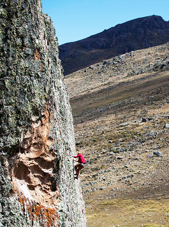
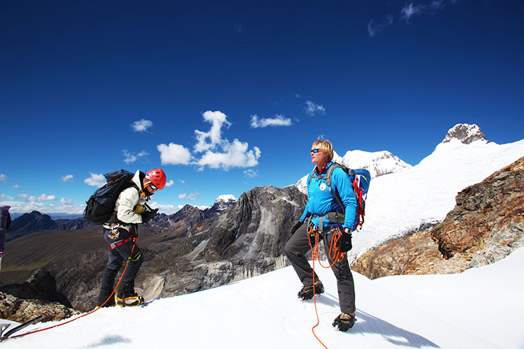
Going Out Again. All and his ACSP team departed for Huascaran National Park in Peru on June 23, just a month after his harrowing rescue in the Himalayas, for a two-month research expedition. All and several of his team members will be carrying the inReach devices.
Just like in the Himalayas, the inReach will give the team the ability to send and receive 160-character text messages from the remotest locations, provide location updates with GPS tracking, and keep them within reach of rescue with its SOS capabilities.
Besides providing peace of mind, the latest version of the inReach — the Explorer — allows the team to plan a route, mark waypoints, and create detailed track logs of their expedition.
“Knowing we would consistently be out of cell-phone range, we researched all satellite communication options to keep us connected,” All said. “A satellite phone was more than we really needed, and as a volunteer-driven non-profit program, it wasn’t very cost effective. We needed to be able to communicate back and forth in the event of an emergency, but we also wanted to keep everyone updated on the day-to-day status of the mission.”
Checking on the team’s status is as easy as visiting their Facebook page. Team members regularly post messages from anywhere in the world they might travel.
In Peru, the team of 20 students and scientists will examine changing climate conditions and the impact of human land use in the mountainous Cordillera Blanca region of the Andes, where Huascaran National Park is located. The park, a magnet for American climbers, has more than 33 peaks higher than 6,000 meters and hundreds of 5,000+ meter peaks. ACSP has been sampling snow in the region for the past three years in an effort to quantify the glacial contamination levels.
“Our work in Peru will be much more comprehensive than our high-elevation work in the Himalayas and will cover whole gamut of environmental parameters, from vegetation to water quality. The region is very remote and we will be collecting some samples from the walls of a crevasse to assess the seasonality of pollutants and their impact over time, so having an inReach with us is critical — both to communicate with each other and our team back home,” All said. Plus, he added, the students on his team will be able to communicate with their parents, providing their parents with peace of mind as their children travel to remote regions.
“Now that we’ve seen how well inReach works, we are looking forward to having more of them on this next trip — especially the newest Explorer model, which will allow us to mark waypoints during data collection,” All said.
In addition to the messaging, tracking and SOS capabilities, users of the company’s latest product inReach Explorer can view, create or navigate routes and waypoints. A map view displays routes, waypoints, tracks, and messages geo-located onscreen for backtracking or self-rescue. The built-in digital compass, barometric altimeter, and accelerometer sensors ensure accuracy and provide heading and bearing information, elevation readings, speed, and other useful trip statistics.
inReach communicates over the Iridium satellite network, providing global two-way satellite connections, high network reliability and low-latency data links (less than 60-second delivery of messages end-to-end) anywhere on Earth, with no gaps, fringe or weak signal areas. inReach has the ability to maintain a satellite signal lock even in difficult GPS environments, such as in a steep canyon or under a heavy forest canopy, DeLorme said.
The ACSP has visited Peru for climate research for three years, including in 2013 the Quillcayhuanca Valley (left) and the Ishinca Valley, places so remote that staying in touch can be a challenge. (Photos: Clinton Lewis/WKU)
DeLorme has announced the launch of its newest product, the inReach SE (Screen Edition) satellite communication device. With 90 percent of the world’s surface lacking cell phone coverage, inReach SE is designed for the traveler or outdoor adventurer to keep them connected and safe anywhere in the world. The expanded standalone capabilities of inReach SE include a color screen, virtual keyboard, slim design and long-lasting internal lithium battery. In standalone mode, inReach SE provides free-form texting capabilities of up to 160 characters to any cell phone number, email address or social media page.
Using DeLorme’s Earthmate App, inReach SE pairs wirelessly with iPhone, iPad and iPod touch to access topographic maps and NOAA charts and to make text messaging more convenient. inReach SE is also compatible with Android devices.
With the ability to maintain satellite signal lock even in difficult GPS environments, inReach SE also offers global SOS capabilities, adjustable tracking intervals from 10 minutes to four hours, and remote real-time follow-me/find-me tracking and ping-me locating. In the event of an emergency, the interactive SOS capability of inReach automatically triggers remote tracking and allows users to describe and update their situation so proper resources can be deployed, DeLorme said.
“Whether you’re deep in the backwoods, floating on a remote lake, or simply traveling abroad, anyone can benefit from the comprehensive functionality of inReach SE,” said Michael
Heffron, DeLorme CEO. “Over the last two years we have been listening to customer feedback, so the next generation of inReach includes many new features based on their input. The internal rechargeable battery and the on-screen, free-form texting are especially beneficial, making on-the-go communications more convenient and delivering peace of mind to family and friends easier than ever before.”
inReach operates over the Iridium satellite network, providing global two-way satellite communications, high network reliability and low-latency data links (less than 60 second delivery of messages end-to-end) anywhere on Earth, with no gaps, fringe or weak signal areas, DeLorme said.
The follow me / find me tracking feature of inReach provides GPS position updates allowing family and friends to follow the user’s trip as it happens. Family and friends can log into a dedicated MapShare page to follow a detailed breadcrumb trail, ping a location, and send messages to the inReach owner. In the event of an emergency, the built-in SOS button can be activated to trigger a distress alert with delivery confirmation and it automatically activates the remote GPS tracking feature. GPS tracking assists search-and-rescue personnel with homing in on the user’s location, whether stationary or on the move.
Pairing the inReach SE via Bluetooth with the Earthmate App turns a mobile device into a global satellite communicator and navigation tool. Real-time GPS location, tracking and text messages are overlaid on the digital maps for easy navigation and position location. inReach owners get exclusive, unlimited access to DeLorme’s topographic maps and North American NOAA charts, which can be downloaded via an Internet connection prior to departure and remain available in the Earthmate App even when outside cellular coverage.
DeLorme today announced at the Esri Users Conference the introduction of ArcSync, a software engine that allows customers to transfer field data edits to Esri repositories and synchronize field databases with the internal GIS database.
ArcSync automates the process of defining and scheduling tasks, providing automatic data flow and keeping field and office databases in sync.
“The ArcSync engine is an automated tool that streamlines the synchronization between field data collection and the ArcGIS database at headquarters,” said John Auble, DeLorme vice president, data products and HA/DR programs. “It is the ideal solution for organizations with a need to collect and distribute GIS data to field personnel in a disconnected format. It creates disconnected GIS layers from ArcGIS feature classes and maintains synchronization as changes are made via DeLorme, ArcMap, or other Esri tools.”
Auble noted that ArcSync permits the GIS Admin to ensure data viewed in the field is current for both the connected and disconnected GIS user, pushing work tickets to field personnel in an automated fashion so that critical data can be collected in a timely manner. It also allows for a scheduled automated process to run in order to make sure that all databases are in sync, eliminating the need for GIS Admin to spend time processing files manually to keep the field database and internal GIS database synchronized.
DeLorme is showcasing its full range of mapping, positioning and tracking solutions in Booth 2407 at the 2012 Esri Users Conference this week in San Diego.
DeLorme announced the introduction of ArcSync, a software engine that allows customers to transfer field data edits to Esri repositories and synchronize field databases with the internal GIS database.
ArcSync automates the process of defining and scheduling tasks, providing automatic data flow and keeping field and office databases in sync.
“The ArcSync engine is an automated tool that streamlines the synchronization between field data collection and the ArcGIS database at headquarters,” said John Auble, DeLorme vice president, data products and HA/DR programs. “It is the ideal solution for organizations with a
need to collect and distribute GIS data to field personnel in a disconnected format. It creates disconnected GIS layers from ArcGIS feature classes and maintains synchronization as changes are made via DeLorme, ArcMap or other Esri tools.”
Auble noted that ArcSync permits the GIS Admin to ensure data viewed in the field is current for both the connected and disconnected GIS user, pushing work tickets to field personnel in an automated fashion so that critical data can be collected in a timely manner. It also allows for a scheduled automated process to run in order to make sure that all databases are in sync, eliminating the need for GIS Admin to spend time processing files manually to keep the field database and internal GIS database synchronized.