Association recognizes key role the agency has played in furthering GPS.
The GPS Innovation Alliance (GPSIA), an organization dedicated to furthering GPS innovation, creativity and entrepreneurship, commends NASA — the U.S. National Aeronautics and Space Administration — on its momentous 60th anniversary. GPSIA celebrates the occasion by recognizing the vital role NASA has played in furthering and facilitating the growth of GPS around the world.
NASA has long been an integral supporter of GPS technologies, from its origins in the first space shuttle program, to the launch of the International Space Station (ISS), to the recent announcement of plans to develop an artificial intelligence-based GPS for space.
Throughout its history, NASA has played a critical role in the success of expanding GPS systems. NASA manages the Navigator GPS receiver, developed by its Goddard Space Flight Center, which has pushed GPS satellites out of lower earth orbit and beyond to enable high altitude applications and track weaker and more rural GPS signals with increased accuracy.
The Global Differential GPS System (GDGPS), a network of more than 350 GPS monitoring stations from 200 contributing organizations in 80 countries developed and operated by NASA’s Jet Propulsion Laboratory, provides an unparalleled combination of real time positioning accuracy and availability and acts as the largest network providing global, multiply-redundant, real time coverage of all GPS satellites at all times.
“GPS contributes immeasurable value to our economy and is used in almost every industry sector,” said NASA Administrator Jim Bridenstine. “It is crucial for our way of life on Earth — the way we communicate, navigate, conduct banking transactions, and so much more rely on our GPS systems. As NASA looks to its future endeavors in exploration and discovery, GPS will remain a cornerstone of technology to accomplish its missions. NASA looks forward to its continued work with the GPS Alliance.”
With the establishment of the National Executive Committee for Space-Based Positioning, Navigation, and Timing in 2004 and other governing bodies since, NASA has also acted as a thought leader on policy trends in the field, advising on and advocating for protections of GPS , one of the world’s most important and ubiquitous public resources.
“The alliance, on behalf of its members and the GNSS industry, congratulates NASA on six decades of cutting-edge innovation and wishes the agency continued success for many decades to come,” said J. David Grossman, executive director of the GPS Innovation Alliance. “As one of the most recognizable technologies in the world, GPS supports navigation, public safety, financial transactions and utilities and varied industries worldwide. We applaud NASA for its unwavering commitment to scientific innovation and to GPS around the globe, now and in the future.”
The GPS Innovation Alliance recognizes the ever increasing importance of GPS and other GNSS technologies to the global economy and infrastructure and is firmly committed to furthering GPS innovation, creativity and entrepreneurship. The GPS Innovation Alliance seeks to protect, promote and enhance the use of GPS.
As technology continues to march forward, and storage and data evaluation use grows, the surveyor and the farmer will begin to use each other’s skillsets to increase their own productivity. So how do we get there? First, we must establish how each side uses their prospective GPS tools.
As a child, I spent several summer vacations at my relatives’ farms in central Illinois. My early impression of working on a farm was one of long hours and hard work. Work and chores completed by my family members was very physical with no set hours to look forward to. My uncles didn’t get to set the schedules for rain and sun and had no say in whether or not a piece of equipment would break down.
What I encountered as a child taught me that there was no technology in farming; it was nothing but hard work. The thought of using something as high-tech as GPS would have made most old-time farmers laugh you right out of the coffee shop.
My career as a land surveyor has had its share of hard work at times, but it has been the technology that has always fascinated me. When I began as a rodman, the electronic distance meter allowed surveyors to measure distances more than a mile instead of hand taping the entire way, and with much more accuracy. Along the way, I’ve watched computer technology grow, with total stations that incorporate cameras and video and GPS receivers that provide accurate locations instantaneously.
That brings us to our modern-day crossroads. As surveyors, we are constantly trying to find ways to incorporate our skills into other occupations to increase productivity. We also see the modern farmer moving away from small family operations with only several hundred acres, morphing into farm management corporations with tens of thousands of acres as well as millions of dollars of equipment.
Efficiency is what they are after, and they are spending significant amounts of money on technology to make it happen. My own curiosity and research has opened my eyes to how far the farming profession has grown, and in many ways surpassed the land surveyor with technology. But I think there is still common ground that needs to be explored, so let’s start at the root of each profession.
The Farmer and the Surveyor
As different as the two professions may seem, farming and surveying have one large common link: data. More specifically, the tools, methods and procedures they operate to acquire the data used in their everyday jobs and projects.
The implementation of GPS equipment and the ability to collect location data has greatly improved the productivity of both professions, but for drastically different reasons. However, as technology continues to march forward, and storage and data evaluation use grows, the surveyor and the farmer will begin to use each other’s skillsets to increase their own usefulness.
So, how do we get there? First, we must establish how each side uses their respective GPS tools.
The Land Surveyor
The land surveyor and his or her staff use GPS daily, with varying degrees of accuracy. Here are a few examples:
Mapping-Grade GPS Device (>= 3 meters)
This handheld unit is primarily used for mapping utilities and improvements that don’t require high accuracy. The data and attributes acquired by this unit will be inserted into geographic information system (GIS) databases for inventory, and maintenance logs for future review and upgrade needs. Surveyors use these units for mapping items that require additional attributes and information necessary to improve the overall usefulness of a GIS database.
Differential GPS (<= 1 meter)
Differential GPS provides live positional solutions for applications that require more accuracy than mapping-grade GPS, at a reasonable equipment and operational price. These systems are used by aeronautical companies for mapping assistance, logistics companies for asset tracking, and emergency operations for 911 systems. These systems are also used by hydrographic surveyors for use in mapping lake and river bottoms as well as surveyors working in open pit mines, producing existing condition maps and volumetric surveys.
Survey-Grade GPS
Surveyors began implementing GPS equipment into their measuring repertoire in the mid 1980s with the introduction of data collection by static methods. This technique allowed for long-distance measurements with good accuracy and precision, but it came at an incredibly expensive cost.
By the mid 1990s, real-time kinematic (RTK) equipment was introduced, and gave the land surveyor a new gateway into long-distance measurement with shorter occupation time and less cost. Additional enhancements to RTK systems included on-the-fly initialization, increased data-collector capability, and cellular/long-distance radio networks.
These improvements allowed increased data-collection productivity, including mobile collection on all-terrain and survey vehicles. A topographic survey of a 40-acre parcel that would take several days of walking now is completed in less than 6 hours on an ATV. Boundary retracements of large parcels that used to take weeks of traversing the perimeter can now be done in a few days.
Many credit GPS technology and functionality for greatly improving land surveying production as well as increasing accuracy and precision of the work.
Farming has been passed down from generation to generation for hundreds of years. History tells us this has been a hard life for many of these families as manual labor was at the root of the occupation. Livestock and family members were used to pull the necessary implements for planting each year’s crop, with most harvesting being done by hand.
The Industrial Revolution brought the tractor and planting and harvesting equipment. After World War II, equipment manufacturers retooled their factories to increase the size and capacity of tractors. Even with the reduced manual labor that a farm tractor allowed, it was still a physical burden on the farmer planting crops and driving the miles of rows necessary to plant fields.
Also, many agricultural areas became more organized, with local farm bureaus and associations being formed to help the farmer. These organizations provided information on how to increase yields in their crops; this data became the basic form of a GIS database for soils and drainage mapping well before digital mapping. These databases provided the initiative for the farmer to analyze planting methods and rates; herbicide, pesticide and fertilizer applications; and to review crop yields for notable increases and deficiencies.
In the 1980s, yield monitoring equipment became a new tool for the forward-thinking farmer to invest in, analyzing how well his crops were producing. The only negative was the inability to accurately map the location of the various yield rates that would occur in the harvest. The farmer was forced to spend more time reading the yield analyzations in smaller parts of his fields in order to identify where adjustments were needed for increasing the output. Many farmers didn’t see the return on investment for this system, and those who did purchase such a system soon gave up.
In the early 1990s, Rockwell International debuted the Vision System, a GPS unit using a U.S. Coast Guard correction system paired with a yield monitoring unit to map the location of yield rates during field operations. Trimble, John Deere and others were soon developing their own systems. All of these systems were expensive, delicate and too complex for most farmers to justify installing in their tractors.
However, new discoveries in GPS technology during the late 1990s brought sweeping changes to this new tool for the farmer. While the term “precision agriculture” had floated around for a while, it wasn’t until the introduction of high-accuracy GPS that the statement reflected correctly on the industry.
Differential GPS (<= 1 meter)
John Deere began its pursuit of GPS technology in the early 1990s along with many others, but the company’s decision to continue pursuing this competitive edge is what led to several advancements for the farming industry. Deere’s work with Stanford University and NASA led to the revision of differential corrections for GPS locations to gain additional accuracy for a guidance system for Deere equipment.
By 1998, John Deere presented a differential GPS system that provided 1-2 meter accuracy to assist farmers with smaller tolerances of precision field planting and harvesting. Innovations such as this led to many more advancements in the farming industry.
Real-Time Kinematic (<= 2.5 centimeters)
Today’s precision farming is more accurate than ever, with RTK networks providing a bulk of the coverage necessary to supply the farmer with corrections. In places where a local correction provider is not available, the farmer has choices of setting up his own base for correction or subscribing to other real-time networks via cellphone coverage. These systems allow for highly accurate mapping and guidance systems so the farmer has more control and information on his field and crops than ever before. Farmers now using GPS control in precise methods have more tools for increasing yields and production, including crop planning, soil sampling, pesticide/herbicide/fertilizer application and harvest analyzation.
Crop planning used to be strictly in the hands of the farmer who drove his tractor in his field in an effort to follow the lay of the land. Today’s farmer uses topographic maps, aerial photography and mapping software to create planting patterns that make farming more efficient. By maximizing the planting configuration, this is also an opportunity to minimize fuel consumption. Soil sampling and weed mapping are now staples of many farmers’ activities.
The farmer uses these methods to reduce the number of contaminants within the crop. He can also analyze the field’s health in order to apply the appropriate amount of necessary chemicals. These procedures are now computer controlled to vary the rate of application depending on the location within the field.
Harvest analyzation has become the biggest source of data collected. Yield monitoring equipment was the first tool introduced into the electronic farming age. Now, coupled with GPS mapping of yield rates and volumes, farmers can accurately predict spot, regional and overall crop production from their fields. This data, along with soil mapping, is reviewed after the harvest and is used to determine a strategic plan for the next year’s planting.
The biggest improvement, in most farmers’ opinions, is the implementation of steering-guidance systems. Initially produced to be strictly a guide to the driver, systems are now automated into the steering system to follow a predetermined path within a 1-inch tolerance. This frees the driver to monitor planting, spray application and harvesting operations.
By turning the driving over to an automated system, field row overlap is reduced by up to 30 percent. This decreases double coverage of seed and spray application and it minimizes fuel consumption. This system also allows for less driver fatigue with the ability to work around the clock as needed or conditions dictate. Coupling this steering system with variable rate planters and sprayers, the farmer has a system that allows him to be more effective in managing and monitoring operations.
Bringing the Two Occupations Together
Both of these noble professions are using a highly accurate form of measurement and data recording, but we must review further how they can help each other. To do that, we must analyze what each is doing with the technology.
Surveyors and GPS Use
Roles of the surveyor are to measure land, provide his professional knowledge regarding parcel boundaries, and collect data for engineering and drainage purposes. A majority of this data is now collected by GPS methods and is in NAD83 state plane coordinates with NAVD88 elevations. This information can be supplemented by county and state GIS data as well. Surveyors also have knowledge of existing monuments by local, state and federal authorities tied to these coordinate systems/datums so all future surveys can be related to each other geographically.
Farmers and GPS Use
Farmers who have embraced GPS technology now have the power not only to map and collect data, but to also utilize previous data for crop efficiency. This ability to run a more efficient farming system is happening now for many farmers. The farmer is educated in regard to seed germination, weed and bug prevention, and maximizing crop yields so collecting this data has become a necessary task.
The Farmer and the Surveyor — Harvesting Data
The farmer and the surveyor can use their knowledge in many ways for the mutual benefit of increasing crop yields, efficiently working the land, and maximizing production.
The surveyor’s knowledge of topography and drainage can assist the farmer with shaping of land to minimize water runoff and loss of key nutrients in the soil. This loss is estimated to be an average of two to three tons of soil per acre per year. Installation of drainage tile in addition to grading can be a critical part of minimizing soil loss, and the surveyor can help with this analysis.
Accurate boundaries allow the farmer to know the limits of his property. The surveyor can provide this information so the farmer can maximize his planting configuration, yet not encroach on the adjacent property. The surveyor can also help with the creation of land-management systems to help farmland owners plan for financial decisions and tax strategies.
The biggest opportunity for the surveyor is to offer assistance to the farmer who has little or no knowledge of data collection. This geospatial data can be confusing to those not familiar with this information. Farmers who become educated in analyzing and reading crop data can increase production and yields.
Surveyors have the math skills and background to assist with the management of the data from a location standpoint. This effort will help the farmer know soil conditions, germination, spray application and harvesting to maximize the cost effectiveness of his investment in the land.
Together, the farmer and the surveyor can create a successful partnership that can increase crop production worldwide. Data is the crop that brings them together, and planted with the right amount of care and nurturing, this data can become more valuable than ever.
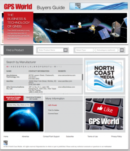
GPS World, the leading publication serving the GNSS Industry, is pleased to announce the industry’s first online buyers guide — gpsworldbuyersguide.com — featuring access to information on hundreds of manufacturers, products and services.
“We’ve taken the GPS World Buyers Guide in print, which we’ve been publishing for 20+ years, to an entirely new level,” said Alan Cameron, editorial director and group publisher of GPS World. “Adding a robust online version offers many benefits to the industry.”
Engineers, integrators, professional end-users and others in search of products and services will continue to have two resources available to them — the print Buyers Guide publishing in June — and the cutting-edge, robust version accessible 24/7 at: gpsworldbuyersguide.com.
Visitors can search for manufacturers by name or location. Products and services are searchable by name or via the following categories:
Vehicle location/tracing workstations and systems (computer-aided dispatch)
These categories are also searchable by sub-categories.
Manufacturers and suppliers are now in control of their listings year-round by having the ability to make listing updates in real time. Listings are free and numerous upgrades are available. Listings found at gpsworldbuyersguide.com will automatically be used to create the print version of the directory.
“GPS World’s new online product offers many economical ways for a manufacturer or supplier to enhance their exposure,” said Steve Copley, GPS World publisher. “We’re excited to offer an online element to our print product and provide a positive experience for users.”
Manufacturers and suppliers are encouraged to review their current listings by using the search functionality found on the directory’s home page. Manufacturers and suppliers not listed in directory are encouraged to create a new listing. All questions relating to the online directory should be directed to Chloe Kalin, Buyers Guide Marketing & Sales Manager, at 216-363-7929.
RIA Novosti is reporting that negotiations regarding the placement of a differential correction and monitoring GLONASS station in the United States have not yet been renewed. The news agency quotes remarks by Grigory Stupak, first deputy general designer of Russian space systems, during the Fourth International School on Satellite Navigation.
In all, 40-50 GLONASS stations are planned for placement around the world, Stupak said. “As for the United States, we now consider the option of placing a station in Alaska, but the lack of it does not significantly affect the performance of our system,” he said, adding that Russia has worked with the southern African region and South America on placement of GLONASS stations, with one station in Brazil already operational. “There also have Cuban colleagues to host GLONASS stations,” he said.
According to Stupak, taking into account developments in the world, it does not make sense to force the negotiation situation by placing a station in Alaska.
GLONASS Satellites Based Mainly on Russian Component Base
The prevailing share of the payload for both GLONASS-M and GLONASS-K spacecraft is created by JSC Russian Space Systems (CSW), but contains an element base of both domestic and foreign production, Stupak said, according to the the GLONASS Herald.
“If you take onboard equipment [for] GLONASS-M, a significant portion of its designers develop mainly on electronic components of domestic production,” Stupak said.
Including onboard equipment, while a significant portion of the GLONASS-M design is based on domestic electronic components, for the GLONASS-K, most of the components are Russian, but some foreign components are also being used.
The U.S. Department of Transportation’s Research and Innovative Technology Administration (RITA), in partnership with the U.S. Coast Guard, is seeking public comments on current and future user needs for the Nationwide Differential Global Positioning System (NDGPS).
The agencies want to know how users use NDGPS, and are seeking ideas for future uses or alternative uses.
According to the notice in the Federal Register,”The NDGPS was designed to broadcast signals to improve the accuracy and integrity of the Global Positioning System (GPS) derived positions for surface transportation, as well as other civil, commercial, scientific, and homeland security applications. This analysis will be used to support future NDGPS investment decisions by the Department of Homeland Security and the Department of Transportation beyond fiscal year 2016. This notice seeks comments from federal, state, and local agencies, as well as other interested members of the public regarding current and future usage of the NDGPS, the need to retain the NDGPS, the impact if NDGPS signals were not available, alternatives to the NDGPS, and alternative uses for the existing NDGPS infrastructure.”
NDGPS is a ground-based augmentation system that provides increased accuracy and integrity of GPS information to users on U.S. land and waterways. The system consists of the Maritime Differential GPS System operated by the U.S. Coast Guard and an inland component funded by the Department of Transportation. NDGPS is built to international standards, and similar systems have been implemented by 50 countries around the world. Modernization efforts include the High Accuracy NDGPS (HA-NDGPS) system, currently under development, to enhance the performance and provide 10-15 centimeter accuracy with integrity throughout the coverage area. For more information about NDGPS, visit the following webpages:
Comments and related material must reach the Docket Management Facility on or before July 15, 2013.
Comments can be submitted identified by docket number USCG-2013-0054 or RITA-2013-0001 using any one of the following methods:
Federal eRulemaking Portal: http://www.regulations.gov.
Fax: 202-493-2251.
Mail: Docket Management Facility (M-30), U.S. Department of Transportation, West Building Ground Floor, Room W12-140, 1200 New Jersey Avenue SE., Washington, D.C. 20590-0001
Hand delivery: Same as mail address above, between 9 a.m. and 5 p.m., Monday through Friday, except Federal holidays. The telephone number is 202-366-9329.
All comments received will be posted, without change, to http://www.regulations.gov and will include any personal information provided.
Nothing can be more certain in today’s economic environment: companies will continue to adjust in order to survive and prosper. Hemisphere GPS has come a long way since its humble beginnings in 1990 in Calgary, Alberta, through to a recent decision to focus on its agriculture business and move its headquarters to Hiawatha, Kansas.
I’ve always had a soft spot for Hemisphere GPS — it grew up alongside NovAtel in Calgary, the company I worked for over many years. I knew a lot of the Hemisphere GPS people and I watched the company wax and wane over the years as it brought other companies into the fold, struggled and often succeeded with integration, with new product development and introduction, and eventually settled into its position as a leader in the GNSS ag business. The company’s recent announcement to sell off its Precision Products and Core GNSS group almost brought a tear to my eye — but it’s really just another step in their ongoing evolution.
Selective Availability. CSI came into the GNSS game back in 1990 when GPS still had to struggle with the inaccuracies of Selective Availability (SA), and it was an initial approach of overcoming SA with differential GPS that got it started. Steven Verhoeff and Michael McCullough got the original company off the ground with the Data Trakdifferential HF unit that was sold into the offshore oil and gas industry, improving 100 meters SA measurements to an accuracy of 5-10 meters. As the U.S. Coast Guard beacon service came online through 1991-1993, CSI jumped on-board with the MBX-1 beacon receiver and business began to take off in early 1994, with significant sales in marine and the newly developing precision agriculture industry.
In order to maintain the rapid growth that CSI had initially experienced, there followed a series of private placements and public offerings that provided the necessary capital needed to sustain growth. The first private placement in Calgary was followed by an IPO on the Toronto Stock Exchange. These funds allowed CSI to not only invest in further beacon receiver development, but also gave it the capability to look at alternative approaches to growth through a series of acquisitions over the next seven years that would change CSI forever.
While the beacon receiver business sustained CSI through many years, by 1999 the talk was that SA would soon be switched off by the U.S. government, putting the need for differential beacon receivers in question. This motivated CSI’s diversification strategy, which saw them acquire Satloc in Arizona. The acquisition added a highly skilled engineering team that had developed the first GPS products for crop duster planes used in the safe and efficient application of chemicals, owning 75 percent of this market. Satloc had also deployed these products into ground-based precision agriculture applications for guidance of tractors, sprayers and other ag equipment.
CSI Wireless. CSI became CSI Wireless in July 2000, following the acquisition of Wireless link Corporation in California, which brought on not only CSI’s entry into the wireless communication market, but also into fleet and asset management, fixed and mobile telemetry, and automotive and consumer telematics markets. To handle this diversity of products and markets, CSI Wireless quickly organized itself into two business units, one for the GPS sector and another handling wireless.
The wireless business went well at first, with revenues of around $200 million between 2000 and 2006, mostly in fixed-base wireless phones sold through Motorola in developing countries without wired communications infrastructures. However, margins fell as completion increased, and the wireless and telematics businesses were to be eventually sold off later in 2006. In contrast during this period, the GPS business thrived.
Outback. Linking up with RHS out of Hiawatha, Kansas, CSI Wireless brought out the Outback-S light-bar guidance systems for retrofit in ground ag. Outback-S quickly became an after-market leader with more than 25,000 units sold. A series of ag guidance derivative products quickly followed as CSI and RHS, operating as a highly successful team, pioneered GPS-based precision agriculture techniques for the mainstream family farm during 2001-2004. e-Dif and COAST — proprietary software technologies — were added to enhance GPS accuracy and reliability without third-party differential corrections and during periods of GPS signal outage.
During the same period, CSI also introduced the Vectorline of GPS heading sensor (compass) products, which re-established a position in the marine market providing heading corrections for seafaring vessels using a technology that was far less expensive and much simpler than competing gyro-compasses — consistent with the performance/value theme established in the family farm market.
CSI also introduced a variety of new GPS and DGPS receivers, including the PowerMAX Bluetooth-enabled DGPS receiver, the Seres integrated DGPS/SBAS smart-antenna system and the DGPS MAX, a high-accuracy GPS receiver integrating GPS, SBAS, WAAS and beacon DGPS.
Hemisphere GPS. Building on the successes that CSI and RHS had enjoyed, in April 2005 CSI announced that the marketing and distribution assets of the Outback Business were to be combined with CSI’s GPS Business Unit to create Hemisphere GPS, with three business units: Ground Agriculture, Air Agriculture and Precision Products. With the addition of the RHS business, the agriculture business unit was suddenly the largest in terms of revenues and set up the goal “to be the global leader in after-market GPS guidance products.” Shortly thereafter, Hemisphere announced that a strategic partnership had been established with CLAAS — one of the world’s top agriculture OEMs — providing it with guidance and auto-steering technology and products for integration with its equipment, all based on the newly developed Crescent receiver. Later in that year, the next-generation Outback S2 guidance product was announced incorporating Crescent technology.
With all three businesses poised for growth, everything seemed set for great things to happen. But the agriculture markets didn’t cooperate and with the wireless group still to be divested; internal costs mounted as sales and margins declined. Before the ship could be righted there were casualties, and unfortunately one of them was the founder and CEO Steven Verhoeff, who left the company in May 2006. Chairman Mike Lang stepped in as interim CEO, and CFO Cameron Olson became interim president. While a CEO search got underway, the cleanup related to the divestment and wind-down of the wireless businesses was completed, and new products in each of the three businesses continued to be introduced. By September 2006, Steve Koleswas was installed as Hemisphere’s next president and CEO, closing a difficult chapter in the CSI story and beginning what everyone hoped would be a phase of recovery.
During 2007 in the Agriculture group, the Outback product family grew with the introduction of the Automate and S-Lite. The Precision Products group also introduced a number of new products, including the LX-1 OmniSTAR-compatible DGPS receiver board and the XF100 receiver for handheld mapping applications.
Total Eclipse. One of the most significant steps forward for Hemisphere came about in 2007 with the release of Eclipse dual-frequency GPS receiver technology. This dramatically extended high levels of precision and reliability into the company’s products. With Eclipse RTK technology, centimeter accuracies were now possible — a dramatic improvement from CSI’s first products that enabled accuracies of around 10 meters.
Making a Beeline. With the return to strong revenues through 2007, Hemisphere felt confident enough to return to its acquisition strategy, and in December it brought Beeline in Brisbane, Australia, into the company fold — adding intelligent high-end GPS guidance and auto-steering solutions for agriculture equipment and autonomous control solutions for other machine control applications. Leveraging highly accurate “steer-by-wire” automatic vehicle steering, the acquisition accelerated the evolution of auto-steering products from hydraulic-based steering to electronic vehicle control, and brought many other talented and experienced engineering employees into the company.
The agriculture markets were extremely robust in North America in 2008, but there was even stronger growth in offshore international markets for the Precision Products group. During 2009, Hemisphere’s AG group introduced the Outback S3, a touch-screen high-end precision guidance terminal that added important new features and enabling entry into new higher-end segments of the market. In the Air group, the Air IntelliFlow dual-rate system was also introduced for aerial applications and the R220 dual-frequency RTK GPS receiver was announced.
Taking a Hit. Then the economic crisis of 2009 hit, and the resultant global recession impacted Hemisphere’s annual revenues significantly — the company experienced its first decline in annual revenues since it went public in 1997. Fortunately, an existing strong balance sheet helped them weather the storm. In late 2009, a “lean forward” strategy and internal restructuring took place, reorganizing each business with its own dedicated Engineering and Marketing teams. This accelerated new product introductions, and 2010 proved to be an all-time high for new product releases.
For the ground AG group, products like Outback eDriveX provided a new level of high-precision AG steering applications and opened up significant new market opportunities. The A220 and A221 dual-frequency smart antennas provided farmers and other machine control customers with RTK level receivers. At that time, the Air group introduced Intellistar and quickly followed with the Satloc Bantam next-generation aerial guidance systems, which were all quite successful. The Precision group also went on to introduce more than a dozen new products, including new Crescent L1-based Vector products under the Hemisphere GPS brand and other private label variants. During this period, the Core GNSS R&D group worked very closely with the Precision group on Vector, Eclipse 2 and the miniEclipse. New antennas were also developed for the new receiver designs, establishing Hemisphere’s Precision group as a significant antenna and board supplier in the OEM market.
With all systems firing, Hemisphere came through the recession of 2010 and 2011 relatively unscathed, and emerged in 2012 to continue with its acquisition strategy. In January, it bought Ag Junction in State College, Pennsylvania, to further its Ag business growth. While John Deere was introducing Farmsight as a soup-to-nuts service for farmers, Ag Junction offered Hemisphere the opportunity to grow alongside, with in-cab real-time crop yield analysis and prescription preparation that is becoming the way ahead for the future of farm automation.
However, despite ongoing revenue growth, Hemisphere continued to struggle with profitability. In a move to reposition itself, in September 2012 the Hemisphere Board decided that a pure play Agriculture focus was necessary for the public company to prosper. Rick Heiniger, a board member since the RHS acquisition in 2005, was appointed Hemisphere’s third third CEO. Rick moved quickly to begin repositioning the public company and recently announced intentions to move the public company’s head office to its Hiawatha, Kansas, Ag distribution center and to divest the Precision and Core GNSS R&D activities.
The Precision/Core business unit remains intact and will continue to be based out of Calgary, Alberta, and Scottsdale, Arizona. It’s understood that new investment is being sought, and that product offerings will continue to be supported and expanded with specific focus on the traditional markets of Marine, OEM, Survey and Machine Control.
So the adventure will continue, but it’s expected to be somewhat different as 2013 rolls forward. As we learn more about the changes at Hemisphere, we’ll be sure to talk with them so we can continue their evolving story.
 With the establishment of the National Executive Committee for Space-Based Positioning, Navigation, and Timing in 2004 and other governing bodies since, NASA has also acted as a thought leader on policy trends in the field, advising on and advocating for protections of GPS , one of the world’s most important and ubiquitous public resources.

 GPS World, the leading publication serving the GNSS Industry, is pleased to announce the industry’s first online buyers guide —