By Li Wang, Director of the International Cooperation Center, China Satellite Navigation Office
By adhering to the principles of independence, openness, compatibility, and gradualness, China is steadily accelerating the construction and development of the BeiDou Navigation Satellite System.
The BeiDou System already provides continuous and reliable Full Operational Services to most parts of the Asia-Pacific region. Its positioning, navigation, and timing performance keeps improving, while the deployment for a global constellation is also making progress. The BeiDou System and its products, which are compatible with other navigation satellite systems, have been gradually applied in many sectors and industries related to the national economy and to entering the mass market.
As one of the four core GNSS service providers, BeiDou has always made unswerving efforts to exchange, coordinate, and cooperate with other organizations, system providers, and users.
BeiDou has been actively engaged in international affairs on the platform of the United Nations, such as participation in related activities held by the International Committee on Global Navigation Satellite Systems (ICG), and coordinated affairs under the framework of the International Telecommunication Union (ITU). It has also pushed forward the integrated applications of BeiDou and other navigation satellite systems in the fields of civil aviation, maritime traffic, mobile communication, and so on.
In order to provide better services for global users, the BeiDou system has carried out exchanges and coordination with the other navigation satellite systems. It has established cooperative mechanisms with GPS and GLONASS, and respectively signed the Joint Statement of U.S.-China Civil Global Navigation Satellite Systems (GNSS) Cooperation, as well as the Memorandum of Understanding between China and Russia on Cooperation in the Field of Satellite Navigation. Furthermore, the cooperation between the BeiDou and Galileo systems has also been included into the China-EU 2020 Strategic Agenda for Cooperation.
Potential areas for cooperation may include compatibility and interoperability, GNSS applications, policies and standards, international GNSS service performance monitoring and assessment, and so on.
Meanwhile, the BeiDou System continues carrying out the BeiDou/GNSS Application Demonstration & Experience Campaign (BADEC) and has negotiated with related countries to jointly establish BeiDou/GNSS Centers. Those centers will implement BeiDou/GNSS popularization, exhibition, application demonstration, and user experience activities, as well as system performance testing and assessment, academic exchanges, training, and R&D, to jointly promote the compatibility and interoperability among the multiple navigation satellite systems, boost the spread of technologies, and improve satellite navigation applications and industrial development..
In 2015, China will continue this effort, launching four to five next-generation BeiDou Navigation Satellites (MEO and IGSO) for testing and verification of new technologies.The BeiDou System with global coverage will completely be established by around 2020. This will enable provision of continuous, stable, and reliable satellite navigation services for global users.
Global navigation satellite systems and related industries are going through an unprecedented revolution. Under such an environment, compatibility and interoperability among systems, and integration of multiple industries, will be the tendencies of future, which will definitely promote wide applications of GNSS in broadening fields. During such a process, the BeiDou System with distinctive characteristics will abide by the objective of “serve the world and benefit mankind,” undertaking the responsibility and obligation to work together with other systems to provide better services for global users.
Li Wang is the director of the International Cooperation Center, China Satellite Navigation Office.
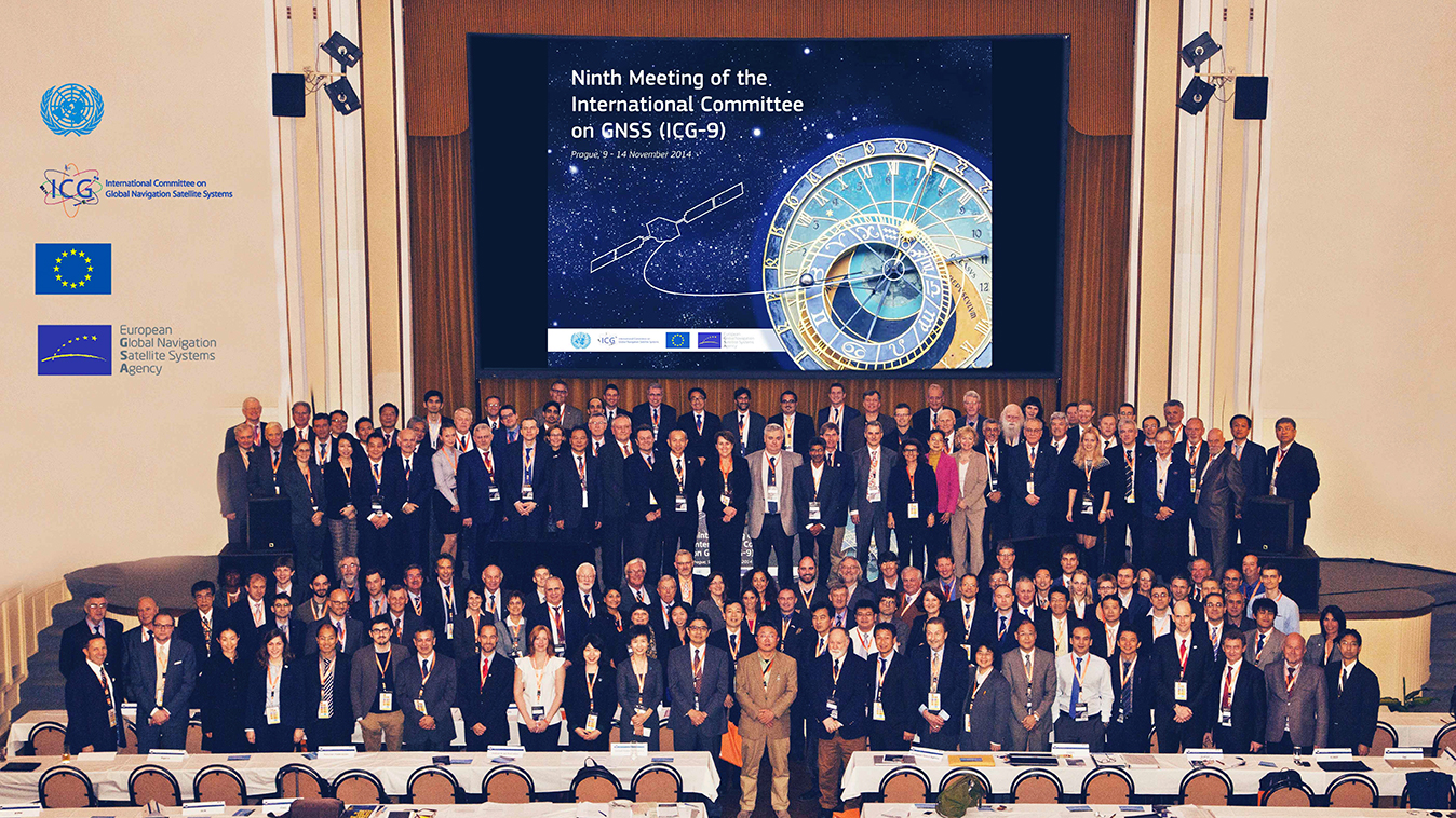
The European GNSS Agency (GSA) hosted the ninth meeting of the International Committee on Global Navigation Satellite Systems (ICG) in November at its headquarters in Prague, Czech Republic. The event is an opportunity for GNSS providers to present the status and future plans for their systems, and an opportunity for ICG members, associate members, and observers to provide updates on recent developments with regard to GNSS services and applications.
Representatives from the world’s leading global and regional GNSS programs were invited to provide the assembly with a “state of play” for their respective systems. Joining GPS, GLONASS, BeiDou, IRNSS/GAGAN, and QZSS was Galileo, represented by Christian Siebert, Head of Unit, Galileo and EGNOS: Applications, Security and International Cooperation, DG Enterprise and Industry, European Commission.
A Secure Foundation
The key message coming from Prague was that, despite the launch anomaly in August, the Galileo program has a secure foundation for moving forward. For instance, it has been given a stable seven-year perspective, a substantial budget, and a new exploitation-driven governance scheme. In terms of budget, the European Commission has allocated €1.930 billion for deployment and €3 billion for exploitation — with an additional €1.580 billion allocation for European Geostationary Navigation Overlay Service (EGNOS) exploitation.
The new governance scheme is based on a recently announced agreement between the European Commission and the GSA; the agreement delegates a range of exploitation tasks for Galileo to the GSA. Serving as an initial step towards the full Galileo Exploitation Phase, the GSA’s responsibilities now include:
provision and marketing of the services;
management, maintenance, continuous improvement, evolution and protection of the space and ground infrastructure;
research and development of receiver platforms with innovative features in different application domains;
development of future generations of the system;
cooperation with other GNSS;
all other required activities to ensure the development and smooth running of the system.
This new budget and governance structure ensures the Galileo program’s stability for the next seven years, according to a GSA press release. The agency will progressively manage exploitation activities as delegated by the European Commission, which serves as the program’s supervisor.
At the same time, the European Space Agency (ESA) will continue its role for system design and development.
A Range of Successes
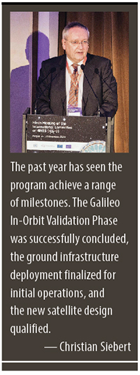
“The past year has seen the program achieve a range of milestones,” said Siebert. “The Galileo In-Orbit Validation Phase was successfully concluded, the ground infrastructure deployment finalized for initial operations, and the new satellite design qualified.”
Even with the satellite launch anomaly that left two satellites in the wrong orbit, the ESA just announced that one of these satellites will soon make a series of maneuvers as a prelude to its health being confirmed. The aim is to raise the lowest point of its orbit — its perigee — to reduce the radiation exposure from the Van Allen radiation belts surrounding Earth, as well as put it into a more useful orbit for navigation purposes. If the operation is successful, the second satellite will follow suit.
As to the cause of the anomaly itself, Siebert said Arianespace has established an inquiry board to investigate, and the European Commission and ESA continue to analyze the best options for recovering the initial mission to the best possible extent. A new launch sequence will be confirmed in the near future.
That being said, the deployment plan for the Galileo constellation is secured, with 26 satellites ordered (four IOV and 22 FOC) and launcher service contracts for the full constellation signed with Arianespace. As to the new satellite design, production proceeds at a good pace, with full operational capability (FOC) satellites being built by OHB Systems and navigation payloads provided by Surrey Satellite Technology Ltd.
In terms of services, the Search and Rescue Forward Link Alert Service successfully tested the networked ground segment last April, and positioning accuracy exceeds expectations.
As to the Commercial Services Demonstrator, the main objective of the demonstrator was to test and characterize the high accuracy and authentication performance obtainable with the Galileo Commercial Service. The first results are extremely promising, with high accuracy already demonstrated through PPP information transmitted via E6B and used to enhance both Galileo and GPS.
Siebert noted that the ongoing Receiver Test Campaign supports manufacturers to ensure that Galileo is well implemented in chipsets and receivers. To accomplish this, the program continues to develop dialogs with the user/receiver segment to understand the market situation and follow up adoption of Galileo.
Looking Ahead
With this secure foundation, looking towards 2015 and beyond, Galileo is set to deliver a reliable, high-quality service to the world, according to EC and ESA spokespersons presenting at the ICG. “With its substantial budget and exploitation-focused governance scheme, it will continue to evolve and introduce innovative features,” Siebert affirmed.
Next steps for the program include a gradual introduction of the early phase of service delivery, which will rely heavily on interaction with users. Early services will be run with continued infrastructure deployments. The program will soon conduct a service validation campaign, along with finalizing the Commercial Service definition and developing a long-term service plan.
“This service plan will be aligned with the trend of most user communities moving towards service levels based on a multi-constellation approach,” concluded Siebert. “Knowing this, it is crucial to continue to improve signal compatibility and interoperability of the Galileo service with other providers and cooperate on building multi-constellation programs.”
By Colonel William T. “Bill” Cooley, U.S. Air Force, Director, Global Positioning System
Last year in my “Directions” article, I emphasized the commitment made by the U.S. government to ensure GPS signals are available to all users, and I shared some of our excitement in the GPS Directorate regarding the modernized capabilities we are developing and fielding. This year I’d like to share with you progress we’ve made in the past 12 months, provide an update on the modernization initiatives, and challenge civil users and receiver companies to innovate and accelerate these modernized capabilities for users worldwide.
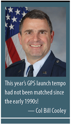
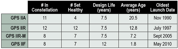
This past year has been productive for the GPS program. The most visible progress was the addition of four new Boeing-built GPS IIF satellites to the GPS constellation, bringing the total number of available satellites from 36 to 39 (SVN-33 was safely disposed in October 2014, or the number would be 40). These additions also reduced the average age of the satellites on orbit from 11.1 to 10.3 years. This year’s GPS launch tempo had not been matched since the early 1990s! Table 1 lists the current satellites in the constellation by block.
TABLE 1. GPS constellation as of October 31, 2014.
Perhaps the most exciting aspect of the GPS satellite constellation is the ever-improving performance. As I mentioned last year, the 2008 Standard Positioning Service (SPS) Performance Standard, issued by the Office of the Secretary of Defense, codifies our commitment to civil users. Among other attributes that make GPS the “gold standard” for positioning, navigation, and timing (PNT), the SPS requires a signal-in-space (SIS) user range error (URE) of 4.0 meters or less for every healthy satellite. The SIS URE is the difference between a GPS satellite’s navigation message (for example, ephemeris data and satellite clock correction data) versus the truth (for example, satellite transmit antenna location and satellite clock offset from GPS time). While the commitment of the U.S. government is four meters or less, the actual average performance over the past year has been 0.68 meters and in the past quarter has been an impressive 0.63 meters!
While this is admirable, continued modernization efforts will allow us even better performance. A significant contributor to the errors experienced by GPS receivers are ionospheric delays that can be eliminated only with knowing the characteristics of the ionosphere (free electron density in the region roughly 100-1,000 kilometers above the Earth’s surface) or by using two signals at different known frequencies. While systems like Federal Aviation Administration Wide Area Augmentation System (WAAS) and the U.S. Coast Guard National Differential GPS (NDGPS) provide a modeled approximation of the ionosphere, the new L2C and L5 civil signals on the GPS IIR-M, GPS IIF, and soon-to-launch GPS III satellites enable GPS receivers to directly measure and eliminate the ionospheric delays altogether — thereby delivering on the GPS modernization program first announced in 1999. These new signals began pre-operational Civil Navigation (CNAV) message broadcast on 28 April 2014 (with the L2C signal set “healthy” and L5 set “unhealthy” until sufficient monitoring capability is established).
With CNAV now on the air, civil users should take advantage of it. My challenge to commercial receiver companies and innovators is to incorporate the modernized signals in future receivers and continue to improve user experience and GPS performance. Currently 14 L2C-broadcasting satellites are in the constellation, and by early 2016 we expect to have 19 on-orbit and transmitting L2C (7 GPS IIR-Ms and 12 GPS IIFs). GPS modernization is well on its way from a signal-in-space perspective; receiver manufacturers and innovators must bring new, improved products and solutions to users.
Less visible but real progress modernizing the GPS Enterprise is underway with the next generation of GPS satellites, ground control, and user equipment segments. The first GPS III satellite and the newly developed navigation payload have been delayed approximately two years from the original planned delivery of the completed GPS III satellite of October 2014. But in September of this year, the GPS III navigation payload was shipped from Exelis (the payload subcontractor) in Clifton, New Jersey, to Lockheed Martin’s (GPS III prime contractor) facility in Waterton, Colorado. There, it completed the payload-level thermal vacuum testing at the end of October, a key step toward payload and eventually satellite vehicle delivery. The first GPS III satellite is now 87% complete and the program is making solid progress.
The GPS Next-Generation Operational Control System (OCX), with Raytheon as the prime contractor, experienced significant challenges in development but can also claim measurable progress this year. Complex cyber-security requirements and their implementation drove a significant number of these challenges, but are essential to provide civil and military GPS users with a secure and resilient command and control system. These and other challenges resulted in significant cost and schedule overruns and a two-year delay to the program, which drove an update to the development plan. The revised OCX plan reflects the complexity of implementing these unique cyber requirements and accounts for planned improvements to Raytheon’s systems engineering and software development approach. The plan establishes a schedule meeting GPS III’s projected first-launch date.
Despite its challenges, OCX development completed four end-to-end space-to-ground launch readiness exercises with GPS III, as well as entered the formal integration and test phase. The new monitoring station receivers are entering qualification test, and the first production receiver is on track to be delivered in spring of 2015. OCX is on track to provide robust PNT services, improvements in URE accuracy, enable access to new military and civil signals, and provide cyber security for the GPS ground control.
Our development of Military GPS User Equipment (MGUE) is another area where we have made important strides this past year. We started the year by developing a commercial market-based acquisition approach that will accelerate delivery of MGUE systems by years. In this effort, we want to establish a race to a certified marketplace where the U.S. government serves as the race official while our industry partners set their own pace to deliver capability. Our goal is to increase speed of delivery to the warfighter while capitalizing on industry’s ability to innovate.
Our MGUE team of government and industry partners (Rockwell Collins, Raytheon, and L3) successfully completed major system design reviews demonstrating a readiness to define the process of security and compatibility certification. Additionally, the team participated in the GYPSY Juliett multi-service, multi-nation PNT demonstration hosted by the U.S. Strategic Command this past summer. While we battled the elements through two hurricanes, the team successfully demonstrated the capability of M-Code receiver cards in an operational demonstration. Our goal is to enable full operational testing with four lead platforms in summer 2016.
While many risks and challenges to GPS modernization still lie ahead of us, the persistent effort by the GPS team has produced important progress in 2014 across the space, ground, and user equipment segments.
A civilian GPS user recently thanked me for providing the incredibly useful utility free to everyone around the globe. Although my impulsive response was to say simply, “You’re welcome,” I’d like to provide a more thoughtful and thorough reply that recognizes those responsible for GPS.
There are two key groups to thank for GPS: the first is the men and women across the United States government and industry who develop, field, and operate the GPS Enterprise. Among this group are satellite factory technicians, software engineers improving the ground segment, receiver designers, program office engineers, and satellite operators continuously monitoring the constellation, updating each GPS satellite’s clock correction and ephemeris data 24/7. This team works with an unwavering passion for this mission that inspires me every day.
The second group responsible for GPS is the American taxpayer who, through Congress, funds the GPS Enterprise every year.The U.S. financial commitment to GPS is not just for U.S. security or the well documented positive impact GPS has on the American economy, but for the benefit of the entire world as a global utility. GPS is the gold standard for PNT because American taxpayers continuously provide fiscal support so the GPS Enterprise’s men and women can design, produce, field, and maintain the global utility that we all have come to depend on.
Thank you for supporting this enterprise, and know that the GPS team works hard to ensure those resources are spent wisely to provide continuously improving, predictable, and dependable performance from the Global Positioning System.
Colonel William T. Cooley is director, Global Positioning Systems (GPS) Directorate, Space and Missile Systems Center, Air Force Space Command, Los Angeles Air Force Base, California.
 By Li Wang, Director of the International Cooperation Center, China Satellite Navigation Office