Tag: drone survey

  • Wingcopter drones conduct aerial surveys in Japan

    Wingcopter drones conduct aerial surveys in Japan

    Wingcopter’s authorized partner in Japan, ITOCHU Corporation, has signed a Memorandum of Understanding (MOU) to collaborate on the practical use of Wingcopter’s long-range drones in aerial surveying together with PASCO Corporation and YellowScan Japan.

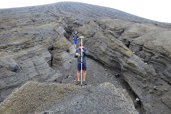
    The companies initially plan to use the Wingcopter 198 in disaster management where drone-based surveying is playing an increasingly important role,

    • to create hazard maps and monitor ground deformation as part of effective pre-disaster prevention,
    • to gather information and assess damage in the event of a disaster, and
    • to measure terrain changes and develop recovery plans during post-disaster restoration.

    According to Wingcopter, carrying out these tasks is easier and less risky with fixed-wing drones such as the Wingcopter 198 than with traditional human or aircraft-based methods.

    About 70 percent of Japan’s land consists of mountainous and hilly terrain, with steep slopes and short, fast-flowing rivers. Conventional multicopter droneswould not be suitable for such tasks as they are limited in range and coverage compared to the Wingcopter 198.

    Image: Wingcopter
    Image: Wingcopter

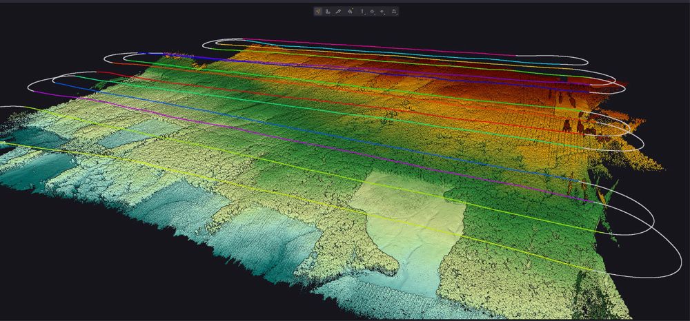
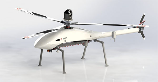
    Under the MOU, YellowScan Japan’s advanced lidaer scanner Voyager will be used on the Wingcopter 198. By integrating this technology with PASCO’s extensive expertise in operational quality and safety in aerial surveying, it is possible to carry out long-distance and large-area surveys that were previously difficult to achieve without manned aircraft. 

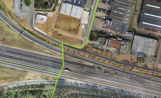
    In a single 45-minute flight, the Wingcopter 198 can scan 1,000+ hectares, simultaneously capturing lidar and RGB data, allowing the system to generate an exceptionally high point density and precision. This makes it suitable even for demanding applications.

    The collaboration also promotes automation and labor savings in surveying tasks, contributing to sustainable development in the surveying industry and reducing disaster risks.

  • SPH Engineering’s UgCS software now supports Velos UAV helicopter

    SPH Engineering’s UgCS software now supports Velos UAV helicopter

    The Velos UAV helicopter has passed field tests to become the first single-rotor helicopter supported by UgCS software, according to UgCS maker SPH Engineering. UgCS now enables Velos helicopter professionals to use Velos for photogrammetry and lidar drone surveying missions.

    UgCS is now able to support the twin-engine telemetry providing input for a UAV. Its newly created Telemetry Viewer can handle extensive telemetry from such complex drones. This allows for optimal flying of the Velos helicopter with a fully redundant twin-motor design and double key components.

    UgCS allows for the control and monitoring of one or multiple Velos helicopters on a single mission in both single and multi-operator modes.

    Photo: Velos UAV
    Photo: Velos UAV

    The field tests were initiated and conducted by GeoInspect, the first company to use c with its Velos helicopter. The new solution allows professionals to fine-tune projects, resulting in maximum performance and very high usability. One of the projects was a fully autonomous test flight with UgCS.

    “GeoInspect has been performing lidar surveys successfully with UgCS for many years,” explained Bart Zondag, GeoInspect founder. “Having started with the M600 model, UgCS is now used to support single-rotor UAVs. We have already delivered a Velos V2 with UgCS to one of our customers to the EU Nordics to perform lidar forestry surveys.”

    Learn more about the solution by joining a free Zoom webinar on March 4, 2021.

  • Land ho! Uncharted island ahead

    Land ho! Uncharted island ahead

    A new island near Tonga has officially been surveyed, courtesy of Goddard NASA scientist Dan Slayback.

    Most new islands vanish as fast as they appear from punishing ocean waves, but this one is different. It’s one of only three volcanic islands to live longer than a few months in the past 150 years, and the first survivor since satellites began collecting Earth imagery.

    “There’s no map of the new land,” Slayback said. The island, nestled between two older islands, erupted from the rim of an underwater caldera in early 2015. The older islands were on some nautical charts at coarse resolution.

    Slayback has been watching the island via satellite since its birth, trying to make a 3D model of its shape and volume as it changes over time to understand how much material has been eroded and what it is made of that makes it partially resistant to erosion. But while high-resolution satellite observations provide some data, nothing beats a visit.

    On Oct. 9, 2018, Slayback and students with the Sea Education Association (SEA) measured the location and elevation of boulders and other erosional features visible in the satellite image. Using a high-precision GPS unit with a rover and base station, Dan and the students took about 150 measurements that narrow down each point’s location and elevation to better than 10 centimeters. They also used a drone to conduct an aerial survey of the island for another layer of observations to make a high-resolution 3D map.

    The elevation changes were more dramatic than Slayback expected. The data that the team gathered on the ground will help scientists hone the model they use to convert satellite images to ground heights, according to NASA.

    NASA scientists are keen to understand how new islands form and evolve on Earth; the knowledge may provide clues about how volcanic landscapes interacted with water on ancient Mars.

    Photo: NASA
    Photo: NASA

    Photo: NASA
    Photo: NASA

  • Virtual Surveyor adds functionality for larger drone survey projects

    Virtual Surveyor adds functionality for larger drone survey projects

    Virtual Surveyor drone surveying and mapping software has added new functionality that enables users to process larger projects without buying more powerful computers or cloud services, according to the company. This addition is one of several included in Virtual Surveyor 6.2.

    “Our objective with Version 6.2 is to make our users more productive while saving them money by eliminating the need to invest in new hardware or processing services,” said Tom Op ‘t Eyndt, CEO of Virtual Surveyor in Belgium. “We have addressed the fact that drones are capturing more data at higher resolution, resulting in enormous files sizes.”

    According to the company, Virtual Surveyor 6.2 solves the problem of large files by offering enhanced clipping and mosaicking functionality. The new version allows users to merge multiple smaller processed pieces of orthophotos and digital surface models into a single project and create smooth edges between these pieces with the new clipping tool. The mosaic can then be exported to a new tiff file or serve as the basis for a full area virtual survey.

    In addition, Virtual Surveyor 6.2 offers a 3D Fly Through capability that allows users to select spatial bookmarks and waypoints in their scene and create a movie that allows the viewer to fly through the terrain in three dimensions.

    Virtual Surveyor 6.2 also features improved surface handling for volume calculations. This feature was developed primarily for users who measure volumetrics of material piles in drone survey data. This capability makes it easy to represent topographies as triangles, contour lines or outlines without creating three different objects, the company said.

    Other enhanced features of Virtual Surveyor 6.2 include a renumbering tool that allows users to select a set of times, features or geometries in the data set and automatically number them sequentially from any chosen starting number; concave hull extraction that allows users to select a section line to create a surface for a curved roadway; and boundary selection that allows users to trace around an unwanted feature and delete that object and all the points within it.

    “The advantage of Virtual Surveyor is that it combines the interpretation skill of a professional surveyor with computing power to create standard survey products,” said Op ‘t Eyndt. “Surveyors can now accomplish more in Version 6.2 without expensive upgrades to other aspects of their workflow.”


    Featured image: Virtual Surveyor