Tag: earthworks

  • Trimble announces new products at Dimensions conference

    Trimble announces new products at Dimensions conference

    Trimble introduced several new products at its annual Trimble Dimensions user conference, taking place Nov. 5-7 in Las Vegas.

    Photo: Trimble
    Photo: Trimble

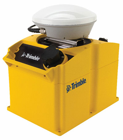
    GNSS Smart Antennas for Civil Construction. The new SPS785 GNSS smart antenna is a fully capable GNSS receiver that features high-quality GNSS accuracy at a lower price point. The SPS785 has full satellite coverage with the combination of GPS and all GNSS constellations. A seamless workflow with the Trimble Siteworks Positioning Systems means that everyone on the jobsite can use the same data and work on the same platform.

    For added protection, the SPS785’s radio antenna fits inside the range pole. The lightweight and compact design enables contractors to work longer with less fatigue.

    Also, a new dynamic tilt functionality was added to the Trimble SPS986 GNSS smart antenna. The SPS986 is specifically designed for rugged jobsite measurement applications, and is now available with a dynamic tilt upgrade. The dynamic tilt feature allows for faster data collection to enable construction surveyors to create larger digital terrain models faster and with improved accuracy. It is designed to capture higher accuracy measurements on steeper slopes from a moving vehicle and more accurate volume measurements to save time and money on material planning.

    The dynamic tilt measurement mode also auto-measures antenna height. From inside the vehicle, contractors can set the height of the antenna and quickly interrogate surface models using the real-time 3D surface display in Trimble Siteworks field software.

    The Kestrel seismogeodetic system. (Photo: Trimble)
    The Kestrel seismogeodetic system. (Photo: Trimble)

    Kestrel Seismogeodetic System. Trimble RTX technology is now delivered via satellite to the Kestrel seismogeodetic system for earthquake, volcano and infrastructure monitoring. Designed for scientists and structural engineers, Trimble’s Kestrel pairs uninterrupted, high-quality GNSS positioning corrections with seismic data — for Earthquake Early Warning (EEW), volcano and infrastructure monitoring of bridges, dams, towers and other civil structures.

    In addition to internet-delivered Centerpoint RTX corrections, the Kestrel system also now supports L-band satellite delivered RTX corrections. This ensures corrections are not affected during communication delays or outages that occur during natural disasters. CenterPoint RTX enables centimeter-level absolute positioning, which is critical when analyzing and responding to the movement of a structure.

    Field Staking and Design Solution for Electric Utilities. Trimble Field Designer is an innovative mobile staking and design solution that enables electric utilities to quickly design overhead and underground electric utility lines on mobile devices in the field.

    Trimble Field Designer leverages mobile technology from Trimble business partner GeoSpatial Innovations, Inc. (GSI). It was developed to add new field staking and design capabilities to Trimble’s Network Information System (NIS), a network asset management solution. At the heart of Trimble NIS is a fully connected “live” network model built on a single database that provides for comprehensive documentation, topology and full life-cycle support of electric utility network assets.

    Trimble Field Designer enables electric utilities to:

    • Capture pole locations efficiently and accurately
    • Measure distances, angles, elevations, offsets, and bisectors
    • Assign construction units to locations and spans for material and labor requirements
    • Capture comments and information about design
    • Reduce design time
    • Eliminate redundant data entry in the office.

    Earthworks Grade Control Platform version 1.7. The latest version of Earthworks provides support for motor graders and automatic guidance for tiltrotator attachments. Trimble Earthworks for Motor Graders is a GNSS-based, 3D-grade control solution designed to make fine grading more accurate, faster and easier. In addition, Trimble Earthworks now gives excavator operators using tiltrotators the advantage of automatic machine control, which can result in increased productivity.

  • Drone platform guides earthworks projects

    Drone platform guides earthworks projects

    Kespry now offers a suite of capabilities that extends the value of aerial intelligence to the full life cycle of planning, bidding and managing earthworks projects in the major site construction industry.

    The company is focused on making it easier to capture, process, use and share high-resolution information from the field with its fully autonomous aerial intelligence system.

    Capabilities include grade planning and analysis, site and surface comparison including cut/fill visualization, and design plan development and compliance.

    Compared to other drone mapping solutions, the earthworks-specific tools enable construction companies to more accurately plan the work, improve their cost structure, and deliver safer working environments through frequent analysis of changes to the site, according to Kespry.

    The new capabilities are a result of customer and partner feedback, including from John Deere, dealers and clients.

    The new earthworks capabilities provide:

    • Faster and more accurate production of earthwork grading plans through on-demand drone data capture and analysis. Mass haul plans can be easily developed before projects begin with an entire site mapped and analyzed in hours. New tools also enable haul road planning to support more efficient site planning.
    • Reduced costs for grading project bids, with project estimates delivered faster than with traditional estimating techniques. Ongoing operational costs are also reduced with on-demand cut/fill analysis enabling close management of the project and specific bid requests.
    • More efficient and safer project operations with progress comparisons delivered through daily drone flights. This enables design plan comparison through project plan overlay onto Kespry data, reducing the complexity and cost of rework. Safety can also be improved through close monitoring of change and analysis of grades around the site.
  • Next-generation of grade control integrates 3D automatics

    Next-generation of grade control integrates 3D automatics

    (Photo: Trimble)

    Trimble is offering Trimble Earthworks for Excavators and Earthworks for Dozers. Trimble Earthworks is transforming machine control with integrated 3D aftermarket excavator automatics capability.

    In addition, a new dozer configuration moves the receivers from the blade to the roof of the cab. Reengineered from the ground up, Trimble’s innovative, next generation grade control platform features intuitive, easy-to-learn software that runs on an Android operating system.

    State-of-the-art software and hardware gives operators of all skill levels the ability to work faster and more productively than ever before, Trimble said.

    “Trimble pioneered machine control,” said Scott Crozier, director of marketing for Trimble Civil Engineering and Construction. “Now, Trimble Earthworks takes machine control to the next level, with a platform that reinvents machine control technology, making it easy to use and learn, and more accessible for many different types of contractors.”

    Live demonstrations of Trimble Earthworks for Excavators and Trimble Earthworks for Dozers will be showcased at ConExpo 2017, March 1-7, one of the world’s largest international exhibitions for the construction industry. Trimble will be located in the Las Vegas Convention Center North Hall #N-12067.

    Intuitive Software. The Trimble Earthworks grade control application is built on the Android operating system, and runs on the new 10-inch (25.7 centimeter) Trimble TD520 touch-screen display. The Earthworks application was developed based on feedback from construction equipment operators around the world, resulting in an interface optimized for productivity.

    Colorful graphics, natural interactions and gestures, and self-discovery features make the software intuitive and easy to learn. Each operator can personalize the interface to match their workflow and a variety of configurable views make it easier to see the right perspective for maximum productivity.

    In addition, Earthworks allows data files to be transferred to or from the office wirelessly and automatically so that the operator is always using the latest design. Using the Android operating system, users can download other applications that provide the operator with additional useful tools inside the cab. To make the system even more flexible, contractors can use the Trimble TD520 display or a third-party Android device.

    Excavator Automatics. With Trimble Earthworks, contractors can now take advantage of the first integrated 3D aftermarket grade control automatics for excavators, allowing operators to create smooth, flat or sloped surfaces more easily.

    When the excavator is placed in Autos mode, the operator controls the stick, and Trimble Earthworks controls the boom and bucket to stay on grade, reduce overcut and increase production. By automating excavator operation, Trimble Earthworks allows operators to achieve grade consistently, with high accuracy and in less time.

    Mastless Dozer Configuration. Trimble Earthworks for Dozers mounts dual GNSS receivers on top of the cab to eliminate masts and cables traditionally located on the blade. The dual-GNSS receivers are ideal for steep slope work and complex designs with tight tolerances. The new configuration keeps valuable receivers safer and can also save contractors time by reducing the time needed to remove and reinstall them each day.

    Trimble Earthworks for Excavators is expected to be available globally in the second quarter of 2017 from the SITECH dealer channel. Trimble Earthworks for Dozers is expected to be available in the second half of 2017 from the SITECH dealer channel.

  • Carlson GIS360 for Android Gives 3D Views on Site

    Carlson GIS360 Android app.
    Carlson GIS360 Android app.

    Carlson GIS360 for Android, new from Carlson Software and Carlson EMEA, is a mobile field GIS-GPS tool that uses both GIS and surveying technologies for field data collection. The app is designed to be easy to learn and easy to use, Carlson said.

    “Taking advantage of the graphics processing power of Android devices, GIS360 now includes an innovative 3D viewer so the user can see data and models in 3D on site,” said David Loescher, Carlson U.K. sales director and director of GIS360 development.

    In addition to allowing field crews to navigate maps and collect and report data in the field, GIS360 provides the data and fully rendered models of mines, earthworks and pipe networks that can be viewed in 3D. The software’s Siteview function uses the Android devices’ built-in GPS, compass and gyros to give the user the view of the site in front of him.

    Carlson GIS360 provides a wireless connection to any map server of choice, so users are never without a map. This saves considerable time and effort as field crews can verify that all of the data collected is accurate before leaving the site, Carlson said. No costly site revisits are necessary and no office work is needed.

    The software’s cloud options provide backup for users’ data, enabling it to be shared between field and office in real time. GIS360 goes beyond positioning with a range of tools for mobile workforce management, GPS data collection, tracking and asset maintenance.

    On an Android tablet or smartphone, Carlson GIS360 for Android can take GIS data anywhere. The built-in GPS and compass instantly calculate what the user is looking at and then displays the data automatically.

    “The GIS360 development team set out to make the collection of asset information easier and more efficient by combining the power of GIS360 with affordable Android devices,” added Loescher. “The result not only saves a lot of field time, but also makes the process far easier for everyone concerned.”

  • Trimble Adds Compaction System for Bulk Earthworks and Landfill Operations

    Trimble has released a new GNSS-based machine control solution to improve efficiency of bulk earthworks and landfill compaction operations. Installed on a four-drum soil or landfill compactor, the Trimble CCS900 Compaction Control System allows a machine operator to make more uniform and efficient passes, report compaction production data in the field, and ensure target compaction is reached with minimal fuel usage and machine wear.

    The announcement was made at WasteExpo 2014, North America’s largest solid waste and recycling tradeshow.

    CCS900 for Bulk Earthworks. The CCS900 system tracks compaction passes in real time with easy-to-read color mapping on the in-cab display. It improves bulk earthworks operations by ensuring fill material is adequately balanced and uniformly compacted from the bottom up.

    CCS900 for Landfills. Landfill operations require contractors to compact the maximum amount of waste into the smallest area of vertical and horizontal cell space. Using CCS900, landfill owners can ensure that cell space is optimized, voids are eliminated and layers are compacted to their target density more efficiently. With real-time mapping on the in-cab display, the operator can avoid unnecessary passes that waste fuel and cause additional wear on the machine. The system also collects as-built layer information for in-field reporting and tracking of daily volumes.

    In-Field Reporting and Printing for Quality Control. For both soil and landfill applications, Trimble CCS900 offers extensive in-field reporting options, including in-cab report generation and printing. This functionality allows compaction production analysis to be carried out in the field instead of waiting until data is transferred back to the office. Compaction progress and problem areas are indicated on the in-cab graphical control box and listed in the in-field report so they can be addressed immediately, instead of at project completion when re-work is more costly. An optional serial printer in the compactor cab also enables supervisors to sign off on the completion of the compaction work in the field.