Tag: eBee

  • UAV company AgEagle to acquire senseFly from Parrot

    UAV company AgEagle to acquire senseFly from Parrot

    AgEagle will acquire senseFly, a Parrot Group subsidiary, for US$23 million.

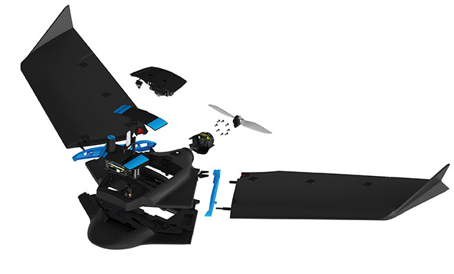
    AgEagle Aerial Systems Inc. is a a provider of drones, sensors and software, and Parrot is a European drone company. Founded in 2009, senseFly develops and produces a proprietary line of eBee-branded, high performance, fixed wing drones for professional use.

    Photo: SenseFly
    The eBee Geo drone was introduced in March. (Photo: SenseFly)

    The development positions AgEagle to provide a full-stack fixed-wing drone solution for agriculture, government, engineering and construction, among other industry verticals. SenseFly also brings to AgEagle solid engineering talent focused on advanced research and development, a well-established global reseller network, and a strong portfolio of intellectual property, AgEagle stated in a press release.

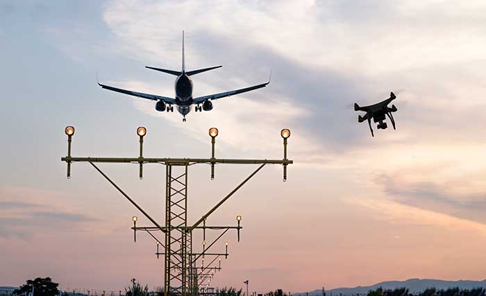
    The eBee drones are designed to be safe, ultra-light and easy to use. They are in use by thousands of customers around the world in agriculture, government, engineering and construction to collect aerial data. Headquartered in Lausanne, Switzerland, senseFly employs 90 people, generating total annual revenues of US$12.5 million in 2020.

    “Recognized as the producer of the world’s most widely used fixed wing drones, senseFly is an ideal strategic fit for AgEagle,” said Brandon Torres Declet, chief executive officer of AgEagle.

    Moving forward, Parrot will focus its expertise and resources on the growth of its professional quadcopter drone equipment and drone data analysis software activities, according to Parrot founder and CEO Henri Seydoux. “The transaction will provide additional cash and lower operational expends to drive Parrot’s growth and industry standing,” Seydoux said. “With the capabilities of the ANAFI line of professional drones and of the Pix4D software suites, Parrot will continue to address its core market segments: 3D mapping, surveying and inspection, agriculture, and defense and security.”

    In tandem with the closing of the acquisition, which is expected shortly, Labossiere will resign as CEO of senseFly. Michael O’Sullivan, who previously served as the company’s head of global marketing, will be appointed managing director of the new AgEagle subsidiary. All other senseFly employees will retain their current responsibilities.

    For details relating to the terms and conditions of the acquisition, refer to the Form 8-K to be filed by AgEagle with the U.S. Securities and Exchange Commission upon closing of the transaction and accessible at www.sec.gov.

  • Conducting integrated drone surveys at a congested airport

    Conducting integrated drone surveys at a congested airport

    Photo: Joel Papalini/iStock / Getty Images Plus/Getty Images
    Photo: Joel Papalini/iStock / Getty Images Plus/Getty Images

    Airports are extremely congested spaces, both on land and in the air, making it difficult to conduct surveys that provide insights into their continued monitoring and maintenance.

    UAVs create the opportunity to survey such sites safer and faster, reducing disturbances to everyday operations while collecting a level of detail unparalleled by conventional surveying techniques to locate and accurately capture areas in need of maintenance and management on airport runways.

    Following several drainage and grading issues throughout a 650-acre airport, Texas-based civil engineering company Gessner Engineering was contracted to provide surveying services to identify the most problematic regions.

    The team had to conduct the survey with minimal impact on runway operations. By coordinating with the airport’s air traffic controllers, the team planned a 6–8-hour flight window, with just a few pauses for ongoing traffic, while the airport operated as usual.

    Before the flight, the surveyors used senseFly eMotion flight-planning software to carry out pre-flight risk assessments and plan flights. During the survey, four 20-minute flights were completed with the senseFly eBee fixed-wing drone. With its fully autonomous and easy-to-use aerial mapping capabilities, the eBee was able to capture the high-resolution aerial photos needed to map the entire airport. The data was processed using Pix4D Mapper to generate a topographic model including a point cloud with a ground sample distance of 1.5 inches.

    The point cloud was so comprehensive, it brought attention to four more areas with drainage issues, providing a level of detail that would not have been possible using only a ground GNSS base station. The UAV survey took one day, compared to four weeks for traditional surveying. This cut the project time in half and significantly reduced disturbances to airport operations.

    “The savings in manpower with the shorter surveying time, accurate data retrieved, and the additional drainage issues identified demonstrate the value of drones, as an enabler of solving complex challenges in congested airspaces, especially where time is limited,” said Troy Hittle, general manager, North America, SenseFly. “The success of this project by using UAV equipment has offered new possibilities to both Gessner Engineering and the future of aviation maintenance.”

  • SenseFly and Trimble optimize workflow for geospatial drone operators

    SenseFly and Trimble optimize workflow for geospatial drone operators

    Photo: Sensefly
    Photo: Sensefly

    SenseFly is partnering with Trimble to optimize the drone mapping workflow for geospatial professionals.

    The new integration is designed to ensure a smooth end-to-end mapping drone workflow. senseFly operators can now, within the recently launched eMotion 3.5 software, transform a senseFly S.O.D.A. camera’s georeferenced imagery into an automatically collated project (in .jxl format).

    This enables the one-click import of drone imagery into the Trimble Business Center Aerial Photogrammetry module without the need for manual project creation and organization of images.

    The senseFly-to-Trimble mapping workflow includes:

    • planning and monitoring a senseFly S.O.D.A.-based drone flight (in eMotion 3.5)
    • downloading the drone’s images for one-click georeferencing in eMotion 3.5 (Flight Data Manager)
    • clicking to create a .jxl format mapping project
    • opening a project within the Trimble Business Center Aerial Photogrammetry module
    • processing the drone’s imagery to generate orthophotos, contour maps, point clouds, digital surface models (DSMs) and feature maps
    • analyzing and acting upon the data.
    Screenshot: Trimble
    Screenshot: Trimble

    “Making work easier and more efficient for geospatial professionals is the goal that drives every solution we develop,” said Jean-Christophe Zufferey, senseFly co-founder and CEO. “Therefore, we are excited to collaborate with Trimble on more tightly integrating our solutions, since enhancements such as this new eMotion-to-Trimble Business Center workflow do exactly that, ensuring that the transition from data collection to acting upon this data is as seamless as possible.”

    The senseFly S.O.D.A. is built for professional drone photogrammetry work. The 1-inch, 20-megapixel RGB camera captures sharp aerial images across a range of light conditions, allowing senseFly fixed-wing drone operators to produce detailed, vivid orthomosaics and ultra-accurate 3D digital surface models.

    senseFly S.O.D.A. is compatible with most senseFly fixed-wing mapping drones, including the large-coverage eBee Plus.

    Trimble Business Center allows surveyors and other geospatial professionals to combine aerial photography with data collected from GNSS receivers, total stations, 3D laser scanners and more, for a complete field-to-finish workflow. By combining imagery from unmanned aerial systems with ground-based survey data, users can visualize their project from both aerial and terrestrial perspectives, measure points within the images and create 3D models of the infrastructure and terrain.