Tag: EMERGE

  • ESA-backed autonomous driving lab coming to Italy

    ESA-backed autonomous driving lab coming to Italy

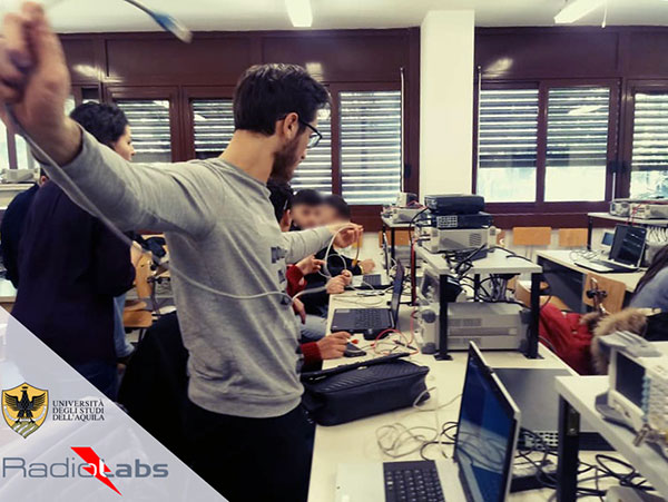
    Central Italy — already home to an ambitious national autonomous driving research initiative — will be the site of the P-CARS laboratory, intended to certify positioning devices for use within driverless cars.

    The new P-CARS laboratory is financed by the Italian Space Agency (ASI) through the Navigation Innovation and Support Programme (NAVISP) of the European Space Agency. The lab will support the goals of EMERGE, a public-private partnership for innovation established in 2018 between Italy’s Ministry of Economic Development, the University of L’Aquila and the mountainous Abruzzo region. Also in the partnership are the RadioLabs research consortium and the Leonardo, Telespazio and Elital companies.

    RadioLabs laboratory at the University of L'Aquila, part of Italy's EMERGE initiative developing autonomous and connected driving solutions. (Photo: RadioLabs)
    RadioLabs laboratory at the University of L’Aquila, part of Italy’s EMERGE initiative developing autonomous and connected driving solutions. (Photo: RadioLabs)

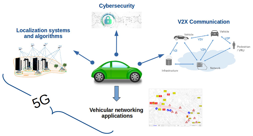
    EMERGE will develop satellite navigation and 5G solutions for connected, cybersecure and autonomous vehicles. The new P-CARS laboratory will be an independent venue for testing devices supporting autonomous and connected driving.

    “The idea behind it is to create a research ecosystem, focused on developing, testing, validating and promoting the use of Galileo and other GNSS — along with 5G communications — for connected and autonomous driving,” said Francesco Rispoli, chief satellite operations at Hitachi Rail STS and director general of RadioLabs.

    Abruzzo already hosts a manufacturing site for Stellantis’ Fiat Ducato light truck, the Galileo control center at Fucino, and the connected-car center of the University of L’Aquila. P-CARS will be integrated into the university’s Center of Excellence for Geo-localized, Connected and Cyber-secure vehicles.

    Italy's EMERGE initiative is developing GNSS and 5G technology for autonomous and connected driving. (Image: RadioLabs)
    Italy’s EMERGE initiative is developing GNSS and 5G technology for autonomous and connected driving. (Image: RadioLabs)

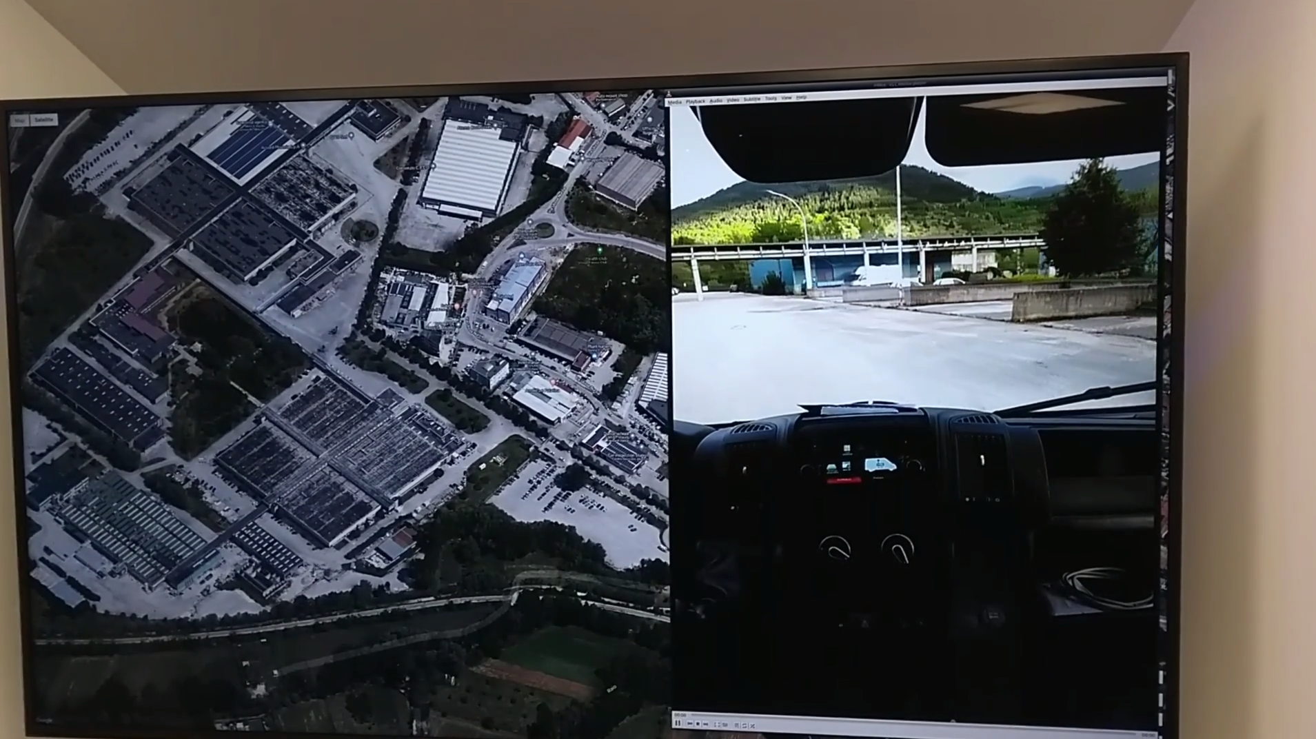
    “The P-CARS lab will have a 150-square-meter testbed area, beside an existing driving circuit, with the right to use the surrounding open space as well,” Rispoli said. “We’ll be addressing connected autonomous driving functions with GNSS technologies that are safety critical, the key point being that safety must be ensured through standardized test procedures, serving as a trusted third-party to validate specific solutions from companies.”

    “This is a valuable response to our national strategy, promoting the adoption of positioning, navigation and timing (PNT) solutions in the fast growing automotive sector by leveraging the latest technologies brought by Galileo and 5G,” said Alberto Tuozzi, head of ASI’s Navigation and Telecommunication Department. “Cross fertilization, cooperation and interaction among the stakeholders will be pursued in the unique ecosystem of the Abruzzo region, bringing together space and non-space stakeholders: ASI, ESA, satellite and automotive industries, universities and research centers.”

    Autonomous vehicles will have two distinct sets of inputs: sensors such as cameras, lidar and radar to know context around the car; and GNSS, inertial measurement systems and accelerometers to knowing where. The two sets work independently but come together to ensure safety. (Photo: RadioLabs)
    Autonomous vehicles will have two distinct sets of inputs: sensors such as cameras, lidar and radar to know the context around the car; and GNSS and inertial measurement systems to know its position. The two sets work independently but come together to ensure safety. (Photo: RadioLabs)

    Leveraging its expertise on Galileo and safety applications, ESA will support this initiative in two ways: with technical support and through cooperation and exchanges with other institutions and laboratories at the international level. ESA said P-CARS could become part of a network of centers of excellence in the PNT domain applied to autonomous cars and beyond.

    P-CARS will exploit the synergies between the rail and automotive sectors to provide benefits to both. “Car manufacturers produce millions of vehicles and are investing heavily in autonomy and safety systems, but had little experience in this field before they began investing a few years ago,” Rispoli said. “Meanwhile, the rail community has almost 20 years’ experience managing train driving functions with a high degree of autonomy, through the common European Rail Traffic Management System, ERTMS.”

    Hitachi Rail and Rio Tinto collaborated to build the world’s first driverless heavy freight train – an automated heavy haul freight transportation system delivering freight from mines to ports in Australia across thousands of kilometres every day. (Photo: Hitachi Rail)
    Hitachi Rail and Rio Tinto collaborated to build the world’s first driverless heavy freight train – an automated heavy haul freight transportation system delivering freight from mines to ports in Australia across thousands of kilometers every day. (Photo: Hitachi Rail)

    “It is well recognized that ERTMS guarantees the highest safety levels as a connected and autonomous driving system, where the human driver is largely bypassed, but not the volume for mass producing such systems for reducing their cost. By leveraging these two peculiarities it will be possible to get low cost but safety-proven GNSS-based devices,” Rispoli said.

    The emphasis will be on connectivity, with the vehicles linked to the infrastructure, including a centralized system of intelligent roads as well as other cars. 5G will enable low-latency communications and be a source of positioning data to extend the performance of GNSS.

    P-CARS is being supported through Element 3 of NAVISP, focused on supporting ESA member states’ navigation priorities.

  • Geospatial a Surprising Highlight of eMerge Trade Show

    Two weeks ago I helped a colleague with a trade show in Miami called eMerge Americas. This was a general-interest trade show focused on U.S. and Latin American trade and economic development. It wasn’t GEOINT or an ESRI users conference, so I didn’t expect any significant geospatial exhibitors, but I was wrong.

    In fact, there were so many geospatial-related displays, I decided to build my column around it — not because there were new developments, but to give you a feel for how business in general is being exposed to and shaped by our geospatial technology.

    I found so much visual content that under the “picture is worth a thousand words” philosophy, I shot video clips of exhibitors so that you could quickly hear and see their stories. I discovered a number of true start-up businesses, as well as a large area devoted to showing robotics from local school programs. You may not have the time to view each clip, so the following are brief descriptions of each exhibitor that caught my attention:

    Introduction to eMerge Americas

    Esri. Because Latin America is a large and growing market, Jack Dangermond had his team there.

    Indra. A large Spanish firm demonstrating their end to end solutions including building 3D models overlaid on Google.

    Cisco. Cisco had a very large display showing city management of transportation/utilities/ planning using geospatial tools and management systems.

    Fish. A company that tracks people and assets using RFID tags and indoor location technology.

    Florida International University. FIU had numerous technology displays but their autonomous catamaran doing bathymetry data collection and mapping was impressive.

    CartoData. This was a Mexican firm doing some very impressive end-to-end solutions including the use of Pix4D to build 3D models from UAV data.

    ImPlaces. A small start-up that builds Smartphone GPS location enabled applications for self guided tours such as museums, parks, real estate, etc.

    Baptist Health. Baptist Health demonstrated its 3D remote surgery system that was dimensionally scalable. These systems permit a surgeon to work at a macro level while the surgical tools operate a at microscopic level.

    ICONICS. A company that can zoom from a country or regional map down to the detail of an individual valve in a specific plant using CAD/BIM data.

    RangeVideo. A UAV company with a very flexible platform and 3D operator viewing goggles.

    ALTA Systems. An alternative to powered UAVs.

    SnowLizard Products. A small start up building durable waterproof Smartphone cases with Bad Elf GPS and solar panel recharging.

    Catbird. A data system security oversight system.

    VSN 360. There was a lot of interest in this product. VSN was showing a new 4K HD quality 360-degree video camera a little bigger than a coffee mug with many features. My video of a video didn’t do it justice, so here is a link to the demo video.

    For fun, view these non-geospatial exhibitors:

    Holography Box USA. A portable, rear projection, point-of-sale video display that looks like a 3D hologram.

    TeamSandTastic. A company that provides sand sculptors for trade shows or other events. Doesn’t sound exciting, but just like a Zamboni clearing the ice, you can’t stop watching as an artist turns a pile of sand into a sculpture.

    Robotics. Local students show off their robotic construction efforts and operational talents.

    Because eMerge has been so well received, I’m happy to see plans are in place to make this an annual event. Latin America is a large and growing market with many talented individuals, some of whom I met at this conference. As a country, we seem to take Latin America for granted, but this a region that shares our values. We need to nurture our relationships and work to prevent the kind of attitudes found in areas hostile to American values.