The 2023 European Navigation Conference (ENC) will take place May 31-June 2 with a focus on resilient navigation. This conference, which will welcome professionals from the positioning, navigation, and timing (PNT) field, is organized by the Netherlands Institute of Navigation, a member of the European Group of Institutes of Navigation (EUGIN).
Given the growing vulnerability of satellite-based position and timing, the conference will focus on resiliency, which requires redundancy in the signal domain, terrestrial and space infrastructures, and on-board implementation — as well as addressing vulnerabilities in navigation functions, data, and guidance control.
Thanks to the hospitality of the European Space Agency, the ENC will be held at the ESTEC site in Noordwijk, The Netherlands, where the Galileo satellite system is designed and where navigation satellites are tested before launching.
It’s conference season again. Every year I struggle with the best way to tote my MacBook Pro, DSLR camera and all the acoutrements I haul around as part of my job. No doubt you, too, need to travel with expensive electronics you want to protect from damage or theft.
Determined to find the best solution for my trip in May to the European Navigation Conference (ENC), I researched several options. Instead of the roller bag I’ve been using, (and accidentally rolled over people’s feet — I apologize if I ever bumped you!), I opted for a backpack.
The TLS Mother Lode Weekender travel backpack includes nifty organizational details and a laptop compartment. It has an expansion zipper — nice, because I always come home with more than I leave with, thanks to all the literature and hand-outs at the booths I visit. It looks like a backpack, but opens like a suitcase.
The Kenneth Cole Reaction backpack has a “checkpoint-friendly” laptop compartment — always a handy feature. The middle compartment features an organization panel, and it has an iPad/tablet pocket.
These are both nice choices, but I found a backpack that has a home for my bigger camera as well as my laptop. The Udee backpack, a new product developed through a kickstarter campaign, is designed not just for office folk like me, but field workers. It has 19 features, including a few unusual ones — a portable cooler, an earphone port, pockets for passpports and glasses, and a USB port for charging electronics using a battery stored within the bag (battery not included).
It also has an anti-theft feature (important to me in case I fall asleep on a train).
If you’re attending ENC, look for me — the one with the backpack pictured above.
This year’s European Navigation Conference in Bordeaux, France, got underway with “Good news from up there .…”
Galileo’s seventh and eighth satellites launched successfully in late March, the European Space Agency (ESA) plans four more satellites to reach orbit in 2015, and space maneuvers for Galileo 5 and 6 have been completed, with a recovery plan currently under study. ESA happily confirms that satellites 7 and 8 are in good position, under control, and behaving very well.
Fiammetta Diani, deputy head of Market Development for the European GNSS Agency (GSA), followed her keynote opener with “… some good news also from down here.”
The GSA predicts that the installed base of GNSS devices will triple by 2023, with per capita rates of 2.5 in North America, and 2.3 in Europe and Russia. Around the rest of the world, in eight years nearly every person, on average, will possess a GNSS device.
Axelle Pomies of Galileo Services, an association of industry players active in GNSS applications, stressed the need for a comprehensive, assertive industry policy to support the development of EGNOS/Galileo downstream sector, leading to growth, job creation and autonomy for Europe. She previewed the mid-May publication of a draft position paper in this regard, for wide consultation within the European downstream sector. Follow www.galileo-services.org for its first appearance.
Concluding the ENC plenary, Florence Ghiron of Topos Aquitaine, a regional council of satnav and intelligent transport companies in southwest France, focused on opportunities and risks for small-to-medium enterprises. One of her points: the long development paths of public and regulatory policy do not help SMEs grow.
The Galileo Services and Topos Aquitaine presentations receive more lengthy treatment in my online column mentioned above.
Diani and Ghiron closed with a call to return to Bordeaux in October for the Intelligent Transport Systems World Congress, themed “Towards Intelligent Mobility: Better Use of Space.” GNSS looks to take a more central role than ever in this far-reaching economic segment. Good news — for us — indeed.
At the ENC-GNSS Conference in Rotterdam, we delved into actions necessary to officially use EGNOS (giving me déjà vu from WAAS’s early days), heard sage words from Brad Parkinson, the father of GPS, and, on the last day, saw amazing proof of a claim many of us initially thought was outrageous — that differential (DLoran) with modern monitoring can result in consistent horizontal accuracies approaching five meters on a moving platform.
When I was asked if I could cover the European Navigation Conference 2014 (ENC-GNSS) in Rotterdam, The Netherlands, it took me about two seconds to answer in the affirmative. Let’s see… Travel to Europe in the spring, visit The Netherlands — my old stomping grounds where my daughter was born — see miles and miles of beautiful Tulips in bloom, and visit with some old friends. Gee, what a tough decision. Oh, and of course, cover the ENC. Almost forgot that
Seriously, my primary purpose, of course, was to cover the ENC and associated events such as the Resilient PNT Forum and a meeting of the European Maritime Radionavigation Forum (EMRF), but literally miles and miles of brilliant red, white, and yellow tulips interspersed with ancient windmills are hard to ignore. But I digress.
In past years the ENC, with approximately 400 attendees, has been naturally dedicated to European PNT matters, and in reality it concentrated almost exclusively on Galileo with a slight mention of EGNOS. That was about it. This year, the venue was the same, but the program was more open, with presentations on PNT augmentations such as EGNOS and DLoran, and maritime navigation to include radar and inertial systems.
For those of us that have been in the PNT (positioning, navigation and timing) or merely the navigation business, say, for the past 40+ years or so, in some respects it was more than slightly reminiscent of times past. As the great American octogenarian baseball philosopher and malapropism aficionado extraordinaire, Yogi Berra, once said, “It was déjà vu all over again.”
European Maritime Radionavigation Forum
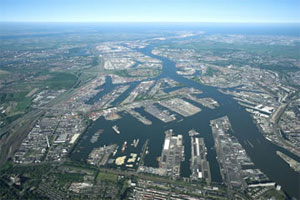
The Port of Rotterdam today (2014).
The EMRF was the first official function to kick off in Rotterdam. When you consider that Rotterdam is one of the busiest ports in Europe and had been around since 1340, you would naturally expect one of the main conversations at the EMRF to concern the port of Rotterdam and navigating in less-than-perfect conditions. The Netherlands is known as the Low Country, and that is as an apt description since most of the country is below sea level — hence the persistent fog, dikes, sea walls, and windmills that pump water and grind grain and all those good things. Today, the modern versions of those windmills are huge — twenty stories tall — and generate electricity. Many of them are close to shore so precise navigation in foggy conditions is even more critical than in times past.
The main topic of conversation at the EMRF revolved around the actions necessary to officially use EGNOS (the European Geostationary Navigation Overlay Service) as a precision and official safety-of-life augmentation for GPS (similar to WAAS, Wide Area Augmentation System) and Galileo.
During those discussions, I swear when I closed my eyes, except for the accented English, I was propelled backward almost 20 years to discussions of WAAS as a safety-of-life system, not for maritime but for aviation purposes. Still, the dialogue and heated discussions echoed down through the years almost verbatim. The main difference, of course, being that in the U.S. it was 20 years earlier, we were embarking on virgin territory, and we had only ourselves, one nation, to debate. Whereas the Europeans are fighting the same battles two decades later, with a system that is purposefully almost an identical copy of WAAS technically, and they are working for maritime and aviation certifications simultaneously. And not with just one nation but the entire European Union. A truly daunting task.
The EMRF website is sponsored by Trinity House in London, which is responsible for the safety of [English and European] shipping and the well being of seafarers, which have been their prime concerns ever since Trinity House was granted a Royal Charter by Henry VIII in 1514. I planned to list the EMRF website for your further edification, but since the latest news on the site concerns the upcoming January 2011 EMRF meeting in Paris, I thought it was best left to molder in obscurity. The website, not the EMRF.
The bottom line for the EMRF is that while it fills an important role where EGNOS and maritime navigation are concerned, it still has a lot to learn and could benefit greatly by lessons learned from WAAS. However, I personally see no indication that will happen, so we wish them luck. Many of us are standing by to assist if asked. Even if it is only, “Been there, tried that, and here is why it did or did not work.” Quod homo non sit Island.
Resilient PNT Forum
I was happy to see Dana Goward (USCG Ret), the head honcho at the Resilient Navigation and Timing Foundation, which conducted the Resilient PNT Forum at ENC 2014. Dana’s forum, which took place just before the official ENC 2014 kickoff, concentrated on the need for and strategies to achieve resilient position, navigation and timing (PNT) services. The event was well attended, and was jointly hosted by the European Group of Institutes of Navigation, the International Association of Institutes of Navigation, and the International Association of Marine Aids to Navigation and Lighthouse Authorities. There was no charge to attend the event, and the collaboration proved interesting, especially since Dana really wanted to talk eLORAN and GPS/Galileo augmentations.
Dana is retired U.S. Coast Guard and worked many years supporting LORAN-C and the USCG Navigation Center. Dana showed a brief video of his recent testimony before the U.S. Congress, where he lobbied for a cessation of the destruction of LORAN-C towers and their associated infrastructure. If recent congressional actions are any indication, he has been somewhat successful in that regard. Now all that is left is to help the U.S. Congress, services, and agencies realize how badly the United States needs LORAN as a backup, enhancement, and augmentation to GPS and other space-based PNT services on a global basis. No small task, but it is a task that Dana Goward and the Resilient Navigation and Timing Foundation have strapped on, and we wish them the best. Plus, as you will see later, a surprise presentation at ENC-GNSS may have given Dana and his cause just the boost they need. Keep reading.
As it turns out, many others thought these non-Galileo presentations were timely topics as well, and the discussions were enlightening, especially the Resilient PNT Forum keynote address by Professor David Last. Among many other titles he holds, Last is a consultant engineer and expert witness specializing in radio navigation and communications systems. He is a professor emeritus at the University of Bangor, Wales, and past president of the Royal Institute of Navigation. He acts as a consultant on radio-navigation and communications to companies and to governmental and international organizations and is active as an expert witness, especially in forensic matters concerning GPS.David and I are old friends, and it is always enlightening and entertaining to hear him speak. On this occasion, Professor Last spoke eloquently and authoritatively concerning the ubiquity of GPS/PNT and the resultant and inherent vulnerabilities of space-based systems. David made the essential point that while GPS remains the sine qua non of PNT, it is still vulnerable and subject to failures as are all space-based PNT systems, the recent GLONASS debacles being prime examples. More on these unfortunate Russian examples of PNT vulnerability at a later date.
David pressed the issue, as he has many times, that we desperately need a ground system or many different ground-based augmentations, backups, and enhancements to ensure that the user is never without navigation and timing data at a critical juncture, such as navigating through an insanely busy commercial port in thick fog.
This theme was carried forward in the ENC-GNSS very adroitly by none other than Dr. Bradford Parkinson, the Father of GPS. Dr. Parkinson spoke at length on the need to “Protect, Toughen, and Augment GNSS” against all enemies, be they manmade or natural. Brad made the point, with all due credit to Will Rogers, that “Rumors of GPS’ death are greatly exaggerated.” Indeed, the GPS constellation has never had more satellites on orbit, in residual status, and spares in the barn than we do today. The SIS or Signal In Space has never been more accurate, and the GPS atomic reference systems have never been more stable than today, and yet GPS remains incredibly vulnerable. But take heart, as Dr. Parkinson is convinced “There are actions such as PTA that can be taken to safeguard PNT for all users.” We will cover Dr. Parkinson’s 60+-slide presentation in depth at a later date.
Surprise! Loran Is the Answer
The big surprise came on the last official day of the conference during a group of alternate PNT presentations co-chaired by Dr. David Last. The rather startling enhanced differention LORAN (eDLoran) presentation was given by Professor Durk van Willigen, representing his colleagues René Kellenbach and Cees Dekker of the Dutch consulting firm Reelektronika, and Wim van Buuren of the Dutch Pilots’ [ed. maritime] Corporation, who helped with the DLoran research and authoring of the paper for the ENC presentation.
Professor van Willigen made what many of us initially thought was an outrageous claim, and then amazingly went on to prove that enhanced differential Loran with modern monitoring produced consistent horizontal accuracies approaching five meters on a moving platform. Needless to say, Professor van Willigen, who teaches at the Delft University of Technology in The Netherlands, was mobbed at the end of his presentation, but I did manage to catch him for a few minutes afterwards. Since then, GPS World Editor-in-Chief Alan Cameron has spoken with Professor van Willigen at length, and the result is the first of what I am sure will prove to be numerous articles on eDLoran in GPS World.
Shipboard DLoran receiver installation (orange boxes on rails).
One would hope that with this rather startling improvement in differential Loran accuracy and the decision by the U.S. Congress to halt the destruction of Loran-C infrastructure in North America, that there might once again be a future for Loran, especially eLoran and/or DLoran in North America, and hopefully globally as well.
As Professor David Last in his best imitation of John Cleese might say, “It is the answer to a maiden.s prayer.”
Until next time, happy navigating. I hope to see you all at the 30th Space Symposium May 19-22 in Colorado Springs at the Broadmoor Resort. More than 10,000 attendees are expected, and I hope you will be one of them. Stop by the GPS World booth and say hello.
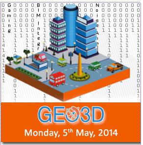
The European Navigation Conference (ENC) will be held April 15-17, 2014, in the World Trade Center in Rotterdam, The Netherlands. The conference aims at technology, innovation, and business in the PNT domain (positioning, navigation, and timing). The conference program is now available for review online.
Satellite navigation and positioning, using current operational systems like GPS and GLONASS, will be major topics. The conference will also highlight recent developments on emerging GNSS like the European Galileo and the Chinese BeiDou.
More than 100 presentations will be given at ENC GNSS 2014. Here are a few highlights:
Keynote speeches
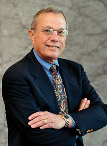
Prof. Bradford Parkinson (Stanford University): Assured PNT – assured world economic benefits.
Prof. Erik Theunissen (Netherlands Defence Academy): So you think you are safe.
Invited lectures
Prof. Cathryn Mitchell (University of Bath): Space weather effects on GNSS.
Ignacio Fernández-Hernández (European Commission): The Galileo commercial service: current status and prospects.
Jaron Samson (European Space Agency): An introduction to interference in GNSS bands.
Prof. Peter Teunissen (Curtin University/Delft University of Technology): Multi-GNSS: combining GNSSs for precise positioning and navigation.
Prof. Frank Van Graas (Ohio University): Disruptive technologies and GNSS aircraft landings.
Prof. Qile Zhao (Wuhan University): Positioning performance and precise applications of Beidou navigation satellite system.
Special sessions
The European Space Agency will organize a dedicated session on Galileo IOV results.
Anwendungszentrum GmbH Oberpfaffenhofen (AZO) will chair the kick-off meeting of the European Satellite Navigation Competition 2014.
Prior to the conference, on April 14, there will be a Resilient PNT forum and a meeting of the European Maritime Radio Forum (EMRF).
The hounds of spring are on winter’s traces. As Galileo emerges from its long, cold slumber, the energy of a new constellation radiates through the skies to encourage blossoms across Europe. ESA’s recent declaration of in-orbit validation means the downstream satnav market can now truly get going.
If a lot of demand has yet to be demonstrated, certainly a lot of pioneer applications have been developed, and the pent-up current is about to flow. Witness a plethora of GNSS and geospatial conferences in March, April, May, and June, from Munich to Rotterdam to Geneva to London, and on to Prague. The presentations at these gatherings no longer lean so heavily on academic and technical projections and predictions, but embody real-world applications and actual products. Long awaited, Europe’s GNSS spring has finally sprung.
Brad Parkinson, the chief and original architect of GPS, fittingly kicked off the season this month in London, where he told a UK conference that GNSS needs to be made more robust to ensure worldwide availability of services to users. His concerns over signal availability relate to threats such as the loss of authorized frequency spectrum (implicitly creating licensed jammers), space weather due to hyperactive ionospheric conditions, and deliberate or inadvertent jamming of GNSS signals. Parkinson made his remarks as the keynote speech at GNSS Vulnerabilities and Resilient PNT 2014, hosted by the Royal Institute of Navigation.
Coming up soon, Dr. Parkinson will also deliver the keynote address for the European Navigation Conference on April 15 in the Netherlands — but more on that anon.
Munich Satellite Navigation Summit, Munich, March 25–27
The scene now shifts southward to Bavaria, where the long-running Munich Summit gathers government, financial, industrial, and scientific dignitaries for high-level perspective on all GNSS, certainly with a Galileo emphasis but prominently featuring GPS, GLONASS, BeiDou, QZSS, IRNSS, and SBAS.
The technical program of the Munich Satellite Navigation Summit includes a multitude of panel discussions involving invited speakers on further topics such as the legal issues of privacy devices and GNSS re-transmitters, achieving precise point positioning (PPP) on a global scale, the role of other autonomous sensors in future navigation, monitoring of climate and natural disasters, and integrated applications of GNSS and Earth observation.
The summit will also officially open the European Satellite Navigation and provide a parallel track on Copernicus, the European Commission´s Earth observation program.
GPS World’s contributing editor Tony Murfin will file a complete report on the Munich Summit in the inaugural issue of EAGER, the European GNSS and Earth Observation Report. Subscriptions are free to this new quarterly email newsletter at the preceding link.
EAGER will feature news of European industry, agency, and scientific developments in satellite-based positioning, navigation, and timing; geospatial technology; Earth observation from space; digital mapping; and location-based services. EAGER focuses on the EU programs Galileo, EGNOS, and Copernicus along with their applications, but also encompasses European involvement in the other GNSSs and their geospatial applications of all kinds. Knowledgeable reporting from European sources, and interviews with and articles by European GNSS/geospatial community leaders. The latest technologies, launch schedules, applications, equipment, and industry and policy developments.
ENC GNSS 2014, Rotterdam, April 14–17
More than 120 technical papers will be presented at the European Navigation Conference (ENC 2014), under the thematic header Technology, Innovation, Business. As previously mentioned, Bradford Parkinson will deliver one of the two keynotes on “Assured PNT – Assured World Economic Benefits,” joined on the podium by Prof. Erik Theunissen of Delft Technical University, speaking on “So You Think You Are Safe.”
The program continues with a Galileo session, in which ESA will present the latest results of Galileo IOV and future plans for FOC.
Preliminary meetings will be held by the European Maritime Radionavigation Forum (EMRF), the Resilient PNT Forum, EUGIN, IAIN, and European Journal of Navigation. On Tuesday, another kick-off (!!) of the European Satellite Navigation Competition (ESNC) 2014 will take place.
The Netherlands Institute of Navigation’s organizing committee chair Jac Spaans (also a long-time Editorial Advisory Board member of this magazine, and furthermore a knight in the Order of Orange-Nassau) is pleased to invite all satnav enthusiasts to the conference, taking place the week before Easter, allowing you to extend your stay and enjoy the tulip fields, the windmills, and other objects of interest in The Netherlands. Host-city Rotterdam, one of the biggest ports in the world, gives proof the Dutch saying, “In Rotterdam they do not sell shirts with long sleeves, because they roll them up anyway.”
Another of GPS World’s contributing editors, Don Jewell, will attend and report on the conference, either in his Defense PNT newsletter in May or as a guest columnist in this GNSS Design & Test newsletter of that month. To be sure, his column will also appear prominently in the second (June) issue of EAGER, the European GNSS and Earth Observation Report. Subscriptions are free to this new quarterly email newsletter at the preceding link.
Geospatial World Forum, Geneva, May 5–9
Now in its sixth edition, the Geospatial World Forum concentrates on geographic information systems (GIS) in mapping, remote sensing, satellite navigation as applied to the electricity sector and energy distribution; architecture, engineering, and construction; sustainable agricultural industrialization; smart cities, municipal management; disaster preparedness and coping, natural hazard monitoring; big data as a competitive business asset, business intelligence, and market analysis; multi-sensor integration for monitoring; geospatial’s role in healthcare; global peace and prosperity; and last but by no means least, in fact probably the most important in our long term, climate change.
Next up on our busy travel schedule — and nothing says an industry is growing like the launch of another new conference — comes GEO Business, primarily an exhibition but also conference featuring industrial training and demonstrations featuring the technology and services used by those working with spatial data.
GEO Business boasts that it was born out of consultation with key industry leaders, and as a result the show is organized in collaboration with the Chartered Institution of Civil Engineering Surveyors (ICES), the Royal Institution of Chartered Surveyors (RICS), The Survey Association (TSA), and the Association for Geographic Information (AGI). This is a joint cooperative event involving major players, both organizational and industrial, in the geospatial community.
Presentations will be given by Leica Geosystems (Mobile GIS), Esri UK, Carlson Software, Fugro (Advanced airborne survey), Trimble, GeoPlace (spatial addressing), Altus Positioning Systems (single- and dual-frequency data collection), Topcon (global-scope monitoring), Spectra Precision, Ordnance Survey (geospatial data management), iXBlue, and others.
By this point, I should start charging a subscription fee to anyone who has failed to sign up for EAGER.
European Space Solutions 2014, Prague, June 11–13
photo: European Space Solutions
Finally, the European Space Solutions conference in Prague has yet to be formally announced by the European GNSS Agency, but a pre-registration page is open.
The 2013 generation of this conference featured sessions on indoor location-based services and solutions, environmental protection, emergency response and disaster management, mobile applications, sustainable energy, road and traffic management, and the future of the Galileo Public Regulated Service, an encrypted navigation service designed to be more resistant to jamming, involuntary interference and spoofing, designated for authorized users.
Tim Reynolds, GPS World’s newest contributing editor, will likely report from Prague on this, as he will from several of the earlier spring shows. Based in Brussels for the last decade-plus, Tim will provide in-depth and up-close perspective on Galileo, Copernicus, and all things Europe connected with space and satellite navigation. His main public forum will be EAGER, the European GNSS and Earth Observation Report, but he will also furnish regular stories for the Navigate! e-newsletter and this one.
Bradford Parkinson, who is known as “the father of GPS,” will give a keynote speech during the opening session of the European Navigation Conference 2014. The conference will be held April 15-17, 2014, in Rotterdam, The Netherlands.
Parkinson’s speech is titled “Assured PNT – Assured World Economic Benefits.” Representatives of the European Commission, the European GNSS Agency, and the European Space Agency will also present keynotes in the opening program.
The conference focuses on technology, innovation and business. Special sessions are scheduled on the Galileo IOV, Galileo PRS, alternatives and back-ups to GNSS ,and PNT applications in the various sectors of land, sea and air.
The conference program will be complemented with an icebreaker party on April 14 at WTC and a conference dinner on board the paddle steamer De Majesteit on April 16. The City of Rotterdam has invited conference delegates to a reception at Rotterdam City Hall on April 15. Accompanying persons are welcome to join these events, as well as the guided walking tour on Tuesday.
With Easter following the conference, there is a good opportunity to visit Rotterdam, tulip fields, windmills, museums and other attractions in The Netherlands.
Deadline for abstracts is December 31. Early bird registration is possible until February 15, 2014.
The Netherlands Institute of Navigation will be hosting the European Navigation Conference (ENC-GNSS 2014) in Rotterdam, the Netherlands, April 15-17, 2014. The conference will cover all aspects of positioning, navigation and timing (PNT) developments and applications. Special sessions will be organized for innovations and their commercialization.
Abstracts can be submitted until December 31, 2013, at www.enc-gnss2014.com. Topics include, but are not limited to
– Algorithms and Methods: Navigation and Positioning
– Algorithms and Methods: Receiver Signal Processing
– Alternatives and Backups to GNSS
– Atmosphere and Space Weather
– Augmentation Systems
– Aviation Navigation
– eLoran and other LF Systems
– Emerging GNSS
– Galileo IOV Results
– Galileo Public Regulated Service (PRS)
– GNSS Programs, Status and Modernization
– GNSS Vulnerabilities
– Indoor Navigation
– Integrated Systems
– Integrity
– Interoperability and Multi-Constellation Results
– Location Based Services
– Maritime Navigation
– MEMS
– Network RTK, Surveying and Hydrography
– New Products and Services/Business, Economic and IP Aspects
– Precise Point Positioning
– Receiver and Antenna Technology
– Signals of Opportunity
– Simulation
– Spectrum, Interference, Interference Detection and Localisation, Spoofing
– Timing, Time and Frequency Transfer
– TRANSMIT
– Unmanned Aerial Vehicles
– Unmanned Vehicles
– Urban Navigation
Further details about the conference, the venue, and the hosting City of Rotterdam can be found on www.enc-gnss2014.com. Note that the conference is the week before Easter, which is a great opportunity to stay a few days longer and visit the Dutch windmills, tulip fields (they will be in full bloom), and the Port of Rotterdam, one of the greatest in the world.
Report from ENC: Constellation Needs 22 Satellites in Three Years
Launch, deploy, and operate “22 satellites in less than 3 years.” That’s two satellites every three months, leading to a four-at-once launch in 2014. And that’s the challenge that Europe and the European Space Agency (ESA) now face.
This pointed call to action during the opening plenary of the European Navigation Conference (ENC) came from Didier Faivre, director of Galileo Programme and Navigation Related Activities at ESA. It was the only somber note sounded during the keynote speeches, which otherwise paraded the stirring recent accomplishments of the Galileo In-Orbit Validation (IOV) phase. IOV now concludes, and Galileo’s operational phase opens.
The ENC takes place in Vienna, Austria this week (April 23–25), hosted by the Austrian Institute of Navigation. Privately and informally, a handful of knowledgeable conference attendees expressed confidence that OHB System can furnish the completed satellites, at least, according to schedule. OHB System is the prime contractor for construction of 22 Full Operational Capability (FOC) Galileo satellites and is responsible for developing the satellite bus and for integrating the satellites. Surrey Satellite Technology Ltd. (SSTL) is developing and constructing the navigation payload and assisting OHB with final satellite assembly.
“Using only European tools and means, European ground infrastructure deployed on European territory, our conception, machine and design, is totally validated,” stated Faivre, referring to the recent Galileo-only positioning fix by ESA. The March 12, 2013, event marks “the end of the beginning,” and culminates 12 years of intense work at all levels of European industry.
“Europe is at par with GPS” with performance as expected. “I hope that soon our U.S. colleagues will be jealous of our performance,” Faivre stated, implying yet again the persistent Galileo claim that the system will be more accurate than GPS. He returned to this theme with reference to Fugro’s accomplishment of real-time precise point positioning at the centimeter level.
He acknowledged that “It’s a technological competition with the United States, Russia, and China,” even though all may be friendly and collegial.
In that competitive light, “the success of Galileo will be measured by the number of users,” and not by the number of satellites, or the degree of accuracy, or the strength of the signal.
Previously, the ENC audience had heard from Ingolf Schädler that “Europe has closed the gap with the technological superpowers,” in what “may be the most complex invention ever of mankind, the system of navigation that is GNSS.” He also made a proud reference to Austrian-produced signal generators aboard Galileo’s orbiting IOV satellites. Schädler is the deputy director general of innovation for the Austrian federal Ministry for Transport, Innovation and Technology.
“We have reached cruising speed,” announced the third keynote speaker, Carlo des Dorides of the European GNSS Agency (GSA). He was referring explicitly to the re-positioning of the GSA headquarters from Brussels to Prague, but the remarks reverberated to the Galileo program as a whole.
David Blanchard, deputy head of unit, EU Satellite Navigation Programmes for the European Commission, quoted an unnamed U.S. publication: “With the capability to make a position fix from four signal-broadcasting satellites, we can now say that Galileo has truly arrived.”
That statement appeared in the May 2013 GPS World, an issue of the magazine that was distributed in conference bags to all attendees at the ENC.
Blanchard then shifted the focus slightly from Galileo, to Galileo together with the European Geostationary Navigation Overlay Service (EGNOS), Europe’s satellite-based augmentation service that also broadcasts GPS corrections. “We have to make sure that all the capabilities afforded by EGNOS are realized.” He also made strong references to the EGNOS Data Access Service (EDAS).
Blanchard cited a current ongoing study that shows that 6 to 7 percent of European gross domestic product (GDP) is dependent upon GNSS.
“A gold mine within arm’s reach of European industry” was how Gard Ueland, head of Galileo Services, characterized the present situation. “Development of European downstream market is crucial; it also has to bring more benefits to European society.” Galileo Services will host a workshop of industry stakeholders in late October, at the OHB System premises in Bremen, Germany. Watch GPS World Events calendar and news for an announcement with specific dates.
Having attained altitude and cruising speed, the Galileo program must now shift to warp speed to hit its goals on time: 18 satellites in orbit by the end of 2014, and a total of 26 by the end of 2015. Early services by the end of 2014, and full services in 2016. Stable, continuous services, as Blanchard emphasized.
“The interest of the navigation community for the European Navigation Conference 2013 is tremendous. We have received more than 150 oral presentations and 50 poster presentations that will be showcased in 32 sessions,” said Susanne Fuchs, organizing committee member. Among those who are taking part as keynote speakers or panelists are:
Paul Weissenberg (Deputy Director General of the DG Enterprise and Industry of the European Commission),
Didier Faivre (Director of Galileo Programme & Navigation Related Activities, European Space Agency),
Carlo des Doride (Executive Director of the European GNSS),
Frank Salzgeber (Head of Technology Transfer Office, ESA),
Gard Ueland (Chairman of Galileo Services),
Bernhard Hofmann-Wellenhof (Vice Rector for Academic Affairs, TU Graz) or Harald Posch (Austrian Space Agency)
The European Navigation Conference 2013 will be the seventeenth conference in the GNSS series held under the auspices of the European Group of Institutes of Navigation (EUGIN). The conference will be hosted by the Austrian Institute of Navigation (OVN) and will take place from 23-25 April 2013 in Vienna, Austria.
Each year the conference attracts researchers, policy makers, manufacturers, users and service providers from around the world. “Thanks to the wide variety of topics in navigation and the outstanding expertise of the attending speakers, we will be able to bring together more than 600 experts,” Fuchs said.
The conference will focus on the present status as well as on future developments in navigation systems, with special emphasis on Galileo. Thus, the ENC 2013 will be a showcase for state of the art technology and, more importantly, for innovations in the field of terrestrial and satellite navigation. The implementation of new technologies in navigation will be illustrated in the industry exhibition, running in parallel to the conference.
Here are highlights of presentations I attended today.
Improving GPS Accuracy for Urban Pedestrians, presented by Jean-Baptiste Prost of Pole Star
A standing-room-only crowd packed the room to hear about map matching, a software program designed to help pedestrians use GPS-based positioning in urban areas. GPS-based positioning for pedestrians in dense urban areas suffers from a lack of accuracy and integrity. Pole Star’s solution combines GIS database containing geometrical descriptions of buildings with raw data from the receiver, then restricting the area of possible locations by matching GPS measurements with the environment and behavioral models. Tests in several cities shows dramatic improvements to the accuracy of GPS-based positioning for pedestrians, especially in areas with tiny streets. Jean-Baptiste said the product is ready under the name of NAO City.
Real-Time Information on Road Traffic Based on Floating Car Data, by Laurent Brecheret
The SINERGIT project has developed a cooperative information system for road and urban networks. The system aims to optimize traffic management means, and provide real-time info on driving conditions to all drivers who use personal navigation devices. The three data sources used are data from existing traffic monitoring systems, data from telecom operators tracking cell-phone use, and tracking of PNDs and GNSS-enabled smartphones. This final category is called floating car data, and is used to measure average speed of traffic and to estimate overall traffic conditions. A central system merges the three sets of data to create the best traffic information which can then be shared with drivers in real time.
Navigation Applications Supporting the Mobility of Disabled People, by Francesca Neccia of Thales Alenia Space
The Navigation for Disability Applications (NADIA) Project aims to improve safety and security for the disabled, while giving them increased autonomy. Using GPS, EGNOS, and eventually Galileo, a blind or wheelchair-bound individual will have supports unavailable now, with access to sports, leisure pursuits, and education. The project is now in the system engineering phase, and once system tests and validation are completed, a prototype will be demonstrated.
Evening 2: Space Walk
Being a fan of space exploration, the Gala Evening at the Cite de l’Espace was right up my alley. Guests toured the Mir space station, ate “space food” (served in test tubes), and enjoyed an eye-popping 3D Imax movie about the International Space Station.
Day 2: eLoran for Europe
eLoran for Europe: The European eLoran Forum makes a case for European support of eLoran in its new policy document. The document sets out the strategic importance of positioning, navigation, and timing (PNT) systems in Europe, and emphasizes the role of Enhanced Loran as a way of making European PNT foundations robust and resilient. “The development and operation of the European eLoran infrastructure is currently being undertaken on an ad-hoc basis,” according to the executive summary. “The importance of eLoran’s supporting role to GPS and Galileo needs to be assessed within the context of a European Radio Navigation Plan. Using these three PNT systems together will protect our critical infrastructure and allow our European service providers and users to retain the safety, security, and economic benefits of GPS that they currently enjoy even when their satellite services are interrupted.”
Seeking the GRAIL: Hoping to hear the final results of the GRAIL project was met with slight disappointment—May is the new target date. GRAIL is a Galileo Joint Undertaking project to study how best to introduce GNSS to railways throughout Europe, in line with the European Rail Traffic Management System (ERTMS) project. ERTMS is an overall effort to make all European trail systems compatible, because each country has its own rail “language” for managing the movement of the trains on its network. Over the past decade, industrial giants and European governments have strived to attain rail interoperability, so that trains can cross borders without stopping. ERTMS has been set up to create unique signaling standards throughout Europe. Alvaro Urech from INECO described the four applications the GRAIL project is aiming for: enhanced odometry (measuring the speed and position of the trains, and possibly increasing speed); train awakening (trains knowing where each other are positioned); absolute positioning; and train integrity to ensure the trains are whole and not “broken.” So far in the project, specifications for these applications have been agreed on, along with performance requirements. A prototype for demonstrating these applications is being developed for tests in the lab or on a real high-speed line. Train awakening has been tested, but it’s too early to report results.
Time for a New Partnership: In business news, two timing companies have announced a strategic partnership. Orolia, parent company for timing providers Spectracom and Pendulum Instruments, and Rapco Electronics (Basingstoke, Hampshire, UK), a high-precision timing provider, announced today that they’ve formed a partnership. In a multi-phased approach, Orolia Group companies Spectracom and SpectraTime will join the existing alliance between Pendulum Instruments (recently acquired by Orolia) and Rapco Electronics to cooperate on several fronts to leverage global distribution channels, operations, and new product development efforts.
Rapco Electronics will represent and distribute Spectracom and Pendulum products in the UK and Ireland. Together with its own products, Rapco will provide a comprehensive range of high-precision time and frequency products for governmental, military, telecom, broadcasting and scientific customers. Outside of this region, both Pendulum and Spectracom will distribute key Rapco products under their own respective brands.
Day 1: Comic Books and Space Tunes
Toulouse is a beautiful city — pink-hued buildings with red roofs, narrow pedestrian-friendly streets, a sense of history and time. Quite a contrast to high-tech science, the subject of the Toulouse Space Show. Upon registering, I was given a bag heavier than the luggage I left back at the hotel. I’ve been to numerous conferences, both scientific and artistic, but I’ve never received such a sheer quantity of literature. I felt like a college student stocking up on the term’s textbooks.
Inside, I discovered three inch-thick spiral-bound abstracts for all three conferences encompassed by the Toulouse Space Show: ENC-GNSS (my main focus), EFTF, and Space Applications Days, all in both English and French.
I also discovered a beautifully designed program (or, I should say programme), and, the most quixotic item, a Galileo comic book — err, graphic novel? — published by Thales Alenia Space. Finally, a document written for me and the other non-scientists! (Edited to add: Having now read the book, some of the contentions put forth are questionable. such as the contention that the GPS signal might be turned off by the military, or that Galileo will naturally prove superior.)
I just had time to get these goodies before settling in for the opening ceremony, a multi-media affair involving speeches, music, slideshows, and lighting effects. The speeches from local and regional officials communicated how passionate the people here are about all things space-related, in business, research, and education.
Between the speeches, a duo dressed in flight jumpsuits sang space-themed songs such as “Fly Me to the Moon,” “Walking on the Moon,” and the Beatles’ “Across the Universe” — you get the idea. As an aside, in February NASA broadcast “Across the Universe” to Polaris, the North Star, in the first-ever beaming of a radio song by the space agency directly into deep space, to celebrate the 40th anniversary of the song, the 45th anniversary of NASA’s Deep Space Network, and the 50th anniversary of NASA. Europe’s space program isn’t as old, but it makes up for age in enthusiasm. Each tune sung by the musicians was accompanied by a huge screen showing clips of moonwalks and space-related images of planets, nebulae, and our favorite, satellites. As a long-time fan of the space program, it certainly got me in the mood for the conference.
Tomorrow, technical sessions begin, followed by an evening gala to be held in the Cite de l’Espace, the premiere space museum. I can’t wait!