On May 16, China launched a BeiDou satellite to replenish the constellation, reported Space News. This brings the constellation total to 56 satellites.
This backup satellite was aboard a Long March 3B rocket, which launched from the Xichang Satellite Launch Center in southwest China at 10:49 p.m. Eastern Time. The satellite aims to improve BeiDou’s stability, positioning precision and overall health.
In addition to launching the BeiDou satellite, China also launched satellites to study Earth and synthetic aperture radar test satellites (SAR) for disaster prevention.
On May 21, the Macau Science Satellite 1A and 1B launched on a Long March 2C rocket from the Jiuquan Satellite Launch Center at 4 a.m. Eastern Time. This satellite was designed to study the Earth’s magnetic field.
Also, on May 21, aboard the same rocket was the Luojia-2 (01), a Ka-band synthetic aperture radar test satellite for Wuhan University. The Luojia-2 (01) will test signal enhancement and integration of remote sensing imaging, meteorological detection and more.
The China Aerospace Science and Technology Corporation has planned more than 60 launches this year and has already completed 20 thus far.
GPS is the gold standard for precise positioning, navigation, and timing (PNT), impacting the lives of more than six billion users worldwide. The United States economy alone depends on the free, government-provided service across 900 million GPS receivers supporting vehicle navigation systems, general aviation, financial transactions, the electrical grid, precision agriculture, surveying and construction. The GPS enterprise must remain consistent and reliable, while keeping pace with emerging technology without interruption for the end user.
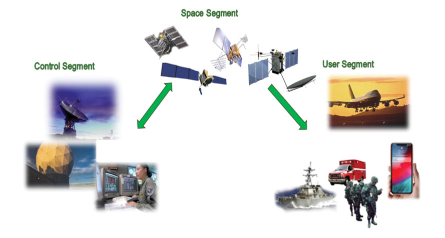
Space Systems Command (SSC) at Los Angeles Air Force Base in El Segundo, California — the U.S. Space Force’s space development, acquisition, launch and logistics field command — is responsible for maintaining and modernizing the GPS enterprise. The enterprise consists of three segments: the space segment, the control segment and the user segment. Each achieved specific milestones during an exciting and productive 2022.
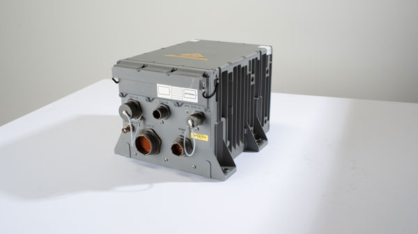
A new MGue for warfighters is moving closer to completion. (Image: EvgeniyShkolenko/iStock /Getty Images Plus/Getty Images)
Space Segment
There are currently 37 GPS satellites on-orbit with 31 set healthy. The constellation requires 24 operational satellites for worldwide coverage and a receiver needs to receive transmissions from four of them to determine its position in three dimensions. GPS continues to operate impressively with an average 45-cm accuracy throughout the past year with the most precise day on record at 31.5 cm. The space segment of GPS modernization focuses on GPS III and GPS IIIF satellite development with significant milestones rounded out in 2022.
For GPS III, after the successful launch of Space Vehicle 5 (SV05) on June 17, 2021, it was set healthy (usable) on May 25, 2022. The significance of SV05 is its full operational capability of the improved civilian L2 (L2C) signal. L2C improves service speed for commercial users via access to two frequencies, improves accuracy when combined with legacy civil GPS signals (L1 C/A), and is less susceptible to ionospheric interference. SV05 is the 24th satellite enabled with the Military Code (M-code), providing worldwide M-code coverage. M-code is designed to give military receivers better defense against jamming, improved accuracy, a more secure and flexible cryptography architecture, and the ability to detect and reject false signals.
On Jan. 18, 2023, SV06 successfully launched into orbit aboard a SpaceX Falcon 9 Block 5 rocket from Cape Canaveral Space Force Station, Florida. The launch of SV06 marks a key step in the larger goal of modernizing the GPS constellation. Additionally, the 10th and final satellite in the GPS III fleet finalized production and has a target launch date of 2026. GPS III Space Vehicles 7–10 are in storage and available for launch.
The next generation of GPS satellites continues development. The October 2022 contract award for GPS III Follow-On (GPS IIIF) satellites will onboard additional capabilities. In addition to introducing new civil signals designed to enhance search-and-rescue efficacy and aviation safety, laser retroreflector array for precise ranging, and a fully digital navigation payload, the GPS IIIF satellites will offer a new Regional Military Protection (RMP) capability providing up to 60 times greater anti-jamming measures. A new port on the Lockheed Martin LM2100 Combat Bus supports a substantial increase in flexibility, providing rapid integration of payloads in response to emerging threats in space.
GPS Enterprise interrelated segments. (Image: Space System Command)
Control Segment
The Next Generation Operational Control System (OCX) will replace the current GPS Operational Control System (OCS), supporting the latest U.S. Department of Defense standards and practices for cybersecurity. The updated system includes a modernized and expanded monitor station network, improved anti-jam capabilities, and enhanced operational capability to control modernized military signals.
In March 2022, OCX completed its fourth and final legacy ground antenna element (LGAE) installation on Kwajalein Island in the Republic of the Marshall Islands. OCX Block 1 and 2 are undergoing Hewlett Packard (HP) Formal Qualification Test (FQT). This event will qualify much of the system’s previously certified mission software functions. The event will also demonstrate system maturity and readiness for system acceptance, operator training, and specific developmental testing milestones with both GPS space and user segments.
The next-generation control system, OCX 3F, will modify OCX Blocks 1 and 2 to use the enhanced capabilities of GPS IIIF satellites. OCX 3F received Milestone B and Acquisition Program Baseline (APB) approval from the Milestone Decision Authority (MDA) and was authorized to enter the Engineering and Manufacturing Development (EMD) phase in May. In November, the OCX 3F program deployed 3F mission software into OCX’s Near Operations Environment (NOE) for the first time after completion of the program’s first Integration Readiness Review (IRR). The IRR event ensures that the software meets integrity standards and receives approval to be integrated and tested on the NOE prior to software releases to the operational users. OCX 3F anticipates achieving operational acceptance in 2027.
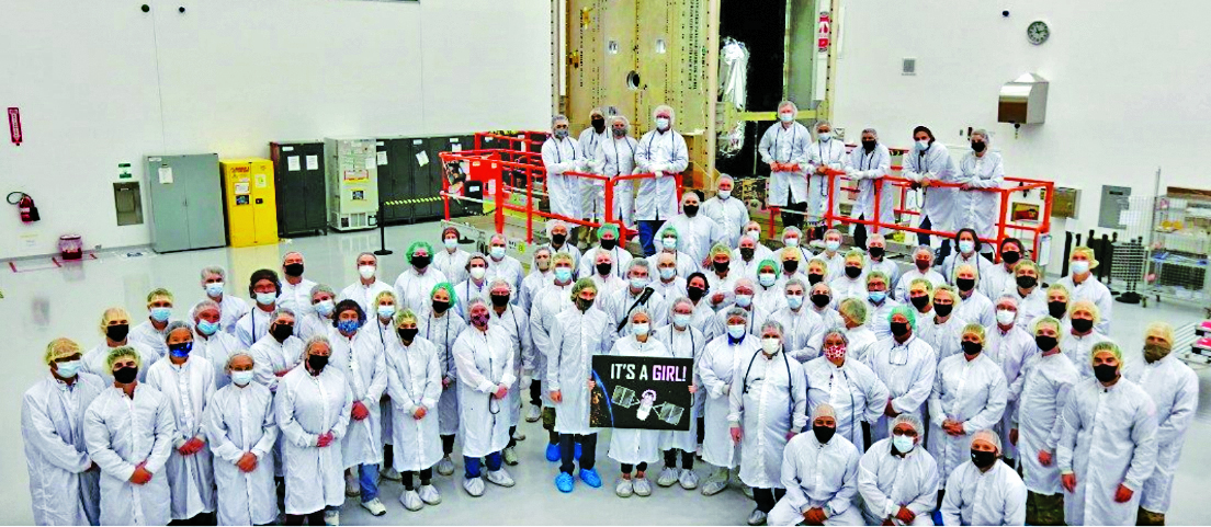
The GPS III government and industry team recently core mated GPS III SV10 and nicknamed it “Hedy Lamarr” after the actress and inventor. (Image: Lockheed Matin)
User Equipment Segment
Among the arsenal of GPS user equipment, very few pieces have the technology to use the M-code signal. Maintaining a competitive advantage against the adversary requires use of these signals; the GPS Enterprise is focused on developing Modernized GPS User Equipment (MGUE) capable of accessing these signals. The MGUE program is a joint service program developing modernized M-code-capable military GPS receivers. The program is broken into two increments (Inc 1 and Inc 2). Both are designed to deliver secure PNT performance, allow navigation warfare operations, enhance anti-jam, enhance anti-spoof and anti-tamper, and enable Blue Force Electronic Attack.
As part of the multiple elements under the MGUE Inc 1 umbrella, L3Harris delivered its final Build 7 ground card to the government on Nov. 16, 2021, and completed regression testing on that kit in February 2022. The final Delta Security Certification and Approval were completed on April 13 and April 29, 2022, respectively. Development of the L3H Ground-Based GPS Receiver Applications Module (GB-GRAM-M) card, which delivers geolocation and precise positioning capabilities for space-constrained applications while providing increased security and anti-jam capabilities, is complete and available for services procurement. MGUE Inc 1 completed qualification testing for the aviation and maritime cards on Sept. 9, 2022, with updated software builds. This build allows the program to progress to 98% of the requirements verified and enables B-2 Bombers and Guided Missile Destroyers (DDG) to continue progress toward operational testing. Completion of this commitment means significant progress toward operational testing for stakeholders and warfighters.
MGUE Inc 2 held Preliminary Design Reviews for the Miniature Serial Interface (MSI) in summer 2022, bringing the project another step closer to finalizing the EMD phase. Once all closure and action items are completed for the reviews, the government will consider each event complete. Critical Design Review (CDR) is scheduled for this summer and will validate the system design and the ability to meet system performance requirements. MGUE Inc 2 continues to execute the second competitive objective under Phase I for the Joint Modernized Handheld component; the effort is moving closer to completion of the handheld prototype and will ultimately make for a more seamless transition to operations.
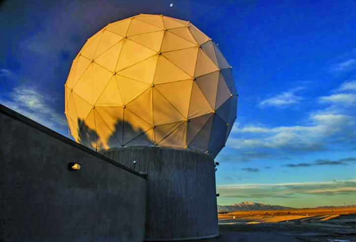
GPS ground antenna at Schriever Space Force Base in Colorado. (Image: U.S. Air Force)
Conclusion
The SSC’s mandate is paramount to maintaining our modern way of life. The space professionals dedicated to developing GPS technology are committed to delivering advanced capabilities to the warfighter, the civil sector, and the world. An interconnected world is ready for us. We’re on our way.
SSC is the U.S. Space Force field command responsible for acquiring and delivering the capabilities needed by warfighters to protect our nation’s strategic advantage in and from space. It manages an $11B budget for the U.S. Department of Defense and works in partnership with joint forces, industry, government agencies, academic and allied organizations to outpace emerging threats.
For analogous updates on the other three GNSS constellations, please see:
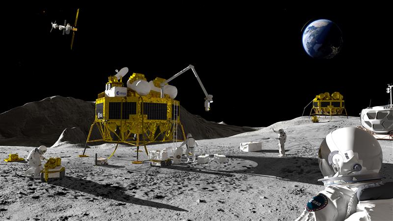
An artist’s impression of a Moon exploration scenario. (Image: ESA)
As there are several missions to the moon planned within the next decade, space agencies have started to consider how to keep time on the moon. To address time concerns, the LunaNet architecture, designed for lunar communications and navigation services, was introduced at the ESTEC technology center of the European Space Agency (ESA) in the Netherlands in November 2022.
“LunaNet is a framework of mutually agreed-upon standards, protocols and interface requirements allowing future lunar missions to work together, conceptually similar to what we did on Earth for joint use of GPS and Galileo,” said Javier Ventura-Trav
eset, ESA’s Moonlight navigation manager, coordinating ESA contributions to LunaNet. “Now, in the lunar context, we have the opportunity to agree on our interoperability approach from the very beginning, before the systems are actually implemented.”
“During this meeting at ESTEC, we agreed on the importance and urgency of defining a common lunar reference time, which is internationally accepted and towards which all lunar system and users may refer,” said Pietro Giordano, ESA navigation system engineer. “A joint international effort is now being launched towards achieving this.”
Each mission to the moon has operated on its own timescale from Earth. Deep space antennas have been used to keep onboard chronometers synchronized with terrestrial time at the same time to facilitate two-way communications. ESA stated that this way of working will not be sustainable in the coming lunar environment.
Time to think about time
Should a single organization be responsible for setting and maintaining lunar time? Also, should lunar time be set on an independent basis on the moon or kept synchronized with Earth? And what about time on other planets?
“Of course, the agreed time system will also have to be practical for astronauts,” said Bernhard Hufenbach, a member of the Moonlight Management Team from ESA’s Directorate of Human and Robotic Exploration. “This will be quite a challenge on a planetary surface where in the equatorial region each day is 29.5 Earth days long, including freezing fortnight-long lunar nights, with the whole of Earth just a small blue circle in the dark sky. However, having established a working time system for the moon, we can go on to do the same for other planetary destinations.”
To efficiently collaborate, the international community will have to settle on a common “selenocentric reference frame,” similar to the role played on Earth by the International Terrestrial Reference Frame, allowing the consistent measurement of precise distances between points across the planet.
On Dec. 20, ComNav Technology launched its Venus Laser RTK, a GNSS receiver with a millimeter-level laser that enables rod-less surveying. This product is a part of ComNav’s Universe Series of GNSS receivers.
Venus Laser RTK comes with an inertial measurement unit (IMU), which can be used in its traditional mode, with a range pole or in laser mode, which does not require a range pole, enabling GNSS surveying beyond typical limitations. In traditional mode, it has tilt compensation up to 60 degrees with an accuracy of 2.5 cm; in laser mode, it has the same tilt compensation but an accuracy of 5.5 cm.
This GNSS receiver is powered by a SinoGNSS K8 high-precision module, capable of up to 1,590 channels. It can survey using GPS, BDS-2, BDS-3, GLONASS, Galileo, QZSS, and SBAS constellations.
Other features include Bluetooth connectivity, more than 20 hours of battery life, and the fact that it is dust and waterproof. Venus Laser RTK can also withstand harsh environments and is designed to survive more than a two-meter drop.
Transport Canada has approved Ontario Power Generation (OPG) to operate Percepto’s drone-in-a-box solution beyond visual line of sight (BVLOS) at McConnell Lake Control Dam without a visual observer on site. A BVLOS Special Flight Operations Certificate was issued for the Percepto Air Max autonomous drone-in-a-box for the remote inspection.
The approval enables remote inspection of the dam as a part of a pilot project, which started in January. Since Canadian power utilities are seeking to ensure their power grid and stations are resilient, the OPG facility will gain actionable insights from the remote inspection.
Percepto’s automated drone-in-a-box has been deployed by other electric utilities to monitor the durability of power grid infrastructure and quickly detect problems, enabling faster response times and restoring power quicker after storms and natural disasters.
MGISS, a United Kingdom-based geospatial technology company, has launched the Interruption Prevention Alert Service (IPAS) project to help minimize disruptions to gas and water supplies in the UK. The European Space Agency (ESA) has partly funded this project, which will run for two years to test its technical and commercial viability and to develop a go-to-market plan.
As gas and water outages caused by construction are a growing problem in the UK, IPAS will offer a preventative solution. By leveraging satellite data and services, IPAS will automatically detect changes to the built environment and alert utility providers. The IPAS is expected to be a cost-effective solution and help utility providers reduce carbon emissions.
MGISS is collaborating on this project with Geospatial Insight, its data partner, Northumbrian Water Group (NWG) and Northern Gas Networks (NGN), its client partners, and funding partners including the ESA and the UK Space Agency (UKSA).
The launch of the pilot project is the result of a joint workshop with ESA and NWG’s 2020 Innovation Festival, and two years of ongoing collaboration with NWG and NGN.
Image: Vincent Ryan/iStock/Getty Images Plus/Getty Images
The annual European Navigation Conference (ENC23), set for May 31-June 2, will be hosted by the European Space Agency (ESA) at its ESTEC facilities in Noordwijk, The Netherlands. Abstracts are due no later than Jan. 24, and notification of acceptance or rejection will be sent out by the end of February.
This year’s conference will focus on resilient navigation. Organized by The Netherlands Institute for Navigation (NIN), the conference will address resilience in the broadest sense, including navigation sub-functions, operational routines, standards and policies.
The ENC23 tech committee has broken down the overarching theme into a range of topics, including integral end-to-end navigation solutions, specifics in position, navigation and timing (PNT), routing, data integrity questions and more.
Early-bird registration is open now and ends March 15. General registration begins thereafter and the deadline to register is May 21. For more information about registration and abstract submission, visit the ENC23’s website.
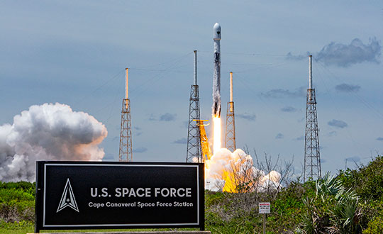
GPS III Space Vehicle 06 (SV06) was launched Jan. 18 from Cape Canaveral Space Force Station in Florida at 7:24 a.m. EST. It is the 18th GPS satellite to broadcast the L5 signal. On Jan. 12, the Space Force Space Systems Command (SSC) had completed encapsulation of SV06 within the Falcon 9 payload.
The launch of SV06 contributed to the SSC’s objective to create resilient GPS, which ensures all users have access to stable positioning, navigation, and timing (PNT) services. SV06, also known as SVN-79, will go through extensive on orbit testing after being introduced into the operational constellation on or about Jan. 25.
Lockheed Martin Space Systems is the main contractor for the GPS III SV06 space vehicle and SpaceX provided launch services. This is Falcon 9’s fifth GPS launch since SpaceX launched GPS III-2 in December 2018.
SV06 is named after the daring pilot Amelia Earhart — the first woman to fly solo across the Atlantic Ocean and to attempt to circumnavigate the world.
The next launch — GPSIII-07 — will take place in 2024.
Constellation Changes. The U.S Space Force Second Space Operations Squadron (2 SOPS) indicates that GPSIII-06, SVN-79/PRN-28, will expand the A2 node in the A plane. It will be identified as position A2F in the vicinity of SVN-52.
SVN-41/PRN-22, forecast unusable until further notice (FCSTUUFN) on Jan. 23, is being set unhealthy and will be used as a test vehicle in AEP.
Ness Czech will supply the Czech Railway Administration with a Digital Technical Railway Map (DTRM) with help from Hexagon’s Safety, Infrastructure and Geospatial division. The DTRM project has been underway since September 2022 and will be implemented by 2025.
DTRM is a railway-specific geographic information system (GIS), that provides access to transport and technical infrastructure information to better prepare investments and repair work. The basis of the DTRM project is the Technical Map Information System (ISTEM) developed by Ness and Hexagon.
The project includes digitization and consolidation of all available Czech Railway Administration data, covering more than 9,200 km of tracks, 27,000 km of technical infrastructure and an area of 21,000 ha. The delivery also includes three data centers.
The project is a legislative obligation of the Czech Railway Administration as the state is developing a national map, which will be fully operational by 2024. The Digital Technical Map of the Czech Republic is being built across the country by connecting regional digital maps, maps from the Railway Administration and maps provided by the Directorate of Roads and Highways. The connection is provided by the Czech Land Surveying and Cadastral Office.
Percepto has announced the U.S. Federal Aviation Administration (FAA) has approved the use of its UAV-in-a-box solution to perform highly automated beyond visual line of sight (HA BVLOS) inspections and monitoring operations at a large solar power plant in Texas.
The HA BVLOS UAV will fly at 200 feet above ground, which is double the altitude of any previously approved operation in the United States. The ability to fly at a higher altitude will enable greater operational flexibility to monitor large areas and tall structures in the future, including mapping and modeling.
Percepto’s HA BVLOS UAV enables an automated detect and avoid cycle, eliminating the need for remote pilot in command interventions if other aircraft are detected. Additionally, this capability negates the need for a pilot or visual observer on site.
The FAA approval for the solar plant deployment serves as a model for other industries including mining and oil and gas, to potentially increase site efficiency through automated remote inspection operation.
A Ukrainian intelligence assessment obtained by CNN and CBS reported an Iranian UAV downed in Ukraine contained technology from companies in the United States and other western countries. The White House has since launched an investigation as to how the technology — including semiconductors, GPS modules and engines — were obtained by Iran.
Screenshot: CBS video
The components removed from an Iranian Shahed-136 UAV totaled 52, 40 of which were manufactured by 13 different U.S. companies. The remaining components were manufactured by other western companies and companies based in Japan, Taiwan and China.The United States monitors exports and imposed restrictions and sanctions to prevent Iran from obtaining components for UAVs. Officials are now looking to enhance enforcement of the sanctions and are encouraging companies to monitor their supply chain, as well as identify third-party distributors who may be re-selling the technology to Iran.
U.S. companies are not alone in having to closely monitor their supply chains. U-blox, a Swiss semiconductor company, made a statement reinforcing its company policy, which bans the use of its technology in weapons. This was after u-blox GNSS modules were reportedly found in Russian UAVs.
The Army tested the EGI units with enabled M-code on the MQ-1C Gray Eagle unmanned aerial system and validated it to be deployed on military aircraft. This year, the Army will begin migrating its fleet to the Honeywell EAGLE-M EGI with M-code, as this navigation solution enhances the resiliency of GPS navigation to enemy actions.
Image: Honeywell
The defense technology company has delivered more than 300 EGIs with M-code to customers and will deliver qualified units, featuring M-code GPS, to the Army. Honeywell is a leader in EGI for military applications and has provided more than 45,000 EGI units for several different types of aircraft in more than 30 countries.