Tag: Francois Gervaix

  • Wingtra adds enhanced data capability with Trimble Business Center

    Wingtra adds enhanced data capability with Trimble Business Center

    Photo: Wingtra
    Photo: Wingtra

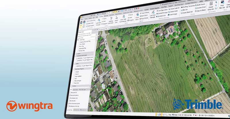
    With Wingtra’s latest software release, surveyors and geospatial professionals can now directly import WingtraOne drone data into the Trimble Business Center (TBC).

    According to Wingtra, the new integration seamlessly combines WingtraOne high-accuracy drone data within TBC, optimizing drone mapping workflows for survey and construction projects within a single software platform.

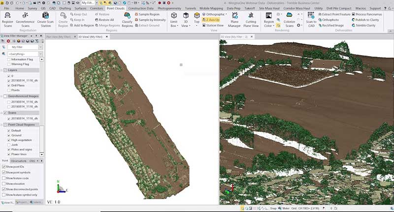
    The integration allows users to drag and drop data into the software suite. Automated point cloud tools, such as classification and feature extraction, can then be used to quickly generate surface models, topographic plans and as-built deliverables.

    Photo: Wingtra
    Photo: Wingtra

    “It’s a solid step forward to enable our data to work smoothly with Trimble Business Center,” said Francois Gervaix, Wingtra’s geospatial expert. “TBC is a reference software in the industry, because of its success as a data hub for construction and geospatial workflows. Optimizing the workflow lets TBC users smoothly integrate data from the fastest drone data capture platform on the market — WingtraOne.”

    This latest Wingtra software release that introduced JobXML (TBC file format) compatibility also brought various other product updates. Namely, high-altitude flight capabilities, longer flight times and more intuitive battery level readings in-flight, Wingtra added.

  • Business benefits of high-precision GNSS in UAV surveys

    Business benefits of high-precision GNSS in UAV surveys

    Francois Gervaix
    Francois Gervaix

    A fourth speaker has joined the panel of the free April 20 webinar, “From Flying Drones to Doing Business,” addressing UAVs in business applications. Francois Gervaix, product manager of surveying for senseFly, will address the business benefits of high precision GNSS, covering: high precision in photogrammetry drones, survey-grade accuracy, workflow flexibility and time/cost savings.

    Webinar attendees will have the opportunity to ask direct questions of the speakers, both upon registration and during the live event. Register for free at env-gpsworld-integration.kinsta.cloud/webinar.

    Gervaix joins a panel consisting of Gustavo Lopez, product manager GNSS solutions for UAV applications for Septentrio; Jan Leyssens, 
managing director of sales and business development for Airobot; and Zak Kassas, assistant professor in the Department of Electrical and Computer Engineering at the University of California, Riverside.

    Other subtopics to be covered include the integration of various surveying and mapping sensors aboard a UAV platform; meeting safety demands for UAVs by providing intelligent safety components, specifically designed for drones, and in facilitating end-users’ success in completing their missions; and exploiting long-term evolution cellular signals for accurate and resilient autonomous vehicle navigation in the absence of clear GNSS signals.

    Gervaix is a qualified geomatics engineer who has worked for Leica Geosystems and as a professor at the Technical University for Applied Sciences Western Switzerland. In 2010, he launched project R-Pod, Photogrammetry on Demand, before founding Easy2map, a drone-based photogrammetry service provider. He joined senseFly in February 2016. He is also president of the Swiss Society of Photogrammetry and Remote Sensing.