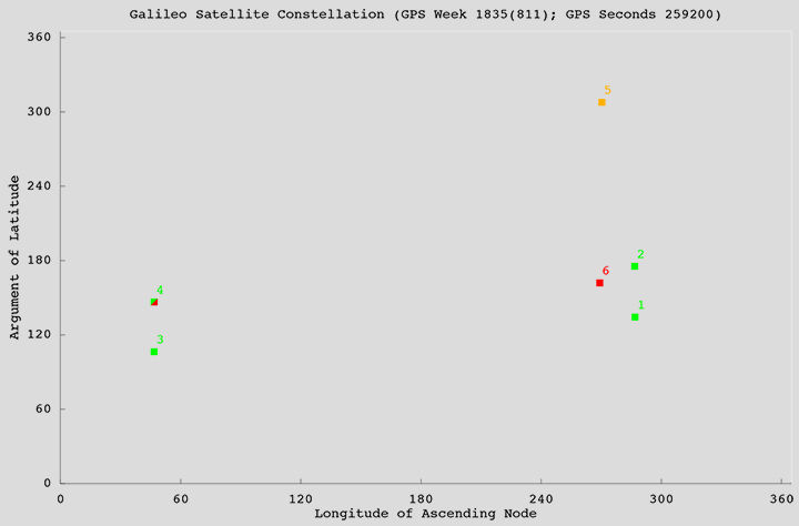
Galileo birds active
Faulty launch victims still viable
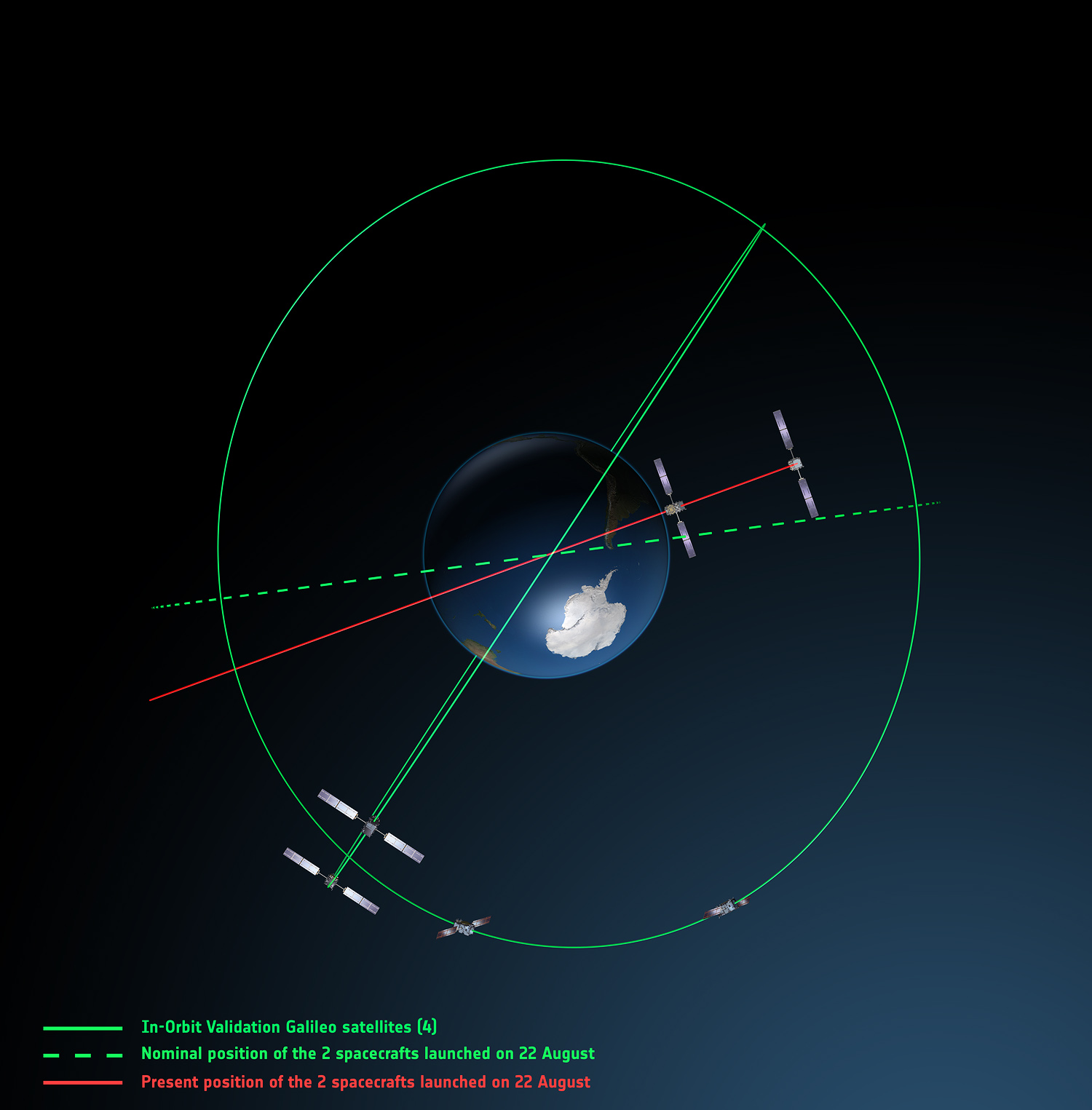
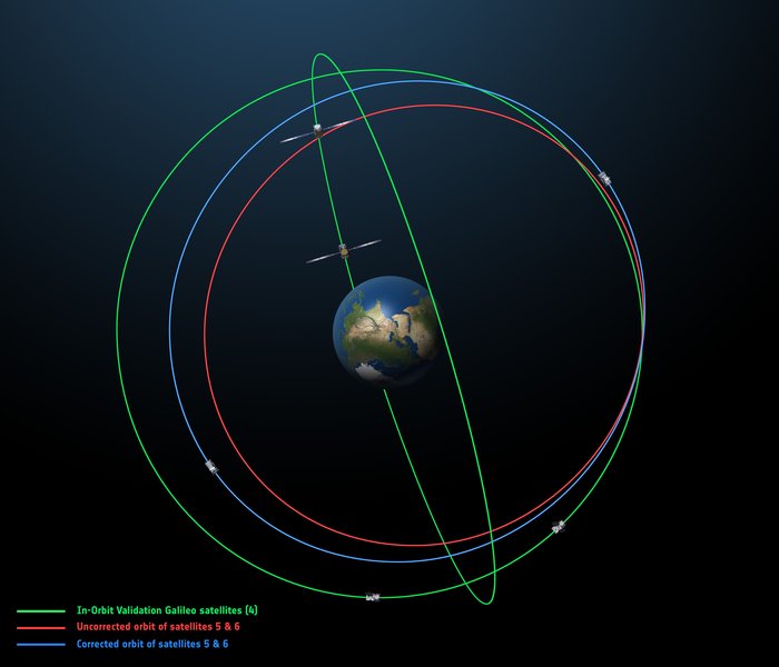
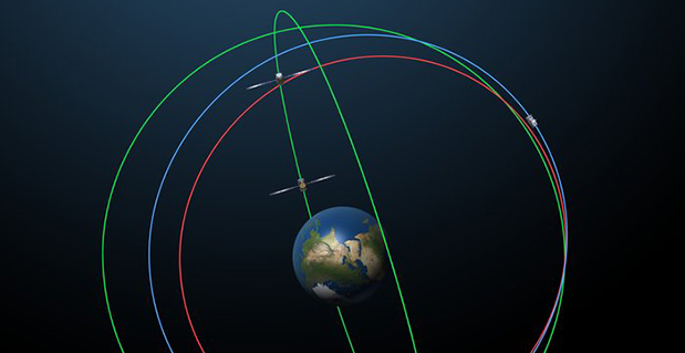
Europe’s fifth and sixth Galileo satellites, salvaged from their faulty 2014 Soyuz launch, will begin broadcasting working navigation signals for test purposes, for the benefit of receiver manufacturers, service providers and scientific researchers. The European Commission will decide later whether the two satellites will become part of the operational Galileo constellation.
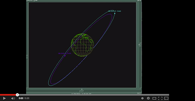
The European Space Agency performed a complex series of in-orbit maneuvers to raise and circularize the two after they arrived in space too low and too elliptical for full Galileo use. Their initial orbits dipped the satellites too close to Earth to keep their antennas properly locked on the planet.
“Once their orbits were modified, their navigation payloads could be turned on and in-orbit testing could take place,” explained Marco Falcone, head of the Galileo System Office. “The good news was their performance was excellent.
“The navigation signals will include a signal health status reading that ‘signal component currently in test’ and its navigation data validity status will be ‘working without guarantee.’ In this way, these signals will not disturb the performance of any receivers using the Galileo signals coming from the other satellites. On the user community side, some application providers are interested in harnessing as many available satellites as possible for precision applications.”
Testing will take place in two phases: initially their navigation signal will be updated via the Galileo ground segment every 14 hours or so. Later this year, the ground segment will be reconfigured to send updates more often, enhancing navigation precision, although they will remain outside the official constellation until decided otherwise.
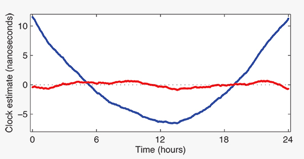
The two satellites are also midway through an ambitious space experiment to test Einstein’s General Theory of Relativity more precisely than ever before, by measuring how their onboard time varies in accordance with their altitude and therefore gravity, known as their gravitational redshift.
New Activation. Galileo GSAT-0210 (PRN E01), one of two launched May 24, began dual-frequency broadcast on Aug. 17, transmitting E1 and E5a signals.
GPS III launch RFP
Competitive bids invited
The U.S. Air Force released a Request for Proposal (RFP) in August for GPS III-3 launch services, scheduled to begin in 2019. The contract will be a standalone for a single GPS III launch.The United Launch Alliance (ULA) and Space Exploration Technologies (SpaceX) are expected to compete for the contract. In April, SpaceX was chosen to launch the GPS III-2 satellite in May 2018. ULA chose not to compete.
The RFP seeks an Evolved Expendable Launch Vehicle (EELV) Launch Service. The Air Force’s acquisition strategy seeks a balance between mission success/operational needs and lowering launch costs, reintroducing competition for national security space missions.
This is the second competitive launch service solicitation under the current procurement strategy. Previously, ULA was the only certified launch provider. In 2013, ULA was awarded a sole-source contract for launch services as part of an Air Force Block Buy of 36 rocket cores. In May 2015, SpaceX was certified for EELV launches, yielding two qualified launch service providers.
M-code, OCX updates
The Air Force awarded a $52.6 million contract to Raytheon for modernization of the Miniature Airborne GPS receiver 2000 (MAGR-2K): test and delivery of an M-code automatic dependent surveillance and broadcast-capable system. Congress has mandated the military buy only M-code GPS equipment by 2018. Last year, Rockwell Collins received a $36.6 million contract for such equipment.
OCX. Raytheon is implementing changes to its GPS Next-Generation Operational Control System (OCX). “Momentum is very good” towards a December 2020 deadline for software delivery, said the program manager. A Pentagon review in July followed breach of a critical cost-growth cap. The complexity of cyber security requirements contributed to delays to date. The company expects to deliver Block 0 software in 2017, in conjunction with plans to launch GPS III satellites. However, the capability will not be turned on until 2018, when an OCX Block 0 launch-and-checkout capability for GPS III launches is to begin.