The end of 2020 marked a milestone for the Galileo First Generation, as the program chalked up its 500th European Space Agency (ESA) Engineering Board.
For more than 12 years, ESA and industry engineers from all relevant disciplines — system, satellite, ground, signal, radio navigation, RAMS (reliability, availability, maintainability and safety), security and infrastructure — have put their best skills at the disposal of the board.
The board is a forum where technical experts regularly meet to maintain, review and update the Galileo Project technical baseline, known as the System Technical Requirements Baseline (STRB). The STRB drives the implementation of the Galileo System and its infrastructure, the space and ground segments, along with associated interfaces and operations.
The G1 system technical specification under ESA adds up to more than 22,000 separate requirements. These requirements are both unclassified and classified, with considerable interdependencies which all that need to be controlled in configuration.
The Galileo G1 Engineering Board is chaired by ESA in accordance with its role as Galileo System Design Authority, assigned to it by the European Commission.
Since the building of the first G1 Engineering Board in 2008, 26 Galileo satellites have been built, tested and flown. The Galileo system’s globe-spanning ground system has also been put in place and made operational. The board continues to be a crucial enabler for further robustness improvements and new service evolutions.
A further 12 Batch 3 satellites are set to join the constellation in the coming decade. These satellites are being finalized at OHB Systems in Bremen, Germany, and then tested at ESA’s ESTEC Test Centre in the Netherlands.
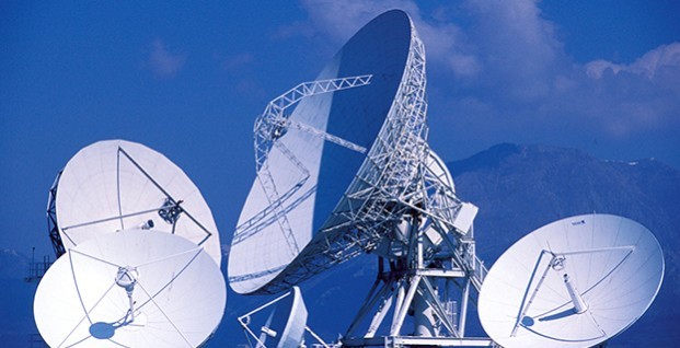
The worldwide Galileo ground segment includes two control centers (Italy and Germany) as well as various tracking, uplink and sensor stations and monitoring and test centers. (Image: ESA)
Galileo began initial operations in December 2016 and today serves more than 1.5 billion smartphones and devices.
The G1 Engineering Board meetings will continue, complemented with Engineering Boards for the new Galileo Second Generation (G2 satellites are planned for later this decade), which are already well underway.
The European GNSS Service Centre has issued Notice Advisories to Galileo Users announcing the completion of a ground segment upgrade and system testing as of 1 April 2015. The three fully operational Galileo satellites (GSAT0101, GSAT0102, and GSAT0103) have been declared available from 1 April 2015 at 00:00 UTC.
GSAT0101 (ID:11) payload on PHM clock
GSAT0102 (ID:12) payload on RAFS clock
GSAT0103 (ID:19) payload on PHM clock
GSAT0104 (ID:20) is still considered unavailable as it only transmits an E1 signal.
GSAT0201 (ID:18) and GSAT0202 (ID:14), although now in improved orbits, have not been declared available.
Meanwhile, the two recently launched satellites (GSAT0203 and GSAT0204) are slowly drifting to their assigned orbits. They are not yet transmitting standard L-band signals.
Galileo’s worldwide ground segment as of March 2013.
News from the European Space Agency
The worldwide Ground Mission Segment providing all Galileo navigation messages has completed a full-scale hardware and software migration to version V2.0, and is now fully operational again.
The Ground Mission Segment was turned off Jan. 26, allowing the migration to take place over the month of February. The following month was taken up with detailed checking by operations and system, concluding in a final “check point” on March 31 to validate the successful migration.
“The upgrade of the Galileo Ground Mission Segment from V1.2 to V2.0 has provided better overall performance and availability, along with improved robustness, security and operability,” explained Martin Hollreiser, overseeing mission segment development for ESA, with Thales Alenia Space France as prime contractor. “The overall outcome of our check point confirmed that the new GMS V2.0 migrated to the operational chain is a major improvement and no blocking issues were identified. An overall 25 percent performance improvement is confirmed.”
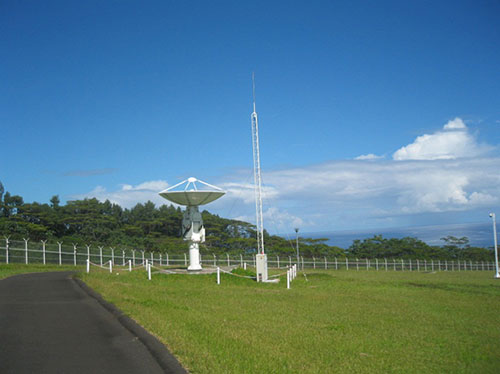
The new Papette Uplink Station in Tahiti, French Polynesia, used for uplinking navigation messages for rebroadcast to users from Galileo satellites.
“The process began with the upgrade of the infrastructure hardware at Galileo’s control centre in Fucino, Italy, and remote sites disconnected from the system to be monitored locally,” Hollreiser said. “This physical process was followed by a software update, and then a full-scale test campaign before handing back to operations and resuming the nominal Galileo mission on 6 March.
“Three new sensor stations (Kiruna, Ascension and Azores) — used to monitor the satellite navigation signals — were also added to the operations chain, as well as a new uplink station (Papeete) — used to uplink corrections incorporated in the navigation message to the satellites for broadcast to the users.”
Papette Uplink Station
Galileo is Europe’s satellite navigation system. The accuracy of its positioning fixes ultimately comes down to accurate satellite orbit determination and timing measurements and corrections that are precise down to a few billionths of a second. A satnav receiver determines its position by calculating the time it takes for signals to arrive from multiple satellites in space.
To keep those timings sufficiently precise, the entire Galileo system can be thought of as one gigantic planetary-scale clock, with the Ground Mission Segment at its core, determining the exact satellite orbits and synchronizing all the satellite and terrestrial elements of that clock: the relevant control center is linked to a global network of ground stations (sensor and uplink stations).
Operated by Telespazio, Fucino in central Italy is among the world’s largest satellite ground stations.
Each of the Galileo satellites in space carries multiple atomic clocks on board, which, although very accurate, drift slightly over time. So sensor stations on the ground extract measurements from the satellites’ signals and send these to the Galileo control center in Fucino, Italy. Here, processing takes place to derive very accurate satellite orbits and clock synchronization.
Any necessary corrections are then built into an updated navigation message that is then transmitted to the satellites via a set of five uplink stations. The satellites themselves then rebroadcast these corrections down to the users, to be automatically interpreted by receivers to maintain service precision.
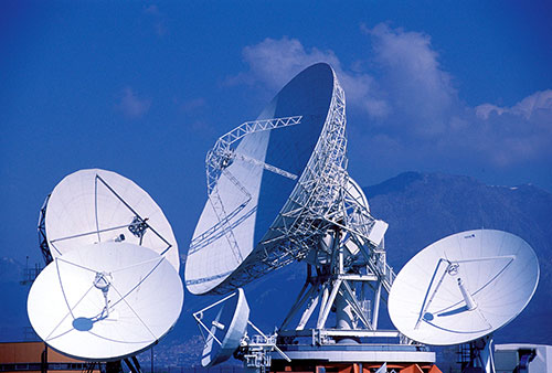
Worldwide Galileo Ground Segment
During the upgrade, this regular updating of navigation messages no longer took place, so the accuracy of the Galileo signals to users slowly degraded. Users were informed of this process through a flag in the signal itself, as well as through the online Notice Advisory to Galileo Users (NAGU) notification process.
An updated NAGU has been issued to inform users that Galileo services are back. Right now the signals are being used for technical testing, with early services for the public projected for 2016.
“A further Galileo Ground Mission Segment update is foreseen for the end of this year,” Martin said. “But this time the upgrade should be executed in a seamless manner, with no interruption of services.”
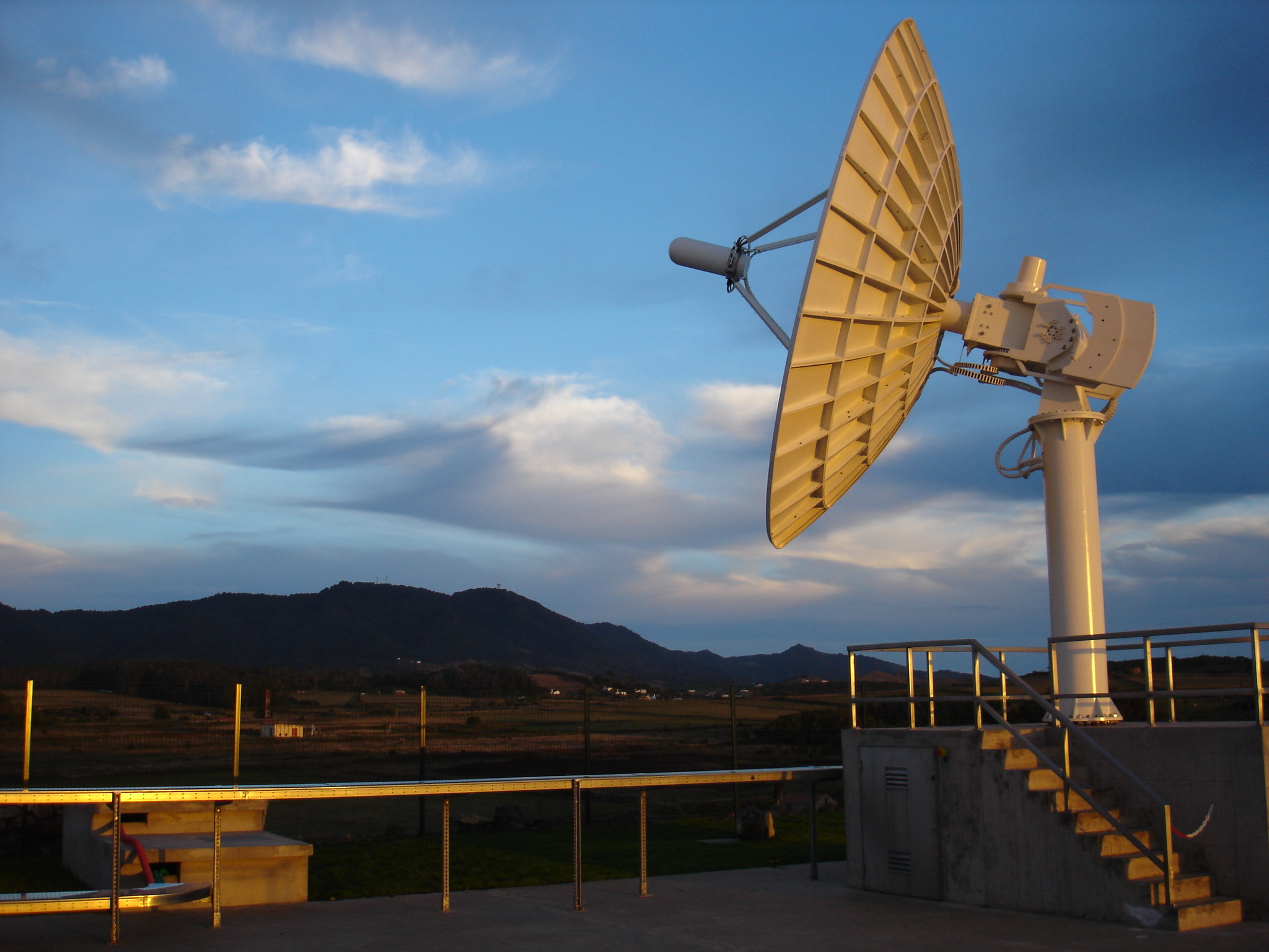
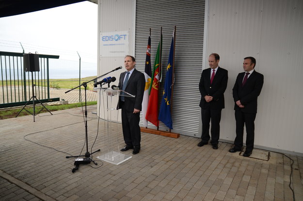
ESA’s Galileo Ground Segment Procurement Manager Syvain Loddo speaks during the opening ceremony of the new Galileo Sensor Station on Portugal’s Santa Maria island.
The latest addition to Galileo’s worldwide ground infrastructure has been made in the mid-Atlantic, on Portugal’s Santa Maria island in the Azores. This new Galileo Sensor Station joins a far-flung network of stations monitoring signal quality, clock timings and positioning of the Galileo satellites orbiting Earth.
Its formal opening ceremony on March 26 was presided over by the Azores’ Regional Secretary of Tourism and Transport Vitor Fraga and ESA’s Galileo Ground Segment Procurement Manager Syvain Loddo.
The station’s omnidirectional antenna itself is just half a meter in length, but also requires a power plant and guard house as well as a pair of small VSAT satellite antennas to link the station to the worldwide Galileo Ground Segment.
About 1500 km from mainland Portugal, the small, mountainous island of Santa Maria is already home to an ESA Estrack station, used to follow launches from Europe’s Spaceport in Kourou, French Guiana. The new station is adjacent to this existing site, known locally as the Montes das Flores (Hill of Flowers). It is built on land owned by the Region of Azores, which is Portugal’s public regional authority overseeing the archipelago. The site meets Galileo’s characteristic needs, located away from built-up areas on flat land offering a clear view of the sky in all directions.
ESA’s Santa Maria ground station is located on the ‘Montes das Flores’ (Hill of Flowers) on Santa Maria island in Portugal’s mid-Atlantic Azores. It includes a Galileo Sensor Station.
Both stations have been built by Portugal’s Edisoft company, part of the Thales Group, also responsible for maintaining and running the sites.
Later this year, the Azores station will also host a reference beacon used for assessing Galileo’s Search and Rescue system. As part of the international Cospas–Sarsat system, the medium-orbit Galileo constellation is equipped to pick up UHF signals from emergency beacons aboard ships, aircraft or carried by individuals for relay to the nearest emergency services.
The island has a notable footnote in the history of navigation: reputedly, Christopher Columbus’s flagship Niña landed there in February 1493, having just “discovered” the Americas.
Santa Maria’s climate is mild, although identical Galileo stations have been established everywhere from stormy Arctic islands to the icebound Antarctic mainland.
Multiple Galileo Sensor Station sites will work together to perform ranging measurements while holding a Galileo satellite in common view, seeking to identify any orbital drift that might reduce satnav accuracy. This is effectively a reversal of the way satellite navigation normally operates, with multiple satellites’ signals used to pinpoint the user’s receiver location.
Galileo’s ground segment also includes a number of larger Uplink Stations to transmit navigation messages, including any corrections for rebroadcast to users, as well as Telemetry, Tracking and Command Stations to oversee the satellite platform. A pair of control centres in Fucino, Italy, and Oberpfaffenhofen, Germany, oversees the satellites and their navigation services.
The first four Galileo satellites are already in orbit and operational. Over the course of 2014 more satellites will join them, with initial Galileo services scheduled to start by the end of this year.