Tag: Galileo Satellite Navigation

  • Galileo’s impressive achievements

    Galileo’s impressive achievements

    Matteo Luccio
    Luccio

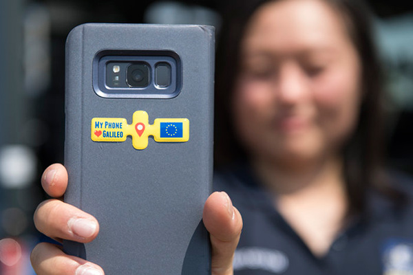
    To paraphrase Galileo Galilei — the great Italian astronomer, philosopher, engineer, mathematician and physicist — positioning, navigation and timing (PNT) does not revolve around GPS. The European GNSS named after the father of modern science (as Albert Einstein called him) is making great strides and currently provides more accurate positioning than the United States’ GPS, Russia’s GLONASS, or China’s BeiDou-3. In fact, there are more Galileo satellites providing an L5 signal than GPS satellites.

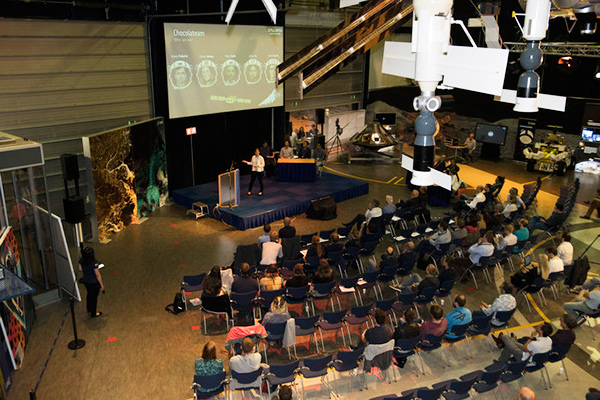
    I heard much well-earned pride about Galileo’s achievements expressed by European presenters at the Institute of Navigation’s GNSS+ conference in Denver in September; during a visit to the European Commission’s Joint Research Center in Ispra, Italy, on Oct. 7; and at the INTERGEO conference and trade show in Essen, Germany, on Oct. 18-20. (On the way, I stayed several days in Pisa, Italy — where I spent my teen years when my father taught physics at the city’s university — at a friend’s home about 100 feet away from the house where Galileo was born in 1564.)

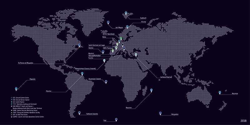
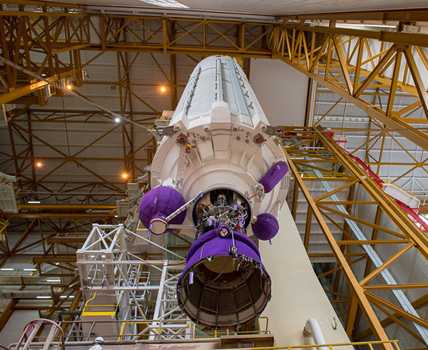
    While two more launches are required to complete the Galileo constellation so that it will have at least one spare satellite per plane, its service availability is already at 98-99% and a new ground segment has been deployed. A second generation of satellites is on its way, with expected initial operational capability in 2028 and full operational capability starting after 2031. Its features will include new signals, improved effective isotropic radiated power (EIRP), inter-satellite links, and a 15-year lifespan.

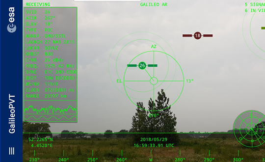
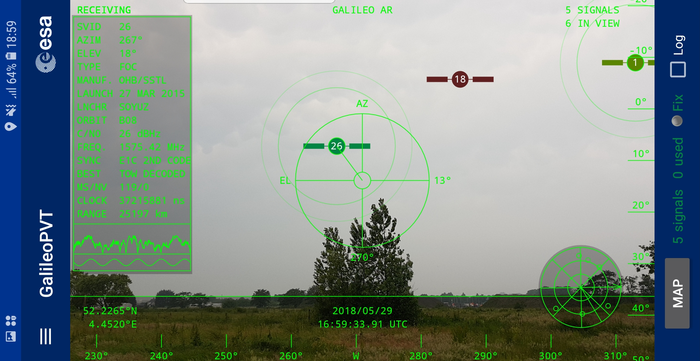
    The Open Service Navigation Message Authentication (OSNMA), a free data authentication function for users of Galileo’s Open Service, has been stably transmitted worldwide for a year. It will enable users to verify the authenticity of GNSS data, thereby greatly helping to detect instances of spoofing. A declaration of initial service is foreseen for 2023, and the first OSNMA-capable receivers are already on the market.

    Galileo’s High Accuracy Service (HAS) signal has been available worldwide with orbit and clock corrections and biases for Galileo and GPS since July 22. While it is still in its validation phase, it is already performing very well and an initial service declaration is expected by the end of the year, including an Internet-based correction distribution service.

    Galileo is also developing an emergency warning service that will use the L1 band to broadcast alerts and guidance to populations at risk of natural disasters. It is expected to enter service in 2024 and reach any Galileo-enabled device, of which there are already about three billion. Other services will include advanced timing, space service volume (to aid in the positioning and navigation of spacecraft in high-Earth orbits), advanced receiver autonomous integrity monitoring (ARAIM), and predictions of ionospheric perturbations.

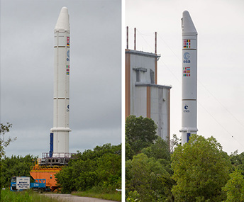
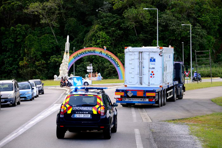
    Like so much else, completion of the Galileo constellation was affected by Russia’s war in Ukraine, because two launches planned for this year from French Guyana aboard Russian Soyuz rockets were scrapped.

    Finally, one of my favorite quotes from Galileo: “Measure what can be measured and make measurable what cannot yet be measured.”

  • CGI joins with Thales on Galileo security software

    CGI joins with Thales on Galileo security software

    Protective "radome" housing for the Galileo ground station on desolate Jan Mayen Island in the Norwegian Arctic. The site is housing a Galileo Sensor Station plus satellite link to pass data back to the Galileo ground system (Photo: ESA/Fermin Alvarez Lopez)
    Protective radome housing for the Galileo ground station on desolate Jan Mayen Island in the Norwegian Arctic. The site is housing a Galileo Sensor Station plus satellite link to pass data back to the Galileo ground system. (Photo: ESA/Fermin Alvarez Lopez)

    CGI has signed an agreement with Thales Alenia Space France to enhance and maintain security software for the Galileo satellite navigation system.

    Valued at approximately 14 million euros, the contract will last until the end of 2020. CGI experts are working on this strategic project from Rotterdam and Toulouse.

    CGI will improve the functionality, robustness and reliability of Galileo’s ground infrastructure, as well as enhance and maintain software for its Public Regulated Service Key Management Facility (PKMF).

    The Public Regulated Service (PRS) is one of the key features that distinguishes Galileo from other satellite navigation systems. It ensures that only government-authorized entities have access to Galileo’s secure PRS signal that meets strict security standards in areas such as defense, law enforcement and customs.

    “We look forward to working with CGI to ensure the highest level of security for Galileo, along with an efficient, high performance infrastructure,” said Guillermo Salgado, Galileo ground mission and EGNOS programs director, Thales Alenia Space France. “CGI’s significant space and security experience, combined with its local presence and global resources, gives us access to the experts we need to launch and operate one of the world’s most advanced satellite navigation systems.”

    “CGI has strong legacy in space, and we continue to support space clients across the globe, actively managing their business and national interests while positioning CGI as a trusted space leader,” said Dirk de Groot, who leads CGI’s business unit in the Netherlands.

    CGI has more than 40 years of experience in the space domain and delivers complex, mission-critical space software systems across Europe, Asia and North America, supporting programs from satellite navigation, communications and operations, to space-enabled applications.

  • Galileo to receive global infrastructure upgrade

    Galileo to receive global infrastructure upgrade

    News from the European Space Agency

    The European Space Agency (ESA) has received approval from the Galileo Security Accreditation Board to upgrade the global infrastructure running Europe’s Galileo satellite navigation system.

    According to ESA, the resulting migration, set to start in February 2019, will incorporate new elements into the world-spanning system and boost the robustness of Galileo services delivered from the 26 satellites in orbit.

    The system qualification campaign, which was run by the ESA Galileo project team in coordination with the WP1x system support team led by Thales Alenia Space in Italy, took more than a year to execute. It included more than 150 system tests — summing up to a total of 409 tests runs across Europe — in the various Galileo operational centers.

    Galileo's global ground segment. (Photo: ESA)
    Galileo’s global ground segment. (Photo: ESA)

    According to ESA, a major driver of this latest update was the growth of the Galileo constellation, which increased by 12 satellites through a trio of Ariane 5 launches in the last three years to become Europe’s largest.

    The updated ground system incorporates a sixth telemetry, tracking and control station in Papeete, used to oversee Galileo satellite platforms, as well as an expansion of the number of antennas at the sites of uplink stations at Kourou in French Guiana, Reunion Island in the Indian Ocean and Noumea in French Polynesia.

    In addition, receivers have been added to the Galileo sensor stations to ensure full redundancy.

    “This marks the first update for Galileo’s operational infrastructure since it entered service,” said Edward Breeuwer, ESA Galileo system test and verification manager. “Galileo Initial Services began in December 2016, then last year we passed control of the system to our partner organization, the European Global Navigation Satellite System Agency, or GSA.

    “This, therefore, marks a major step, but migration to the upgraded system should in principle be entirely transparent to Galileo users. We achieve this by taking advantage of the redundant elements of the Galileo system, taking them offline to update them while their operational counterparts continue to run.”


    Featured photo: ESA/Fermin Alvarez Lopez

  • Galileo satellites viewed in smartphone app

    Galileo satellites viewed in smartphone app

    The European Space Agency (ESA) has released an augmented reality view of Galileo satellites in the sky close to its technical centre in the Netherlands.

    The image comes from a Galileo-focused satnav app for Android smartphones, developed by ESA engineers. ESA ran an internal competition for its trainees to develop an app capable of making positioning fixes using only Galileo satellites.

    “As part of our support for the competition, we developed our own app on a voluntary basis to serve as a benchmark,” said Paolo Crosta of ESA’s Radio Navigation Systems and Technology section. “We included this augmented reality view, so users can ‘see’ the satellites their smartphone is using as they hold it up to the sky.”

    Galileo satellites viewed in smartphone app. (Photo: ESA)
    Galileo satellites viewed in smartphone app. (Photos: ESA)

    The positioning calculations and assistance data functions for the app were developed by Paolo, with telecom engineer Tim Watterton contributing the main structure of the app, together with how it looks and its user interface.

    “The satellites are overlaid in real time on the camera view in their predicted positions in the sky, based on ‘ephemeris’ information, assistance data that describes the current satellite orbits with high precision,” Watterton said. “When a signal is being received, the satellite is shown in green, overlaying the predicted position. The satellite shown in red is one of the two placed in elongated orbits, but these satellites are expected to be used soon in the operational constellation. Satellites colored orange are transmitting, but the signal is not detected, which may be due to obstruction by terrain or buildings.”

    Panning the phone around to position the crosshair over a green-colored satellite adds additional information, such as its signal status, pseudorange (the uncorrected distance the signal has traveled to reach the receiver) plus the satellite’s manufacturer and launch date, among other items.

    The reference app is now being tested with the hope of making it publicly available on the Google Play Store. Following the competition, the trainees are also testing their own apps with the goal of releasing them.

    There are 22 Galileo satellites in orbit, with four more satellites set for launch on July 25.

  • ESA trainees compete in Galileo app contest

    ESA trainees compete in Galileo app contest

    News from the European Space Agency (ESA)

    Testing of the three Galileo apps took place in May. (Photo: ESA)

    ESA challenged its young graduate and national trainees to develop a smartphone app to perform satnav fixes using only Galileo satellites.

    Three teams developed apps in their spare time, presenting their results to a jury of experts from ESA, the European Global Navigation Satellite Systems Agency (GSA) and Google.

    “I’m very impressed,” said Javier Benedicto, ESA’s Galileo programme manager. “With little detailed knowledge of satellite navigation, these teams have developed something that didn’t exist just a few months ago. Working on Galileo we love to see that the systems we’re putting together can reach widespread application and inspire new uses.”

    The winning Galfins Team put together the GNSS Compare app that promises to turn a smartphone into a “research lab in your pocket” to test Galileo performance in isolation or in combination with other systems. Their prize is to attend an ESA and European Commission-sponsored GNSS Summer School in Austria.

    The final presentation and results of ESA’s internal Galileo smartphone app competition took place in the Erasmus centre of ESA’s Erasmus technical centre on May 31. (Photo: ESA)

    “Only one of our four-strong team started the challenge with any knowledge about satellite navigation,” said Mateusz Kraiński of the Galfins team. “The rest of us come from different areas — for example, I’m working on the European Robotic Arm project, due to launch at the end of next year. We have learnt a lot and the radio navigation experts at ESTEC were a great source of support.”

    “We see a need on the market for such an application, so we will definitely continue with the development. The application will be made available for download when ready, and the project will be released as open source soon after.”

    The other two teams were also commended for their work; Chocolateam developed a richly-designed game-based app, giving the user the feeling of observing the Galileo satellites from a spacecraft, while Team 5G distinguished themselves by writing all their own navigation algorithms from scratch rather than relying on open source software.

    The challenge was to design an Android smartphone app that allows users to compute and visualize their position based solely on Galileo measurements, as well as the possibility of selecting a combination of satnav constellations to assess their performance.

    Testing the three apps entered in the Galileo smartphone app competition in the grounds of ESTEC, working in pedestrian mode. (Photo: ESA)

    The receiver chipsets inside smartphones make use of Galileo signals in combination with several other satnav constellations — the U.S. GPS, Russian GLONASS and Chinese BeiDou. These chipsets function like “black boxes,” making the resulting positioning fix accessible to users, but not giving any option for the user to select which constellation to employ.

    Current phone applications only display general satnav status information, such as which satellites are contributing to the positioning fix, their visibility parameters and overall power levels. This is not sufficient to single out Galileo’s contribution to the phone’s overall positioning performance.

    However, in newer Android smartphones it has become possible to access the raw signal measurements used to compute position, opening the door to the development of applications where the user can indeed select which satellites to use.

    The teams received one Galileo-enabled smartphone each for developing and testing the app.

    ESA’s Director of Technology, Engineering and Quality supported the teams by supplying dedicated software modules to simplify computations of the phone position. During the competition, a technical advisory team also developed an internal app as a benchmark.

    The app, named Galileo PVT and developed by ESTEC engineers Paolo Crosta and Tim Watterton, includes an augmented reality system allowing users to “see” the Galileo satellites from which they were receiving signals in the local sky.

    “This was a very useful exercise because it helps us understand the needs of satnav app developers in Android,” said the lead advisor, Paolo Crosta. “Then, once the apps were complete, we tested them together, here on the grounds of ESTEC, working in stationary, pedestrian and vehicular modes.”

    “Congratulations to all the teams here today,” said Frank Van Diggelen from Google, who had just come from a satnav raw measurements workshop hosted by GSA. “It’s been great to be here and see all the activity around raw signal measurements. Our aim has always been to raise standards by making these measurements available, to let developers see what’s happening inside. And the work you’re doing here is feeding back to chip and smartphone manufacturers, to help change and improve them for the future.”

  • Satellites and rocket readied for July 25 Galileo launch

    Satellites and rocket readied for July 25 Galileo launch

    Ariane 5’s cryogenic main stage is moved into position over the mobile launch table inside the Spaceport’s Launcher Integration Building. (Photo: Arianespace)

    Four more Galileo satellites will be launched on a customized Ariane 5 on July 25.

    The next Arianespace rocket to orbit Galileo satellites has begun taking shape at the spaceport in French Guiana, reported Arianespace. Build-up of the heavy-lift vehicle is now underway inside the spaceport’s Launcher Integration Building.

    Following the established assembly flow, the rocket build-up began with this week’s positioning of the launch vehicle’s central core cryogenic stage over one of two mobile launch tables used for Ariane 5.

    Ariane 5’s two solid propellant boosters are rolled out. (Photos: Arianespace)

    It was followed by integration of the two large solid propellant boosters — installed directly on the launch table and mated to the core stage — clearing the way for placement of the upper stage, topped off with the vehicle equipment bay.

    Once the Ariane 5’s basic build-up is completed under the direction of production prime contractor ArianeGroup, it will be moved to the spaceport’s Final Assembly Building for installation of its four Galileo FOC (Full Operational Capability) satellite passengers, which are undergoing their own pre-flight preparations at the spaceport.

    The Ariane 5 will deploy its satellite passengers at a targeted orbital altitude of 23,222 kilometers in circular medium Earth orbit. The launch is designated Flight VA244 by Arianespace.

    Galileo satellites arrive

    In early June, Galileo satellites 25 and 26 landed at Europe’s Spaceport in Kourou, French Guiana, joining their two predecessors, satellites 23 and 24, according to the European Space Agency (ESA).

    One of the two Galileo satellites 25 and 26 is unloaded from a Boeing 747 cargo jet at Cayenne – Félix Eboué Airport in French Guiana on June 1. The satellites travel inside protective air-conditioned containers. (Photo: ESA)

    The pair left Luxembourg Airport on a Boeing 747 cargo jet on the morning of June 1, arriving at Cayenne – Félix Eboué Airport in French Guiana that evening.

    After they were off-loaded, they were driven by truck to the cleanroom environment of the S1A payload preparation facility at Europe’s Spaceport, still in their protective air-conditioned containers. In the cleanroom, they joined Galileo satellites 23 and 24, which arrived last month.

    The cryogenic main stage of the Ariane 5, known as the EPC — from its French title Etage Principal Cryogénique — arrived by sea at French Guiana’s Port Pariacabo on May 30.

    A further 12 Galileo “Batch 3” satellites were ordered in 2017, supplementing the 26 built so far to provide further in-orbit spares and replacements for the oldest Galileo satellites, first launched in 2011.

    A steady stream of orbital spares, ready to replace satellites reaching the end of their operational lives, is essential to ensure Galileo continues operating seamlessly, according to ESA.

    Looking further ahead, with the aim of keeping Galileo services as a permanent part of the European and global landscape, new satellites will be required by the middle of the next decade, offering improved performance and added features.

  • Galileo pair arrive at spaceport for July launch

    Galileo pair arrive at spaceport for July launch

    News from the European Space Agency

    The next two satellites in Europe’s Galileo satellite navigation system have arrived at Europe’s Spaceport in Kourou, French Guiana, ahead of their planned launch from the jungle space base in July.

    Galileo satellites 23 and 24 left Luxembourg Airport on a Boeing 747 cargo jet on the morning of May 4, arriving at Cayenne – Félix Eboué Airport in French Guiana that evening.

    Arrival at the Felix Eboué airport on April 5, 2018. (Photo: ESA)
    Arrival at the Felix Eboué airport on April 5, 2018. (Photo: ESA)

    They were then unloaded, still in their protective air-conditioned containers, and transported by truck to the cleanroom environment of the preparation building within Europe’s Spaceport.

    This pair will be launched along with another two Galileo satellites, which are due to be transported to French Guiana later this month.

    The quartet will be launched together on a customized Ariane 5 on July 25.

    The Galileo System began Initial Services on Dec. 15, 2016, and a growing number of commercial devices are using Galileo today. Completion of the constellation should improve Galileo’s positioning accuracy further still.

    One of two Galileo satellites being driven by truck to the Guiana Space Centre inside its container. Galileo satellites 23 and 24 left Luxembourg Airport on a Boeing 747 cargo jet on the morning of May 4, arriving at Cayenne – Félix Eboué Airport in French Guiana that evening. (Photo: ESA)

    But Galileo satellites will continue to be launched into the future: a further 12 Galileo “Batch 3” satellites were ordered last June, supplementing the 26 built so far to provide further in-orbit spares, and replacements for the oldest Galileo satellites, first launched in 2011.

    A steady stream of orbital spares, ready to replace satellites reaching the end of their operational lives, is essential to ensure Galileo continues operating seamlessly.

    Looking further ahead, with the aim of keeping Galileo services as a permanent part of the European and global landscape, replacement satellites will be required by the middle of the next decade, offering improved performance and added features.

  • Software-based GNSS receiver available on Cadence digital signal processor

    A software-based GNSS receiver from Galileo Satellite Navigation (GSN) is now available for the Cadence Tensilica Fusion F1 digital signal processor (DSP).

    The software-based GNSS receiver allows customers to add full GPS functionality with design flexibility and long-term upgradeability at a minimal cost, low power and no physical size to today’s cost-sensitive internet of things (IoT) applications, according to Cadence Design Systems.

    To get the lowest possible power, GSN accelerated the performance of its GPS software receiver by creating several custom instructions to run on the Tensilica Fusion F1 DSP. As a result, the GPS software requires less than 110 MHz for full 12-satellite functionality.

    Additionally, with this software-based solution, customers can reduce the overall processor requirements to meet less-demanding location-based use cases such as asset tracking.

    “The Tensilica Fusion F1 DSP delivers outstanding performance for the implementation of our GNSS receivers, providing a low-power footprint required for IoT applications,” said Eli Ariel, CEO at GSN. “This enables customers to easily upgrade their Fusion F1 DSP-based designs to future satellite systems such as Beidou, GLONASS and Galileo via software. By leveraging several customized instructions in the Fusion F1 DSP, we were able to keep the required processor speed at the same frequency compared to DSPs with more than three times the processing power.”

    “GSN’s software-based approach for GNSS allows our Fusion F1 DSP customers to precisely scale their GNSS receiver requirements to meet their applications needs,” said Gerard Andrews, group director marketing, at Cadence. “The availability of GSN’s technology on this low-power DSP platform allows our customers to add location-based services at minimal cost and power.”

    The Tensilica Fusion F1 DSP offers low-energy, high-performance control and signal processing for a broad segment of IoT/wearable markets. This highly configurable architecture is specifically designed to excel at always-on processing that requires a merged controller plus DSP, ultra-low energy and a small footprint.

    The DSP is efficient in running the narrowband wireless communications standards typically associated with IoT device communications, including protocols such as Bluetooth Low Energy, Thread and Zigbee using IEEE 802.15.4, Wi-Fi 802.11n and 802.11ah and GNSS.

  • Two more satellites join Galileo constellation

    Two further satellites have formally become part of Europe’s Galileo satnav system, broadcasting timing and navigation signals worldwide while also picking up distress calls across the planet, reported the European Space Agency.

    Liftoff of Ariane flight VA233, carrying four Galileo satellites, on Nov. 17, 2016.

    These are the 15th and 16th satellites to join the network, two of the four Galileos that were launched together by Ariane 5 on Nov. 17, 2016, and the first additions to the working constellation since the start of Galileo Initial Services on December 15.

    The growing number of Galileo users around the world will draw immediate benefit from the enhanced service availability and accuracy brought by these extra satellites.

    The launch into space and the maneuvers to reach their final orbits still left a lot of rigorous testing before the satellites could join the operational constellation.

    Their navigation and search and rescue payloads had to be switched on, checked and the performance of the different Galileo signals assessed methodically in relation to the rest of the worldwide system.

    Galileo L-band antenna at ESA’s Redu ground station.

    This lengthy testing saw the satellites being run from the second Galileo Control Centre in Oberpfaffenhofen, Germany, while their signals were assessed from ESA’s Redu centre in Belgium, with its specialized antennas.

    The tests measured the accuracy and stability of the satellites’ atomic clocks – essential for the timing precision to within a billionth of a second as the basis of satellite navigation – as well as assessing the quality of the navigation signals.

    Oberpfaffenhofen and Redu were linked for the entire campaign, allowing the team to compare Galileo signals with satellite telemetry in near-real time.

    Making the tests even more complicated, the satellites were visible for only three to nine hours a day from each site.

    The satellites are now broadcasting working navigation signals and are ready to relay any Cospas–Sarsat distress calls to regional emergency services.

    Now that these two satellites are part of the constellation, the remaining pair from the Ariane 5 launch is similarly being checked to prepare them for service.

  • u-blox joins Qualcomm and Broadcom as top three GPS/GNSS IC vendors

    ABI Research’s competitive analysis evaluates GNSS IC vendors across innovation and implementation parameters

    The GNSS market is slowly shifting in new directions, according to ABI Research. While the smartphone market continues to grow, new opportunities are also emerging in automotive, insurance, wearables, unmanned aerial vehicles (UAVs) and the Internet of Things (IoT).

    Overall, the GNSS market is forecast to continue to grow strongly, with ubiquitous location and market-specific IC design as key differentiators.

    In its latest competitive analysis of GNSS IC vendors, ABI Research evaluates a variety of innovation and implementation parameters to determine emerging competitive threats and technologies, the companies best positioned for success and those in danger of losing out.

    Unchanged for the past three years, the market’s two top IC vendors remain Qualcomm and Broadcom, soon to be acquired by Avago. Both companies continually illustrate the ability to lead the way on cutting-edge innovation, which in turn drives their dominant market-share position, ABI Research said.

    Beyond just GNSS, both companies also offer comprehensive location technology platforms in HULA (Broadcom) and Izat (Qualcomm), which will enable smartphone OEMs to begin offering ubiquitous location in 2016. Qualcomm’s work on LED/VLC and LTE Direct illustrates the gap that now exists between it and pure-play GNSS IC vendors.

    u-blox, a well-established GNSS IC company, has shown continuous growth each year by implementing  new technologies and making  acquisitions, culminating in its first ever third place ranking, ABI Research said. The company continues to lead the way in its core markets, while also expanding into the emerging IoT space.

    “The big surprise this year has been MediaTek dropping to fourth place,” said Patrick Connolly, principal analyst at ABI Research. “This is primarily due to a lack of new GNSS or indoor location products. However, this did not affect its IC market share, or its ability to win an important GNSS IC win with Fitbit in wearables. MediaTek has a history of delivering when its customers need new innovation. As a result, ABI Research expects new product announcements from the company in 2016, especially around indoor location.”

    Ranking fifth, STMicroelectronics is seeing customers migrate to its TESEO III platform. Its modular, high-performance approach should also enable it to move beyond its traditional markets of automotive and recreational/fitness, especially as it has begun to leverage the company’s expertise in sensor fusion.

    As new opportunities for GNSS continue to develop in markets such as wearables, IoT, personal tracking and UAVs, there will also be a number of new or emerging companies looking to claim a share in the stakes. Analysis findings point to the Chinese regional market as one such area that has potential to demonstrate strong growth trends in future years.

    “There’s big opportunity for emerging Chinese start-ups, such as CEC Huada, to meet new, indigenous, market demand over the next 10 years, while also working their way toward becoming major international competitors,” concluded Connolly. “Additionally, Galileo Satellite Navigation, an emerging company focused in software GPS, is reporting impressive results in trials. As consumer electronics start supporting software GPS, it will be interesting to watch whether or not it can achieve volume shipments in 2016.”

    These findings are part of ABI Research’s Location Devices Service, which includes research reports, market data, insights and competitive assessments.

  • Israeli startup aims for flexibility with GNSS software receiver

    Galileo Satellite Navigation Ltd. (GSN), an Israeli startup, is demonstrating a navigation solution that can “pull the sword out of the stone,” said Uri Michon, sales and marketing manager for GSN.

    The company has developed its own GNSS software receiver, and is now in the final stage of integration to a Korean (long-term evolution) LTE integrated circuit (IC) manufacturer platform.

    As opposed to a standard hardware receiver convention of one size fits all, GSN offers a tailor-made flexible solution that accommodates each customer’s use cases, performance needs and system resource tradeoff.


    The receiver requires any regular RF front-end, simple glue logic and existing platform digital signal processor (DSP)/central processing unit (CPU). The receiver is hardware agnostic and has already been demonstrated working on CEVA, Cadence, ARM and Intel processors.

    While reducing the need for an external IC, the customer gains the ability to install only the GNSS constellation required, reducing inventory and solution costs. The customer can also introduce upgrades (new constellation features) and updates when available.

    GSN is targeting the cellular market, but the company said its flexibility and ability to create a low resource solution has its best fit for the rapdily evolving markets of machine-to-machine (M2M), the Internet of Things (IoT) and wearables.