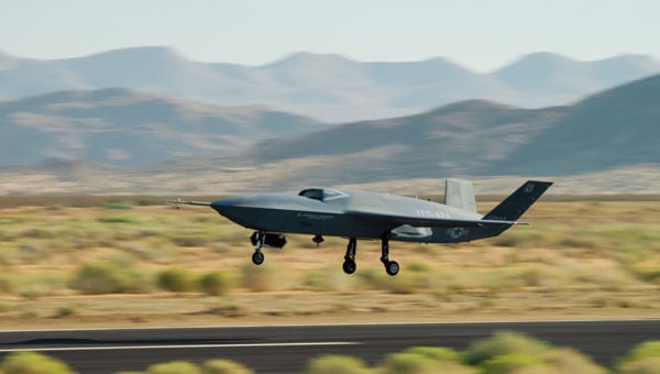
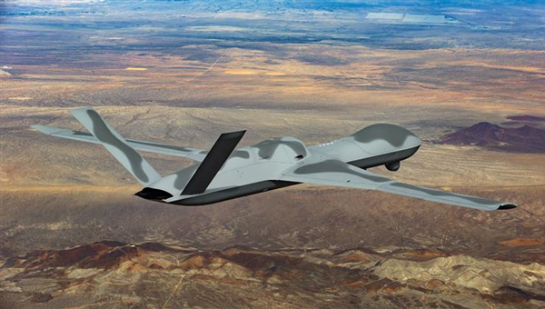
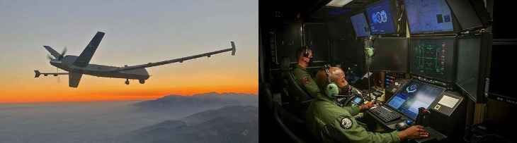
General Atomics Aeronautical Systems Inc. (GA-ASI) is in the news again, as it got its prototype version of the U.S. Air Force (USAF) Collaborative Combat Aircraft (CCA) into the air for the first time, with an anticipated lengthy flight test campaign to follow. This latest CCA iteration, refered to as the YFQ-42A CCA, was derived from an earlier jet-powered XQ-67A Off-Board Sensing Station, a platform that enabled the company to not only develop and build but also fly this latest aircraft in just one year.
GA-ASI CAA makes first flight Aug. 27, 2025. (Credit: GA-ASI)
The UAV features significant autonomous capabilities developed over nearly five years of training using the MQ-20 Avenger unmanned jet aircraft. The strategy of beginning with a company-developed baseline aircraft (Avenger), securing USAF support for an initial derivative and then for the YFQ-42A CCA, appears to be accelerating development of the Loyal Wingman concept toward USAF operational manned-unmanned airborne teaming.
Previously, in July, GA-ASI began preparations to enable friendly European countries to rapidly participate in the future CCA-capabilites by teaming with its German affiliate General Atomics Aerotec Systems GmbH (GA-ATS). The agreement appears to enable high-volume local manufacture of a European CCA, and press releases have implied that potential content is expected to be provided by other high-tech local suppliers.
Following earlier reports that Reliable Robotics (RR) has been busy automating all phases of aircraft operations, including a Cessna Caravan cargo aircraft, USAF has awarded RR a $17.4 million contract to install a Reliable Autonomy System (RAS) in another Cessna. The resulting automated Cessna 208A Caravan is to be used in an estimated two-year program toward obtaining FAA certification that should enable flight within the U.S. National Airspace System (NAS). The system has been demonstrated — with a remote pilot in the loop — to be able to take an aircraft from startup on the ramp, through taxi, takeoff, en route flight, landing and taxi return to the ramp for unloading.
RR autonomous Cessna 208B takes off from Mojave Air and Space Port, California, on Aug. 8, 2024. (Credit: RR)
Cessna Caravans have been heavily used for cargo transport across the U.S. (and around the world) with a range of 1000 miles, carrying up to 1000 lb of cargo. The RR certification program is intended to allow these types of automated unmanned commercial and military operations on a regular basis throughout FAA controlled US airspace, alongside manned aircraft. Flying military unmanned aircraft in the NAS currently requires extremely highly-coordinated, continuous activity. The hope is that eventually it could become an easier more regular form of autonomous cargo/people air transport.
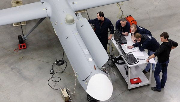
The cost of the continuing war in Ukraine may be affecting the Russian economy — a major drone manufacturer apparently is facing bankruptcy despite Russia currently using thousands of drones in attacks on Ukraine. The situation is difficult to understand, but this is an expensive war.
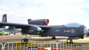
However it appears that, AO Kronshtadt, one of the major drone suppliers in Russia is also beset by civil lawsuits from several organizations to which it owes lots of rubles. Its Orion and an updated version Inokhodets drone are apparently somewhat similar to the US MQ-9 Reaper UAV.
AO Kronstadt employees assemble the Russian Orion UAV. (Credit: open source)
Russia has apparently converted the Orion/Inkhodets medium-altitude surveillance drone into a strike version, but with limited success. Nevertheless, Kronshtadt apparently has made some progress, selling an export version in Asia.
Meanwhile, Russia still is apparently producing up to 6,000 Shahed one-way drones per month by another manufacturer in the Alabuga Special Economic Zone at a unit cost of around $70,000. This is significantly lower than drones that were originally purchased from Iran at $370,000 each.
The U.S. Federal Government through its transport agencies apparently has the exclusive right to control drones, including bringing malicious UAVs down from the sky. Most people understand that the Federal Aviation Administration (FAA) regulates who flies what and where, but who is in charge of reducing and removing drone threats? It may have been difficult to understand during recent unauthorized overflights of military installations on the East Coast why someone didn’t shoot down the offending drones.
Now, a group of police agencies has approached members of Congress to ask for the right to “detect, track, identify and mitigate” the unlawful, negligent or malicious use of drones that threaten public safety. Citing a number of incidents — including drone incursions at airports and other incidents where unmanned aircraft have interfered with firefighting and disaster response, instances where law enforcement activities have been overflown and disrupted, and the practice of using drones to drop drugs, guns and mobile phones into prisons — the law enforcement group sees a need for permission to engage. With several major events scheduled across the U.S., it likely is time to support law enforcement with the appropriate powers needed to protect the public.
It is true that several bills are already pending before Congress to enable state, local, tribal and territorial law enforcement agencies to find, identify and possibly mitigate inappropriate drone activity, but the group is urging action now. And they clearly demonstrate the need to be able to stop drone activity when necessary — the federal government cannot cover the whole country all the time, so it makes more sense to adequately train law enforcement and to distribute authorized local mitigation activity whenever it is found to be necessary.
So a mixed bag this month — progress for the U.S. Collaborative Combat Aircraft initiative, more steps toward automation for air cargo transport, problems for one Russian drone supplier while others increase volume and the United States seeks options for better defense against them, and U.S. law enforcement seeks the capability to help mitigate drone incursions where they are not wanted — plenty of different angles to consider around unmanned aerial vehicles.
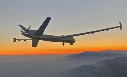
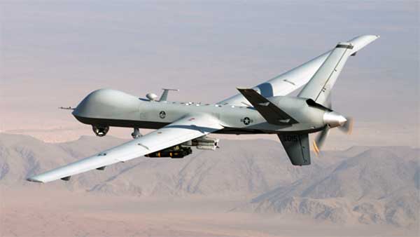
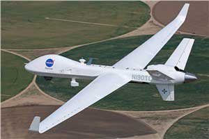
One of the top dogs in the mil-spec UAV world, General Atomics Aeronautical Systems Inc. (GA-ASI) has developed and built several jet-powered demonstration UAVs known as the MQ-20 Avenger, which is currently being used to test out new U.S. Navy communications systems. Derived from the MQ-1 Predator and MQ-9 Reaper, the Avenger is equipped with a Pratt & Whitney turbofan jet engine, allowing it to reach speeds of around 400 Knots at an altitude of up to 50,000 ft.
Predator C Avenger UAV. (Photo: GA-ASI)
After extensive testing since its first flight in April 2009, a larger extended range (ER) version began test flights in 2016. The extended range version has longer wings and an increased fuel capacity with a range of 2,000 miles and an endurance of 20 hours. Avenger has several stealth features, including an S-shaped engine exhaust and an internal weapons bay for precision weapons and sensor packages, similar to the F-22 Raptor and F-35 Lightning front-line fighters. Another recent project saw F-35 technologies passed onto the same jet-powered UAV platform.
The recent Navy communications trials were used to prove the new space-based comms capability and to remotely adjust Avenger’s autonomous internal navigation system while in flight. The aircraft has been designed for long-range, high altitude, speedy, autonomous penetration of enemy areas and this latest capability allows operations where the run-in-to-target phase can be redirected in the very last minutes of an attack. Enemy radar tracking and defenses might, therefore, be misaligned at a crucial phase of an incoming drone alarm without sufficient time to re-align and protect the actual target.
Space-based communications, in this case, used signals via the Proliferated low-Earth orbit (LEO) system of satellites, which is reportedly a mil-spec LEO constellation of communications. satellites — somewhat related to the orbits of the Space-X commercial Starlink LEO internet satellite system.
While we are in the military domain, a recently displayed Chinese development is being claimed to be a jet-powered ‘mothership’ UAV. The concept is that the carrier aircraft travels longer distances and releases a swarm of short-range drones when within range of their target(s) — a possible mock-up of such a vehicle was shown before a recent Chinese airshow.
Jiu Tian mothership UAV mock-up. (Photo: Chinese internet)
The center section of the UAV appears to be detachable or has large opening doors – the Chinese and English inscriptions on it imply that it is a module for carrying drones. There have been other reports that Chinese military thinking includes the deployment of large swarms of drones to attack multiple targets simultaneously. However, The Jiu Tian UAV does not come with a stealthy design.
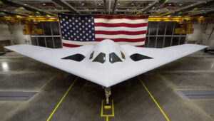
In light of the recent competition between the U.S. and China, an article about the new U.S. Air Force B-21 stealth bomber has been published. The article suggests that, given the F-35 stealth fighter-bomber’s exceptional stealth capabilities and its ability to carry and release multiple weapons from an internal bay, the B-21 may already face obsolescence.
So then, why not re-purpose the B-21 to be a drone-carrying mothership that could, while undetected, penetrate enemy defenses to release swarms of U.S. attack drones?
B-21 next generation Stealth bomber. (Photo: U.S. Air Force)
Currently, a part of the U.S. three-pronged nuclear delivery deterrents alongside submarines and ballistic missiles, the Air Force believes that the role of the existing B-2 Spirit bomber is not obsolete, and the B-21 should become operational as planned in the 2030s with its new stealth and suite of high-end technology sensors and control systems.
The concept of a Chinese “mothership” is designed to transport drone swarms close to targets before launching them. Additionally, there may be a stealthy response from the US, utilizing low-Earth orbit (LEO) satellites for space-based communications to adjust the routing of autonomous drones. This approach raises the question of whether it could be used to deceive drone defenses during the terminal phase of an attack. These solutions are complex but could significantly enhance the effectiveness of future military drone operations.
This month, we look at new applications that might interest even the most tech-savvy. From military Reaper unmanned vehicles being turned into civilian fire-fighters, through continuing drone flights on Mars, to e-scooters monitored by AI-system, the autonomous arena continues to grow.
Reaping Disaster-Response Benefits
The General Atomics Reaper unmanned aerial vehicle (UAV) is usually a weapon of war. Most of us picture them loaded with missiles to be fired on terrorist hideouts, with video of the impact appearing on the six-o’clock news. Soldiers in small control shacks guide these worldwide attacks, while politicians watch the outcomes remotely with their own direct TV coverage. This is how we tend to think of these destructive systems.
However, Reapers recently have been helping fight the huge fires devastating the California landscape — a more humanitarian, supportive role for a military asset.
General Atomics Reaper UAV on patrol and remote pilots (Photos: California Air National Guard)
The California Air National Guard (ANG) has been assisting firefighters for many years by using helicopters and fixed-wing aircraft to determine the intensity of large California fires and to plot their boundaries.
In the past 10 years, with the availability of large reconnaissance UAVs and assistance from the Federal Aviation Administration to develop and approve operational procedures, an approach has been formulated to employ Reapers, with the potential to reduce costs and greatly improve response times.
Having large UAVs at altitude in civilian airspace requires an accompanying chase plane to ensure safe operation. With proven onboard detect-and-avoid capability and visibility through crew monitoring, the chase aircraft only monitors the Reaper’s climb to operational altitude. Using infrared and video from onboard cameras, data is downlinked and post-processed to create fire maps. Artificial intelligence (AI) automates this procedure to provide incident commanders with a near-real-time situational overview.
Besides mapping the fire, the incident commander can keep track of firefighters on the ground and gain a clearer picture of the fire’s intensity, rate of growth and direction. With a high altitude view of the landscape, Reaper pilots also help determine the best evacuation routes. Video downlinks provide real-time fire dynamics to commanders and even to firefighters on the ground who carry handheld devices.
When equipped with long-range fuel tanks, Reapers can remain on task for up to 18 hours. The pilot and systems operator in their remote mission-control shack can hand over control to a new crew for such a long mission. The new crew can even be in a different location when it assumes control.
The experience gained in California regarding flight approvals, operations and use of data is being shared with remote UAV crews and emergency-response controllers in other U.S. jurisdictions as well as other countries. The procedures can be used not only for firefighting, but also for earthquake, flooding and hurricane response.
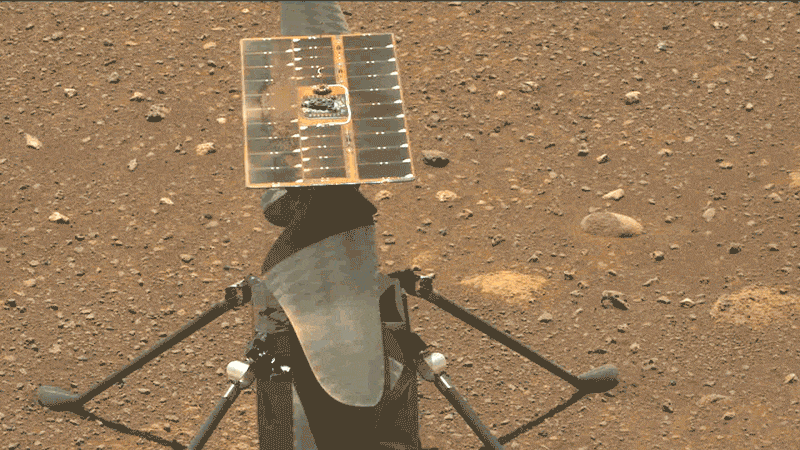
Our Martian Adventure
NASA has extended the mission on Mars of its Ingenuity UAV, which arrived on the planet attached to the belly of the Perseverance rover. The original mission was to establish that controlled flight on the planet’s surface was possible.
Ingenuity has now spent more than one year on the surface of Mars and has 21 flights under its belt. The diminutive copter has taken on an extended role of scouting out potential routes for its SUV-sized mother ship.
Integrity runs a “wiggle test” of its rotor blades prior to flight. (Photo: NASA/JPL-Caltech/ASU)
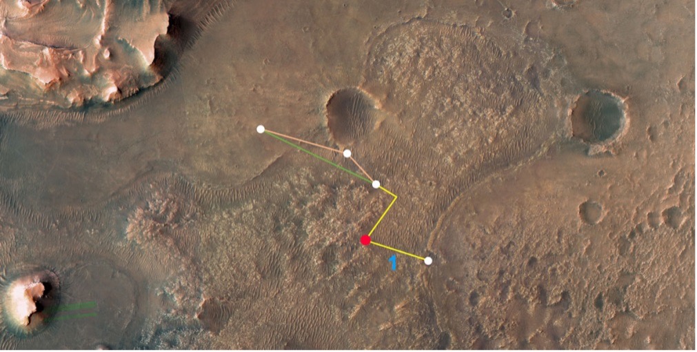
Ingenuity’s 21st flight is the first of at least three needed to transverse the Séítah region to reach its next base. From there, it will make flights to examine an old river delta. The whole relocation trip will cover about 1,150 feet as Integrity navigates around a large hill. While flying these investigative routes, the NASA team continues to gently push the drone’s capabilities to better understand improvements that can be applied to future Mars UAV designs.
Proposed route to reach river delta. (Image: NASA/JPL-Caltech/University of Arizona/USGS)
Once at the river delta, Ingenuity will encounter higher ground — up to 130 feet above the floor of the Jezero Crater, where it previously flew. The new area is expected to present significant obstacles: jagged cliffs, angled surfaces, rocky outcroppings and sand-filled traps. These obstacles could hamper the Perseverance rover or tip over the small drone on landing. But it’s also a place NASA thinks could harbor evidence of past life.
On arriving at the delta, Ingenuity’s first task will be to help decide which of two river channels Perseverance should take to climb to the delta. Data from the drone will also pick out science targets that Perseverance could investigate on the way. Once established in the delta region, NASA also hopes to fly Ingenuity to scout other features the rover might not be able to reach, but which might be accessible on future missions.
NASA has uploaded several upgrades to Ingenuity. They enabled higher, faster and longer flights and speed changes. The upgrades also have improved the drone’s perception of landing areas. Potential upgrades include adding terrain elevation maps and a hazard-avoidance capability for safer landing.
E-Scooters Adopt Pedestrian Defense
An outfit that rents e-scooters in more than 60 cities worldwide is adopting a “pedestrian defense” AI upgrade to prevent renters from abusing others around them and keep them riding within acceptable rules of operation.
LINK e-scooter. (Photo: Superpedestrian)
Previous efforts have only give riders visual and audio warnings that they should not enter a sidewalk. This new e-scooter active defense system slows the scooter to a stop and will not allow it to resume operation until it is moved outside the prohibited area.
Other unsafe behaviors — riding the wrong way up one-way streets, parking in the wrong place or aggressively swerving — also can be detected and actively deterred.
Sensors on the scooter provide data that relates location and activity to onboard stored city maps and geofenced areas. This enables application of enforcement commands within a second of them being detected.
The system provides cities and operators with visibility for the whole fleet of scooters. It shows what renters are doing within existing street safety restrictions, allowing both city and rental company officers to address perceived operational issues.
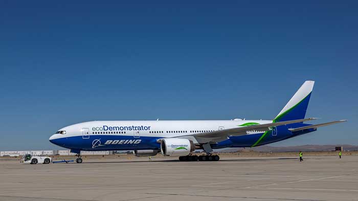
The Boeing B-777 or “Triple-7” is a big airplane — at over 200 feet long, with a wingspan of more than 200 feet, it carries more than 300 people. But getting it from one airport to its destination, which could be up to 8,500 nautical miles away, presents a significant navigation challenge. Combined Air Data and Inertial Reference Unit(s) (ADIRU) and three GPS L1 receivers form the certified primary navigation sensor cluster for the B-777-200.
Boeing has been undertaking its ecoDemonstraor program using various models of its aircraft, and in 2019 a B-777-200 was available for a number of technology demonstrations.
Along with the basic objective of testing out new fuel efficient technologies, Collins Aerospace collaborated with Boeing to demo and test their new generation navigation system using dual frequency, multi-constellation GNSS receivers.
Boeing B-777-200 ecoDemonstrator (Photo: Boeing)
The aircraft is normally equipped with buyer selected, certified GPS receivers which also track world-wide Satellite Based Augmentation System (SBAS) signals — not only improving accuracy but also improving (or reducing) the size of integrity bounds of the position solution. Currently, GPS/SBAS L1 is the only signal permitted under current FAA approved MOPS (Minimum Operational Performance Standards) for aircraft use in the US, but new MOPS standards are under development for the use of DFMC. Hence, this demonstration program would significantly aid towards validation of the new MOPS standards.
For the demo program, the Collins Aerospace GLU-2100 Dual-Frequency Multi-Constellation (DFMC) enabled multi-mode receiver (MMR) was used as the primary position source. The three GLU-2100 MMRs fitted were loaded with modified software that enabled the tracking and use of GPS L1/L5 and Galileo E1/E5a for the navigation solution using multi-frequency GNSS antennas.
The navigation mode and position integrity algorithms were also revised so the DFMC navigation outputs could be used as the primary navigation outputs for the Flight Management System and the transponder. The Collins GLU-2100 certified L1 position solution was computed in parallel and used to bound the integrity of the Collins DFMC position solution.
The demo gathered stacks of data on this first use of a DFMC receiver as the primary position source on a civil air transport aircraft. The lessons learned will undoubtable support the effort towards the introduction of dual frequency multi constellation GNSS for regular use in civil aviation.
Meanwhile, in the world of unmanned aircraft, several thing of note were recently reported, including:
Aveum Inc. rolled out its Ravn-X autonomous UAS, which is claimed to be a large, fully autonomous unmanned vehicle which can deliver satellites to low earth orbit.
General Atomics demonstrated its Avenger UAV with autonomous CODE (Collaborative Operations in Denied Environment) capability and completed static load testing of the MQ-9B SkyGuardian wing, part of the regular qualification program for civilian aircraft certification.
Airbus Zephyr High Altitude Platform Station (HAPS) UAV completed another phase of high-altitude flight testing in Arizona.
The Ravn-X is a large UAV which apparently uses regular jet fuel, yet claims to be able to get to low-orbital altitudes. With a 60-foot wingspan, 80-f00t length and up to 55,000-pound take-off weight, this is certainly a large vehicle.
There looks to be a long tubular belly protrusion which could be a rocket motor, or fuel tank, or even a payload bay — absent any explanation of how regular air-breathing engines could reach space, we’ll have to speculate — maybe a new type of engine? Nevertheless, burning jet fuel alone, gaining space access might be difficult. Apparently the US Space Force is a sponsor and future customer, so there should be credibility to these claims.
Ravn-X new-gen space UAV (Photo: Aveum)
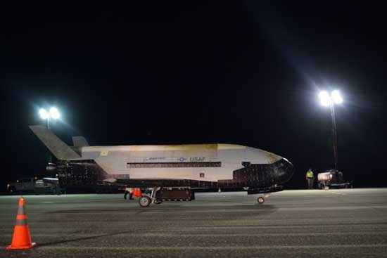
X-37B U.S. Spaceplane (Photo: U.S. Air Force)
The object is to provide rapid access to space for small payloads with a reusable, autonomous, unmanned vehicle. The current vehicle is apparently 60% re-usable, soon to become up to 95%. And minimizing turn-round time is also a major target, with a claim of 3 hours being possible — quite an achievement. Of course, the U.S. already has the X-37B Orbital Test Vehicle spaceplane in operation, with a record 780 day stay in space already under its belt.
During the recent two-hour test flight of the General Atomics Aeronautical Systems Inc. (GA-ASI) Avenger UAV, equipped with tactical radio/data links and targeting capability, independence between control and mission systems was demonstrated.
The flight also tested a degree of autonomy related to the U.S. Air Force Skyborg (aircraft-UAV teaming) program. The USAF Collaborative Operations in Denied Environment (CODE) software controlled the flight for over two hours without regular ground operator inputs, and coordinated air-to-air search operations with one actual and 5 simulated aircraft.
GA-ASI Avenger UAS (Photo: GA-ASI)
The Airbus Zephyr High Altitude Platform Station (HAPS) successfully completed another series of flight tests in Arizona in the first weeks of November. The UAV has undergone weight reductions and was equipped with revised control software which improved system robustness. The UAV is powered solely by sunlight, operates in the stratosphere and provides persistent services currently provided by satellite.
Zephyr is prepared for flight-test (Photo: Airbus)
Operational flexibility and aircraft maneuverability were demonstrated, particularly during lower altitude flying and during transition into the stratosphere. A new flight planning tool suite was put through its paces and a number of different operational concepts were tested by conducting many flights in quick succession.
These tests again demonstrated Zephyr’s capability for take-off, climb, cruise, the performance of the upgraded flight control system, descent and successful landing. Day and night on-station performance of almost 26 days was previously demonstrated during July 2018 flight tests.
It’s good to see demonstrated progress towards dual frequency GPS/Galileo civil aircraft operations through the Boeing ecoDemonstrator program, along with UAV initiatives in potential space-launch capability, autonomous aircraft-UAV teaming, and advances in the HAPS concept. All this, even with the work managed despite these interminable COVID-19 restrictions.
UAV developments are taking flight across the globe.
In one development, older technology might enable new capabilities for a pseudo-satellite UAV. Meanwhile, new technology adds significant landing capability to an Air Force drone. Finally, further trials are expected to help develop drone operational procedures and regulations in India.
Spain’s Skydweller moves to Oklahoma
An unmanned aircraft builder from Spain — Skydweller — is setting up operations in Oklahoma. This latest outfit to relocate is establishing its headquarters in Oklahoma City to develop a pseudo-satellite vehicle with a large payload capability.
For anyone who has kept tabs on the Airbus Zephyr, the UAVOS ApusDuo, The Aurora/Boeing Odysseus, or the Softbank/AeroVironment Hawk30 high-flying drone programs, you might have noticed that the stratospheric pseudo-satellite business is not easy. None have yet made it to true operational status — loitering for months at +60,000 feet and living off only sunlight, while carrying significant payloads to provide communications services. That said, some trials to date have apparently been quite successful.
All those existing UAVs are huge, flimsy, flex-wing aircraft that take an inordinate amount of care to handle in the difficult phases of take-off and landing. Airbus’ second prototype crashed in Australia in October 2019, and several other companies’ earlier prototypes have crumpled somewhat when they inadvertently contacted the ground.
Now enter Skydweller. Skydweller is designed to carry a relatively large payload and fly persistently in the stratosphere.
The payload includes one or more communications relays: 4G/5G cellular, day/night full-motion video, satellite communication, and imaging radar. This looks like it could be one capable vehicle. The makers hope to capture business in commercial and government telecommunication, geospatial, meteorological and emergency operations. Skydweller has apparently been around since 2017 and has a lot of capability, so let’s see how they do with their new venture in Oklahoma.
If you were wondering where this technology came from, it is today’s carry-over of the famous around-the-world flight by the Solar Impulse aircraft from 2016, which circled the globe without fuel, using electrical power generated by solar cells on its wings.
GA Makes Improvements with Reaper
In another life, I was quite attuned to what it took to “automatically” land a passenger jet, so a recent release from General Atomics (GA) about improving the auto-landing system on Reapers (new-generation Predators) caught my eye. GA has a U.S. Air Force contract to update these unmanned reconnaissance/attack drones with the latest and greatest, so making a working system better is one of those improvements.
Actually, GA made three changes. The first enables the drone to divert to an alternate landing zone if the planned landing area is compromised — another word to express the possibility that hostile action or weather forced home base to send the vehicle elsewhere. Quite clever, in that the alternate site might not have a ground control station, along with someone who can fly the aircraft.
MQ-9A Reaper drone, (Photo: USAF)
The ground pilot at home base has to either enter coordinates for the new alternate landing zone and the aircraft flies there and lands itself, or he needs to overfly the landing zone so that the Reaper can collect its own waypoint with which it can automatically align and land.
The second improvement has increased the speed limit of the cross wind in which the drone can land
The third enhancement allows the drone to land heavier than previously — both essential elements of being able to divert in an emergency, when weather may be poor and the aircraft could be carrying unused ordnance and fuel.
All this is a far cry from landing civilian air transports with GPS-based guidance, which is much more restrictive and with a whole mess of mathematical probabilities of the unlikeliness/likeliness of failure. Not so much for a Reaper drone on a mission during a “time of unrest.”
Home Deliveries in India
For those of you eagerly waiting for Amazon to start speedy deliveries of your online orders by drone, or Grubhub to drop in with an order of curry in a package dangling from a friendly unmanned air vehicle in your yard, there may be hope… especially if you live in India.
Following our earlier report of anticipated food deliveries by drone in India, more trials are leading to regulations and control systems. Altitude Angel from the United Kingdom has teamed with Indian Sagar Defence Engineering for a series of beyond-visual-line-of-sight (BVLOS) drone trials.
Altitude Angel’s GuardianUTM platform will be used to monitor and control these flights through real-life scenarios. Scenarios include medical and cargo transport, surveillance operations, survey and mapping, and search-and-rescue operations. Sagar will operate the cargo carrying drones; feedback from the GuardianUTM system will enable the BVLOS flights.
While the Indian government has begun to grant permission for some commercial UAV undertakings, the intent is apparently to use the output from the Sagar/Altitude Angel BVLOS trials, taking place August through October, to help develop regulations for safe operation of drones over increasingly longer distances in Indian airspace.
To sum up, intellectual property from an around-the-world photo-voltaic airplane may become a substitute for low-cost satellite TV and Wi-Fi, while auto-land is old hat for a Predator cousin and the Air Force has gained even greater landing flexibility for a principle recon/attack drone.
Finally, we can expect at least one continent to get to regulations that allow drone deliveries to become a reality at last. As usual, there is a lot cooking in drone-land….
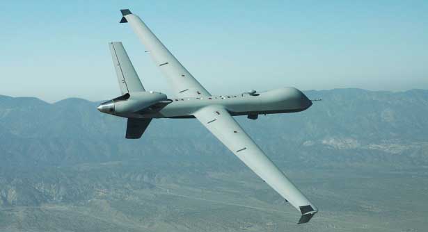
General Atomics MQ-9 Predator. (Photo: General Atomics)
There has been a lot of scene stealing by General Atomics recently with Predators flying hither and thither, new orders for the Boeing-Navy unmanned re-fueling drones and a UAV flying on Mars — this month’s unmanned aircraft summaries.
The Predator is the archetypical unmanned aircraft which most people might visualize as a “drone” as a result of numerous news reports and photos. Its what we might refer to a “Large UAV” with a 65-ft. wingspan, a 35 ft.-long fuselage and weighing in at around ~10,500 pounds fully fueled.
The SkyGuardian. (Photo: General Atomics)
In fact it’s bigger than a small manned aircraft, like the single engine Cessna 182 which checks in at 36ft wingspan/29ft fuselage. So its clear that something this big and without an on-board driver has to watch where its going, especially when flying within in the US National Airspace System (NAS).
So it was no small feat when General Atomics recently flew a new MQ-9 Predator on a delivery flight from its flight ops center in Palmdale, California, to the Holloman Air Force Base in New Mexico. There was significant coordination by the flight teams in both locations, and with the approval by the FAA. Delivering a new Predator by air saves the Air Force significant manpower, as normally new ones arrive in a crate and require effort to re-assemble.
It’s a sign of progress towards achieving approval to allow regular flights of such large UAVs in the NAS. Nowadays a Cessna 182 pilot can file a flight plan and then basically fly anywhere in unrestricted airspace. Hopefully one day — as a consequence of following rigorous certification verification and FAA approval – pilots of such Large UAS will be authorized to operate in a similar fashion.
General Atomics is working with the U.K. Royal Air Force (RAF) to develop and certify the all-weather, long-endurance SkyGuardian MQ-9B variant to meet NATO-standard Type-Certification requirements, which will then enable the UAV to be flown in civil airspace. The Australian Defence Force (ADF) has also selected this UAV variant for its unmanned applications in and around Australia. In late March, General Atomics flew the first production representative SkyGuardian – known to the RAF as the ‘Protector’ – out of its flight ops facility in El Mirage, California.
Staying with the military theme, Boeing has been working with the US Navy to develop a UAV that can land on aircraft carriers, and following a concept change by the Navy, won a contract to provide tanker UAVs. Tanker UAVs will fill up with aircraft gas on an aircraft carrier or land base, then take off and fly to rendezvous with fighter aircraft to transfer fuel and extend fighter endurance and range.
Right now tanker aircraft are usually quite large aircraft – like the Boeing KC-46A tanker which is based on the Boeing B-767 civil transport aircraft which many of you may have flown on as passengers.
The MQ-25 is still in its initial phases, with four test UAVs slated to undertake the initial flight test program. The first test vehicle has already begun exploring the UAV flight envelope and has 30 flight-test hours under its belt. The Navy has just shown confidence in the program by ordering another three aircraft, bringing the total initial build to seven vehicles.
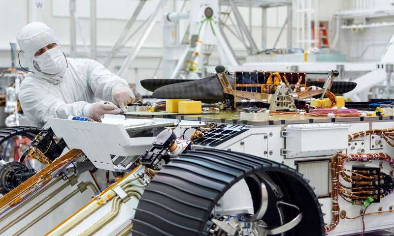
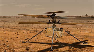
Its easy to see that UAVs are showing themselves to be extremely useful to military forces, but it might be difficult to understand how a UAV might find itself in the U.S. space program. The “Mars Helicopter” has just been mated to the underside of the next Mars Rover — now called “Perseverance” — both are slated to leave on their eight month journey to Mars in July this year.
Mars UAV being mater with Perseverance. (Photo: NASA)
With two ~4ft rotors which spin in opposite directions, the UAV will have to wait patiently for up to 90 Martian Days after Perseverance touches down in February 2021 until it gets a chance to prove that it can fly in the thin Mars atmosphere — chamber tests here on Earth in simulated Mars air have already shown that flight should be feasible.
Built to withstand high g launch and vibration forces and those of the Mars landing, the UAV carries a high resolution camera which is used for navigation, landing and survey of Mars’ surface. Its also designed to withstand the extreme temperatures and high radiation environment on the surface of Mars. The UAV is equipped with a dual-processor flight controller linked to sensors which include a gyroscope, an altimeter, visual odometer, hazard detectors and a ‘visual inertial nav system’ developed by JPL. Although the Mars Helicopter operates autonomously, it communicates with and receives control inputs from the lander, so controllers on Earth load up the flight plan ahead of time into the lander, and then wait for the helicopter UAV to execute the commands. Don’t expect vast coverage of huge panoramas of Mars – its flights are each intended to be more of an extensive hop lasting around 90 seconds at 10-15 ft above the terrain.
Mars Helicopter on simulated Mars surface. (Photo: NASA)
With a body no larger than a softball and weighing less than 4 pounds, the Mars Helicopter is an experiment to see if its possible to fly in the extremely thin Martian atmosphere. With less than 1% the density of our sea-level atmosphere, its necessary to spin the rotors at 2,800 rpm, ten times faster than on Earth. The UAV collects power from its own small solar panel and needs several days to recharge after each flight — of which five are planned. The main objective if flight is possible is to pre-survey interesting potential routes for the lander.
So preparations for large UAVs to regularly fly in civilian airspace, a new approach for Navy refueling systems, and a helicopter UAV destined to fly on Mars next year — completely different unmanned applications, all making progress.
After a couple of good hours of progress, we suddenly ran up against a massive “tail-back” — as the English call road-blocks — on the A303. We eventually crawled along further and discovered that all the rubber-neckers were slowing to grab a glimpse of Stonehenge, which you can see on the left, not far from the road. A little further on I saw a sign for Farnborough and thought that its surely around this time of year for that huge aerospace show known as the Farnborough International Airshow. So when I arrived home after almost three email-less weeks, it was not surprising that my inbox was crammed with lots of European aerospace news.
SkyGuardian MQ-9B
General Atomics (GA-ASI) seems to have come out tops in UAV public relations, flying its MQ-9B company-owned SkyGuardian from Grand Forks, North Dakota, to Royal Air Force (RAF) Fairford in Gloucestershire, U.K. on July 10-11 — that’s a 3,760 nautical mile flight in a fraction just over 24 hours. The RAF has operated the MQ-9 Reaper for over 10 years and the RAF configuration of the MQ-9B will apparently be called PROTECTOR RG Mk1. It just so happens that the RAF is celebrating its 100-year anniversary, so GA-ASI took the opportunity to drop in and say hello at a much smaller airshow at Fairford July 13-15.
Then they announced last week at Farnborough that GA-ASI had been selected to provide UAS to the Royal Netherlands Air Force (RNLAF) following consideration by the Ministry of Defence for the Netherlands. Doesn’t sound exactly like a contract yet, but its close enough to say that the Netherlands will take delivery of the Predator B/MQ-9 Reaper Medium Altitude, Long-endurance UAS. They also reminded us that the Spanish Air Force is to take delivery of MQ-9 systems in 2019.
From a SatNav point of view, we might also be interested that the GPS receiver on this UAV has also been upgraded to add Galileo signal capability — a requirement for what seems to be an expanding number of government forces in Europe. No luck yet in securing better information from GA-ASI about this upgrade, but Farnborough has likely kept them hopping, so hopefully more news later.
Zephyr S High Altitude Pseudo-Satellite UAV
Photo: Airbus
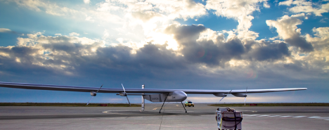
Fresh on the heels of taking on the Canadian Bombardier C-Series program (now the Airbus A-220) and closing the first deal with JetBlue for 60 of these aircraft, Airbus has committed to production of the Zephyr S HAPS (High Altitude Pseudo-Satellite) solar–electric, stratospheric UAV.
Zephyr has an 82-ft. wingspan and is designed to operate on solar power in the stratosphere at an altitude of around 13 miles emulating equivalent services provided by satellite. This is well above clouds, the jet stream and the ozone layer, and importantly well away above regular air traffic. Airbus anticipates the drone flying for up to 100 days without landing (its currently record is 14 days) and to travel up to 1,000 nautical miles per day. It weighs 165 pounds, but can support a payload up to five times its own weight.
The Zephyr aircraft began its maiden flight in Arizona a few days ago — the “qualification flight” is being supported by both the U.K. and U.S. governments — and the U.K. Ministry of Defence is the launch customer for Zephyr. The aircraft has so far logged around 1,000 hours total flight time. The test flight will conclude once engineering objectives have been met. Other solar-cell powered aircraft have struggled with landing or take off due to the large wing, light weight and hence stability under wind gusts, so several projects have not progressed past the R&D stage. Airbus & RAF’s commitment to production indicates their faith in the aircraft design.
Staying with the U.K. theme, the Goodwood Estate in Chichester, England — famous for the Goodwood car racing circuit — has recently hosted the Goodwood Festival of Speed, which apparently included drone racing. And at the same time, a Guinness World Record drone speed record was established.
Wingcopter XBR
The Wingcopter XBR is a tilt-rotor UAV with two lift props and two horizontal velocity props, and the drone flown by teenage drone racer Luke Bannister reached an average of 240.6kmph (~150m/h) over a Goodwood 100 meter track, flying over the measured track in both directions to account for wind. This set the world record for the fastest ground speed by a “remote-controlled tilt-rotor aircraft.” A previous record of 179.6 mph has been achieved by a quadcopter drone rather than a tilt-rotor UAV like the Wingcopter, but there is apparently more drag with type of drone, so its classified as a different category of UAV.
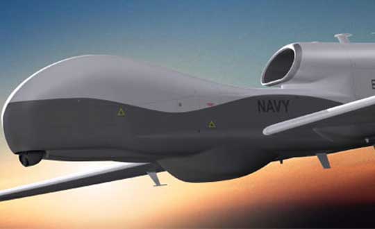
Northrop Grumman Triton High Altitude UAV
Northrop Grumman Triton High Altitude UAV. (Photo: Northrop Grumman)
Meanwhile, Northrop Grumman released a statement at Farnborough on their continuing discussions with Germany towards the sale of its high-altitude Triton MQ-4C unmanned surveillance drone, but apparently a lot of work still remains. In April the U.S. State Dept. authorized the sale of up to four drones worth up to $2.5 billion, and the German government has since been working closely with the US Navy towards a deal.
People may recall the previous cancellation of the “Eurohawk” program back in 2013 — under which Germany had planned to buy a version of Northrop’s Global Hawk drone — after escalating estimated costs for civil certification of the vehicle hit 600 million euros ($702 million) — not a minor task in any way.Subsequently, Northrop and Airbus Defense and Space have teamed up on a new ‘Pegasus’ program, which will add UAVs to Germany’s surveillance capabilities — drones flying autonomously as high as 60,000 feet to gather a wide array of intelligence data.
The German government plans to buy three of the drones, equipped with sensors and a mission system now to be engineered by Airbus. Preparations for certifying equipment to enable the drones to operate in civil airspace are moving more smoothly this time, but with deliveries to only start in 2025. Northrop developed the Triton, a marine-based variant of the Global Hawk, under a U.S. Navy contract awarded in 2008. And Australia last month said it plans to buy six Triton aircraft for maritime patrol, initially expected to cost A$1.4 billion ($1 billion U.S.).
So, lots of military drone stuff this month — not unusual given the nature of the Farnborough U.K. airshow, even though Boeing and Airbus also use the show to one-up each other’s announcements of commercial aircraft contracts and options. Lots of good news for General Atomics, not so much yet for Northrop Grumman, and some light relief with high speed drone records at Goodwood. Back to more North American UAV news hopefully next month.
Assessing the health of an entire industry is not an easy task, but talking with industry leaders and looking for examples of growth and investment can help.
Our “State of the UAS/UAV Industry” inquiries have lead to discussions with General Atomics, Association for Unmanned Vehicle Systems International (AUVSI), Aeryon Labs and SensoFusion. SensoFusion might be a little well less known that the others, but we felt the need to include the views of an anti-drone system supplier to counterbalance the industry’s perception of itself.
Discussions included questions around the following issues:
The level of maturity of common technologies in use on UAV platforms and systems?
The level of maturity of integration of those technologies?
A sketch portrait of the industry?
Rough numbers or percentage of small players versus large ones?
The rate of consolidation of companies (has it happened or has it yet to happen?)
The financial underpinnings of the market — does it have real “legs” or will it be like the first Internet boom/bust?
If we start with a top-level overview of the industry, as a whole we find that on the commercial side it’s an industry trying to figure out what it is and who its customers might be. But there is also a well-established military part of the industry that is quite mature. A large number of multi-rotor UAV suppliers use simple handheld controllers, all aimed at different applications where they are seeking a niche. The FAA’s release of regulations last year for use of small unmanned vehicle systems (sUAS) has provided a real boost to many more commercial pay-for-service ways these vehicles are now being used.
Multi-rotor UAVs are being put to use in surveying, filmmaking, newsgathering, real estate, crop and pipeline inspection, firefighting, law enforcement, security, search and rescue, and disaster monitoring and relief, just to mention a few applications. And, of course, home/hobby flying your own drone in your backyard or open areas has fueled the Chinese DJI drone manufacturers’ growth significantly. While the FAA requires registration of these private drones, it has not prevented an increase in commercial passenger aircraft pilot reports of UAV incursions into controlled airspace, which appear to be on the increase.
Then there are small, medium and large fixed-wing UAVs that appear to have been mostly developed for and used by the military. Hand-launched surveillance drones for small groups of ground troops; mid-sized, longer range surveillance drones finding applications in commercial inspection; and the bigger General Atomics Predator type aircraft which have become the U.S. military’s search and destroy long-range vehicle, which can carry significant ordinance. At the top end, we have UAVs like Global Hawk which are used for very high altitude, long-endurance surveillance. Not forgetting target drones like the Northrup Grumman BQM-74E, which earns its living pretending to be an enemy anti-ship cruise missile for the U.S. Navy.
Global Hawk (Photo: USAF)
BQM-74E target drone.
Commercial Growth Anticipated
Brian Wynne, president and CEO of the Association for Unmanned Vehicle Systems International (AUVSI), believes for the commercial segment that, “The UAS industry is primed for incredible growth. UAS are being used in all 50 states by industries like real estate, agriculture and the oil and gas industry for more than 40 different types of business applications, including aerial photography, emergency management and utility inspection.”
More than 500,000 people have registered their UAVs with the FAA in the U.S., and around 20,000 of those are looking to start commercial operations. AUVSI expects more than 100,000 jobs will be created when UAS are integrated into and allowed to operate in the U.S. National Airspace System (NAS).
However, Wynne went on to comment, “This this can only happen if the government puts in place a true, holistic plan for full UAS integration that includes flights over people, as well as beyond line-of-sight operations, access to higher altitudes and platforms above 55 pounds.” AUVSI estimates that in the first decade after full UAS integration into the NAS, these commercial operations could generate more than $82 billion is economic impact.
Even before the FAA’s release of formal regulations (known as Part 107) for use of sUAS in June last year, more than 5,500 businesses received approval to fly for commercial purposes. AUVSI published a report that analyzed these applications — the analysis provides an overview of the developing commercial UAS industry in the U.S.
AUVSI analysis of initial UAS applications.
Over 90 percent of these businesses make less than $1 million in annual revenue and have fewer than 10 employees. This also provides an indication that the engine behind this growth comes from small, independent business.
Nevertheless, big organizations such as CNN are also exploring visual line-of-sight operations over people and safely using UAS for newsgathering in populated areas. PrecisionHawk is testing extended visual line-of-sight operations in rural areas, aimed at precision agriculture, and BNSF Railway is testing beyond visual line-of-sight (BVLOS) operations, in rural and isolated areas, for the inspection of rail system infrastructure. These tests are being conducted as part of the FAA’s Pathfinder Program.
More recently, anti-drone systems have joined the party to help defend against unwanted UAV incursions into secure areas already protected by conventional systems like radar, acoustic and optical detection systems. Secure areas include such places as prisons, government buildings/facilities, utility companies (including nuclear power stations) and airports. Sensofusion in Finland is one such company, with its Airfence anti-drone system — one of three anti-drone systems tested last November by the FAA at Denver airport. The other systems were supplied by CACI International and Liteye Systems.
Kaveh Mahdavi, VP of Operations for Sensofusion, thinks that, relatively speaking, the UAV industry is quite mature — what’s still being developed are systems to enable autonomous drone flight. The regulations published so far only address ground-pilot-controlled operations, even though BVLOS testing is progressing well.
Anti-Drone Systems
On the other hand, the maturity level of anti-drone systems range from proven to embryonic. As many as 50 companies with different technical solutions are vying to succeed in this new segment. But as the UAV segment continues to grow, so does the need for detection and prevention of drone incursions.
These systems employ three basic technologies: radar, optical and RF. Radar and optical need direct line of sight and cannot see “over the horizon.” That makes them quite short-range, and detection and defense has to be exceptionally quick to prevent unwanted UAV flying visits. Whereas, the Airfence RF system is omnidirectional and can even detect UAS preparing for take off up to six miles away, as demonstrated at the Denver airport.
So, intrusion warnings at a geo-fence distance of, say, 3-4 miles can be generated, and automatic defense/prevention is readily achieved. For instance, some utility companies want to have detection, warnings and control of intruder drones within a mile of their facilities.
Mahdavi went on to describe how Airfence uses a library of drone control RF signatures for all known UAS, with new signatures being added on a regular basis. They can detect, intercept and directly take control of the offending vehicle. During the Denver tests, Airfence initially only detected one third of the target UAVs, but the RF signatures of all targets were acquired. Then, using remote engineering updates to the library, by day three all were detected. With lower prices, consumer drones are becoming a real threat for these sensitive areas.
The anti-drone industry will no doubt face considerable consolidation over the next couple of years, but Mahdavi feels that Sensofusion is well placed with significant military and government business, which is funding their growth without external investment. “Securing the right contracts with the right customers,” as he says, has well positioned the company for now and the future.
General Atomics Aeronautical Systems Inc. (GA-ASI), makers of the well-known Predator, Reaper and other Medium-Altitude Long-Endurance (MALE) drone systems, has been in this business for almost 25 years. GA considers its products to be proven, mature and resilient for the military and government markets that demand them to be so. The company uses “best of breed” in-house products and technology across the range of air and ground systems that make up its highly successful drone systems.
In an effort to align with European customer interest, GA-ASI has been investing in a “certifiable” version of the Predator-B, recently named SkyGuardian. A derivative for marine applications will be known as the SeaGuardian.
SeaGuardian.
SkyGuardian.
Just as military transport aircraft want to transit through civilian airspace and, in order to do so, have been equipping with certified navigation systems for a number of years, military drone operators want to be compatible with Europe’s high-density commercial flight regulations and to operate within existing air-traffic control corridors. To arrive in time for these European programs, GA-ASI has invested to get ahead of the market. This has entailed assessment of all on-board and ground components, and has led to upgrades and re-designs where necessary.
“Nevertheless, on existing product lines, there is a large degree of commonality across common systems on multiple platforms,” said Mike Cannon, VP of international programs. Common systems include datalinks, power avionics, de-icing systems, and some airframe components.
GA-ASI has developed and integrated its own flight control system in its aircraft for more than 20 years. This has proven to be a key element of the success for the Predator family of products. Because all these systems have been flying for so long, they have been proven and become very reliable, dependable elements of the company’s unmanned systems.
Having said that, Hughes Network Systems has just announced that its Defense and Intelligence and Systems Division (DISD) has been selected by GA-ASI to provide satellite communications on the “Type-Certifiable” Predator B Remotely Piloted Aircraft (RPA) system. Working with GA-ASI, Hughes will customize the aircraft’s satellite communications system with modified Hughes HM series modems. The advanced modems will enable a significant increase in data transfer rates, using an enhanced waveform that ensures resilient and secure communications when operating in challenging environments.
So, its very difficult for new start-up companies to enter this top level segment of the UAV market — its very expensive to develop, demonstrate and prove large airframes, control systems and avionics that customers can rely on. GA-ASI has a unique position alongside major suppliers such as Boeing, Northrup Grumman, Israel Aerospace Industries (IAI), and Lockheed Martin — however, Chinese UAS are beginning to show up in the marketplace, apparently as a result of significant, focused investment.
Nevertheless, with an enviable position as a major supplier of platforms used in multiple applications, with sufficient internal resources to fund their initial vehicle developments, GA-ASI has secured a large number of programs with multiple follow-on orders and funding for increasingly more capable derivative UAS. As the company now looks towards the “certifiable” segment using another internally funded product launch, it is again reinforcing its leadership position in its chosen unmanned market segment.
Small UAS by Aeryon Labs
Meanwhile, the world of small unmanned air vehicles (sUAS) continues to thrive, given the release of FAA regulations last year, and many commercial applications are blossoming, using increasingly capable small multi-rotor drones. David Kroetsch, CEO and co-founder of Aeryon Labs in Ontario, Canada, thinks that the sUAS segment is maturing from an early adoption phase into providing utility to a growing number of organizations. Aeryon is an established player in the sUAS market and has been around for more than 10 years, so it has also had time to prove its platforms and internal systems. Aeryon also built its own flight-control hardware and software, which enables the company to gain substantial power savings and get longer endurance from how it automatically manages rotor speeds.
“The quad platform has been around since 1938, so the concept is hardly new; however, over the last decade, Aeryon Labs has substantially matured and ruggedized our platform, the Aeryon SkyRanger sUAS,” said Kroetsch. Their focus is on not only on the UAV platform, but also on supplying complete systems that meet the various needs of their customers. With electro-optical and thermal-imaging camera payloads and an on-board georeferencing data collection/processing system, Aeryon provides integrated solutions for customers, such as AeryonLive Video and Telemetry and AeryonLive Fleet Management using real-time software tools.
Aeryon SkyRanger sUAV.
AeryonLive tools.
For the oil and gas industry, providing compatibility for off-line flight planning software inputs and importing compatible aerial imagery into existing GIS systems is a significant feature for these customers. The SkyRanger UAS has benefited from many years of use in the field, and has been designed with modularity and ease of use with snap-on/off parts that make operating in bad weather a lot easier.
Aeryon’s business is currently 50%military, 25% oil and gas and 25% public safety (such as rapid traffic accident data gathering). Other entrants to these segments might find it easy to put together an unmanned system from parts bought on the internet; what comes considerably harder is proving reliability and interoperability with existing customer systems. Actually, to develop an industrial-grade UAV takes lots of investment and requires experience gathered over many years. Customers have learned how to differentiate between those dabbling in the market and those with serious capabilities.
Consolidation is inevitable in this market segment — perhaps within the next six months, certainly over the next two years — just because there are so many companies trying. Investment is getting harder to find for these start-ups and it may be too late for most, as the leaders are already well established.
“It’s essential to pick a niche within the increasingly competitive UAV industry,” Kroetsch said. “This is why Aeryon chose early on to focus on enterprise-level offerings in commercial, public safety and military.”
Recall what happened to 3D Robotics. Even though 3D Robotics raised many millions in funding, its Solo quadrotor fell from grace, perhaps due to continuing design issues and being higher priced compared to rapidly declining DJI Phantom 3 prices. “‘Competition and consolidation look to be very similar to that which happened with digital cameras,” Kroetsch said.
For Aeryon, being Canadian appears to be an advantage right now, as U.S. export regulations seem to be handicapping U.S. drone manufacturers. Aeryon sells in 35-40 countries because its product does not contain military-restricted components and only uses commercial parts. Canadian regulations for drone system exports do not prohibit world–wide sales for such products, while U.S. regulations can be difficult for U.S. suppliers to negotiate.
Nevertheless, unexpected hurdles to adoption still exist, such as company policies related to health and safety, union restrictions, and potential internal clashes on responsibility for implementation. But with 100% test, and a hardened design for tough environments, Aeryon sees itself well positioned to grow in its chosen industrial sector.
Conclusion
This has been a brief and incomplete overview of the UAV/UAS industry — a first try, if you will. Nevertheless, it’s a summary that we can use a benchmark for where we are right now, and a departure point for future growth.
We have quite mature capability in both large and small UAS, with integration focused on flight-control and navigation systems. The larger UAS enjoy a relatively mature market with established suppliers of lower numbers of expensive systems, while the sUAS segment is larger, younger and less expensive, with not as many barriers to entry.
Nevertheless, there are mature industrial segments with harder, more integrated requirements that make it hard for new entrants to climb the steps into more difficult commercial operations. The recreational segment is dominated by DJI, and it remains strong with well-performing, easy-to-operate drones.
Because of the ease of access to smaller drones, despite FAA and other countries’ regulations, people seem to want to penetrate secure facilities such as utilities, airports, military bases, prisons and other government locations. Therefore, anti-drone systems using optical, radar and RF are becoming available, and facilities are being equipped to prevent unwanted drone incursions.
AUVSI xPONENTIAL
I’ll be roving the show floor at the upcoming AUVSI xPONENTIAL show in Dallas, and I welcome your added insight, from all corners of the UAV industry, for a continuation of this assessment in an upcoming Professional OEM & UAV e-newsletter column (subscribe free at gpsworld.com/subscribe).