Tag: GeoExplorer

  • Deformation monitoring company NavStar joins Terra Insights

    Deformation monitoring company NavStar joins Terra Insights

    Photo: NavStar
    Photo: NavStar

    NavStar — a deformation monitoring company — has joined the Terra Insights platform of geotechnical brands.

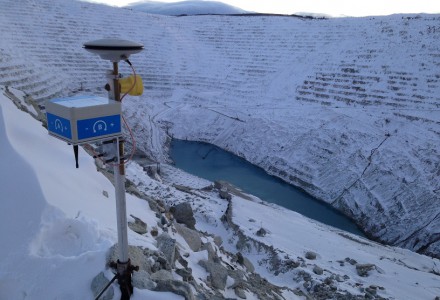
    NavStar develops specialized hardware and software for automated detection of movement on slopes and structures, with an emphasis on GPS/GNSS sensors. It provides a scalable and modular data-collection and presentation software platform.

    “NavStar perfectly complements Terra Insights’ vision of being the global platform to provide trusted geotechnical, structural and geospatial monitoring technology and data delivery solutions,” said Mark Price, CEO, Terra Insights. “NavStar’s specialized expertise in automated deformation monitoring systems from both a hardware and software perspective expands Terra Insights’ core capabilities while pushing us further into the future.”

    NavStar’s team of surveyors, engineers, technologists and software developers has been providing specialized GPS/GNSS solutions, products and support to clients around the world since 2001.

    NavStar’s specialized GeoExplorer and deformation monitoring products are used by the mining, oil and gas, power, construction and government sectors.

    “We are excited to join Terra Insights,” said Glen Bjorgan, manager of Field Operations at NavStar. ”Over the years we have worked extensively with the companies that make up the Terra Insights platform. Through that experience, we know that Terra Insights will be a great fit for NavStar and our customers.”

  • Trimble Adds Two Handhelds to GIS Data Collection Portfolio

    Trimble introduced today the Trimble Geo 5 and Juno 5 handheld GNSS devices, further extending Trimble’s portfolio for data collection, maintenance and inspection applications. The Geo 5 and Juno 5 series are both optimized for GIS field workflows, including Trimble’s TerraSync field software available on all Trimble GIS platforms.

    Since 1994, the Trimble GeoExplorer line of GNSS handhelds has been used for professional GIS data-collection applications. While the GeoExplorer 6000 series is the most capable Trimble handheld for GIS data collection, not all customers require the larger screen and innovative Floodlight technology of the 6000 series. The Geo 5 provides the essential functions for all day, submeter productivity in a smaller package, Trimble said.

    The Trimble Juno product line is used worldwide for maintenance, inspections and asset management applications. With the addition of the Juno 5 series, Trimble is providing a rugged handheld that delivers the capabilities and convenience of a smartphone, Trimble said. The Juno 5’s slim, ergonomic design is thinner and lighter than other rugged computing products in its class today and provides a more advanced feature set than the Juno 3 series.

    “Whether users are engaged in initial data-collection tasks or inspection of assets, it is critical they have a complete solution they trust,” said Daniel Wallace, general manager of Trimble’s GIS Data Collection Division. “Now with two platforms in both the Geo and Juno families, customers can confidently choose a handheld that best fits their needs. Trimble TerraSync software is the unifying workflow that brings these choices together, so customers can always trust the quality of their data throughout the complete lifecycle of a field management project.”

    Complete with wireless communications options, integrated cameras and bright, sunlight-readable screens, both devices are built for work in the field and rugged enough to withstand shock, vibration, water and dust.