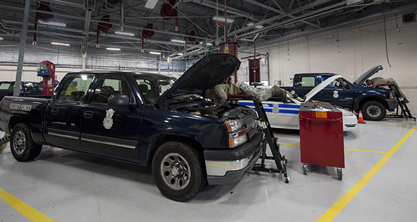
U.S. Air Force Airmen repair government-operated general-purpose vehicles at Moody Air Force Base, Georgia. (Photo: U.S. Air Force/Airman 1st Class Lauren M. Johnson)
The U.S. Air Force will equip its 21,000 general-purpose vehicles with Geotab fleet-management technology after the company was awarded a sole-source contract.
Geotab received FIPS 140-2 validation for its cryptographic library in February 2019 as well as FedRAMP authorization and ISO 27001 certification for its telematics platform. These compliance certifications and authorizations validate Geotab’s system and organizational processes, enabling the company to offer its fleet-management services to all levels of federal, state and local government agencies.
Geotab’s fleet-management technology for the Air Force is secure and customized. It includes the following features to help the service more effectively manage its vehicles:
automated odometer capturing
engine diagnostics
problem predictive analytics
fuel data
custom reporting
GHG reduction dashboards
fleet right-sizing reporting
Selected for its integration capacity and proven commitment to information security, the sole-source award from the Department of the Air Force yields an Authorization to Operate (ATO) within the Department of Defense (DoD). The authorization will allow other DoD agencies to leverage Geotab services by piggybacking off of this DAF ATO.
Geotab fleet-management products are used by more than 2,000 government agencies and departments at all levels to capture, measure and analyze crucial fleet data with deep granularity. “Winning this sole-source contract from the Department of the Air Force further solidifies Geotab’s ability to collaborate with agencies that operate at the highest levels of national data security and to provide a customized and highly secured telematics solution,” said Dan Zdarko, business development manager, federal government, Geotab.
“It is vitally important that the technology we deploy in our fleets meet the highest standards of data security put forth by the U.S. government,” said Tim Patterson, program management flight chief from the U.S. Air Force’s 441st Vehicle Support Chain Operations Squadron at Langley Air Force Base in Virginia. “Our objective is to enhance fleet-management strategies and reduce the total cost of ownership longer term across the Department of the Air Force.”
Integrated solution combines and consolidates valuable telematics data for Geotab and GM customers in Canada
Geotab Inc. has announced the availability of the Geotab Integrated Solution for General Motors in Canada. With no additional hardware installation required, the offering provides Canadian customers with a simplified fleet management platform to help businesses make better informed decisions.
With this integration, data from compatible GM vehicles, 2016 or newer, with OnStar embedded factory-first hardware can be securely transferred into Geotab’s web-based fleet management software, integrating all vehicle data into one platform, offering businesses and fleets a seamless user experience.
By enabling fleet managers to access rich proprietary vehicle data, they can generate safety reports, activity reports and measure other key metrics on one platform to help optimize fleet performance.
Users can expand the functionality of the solution further with access to the Geotab Marketplace, a growing portfolio of mobile apps and software and hardware add-ons to enable customers to tailor their fleet management solution to help meet all of their connectivity needs including improved safety, productivity and efficiency.
A roundup of recent products in the GNSS and inertial positioning industry from the May 2021 issue of GPS World magazine.
OEM
GNSS/LTE Antenna
Low profile for covert installations
Photo: Maxtena
The MEA-GNSS-LTE-MM is a two-in-one low-profile antenna solution that combines GNSS and LTE antennas in one. It is suitable for asset tracking as well as industrial and internet of things (IoT) applications. The antenna offers an ultra-low profile rugged IP67-rated design with a magnet mounting and customizable cables and connector options. The small size makes it a desirable solution for covert installations.
The NCS Nova GNSS simulator now fully supports the simulation of Galileo Open Service (OS) signal improvements based on the new Galileo OS SIS ICD V2.0. The NCS Nova GNSS simulator is a high-end, powerful and easy-to-use satellite navigation testing and R&D device, the company said. It is fully capable of multi-constellation and multi-frequency simulations for a wide range of GNSS applications. It provides multiple GNSS frequencies in one box. A key enhancement to the NCS Nova GNSS simulator is comprehensive support of new Galileo OS signal message improvements on E1B. By enabling real-time simulation of the Galileo OS message improvements, the NCS Nova GNSS Simulator expands the user’s Galileo signal capability.
The SyncServer S600 Series network time server and instrument is now integrated with BlueSky technology signal-anomaly detection software. With the upgrade, the SyncServer S600 Series now provides GPS jamming and spoofing detection and protection, in combination with local radio-frequency data-logging and analysis. The Stratum 1 instrument continuously monitors local GPS constellation health and examines GPS and local RF signal integrity to assure validity. If an anomaly is detected, the solution sends an alarm and, if necessary, the SyncServer instrument can be shifted to alternative time sources or an internal oscillator. This protects ongoing timing outputs while ensuring only minimal, predictable timing degradation to vital network and business operations in applications ranging from banking and stock trading to electric utilities and aerospace and defense.
Microchip Technology, microchip.com
L1+L5 receiver
Provides fast updates, multipath resistance
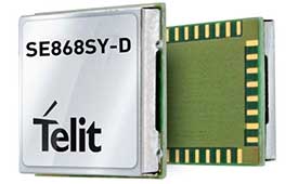
Photo: Telit
The SE868SY-D is a multi-frequency, high-precision GNSS receiver module for applications that require high accuracy, fast updates, multi-constellation support and multipath resistance. At 11 x 11 mm, the SE868SY-D accommodates ultra-compact devices and internet of things (IoT) trackers. Available now, the high-precision SE868SY-D module is Telit’s first multi-frequency, multi-constellation GNSS receiver module, featuring an ultra-sensitive -167 dBm (tracking) RF front end. By using both the L1 and L5 bands, the SE868SY-D supplies a higher location accuracy than single-frequency devices, even in high-multipath environments such as urban canyons.
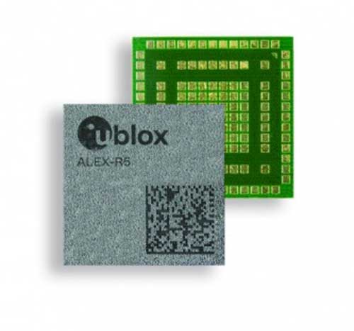
The ALEX-R5 miniature cellular module integrates low-power wide-area connectivity and GNSS technology into an ultra-small system-in-package (SiP) form factor. It is based on the secure UBX-R5 LTE-M/NB-IoT chipset platform with out-of-the-box Secure Cloud functionality and the u‑blox M8 GNSS chip for location accuracy. It has a 14 × 14-mm footprint and 23-dBm cellular transmission power, enabling devices to operate effectively in all signal conditions. A dedicated GNSS antenna interface enables independent, simultaneous operation of the u‑blox M8 GNSS chip. The ALEX-R5 is suitable for wearables and connected medical devices.
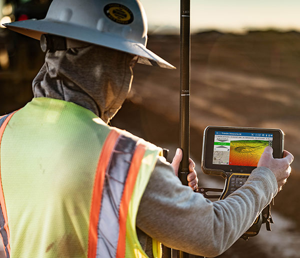
The TSC5 is a rugged, lightweight field data controller for land construction and surveying. Its backlit alphanumeric keypad is usable while wearing gloves. The battery provides all-day power on a single charge, with an optional external battery nearly doubling the power for extended use. It has a lightweight, ergonomic design and is suitable for rugged environments, with resistance to shock, dust and water. Running on the Android 10 operating system, the TSC5 is fully integrated with Trimble Access 2021 Field Software and Siteworks Software as well as Trimble Forensics Capture. The EM100 Empower module provides GNSS connectivity.
INSITE is a comprehensive cloud-based platform that enables users to more efficiently manage geospatial data, from acquisition to delivery. With applications designed for electric utilities, telecommunications and governments, INSITE provides tools to support the entire geospatial data lifecycle — project tracking, data collection and delivery, quality control, on-demand reporting, analytics and enterprise integration. INSITE enables users to import, search, analyze, manage, integrate and export all types of geospatial data and multimedia. As a cloud-based platform, INSITE improves speed and efficiency, minimizes storage expenses and supports greater collaboration.
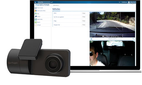
The Surfsight AI-12 camera solution is designed to help improve fleet safety through its continuous recording and advanced machine vision (MV) and artificial intelligence (AI) technology. Offered by Lytx, it integrates with Geotab’s telematics platform to provide fleets with insight into driver behavior through a combination of MV+AI, sensors, and live video streaming. The Surfsight AI-12 provides distracted driving detection, audio and visual alerts and the ability to connect auxiliary cameras. Its MV+AI technology can help identify risky driving behaviors including smoking, eating and drinking, handheld device use, unbelted driver and distracted driver. When connected with Geotab’s GO9 device, it can also capture video evidence of sudden acceleration, sharp turns and harsh braking. Through access to these insights, fleet managers can help prevent avoidable accidents and reduce the likelihood of driver or pedestrian injury, insurance claims, maintenance costs and downtime.
Suitable for rolling stock, automotive and heavy-duty applications
Photo: Eurotech
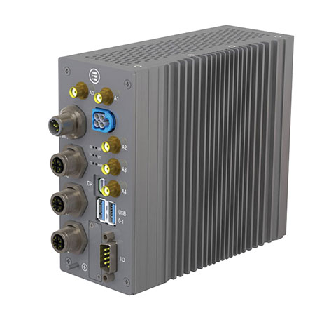
The BoltGPU 10-31 is a GPU-accelerated subsystem for machine vision and artificial intelligence (AI) applications at the edge and on vehicles. The BoltGPU 10-31 provides multi-constellation GNSS with untethered dead reckoning for geolocation. A factory option for high-precision real-time kinematic (RTK) GNSS is available. It also has Wi-Fi 6, Bluetooth 5.1 and option for LTE cellular. It is powered by NVIDIA Jetson Xavier NX and combines a 6-core, high-performance ARM CPU with a 384-core GPU and 48 Tensor Cores, offering power efficiency and accelerated computing. The rugged, fanless unit allows for simultaneous execution of neural models and the processing of multiple high-resolution, high-frame-rate sensors, even in harsh environments.
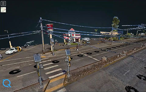
High-frequency change management for map platforms
Screenshot: Carmera
Carmera’s Change-as-a-Service (CaaS) uses consumer-grade cameras from its fleet partners and customer vehicles to detect and log changes, reducing the cost of map maintenance. With a network of commercial fleet–mounted visual probes, it overcomes the problem of GPS canyons in urban areas using a blended algorithm to localize its auto-based probes with pinpoint accuracy. CaaS is designed to be an add-on to existing map systems (both HD and SD), and will identify, analyze and localize both road inventory changes and traffic-impacting events, such as construction. A live sandbox has launched in the San Francisco-Silicon Valley area for companies to test the CaaS technology on real urban and suburban streets.
Parkopedia is designed to address challenges in navigating indoor parking facilities: system blackouts, finding a vehicle within large parking facilities, and locating services such as EV charging stations. Parkopedia provides indoor maps based on high-definition 3D models of indoor parking facilities for in-vehicle navigation. Parkopedia technology can also be used for automated valet parking. Its proprietary SLAM system integrates lidar, IMU, GNSS and high-resolution imagery.
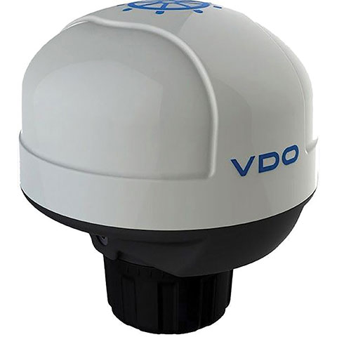
The Acqualink NavSensor can be used with any multifunction N2K-networked multifunction display. Its GPS receiver module provides position, speed and vector data, and UTC time. The inertial sensor delivers pitch and roll data. An integrated fluxgate compass with a +/- 40° tilt angle delivers course heading and the information needed by a networked autopilot to stay on course. Built-in barometer and air temperature sensors offer indicators of impending weather changes. The radome has an IPX6 extended protection rating. It is powered by the NMEA network and operates between –4° and 158° F.
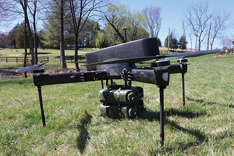
The Periscope tactical-grade UAV provides efficiencies in flight time, endurance and payload capacity. Designed for military and other federal government customers, the high-performance UAVs accomplish mission-critical tasks with speeds of up to 100 mph. They are optimized for specific mission requirements including tactical resupply, remote communications, and enhanced C4ISR. In September, Periscope Aviation won a contract to deliver prototype Tactical Resupply Unmanned Aircraft Systems (TRUAS), which the U.S. Marine Corps will field test at Yuma Proving Grounds this year. The UAVs will fly 60–90 pounds of cargo to locations 10–20 kilometers away, delivering supplies such as food, water, fuel and ammunition to marines on the front line.
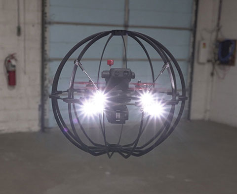
The Fixar 007 is a vertical takeoff and landing commercial drone with primary application in the mapping and surveying, monitoring, mining, oil and gas, energy and agricultural sectors. The intuitive approach to working with its ground control station simplifies use (flight preparation is estimated to take only 5 minutes). With inertial orientation, the Fixar 007 can work stably under magnetic anomalies and in the event of satellite loss. A wide range of modifications is available. The Fixar 007 uses a closed, specially designed hardware and software system that guarantees security of information. The applications and UAV use a special communication protocol that eliminates control interception.
Skycopter is a ready-to-fly UAV designed to work in extreme conditions and tight spaces. The drone is enclosed and protected by an external ultra-light and ultra-resistant cage to ensure safety and avoid damage to inspected structures and to the airframe itself. The Skycopter‘s tiltable camera can record 1920 x 1080 video at 60 FPS while sending latency-free images to the ground in 5.8 GHz for first-person view on a display or (optional) high-definition goggles. It uses an ultra-bright LED system for applications in complete darkness. The Skyloc real-time location and monitoring system provides control and tracking with high accuracy in indoor scenarios or where GPS is not available.
Helps enable state and municipal government agencies to improve fleet operations and increases operational efficiencies
Photo: THEPALMER/E+/Getty Images
Geotab, an Internet of Things (IoT) and connected transportation company, has launched its Geotab Public Works solution in North America.
The all-in-one solution offers fleet managers full visibility into the operational data of all government vehicle types on a single platform,and provides the toolsets to effectively remain compliant, reduce costs and maintain road safety.
Designed to help government agencies better manage vehicles such as salt spreaders, snowplows, street sweepers and waste management vehicles, the Geotab Public Works solution is integrated with an extensive number of spreader controllers.
The solution is built to support key government business drivers including material management, compliance, accountability and liability. Providing public works departments with improved fleet management capabilities, fleets can utilize the solution to more accurately measure material usage, such as salt, allowing government fleet managers to feel more confident that community roads are not over- or underserviced.
With Geotab Public Works, government fleets are better able to control costs while reducing the impact that excessive material usage can have on the environment.
“Empowered by an industry-leading number of spreader controller integrations alongside various geospatial capabilities, the Geotab Public Works solution is designed to help government fleets optimize both their seasonal and ongoing fleet operations,” said Chris Jackson, associate VP of Business Development, Public Works and Smart Cities. “Spreader controllers provide fleet managers with rich insights that can help government agencies ensure that their fleets are adequately servicing roads without sacrificing the health of the environment.”
Available as a configurable add-in on the MyGeotab platform, the Geotab Public Works solution allows governments, including municipalities of all sizes, to customize their database to help meet the specific needs of their fleet.
In addition, users can add further value and customization through access to the Geotab Marketplace, an extensive portfolio of mobile apps, software add-ins and hardware add-ons that enable Geotab customers to further customize the fleet management solution.
“As many governments continue to look for ways to optimize their operations, Geotab Public Works is the type of robust, scalable, secure solution that provides real value by giving government fleet managers and local constituents unprecedented visibility to their public services,” said Jean Pilon-Bignell, vice president of Business Development, Government and Smart Cities at Geotab. “With high-frequency, near real-time reporting, the Geotab Public Works solution allows governments to know where their fleets are and how they are operating at all times, enabling fleet managers to more efficiently leverage their fleet data to provide better and more transparent services to their residents.”
A roundup of recent products in the GNSS and inertial positioning industry from the December 2019 issue of GPS World magazine.
OEM
GNSS simulator
Testing for signals and sensors
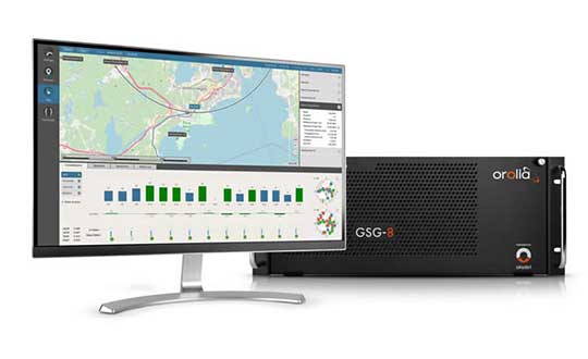
Photo: Orolia
The GSG-8 is an advanced software-defined simulator that offers ultra-high performance and flexibility in an easy-to-use format. It was developed to deliver the highest standard of GNSS signal testing and sensor simulation performance in an upgradable, scalable platform. The GSG-8 uses the robust 1000-Hz Skydel software engine. It is designed for customers who require complex capabilities to validate product and program performance in harsh, high-risk environments where failure is not an option, such as government agencies, space programs and specialized commercial programs.
The Edge Locate GNSS L1/L2/E5 module combines antenna, RF electronics and receiver technology to deliver reliable centimeter-level positioning for the internet of things (IoT). It provides 1- to 3-centimeter-level accuracy using multi-band GNSS technology. With Edge Locate, manufacturers can quickly and effectively build devices with centimeter-level positioning technology. Its multi-band GNSS positioning can be used in conjunction with real-time kinematic (RTK) positioning capability. It uses a common connector for integration into any electronics device. It also connects directly to the Taoglas Edge board for immediate connectivity options.
The VSP600L VeroStar precision antenna supports the full GNSS spectrum, as well as L-band correction services, and provides low-elevation satellite tracking with a high-efficiency radiating element. It is suitable for real-time kinematic (RTK) and precise point positioning (PPP) applications, and features a light, compact and robust design. It also has a low axial ratio through all elevation angles, providing strong multipath rejection. The VSP600L VeroStar provides high receive gain over the full GNSS spectrum: low GNSS band (1164 MHz to 1300 MHz), L-band correction services (1539 MHz to 1559 MHz) and high GNSS band (1559 MHz to 1610 MHz).
Tallysman, www.tallysman.com
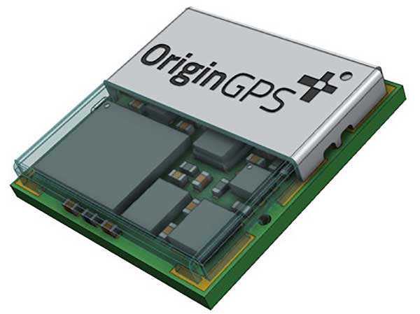
L1 + L5 chip
Suitable for IoT and auto OBD
Photo: OriginGPS
The ORG4600-B01, OriginGPS’ first dual-frequency GNSS module, is supported by the BCM47758 chip, enabling ultra-accurate GNSS positioning. It was developed for solutions requiring super-precision GNSS and a dual-frequency combination. The module enables customers to build solutions with sub-1-meter accuracy without implementing external components. Measuring 10 x 10 millimeters, the ORG4600-B01 supports L1 + L5 GNSS reception with one RF port, enabling use of a low-cost, dual-band antenna delivering sub-1-meter accuracy performance in real-world conditions. An alternate build option allows for separate L1/L5 RF outputs when dual antennas are required. The module is suitable for solutions requiring ultra-accurate positioning, such as telematics, the internet of things (IoT) and auto OBD applications.
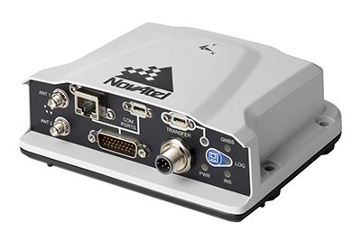
The PwrPak7-E2 contains an advanced Epson G370N MEMS inertial measurement unit (IMU) to deliver NovAtel SPAN technology in an integrated, single-box solution. It has a powerful OEM7 GNSS engine, built-in Wi-Fi, onboard NTRIP client and server support, and 16 GB of internal storage with higher performance and INS data rate. Connection options include serial, USB, CAN and Ethernet. Features include a 555-channel, all-constellation, multi-frequency positioning solution and multi-channel L-band that supports TerraStar correction services. It can be paired with an external receiver to support ALIGN GNSS azimuth aiding for low dynamic applications.
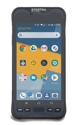
The MobileMapper 60 is a durable, efficient and accurate handheld device for geographic information system (GIS) and professional data-collection applications. The all-in-one GNSS receiver and smartphone offers 2-4 meter positioning accuracy in an all-weather design with a hand strap. It operates in extreme temperatures and rugged field conditions. It features a 6-inch high-resolution screen, large capacity all-day battery, Android 8.0 operating system and 2.2-GHz processor. Its 4 GB of memory and 64 GB of storage can manage large data sets with ease and speed. Bluetooth 4.1, 4G LTE and Wi-Fi capable, the MobileMapper 60 is suitable for cadastral, survey, topography and forestry.
Spectra Geospatial, spectrageospatial.com
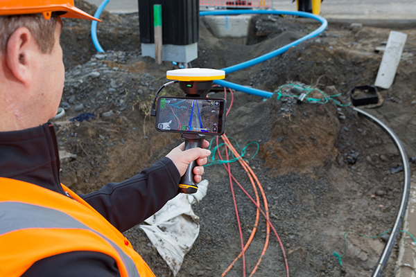
Outdoor AR
Enables visualization of 3D data
Photo: Trimble
The SiteVision outdoor augmented reality (AR) system enables users to visualize 2D and 3D data with cellular or internet connectivity for planning, collaboration and reporting. Combining hardware and software in an integrated, lightweight handheld or pole-mounted solution, users can view 3D models and assets in a real-world environment at a 1:1 scale, from any angle or position. SiteVision integrates a Trimble Catalyst DA1 antenna, electronic distance measurement (EDM) rangefinder and power management into a lightweight, handheld device that connects to a user-supplied Android mobile phone. The SiteVision subscription is available monthly or yearly, and combines Trimble’s high-accuracy positioning services and cloud-based processing technology to create a centimeter-accurate AR system. Users can visualize digital models from a wide range of data collection, design and constructible modeling tools in open industry-standard formats, including IFC and LandXML. For civil projects, SiteVision accurately visualizes data from Trimble’s Quantm, Business Center and Novapoint; design data from Civil 3D and Bentley OpenRoads; and GIS data from Esri ArcGIS software.
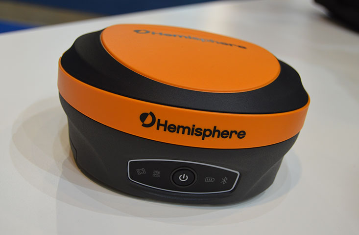
The S621, powered by the Phantom 40 GNSS OEM board, is a redesign of Hemisphere’s previous S321+. It processes and supports more than 800 channels with flexible and scalable simultaneous tracking of every modern and planned GNSS constellation and signal including GPS, GLONASS, BeiDou (including Phase 3), Galileo, QZSS, IRNSS, SBAS and Atlas L-band. The S621 combines Hemisphere’s Athena GNSS engine and Atlas L-band correction technologies with a new web user interface. It meets IP67 requirements and is immune to magnetic interference. It is designed for use in land or marine survey, GIS, mapping, construction or other applications requiring high-performance precision and positioning.
Records and transfers raw data for post processing
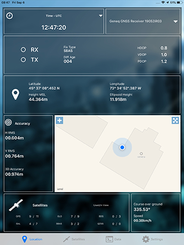
Photo: Geneq
The SXblue ToolBox is now available for iOS-compatible devices. The application was developed with special interest paid to raw data recording and NTRIP service connection. The Android application debuted in 2018. With the new iOS application, iPhone and iPad users can analyze the position data provided by the SXblue receiver, as well as location metadata. The application can record, save and transfer raw data from the GNSS receiver, thereby allowing post-processing activities. The application also acts as an NTRIP client, capable of connecting to an NTRIP server for real-time kinematic (RTK) corrections, and thus allows the receiver to issue very accurate location information. Receiver configuration is easy through the application, with the ability to set up and save user-defined commands for subsequent use. The settings include constellation to be used, differential source, NTRIP login credentials list and more.
TRANSPORTATION
Telematics for Ford
Simplifies mixed-fleet management
Photo: Ford
The Geotab Integrated Solution for Ford Vehicles integrates Ford vehicle data into the MyGeotab platform to give fleet managers a dedicated portal to process data. Ford Data Services securely transfers data from Ford vehicles with a factory installed or plug-in modem to Geotab’s cloud environment. It provides access to the Geotab Marketplace, a portfolio of mobile apps, hardware add-ons and software add-ins.
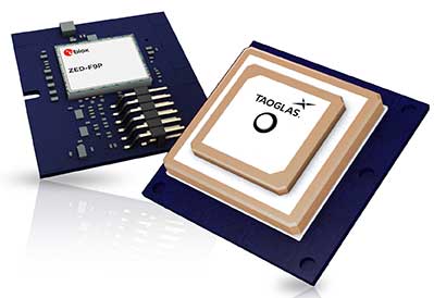
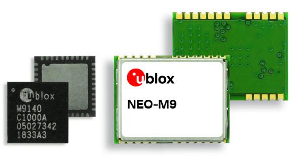
The M9 platform is designed for demanding automotive, telematics and UAV applications. With the u-blox UBX-M9140 GNSS chip, the M9 technology platform and the NEO-M9N (the first module based on the platform) can receive signals from GPS, GLONASS, BeiDou and Galileo concurrently. It can achieve high positional accuracy in difficult conditions such as deep urban canyons. The M9 offers a position update rate of up to 25 Hz, enabling dynamic applications to receive position information with low latency and has special filtering against RF interference, jamming and spoofing. U-blox also provides Explorer Kit M9 (XPLR-M9) for developers.
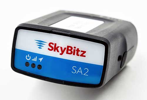
The SA2012 GPS tracker is equipped with the latest 4G LTE with 3G fallback. It is designed for customers looking for a scalable vehicle telematics solution. The hardware can be installed using the SkyBitz Ops Center mobile device, either directly plugging it into the vehicle diagnostic port or covertly installing it behind the dashboard. Once installed, the device feeds into the Ops Center platform, where users can manage the new device and others via a single interface. Coverage is across North America.
Geotab, an IoT and connected transportation company, now offers the Geotab Integrated Solution for Ford Vehicles. Integrating Ford vehicle data into the MyGeotab platform gives fleet managers one dedicated portal with powerful tools to process data from vehicles with an embedded modem as well as those which require a third-party device.
Through this integration, Ford Data Services will securely transfer data from Ford vehicles with a factory installed modem (or Ford Plug-In Modem, where required) to Geotab’s cloud environment, eliminating the need for third-party hardware in Ford vehicles.
A business unit of Ford Smart Mobility, Ford Commercial Solutions help fleets improve their operational effectiveness by offering OEM-grade data verified by Ford engineers such as fuel use and vehicle health alerts. The Transportation Mobility Cloud (TMC), an open platform that securely manages information flow to and from Ford vehicles’ embedded modems, facilitates both new products.
Simplifying the task of mixed-fleet management, the latest solution from Ford and Geotab provides fleet managers with the ability to oversee their entire fleet in one portal while also presenting the added benefit of access to the Geotab Marketplace, a portfolio of mobile apps, hardware add-ons and software add-ins that enable Geotab customers to further customize their fleet management solution.
“Ford Data Services provides the ‘Power of Choice’ so that businesses can get manufacturer-grade vehicle information from the telematics provider of their choice, such as Geotab,” said Michelle Moody, director at Ford Commercial Solutions. “With the launch of Geotab Integrated Solution for Ford Vehicles, fleets are able to access vehicle information such as fuel usage, vehicle health and driver behavior, through the Geotab platform for vehicles with a Ford modem.”
With the solution, fleet managers can access proprietary Ford-specific data available for all Ford 2020 or newer models in the United States.
“The Geotab Integrated Solution for Ford Vehicles will allow fleet managers to benefit from the combination of Geotab’s actionable data insights and powerful rules engine with the rich diagnostic data from Ford’s factory-fitted modem,” said Geotab’s Sherry Calkins, Vice President, Strategic Partners. “This means that regardless of whether they are utilizing an embedded or externally installed telematics solution, the entire fleet can be managed from one platform.”
SmartDrive Systems, a video-based safety and transportation intelligence company, is collaborating with Geotab to provide fleets with integrated solutions that leverage the SmartDrive platform as a single on-board data collection hub.
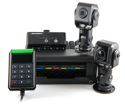
The SmartDrive SR4 video hardware platform. (Photo: SmartDrive Systems)
SmartDrive and Geotab are helping to simplify the on-board technology footprint, providing fleets the freedom to choose solutions that fit their business and their budget, and dramatically lowering the total cost of ownership.
SmartDrive offers a single integrated and aligned understanding of time, location and driver and vehicle performance to third-party applications. Fleets will be able to select solutions without incurring the additional costs associated with managing and maintaining multiple onboard devices.
“The ability to integrate and operate applications from a single data collection platform breaks through significant technology and operational barriers — unlocking efficiency gains for fleets across routes, drivers and risk,” said Steve Mitgang, SmartDrive CEO. “Collaborating with Geotab allows us to make good on the promise of convergence with a company that shares our commitment to providing open, connected and flexible solutions for fleets of every size. We believe this is a transformational shift — and it’s only the beginning of what is possible for our customers.”
With the growth of technology in the cab, fleets are struggling with how to manage the number of devices on the windshield and the connection of those devices in the vehicle.
Video-based safety cameras, electronic logging devices and advanced driver assist system (ADAS) sensors are causing fleets to look for integrated solutions that solve the hardware and data overload problem. Beyond the number of devices on the vehicle, fleets also are contending with the cost to install, maintain and train on each of these technologies. With the migration from 3G cellular networks to 4G, and resulting need to upgrade onboard hardware, fleets have an opportunity to re-think and streamline their technology strategy.
“For too long, traditional telematics systems have saddled fleets like ours with costly hardware that is expensive to maintain and upgrade, and monthly subscription costs that continue to escalate,” said Matt Penland, vice president of safety, Cypress Truck Lines. “There has to be a better way. Fleets should have the same freedom and flexibility to consolidate devices and applications that we all now have on our cell phones. The technology is available to make this possible.”
The SmartDrive platform provides a unified video and telematics data stream that can be leveraged by third parties to power their applications, the companies said. This same data stream powers the SmartDrive video safety program, ADAS and transportation analytics applications.
Through the collaboration, Geotab telematics and compliance offerings take advantage of the SmartDrive single box architecture and unified data stream, eliminating redundancy across hardware, cellular connectivity, GPS modules, connections to the ECU and cabling. It also provides data alignment across the two providers’ applications, unlocking new fleet performance insights and eliminating problematic data discrepancies.
As a result of the collaboration, fleets can benefit from:
The SmartDrive video safety program
SmartDrive SR3 or SR4 video hardware platform
“Single box” architecture enabling the convergence of data, devices and network connectivity
Analytics powered by SmartDrive SmartIQ
Geotab tracking, which delivers real-time and historical visibility to location, speed and geofencing information
Geotab regulatory compliance, including hours of service, driver vehicle inspection reports, International Fuel Tax Agreement (IFTA) recording and tax reports
Access and integration to Geotab Marketplace partners.
“Geotab’s open platform centers on a reliable, scalable and secure approach to data access for business solutions,” said Colin Sutherland, executive vice president of sales, Geotab. “We have always said that our hardware is agnostic. The SmartDrive video hardware integration is a solution that not only leverages Geotab’s platform strength to incorporate data from non-Geotab hardware, but it is a great example of telematics solutions that extend the capital investments across multiple solution providers.”
With more than three billion data points collected daily from over one million vehicles, Geotab helps companies access critical business intelligence and benchmarking data to help increase productivity, reduce fuel consumption, improve driver safety and strengthen compliance.
The integration with Geotab will be generally available early in the first quarter 2019, and the SmartDrive convergence early adopter program is in progress.
Current and prospective customers will be able to take advantage of the integration to Geotab from either the SmartDrive SR3 or SR4 platform.
Released in March 2018, the new SR4 hardware includes unprecedented compute power in a small, flexible footprint; new sensors for advanced risk identification and real-time driver-assist; innovative architecture enabling the convergence of data, devices and network connectivity; new analytics powered by SmartDrive SmartIQ; and a video safety program.
Geotab has released an interactive infographic depicting the evolution of America’s iconic Interstate Highway System.
The interactive timeline allows users to watch the network expand over the years, providing a detailed look at the development of the infrastructure that has supported transportation and trade across the America for several decades.
Today, the Interstate Highway System accounts for 25 percent of all highway traffic in the United States. As the system nears a major milestone, with the total network approaching 50,000 miles in length, Geotab created the interactive infographic to highlight the development of the highway system in the U.S. throughout the years.
Since its inception in 1956, the Interstate Highway System has been regarded as the backbone of U.S. commerce and infrastructure, playing a vital role in America’s economic growth. The map highlights major developments over the last 60 years, such as the 1974 completion of the I-5 that now connects Mexico and Canada with a singular route and the opening of the I-80, the country’s first coast-to-coast highway.
Geotab’s “Evolution of the Interstate” infographic provides the public with the ability to watch the Interstate Highway System expand over the years, enabling them to engage with particular dates and sections of the extensive network. The interactive map also includes relevant details about the city each highway serves, the length of that specific highway, and provides the total mileage covered by the entire network in any given year.
“As America’s Interstate Highway System approaches a major milestone, we wanted to pay tribute to this intricate and expansive network,” said Maria Sotra, vice president of marketing at Geotab. “Connecting people, enabling business and providing a straightforward path across one of the largest countries in the world, the nearly 50,000 miles of highway that makes up the Interstate Highway System has played an undeniable role in transportation and trade in the United States.”
Wyzelink Systems’ IoT workflow-automation application, WyzeTask, is now available in the Geotab Marketplace. WyzeTask is the newest application in the marketplace and is a complement to the MyGeotab platform, which serves more than 14,000 Geotab customers.
WyzeTask maximizes employee productivity by automating task tracking and job completion processes, freeing workers from paperwork and manual data entry. Automation also maximizes record accuracy by avoiding the errors that come with manual entry.
The WyzeTask solution includes the WyzeBeacon, a wearable device that uses Bluetooth Low Energy (BLE) to transmit data to a nearby BLE scanner, which can be a Geotab IOX-BT hub or a smartphone/tablet running the WyzeTask application. Employees simply click a button on their WyzeBeacon to have it log and share information such as their task status, time and GPS location.
Designed for field workers in public works, construction and manufacturing, WyzeTask leverages Geotab’s IOX-BT hub to reliably transmit data even when they’re away from their smartphone or IOX-BT-enabled vehicle.
WyzeTask includes an easy-to-navigate Geotab webAdd-in with an interactive map that allows administrators to view task progress and other key information. A mobile app also lets supervisors assign and change worker’s tasks from the job site or remotely.
“Wyzelink creates intelligent solutions for workforces outside of a typical office building with wireless IoT technology, smart sensors and wireless applications,” said Brian Barry, Wyzelink Systems CEO. “By closely tracking workforce tasks, businesses can cut through the tedious paperwork process and focus on core responsibilities while improving efficiency, productivity and workplace safety.”
“The addition of Wyzelink provides increased IoT capability as we continue to create an impressively connected ecosystem for Geotab’s Marketplace customers,” said Joey Marlow, Geotab executive vice president of U.S. operations. “Through Geotab’s IOX Bluetooth hub, telematics tracking and data collected from WyzeTask, management now has the ability to collect and analyze workforce data to deliver business intelligence.”
The Geotab Marketplace provides an extensive ecosystem of valuable business focused applications and Add-Ons, helping customers add value to their Geotab fleet management solution. Launched in 2015 as a complement to the MyGeotab platform, the marketplace is used by more than 14,000 Geotab customers.
LAS VEGAS — About 30,000 attendees sweltered in Las Vegas for CTIA’s Super Mobility show this past week. Attendance was flat from last year, but the exhibit floor and meeting rooms bustled. The energy of the show focused on M2M and Internet of Things (IoT). In past years, the connected vehicle was a highlight, but not so this year. Wearable technology was scant. Those looking for the big product introductions of the past were disappointed. However, CTIA’s keynote speakers added focus and vision into the show, reminding us of the drive and vigor that built the industry.
In the past, the network operators (we once called them carriers) and device manufacturers owned the CTIA show, where they made their biggest product reveals. This year, AT&T had a flurry of announcements, including a partnership with car manufacturer Jaguar Land Rover North America. AT&T will supply connectivity to the cars for features such as Wi-Fi hotspots, connected navigation and a suite of apps. Customers will be able to share wireless data between phones, tablets and vehicles on its Mobile Share Value plan for an additional 10 dollars per month access fee. AT&T previously signed agreements with Audi, BMW, GM, Ford, Tesla, Nissan, Volvo and Subaru.
AT&T and Telogis announced a collaboration to offer solutions for companies with mobile workforces, a combination of AT&T’s network and Telogis’ telematics, compliance and navigation fleet solutions. AT&T was showing off ZTE Mobley, AT&T’s first plug-in vehicle Wi-Fi hotspot, which has just appeared in stores. Smaller announcements from AT&T included the formation of a dedicated smart city organization and a personal security app that provides live, OnStar-type professional monitoring (video and audio).
Verizon unveiled Go90, a streaming-video, social media service that works across carriers. Go90 is a free, ad-based service accessed only on a mobile phone and focused on short clips, viral videos and a social element, with crowdsourced recommendations and the ability to join groups. Go90 is targeted at Millennials, people younger than 30 years old. Although this seems like a minor announcement, obtaining the loyalty of Millennials and Generation Z (those still in their teens) is critical. With two-thirds of Millennials considering smartphones as their most important device for video, the strategy behind Go90 makes sense.
New Sprint CEO Marcelo Claure is never boring and used his time at the podium to continue trash- talking the competition. With cocky confidence, he pronounced that under his leadership, Sprint will enjoy “one of the biggest turnarounds in telecom history.” In July, Claure used Twitter to declare T-Mobile’s aggressive “uncarrrier” promotion to be “bullshit and a fake show.” He continued his rant at CTIA. “We spent the first year cutting AT&T or Verizon’s bills in half, which was fun. We’ve moved on today to offering all the DirecTV customers the choice to not be stuck with AT&T.”
One of the most pressing industry issues is spectrum. With wireless data forecast to grow ten-fold by the end of 2020, the industry is concerned that the 2016 spectrum auction will not be sufficient. Keynotes appealed for more spectrum to enable the U.S. to lead in 5G, just as it led in 4G. U.S. company-run operating systems are currently on nine out of ten smartphones, worldwide. FCC Chief Tom Wheeler was at CTIA to give assurances that the spectrum auction slated for March 2016 will be successful and occur as scheduled. He countered CTIA’s CEO Meredith Baker’s assertion that the FCC has no added plans beyond this auction for freeing up spectrum.
Freetel mobile products of Japan was one of several international companies participating in CTIA this year.
Location Players, M2M, IoT
TeleCommunication Systems (TCS), a stalwart of location-based services, beefed up its indoor location capabilities with the purchase of Loctronix. The platform, Sensorvision, aggregates and integrates location-positioning technologies, like Bluetooth, beacons and Wi-Fi, as well as content, such as mapping. Sensorvision is currently in beta testing and is aimed at wireless operators. With more stringent rules for 911, including indoor location requirements, TCS is positioned for both public safety and commercial needs. What’s next? In five years, Michael Mathews of TCS predicts, “We’ll be talking about the huge amount of information available from the road and the great impact on apps, including vehicles that are informing other cars of their actions, such as when they initiate traction control or start windshield wipers.”
u-blox, the maker of wireless and positioning modules and chips, announced a portfolio of new LTE low data rate cellular modules for IoT and M2M applications in the industrial and automotive markets. The portfolio consists of multi mode, multi carrier and of LTE only modules specific for large North American carriers. u-blox expects LTE Cat. 1 technology to become the future norm for M2M applications. And when asked about long-term success, Sven Etzold of u-box says, “The challenge for our industry is picking the right partners and being part of successful consortia. We need to partner with the right network operators and play with sensors’ companies.”
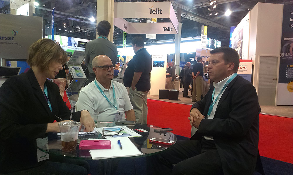
Janice visits with Chuck Moseley (center) and Don Wigglesworth (right) of Inmarsat.
Inmarsat unveiled its new machine-to-machine (M2M) and its IoT strategy, the “Internet of Everywhere.” The company is increasing use of VARs and OEMs to enable solutions that will provide more visibility and control of mobile assets throughout the world. “We are empowering existing and prospective VAR partners to offer unparalleled worldwide connectivity to their M2M and IoT customers through a single network and a single SIM,” said David Wigglesworth of Inmarsat. The company’s dedicated M2M services are IsatData Pro, a low-data-rate messaging service, and BGAN M2M, a two-way IP data service for monitoring and control of assets that require higher bandwidth capabilities.
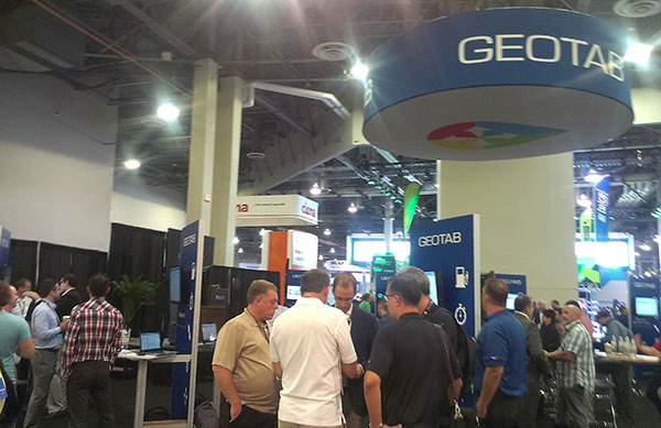
Geotab, with one of the exhibit floor’s most crowded booths, showcased the development platform of a small form-factor GPS tracking device. The Geotab GO7 device plugs directly into a vehicle’s OBDII port. Developers create applications that are available on the Geotab Marketplace. The booth was crammed with developers who offer M2M and IoT solutions.
Geotab’s booth was crowded with developers interested in the Geotab Marketplace for M2M and IoT solutions.
Microsoft’s Start-Up Alley contained interesting ventures from the Microsoft Accelerator. One young company, Parknav, offered an app for finding parking spaces based on predictive modeling, and not sensors. Users are guided to street blocks with the highest probability of available parking spaces. The app uses a number of sources, including number of parking spaces, traffic flow and undisclosed data. Parknav enables searches for free, paid and permit parking in 30 cities in Germany and a few cities in the U.S.
On a charitable note, Jimmy Whales of Wikipedia fame was at CTIA to promote his phone business, a Sprint-based MVNO cellular service. Like Wikipedia, The People’s Operator (TPO) is not a profit driven enterprise. Ten percent of a subscriber’s monthly bill goes to a charity of her choosing, and 25 percent of the company’s profits are donated to non-profits. In talking about Wikipedia, Whales cited China’s current ban of the website. Wikipedia has recently made changes to its website that make it impossible for censors to ban specific Wikipedia pages, although the entire site can be blocked, as it currently is in China.
I have parting advice for the organizers of CTIA. This year’s show was disrupted by competing events that included the iPhone 6 announcement in Cupertino. Shame on Apple, who is a member of the CTIA board. Also, CTIA had organized a virtual co-conferencing with Internationale Funkausstellung Berlin (IFA), one of the largest trade shows for consumer electronics and home appliances. The IFA event was held in Berlin the prior week and stole attention from CTIA. It isn’t all about location. Timing matters.
This year’s Mobile World Congress in Barcelona was the biggest ever, with 95,000 attendees and thousands of booths, conferences and people with sore feet walking a cavernous exhibition hall. While the Geneva Auto Show ran close to the same dates, connected vehicle companies and technology were prominently featured. What was interesting, however, was the rise of indoor positioning companies and mobile advertising agencies with interest in location.
BARCELONA — Joining the 95,000 or so Mobile World Congress attendees were about three dozen companies who are offering indoor location and location advertising services. These companies have exhibited at previous conferences, but not in the numbers this year.
At the huge Fira convention center where MWC was held March 2-5, Los Altos, Calif.-based Pole Star installed more than 600 beacons for indoor location. Visitors were able to be guided to booths and other areas through an interactive map. “Business was good in 2014, we sold 10,000 beacons. We are making money,” said Christian Carle, Pole Star CEO.
One analyst said that the big change at MWC wasn’t the number of indoor positioning companies and demos, but the maturity and breadth of the technology. “Intel announced indoor positioning capabilities in their Wi-Fi chip, and had a demo that was very impressive. Many smaller companies that in past years were showing raw technology were showing polished solutions this year, such as Quuppa, MTI and Sensewhere, said Bruce Krulwich, Grizzly Analytics president, who has authored a report identifying 150 indoor positioning companies. “I definitely see a shake-out coming up, but it won’t be one technology prevailing over another. Different technologies meet different needs in the industry, and different technologies fit different sites. There are technologies that deliver universal indoor positioning, without any infrastructure or preparation, such as Wi-Fi multilateration and sensor fusion.”
Krulwich said that there is a shake-out that’s already started because there are too many companies working on similar technologies. “Start-ups in the area that don’t have differentiating innovation, don’t have integration into retail or other back-end systems, and don’t have market penetration, are already finding themselves in a challenge. But companies with clear innovations and commercial deployments will do fine,” he said.
United Kingdom-based Sensewhere is using crowdsourcing in its indoor positioning software. The software uses radios to scan for Wi-Fi and Bluetooth to allow an IP location to reference the sources and form a location database.
“It’s what we call the universal indoor positioning versus venue specific indoor positioning, which can work anywhere — we just need a crowd of people. Our target partners are handset manufacturers, network operators, social media, social network providers, and also chipset guys as well,” said Rob Palfreyman, Sensewhere CEO. “So, there are obviously a lot of companies like Google looking at venues; there is Micello and TomTom looking at add-ins in the indoor location, which is great news, but it just needs to have a technology that can drive the blue dot on their map, and we feel that Sensewhere is the right place to provide that blue dot because of the crowdsourcing global nature of our approach.”
One company, which has developed a popular mobile game, is using its network to attract advertisers for its location-based ad platform. “We already have the infrastructure in place because of our mobile game. With our platform, we can allow advertisers to launch campaigns using our beacon signals and geofencing,” said Pedro Jahara, CEO of Brazil-based RevMob.
New location technology like the ability to track SIM cards was rolled out at MWC. W-Locate, which is partnering with Morpho in Thailand, is tracking SIM cards with its XimLoc product, which the company said is more accurate indoors than other technology.
Even such companies as Geotab, which is a strong player in the fleet market, are leveraging MWC to continue a foothold in the European market. The company displayed its IOX-CAN system that can send data from a mobile device to the MyGeotab system, which can be viewed an analyzed by fleet managers, said Maria Sotra, Geotab marketing manager.
Geotab also partnered with Telefonica in November 2014 to focus efforts in Spain, Germany and the United Kingdom, Sotra said.
At MWC, location-based advertising market is gaining traction as advertisers are seeing the benefit of locating and attracting customers. New York-based xAd said it has doubled its revenue for the second year. “We have billions of mobile ads processed and billions of ad impressions. The company is profitable,” said Dipanshu Sharma, xAd founder and CEO.
He said the company has expanded into France and Germany and added China to its global ad network.
Another company that is using location technology as a differentiator is Airpush, which had another big presence at MWC. The company’s Abstract Banners was a big draw to attendees. Location, particularly geofenced areas, have created a call to action for consumers, which is attractive to advertisers, said Cameron Peeples, Airpush vice president of marketing.
Connected Car Still Big Opportunity at MWC
Although the Geneva Auto Show was starting as the MWC was ending, there were still several big announcements by connected car companies in Barcelona. Even the well-publicized Samsung S6 and S6 Edge and HTC One M9 handset rollouts included Mirrorlink, the connected vehicle standard from the Connected Car Consortium.
In another big announcement, Audi and AT&T said that all 2016 model vehicles equipped with Audi connect will come with the carrier’s 4G LTE or 3G coverage. This increase in services is big because the auto giant just rolled out 4G AT&T service in Audi A3s last year.
AT&T selected Airbiquity to provide end-user registration and device management connected vehicle services for select customer programs. “Airbiquity will deliver these services to AT&T using our Choreo cloud-based connected vehicle services delivery platform and project management, engineering, and operations teams,” said David Jumpa, Airbiquity chief revenue officer. “This is a ‘white label’ agreement whereby AT&T will integrate Airbiquity’s service delivery capability into AT&T’s connected vehicle customer solutions.”
Another location company is making huge inroads in connected vehicle markets with its Glympse for Autos product. Glympse will be installed in select Volkswagen and Peugeot models through MirrorLink, said Bryan Trussel, company co-founder and CEO.
The app allows users to share location from their vehicle by setting the recipient and timer, and hitting send. The company has a similar app for Gogo inflight aviation networks to allow a person on the ground to know where an airplane is for picking up passengers.
In other connected car news, Accenture is providing Fiat Chrysler Automobiles the capability of in-car, Internet-based services. Starting with the new Fiat 500X, Uconnect Live services, which was co-developed by Accenture, will power an infotainment system that offers music and news services, social network access, the ability to monitor driving style and a range of diagnostic services.
Accenture also partnered with Visa for an IoT-based connected car commerce test. At MWC, the company tested a scenario where drivers could order food from the car using cellular, Bluetooth and beacon connectivity. Accenture deployed a similar system with BMW’s ConnectedDrive, which allows customers to choose services in real time for a vehicle.
Health Market Even Has Location Potential
Niche location applications are growing as Internet of Things, or IoT, markets start to grow. One company taking advantage of the mobile market is Annapolis, Md.-based TCS, which featured its VirtuMedix platform in its MWC booth.
The platform is tailored to emergency physicians as part of the growing market for video telemedicine products and mobile health, said Jay Whitehurst, TCS commercial software group president. “It’s already saving lives,” he said of the platform, which combines encryption, navigation, mapping and messaging.
While the product, now being rolled out in a North Carolina emergency medicine group, provides patients with an alternative to urgent care centers and emergency rooms, it also can be used for longer term cases such as assisted living and rehab centers, the company said.
Whitehurst said TCS has made several company acquisitions that have played a part in new product rollouts, which include the company’s Trusted Location. The application allows financial firms, online gaming companies and others to identify and prevent credit-card fraud. The application identifies and validates a device’s location worldwide.
In other Mobile World Congress news:
Spirent said its simulators have the capability to evaluate Wi-Fi Offload and Wi-Fi performance of mobile devices on its test framework. The new product allows companies to test multiple devices on a single unit to cover Wi-Fi/LTE mobility and interoperability. The testing is important in light of wireless carriers’ strategy to extend VoLTE in areas where cell coverage is limited, said Saul Einbinder, Spirent vice president, venture development.
Google Waze said its Google Mobile Service (GMS) will be available as a preinstall option on mobile devices. OEMs and carriers can preinstall the app on their handsets so consumers can use the service immediately, the company said.
Trimble’s ALK said its ALK Maps and route visualization software is now available in Europe. ALK Maps, launched in the United States in 2012, allows users to overlay routing, geocoding points, weather and other features, the company said.
Geotab, a telematics engineering company, has released its IOX-CAN extender, a plug-and-play solution that allows partners to send data from their device over a private CAN network in the vehicle, supporting integrations on all vehicle types.
Geotab is exhibiting at Mobile World Congress 2015, at Hall 3, Stand 3J20.
According to Geotab, Fortune 500 companies, including 40 percent of the top ten fleets and 18 percent of the top 100 fleets in North America, rely on Geotab’s solutions to improve productivity, optimize fleets through the reduction of fuel consumption, enhance driver safety, and achieve stronger compliance to regulatory changes.
A number of companies are already leveraging the IOX-CAN extender to send data from their devices to the MyGeotab system. Geotab’s integration with Mobileye, a technology company that develops vision-based Advanced Driver Assistance Systems (ADAS) providing warnings for collision prevention and mitigation, has been upgraded with the IOX-CAN extender allowing full support for all vehicle types, including OBDII (on-board diagnostics II) vehicles.
Geotab’s new add-on solution allows Mobileye devices to plug into Geotab’s GO6 and GO7 devices, allowing Mobileye data to be sent to the MyGeotab software platform, where it can be viewed and analyzed by dispatchers and fleet managers.
“Our solutions are designed to make the roads safer for everyone as the issue of distracted driving continues to be a problem,” said Elad Serfaty, vice president and general manager of Mobileye Aftermarket. “Working with Geotab allows us to not only provide feedback to the driver, and with managers who can effect change where needed, but we can do this across all vehicle types.”
“Expanding our integration capabilities and continuing our work with Mobileye is a natural evolution as more and more companies realize the benefits of fleet management,” said Neil Cawse, CEO, Geotab. “Providing collision warnings to drivers just before a crash is the first step to creating a safer driving environment for everyone.”