Tag: GNSS navigation

  • Advancements in satellite-driven farming

    Advancements in satellite-driven farming

    Precision agriculture — which promises to reduce inputs of water, fertilizers and pesticides by matching them to variations in soil conditions, thereby reducing environmental impacts, while increasing yields and productivity and reducing fuel consumption —has been around for a long time. This magazine published a few issues of a special supplement on the subject more than 20 years ago. In recent years, the convergence of enabling technologies — including improved satellite-based sensors, unmanned aerial vehicles, ground-based sensors, and GNSS corrections services — and greater demand has made agriculture one of the largest users of GNSS.

    Compared to autonomous vehicles on public roads, autonomous tractors, sprayers, combines, and other farming equipment pose much lower safety concerns, because they need not deal with the vagaries of traffic, accidents and construction. They also are not subject to the kind of signal occultation and multipath that is the bane of GNSS navigation in urban canyons and, at least for now, they are not at significant risk of jamming or spoofing. However, they face other challenges, including severe roll and pitch due to bumpy terrain, some multipath from silos and other tall structures, occasional signal interference, occasional dense tree canopies, the requirement to maintain exact heading at very low speeds, the need to receive corrections over very large areas, complicated weather conditions (including rain, fog and dust clouds) and, like every other sector, cost constraints.

    Despite this, guidance for farm vehicles must be consistently accurate at the decimeter-level, lest the machines damage the valuable crops that they are designed to service.

    In the following articles, seven companies briefly describe their advancements in precision agriculture:

    Advanced Navigation robots take to the field

    CHC Navigation provides affordable auto-steering

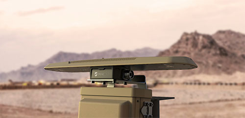
    Harxon & Hexagon | NovAtel’s Smart Antenna rides steady on uneven ground

    Hexagon | NovAtel keeps rows straight despite the weather

    Septentrio’s careful tractors weeding vineyards

    Trimble weeds out the uninvited guests in the field

    Unicore’s position accuracy matters for all farm tasks


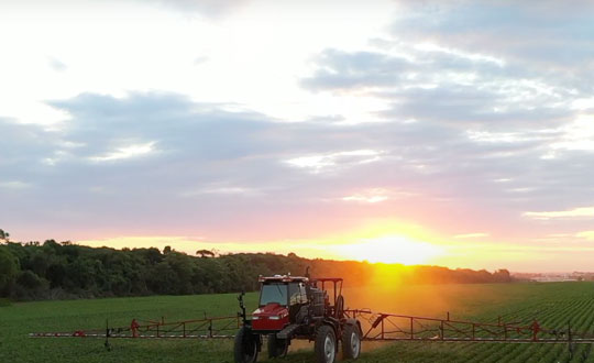
    FeaturePhoto: Trimble

  • Navigating Urban Roads

    Navigating Urban Roads

    From its very first issues, 31 years ago, this magazine has covered the role of GPS, now GNSS, in guiding ships, trains and automobiles. What were then some of the most aspirational visions of future applications are now routine. For all forms of transportation, navigation is a safety-critical issue. This is particularly true in the case of cars on public roads, which is also where the technical challenges are the greatest. Ships mostly travel in deep waters, far away from other traffic and fixed obstructions, and nearly always enjoy an unobstructed line-of-sight to GNSS satellites. So do trains, which have the additional advantages of being kept, literally, on track and of operating in controlled environments, with hardly any concerns for unexpected intrusions on their path. Cars, trucks, and busses, on the other hand, must contend with many other vehicles, including those with distracted, drowsy, drunk, or drugged drivers, as well as cyclists, pedestrians, accidents, construction and a bedeviling myriad of sudden and often unpredictable circumstances. Additionally, their view of the sky is often limited by overpasses, tunnels and tall buildings, which challenge GNSS-based navigation with signal occultation and multipath, and their view of their surroundings is often blurred by weather conditions.

    Currently, prototype autonomous vehicles carry cameras, lidar scanners, radars and ultrasonic sensors to provide positioning relative to mapped features, as well as for collision avoidance. However, some use cases require absolute positioning sensors, consisting of GNSS receivers coupled with inertial sensors. For example, autonomy levels 3 and 4 require dynamic error bounds of no more than a few meters most of the time under challenging highway conditions and levels 4 and 5 will require this level of accuracy even in deep urban canyons.

    This month’s cover story highlights progress in several transportation-related GNSS/PNT applications

    u-blox partners with Bird e-scooters

    Domino’s delivers with Nuro

    u-blox shares autonomous insights

    Hexagon guides Indy Autonomous Challenge

    Swift Navigation provides precise corrections

    Skytraq Technology modules meet market needs

    SBG Systems drives GNSS+inertial in Paris

    Featured Photo: Bird

  • DroneShield releases GNSS compass for harsh environments

    DroneShield releases GNSS compass for harsh environments

    Photo: DroneShield
    Photo: DroneShield

    DroneShield Ltd. has released CompassOne, a self-contained navigation solution for fixed site, vehicle and marine applications.

    The device provides real-time military-grade location, orientation and direction sensing for deployed static and on-the-go assets. The device can be used both in counter UAS systems and general situations requiring satellite navigation.

    The CompassOne receives:

    GPS L1CA/L1P/L1C/L2P/L2C/L5
    GLONASS G1/G2/G3, P1/P2
    BeiDou B1i/B2i/B3i/B10C/B2A/B2B/ACEBOC
    Galileo E1BC/E5a/E5b/E6BC/ALTBOC
    QZSS L1CA/L2C/L5/L1C/LEX
    IRNSS L5
    Atlas

    With a strong focus on durability and ruggedness, CompassOne is suitable for installation and operation in harsh environments. Military-grade (MIL-SPEC) connectors and high-end stainless-steel hardware ensure uninterrupted connection and protection from the elements, while the aluminium underside provides exceptional impact resistance and rigidity while keeping overall weight low.

    CompassOne can operate stand alone or integrate with DroneShield’s DroneSentry system. Power over Ethernet reduces cable clutter and VESA compatibility makes CompassOne easy to integrate into new or existing systems. Installation is clear and fast with status LEDs, installation graphics and tool-less fasteners.

    “CompassOne, with its ruggedness and incorporation of advanced technologies, integrates seamlessly within DroneShield’s product ecosystem, and equally with third party systems as a stand-alone product,” said Oleg Vornik, DroneShield CEO. “Its accurate navigation is substantially superior to other systems on the market globally.”

    The product is expected to be of interest to both counterdrone and other customers requiring a rugged navigation solution.

  • EUMETSAT Polar System may provide GNSS navigation bit data

    EUMETSAT Polar System may provide GNSS navigation bit data

    EUMETSAT logoNews via the CANSPACE Listserv

    The EUMETSAT Polar System is considering providing GNSS navigation bit data, should there be sufficient interest in the user community.

    “In the framework of the development of the radio occultation data processor for the new EUMETSAT Polar System – Second Generation mission, we envisage a GNSS Navigation Bit Data product,” wrote Riccardo Notarpietro, a remote sensing scientist with EUMETSAT’s radio occultation team, in an email.

    “This product will contain the bit stream of each of the GNSS navigation messages which are modulating the open service GNSS signals. We are thinking to provide this product operationally on an hourly base covering the last hour of observations from a dedicated ground-based network of GNSS receivers.”

    If there is sufficient interest, the data would be made available from the EUMETSAT data distribution system. Notarpietro invites those who are interested or have questions to contact the team at [email protected].

    EUMETSAT is the European Organisation for the Exploitation of Meteorological Satellites. The second-generation of the polar system, also known as EPS-SG, will secure the continuation of meteorological observations from polar orbit in the 2022-2043 timeframe.

  • Ukrainian MiG-29 fighter jet upgraded with GNSS navigation

    Ukrainian MiG-29 fighter jet upgraded with GNSS navigation

    A Ukranian MIG-29. (Photo: Ministry of Defense, Ukraine)
    A Ukranian MIG-29. (Photo: Ministry of Defense, Ukraine)

    Ukrainian Lviv Aircraft Repair Plant is upgrading the country’s MIG-29 fighter jets with domestically developed GNSS-assisted navigation capability, reports defenseworld.net.

    GNSS data will be viewed on a 8-inch, highly informative Cockpit display alongside the map of the terrain being overflown, target data and weapons parameters.

    Also being upgraded is the jet’s air-to-ground and surface attack capability, making it a “multi-role” fighter aircraft.

    The air-to-ground capability will be achieved through the use of TV-guided missile-bomb weapons of the X-29T and KAB-500KR types. The MiG-29 was originally designed as an air-superiority fighter to provide cover to ground attack planes such as the MiG-21.