Spirent Communications, now part of Keysight Technologies, has launched SimXTRACT, a GNSS test tool that bridges the gap between field and laboratory.
SimXTRACT enables signals captured in field environments to be comprehensively decomposed into individual, discrete signals and applied to lab simulation for realism at every stage of the development test cycle.
“By combining real-world insights with lab-based control and repeatability, our customers will no longer have to compromise on how they test in this fast-moving technology area,” said Peter Terry-Brown, divisional CEO of Spirent’s Positioning business. “SimXTRACT ensures customers get the best of both worlds, with enhanced realism delivering more accurate results, quicker issue resolution, and faster time to market.”
Developers usually rely on either RF record-and-playback or lab simulation for testing and validation of PNT systems and devices. While both methods play important roles in product development, neither is able to combine the richness of the real world with the control needed for tasks such as research and development, receiver integration, or regression testing.
The introduction of SimXTRACT brings the advantages of both field and lab test methods together by taking real signals captured in field environments and accurately breaking them apart to create realistic simulator drive data for use in Spirent simulators.
Using signals and scenarios captured in the field by Spirent record-and-playback devices, SimXTRACT performs complex signal decomposition, breaking down each received signal into discrete line-of-sight and multipath ray paths, along with metadata such as Doppler offset, code error, power level, and angle of arrival (AoA).
This decomposed environment is then automatically converted into fully controllable simulation scenarios for Spirent GNSS simulators, reducing time spent in the field, cutting the cost and complexity of scenario capture and generation, and enabling repeatable, high-fidelity testing.
Combined with the option for developers to analyze and understand signal recordings, as well as search for and recreate specific conditions in order to focus testing, SimXTRACT will help accelerate development workflows for sectors that include automotive, chipset, consumer devices, defense, critical infrastructure and more.
“In today’s high-precision PNT ecosystem, SimXTRACT redefines how you can develop, test and debug PNT-enabled systems,” said Terry-Brown. “You can now bring the real-world environment into every stage of your product realization process, saving you time and money, while also improving product quality.”
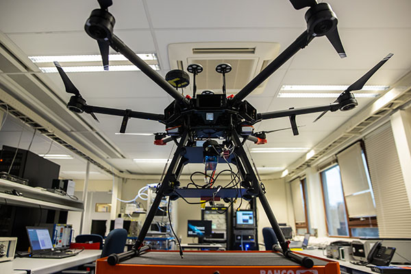
The Navigation Laboratory of the European Space Agency (ESA) has acquired an unmanned aerial vehicle (UAV) that can carry different types of satellite navigation receivers to collect data for follow-on analysis.
The NavLab, based at ESA’s ESTEC technical centre in Noordwijk, the Netherlands, is focused on the testing, analysis and characterization of navigation systems for both ESA and external customers.
With UAVs representing a rapidly expanding user base, the new UAV is a timely addition to the NavLab’s suite of platforms for testing GNSS technologies and techniques, ESA said. Other tools include static, mobile and pedestrian platforms and a pair of test vans.
Along with receivers and antennas, the UAV can host radio-frequency spectrum samplers and support equipment such as inertial sensors and stereo cameras, allowing the assessment of performance in specific dynamics and environments related to UAV applications, such as approach, landing, flying beside buildings or indoors.
Simulator vendors explain their evolution in response to changes in GNSS/PNT, comment on technical challenges they face, and outline principal markets.
GNSS receivers — which were never as simple as FM radio receivers or garage door remote controls — are becoming increasingly complex. The causes for this include continuing efforts to:
reduce their size, weight, and power (SWAP)
utilize new signals from up to four GNSS constellations
integrate them with other sensors, such as inertial measurement units (IMUs), cameras, and lidars
take advantage of a growing number of public and private, global, regional, and local correction services
meet the requirements of booming new markets, such as autonomous vehicles
mitigate the threats posed by the proliferation of unintentional and intentional RF interference, the latter better known as jamming, and by spoofing.
In short, receiver manufacturers must constantly adapt to a GNSS/PNT landscape that is, as one of the respondents to this Q&A put it, “ever evolving.”
In turn, the growing complexity of GNSS receivers requires increasingly sophisticated simulators to test receivers and their integrations in controlled conditions before field testing and deployment. Increasingly, this is achieved by replacing with software what was once done in hardware. Simulation remains a vital, though often underappreciated, segment of our industry.
On the following pages, five simulator vendors briefly explain their evolution in response to changes in GNSS/PNT, comment on the principal technical challenges they face, and outline their principal markets.
Spirent Federal Systems’ GSS6450 RF record and playback GNSS simulator is portable, for testing automotive applications in the field. (Photo: Spirent Federal)
Lisa Perdue Product Line Director, Simulation Orolia
OROLIA
How has your approach to simulation changed over the years and in response to what changes in GNSS/PNT?
We have transitioned away from the GNSS simulator approach of using fixed, allocated hardware that we used in our early simulators to the more modern software-defined approach we use today. Given the ever-evolving PNT landscape, it is difficult to design hardware that will support all future GNSS and PNT simulation needs. Instead, we focus on the development of the Skydel software platform, which can then be used with the supported COTS hardware or turnkey system to generate the necessary signals. This gives us the benefit of maximum scalability and flexibility while being truly future proof.
The software-defined approach also allows us to offer Skydel in new and exciting ways. We aim to make PNT simulation accessible to everyone and we can do that through subscription and cloud-based simulation services.
What are currently the greatest technical challenges to GNSS/PNT simulation?
Today GNSS is only a part of the PNT picture. GNSS receivers are often tightly integrated with other sensors and many times the GNSS receiver cannot be isolated to test it on its own. Other sensors must also be stimulated or simulated and included as part of testing. Correction services are becoming more common, but many are proprietary with no public specification. With no common standards available, it can be technically challenging to create a one-size-fits-all test solution.
We tackle these challenges through our plug-in feature. The plug-in architecture allows you to expand the capabilities of Skydel by adding your own features or complex integration with other systems. It allows you to exchange information with the Skydel Engine and even integrates it into the Skydel UI. With our open-source SDK, which includes example plug-ins, you can create your data outputs synchronized to the GNSS simulation, such as IMU or correction services data.
In what markets and applications are your simulators used? Are they used only in labs or also in the field?
At Orolia, we say ‘Skydel Everywhere.’ Skydel is used in applications ranging from military encrypted receiver testing (SAASM, M-Code, PRS) to commercial applications supporting any of the GNSS signals available.
Skydel is used in systems that are found in labs, but you can also find Skydel at an individual engineer’s desk, or even home offices. In the field, Skydel has provided simulation and threat generation capability to authorized test ranges and field test events.
The broadsim software-defined GNSS is powered by Orolia’s Skydel GNSS simulator engine. (Photo: Orolia)
RACELOGIC
Julian Thomas Managing Director Racelogic
How has your approach to simulation changed over the years and in response to what changes in GNSS/PNT?
Over the years, GNSS technology has changed significantly but our approach of identifying a need and creating a solution hasn’t changed since we launched our first LabSat GNSS simulator. We created LabSat because we needed a cost-effective, accurate and easy to use record and replay simulator that we could use for product development and production line testing for our VBOX Automotive and VBOX Motorsport technologies. This need could not be met by any other simulator manufacturer, so we developed our own solution, which in turn became LabSat. Although our approach has not changed, the needs of users, including our own engineers, have, so we continue to develop and improve LabSat to meet these needs.
With the increasing number of satellite launches in market segments such as communication and navigation, the number of requests for testing space-qualified receivers has increased dramatically. To test these kinds of scenarios, we have been making some major upgrades to simulate rocket launches and Earth orbit trajectories that require very different characteristics from land-based simulation.
As the number of constellations and signals has expanded very rapidly, the number of simultaneous signals that need to be simulated has put a far greater requirement on the computing power needed to render them. We have been working very hard on optimizing our routines to make the most of the new breed of high-performance multi-core processors. The result has been a big decrease in the time taken to create a scenario, and an increase in the number of signals that can be simulated in real-time.
What are currently the greatest technical challenges to GNSS/PNT simulation?
The biggest challenge is in simulating a large number of constellations and signals in real-time without using dedicated, expensive hardware to create them. The good news is that with the latest Intel Xeon processors boasting up to 40 cores and 80 threads, a much larger number of signals can now be created in real-time using off-the-shelf PC components.
In what markets and applications are your simulators used? Are they used only in labs or also in the field?
With the global pandemic causing national lockdowns, many engineers switched to working from home. Our largest growth in the simulator market has therefore been due to providing these engineers with a small, low cost, easy to use simulator that they can have on their desks at home, allowing them to continue to develop GNSS applications without having to go into the office. The markets these engineers work within are as varied as the markets that use GNSS technology.
We have also seen a big increase in the use of our simulators to test mass produced satellites used in providing global internet coverage. These satellites are being produced in large volumes, and the need for a low cost, reliable testing method on the production line has driven strong growth in this area.
Our simulators are often used in the field to gather data for in-lab testing, as small size and battery life are very important factors in this environment.
SPIRENT FEDERAL SYSTEMS
Phillip Bonilla Senior Systems Engineer
How has your approach to simulation changed over the years and in response to what changes in GNSS/PNT?
Spirent has provided highly accurate simulation solutions since the early phases of GPS availability, starting with defined hardware for each signal type. As the GNSS landscape has grown, Spirent has worked closely with leading developers, adding key flexibility and functionality to adapt and provide a growing product portfolio. By adopting a robustly defined system architecture, and employing signal-agnostic hardware, Spirent simulators can generate any of the available constellations and frequencies, with no more than a few clicks of a mouse.
While broadening the support for the increasing number of constellations has been a focus, so too has the necessity to provide users with high numbers of available channels and auxiliary simulation needs. To complement GNSS simulation, significant effort is being devoted to resilient application testing, providing users with flexible solutions for introducing jamming and spoofing to the test environment. Our agnostic hardware supports signal generation using software defined radio (SDR), including interference sources and user-defined IQ signal data. As customer demands have grown, alternative RF and PNT sensors have been—and continue to be—incorporated, allowing users an expanded and comprehensive test environment.
The new spirent simulator generates alternative RF navigation signals concurrently with GNSS signals. (Photo: Spirent Federal)
What are currently the greatest technical challenges to GNSS/PNT simulation?
Today, nearly all industries rely on GNSS or other PNT sources to some extent. With such varied and widespread use, laboratory testing is critical, and maintaining the highest levels of accuracy, reliability and robustness remains one of the greatest challenges. For modern hardware-in-the-loop configurations, simulation systems must be able to keep latency consistent to enable powerful post-processing of results. With this challenge in mind, we at Spirent design and manufacture our own hardware, ensuring precision and ultra-low latency.
Another significant test challenge posed by modern applications is the growth in vehicle speed and maneuverability. Creating a truly realistic test environment for supersonic and even hypersonic vehicles with high rates of spin and jerk places huge demands on a simulator. Spirent recently has introduced the industry’s first 2 kHz update rate, enabling the most accurate trajectories for the most mobile technologies.
Lastly, positioning engines are becoming more complex. In addition to GNSS and inertial, vision systems and a range of other sensors and signals-of-opportunity are providing developers greater opportunity for precision and robustness. Therefore, a core part of Spirent’s mission statement is delivering test equipment that is designed to be integrated into wider test benches and ensuring that equipment is always orders of magnitude more accurate than any device under test.
In what markets and applications are your simulators used? Are they used only in labs or also in the field?
Spirent simulators are used in all phases of the product life cycle across nearly all applications. Receiver manufacturers use our solutions beginning with initial research and development, throughout product development, and well into production and field testing. Along with the ability to use Spirent’s simulators for live range testing, Spirent’s GSS6450 record and playback system enables users to record the real world in high dynamic detail for repeatable lab testing.
JACKSON LABS
Gregor Said Jackson President and CTO
How has your approach to simulation changed over the years and in response to what changes in GNSS/PNT?
Initially, we saw a large demand for GPS-only solutions. We are shipping units into this market and it is growing more than 30% year over year for us. Recently, customers are looking to also supporting other constellations. There is an emerging market for LEO simulation capability. Many LEO constellations are becoming reality, such as OneWeb, Kuiper, Starlink, Iridium, Xona, and others, and customers are more frequently asking if we can support these types of signals in our simulators. Demand also is arising for additional base-band signals to accommodate the RF signals, such as synchronized raw IMU data and other observables. Jamming and spoofing signals also are being requested and reproducing these as faithfully as possible is a big challenge for synthesized simulation. Lastly, we see demand rising for mil-type secure applications, such as M-Code, PRS (Galileo) and P(Y) code SAASM of course. The complexity of future simulators will rise in lockstep with the complexity of the RF spectrum coming to us from space.
What are currently the greatest technical challenges to GNSS/PNT simulation?
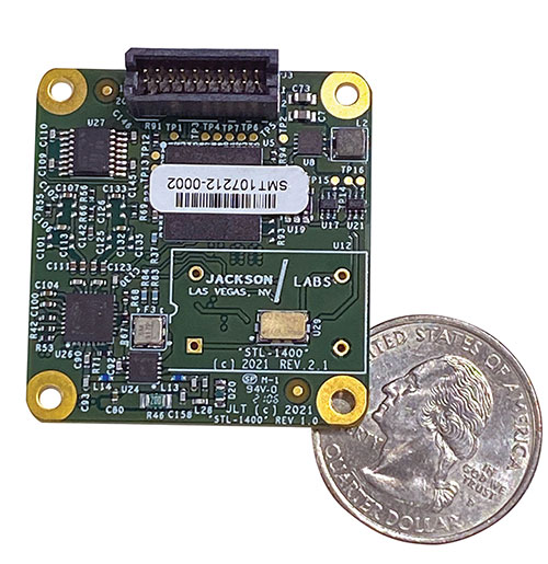
The STL-1400 positioning and timing receiver is designed for battery-operated low SWaP-C applications. (Photo: Jackson Labs)
A faithful reproduction of the real live-sky RF signals would rank high on this list. There are almost an unlimited number of out-of-band and in-band benign and adversary RF signals on a typical GNSS antenna these days, and more recently the sun has been acting up with solar flare activity that can disrupt GNSS signals. As GNSS receivers mature and become capable of tracking four, five or more carrier frequencies and constellations at once it becomes increasingly challenging to supply these types of signals from a simulator, and at a reasonable price-point. Sometimes, a wideband recording and playback system can do a better job at reproducing live-sky signals, however these systems are limited to playing back the same exact mission over and over again of course, and thus are not very flexible.
In what markets and applications are your simulators used? Are they used only in labs or also in the field?
Our simulators are built for two different applications: the first is a traditional type of GPS signal simulation where a Windows application allows a user to set up static or dynamic scenarios, allows them to upload NMEA playback files, create jamming or spoofing signals, and generally tweak the RF signal in many ways, such as modifying power levels and antenna patterns and even creating space vehicle failures in real time. Our customers range from car, aircraft, and avionics manufacturers, to R&D labs, to the government and academia.
Our simulators also are used for a hardware-in-the-loop application that we call transcoding. It allows glueless retrofitting of existing GPS equipment with any and all the emerging PNT solutions such as LEO positioning and timing, celestial navigation, INS/IMU, CSAC holdover, and concurrent/multi-frequency GNSS using a 1×1-in. transcoder module. Our transcoders fly on Air Force aircraft, are used to retrofit telecom equipment, and allow deep-indoors and underground GPS reception. Transcoders created an entirely new market for simulators.
SYNTONY GNSS
Sylvain Daubas GNSS Simulators R&D Teams
How has your approach to simulation changed over the years and in response to what changes in GNSS/PNT?
Manufacturers of GNSS receivers are targeting more precision and availability, especially in urban areas, which require acquiring more signals from more constellations and greater effort to minimize multipath errors. This confirms that an SDR design for signal generation is decisive to keep systems cost-efficient, as it directly benefits from Moore’s law. For instance, our new RTGS4-12 configuration is about four times more powerful (240 channels) than our previous standard configuration, for a similar budget level.
Regarding precision and RF quality, our simulators benefit from the same RF cards as Echo, our high-fidelity record and playback equipment, with a state-of-the-art RF front end: three channels at a 100 MHz sampling rate and a 16 bit IQ. The capacity to simulate protected signals is also crucial: with PRN Link, Constellator is ready for any present or future signal with encrypted spreading codes.
What are currently the greatest technical challenges to GNSS/PNT simulation?
Building a CRPA simulator is not an easy task, as this requires extreme levels of phase and time synchronization between several RF outputs, typically four, seven or more. This can be done in two ways: with a dedicated new RF board running with a single synthesizer for all channels or using the classical one, to which one should add a complex calibration mechanism. SYNTONY has made the tough choice, investing more at first in a mono-synthesizer version. However, this will benefit our customers, for which the usage will be simplified and it will save them a lot of time by shortening the calibration phase. This version already is available for sale.
On another note, it is a significant challenge to keep our product and its interfaces user friendly while also enabling our clients to configure each of the more than 500 parameters available (at the last count). We also keep in mind that new signals may appear, from LEO constellations for instance, answering to new needs such as autonomous driving. Constellator is HW ready for them, only requiring a software update.
In what markets and applications are your simulators used? Are they used only in labs or also in the field?
Constellator currently is mainly used in laboratories, in many market segments. Because it was initially built in partnership with spacecraft manufacturers, it benefits from the high standards of performance of space industries and includes several advanced space-dedicated features.
On top of the typical usage inside the labs, two other SYNTONY simulator products that are directly derived from Constellator are used in the field:
ECHO Recorder & Playback is used to record the GNSS environment with ultra-high fidelity: today @ 100Mhz, and before the end of 2021 even up to @ 200Mhz. ECHO has been used by our customers in cars, trains and often in aircraft test flights. Another usage of ECHO is to detect and record scintillation phenomena, as we will soon do in Brazil.
SubWAVE (GNSS coverage extension for underground places) allows indoor positioning with precision, directly compatible with standard GPS receivers, which can be crucial for safety or operational reasons. We have installed SubWAVE inside subways stations and tunnels (for example, in Stockholm, Paris and New York), in road tunnels (soon in France, in the “Tunnel du Mont Blanc”), in an underground bus terminal (also in Stockholm), in underground train stations (in Switzerland), and before the end of 2021 also in an underground mine (in Finland).
The U.S. Space-Based Positioning, Navigation and Timing (PNT) Policy tasked the NASA Administrator to develop and provide requirements for the use of GPS and its augmentations to support civil space systems. NASA is exploring the viability and enhancement of GPS and GNSS signals in the Space Service Volume and beyond to support operational U.S. missions and civil space systems. Spirent GNSS solutions and expertise will support testing of the GNSS receivers intended to be deployed in the upcoming lunar exploration, the company said.
“For over two decades, NASA and other space users have selected us to provide leading-edge test and development solutions for missions ranging from short suborbital flights to weeks-long orbits beyond geosynchronous altitudes,” said Ellen Hall, president at Spirent Federal Systems. “Working collaboratively with our customers enables us to meet their demanding test and development needs with the trusted solutions for which Spirent is known.”
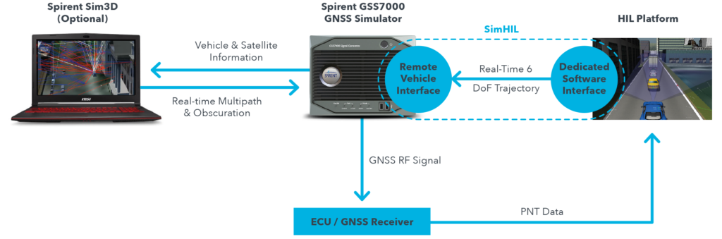
New hardware-in-the-loop application programming interface (API) for GNSS simulators enables greater accuracy, integrity and control for growing sensor fusion testing needs
Spirent Communications plc has released SimHIL, an integrated hardware-in-the-loop (HIL) testing software API for Spirent GNSS simulators.
SimHIL brings high-fidelity GNSS signal simulation with low latency to automotive industry HIL testbeds, the company said.
Image: Spirent
Spirent’s SimHIL software has been developed to meet the automotive industry’s growing need for realistic positioning, navigation and timing (PNT) testing for sensor fusion. As customers apply increasing pressure on car manufacturers for more advanced driver-assistance system (ADAS) features and advanced infotainment systems, test labs need to be able to combine Wi-Fi, camera, lidar, radar, inertial and GNSS data that power these advanced automotive systems.
SimHIL helps test engineers bring accurate, controlled and coherent data from GNSS and inertial sensors to their sensor-fusion algorithms within HIL test environments. Facilitating the ultra-low latency, complete control, enhanced realism, and ease of use and setup of Spirent GSS7000 and GSS9000 GNSS simulators, SimHIL is suitable for OEMs and tier-one suppliers developing ADAS, V2X and sensor-fusion engines.
The new SimHIL API enables:
external motion input – real-time direct motion and trajectory data input from simulators
sensor fusion – introducing GNSS signals into sensor-fusion engines
V2X testing – validation and performance benchmarking of V2X applications
infotainment system testing – real-time scenario feedback to system and driver responses
vehicle-in-the-loop (VIL) – final production form product testing
accurate testing – reliable results supported by ultra-low latency simulation. Criticality of ADAS features, such as lane assist and automatic braking, mean that 3+ metres of uncertainty introduced by higher latency systems is not sufficient.
“With our SimHIL software and GNSS simulators, test engineers can bring realistic, controlled GNSS simulation to their HIL testing environments – a vital requirement in a world where ADAS features are relying more heavily and critically on accurate positioning,” said Martin Foulger, general manager of Spirent’s PNT business.
Spirent has worked with leading suppliers to ensure SimHIL is compatible with their HIL platforms, and because of its open API, there’s broad scope for additional custom third-party integrations.
“When used with our GSS7000, SimHIL latency is less than 40 ms from motion command to RF output and supports all GNSS and SBAS signals,” said Ricardo Verdeguer Moreno, product manager for Connected and Autonomous Vehicles at Spirent. “SimHIL is also compatible with all the options and features available in Spirent’s GNSS simulators, including ionospheric and tropospheric modeling, antenna patterns, date and time settings, and obscuration and multipath effects via Sim3D.”
Users can easily configure and control both the GNSS scenarios, and signal generation and vehicle motion from within the HIL simulator graphical user interface — saving time and the possibility of error.
Spirent is also offering three service packages alongside SimHIL to help customers mitigate project risk and reduce the time from delivery to useful deployment.
For more information about Spirent’s SimHIL integrated testing for Spirent GNSS simulators, visit the SimHIL information page.
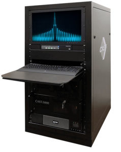
The CAST-5000 produces a coherent wavefront of GPS RF signals to provide repeatable testing in the laboratory environment or anechoic chamber. The basic system generates four independent, coherent simulations that reference a single point and is configurable to support up to eight elements for CRPA testing. With an intercard carrier-phase error of less than 1 millimeter, the CAST-5000 is extremely accurate.
The system generates a wavefront of GPS when its GPS RF generator cards are operated in a ganged configuration. Each generator card provides a set of GPS satellites coherent with the overall configuration. Several RF generator cards may be utilized together, ensuring phase coherence among the bank of signal generator cards. The CRPA antenna, antenna electronics and the GPS receiver can be tested as a unit with or without radiating signals.
The CAST-8000 is a new simulator that merges the CAST-5000 CRPA tester with a CAST-3000 EGI tester. The CAST-5000/8000 has the ability to be “ganged” together with additional CAST simulators to provide multiple vehicle and/or multiple antenna test configurations.
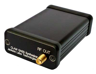
The 18-channel miniature full-constellation CLAW GPS Simulator is a fully self-contained, low size, weight, power and cost (SWaP-C) miniature GPS simulator. It is very popular in manufacturing environments as well as R&D applications that require consistent and repeatable local GNSS signals at low price points.The CLAW simulator does not require external computers for processing and control — it works fully self-contained by simply applying power, and storing location/time/date data in internal non-volatile (NV) memory, or by storing complex vector data to simulate highly dynamic scenarios. The CLAW also can be used to transcode NMEA or SCPI position/velocity/time (PVT) data into GPS RF signals. JLT offers an easy to use, highly configurable and cost-free SimCon Windows application program that is downloadable from the JLT website.
The SimConapplication allows random scenario generation and is thus usable to simulate leap-second events, week 1023 rollover events, or any other GPS live-sky scenarios including highly complex yet easy-to-create dynamic vector simulations. For authorized U.S. government users, a version that does not have altitude and velocity limitations is popular for low-Earth-orbit (LEO) simulations. Multipath simulation allows use of the entire 18-channel simulator capability. The unit can be field-upgraded with an easy to use in-field software upgrade feature. The CLAW is also very useful in GNSS receiver sensitivity testing for R&D or mass-production assembly lines as it allows accurate control of RF output power ranging from –100 dBm to less than –130 dBm with 0.1-dB resolution and typically better than 1-dB accuracy over the controllable power range.
The CLAW GPS Simulator also has a built-in RF signal generator with sweep, CW and random noise functions that are useful in simulating GNSS jamming scenarios, as well as GPS spoofing scenarios. The simulator comes in an FCC-certified metal desktop enclosure with numerous accessories.
The Orolia family of GNSS simulators offers a wide breadth and depth of tools for those responsible for mission-critical positioning, navigation and timing (PNT) applications. The simulation tools enable users to test a variety of scenarios, from simple to complex. Orolia’s simulators are feature-rich and easy to use, offering a way to harden GPS/GNSS-based systems without the limitations of testing from live-sky signals. Orolia’s approach allows users to buy only what they need today and upgrade later.
ESSENTIAL
Photo: Orolia
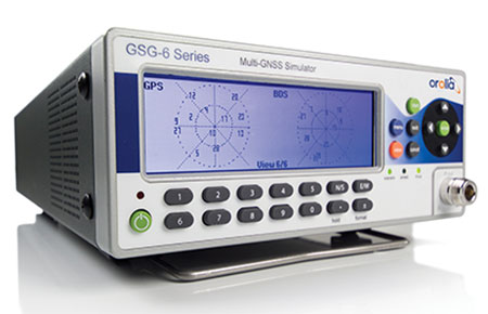
GSG 5/6. An essential scenario-based simulator used for testing a variety of smart applications such as drones, the internet of things (IoT), connected cars, cellular and more. GSG 5/6 offers ease-of-use with an out-of-the-box configuration and comprehensive set of pre-defined scenarios, plus the ability to create scenarios. It can simulate all constellations, all frequencies, and movements/trajectories anywhere on or above Earth. This enables a multitude of test solutions covering accuracies and sensitivities due to environmental conditions, technology factors and other events. Application packages are available for real-time kinematic (RTK), eCall, high-velocity, jamming and sensors.
ADVANCED
Skydel Software Engine. The software behind Orolia’s high-end GNSS simulators: GSG-8, BroadSim, BroadSim Anechoic and BroadSim Wavefront. All share the same software-defined benefits and interoperability. In addition to Orolia’s turn-key systems, Skydel can run on the user’s own commercial off-the-shelf (COTS) hardware. It is suitable to test and validate GNSS systems for a variety of applications, with advanced signal customization and configurable outputs. Users can create advanced scenarios with multiple parameters and variables: antenna patterns, orbits, multipath, hardware-in-the-loop (HIL) and more. The easy-to-use API configures all aspects, available in Python, C#, C++ and LabVIEW. User interactions can be recorded and exported as executable Python script — a learning tool that drastically reduces the automation learning curve.
Photo: Orolia
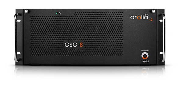
GSG-8. An advanced software-defined GNSS simulator supporting multiple constellations, frequencies and hundreds of signals all-in-view. With a 1000-Hz iteration rate, high dynamics and real-time synchronization, GSG-8 delivers ultra-high performance and flexibility. It is designed for space trajectories, custom PNT signals, HIL and more. Advanced jamming and spoofing options allow users to create benign and threat scenarios required for critical applications. Complex objects such as Differential GNSS (RTK), multi-antenna vehicles, attitude measurements and sophisticated GNSS receivers can be tested. A comprehensive software development kit (SDK) allows users to incorporate encrypted or proprietary signals. Powered by the Skydel Simulation Engine.
Photo: Orolia
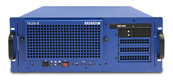
BroadSim. Available through Orolia Defense & Security, BroadSim was designed to meet the demand of NAVWAR testing. BroadSim supports high dynamics, advanced jamming and spoofing simulation tools, and encrypted military codes including Y-code, M-AES and M-MNSA. BroadSim uses a custom Linux operating system for security and better performance. BroadSim excels in NAVWAR applications due to its four independent RF outputs, a wide dynamic range with up to 0 dBm transmit power, and integrated jamming and spoofing scenario creation. BroadSim’s ease-of-use and functionality to configure multiple vehicles allows any user to seamlessly test the performance and vulnerability of their system without requiring a high level of expertise. Powered by the Skydel Simulation Engine.
Photo: Orolia
BroadSim Anechoic. Available through Orolia Defense & Security, BroadSim Anechoic enables users to accurately simulate over-the-air (OTA) GNSS environments in their anechoic chamber. Designed from the ground up for the user, by users, the system has 32 individual RF outputs enabling it to drive 16 dual-frequency antennas. The automation of antenna mapping, time delay and power loss calibration cuts set-up time from days to minutes. Easily verify signals with a built-in spectrum analyzer. The 48-dB transmit chain amplifier and 80-dB transmit chain dial attenuator allow for complete signal control and high dynamic range. Powered by the Skydel Simulation Engine.
Photo: Orolia
BroadSim Wavefront. Available through Orolia Defense & Security, BroadSim Wavefront enables fully featured testing of controlled reception pattern antenna (CRPA) and multi-element antenna electronic systems. Scaled upon the same easy-to-use software-defined platform and interface, it supports 4-16 antenna elements with integrated high dynamics and a phase coherence of 1° σ. Users can simultaneously simulate multiple spoofers, jammers, repeaters and alternate PNT sensors with just a few clicks. The Wavefront makes no compromise between the number of signals and the iteration rate, which remains at 1,000 Hz. It is designed to help engineers deliver results and make decisions, and can be calibrated in a matter of minutes. Powered by the Skydel Simulation Engine.
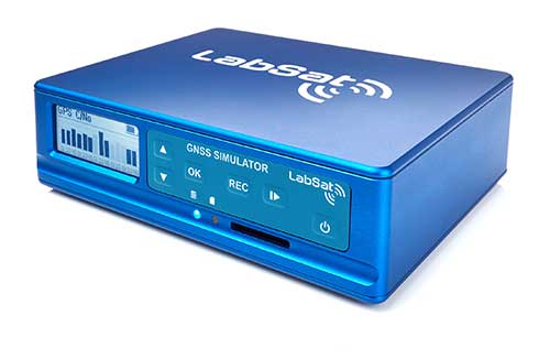
The LabSat 3 Wideband is a compact yet powerful multi-constellation and multi-frequency GNSS testing solution.
The easy-to-use, one-touch record and replay function provides an efficient way to test and develop GNSS-based technology without the cost and limitations of live-sky signals.
With simple-to-install upgrade options available, customers can invest with the confidence that its capabilities can grow alongside their future requirements.
LabSat 3 Wideband can record and replay up to three different channels at 56-MHz bandwidth across all major constellations and signals including:
GPS: L1/L2/L5
GLONASS: L1/L2/L3
BeiDou: B1/B2/B3
QZSS: L1/L2/L5
Galileo: E1/E1a/E5a/E5b/E6
L-band correction services including SBAS and IRNSS
2x CAN, RS232 and digital inputs tightly synchronized with GNSS data
Future signal launches are also supported, including L2C, L5 and L1C
LabSat 3 Wideband has a removable SSD (up to 7TB) and a two-hour runtime provided by an internal battery. It is lightweight and portable, making it ideal for field testing in any environment.
SatGen Signal Simulation Software
SatGen software allows users to quickly create bespoke, accurate scenarios with their own time, location and trajectory, that can be replayed via a LabSat GNSS Simulator.
The latest version of SatGen can be used to create a single scenario containing all the upper and lower L-Band signals for GPS, Galileo, GLONASS and BeiDou.
Precision-sensitive applications such as autonomous driving, control of unmanned aerial vehicles (UAV), or positioning of aircraft during landing procedures in coordination with ground-based augmentation systems (GBAS) require that modern GNSS receivers undergo detailed tests before implementation.
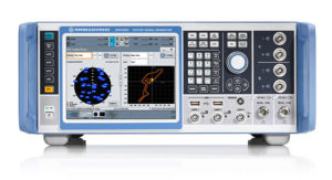
Rohde & Schwarz signal generators like the R&S SMW200A and the R&S SMBV100B offer a unique approach to generating complex and highly realistic scenarios for testing of GNSS receivers that are able to work with diverse navigational systems such as GPS, GLONASS, Galileo, BeiDou and QZSS/SBAS signals. Both simulators can emulate them all for testing.
R&S SMW200A. The R&S SMW200A GNSS simulator (pictured above) can be used to produce complex interference scenarios with multiple interferers — all generated within the instrument itself. It can emulate up to 144 GNSS channels and can be equipped with up to four RF outputs. With its ability to simulate multi-constellation, multi-frequency, multi-antenna and multi-vehicle scenarios, the R&S SMW200A is able to cover a variety of high-end GNSS applications.
R&S SMBV100B. The R&S SMBV100B supports the same navigational systems, with access to 60 GNSS channels and one RF output, with the same ability to configure realistic scenarios including obscuration, multipath and atmospheric effects, as well as the specific characteristics of the antenna and the simulated vehicle. An integrated noise and CW interference generator also can be added.
Since the devices do not require an external PC for scenario configuration, all the tests can be created quickly through the user-friendly GUI. Due to all-encompassing instrument options available, both simulators can be set up to fit unique user requirements.
For testing GNSS receivers under controlled and repeatable conditions, the R&S SMW200A and the R&S SMBV100B provide extensive and cost-effective solutions. The platforms are ready to adapt to future requirements and testing of newly implemented GNSS signals.
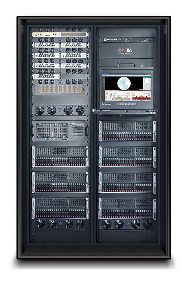
GSS9000, SimMNSA, CRPA test system, anechoic chamber testing, mid-range testing
Photo: Spirent Federal
Spirent Federal provides GPS/GNSS test equipment that covers all applications, including research and development, integration/verification and production testing.
GSS9000. The enhanced GSS9000 Multi-Frequency, Multi-GNSS RF Constellation Simulator is Spirent’s most comprehensive simulation solution. It can simulate signals from all GNSS and regional navigation systems and has a system iteration rate (SIR) of 1000 Hz (1 ms), enabling higher dynamic simulations with more accuracy and fidelity. The GSS9000 supports restricted/classified signals. Users can evaluate the resilience of navigation systems to interference and spoofing attacks, and have the flexibility to reconfigure constellations, channels, and frequencies between test runs or test cases.
SimMNSA. The first fully approved MNSA M-code simulator. Authorized users of the GSS9000 series of simulators will be able to utilize the advanced capabilities of SimMNSA to create more robust solutions for their customers. SimMNSA has been granted Security Approval by the Global Positioning System Directorate.
CRPA Test System. Spirent’s Controlled Reception Pattern Antenna (CRPA) Test System generates both GNSS and interference signals. Users can control multiple antenna elements. Null-steering and space/time adaptive CRPA testing are both supported by this comprehensive approach.
Anechoic Chamber Testing. Spirent’s GSS9790 Multi-Output, Multi-GNSS RF Constellation Wave-Front Simulator System is a development of the GSS9000. The GSS9790 is a unique solution providing the core element for GNSS applications that require a test system that can be used in both conducted (lab) and radiated (chamber) conditions.
Mid-Range Solutions. Spirent also offers solutions that cater to intermediate GPS/GNSS testing needs. The GSS7000 multi-constellation simulator provides an easy-to-use solution for GNSS testing that can grow with users’ requirements. The GSS6450 RF record and playback system enables replay of a real-world GNSS/GPS test repeatedly in the lab.
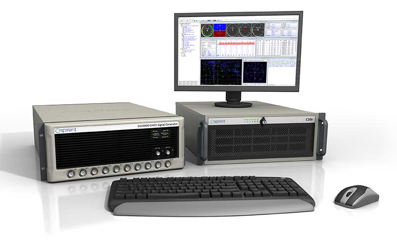
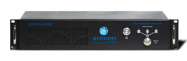
High-end GNSS simulation solutions for R&D, integration and production testing
Photo: Syntony GNSS
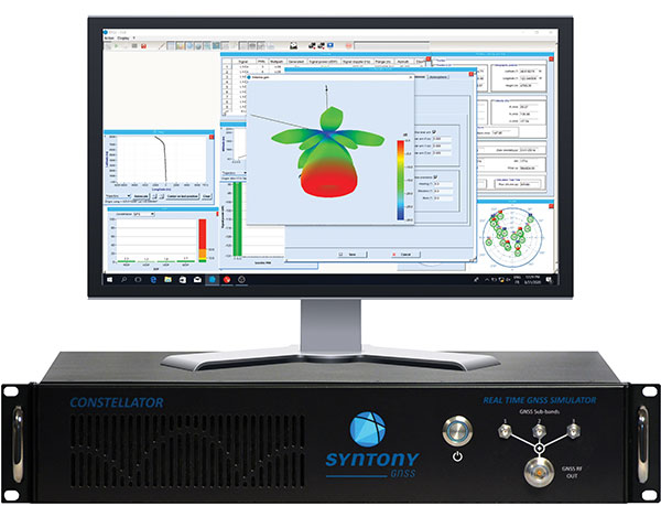
Constellator. Syntony’s GNSS simulator Constellator supports all constellation signals available and provides a high level of service in different ranges. It covers, in a single unit, a wide spectrum of use cases from entry-level with L1C/A up to very demanding configurations such as multi-frequencies and 400 channels management.
Extensively used in aeronautics, space and defense industries, Constellator answers complex requirements:
Standalone mode (on the ground and in space)
Multi-frequencies
All constellations and their signals, including NavIC/IRNSS
Hardware in-the-loop (HIL) mode with zero-effective latency and 1000-Hz update rate
All typical synchronization interfaces
Particularly in the space industry, Constellator implements the advanced models (Earth gravity, drag, 3D ionospheric models, side lobes, etc.) needed to achieve accurate simulations for all kinds of orbits (from LEO to GEO and SSTO). Combined with other Syntony GNSS simulation products (interference generator, Recorder & Player Echo, GBAS simulator, etc.), Constellator can be used to tackle challenging use cases such as jamming, spoofing, multipath, and multiple antennas testing. Constellator is based on a software-defined radio (SDR), making it hardware-ready for future constellations, signals and codes. It is easily upgradeable and versatile.
GNSS Recorder & Player. Syntony’s Echo is an ultra-high-fidelity GNSS recording and playback solution. It is designed to capture real-life signals and environments, for instance from airplanes, and then replayed for R&D or production tests. Echo offers:
3 RF channels of 100-MHz bandwidth each (for the whole set of GNSS signals from all constellations)
16-bit resolution (I&Q)
from 7 to more than 1,000 hours of record/replay capabilities depending on configuration
Echo-R can also record complex and very long realistic scenarios from a simulator; Echo-P can replay them with very high fidelity for long-run or production tests. Please ask Chief Sales Officer Francois Goudenove for distributor contacts in the U.S., Europe, India, China, South Korea and Japan.
Averna celebrated its 20th anniversary Sept. 20 as a test and quality solutions provider. Founded in 1999 by a team of three in Montreal, Quebec, Averna has grown to 400+ employees with 10 offices and more than 300 customers around the world.
“I am proud to see what Averna has become,” said Adil Lahlou, one of the co-founders of Averna. “We started Averna by understanding our clients’ manufacturing challenges and now reflecting on the continuing success we’ve had, it’s a reminder that we are still on the right path, particularly with the growth of Industry 4.0.”
Averna’s growth can also be attributed to business alliances. Company founders Kurt Hensen (T&M Solutions NV) and Darren Lingafeldt (Nexjen Systems) both believed that combining more than 100 years of test and quality experience would only benefit their customers and the industry.
“With each company bringing their own expertise to the forefront, different technologies are being exposed to a wider range of clients internationally,” the two said in a press release.
With proficiency in vision, RF signals, optics, precision assembly, robotics and automation, Averna has developed hundreds of unique solutions to service major industries such as medical technology, automotive and transport, and consumer goods and electronics.
Through standalone projects and complete program outsourcing, Averna’s global team has demonstrated its capability to support their customers at every step of the product life-cycle, the company said.
“What makes Averna outstanding is the willingness to consistently evolve and stay in front of our customers’ business needs,” said Francois Rainville, president and CEO of Averna. “It’s our employees’ enthusiasm to understand and tackle customers’ evolving requirements that has kept us ahead for the last 20 years and will continue to through the next 20.”
The new portfolio offers a comprehensive array of GNSS validation technology, as well as signal and PNT data protection through jamming/spoofing detection, suppression and countermeasure solutions.
The capabilities are built on Orolia’s legacy of resilient PNT solutions, together with two key acquisitions completed this year: Skydel Solutions and Talen-X. These companies were selected based on their demonstrated GNSS testing and simulation experience.
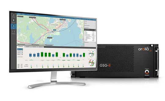
GSG-8, the latest advanced simulator from Orolia, was also introduced to the global GNSS community this week at ION GNSS+. This software-defined simulation solution offers ultra-high performance and unmatched flexibility in an easy-to-use format. GSG-8 was developed to deliver the highest standard of GNSS signal testing and sensor simulation performance, in an upgradable and scalable platform.
“With its scientific precision and advanced simulation capabilities, GSG-8 is revolutionizing the GNSS simulation industry with Orolia’s robust 1000Hz Skydel software engine and COTS software-defined radios,” said Stephane Hamel, director of testing and simulation at Orolia. “GSG-8 is designed for customers that require complex capabilities to validate product and program performance in harsh, high risk environments where failure is not an option- such as government agencies, space programs and specialized commercial programs.”
It can be programmed to simulate operations with multiple GNSS constellations and to incorporate the use of encrypted or proprietary signals. GSG-8 can also be configured for Wavefront and Anechoic chamber simulation protocols to test anti-jam antennas and complete systems, to serve the most challenging program requirements.
3D modeling solution creates true-to-life synthetic environments for more accurate testing.
Spirent Communications plc has launched an innovative multipath simulation solution, Spirent Sim3D. The 3D modeling solution enables the testing of realistic multipath and obscuration effects on GNSS signals in a true-to-life synthetic environment.
Sim3D is suitable for use by automotive, chipset, handset and receiver manufacturers, as well as in aerospace, military, mining and precision agricultural applications.
Spirent will demonstrate Sim3D at ION GNSS+ 2019 in Miami, Florida, Sept. 16-20.
Studying multipath. Historically, researchers and developers of GNSS receivers have had to rely on statistical models and time-consuming field testing to study the effects of multipath on GNSS signals.
With Sim3D, the industry can now gain a greater understanding of the impact of multipath and obscuration in a broad range of real-life situations. It offers the level of control and traceability needed for developers to improve their customers’ experience in the most challenging environments.
A satellite signal reflecting off surfaces, such as a building, a high-sided vehicle, a tree, or even the ground, alters the pseudorange, causing the signal to arrive at the receiver slightly later than line-of-sight signals.
Without proper mitigation, this can cause a receiver to output an inaccurate position.
“Obscuration and multipath effects are one of the major obstacles faced by engineers trying to achieve accurate GNSS positioning solutions,” said Spirent Managing Director of Positioning Martin Foulger. “The accelerating development of connected autonomous vehicles and other precision applications means the need to test for higher precision positioning, navigation and timing in a variety of environments is growing rapidly. Sim3D is an important and timely development.”
Image: Spirent
Simulation of 3D environments. The unique system has been developed in partnership with OKTAL Synthetic Environment. It offers the ability to simulate multipath effects in a range of lifelike geo-typical environments, using different models to recreate locations such as urban highway, an inner city or a forest. Geo-specific models of real locations can also be commissioned.
During simulation with Sim3D, the GNSS signals interact with fully customizable 3D environments to simulate real-life applications in operation, like a vehicle on a highway, or a wearable device on a pedestrian.
This gives a level of detail, control and realism in testing not previously available. Such realistic multipath and obscuration simulation will add greater credibility to GNSS testing and assure that developed solutions are optimized and tested for their intended environments.
“As vehicles become increasingly autonomous, it’s vital to get a more detailed understanding of the effects of obscuration and multipath on a vehicle’s ability to generate an accurate GNSS-based position” explained Foulger. “Statistical models cannot sufficiently achieve this.
“Sim3D’s ability to realistically simulate different environments provides this greater accuracy and brings a host of benefits to researchers and developers of autonomous vehicle systems,” Foulger said. “It will help to guide critical design decisions like where to place the GNSS antenna on the vehicle, what GNSS receiver to use and when to hand over to other position sensors as GNSS signals degrade.”
Rohde & Schwarz’s Navigation and Guidance Solutions Learning Center offers brochures, articles, technical documents, videos and posters. (Image: Rohde & Schwarz)
Rohde & Schwarz has updated its Navigation and Guidance Solutions Learning Center with several features, including application notes, white papers, training videos and products for aerospace and defense applications.
Rohde & Schwarz provides accurate, flexible, high-performance test solutions to cover every need — from design, development, calibration and production to operational maintenance for ground based systems and advanced hybrid constellation simulations for GNSS systems, the company said.
The navigation learning center now includes the latest Rohde & Schwarz solutions for GNSS testing and avionics testing. It highlights the latest company products, including aeronautical radio navigation measurement solutions, vector signal generators and GNSS signal simulators. It also provides users with brochures, articles, technical documents, videos and posters.
The navigation center is organized under three main categories: radar and electronic warfare test, satellite communication systems, and navigation and guidance.
The SMW200A GNSS simulator adds a high-end solution to the Rohde & Schwarz portfolio of satellite navigation system simulators. It can be extended to up to four RF outputs and allows GNSS signals to be simulated simultaneously in multiple frequency bands for multiple antennas.
The SMW200A can internally simulate a complex interference environment in parallel with GNSS signals.
The instrument was unveiled at ION GNSS+ 2017, which took place Sept. 25-29 in Portland, Oregon:
An increasing number of GNSS receivers are able to process signals from diverse navigation systems such as GPS, GLONASS, Galileo or BeiDou in several frequency bands — and in some cases, with several antennas in parallel — to improve positioning accuracy.
Accuracy can be further improved with differential GNSS (DGNSS) techniques. These techniques are used in applications such as autonomous driving, and they are indispensable for precise and reliable positioning of aircraft during landing approaches. The GNSS receivers used in these applications must undergo extensive tests before deployment in vehicles or aircraft.
The new R&S SMW200A GNSS simulator now offers an innovative test solution for easy generation of complex and highly realistic test scenarios for a wide variety of GNSS applications. To test multi-frequency and multi-antenna systems, users now have access to 72 GNSS channels that can be assigned to up to four RF outputs.
The R&S SMW200A can generate QZSS and SBAS signals as well as GPS, GLONASS, Galileo and BeiDou signals. This solution enables users to quickly and easily verify the position accuracy of their receivers under realistic conditions.
The R&S SMW200A also has an internal noise generator and can generate complex interference scenarios with multiple interferers. All signals (GNSS, noise and interference) are generated directly in the instrument. Additional signal sources for external generation of interference signals are not necessary, considerably simplifying test setups.
No external computer is needed to configure and operate the R&S SMW200A. The integrated, intuitive graphical user interface (GUI) allows users to generate GNSS scenarios quickly and easily. Thanks to the multitude of instrument options, the solution can be optimally adapted to individual user requirements.
The R&S SMW200A is an extensible, future-proof platform ready to implement future test requirements such as testing new GNSS signals.
The R&S SMW200A with the new GNSS options is now available from Rohde & Schwarz.
Rohde & Schwarz and MediaTek have successfully completed the verification of location-based services (LBS) in the U-plane and C-plane for Assisted Beidou (A-BeiDou), China’s GNSS satellite positioning system.
The R&S TS-LBS test solution allows mobile manufacturers, chipset manufacturers, test houses and network operators to verify chipsets and mobile devices in order to obtain permission to operate them in a particular network.
The successful A-BeiDou verification of the MediaTek device under test (DUT) using the Rohde & Schwarz test system marks an important milestone in the GNSS evolution of positioning and navigation. According to Rohde & Schwarz, this was the first time that the setup could be used to validate and verify a device for A-BeiDou location-based services.
The R&S TS LBS from Rohde & Schwarz is a test system for testing GNSS and network-based LBS. It consists of an R&S CMW500 as the base station simulator and an R&S SMBV100A GNSS simulator. The R&S CMW500 provides assistance data to the DUT and the R&S SMBV100A simulates the BeiDou satellites. The R&S TS-LBS test system can be used to obtain GCF and PTCRB certification as well as network operator-specific certification for chipsets and mobile devices.
“We are delighted to collaborate with MediaTek and to contribute our test and measurement expertise to the development of A-BeiDou location based services,” said Alexander Pabst, vice president of Systems and Projects within the Rohde & Schwarz Test & Measurement Division. “Rohde & Schwarz already has a strong global footprint with testing solutions for A-GNSS, such as A-GPS or A-GLONASS, and for OTDOA/eCID. Thanks to our close cooperation with our partners, Rohde & Schwarz is committed to accompanying the evolution from existing to new satellite systems such as A-BeiDou with our innovative test and measurement solutions.”
“MediaTek is committed to developing and testing the latest mobile technologies and standards to drive the industry forward,” said TL Lee, general manager of the Wireless Communications Business Unit at MediaTek. “We have worked closely with Rohde & Schwarz to develop and validate the test solution for A-BeiDou LBS, verifying the A-BeiDou proof-of-concept trial system based on the R&S TS-LBS and MediaTek DUT. This represents an exciting step forward in the evolution of LBS technology, enabling the mobile ecosystem to verify chipsets and mobile devices on the new LBS technology.”