Tag: GPS handheld

  • SMC awards 3 agreements for modernized GPS handheld

    SMC awards 3 agreements for modernized GPS handheld

    SMC awards multiple rapid prototyping agreements for joint modernized GPS handheld device; four demonstrations to be held

    The Defense Advanced GPS Receiver (DAGR) in use in 2011. (Photo: U.S. Army)
    The Defense Advanced GPS Receiver (DAGR) in use in 2011. (Photo: U.S. Army)

    On June 26, the United States Space Force’s Space and Missile Systems Center awarded three separate rapid prototyping agreements to Collins Aerospace, Raytheon Intelligence & Space and the Technology Advancement Group for a total of $41.1 million.

    The firm-fixed price agreements are for the development of a basic working prototype of the joint modernized GPS handheld device. The contract provides the government with innovative solutions demonstrated via hardware and software prototype development.

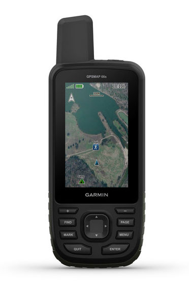
    The purpose of this rapid prototyping effort is to produce a joint modernized handheld smaller in size with low power consumption, increased military-code capability, and improved anti-jamming and anti-spoofing capabilities compared to the equipment now used by the military.

    4 demonstrations coming

    This is the second competitive objective under the current Phase I strategy and is the result of a down-select from five to three vendors. It builds off the first objective of Phase I, which focused on mock-ups and drawings.

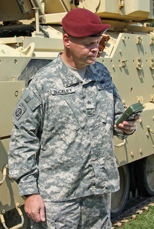
    These agreements provide for four demonstrations to be held with Army and Marine Corps representatives. The demonstrations give the end users an early opportunity to provide feedback and the ability to influence the final design — ultimately making for a more seamless transition to operations.

    “This is the first major update to the military’s GPS handheld device in more than 15 years,” said Col. Clifford Sulham, User Products Division chief.  “The advanced capabilities of this device will allow our airmen, soldiers, sailors and Marines to conduct operations in GPS-challenged environments.”

  • New Garmin GPS handheld logs raw measurements in RINEX

    New Garmin GPS handheld logs raw measurements in RINEX

    Photo: Garmin
    Photo: Garmin

    Garmin International is offering a new outdoor GPS handheld that can log raw measurements in RINEX form, the GPSMAP 66

    “We’ve had good success achieving carrier-phase ambiguity resolution with the unit, and I suspect many readers will be interested in this feature from a purpose-built device,” said Jared Bancroft, GNSS sensors & algorithms, Garmin, in an email to GPS World. “We’ve observed accuracies down better than 30 centimeters.”

    The GPSMAP 66 is a premium outdoor handheld with expanded wireless connectivity, direct-to-device access to BirdsEye satellite imagery and a 3-inch sunlight-readable color display. The handheld comes in two models, the GPSMAP 66s and GPSMAP 66st. The latter offers preloaded topographic maps for U.S. and Canada.

    Professionals and serious GPS enthusiasts will appreciate the inclusion of RINEX data logging, which allows for sub-meter accuracy of GPS position after post processing, Garmin stated in a press release.

    “The GPSMAP 66st builds on the GPSMAP series heritage by adding new and requested features like a bigger screen, weather forecasting and easy direct-to-device access to satellite imagery,” said Dan Bartel, Garmin vice president of global consumer sales. “Between multi-GNSS network support and connectivity to the new Garmin Explore app, the new GPSMAP 66s and the GPSMAP 66st are reliable companions for any adventure.”

    The handheld can receive weather updates for real-time forecast information by being paired via Bluetooth to a compatible mobile device. It will also provide predictive maps for temperature and wind speed/direction, as well as live weather radar.


    Other new GPSMAP 66s/st connected features include Geocaching Live and compatibility to the Connect IQ platform, giving users access to 9 million trails through the preloaded Wikiloc app. The devices all pair with the inReach Mini, allowing the user to send and receive messages directly on their 66s/st device via the Mini.

    Between the multi-GNSS satellite support and  altimeter, barometer and compass sensor capabilities, the GPSMAP 66s/st will track an entire journey. The handheld devices have 16 hours of battery life in full GPS mode and can track the user’s position for up to one week using Expedition mode on a single set of AA batteries, the company said.

    The devices include an LED flashlight and SOS beacon that can be used to signal for help. It is built to military standards for thermal, shock and water performance (MIL-STD-810G).