By 50th Space Wing Public Affairs, Schriever Air Force Base
Throughout the years, GPS has achieved historic milestones and garnered recognition for its contributions to the betterment of humanity.
2015 was no different.
Photo: 50th Space Wing Public Affairs, Schriever Air Force Base
GPS, operated by the dedicated men and women of the 2nd and 19th Space Operations Squadrons at Schriever Air Force Base, Colorado, is also the world’s largest military satellite constellation. Uses of GPS include precise timing for financial transactions, search and rescue, communications, farming, recreation and both military and commercial aviation.
The 2 and 19 SOPS, referred to as Team Black Jack, hosted GPS Week Feb. 15-20 to honor their heritage and interact directly with the Colorado Springs community. The week included a community geo-caching event, GPS/base tours for dozens of middle and high school students, 2 SOPS educational outreach events at local schools and culminated with a GPS heritage celebration.
“We wanted to touch the different facets of our community and that’s why we planned these events,” said Tech. Sgt. Abifarin Scott, 2 SOPS GPS maintenance flight chief.
GPS received historic recognition from the city of Colorado Springs a few months later.
Colorado Springs City Council members presented a proclamation declaring July 17, 2015, GPS Day during a ceremony July 15.
“It’s a great time, a significant milestone that [GPS] has been active this long,” said Andy Pico, Colorado Springs City Council member. “GPS has grown to be such a tremendous part of everybody’s lives, it runs everything…it’s so much into the fabric of everybody’s life.”
The proclamation came as the Air Force celebrated GPS’s 20 years of full operational capability, confirmed July 17, 1995. During the last 20 years, GPS has become an integral part of technology that affects the lives of billions of people around the world.
The men and women of GPS stayed busy supporting many operations throughout the year.
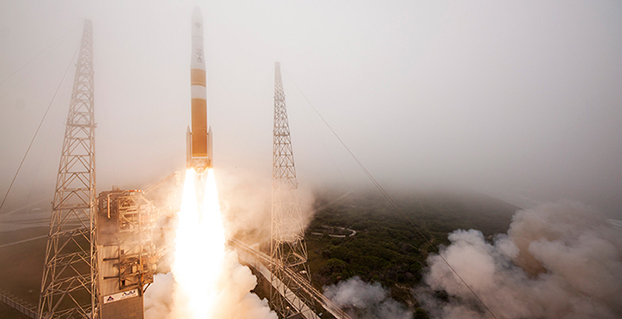
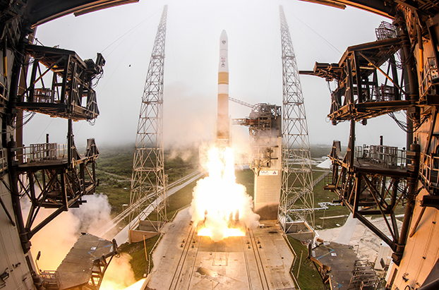
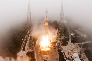
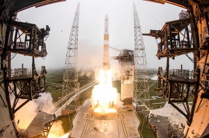
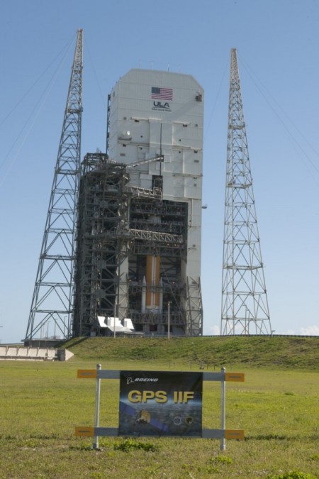
GPS IIF-10. (Photo: ULA)
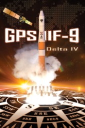
The Air Force and the 45th Space Wing supported the successful launch of a United Launch Alliance Delta IV rocket that roared to life March 25, carrying the Air Force’s ninth Block IIF-09 navigation satellite for the GPS.
2 and 19 SOPS accepted satellite control authority of GPS IIF-9 Satellite Vehicle Number-71 April 3.
2 SOPS successfully completed a transfer operation of GPS satellite control authority to the Alternate Master Control Site at a backup location on June 6.
2 and 19 SOPS accepted command and control of the 10th GPS Block IIF satellite July 24.
After 15 years of launch operations for the GPS, 19 SOPS completed their 26th launch as a squadron Oct. 31, performing checkout operations on the 11th GPS IIF satellite.
On Nov. 6, Team Black Jack accepted SCA just six days after the Halloween launch of satellite vehicle number-73 – in record time. Members of Team Black Jack prepped for the launch and subsequent SCA acceptance of SVN-73 for approximately three months.
The Command’s GPS operations were showcased in multiple venues this year, engaging with communities and making the mission known all over the world.
CBS featured the 50th Space Wing and GPS on an episode of 60 Minutes, and BLUE, the Air Force’s flagship TV show, also featured GPS — both of which displayed the capabilities it offers to humanity.
Beyond its essential capability for the military, GPS is a worldwide utility that provides the highest accuracy data available to people all around the world and enables such vital activities as weather forecasting, transportation, global commerce and farming/agriculture.
“2 SOPS’s continuing objective is to ensure GPS remains the gold standard for global space-based navigation and timing by providing highly reliable and accurate GPS signals to users around the world,” said Lt. Col. Todd Benson, 2 SOPS Commander. “We look forward to continuing to provide our mission partners and global users with the most accurate position, navigation and timing signal available in the history of GPS.”
Planet Earth gained five new navigation satellites in late March, for four satellite systems.
GPS. The U.S. Air Force’s ninth GPS Block IIF satellite (GPS IIF-9) launched on March 25 from Cape Canaveral, Fla. The IIF-9 rode aboard a Delta IV rocket, the workhorse of the GPS fleet for successful launches. The satellite was declared operational on April 21.
“Many thought the Delta IV and GPS days were long gone, but the recent questions concerning reliable and proven launch vehicles have brought them back online, so to speak,” said GPS World Defense Editor Don Jewell. “The 20-year milestone for GPS space vehicles on orbit that occurred on April 27 translates to approximately 500 orbital years just for the IIR and IIF constellations alone. The IIAs may account for that many orbital hours as well.
“This is by far the most successful launch record ever put together by any nation or government. No other space-faring nation even comes close. The U.S. Air Force and all the players should be proud of all these records and more, plus we have one more GPS asset on orbit, providing GPS signals to the world and all they enable, courtesy of the USAF.”
Galileo. Two days later, March 27, a duo of Galileo satellites was successfully launched from Europe’s Spaceport in French Guiana. The seventh and eighth Galileo satellites rode aboard a Soyuz ST-B rocket. Both are in their planned orbits.
IRNSS. The next day, March 28, the fourth satellite (IRNSS-1D) ofthe IRNSS satellite navigation constellation was launched onboard PSLV-C27, and reached its orbital slot April 9. The Polar Satellite Launch Vehicle blasted off from the Satish Dhawan Space Center on India’s east coast, in the 28th consecutive successful PSLV mission.
BeiDou. On March 30, China launched the first of a new generation of navigation satellites, BeiDou-3 M1, for its BeiDou constellation. BeiDou-3 M1 is the first of 17 next-generation Beidou navigation satellites. It will have a new navigation signal system with inter-satellite links and other tests to verify the satellite navigation system. The new series of satellites is expected to mark an advancement in the completion of Beidou Phase III several years ahead of schedule, by as soon as 2017 rather than 2020.
GLONASS. Not making the March launch cut, GLONASS kept its hat in the orbit ring, so to speak, by issuing some far-sighted predictions. Nicholas Testoyedov, CEO of Information Satellite Systems Reshetnev, said that the first GLONASS-K2 spacecraft will be launched into orbit in 2018. “New code division (CDMA) signals will be emitted, so it will provide more accurate positioning for users.”
The GLONASS budget for 2015 will be cut by more than 5 billion rubles, a drop of more than 10 percent. GLONASS is also suffering through an embezzlement scandal, related to construction of a new ground control center.
Galileo’s worldwide ground segment as of March 2013.
Galileo Ground Upgrade
On April 9, the European Space Agency announced completion of a full-scale hardware and software migration to version V2.0 of its global Ground Mission Segment providing all Galileo navigation messages. The Ground Mission Segment was turned off Jan. 26, allowing the migration to take place over the month of February. March was taken up with detailed checking by operations and system, concluding in a final check on March 31 to validate the successful migration.
“The upgrade has provided better overall performance and availability, along with improved robustness, security and operability,” explained Martin Hollreiser, overseeing mission segment development for ESA, with Thales Alenia Space France as prime contractor. “An overall 25 percent performance improvement is confirmed.
“Three new sensor stations, Kiruna, Ascension and Azores — used to monitor the satellite navigation signals — were added to the operations chain, as well as a new uplink station in Papeete, to uplink corrections incorporated in the navigation message to the satellites for broadcast to the users.”
The Ground Mission Segment at its core is determining the exact satellite orbits and synchronizing all the satellite and terrestrial elements of that clock: the relevant control center is linked to a global network of ground stations (sensor and uplink stations). The Galileo signals currently undergo technical testing, with early services for the public projected for 2016. “A further update is foreseen for the end of this year,” Hollreiser added, although this will occur with no interruption of services.
GPS Glitch Dates from 2011
On April 15, the U.S. Air Force GPS Directorate said data analysis shows that a technical error affecting some GPS IIF satellites first appeared in 2011. The error affects the way the ground control system builds and uploads messages transmitted by the satellites, but does not affect the accuracy of GPS signals. It involves the ground-based software used to index messages. “A GPS message indexing issue was recently identified that affects a limited number of active GPS IIF satellites, but does not degrade the accuracy of the GPS signal received by users around the globe. The result is an occasional broadcast not in accordance with U.S. technical specifications. ”
The U.S. Air Force’s ninth GPS Block IIF satellite (GPS IIF-9) launched on March 25 aboard a United Launch Alliance (ULA) Delta IV rocket, which has been the workhorse of the GPS fleet for successful launches. ULA provided this video showing highlights of the launch.
April marks the 20th anniversary of GPS FOC. U.S. Air Force Space Command declared Full Operational Capability (FOC) for the GPS constellation April 27, 1995, signifying the system met all requirements with 24 operational Block II/IIA satellites in their assigned orbital slots and providing both the military Precise Positioning Service (PPS) performance standard and the civil Standard Positioning Service (SPS) performance standard.
FOC was formally announced on July 17, 1995.
GPS IIF-9 Launch on March 25
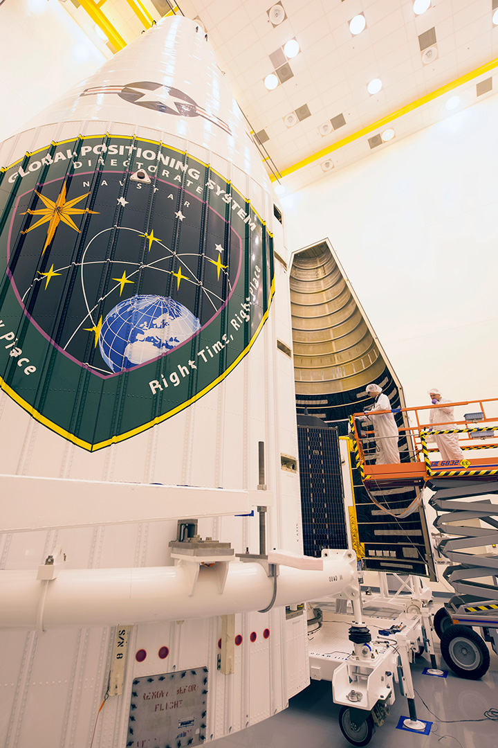
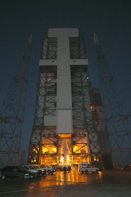
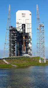
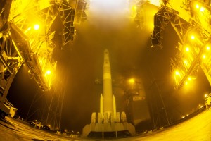
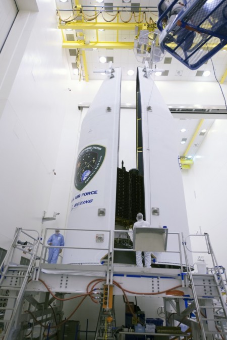
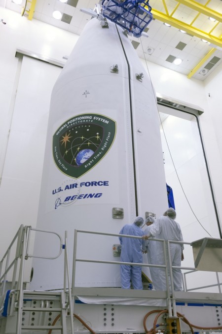
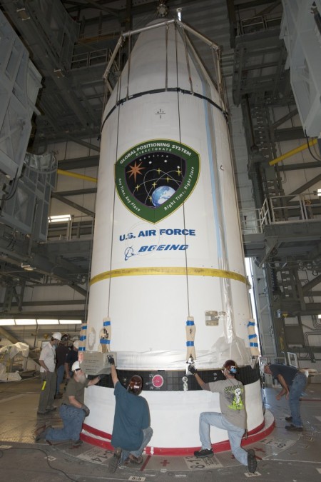
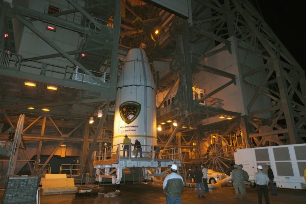
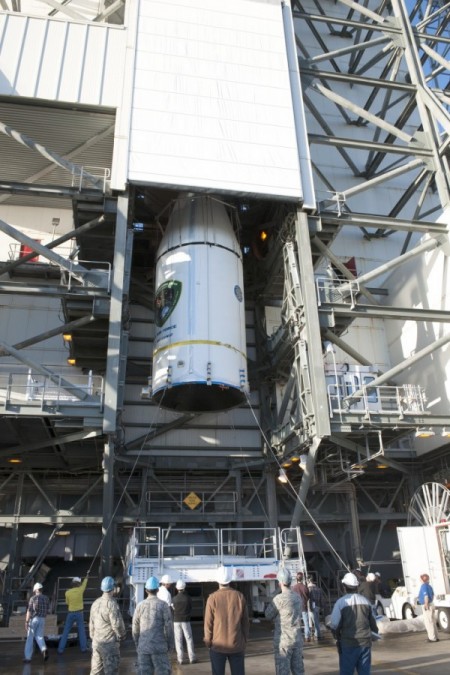
As this magazine went to press on March 19, the U.S. Air Force’s ninth GPS Block IIF satellite (GPS IIF-9) was being readied for a March 25 launch [since successfully launched]. The satellite was encapsulated in the Delta IV rocket’s 4-meter-diameter nose cone at a processing facility, and moved to the launch pad at Space Launch Complex 37 for mating to its booster inside the mobile service tower.
Launch is scheduled for March 25 at 2:36 p.m. U.S. Eastern time from Space Launch Complex 37 at Cape Canaveral Air Force Station, Fla. GPS IIF-9 marks the 29th Delta IV launch and the 57th operational GPS satellite to launch on a ULA or heritage launch vehicle.
CNAV Performance Compares Favorably to Legacy Signals
A March 5 announcement concerning the new L2C and L5 GPS civil signals states: “CNAV Message Types 10, 11, 30 and 33 are currently transmitted on seven GPS IIR-M (L2C) and eight GPS IIF satellites (L2C and L5). A Modernized Navigation (MODNAV) Tool integrated with the GPS ground control software (Architecture Evolution Plan or AEP) is generating the CNAV data messages. Daily CNAV uploads began December 31, 2014, and the U.S. Air Force reports that signal performance of CNAV matches or slightly outperforms Legacy performance: average user range error (RMS URE) from 25 February – 3 March 2015 was 0.50 m for Legacy and 0.57 m for Modernized; best week for Modernized signals since the broadcast initiated April 2014 was 0.42 m for 6 – 13 January 2015.
“Users are reminded that these CNAV signals are ‘pre-operational’ and should be used with discretion until they become fully operational; the L5 message is currently set unhealthy,” concluded Rick Hamilton, CGSIC Executive Secretariat, USCG Navigation Center, in a status email to the Civil Global Positioning System Service Interface Committee (CGSIC).
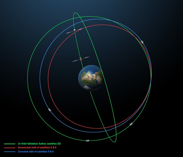
Galileo Six, Seven, Eight: Lay Them Straight
The original (in red) and corrected (in blue) orbits of the fifth and sixth Galileo satellites, along with that of the first four satellites (green).
On March 17, some stations participating in the International GNSS Service Multi-GNSS Experiment acquired E1 and E5a signals from Galileo 6 (FOC-FM2, GSAT0202). The satellite is using pseudorandom noise code E14.
This development follows the successful repositioning of the sixth Galileo satellite into a corrected orbit, which will now allow detailed testing to assess the performance of its navigation payload. A 20-meter-diameter antenna at the European Space Agency’s (ESA’s) Redu center in Belgium will study the strength and shape of the navigation signals at high resolution.
Launched with the fifth Galileo last August, its initial elongated orbit saw it traveling as high as 25,900 kilometers above Earth and down to a low point of 13,713 kilometers — confusing the Earth sensor used to point its navigation antennas at the ground.
A recovery plan was devised between ESA’s Galileo team, flight dynamics specialists at ESA’s ESOC operations centre and France’s CNES space agency, as well as satellite operator SpaceOpal and manufacturer OHB. This involved gradually raising the lowest point of the satellites’ orbits more than 3,500 km while also making them more circular.
The fifth Galileo entered its corrected orbit at the end of November 2014. Both its navigation and search-and-rescue payloads were switched on the following month to begin testing. Now the sixth satellite has reached the same orbit.
This latest salvage operation began in mid-January and concluded six weeks later, with 14 maneuvers performed in total. Its corrected position is effectively a mirror image of the fifth satellite’s, placing the pair on opposite sides of the planet. The exposure of the two to the harmful Van Allen Belt radiation has been greatly reduced, helping to ensure future reliability.
The corrected orbit means they will overfly the same location on the ground every 20 days. This compares with a standard Galileo repeat pattern of every 10 days, helping to synchronize their ground tracks with the rest of the constellation.
“I am very proud of what our teams at ESA and industry have achieved,” said Marco Falcone, head of the Galileo system office. “Our intention was to recover this mission from the very early days after the wrong orbit injection. This is what we are made for at ESA.”
The decision whether to use the two satellites for navigation and search-and-rescue purposes will be ultimately made by the European Commission, as the system owner, based on the in-orbit test results and the system’s ability to provide navigation data from the improved orbits.
March 27 Launch Date for Galileo Seven, Eight
The seventh and eighth Galileo satellites, set for launch together on March 27, were placed onto the Fregat upper stage of their Soyuz ST-B launcher in mid-March. [The satellites have been successfully launched.]
The Fregat stage will hold the satellites in place during their four-hour flight into orbit 22,300 kilometers above the Earth. Then, at the correct altitude, the two satellites are sprung away in opposing directions.
The Fregat upper stage was blamed for theAugust mis-delivery of Galileo satellites five and six. The root cause of the anomaly producing the wrong orbits was a shortcoming in the system thermal analysis performed during stage design, according to findings by an independent inquiry board.
The anomaly occurred during the flight of the launcher’s fourth stage, Fregat. It occurred about 35 minutes after liftoff, and was due to a temporary interruption of the joint hydrazine propellant supply to the Fregat thrusters. The interruption in the flow was caused by freezing of the hydrazine, resulting from the proximity of hydrazine and cold helium feed lines, these lines being connected by the same support structure, which acted as a thermal bridge. Ambiguities in the design documents allowed the installation of this type of thermal bridge between the two lines.
IRNSS Launch Scheduled for March 29
The launch of the fourth satellite for the Indian Regional Navigation Satellite System, previously scheduled for March 9, was postponed until March 29 at 13:00 UTC, due to the replacement of a faulty telemetry transmitter on the satellite. [The satellite has been successfully launched.]
IRNSS-1D will be fourth in the seven-spacecraft IRNSS constellation.
BeiDou, Too, in Late March
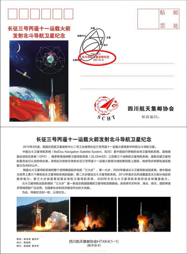
There are indications that the first satellite in the BeiDou Phase 3 expansion may be launched by the end of March [since successfully launched]. Apparently, a BeiDou satellite has been shipped to the Xichang launch site, and tracking ships have left port for the open ocean. Also, a philatelic first day cover for the launch (a common Chinese practice) has been issued with a March 2015 inscription. This is likely a launch of a medium Earth orbit (MEO)satellite.
Where It All Began for Galileo and EGNOS
The European Space Agency issued a press information notice on June 11, 1995 — in the same timeframe as the GPS FOC announcement noted on the previous page — titled “Europe’s Contribution to a Navigation Satellite System.”
“The European Commission, the European Space Agency (ESA), and the civil aviation organisation EUROCONTROL have agreed to cooperate on a joint programme).The European Satellite Navigation (ESN) Action Programme, elements of which are GNSS-1 [First Generation Global Navigation Satellite System] and GNSS-2, is planned to run for five years (from mid-1995 to mid-2000) with a budget of the order of 150 million euros.
“National aviation authorities and the parties involved in the action programme see Europe’s commitment to satellite navigation as being of strategic significance for the future.
“The main objective of the programme is to develop technologies that will ensure that data from the two existing Global Navigation Satellite Systems — the United States’ GPS and Russia’s GLONASS — which are both under military control, will also be available for civil use on a reliable basis and will provide the requisite precision.In parallel, studies will be conducted in order to make preparations for a second generation satellite-navigation and positioning system (GNSS-2), to be deployed as from 2005.
“In the first phase (GNSS-1), ESA’s contribution to the joint action programme will be EGNOS [European Geostationary Navigation Overlay Service].Satellites stationed in geostationary orbit at an altitude of about 36,000 km will relay to aircraft, shipping or road vehicles information that will enable the recipients to determine their actual positions with greater precision than is possible by using GPS/GLONASS data alone.Civil users of those systems receive artificially degraded data deviating by about 100 metres.EGNOS, will enable in particular, to increase the number of satellites that can be seen by a given user within the geostationary broadcast area.
“Around the period 2005–2008, after completing a trial period, the new system is due to be used as sole means.”
Galileo, Previously GNSS-2
“It is planned to develop GNSS-2 in the period between 2005 and 2020, building on experience acquired under GNSS-1.From the technical viewpoint, the second generation will be a considerable improvement on the first in terms of reliability, precision and availability.
“However, if Europe were to confine itself to developing the relevant technologies, its industry would have only a very slim chance of being involved in the construction of the satellites for the system or in the control and user segments for a second-generation civil system (GNSS-2). Given that U.S. and Russian firms are the current leaders in this area, it is necessary for strategic reasons for Europe to carry out a comprehensive development and demonstration programme as it must be able to prove it has the requisite capabilities before GNSS-2 becomes operational, which, in the experts’ opinion, will be from 2005.
“The time schedule foreseen for the different steps can be summarised as follows:
GNSS-1 mission analysis and definition studies: mid-1995 to mid-1996
European GNSS-1 pre-operational mission (task 1): to end 1997. Development of the geostationary network, following the Inmarsat III launch and first ranging demonstration phase
GNSS-1 (task 2): 1996 to end 1998. In parallel to the development of the network, the Ground Integrity Channel will be set up, followed by a second demonstration phase
GNSS-1 (task 3): 1997 to early 2000. Wide Area Differential service for precision approaches to be set up and tested
Introduction of GNSS-1 as sole means: 2000/2003.”
GPS World is indebted to Richard Langley’s CANSPACE archive of historical documents for this note of interest.
UPDATE: The GPS satellite has been deployed by the Delta IV rocket, completing today’s launch. The deployment occcurred as scheduled about 3 hours after launch.
The U.S. Air Force’s ninth GPS Block IIF satellite (GPS IIF-9) launched on time Wednesday at 2:36 p.m. EDT (1836 GMT) from Space Launch Complex 37 at Cape Canaveral Air Force Station, Fla.
The GPS IIF-9 rode aboard a United Launch Alliance (ULA) Delta IV rocket, which has been the workhorse of the GPS fleet for successful launches.
GPS IIF-9 is one of the next-generation GPS satellites, incorporating various improvements to provide greater accuracy, increased signals, and enhanced performance for users.
The Air Force and the 45th Space Wing supported the successful launch of the ULA rocket. This launch is the fourth ULA launch this year and the 95th launch since the company was formed in December 2006.
GPS IIF-9 launched aboard a Delta IV Medium-plus (4,2) Evolved Expendable Launch Vehicle, using a single ULA common booster core powered by an Aerojet Rocketdyne RS-68 main engine, along with two ATK GEM 60 solid rocket motors. The upper stage was powered by an Aerojet Rocketdyne RL10B-2 engine with the satellite encapsulated in a four-meter diameter composite payload fairing.
GPS Launch Workhorse. The launch marks the 29th Delta IV launch and the 57th operational GPS satellite to launch on a ULA or heritage launch vehicle. Delta IV has delivered numerous satellites for the National Reconnaissance Office (NRO), as well as GPS satellites for the Air Force and weather satellites for NASA, according to a ULA media release.
“Many thought the Delta IV and GPS days were long gone, but the recent questions concerning reliable and proven launch vehicles have brought them back online, so to speak, for GPS,” said GPS World Defense Editor Don Jewell. The upcoming (April 27) 20-year milestone for GPS space vehicles on orbit translates to approximately 500 orbital years just for the IIR and IIF constellations alone,” Jewell said. “The IIAs may account for that many orbital hours as well. Quite a record, and something of which the U.S. Air Force (USAF) and all the companies involved should be very proud.”
Yet Another USAF Success. Jewell points out that this is another successful government launch in a long string of successive launches, without a failure. “It is by far the most successful launch record ever put together by any nation or government. No other space-faring nation even comes close. The U.S. Air Force and all the players should be proud of all these records and more, plus we have one more GPS asset on orbit, providing GPS signals to the world and all they enable, courtesy of the USAF.”
“I’m elated with today’s successful launch, the GPS constellation remains healthy, strong and robust and in over 20 years since initial operational capability, GPS has never failed to deliver on its global positioning, navigation, and timing commitments,” said Brig. Gen. Cooley, director of Space and Missile Systems Center’s Global Positioning Systems Directorate.
“Each new generation of GPS satellites provides enhanced capability over the prior generations, and has delivered reliable performance demonstrating our commitment that GPS remain the Gold Standard space-based positioning, navigation, and timing service for the future,” Cooley said. “Thanks to the men and women of SMC, the 45th, 50th 310th Space Wings, Boeing, United Launch Alliance, the Aerospace Corporation, GPS IIF and Delta IV launch teams, the GPS IIF program continues to meet GPS enterprise needs.”
45th Space Wing. Once again, the 45th Space Wing team of military personnel, government civilians, and contractors provided support to the ULA launch of the Air Force Space Command mission, including weather forecasts, launch and range operations, security, safety, and public affairs.
The 45th Space Wing commander was both proud and pleased with the team she works with on the Eastern Range. “First, let me offer my heartiest congratulations to ULA, Boeing, Space and Missile Systems Center, the Launch Systems Directorate, the Global Positioning Systems Directorate, and all the mission partners who made this happen,” said Brig. Gen. Nina Armagno, 45th Space Wing commander, who also served as the Launch Decision Authority.
“What a treat — and an honor — it is to know that we have played such a significant part in something that we will celebrate two decades of helping people all around the world,” Armagno said. “Every GPS satellite since the program’s inception has been launched right here from Cape Canaveral Air Force Station safely and reliably by members of the 45th Space Wing.
“And that’s because we continue to take a ‘one launch at a time’ mentality and focus on our number one priority — 100 percent Mission Success. I am so very proud to be part of Team Patrick-Cape.”
Constellation Changes. The Air Force Second Space Operations Squadron (2 SOPS) indicates that IIF-9, SVN-71/PRN-26, will replace SVN-35 (currently being operated in Launch, Anomaly Resolution and Disposal Operations [LADO]) in the B plane slot 1F. SVN-35 is a GPS 2A-22 satellite originally launched aboard Delta 222 on August 30, 1993. It was decommissioned from active service in 2009, remained in orbit as a spare, then was set usable again in 2011. The satellite was declared unusable in 2013 and decommissioned a second time, reports Spaceflight Now. It was tested again in 2014.
SVN-38/PRN-08 will be taken out of the operational constellation prior to SVN-71 payload initialization and sent to LADO. PRN-08 will be assigned to SVN-49 in May and set to test, but is tentatively scheduled for assignment to IIF-10 to launch June 16.
SVN-35, launched on August 30, 1993, has been in a residual status since March 2013 in an expanded node slot in the B plane and successfully served 21.5 years, 14.0 years beyond its designed service life, due to the diligent efforts of the men and women of the U.S. Air Force.
SVN-51 is still in a re-phase journey from E1 (GLAN=146 °) to an auxiliary node at E7 (GLAN=60.7 °) scheduled to arrive sometime this summer.
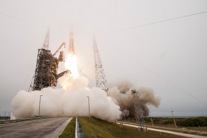
Courtesy photo/John Studwell, provided by 45th Space Wing Public Affairs.
This week nearly all the global navigation satellite systems will push their spatial presence one or two steps further, or higher, if they perform as scheduled. Rarely if ever has there been such a concentrated period of activity in the catapult category. Are we witnessing the real dawn of the multi-GNSS era? GPS, Galileo, BeiDou, and IRNSS all have positioned loaded rockets on the launching pad, destined to heave satnav payloads aloft. Only GLONASS seems stuck in stasis.
Leading the pack, as ever, GPS should send forth the ninth GPS Block IIF satellite (GPS IIF-9) on March 25 at 2:36 in the Eastern U.S. afternoon. Perhaps the event has already occurred by the time you read this.
The seventh and eighth Galileo satellites, Adam and Anastasia, are destined for a double date in space on March 27. After a four-hour flight into orbit 22,300 kilometers high, the duo will spring away from their Fregat fourth stage in opposite directions.
The launch of the fourth satellite for the Indian Regional Navigation Satellite System, scheduled for March 9 but postponed to replace a faulty onboard telemetry transmitter, will now take place on March 29. IRNSS-1D will pass the halfway point in India’s march to a seven-spacecraft regional constellation.
This philatelic first-day cover to commemorate an upcoming BeiDou launch indicates a specific date of March 31, 2015 (circled in red). Credit: BeiDou
There are indications that the first satellite in the BeiDou Phase 3 expansion may be launched by the end of March. Apparently, a BeiDou satellite has been shipped to the Xichang launch site, and tracking ships have left port for the open ocean. Also, a postal stamp first-day cover for the launch — a common Chinese practice — has been issued with a March 2015 inscription. The launch will likely be that of a medium Earth orbit satellite.
A GLONASS-M single-satellite launch from Plesetsk had been expected in the first quarter of this year, but has not materialized. A GLONASS-M triple-satellite launch from Baikonur is expected in the April/May 2015 timeframe. The Russian constellation’s orbit count now stands at 26, fully sufficient for global coverage.
As the Ides of March in 44 B.C. mark a turning point in Roman history, the transition from Republic to Empire, so might this week mark complete world domination. GPS is now ¾ down the last section of road that leads to the fully modernized Block III generation. Galileo will reach, numerically, 1/3 of the total number of satellites it needs for full operational capability, although there is some doubt about whether all satellites now in orbit can be counted as full integers. BeiDou will mark its 15th operational satellite, out of a planned total of 35, with the new philatelically commemorated rising. And, as mentioned, IRNSS will pass its halfway point this weekend.
Ironically, just as GNSS begins to show signs of approaching its apogee (similar to the dawning of Empire in the Augustan Era that followed Caesar’s assassination on the Ides of March), the world is starting to turn away from, or turn beyond, GNSS.
GNSS will remain at the core of our navigation and positioning technologies — as Roman values remain at the core of Western civilization. But we need to go now to multi-sensor approaches for several reasons:
some requisite positioning data, such as precise attitude, is not optimally derived solely from GNSS measurements;
despite their increasing numbers, GNSS satellites will never be ubiquitous enough to be visible in sufficient numbers everywhere;
threats such as jamming and interference will likely surmount all efforts at single-solution resilience to overcome GNSS vulnerability.
‘Twas ever thus. With rise come decline, with ripeness, decay. Sic transit Gloria.
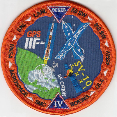
A patch for the upcoming GPS satellite launch shows a stylized GPS IIF-IX formed by the Delta 4 rocket and the constellation Cygnus (Latinized Greek word for swan). The satellite is nicknamed Deneb, the brightest star in the constellation and one of the 57 stars used in celestial navigation. The patch also indicates that the satellite is SV-10 and 71. The SV-10 identifier may indicate that it is the 10th satellite off the IIF assembly line. Photo: US Air Force
The U.S. Air Force’s ninth GPS Block IIF satellite (GPS IIF-9) is set to launch Wednesday at 2:36 p.m. EDT (1836 GMT) from Space Launch Complex 37 at Cape Canaveral Air Force Station, Fla.
The GPS IIF-9 will ride aboard a United Launch Alliance (ULA) Delta IV rocket, marking the 29th Delta IV launch and the 57th operational GPS satellite to launch on a ULA or heritage launch vehicle.
GPS IIF-9 is one of the next-generation GPS satellites, incorporating various improvements to provide greater accuracy, increased signals, and enhanced performance for users.
UPDATE (April 17, 2015): The USCG Navigation Center has confirmed that SV-10 was launched instead of SV-9. The Air Force discovered a problem with SV-9, so it was pulled from the launch and SV-10 was sent into orbit in its place. SV-9 will be used in a future launch.
Constellation Changes. The Air Force Second Space Operations Squadron (2 SOPS) indicates that IIF-9, SVN-71/PRN-26, will replace SVN-35 (currently being operated in Launch, Anomaly Resolution and Disposal Operations [LADO]) in the B plane slot 1F. SVN-38/PRN-08 will be taken out of the operational constellation prior to SVN-71 payload initialization and sent to LADO. PRN-08 will be assigned to SVN-49 in May and set to test, but is tentatively scheduled for assignment to IIF-10 to launch June 16. SVN-35, launched on August 30, 1993, has been in a residual status since March 2013 in an expanded node slot in the B plane and successfully served 21.5 years, 14.0 years beyond its designed service life, due to the diligent efforts of the men and women of the U.S. Air Force. SVN-51 is still in a re-phase journey from E1 (GLAN=146 °) to an auxiliary node at E7 (GLAN=60.7 °) scheduled to arrive sometime this summer.
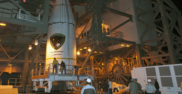
The U.S. Air Force’s ninth GPS Block IIF satellite (GPS IIF-9) has been encapsulated in the Delta IV rocket’s four-meter-diameter nose cone at a processing facility, and moved to the launch pad at Space Launch Complex 37 for mating to its booster inside the mobile service tower.
Launch is scheduled for March 25 at 2:36 p.m. EDT (1836 GMT) from Space Launch Complex 37 at Cape Canaveral Air Force Station, Fla. GPS IIF-9 marks the 29th Delta IV launch and the 57th operational GPS satellite to launch on a ULA or heritage launch vehicle.
To follow the launch countdown, dial the ULA launch hotline at 1-877-852-4321 or join the conversation on Facebook, Twitter or Instagram.
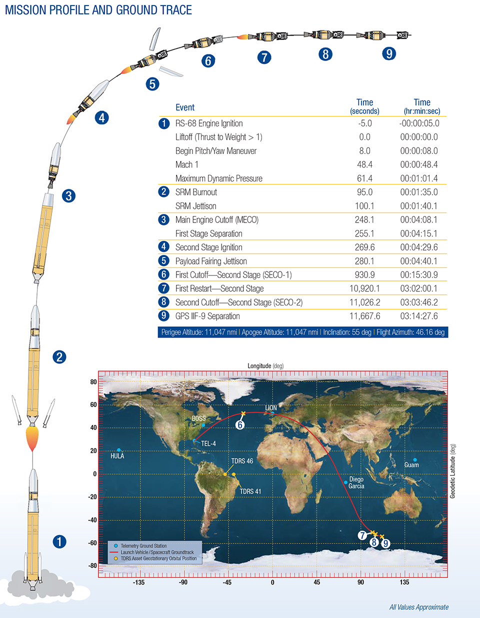
The planned GPS IIF-9 launch trajectory, event times, and ground trace. (courtesy of ULA)
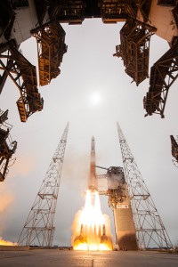
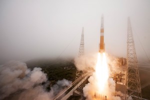
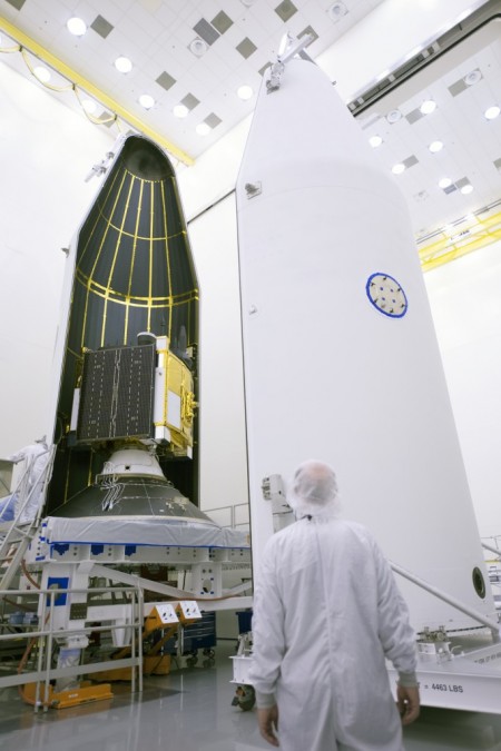
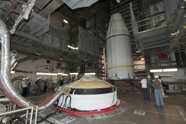
Below are photos from the United Launch Alliance, which supplies the Delta IV rocket and serves as the launch provider for the GPS Directorate.