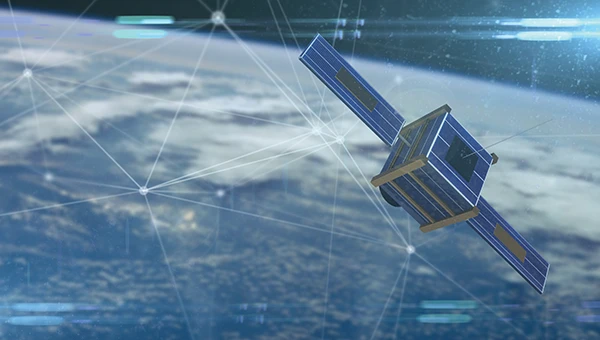
Hexagon | NovAtel has joined the GPS Innovation Alliance (GPSIA) as its newest member.
NovAtel develops positioning, navigation and timing (PNT) products for land, sea and air applications, with users in agriculture, defense, autonomous mobility and marine sectors. The company’s portfolio includes high-precision GNSS receivers, correction services, sensor fusion systems, GNSS anti-jam technology and post-processing solutions.
GPSIA Executive Director Lisa Dyer said the addition comes at a critical time for PNT infrastructure.
“NovAtel brings world-class expertise in high-precision GNSS, inertial integration, and anti-jam capabilities that help protect critical services people rely on every day, from transportation and public safety to the supply chains and infrastructure that power the world’s economy,” Dyer said. “Their leadership will strengthen GPSIA’s work to protect GPS and complementary PNT technologies from harmful interference and to accelerate the innovation that underpins the decades-long reliability of these systems.”
Jonathan Auld, president of NovAtel’s Positioning Division at Hexagon, said the company plans to use its membership to raise awareness of PNT’s role in critical industries.
“From precise positioning and correction services to resilient solutions that help mitigate interference, we support customers operating in mission- and safety-critical environments,” Auld said. “We look forward to working with GPSIA to heighten awareness of the role these technologies play in innovation, critical infrastructure, and economic growth.”
NovAtel joins existing GPSIA members Apple, Garmin, Deere & Company, Lockheed Martin, Trimble and TrustPoint, along with organizations participating in the alliance’s affiliates program. GPSIA describes its mission as protecting, modernizing and advancing GPS, GNSS and complementary PNT technologies.
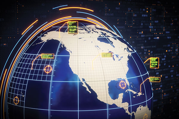
A coalition of 14 major industry associations has called on the departments of Defense and Transportation to address increasing threats from GPS signal jamming and spoofing that are affecting civilian operations beyond traditional conflict zones.
The letter, signed by organizations including the GPS Innovation Alliance (GPSIA), Aircraft Electronics Association, Airlines for America and the U.S. Chamber of Commerce, was sent to Defense Secretary Pete Hegseth and Transportation Secretary Sean Duffy, outlining concerns about GPS signal interference. The letter warns that such interference is expanding beyond military conflict zones to affect civilian transportation and commerce operations in international airspace and waters.
The coalition represents industries that collectively contribute significant portions to the U.S. economy. The aviation system accounted for 5% of U.S. GDP in 2024, totaling $1.45 trillion, while ports and maritime operations contributed $2.9 trillion, nearly 10% of GDP. GPS technology has generated more than $1.4 trillion for the U.S. economy since its introduction, with more than 6 billion GPS-enabled devices in use worldwide.
The organizations are seeking coordinated action from the Trump administration to modernize GPS infrastructure and enhance its resilience against interference. The coalition has indicated its willingness to work with federal agencies on addressing what it describes as challenges to national security, public safety and economic prosperity.
System Vulnerabilities
Despite GPS maintaining a 99.99% availability rate with no recorded outages since 1993, the system faces several challenges. On-orbit satellites operate years beyond their intended design life, ground system upgrades have been delayed, and the system lacks counter-spoofing capabilities.
The coalition emphasizes that GPS serves as a foundation for modern defense, aviation, maritime operations and commercial activities. Transportation industry officials note their sector’s role as a key partner in U.S. military logistics operations.
“GPS is one of the most important innovations of the modern era, underpinning national security, critical infrastructure such as transportation, and commerce,” said Lisa Dyer, Executive Director of the GPS Innovation Alliance. “The Trump administration’s approach to “getting stuff done” is what this nation needs to finally achieve a modern GPS that is resilient to jamming and spoofing. The President’s leadership can also deter further harmful interference – actions that will benefit most critical industries that are delivering goods and services around the world and transporting passengers safely to their destinations.”
The GPSIA recommendations call for executive branch agencies to:
Accelerate the procurement and launch of modern GPS satellites and include anti-jamming and anti-spoofing technology upgrades in GPSground systems. Prepare a program plan that ensures GPS is technologically more advanced than China’s BeiDou and Europe’s Galileo GPS-like systems.
Strengthen enforcement and coordination across the U.S. government to rapidly identify and respond to interference events and crack down on illegal sales and use of jamming devices.
Streamline regulatory and certification processes to accelerate adoption of advanced technologies such as jam- and spoof-resistant antennas, modern GPS signals, and anti-spoofing signal authentication in airframes, receivers and devices.
Deter interference through public statements and diplomatic engagement, making clear the United States will not tolerate harmful jamming and spoofing outside conflict zones that risks public safety and impedes commerce.
“These are concrete, achievable actions that, if pursued, will ensure the integrity, continuity, availability, and resiliency of GPS. This approach also offers the commercial position, navigation, and timing industry time to mature and deploy their technologies so that they can meet the high regulatory bar that is appropriately set for public safety applications,” Dyer said.
“This partnership draws on the strengths of both organizations,” said GPSIA Executive Director Lisa Dyer. “Positioning and navigation are critical to today’s automotive industry and the millions of workers and families who depend on vehicles for work, to transport their loved ones and to connect with the world around them. Future positioning and navigation satellite systems operated from low-Earth orbit will be key enablers for connected vehicles.”
GPSIA’s network now includes 13 national organizations and industry leaders, such as John Deere, Garmin, Trimble, Apple, Lockheed Martin and TrustPoint. The Alliance for Automotive Innovation brings deep expertise in the automotive sector and a strong commitment to advancing safer, smarter personal transportation technology. This addition aims to strengthen GPSIA’s commitment to fostering innovation, creativity, and entrepreneurship in GNSS and related space-based position, navigation and timing (PNT) technologies.
The Department of Defense (DOD) shoulders an enormous responsibility, perhaps one whose significance the world does not fully grasp: the sheer number of military, civil and commercial users, each with hundreds of unique use cases, that depend on the Global Positioning System (GPS).
No other DOD-operated system serves such a diverse array of users and interests. From Special Operators to ship and tank drivers, pilots and operators, the military user base is expansive. Civil users include first responders, general aviators, and those supporting the international flying public, whose numbers are again setting records. Additionally, countless average people like you and me just “use it” in our daily lives without considering how it works. The ever-expanding commercial market consists of $1.7 trillion in 2023 dollars in economic benefits accruing to the U.S. economy alone, millions of jobs, and fierce global competition to produce the “best of the best” of the 6.5 billion user receivers in operation today.
With these users and interests in mind, what does that mean for GPS’ future? It raises more questions than answers — about policy, governance, program execution and threats that urgently need to be addressed:
What indicators will determine whether the United States has met its policy goal to be the global leader in “service provision and the responsible use of global satellite navigation systems, including GPS and foreign systems?”
Building on this publication’s previous articles, what constitutes a “Gold Standard” in 2024? Which users determine this definition? How and when do foreign global navigation satellite systems’ capabilities factor into this definition?
What funding levels ensure the security, accuracy, availability and resilience of GPS? In Fiscal Year 2022, Congress provided more than $2 billion for DOD to procure and conduct research and development on GPS III and IIIF satellites, procure military user equipment, and upgrade the ground architecture. In 2022, the Department of Transportation received $22 million for GPS resiliency and $92 million for the Wide Area Augmentation System. Is this level of funding sufficient to bring innovative technologies to GPS?
Speaking of innovation, U.S. law directs DOD to “sustain and operate” GPS for military and civilian purposes. How can innovative GPS technologies contribute to “sustain and operate” missions?
Who should participate in decisions regarding the timing of GPS upgrades and satellite launches?
Where does the most accurate data on cyber and other threats to GPS satellites, ground stations, military and civil user equipment, and commercial receivers reside? Who evaluates that data to determine the overall risks to GPS? Should those risks be shared with all users? How quickly will the most severe risks be mitigated?
Do the Federal Communications Commission, the Department of Homeland Security, and the Department of State have sufficient resources to detect and prosecute illegal and irresponsible spoofing and jamming incidents in the United States and overseas?
What is the earliest date the much-anticipated L1C, L2C, and L5 signals can be operational?
The GPS Innovation Alliance (GPSIA) believes the U.S. government does not have to shoulder such difficult and urgent questions alone. GPSIA looks forward to sharing insights while working with government agencies and the wider user community to answer these questions and put in place executable plans to address these challenges.
From its humble beginnings in the 1970s to its expanded use in the present day, GPS technology has been vital for nearly every industry from defense and aviation to farming and construction. GPS devices are designed to receive faint GPS signals transmitted from satellites about 12,000 miles away. Acknowledging this reality, regulators have historically maintained for GPS, which relies on such faint radio signals and sensitive equipment, an appropriately quiet spectrum neighborhood—populated by similar users.
With the NASEM report’s confirmation of harmful interference, the deficiencies of the FCC’s April 2020 decision are even more striking
Although these GPS signals and equipment have benefitted from decades of optimization, it is impractical to place highly sensitive GPS receivers designed to capture faint signals from remote transmission facilities immediately next to high-power communications equipment. Unlike those from communications systems, GPS signals are below the thermal noise floor when they are received. As a result, increases in that noise floor often decrease the availability of GPS services, which in turn places at risk high-consequence and safety-of-life services that rely on GPS.
Alex Damato
Why does this matter? In April 2020, the FCC approved a plan to deploy a terrestrial network in spectrum adjacent to the frequency bands used by GPS — operating communications signals that would be around two billion times more powerful than GPS signals at the same location.
This past September, the National Academies of Sciences, Engineering, and Medicine (NASEM) released a report detailing the harmful effects of a terrestrial communications network that would operate in a frequency band close to that of GPS.
Expert concern within 14 federal agencies and departments, a broad coalition in Congress, and the GPS industry resulted in a congressional mandate that NASEM conduct an independent technical review of potential interference to GPS. After a thorough review of the materials, NASEM concluded that the proposed terrestrial network would result in harmful interference to a substantial number of GPS receivers.
In particular, the report noted that high precision GPS devices, which are used in the most economically significant GPS applications, are the most vulnerable receiver class and likely to be affected by interference. The potential for any interference with GPS, especially with devices used by the Department of Defense, poses a threat to national security, the economy, and our daily lives.
With the NASEM report’s confirmation of harmful interference, the deficiencies of the FCC’s April 2020 decision are even more striking: potentially millions of farmers, pilots, construction companies, and first responders may be required to repair or replace GPS equipment at their own cost. Although the FCC assumed that this equipment could be repaired through upgrades or filters, some devices cannot be filtered without significant financial and performance costs, and some devices simply cannot be filtered at all.
GPS is estimated to provide up to $300 billion annually in benefits to the economy. Any disruption in GPS accuracy and usage would have detrimental effects on productivity and economic growth. Moreover, the year before the FCC’s flawed decision, another key report revealed that the loss of GPS service would have an average impact of $1 billion per-day on the nation.
The GPS Innovation Alliance will continue to work with all federal and industry stakeholders to maintain open channels of communication to connect, listen, and learn from all those involved in the discussion. As technological innovation continues, these debates on harmful interference are not going away, and GPSIA is looking forward to engaging further.
By Alex Damato, Acting Executive Director, GPS Innovation Alliance
Alex Damato
It can be easy to take GPS for granted as the average driver and smartphone user continues to enjoy convenience, entertainment and navigation from this technology, enhancing nearly every part of our daily lives. While we may not enjoy its benefits every day, one important use case keeps us and our environment safer: GPS has become a vital part of modern emergency response.
Many Americans across the nation are preparing for the impending hurricane season or the threat of other natural disasters, such as wildfires and earthquakes. GPS will play a critical role in recovery and response efforts. When natural disasters occur, accurate and actionable location information helps save lives and restore critical infrastructure as quickly as possible.
GPS has fundamentally improved access to information that can help the public prepare for these natural disasters, rather than waiting for them to strike. This information is more critical than ever. For example, California’s Oak fire spread to almost 20,000 acres and is part of a larger trend in California that has destroyed 14,700 buildings and killed 36 people over the past two years. Farther north, 530 wildfires in Alaska burned areas larger than the state of Connecticut in the state’s worst fire season in recent history.
In addition to helping the public face natural disasters, GPS helps firefighters plan their operations more efficiently and enables them to receive real-time information on the location of the wildfires they are fighting. With real-time mapping, planning and operations, fire chiefs can respond immediately to areas where wildfires are dangerously advancing.
In turn, GPS protects our first responders by preventing firefighters from getting caught in unpredictable fires they would have otherwise not known were heading their way.
Firefighters use IGNIS drones to help prevent wildfires from starting or safely contain them with backburns. IGNIS relies on GPS for tracking, safety and control, which in turn helps firefighters avoid the dangers associated with being near prescribed burns. Without GPS, resources to help firefighters would not be deployed as efficiently — wildfires could spread even more quickly as a result, causing even more damage to our homes and infrastructure.
Beyond wildfires, GPS technology is critical to emergency response and weather safety. GPS data allow emergency responders to better locate callers and reduce the incidence of misrouting to outside jurisdictions. Using GPS data, a caller can be located in close proximity to his or her actual location. By reducing rates of misrouting and accurately pinpointing emergency locations, GPS helps reduce response time by taking away the need to reroute calls and search for callers’ locations.
In a recent experiment, NASA-commissioned researchers used GPS signals to better predict a hurricane’s maximum wind speed, which could help federal agencies and forecasters better predict the danger of hurricanes and provide more actionable information to determine whether to issue evacuation orders.
The GPS Innovation Alliance (GPSIA) is proud to support the role of GPS as a critical enabling technology for public safety, disaster response and relief efforts. With GPS, precise real-time location information is at the fingertips of both consumers and first responders from pre-disaster planning efforts to post-disaster recovery. While GPS has already fundamentally improved modern emergency response systems, GPSIA will continue to advocate for the continued growth of these lifesaving GPS-enabled technologies and applications through rigorously developed technical rules, interference protections, and a predictable spectrum environment.
Many of us have grown accustomed to the ease of GPS-enabled technologies, from smartphone to fitness trackers. At GPSIA, we’re also particularly proud of the role GPS plays in the many other life-saving ways the technology is being used and are committed to continuing this critical work.
Innovation is the watchword in Washington this year. Amidst an ongoing supply-chain crisis and rising global trade tensions, policymakers have put renewed emphasis on U.S. leadership in such industries as semiconductors, wireless broadband and artificial intelligence — areas rightly seen as the “enabling technologies” of the 21st century.
Alongside chips and supercomputers is another innovation underpinning everything from our communications networks to financial transactions and air transportation: GPS technology. 2022 will see a flurry of activity to accelerate U.S. competitiveness for the modern economy and accelerating the modernization of our GPS constellation must place high on this list.
It’s no surprise that allies and adversaries alike have taken notice of GPS. While for decades U.S.-led GPS was the “only game in town” for global navigation satellite systems (GNSS) services, the current global picture is much changed. Russia, China, the European Union, Japan, India and other nations have explored, tested and deployed satellites to build out their own global or regional positioning, navigation and timing (PNT) networks and capabilities. The more recently deployed GNSS — including China’s BeiDou, which was completed in 2020 — represent a competitive threat by our international adversaries in spite of U.S. GPS technology advancements in performance and resilience. The potential loss of global leadership poses a dramatic challenge for U.S. interests.
Although our current GPS constellation continues to enable critical services that touch nearly every aspect of daily life, the oldest satellites were launched in the late 1990s. As new, more advanced GPS satellites go up in the sky, we can take several policy steps here on the ground to ensure that GPS remains the global standard — undermining attempts to create an information ecosystem independent of the United States and reliant on our international competitors.
Enter the United States’ GPS modernization program. Allocating the resources necessary to accelerate the launch of new GPS satellites will pave the way to keeping GPS globally competitive — both in defense and civil applications. Take accuracy, for starters. New GPS satellites will bring three times better accuracy than existing systems and up to eight times improved anti-jamming capabilities, both of which will keep us competitive and add critical security against domestic spoofers and foreign adversaries.
While U.S. firms should continue to create multi-constellation receivers that are interoperable with global PNT signals, U.S. policy should promote American technological leadership by accelerating modernization of the GPS space and control segments. Importantly, a necessary element of this technological leadership is development of a systematic roadmap to spur adoption of these new modernized features in civil applications. Establishing this clear pathway for civilian applications of a modernized GPS constellation is critical to ensuring that the potentially more than $1 billion of economic benefits added every day by the U.S. civil GPS sector are fully realized.
As Congress continues to focus on innovation and global competition, the GPS Innovation Alliance is committed to working with policymakers to promote the critical security, economic and diplomatic benefits to the United States of investing in next-generation GPS infrastructure.
Originally a product of the Sputnik era, GPS has demonstrated the very best features of competitive U.S. government investment. As the United States prepares for a renewed era of global competition, the promise today of invigorated support for GPS remains the same.
The United States must continue to lead by modernizing GPS and establishing a clear pathway for civilian applications of the improved constellation. (Image: matejmo/iStock/Getty Images Plus/Getty Images)
Guided by the leadership of the U.S. Air Force, and now the Space Force, for four decades GPS has supported all aspects of military operations, from precision guided munitions to search and rescue missions. GPS, however, is also ingrained in our economy, enabling a wide range of civil and consumer applications, including aviation, precision agriculture, construction, banking and public safety.
It’s easy to take GPS for granted, because we use it every day and it works so well. But what if someone interfered with the reliability and accuracy of GPS on which we depend? A 2019 study sponsored by the National Institute of Standards and Technology (NIST) estimated a $1 billion-a-day impact to our economy if GPS were lost.
Regrettably, the Federal Communications Commission (FCC) rolled the dice on this scenario in 2020, when it approved an application from Ligado Networks, a satellite communications company, to repurpose satellite spectrum in the L-band for high-power terrestrial use.*
Ignoring the warnings of a broad coalition of stakeholders, including U.S. federal agencies, congressional leaders and businesses, the FCC moved to open the traditionally “quiet neighborhood” used by satellite-based navigation services like GPS to ground-based signals that are billions of times more powerful.
The FCC itself was clear on the risks when it issued the order, and so it’s no surprise they explicitly required Ligado to “repair or replace as needed any U.S. government GPS devices that experience harmful interference from Ligado’s operations.” At the time, however, a key constituency was excluded from these protections: the millions of U.S. consumers and businesses who rely on accurate, reliable GPS signals.
In fact, 99% of the more than 900 million GPS devices found in the United States are used by the private sector, consumers, as well as state and local governments. Under the FCC’s order, first responders, pilots, municipal governments, farmers and countless other GPS users have been left on the hook for costs associated with Ligado’s disruptions.
On June 22, a bipartisan group of senators, led by Sen. Jim Inhofe (R-OK), took a critical step toward addressing this inequality by introducing the Recognizing and Ensuring Taxpayer Access to Infrastructure Necessary for GPS and Satellite Communications Act (RETAIN Act). A bipartisan House companion bill was subsequently introduced on July 22. This carefully balanced proposal ensures that Ligado, as the license holder and source of interference, is the one responsible for paying the costs to upgrade or replace affected GPS receivers used by consumers and businesses.
Across the country, GPS is woven into the fabric of the economy and people’s everyday lives. More than 100 million vehicles are equipped with a GPS receiver, and trains and aircraft use GPS to move people and goods. Our farms depend on GPS to increase crop yields and reduce waste. Similarly, with accurate and reliable GPS,
America’s bridges, and roads are being built more accurately, improving safety, and reducing construction times.
The RETAIN Act also protects municipal fire crews that depend on GPS for improved situational awareness and to speed response times to people in danger. In the critical moments between a 911 call and the arrival of firefighters, seconds matter. An unexpected loss of GPS could therefore be catastrophic. This is why GPSIA and more than 100 industry organizations and companies are supporting the RETAIN Act.
The RETAIN Act also considers the thousands of businesses that are showcasing their grit and ingenuity to bounce back from the COVID pandemic. Many of these companies are implementing GPS-enabled solutions, including app-based delivery and contact-tracing tools to increase efficiency and protect the safety of their employees.
The GPS Innovation Alliance, an organization committed to furthering GPS innovation, creativity and entrepreneurship, is grateful to these leaders in Congress who are standing up in support of GPS users.
Consistent with the terms of their litigation settlements with Ligado, Garmin International Inc. and Deere & Company do not affirmatively endorse or oppose the deployment of Ligado’s proposed mobile communications network. To the extent this op-ed discusses Ligado’s deployment of its proposed 5G mobile communications network (or any interference therefrom), GPSIA is not authorized, and does not purport, to speak for Garmin and Deere.
Alliance membership has tripled in past 13 months as the organization grows advocacy for ever-increasing importance of GPS technologies to the global economy.
L3Harris Technologies, a global aerospace and defense technology innovator, joins a core of companies committed to furthering GPS innovation, creativity and entrepreneurship.
As the newest member, L3Harris Technologies will work with GPSIA to promote the modernization of GPS and its impact on military operations, economic growth and technological innovation.
J. David Grossman
“With the addition of L3Harris, the alliance welcomes a company recognized globally for developing and advancing innovative uses of GPS to protect our nation’s national security,” said GPSIA Executive Director J. David Grossman. “Having now tripled membership over the last 13 months, GPSIA is in a position of strength to continue leading advocacy for the promotion, protection and enhancement of GPS, both in the U.S. and around the globe. L3Harris Technologies is an integral part of the deployment of next-generation GPS III satellites and we look forward to working with them to ensure this technology remains the gold standard for delivering positioning, navigation and timing functions to our military as well as a wide range of other sectors, including transportation, agriculture, electricity and finance.”
L3Harris Technologies has played an integral part in the story of GPS, as it has provided navigation technology for every U.S. GPS satellite ever launched. L3Harris Technologies is developing 10 GPS III satellite navigation payloads for the U.S. Air Force’s GPS III satellite program, four of which are already operational.
The company will also provide navigation payloads with fully digital Mission Data Units (MDU) for the U.S. Air Force’s GPS III Follow-On, known as GPS IIIF, satellites. The MDU will provide even more powerful signals and ensure flawless atomic clock operations.
“GPS technology is an important part of the modern world and critical for the warfighter,” said Joseph Rolli, L3Harris Technologies Positioning, Navigation and Timing.
“With more than 40 years of experience developing GPS technologies, L3Harris aims to continue to improve the system with a more powerful, reliable, and flexible signal. We look forward to joining GPSIA and its other industry leading members as we advocate for continued support of this incredible system,” Rolli said.
As we embark on a new year, 2021 ushers in a new administration and the start of the 117th Congress. With these changes comes a litany of opportunities, as well as challenges, for the nearly four-decade-old GPS industry.
Next month, the GPS Innovation Alliance (GPSIA) will mark its eighth anniversary as the voice of the GPS industry, educating policymakers and regulators about the GPS success story of innovation, economic growth and job creation. It is a uniquely American story made possible because of bipartisan support for protecting the spectrum used by GPS and maintaining funding to enable the modernization of the GPS constellation, ground control and military ground user equipment.
Congressional Support. This commitment was evident in the last Congress through broad support from both parties for two Congressional resolutions, H.Res.219 and S.Res.216, that affirmed the importance of continuous availability, accuracy, efficiency, robustness, reliability and resiliency of the GPS constellation.
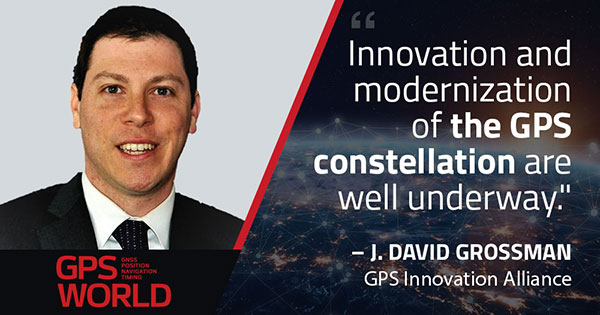
Innovation and modernization of the GPS constellation are well underway. Last year, under the emerging leadership of the U.S. Space Force, two new Lockheed Martin-built GPS III satellites were launched into space. This new generation of GPS satellites offers three times greater accuracy, up to eight times improved anti-jamming capability for military users, and the addition of the L1C signal to enable interoperability with other navigation systems, such as Europe’s Galileo.
GPS modernization also has led to the introduction of M-code, an advanced, new signal designed to improve anti-jamming and anti-spoofing, as well as to increase secure access to military GPS signals for U.S. and allied armed forces. In GPS-denied environments, M-code reduces the jamming radius, giving military planners and targeteers options to minimize or avoid collateral strike damage.
With at least two additional GPS III satellites set to launch this year and a new ground control segment known as the Next Generation Operational Control System (OCX), the continued success of the GPS program remains bright.
Ligado Still Looms
As GPSIA continues to urge Congress to allocate the funding needed to support the modernization of GPS, we also are fighting to ensure uninterrupted operation of the estimated 900 million GPS devices in the United States ranging from precision agriculture to consumer gadgets.
Last year, we were deeply disappointed by the Federal Communications Commission’s (FCC) decision approving the applications of Ligado Networks, despite the well-documented objections of the expert agencies charged with preserving the integrity of GPS, specifically, on the critical issue of what constitutes harmful interference to users of GNSS.
Regrettably, the FCC chose to ignore the established “1-dB Standard,” which has a long history of protecting GPS operations from harmful interference in both international and domestic regulatory proceedings.
“All Americans benefit from a competitive 5G landscape.”
At the same time, Ligado and its supporters continue to argue that their proposal is the fastest way to bring 5G to all Americans. In actuality, millions of Americans already have access to 5G services and, thanks to the efforts of the FCC, hundreds of megahertz of 5G spectrum in low-, mid- and high-band frequencies have been or will soon be made available for commercial use. GPSIA believes all Americans benefit from a competitive 5G landscape.
5G without compromise. However, that goal can be achieved without undermining GPS receivers and devices that are foundational to wireless technology in general, including 5G. We remain hopeful that a new administration and congress will commit to protecting GPS receivers from harmful interference using the appropriate standard for determining such interference to ensure that the more than $1 billion per day in U.S. economic impact created by GPS continues to flourish.
2020 also brought the issue of GPS resiliency into the national forefront. In February, the president signed an Executive Order aimed at fostering greater resiliency for positioning, navigation and timing (PNT)-based systems, including GPS.
GPSIA supported this order and outlined in subsequent regulatory filings why GPS remains the gold standard for delivering PNT functions to our military as well as a wide range of other sectors, including transportation, agriculture, electricity and finance.
Complementing GPS. As the federal government considers alternative PNT solutions, it is critical that they be complementary to GPS, able to easily integrate into current or future devices, and based on a recognition that each PNT application has unique requirements driven by its intended function, environment and design factors. In sum, there is no one-size-fits-all solution.
Protecting Consumer Privacy. Looking ahead, GPSIA expects 2021 will bring a robust discussion around consumer privacy protections. While GPS satellite broadcasts are one-directional and cannot track a user’s location, we recognize that GPS is one of many data points that can contribute to application-specific location tracking. As such, GPSIA would urge Congress to ensure that geolocation data is appropriately addressed as part of any U.S. federal privacy legislation. In doing so, we believe protections for precise geolocation information will empower consumer choice, enhance transparency, and strengthen security.
On the surface, infrastructure modernization, protecting GPS spectrum, PNT resiliency, and consumer privacy may seem like distinctly different issues. What they have in common, though, is an ability to garner bipartisan support, deliver substantial consumer benefits, and strengthen our nation’s economy. GPSIA stands ready as a resource and looks forward to working with the Biden-Harris Administration and leaders in the House and Senate to promote, protect and enhance GPS.
The document covers a number of details regarding the Ligado Networks and the advancement of 5G.
According to the document, former NASA Administrator Daniel Goldin claims that FCC’s approval of the proposal by Ligado Networks to repurpose satellite spectrum in the L-Band for high-power terrestrial use should be upheld because it will help advance American leadership in 5G technologies.
“Winning the race to 5G — against China and other countries — is important, but Ligado’s proposed network is largely irrelevant to 5G,” the GPS Innovation Alliance said in response. “The availability of Ligado’s spectrum for terrestrial use will not contribute to the advancement of 5G but will instead undermine U.S. Global Positioning System receivers and devices that are foundational to wireless technology in general, including 5G.”
In addition, the GPS Innovation Alliance’s stated in its ex party that the use of L-Band spectrum is not critical for 5G services.
Other points mentioned in the document include that Ligado’s spectrum is not internationally harmonized, significantly diminishing its effectiveness as a 5G band, and that Ligado’s proposed network simply will not offer a 5G service. According to the GPS Innovation Alliance, Ligado merely proposes to offer limited internet of things services, primarily delivered over custom private networks to specific geographic areas for limited vehicular and utility operations. Not only is this not a 5G service offering, but similar services are already being provided by wireless service providers, the alliance added.
The global security, defense and aerospace company joins alliance dedicated to protecting, promoting and enhancing the use of GPS technology
The GPS Innovation Alliance (GPSIA) is welcoming BAE Systems Inc. as the newest member of the organization. BAE Systems, a global defense, security and aerospace company, joins member companies John Deere, Garmin, Trimble, Lockheed Martin and Collins Aerospace, a unit of Raytheon Technologies Corp., as well as 11 national organizations that make up GPSIA’s affiliates program.
As the newest member of the alliance and the third aerospace and defense corporation to join the organization in eight months, BAE Systems will work with GPSIA to support its goal of enhancing GPS innovation, creativity and entrepreneurship — while advocating as the voice of the GPS industry in Washington.
“We are excited to welcome BAE Systems as the newest member of the Alliance — a monumental addition that marks the doubling of our membership in the past eight months,” said GPSIA Executive Director J. David Grossman. “The continued growth of GPSIA demonstrates the criticality of protecting GPS and the substantial value our organization delivers through advocacy, information sharing, and technical standards. We remain committed to ensuring the economic and societal benefits of GPS are fully realized.”
BAE Systems is a global leader in designing and implementing high-end technology to extend the reach and significance of GPS in defense. BAE Systems’ radiation-hardened electronics have been on board satellites and spacecraft for almost 30 years and are currently providing the high-performance onboard processing capability for the GPS III satellite mission. Promoting space resiliency for over 30 years, BAE Systems is a cornerstone of the growing importance of GPS technologies on the space frontier.
BAE Systems has not only pioneered critical technologies suitable for GPS applications in space, but has also developed, manufactured, integrated and supported GPS receivers and guidance systems for advanced military applications on land, sea or air.
The company was instrumental in the development of NAVWAR sensor technology, intended to meet growing challenges associated with maintaining military positioning, navigation and timing (PNT) advantage using satellite navigation, and has engineered top-tier jammers and navigation systems for decades. Their work has been critical in securing the safety and technological supremacy of our nation’s defenses.
“GPS is an essential part of our world — from our infrastructure and economy to the security of our nation,” said Frank Ruggiero, senior vice president, government relations, BAE Systems. “As a leading provider of defense electronics and communications systems, we are excited to join the GPS Innovation Alliance to expand the development of cutting-edge GPS technologies.”