Tag: GPS policy

  • Behind GPS is the people

    Behind GPS is the people

    Headshot: F. Michael Swiek
    F. Michael Swiek, president, Mike International LLC

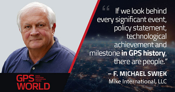
    It is often said that “Behind every successful man there is a woman.” Likewise, if we look behind every significant event, policy statement, technological achievement and milestone in GPS history, there are people. They make the textbook chronologies of impressive progress both personal and human.

    My own 30-year association with GPS has tracked closely with that of GPS World. Here are vignettes that sit most warmly in my “family snapshot album” of great moments in GPS.

    In December 1994, the Civil GPS Service Interface Committee (CGSIC) held its first international meeting in Edinburgh, Scotland, hosted by the Northern Lighthouse Board (NLB). The small team of Americans attending the meeting were invited the following day to participate as the “International Team” in the annual NLB quiz competition held in a venerable pub. The competition is hotly contested each year among the NLB divisions, with the winning division commemorated with a brass medallion on a large wooden plaque kept for decades in NLB headquarters. To everyone’s chagrin, the Americans won. The good humor and boisterous camaraderie of that evening laid the foundation for close and candid dialogue between U.S. and European institutions on a wide variety of satellite navigation issues for years to come.

    In 1996, Charlie Trimble was to introduce Vice President Al Gore in a ceremony at the White House to announce a Presidential Policy Statement on GPS. On the scheduled day, Charlie was unable to enter the White House, despite being vouched for by White House officials, because he was carrying no photo ID. White House security asked me if I had anything official with Charlie’s picture. They finally accepted a copy of the Trimble Navigation annual report, because in the words of one security officer, “I’ve heard of fake driver’s licenses, but not fake corporate annual reports.” Charlie was admitted.

    On September 11, 2001, all of us attending CGSIC and ION in Salt Lake City sat stunned in our conference room watching the news reports from New York. Our meeting sessions were canceled, but we came from our hotel rooms because we needed to be together as friends in our shock and confusion, worrying about our families and friends and what the days ahead would be like. Anyone with a cell phone able to get a line out gladly shared it.

    “I’ll only be a minute, just want to check with my family.”

    “Talk as long as you want.”

    In the mid-1990s in the ION exhibit hall, I was walking and talking with Charlie Trimble, Randy Hoffman (founder of Magellan Systems) and Gary Burrell (co-founder of Garmin), who were engaged in good-natured trash talking about each others’ companies, products and personalities. Glen Gibbons, founder of this esteemed publication, came across us, smiled, and said he was surprised to see such a congenial group of competitors. Charlie responded that in the marketplace they were competitors, but at ION they were all colleagues.

    Glen added, “So, all friends!”

    All three blurted, “Don’t go that far!” amid more laughs and grins.

    The Japan GPS Council became one of the earliest and most influential industry groups in helping to guide the evolution and growth of GPS policy and industry, due to the personal passion of Hiroshi Nishiguchi. When meetings were held in Washington, Nishiguchi, other international representatives, industry and government officials would be guests in our home for convivial dinner chats. Nishiguchi became so comfortable, we considered him like family. He would leave a cardigan sweater in our coat closet between visits, and upon entering our house would remove his tie and suit jacket, go to the closet, and put on his sweater — like Mr. Rogers — before relaxing for the evening. He performed this ritual even when accompanying senior Japanese officials.

    So, while technological milestones and policy commitments tell a great deal of the story of GPS, there are also the unique and cherished people, and the privilege it has been to know them as friends.

  • GPS tracking need not sit out COVID-19 because of privacy laws

    GPS tracking need not sit out COVID-19 because of privacy laws

    Photo: AntonioGuillem/iStock / Getty Images Plus/Getty Images
    Photo: AntonioGuillem/iStock / Getty Images Plus/Getty Images

    Commentary by Jeremy Meisinger

    Headshot: Jeremy Meisinger
    Jeremy Meisinger

    The scale and speed of the COVID-19 crisis has left policymakers searching for new tools to address an unprecedented challenge. Everything from faster testing to new treatments to more supplies for frontline providers is needed, and smart deployment of these resources requires an ability to track infections that is not yet available for a problem of the scale of COVID-19.

    The recent economic stimulus package passed by Congress — the Coronavirus Aid, Relief, and Economic Security Act (“CARES Act”) – looks to fund this kind of tracking. Among its many priorities, the CARES Act appropriates half a billion dollars to the Centers for Disease Control and Prevention (CDC) for modernization of its public health data surveillance capabilities, and specifically directs the CDC to report to Congress on the development of a “public health surveillance and data collection system for coronavirus within 30 days.”

    The legislation does not give much in the way of additional direction to the CDC, meaning that the CDC is likely to think expansively and look for proven models in other highly developed public health systems.

    Disease surveillance efforts around the world have taken a variety of approaches, in many cases informed by experience in battling prior pandemics. Public health systems in places such as South Korea, Singapore and China were built on the lessons of the outbreak of Severe Acute Respiratory Syndrome (SARS) and similar conditions over the past several years.


    Location-based tracking using GPS provides greater insight and precision than, for example, asking an infected patient to remember and re-trace his or her steps.


    Among many other elements, these systems frequently employ GPS-enabled smartphone apps both to gather information and to target alerts to local populations. Location-based tracking using GPS provides greater insight and precision than, for example, asking an infected patient to remember and re-trace his or her steps.

    As discussions of similar solutions have begun in the United States, privacy advocates have rightly pointed out the risks inherent in systems that necessarily gather and communicate health information and pair that information with location-based information provided by GPS. But both legally and practically, there need not be an exclusive choice between health information privacy and using GPS and other technology to gather and provide information about COVID-19.

    On the legal front, HIPAA broadly exempts disclosures of protected health information for public health activities, allowing disclosures to public health authorities without first obtaining patient consent. Similarly, HIPAA permits data to be de-identified — subject to recognized standards laid out in regulations and guidance — and thereafter shared and used for research purposes, including public health research and similar purposes.


    Legal avenues certainly exist to permit significant information sharing about COVID-19 in order to help protect public health.


    Furthermore, federal authorities tasked with enforcing HIPAA have already signaled in guidance that they will take a flexible approach to enforcement in order to meet the exigencies of the crisis. Thus, while it is true that HIPAA has not been applied directly to a public health emergency on the scale of COVID-19, legal avenues certainly exist to permit significant information sharing about COVID-19 in order to help protect public health.

    On the practical front, HIPAA also points the way to sensible decision-making that balances privacy interests with the needs of the crisis. First, de-identification provides a significant opportunity to share data in a way that is protective of privacy. Second, we should not assume that widespread participation — both in information gathering and information dissemination — must be involuntary in order to be widely adopted.

    Smartphones users can — and should — be given a choice before enabling tracking features on their devices, just as they can and should be informed in a transparent way about what data would and would not be shared. HIPAA establishes a “minimum necessary” standard that should provide the guiding principle here: no more information should be shared than is necessary to accomplish the intended objective.

    As we search quickly for tools to enable the kind of tracking that we have not undertaken before, we should be careful not to construct a false dilemma between privacy and efficacy — the two go hand in hand. Strong and transparent privacy protections are both possible and necessary to secure the public buy-in that is necessary to make public health surveillance work.


    Jeremy Meisinger is a Boston-based attorney at Foley Hoag LLP.

  • PNT Board opposes Ligado ‘lite’ proposal, DARPA seeks photonics

    PNT Board opposes Ligado ‘lite’ proposal, DARPA seeks photonics

    On Aug. 10, the National Space-Based Positioning, Navigation, and Timing (PNT) Advisory Board, the government’s GPS expert board, sent a letter to the National Executive Committee for Space-Based PNT (a multi-agency body that steers GPS policy) that concluded, “We strongly recommend your opposition to the Ligado proposal.”

    The letter sprang from a unanimous vote five days earlier to oppose allowing Ligado Networks to use spectrum neighboring the GPS band for terrestrial communications.

    Ligado possesses licenses to broadcast on two satellite bands located adjacent to the GPS frequencies. The company has been seeking permission from the Federal Communications Commission (FCC) to repurpose these licenses from satellite-based use to ground-based use from powerful tower transmitters.

    Ligado said in May it would lower the power in its proposal for the 1526–1536 MHz band to 9.98 dBW to avoid interference with certified aviation receivers. However, the PNT Advisory Board reiterated its opposition, saying that even if the transmissions’ power was lowered to just under 10 watts, it “will create totally unacceptable interference for a great number of GPS users in the United States.”

    From the Letter: “This risk is far too great, and far too many questions remain, for Ligado’s proposal to be approved. While there are many broadband alternatives (Ligado would be a very small percentage of this national asset), there is only one GPS. Any impairment to current and future uses is clearly contrary to the national interest. Therefore, implementation of their recently proposed ~10-watt operating scheme will create totally unacceptable interference for a great number of GPS users in the United States. In fact, despite power limits in their current amended application, it is probable they could still be allowed to increase this power over time. This would be even more destructive to GPS users.

    “We believe avoiding degradation over at least 90 percent of the region near Ligado transmitters is the absolute minimum protection for GPS receivers in each class. This would be a hypothetical 90 percent Protection Evaluation. This is not an endorsement of this level since, of course, all users would prefer 100 percent protection. The Department of Transportation (DOT) Adjacent Band Compatibility (ABC) study is the only validated test to verify degradation at various received power levels.

    “Those results inform that to insure degradation not exceed 10 percent of the Region (90 percent Protection) for High Performance receivers, either:

    Ligado maximum power can be no more than .0036 watts at the 400-meter spacing they had earlier planned. Tolerable power would be 3/10ths of 1 percent of their proposed ~10 watts. Or

    the closest spacing of Ligado transmitters is 20,000 meters (over 12 miles) for their proposed ~10 watt power level (see Figure 1).”

    Figure 1. The PNTAB strongly believes that 90% is the minimum Area Protection Criterion (maximum 10 % degradation). (Chart: PNT Advisory Board)
    Figure 1. The PNTAB strongly believes that 90 percent is the minimum Area Protection Criterion (maximum 10 percent degradation). (Chart: PNT Advisory Board)

    DARPA wants photonic integrated circuits

    High-energy photons emission (abstract illustration). (GiroScience/Shutterstock.com)
    High-energy photons emission (abstract illustration). (Photo: GiroScience/Shutterstock.com)

    The U.S. Defense Advanced Research Projects Agency (DARPA) Microsystems Technology Office is soliciting research proposals for the development of a new class of atom-based systems using integrated photonics and trapped atoms to enable high-performance, robust, portable clocks and gyroscopes.

    The military researchers are asking industry to develop relatively simple portable photonic integrated circuits (PICs) for high-performance position, navigation and timing (PNT) devices as an alternative to GPS for when satnav signals are not available.

    A PIC or integrated optical circuit, similar to an electronic integrated circuit, integrates multiple photonic (having to do with light) functions, providing capabilities for information signals imposed on optical wavelengths, typically in the visible spectrum or near-infrared, 850–1650 nanometers.

    A-PhI Program

    The Atomic-Photonic Integration (A-PhI) program seeks to develop trapped-atom based, high-performance PNT devices, reducing the complexity of these atomic systems by using PICs. According to the DARPA document, the PICs will replace the optical assembly behind devices such as sensitive and accurate angle sensors and clocks, while still enabling the necessary trapping, cooling, manipulation and interrogation of atoms.

    A-PhI aims to demonstrate that compact PICs can replace the optical bench of conventional free-space optics for high-performance trapped-atom gyroscopes and trapped-atom clocks without degrading the performance of the underlying physics package.

    Physics

    Atomic systems using trapped atoms have the potential to be made portable while maintaining their accuracy due to the atomic trap’s small size and the inherent isolation a trap offers an atomic system from the environment, especially from acceleration.

    Currently, these systems are bulky, heavy, and not notably portable, because of the complexity of the optical systems used to create the trap.
    In the past, efforts to miniaturize the hundreds to thousands of optical components in such benchtop systems have relied on removing optical elements, miniaturizing the remaining elements, and tightly integrating them in a small package.

    The products deliver degraded performance with the need to maintain very tight optical alignment, causing both poor environmental robustness and poor tolerance to design errors. Effective miniaturized atomic systems cannot be achieved at a reasonable cost with this approach.

    Recent developments in PIC research suggest that on-chip optical frequency combs based on microresonators, optical frequency synthesis, novel on-/off-chip coupling, wavelength demultiplexers, and on-chip phased arrays for dynamic manipulation of light fields can replace optical systems with readily manufacturable, low-cost chips without the alignment sensitivity of conventional free-space optics.

    Gyroscopes

    A-PhI also seeks to develop proof-of-concept trapped atom gyroscopes, a matter-wave analog of the interferometric fiberoptic gyroscope. Such a miniaturization effort could generate an order of magnitude improvement in angular sensitivity and dynamic range over current free-space products.

    A-PhI hopes to develop portable, high-performance, navigation and timing systems: the miniaturization of the optics of atomic systems without a decrease in performance. Subsequent work, the RFP asserts, will be required to incorporate the necessary compact and robust lasers and electronics to achieve a fully functioning, high-performance, portable PNT system.

  • PNT Advisory Board presentations now available

    Presentations from the 20th meeting of the National Space-Based Positioning, Navigation, and Timing Advisory Board (PNTAB), held Nov. 15-16, are now available online at GPS.gov.

    Ligado Networks was scheduled to appear and present at the meeting, which was held in Redondo Beach, California. Read more about the issues here.

    Ligado and its predecessors have sought to install high-powered ground transmitters that have been shown to harm and overwhelm GPS signals and receivers in their general vicinity. The controversy has simmered for at least eight years without resolution.

    PNTAB provides independent advice to the U.S. government on GPS-related policy, planning, program management, and funding profiles in relation to the current state of national and international satellite navigation services.