Tag: GPS testing

  • Orolia awarded US defense contract for advanced GPS simulation Suite

    Orolia awarded US defense contract for advanced GPS simulation Suite

    The U.S. military selected Orolia Defense and Security to supply multiple BroadSim advanced GPS simulator systems, a contract valued at $1.7 million (USD), in an effort to upgrade testing facilities and field test assets.

    The BroadSim Advanced GNSS Simulator (Photo: Orolia)
    The BroadSim Advanced GNSS Simulator (Photo: Orolia)

    These new simulator systems will enable better testing of widely deployed military GPS receivers, which are integrated into air and ground-based positioning, navigation and timing (PNT) systems.

    BroadSim will be leveraged with Orolia’s Panacea test suite, which the U.S. military uses to conduct automated testing and analysis for PNT system performance and vulnerabilities.

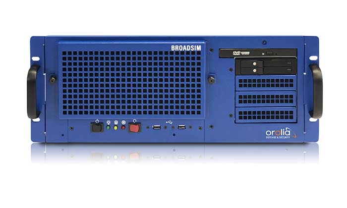
    BroadSim will bring versatility to the testing process by supporting diverse test methods and environments such as a laboratory setting, or an over-the-air (OTA) field test event.

    BroadSim was selected based on its flexibility to support the ever-changing military tasks at hand, according to Orolia. It can be easily configured to support laboratory testing one day, and field testing the next with its four independent RF outputs, removable drives, and software-defined architecture.

    “Equipping our actively deployed warfighters with state-of-the-art technology is of utmost importance and can mean the difference between mission success and failure. To help achieve that goal, Orolia’s GPS testing and simulation solutions ensure that these systems are battlefield ready,” said Tyler Hohman, Orolia Defense and Security’s director of products.

    The U.S. military and other federal agencies such as DHS host several test events per year in which industry participates, such as GPS Testing for Critical Infrastructure (GET-CI).

    Orolia will host a webinar on this topic on Thursday, July 16, at 2 p.m. EDT, titled “PNT Vulnerability Testing for Critical Infrastructure:Lessons Learned from Defense.”

    The federal government considers PNT to be a critical aspect of mission success, as outlined in the C4ISRNET white paper “Protecting the U.S. Military PNT Advantage from GPS Jamming and Spoofing” and defined in the PNT Executive Order. For the 2021 federal fiscal year, the U.S. Army alone budgeted more than $275 million towards Assured PNT Research, Development, Test & Evaluation (RDT&E), as published in the 2021 Defense Budget.

  • USAF to test increased GPS signal power Jan. 25

    Beginning Wednesday, Jan. 25, Air Force Space Command (AFSPC) will conduct a limited-duration test implementing an increase of the Ll C/A power level on the GPS Block IIR-M and llF satellites — a total of 19 satellites.

    The C/A power will remain within IS-GPS-200-H specifications, and the power increase is not expected to increase the noise floor by more than 0.3 signal-to-noise ratio in the worst case.

    “We assess that there will be no adverse impacts to civil, commercial or military GPS users, but anyone who experiences issues during this test should address them through established reporting channels,” said Gen. John W. Raymond, U. S. Air Force (USAF) commander, in a “Memorandum for Distribution.”

    Military users can contact the GPS Operations Center at DSN 560-2541, while civilian users can contact the U.S. Coast Guard Navigation Center at 703-313-5900. In the event of unexpected critical impacts, a process to cease testing operations has been put in place.

    The AFSPC point of contact for this test is Maj. Jeffrey Koch, DSN 692-0233, commercial 719-554-0233.

  • FAA issues GPS interference flight advisory

    FAA issues GPS interference flight advisory

    [[Editor’s note: After this story was posted, and after the Navigate! enewsletter containing it was sent out to 27,128 subscribers, GPS World received notice that in fact the U.S. Navy  canceled plans to jam GPS signals in the vicinity of the China Lake, California, Naval Air Weapons Station. The Aircraft Owners and Pilots Association (AOPA) had raised concerns about the impact on civilian air traffic and the size of the affected area. The Navy did not reveal the cause of the cancellation, other than to say the reason was “internal.”]]

    According to a June 4 Federal Aviation Administration advisory, GPS testing is scheduled several days this month that may affect GPS reception on the West Coast of the U.S. with an unreliable or unavailable GPS signal.

    The time periods discussed in this advisory may be reduced or cancelled with little or no notice. Pilots are advised to check NOTAMs frequently for possible changes prior to operations in the area. NOTAMs will be published at least 24 hours in advance of any GPS tests.

    GPS Interference testing this June on the West Coast of the United States.
    GPS Interference testing this June on the West Coast of the United States.

    Location: The location is centered at 360822N1173846W or the BTY VOR 214 degree radial at 059 NM.

    Dates and times

    7 JUN 16 1630Z – 2230Z
    9 JUN 16 1630Z – 2230Z
    21 JUN 16 1630Z – 2230Z
    23 JUN 16 1630Z – 2230Z
    28 JUN 16 1630Z – 2230Z
    30 JUN 16 1630Z – 2230Z

    Duration: Each event may last the entire requested period.

    NOTAM INFO:

    NAV (CHLK GPS 16-08) GPS (including WAAS, GBAS and ADS-B) may not be available within a  476 nautical mile radius centered at 360822N1173846W (BTY 214059) FL400-UNL DECREASING IN AREA WITH A DECREASE IN ALT DEFINED AS:
    432NM RADIUS AT FL250
    375NM RADIUS AT 10000FT
    340NM RADIUS AT 4000FT AGL
    253NM RADIUS AT 50FT AGL

    THIS NOTAM APPLIES TO ALL AIRCRAFT RELYING ON GPS. ADDITIONALLY, DUE TO GPS INTERFERENCE IMPACTS POTENTIALLY AFFECTING EMBRAER PHENOM 300 AIRCRAFT FLIGHT STABILITY CONTROLS, FAA RECOMMENDS EMB PHENOM PILOTS AVOID THE ABOVE TESTING AREA AND CLOSELY MONITOR FLIGHT CONTROL SYSTEMS DUE TO POTENTIAL LOSS OF GPS SIGNAL.

    Affected Centers: Pilots are encouraged to report anomalies only when ATC assistance is required.