Following the announcement that ION GNSS+ 2020 will be virtual only this year, GPS World has decided to cancel this year’s Leadership Dinner and Awards Ceremony, which would’ve been held Sept. 24 in St. Louis.
The GPS World Leadership Dinner and Awards Ceremony is held annually at the time of (although separately from and independent of) the ION GNSS+ conference. Four innovators in the fields of satellites, signals, services and products are honored with awards in front of an audience of nearly 150 PNT industry and research community VIPs.
“This was not a decision we took lightly as so many of us look forward to wrapping up the conference by honoring deserving colleagues over a nice meal followed by a fun activity,” said Marty Whitford, GPS World’s group publisher and editorial director.
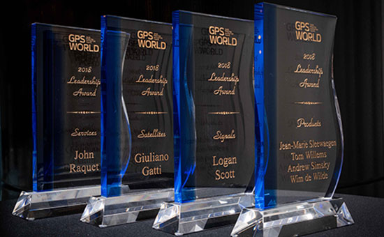
At the GPS World Leadership Dinner and Awards Ceremony in Miami on Sept. 27, 120 VIPs from the international GNSS/PNT community gathered to honor recent significant achievements in four fields: Satellites, Signals, Services and Products.
The honorees, so voted by a panel of their peers, appear below. Also, see our article here.
Their remarks upon receiving the awards will appear in the December issue, along with Future Visions for 2019 by the executive officers of GPS, GLONASS, Galileo and BeiDou.
Rounding out the evening after speeches, dinner and good conversation among good friends, old and new, was the Smart City Jam! We attempted to replicate, on the carpet of the 14th-floor banquet room, an obstructed urban environment, replete with malicious jammers. And we challenged all comers to “autonomously” navigate to a goal in this hostile environment with remote-controlled rock-crawlers. Details on this as well coming up in December.
Opening remarks by Alan Cameron, editor and publisher of GPS World
Everyone at this great conference is actively engaged in innovation: new approaches, new combinations, new integrations, new methodologies.
Our sponsors are not only innovators, they are active in building those innovations in the field, installing the cornerstones of GPS and GNSS technology. Harris Corporation has been building the GPS satellite payloads since the beginning of time, Rockwell Collins has built so much user equipment, historically and currently, and Spirent Federal Systems has been enabling the development and testing of much user equipment by many companies in this room.
Just to give you an idea of who else is seated among you at the tables, we have NovAtel, Spectracom, IFEN, Septentrio, Satelles, Syntony, Unicore, u-blox, ComNav, RaceLogic, Rohde & Schwarz, ublox, Locata, GMV, Leica, Thales, Boeing, Broadcom, Qualcomm, Google, Apple, Intel, MITRE and Aerospace Corporation; the U.S. Air Force GPS Directorate, the U.S. State Department, the European Space Agency, the European GNSS Agency and the European Commission, NASA, the French and German aerospace agencies; the Institute of Navigation and the Royal Institute of Navigation; and universities and research institutes almost too many to number.
This is a great industry to be part of, and I feel lucky to be kind of a spectator, a commentator in it without the benefit of the scientific upbringing that everybody else in this room has had. I still get to participate in the excitement and the developments and for that I am truly grateful.
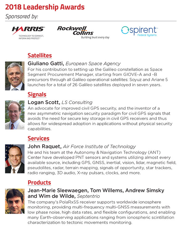
Satellites Leadership Award
Galileo Builder
Wolfgang Paetsch
Director of Navigation and Member of the Executive Board, OHB
For his leadership in setting up the routine production of the Galileo satellites leading to Galileo constellation deployment, including thequadruple Ariane 5 launch in November 2016.
Paul Verhoef (right), director of the Galileo Programme and Navigation-related Activities, European Space Agency, accepted the award and delivered remarks on behalf of Wolfgang Paetsch. (Right photo: Melanie Beus)
Introduction by Rob Scott, Rockwell Collins
“Forty years ago, Rockwell Collins celebrated the first receipt of a GPS signal,using a six-foot tall, two-person receiver. Now we have something something 1 by 1-1/4 inches that is far more capable. It’s amazing to see how technology has advanced.”
Remarks by Wolfgang Paetsch
I must admit I am rather at fault for Wolfgang not being here, because I keep him rather busy producing satellites, as OHB is completing the last of 22 satellites under contract from ESA. We are going to launch again in December, as you know we have had a few problems, which I’m glad to say we have solved. The issues are behind us, and the Swiss clocks are working fine now, which is great.
On Dec. 12 we are going to launch. The first two satellites are in Kourou already, the next ones are going in two weeks [as of Sept. 28; all satellites are now in Kourou. — Ed.] We’re going to go up on an Ariane 5 again, with these four satellites. Next summer we are doing another four, so it brings the whole Galileo constellation from 18 to 26, and then we are fully operational.
In this business it is quite a challenge to keep up the pace. I think OHB, with Wolfgang in the lead, has done very well in the past years to set up indeed a very impressive production line and keep all the machinery ticking over. It has been a big challenge for them, as they had been a relatively small player in the space business, while at the same time they have been able to win other competitions in the space business in other areas. OHB has been doing very well and we are glad of course that they are doing well because it was important to get Galileo up and running.
OHB has managed to win recently another contract, good for them, we are about ready to give them the first options on that contract, so we will have a total of 14 satellites under contract with them, in addition to the 22 they are completing. These satellites will further complete the constellation and they will already start replacing the first IOV satellites which we have put up. So you see the cycle is rather quick. Of course we are waiting a bit to see what the real lifetime of the satellites is going to be. We don’t know that yet but we will find out in the next couple of years.
Looking Ahead. So what are the challenges for us in the next years? We are currently working with colleagues from the European Commission and the European GNSS Agency on what the next constellations are going to do. Obviously there is a lot of pressure for further innovation, for further improvements. The user community over the last couple of years has become more outspoken about what they want and what they expect, which is nice. Obviously we need to take care of the legacy users, and we are having to see what new technology would allow us to do. At the end of the day there is then also a small thing called budget, which needs to have its play in these things.
In any case, the plan is by the end of the year we will start the procurement of the next batch of satellites. This will take a while to do, this procurement, as it concerns new developments, but then we are going to go for the next constellation.
So let me finish by paying a tribute to Wolfgang and his team. It has been a real challenge for them. I know that he was pretty amazed, and after that pretty proud, of this prize he has gotten, and I will carefully carry this back to him in Europe.
Alan, thank you very much.
Services Leadership Award
Global Educator
Patricia Doherty
Director and Senior Scientist, Institute for Scientific Research, Boston College
For initiating and leading the African GNSS Outreach program since 2009, to help developing countries derive social and economic benefits from satellite-based PNT.
Frank van Diggelen (left, above), an African Outreach faculty member and principal software engineer, Google, introduced and conferred the award to Pat Doherty. (Photo: Melanie Beus)
Introduction by Frank van Diggelen
“I had the great honor and privilege of teaching in the African GNSS Outreach program. If you are approached to participate in this, seize the opportunity! It’s a fabulous thing, with people from all over Africa, and you’ll learn far more than you think.”
Remarks by Patricia Doherty
I would like to thank GPS World for this Leadership Services Award. I am sincerely honored and humbled by this recognition. Serving the GNSS community with the African Outreach Program has been a joy and a privilege that I am personally grateful for every day.
This program began in 2009. The idea was conceived at a G8-UNESCO World Forum that I was fortunate to attend in 2007. At that forum, leaders from developing nations of Africa described the need for assistance in developing science and technology in their countries, technologies that would lead the way to socio-economic transformation and integration into the world economy. As all of us here know, GNSS is a space technology that can change the world with applications that can increase food security, monitor natural resources, manage wildlife conservation, improve emergency location services, and provide greater precision and safety in land, sea and air navigation — just to name a few of the possibilities.
Thus the goal of the African Outreach Program was to encourage the use of GNSS for societal and economic development and for scientific exploration in Africa. The way to do that was to help build a knowledgeable African GNSS workforce. I am glad to report that the program has been quite successful. To date, we have hosted 9 workshops. In those workshops, we have introduced the art and science of GNSS navigation to over 450 professors and students from at least 23 of the 54 countries in Africa. Many of the African participants have gone on to do great things: hosting local workshops, developing GNSS programs in their universities, gaining government confidence and interest in GNSS technology and building infrastructure that enabled the use of GNSS.
One of the prime reasons for this success are the sponsors who support us and the lecturers who generously share their time, their knowledge and their zeal for GNSS to teach at the workshops. Many of these lecturers are here tonight. So thank you all. Many of these lecturers have expressed that their lives were enriched by this program. Others have told me that they have never seen a more attentive audience and that just having the opportunity to meet and work with people from the developing world in Africa is a gratifying experience. Several of our lecturers, including myself, are now involved in collaborations with scientists in the developing world.
More to come. Although this sounds like we have done our job, there is still so much to do. Change is slow in Africa. Our plans for the future include building on our success by hosting additional workshops where we will try to reach additional countries in Africa and strengthen current programs and infrastructure in countries where that has been slow to develop. We are also opening the program to other developing countries around the world, as there has been much interest from Central America, South America and Asia. Finally, we are working to bring more workshops to the African continent, where we can reach more students, have an effect on local universities and speak to the local government about the benefits of using GNSS as an enabling technology for societal betterment and economic growth.
In closing, I am honored to receive this award and I look forward to continuing our work to support the use of GNSS in developing nations. Thank you, GPS World, and thank you to our sponsors, lecturers and our African participants for making this program a success.
Signals Leadership Award
Spectrum Advisor
Chris Hegarty
Director for Communications, Navigation and Surveillance Engineering and Spectrum, The MITRE Corporation
For contributions to the U.S. Department of Transportation’s GPS Adjacent Band Compatibility Assessment.
Chris Hegarty (Photo: Melanie Beus)
Introduction by Joe Rolli, Harris Corporation
“On behalf of the Harris Corporation and the team I work with in the Precision Navigation and Timing Business Area, providing the world with GPS signals from space for over forty years, I am pleased to present this year’s Leadership Signals Award.”
Remarks by Chris Hegarty
Thank you very much. I really appreciate this. The truth be told, of course, the Adjacent Band Compatibility (ABC) study has had many contributors. I’m honored to receive this award, but equally deserving are many others including Karen Van Dyke at DOT, Steve Mackey and Hadi Wassaf at DOT’s Volpe Center, Karl Shallberg at Zeta, and too many others to list at DOT, the Air Force, NASA, other federal partners and their contractors.
Looking forward, for those of you who have not been following this issue, the GPS spectrum is being challenged. The spectrum is highly valued and of course there are companies that would like to use that spectrum.
I think that it’s safe to say that no one would really want to stop them from using that spectrum if it didn’t have an impact on GPS, but the unfortunate reality is that it appears the deployment of a 4G network or other potential use of the bands adjacent to GPS with similar transmitter power levels would disrupt the operations of many hundreds of thousands of receivers. To ignore the issue would really be a mistake for our industry.
This issue unfortunately isn’t going to go away. The pressure on spectrum is going to continue to grow — until someone figures out how to communicate without using electromagnetic waves. So this is going to be a persistent problem.
I think we can build receivers, in the future, that can deal with some new systems in adjacent bands, but it’s going to be imperative for a long transition period to protect the investments made by many people in the room here and the folks that we support.
That’s all I wanted to say, thank you again very much.
Products Leadership Award
Advanced Capability Developers
Charles Abraham, Andreas Warloe and Javier de Salas
Vice President of Engineering, Senior Director of Engineering, and Director of Software Engineering, respectively, Broadcom
For developing the first dual-frequency L1/L5 E1/E5 GNSS chip for smartphones, ushering in a new era of high-precision GNSS in mass-market products.
Charles Abraham and Andreas Warloe, with Javier de Salas (not shown); Ellen Hall (left), CEO of Spirent Federal Systems, introduced and conferred the award. (Photo: Melanie Beus)
Introduction by Ellen Hall, Spirent Federal
“As pioneers in GNSS satellite simulation, beginning in 1985, we’re really proud of our heritage. We’re also really proud of Broadcom.They are a user of Spirent equipment as well, so that makes us doubly happy to award this to them.”
Remarks by Andreas Warloe
Thank you to GPS World and the sponsors and supporters of this event, from Charlie Abraham, Javier de Salas, myself and the Broadcom marketing and engineering teams, for this award. We are very honored that our efforts to provide the best possible GNSS to as many people as possible have been recognized in this way.
A few years back, we had completed receiver support for a fifth GNSS L1 system and asked ourselves “What’s next?” At that time, technology nodes were getting to a point where a single chip L1/L5/E1/E5 receiver could be contemplated, and the Galileo launch schedule was picking up speed. An old outlandish idea suddenly didn’t seem as outlandish any more.
Many or most of you in this room are experts in the business of perfection; the business of perfecting and pushing performance boundaries for GNSS. As designers of mass-market devices, we have instead become experts in the art of compromise: If we can achieve good performance at 10mA, then how about 5mA? If we can implement a 16-bit data path with 0.1dB losses, how few bits can we get away with for 0.2dB losses? How can we add support for new GNSS systems without growing RF, digital hardware or software? It is this extreme frugality that now has enabled us to put a complete single chip L1/L5 system in the hands of phone and wearables manufacturers, with smaller size and lower power consumption than the previous L1-only generations.
Competition in our market is fierce, but we are excited about this opportunity to work together with our competitors to promote this new level of precision to our common customers. We have taken initiative in this area by forming the Dual Frequency Alliance. There is an investment that has to be made in phones, with antenna and filtering support for the new band. Only when these investments are made will we be able to bring this new performance level to hundreds of millions of people. Only then will we start seeing new applications built on high-precision — applications that haven’t even been envisioned yet. Once those applications are available, there will be pressure to expand L1/L5 technology from flagship phones to truly mass-market phones.
L5 support enables high-accuracy GNSS, but it does not guarantee it. To go from multi-meter precision to sub-meter precision requires advanced software. GNSS chip manufacturers can provide a good starting point, but once GNSS measurements are made available, GNSS students and experts alike can supply clever applications, professional software tools and infrastructure to further advance GNSS technology. Our job is to work together to push the L1/L5 technology into phones, to provide a new platform for GNSS development.
In summary, we would like to work as an industry to make L1/L5/E1/E5 the new standard for GNSS performance, and to make these measurements available in phones for as many engineers as possible to either monetize their existing IP or develop entirely new IP.
Tweet a selfie with @GPSWorld Group Publisher and Editor-in-Chief Alan Cameron OR in the GPS World booth at ION GNSS+ and you will be entered to win two tickets to the GPS World Leadership Dinner!
To qualify, simply tweet a selfie with @gpseditor Alan Cameron, or in the GPS World booth, tag @GPSWorld and use #iFoundAlan. One winner will be randomly selected at 1 p.m. on Thursday, Sept. 28, and contacted via direct message on Twitter. Photo must be taken at ION GNSS+ 2017 and submitted prior to noon on Sept. 28.
What are your challenges this year? How are you driving business in today’s economy? What issues are you concerned about? How much accuracy do you require?
We want to know, and so does the rest of the industry.
GPS World is asking PNT professionals about the state of their business, the economic climate for GNSS products and services, driving market factors, the effects of jamming, the Issue of the Year — and more! Please take the 2016 State of the Industry Survey. It should take approximately 10 minutes, and your responses are confidential.
A handful of lucky participants drawn at random will win:
TWO $100 gift cards good (virtually) anywhere;
a pair of tickets to GPS World’s 2016 Leadership Dinner held during ION GNSS+ (or a voucher for a comparable dinner in your hometown).
Complete the survey by August 17 — not much time! Then look for a complete report of our findings in the September issue of GPS World. If you have any questions, please don’t hesitate to contact me.
Thank you for taking the time to share your feedback and help us improve our magazine content, industry awareness — and your own business!
Despite being an avowed Anglophile since my first visit to the United Kingdom, somewhere around 50+ years ago, I just could not help myself. Professor David Last, Professor Emeritus at the University of Wales (Bangor) and former president of the Royal Institute of Navigation (RIN) was holding forth, with that wonderful, attention-arresting public school accent, on weighty PNT (position, navigation and timing) matters before an awestruck audience.
Professor Emeritus David Last.
And what did I do? I just could not stop myself reminding him and everyone within earshot that the American Institute of Navigation (ION) predated the British Royal Institute of Navigation by more than two years. The point being, of course, that while two years actually makes little difference in the scheme of things, actuarially speaking we yanks rarely have the opportunity to make such a claim where our stiff upper-lipped Red Coat cousins are concerned. So, when the opportunity presents itself, as it typically does at ION GNSS+, then in my opinion, we former colonists just have to jump in with both feet — or one if by land and two if by sea, and all that.
An even more compelling argument for being first revolves around GPS versus Galileo operational satellites. The first GPS operational launch occurred in 1978, while Galileo has yet to launch a non-R&D operational PNT satellite, into a useable orbit that is. Now, before you accuse me of being smug, I am actually making a case for increased cooperation between the United States Air Force (USAF) and our European counterparts (ESA) where precision positioning, navigation and timing (PNT) schemes are concerned. For when it comes to satellite navigation and PNT, we yanks can definitely declare “been there, done that” mistakes and successes. What better place to “crow,” or rather, impart our considerable knowledge and network with fellow PNT aficionados, than at ION GNSS+.
ION GNSS+
All vocal eloquence jealousies and juvenile kidding aside, in many respects the ION GNSS+ event is actually the epitome of international cooperation in the PNT and GNSS (Global Navigation Satellite System) arena. This annual premiere event is described as “the world’s largest technical meeting and showcase of GNSS technology, products and services,” and I wholeheartedly agree. Indeed, the 2014 event, which took place from September 8-12 at the Tampa Convention Center in Tampa, Florida, had the stated goal of bringing together international leaders in GNSS and related positioning, navigation and timing fields to present new research, introduce new technologies, discuss current policy, demonstrate products and exchange ideas. It was a networking paradise in a wonderful, albeit somewhat steamy, venue, which you can review in two excellent videos concerning the event at the ION website.
This ION conference improves every year in content and attendance, and this year was no exception. Congratulations to Lisa Beaty and her whole team for a great conference, year after year. My favorite events are the annual GPS World Leadership Dinner and the prestigious annual ION Kepler award luncheon. Notice a trend?
GPS World Leadership Dinner
This much ballyhooed event becomes more and more of a draw each year. Tickets are coveted (as scare as hen’s teeth as Granny used to say) and competition is fierce. Every year we have about twice as many people wanting to attend as we have room to accommodate them. So the competition is never boring. This year was special in that one of our own GPS editors was nominated for an award and was overwhelmingly elected to receive it.
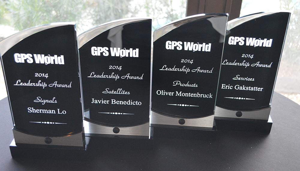
The Leadership Award winners this year were Javier Benedicto Ruiz, the Galileo Project Manager from the European Space Agency (ESA), who won in the Satellites category, while an old friend Sherman Lo, who is a senior research engineer and associate investigator (APNT) at Stanford University, won in the Signals category. Our own Eric Gakstatter, contributing editor for Survey and GIS from GPS World, won in the Services category; and finally Oliver Montenbruck, who is head of the GNSS Technology and Navigation Group, from DLR, the German Space Operations Center, won in the Products category.
GPS World 2014 Leadership Trophies.
The invited guests, and there was not an empty seat in the house, heard various perspectives from sponsors Lockheed Martin, Exelis, Raytheon, and Braxton Technologies, as well as visions of GNSS progress from our four award winners.
This event will be covered in much more depth in our December issue, but suffice it to say it was as usual a great event. I wonder from year to year how we will ever top the previous year’s entertainment, which always involves audience participation, but Alan Cameron just keeps coming up with outrageous ideas that seem to always pan out. Hope to see you there in Tampa next year.
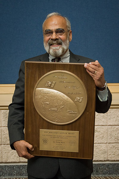
The Kepler Award
This year, the highly prestigious ION Kepler Award was won by Dr. Pratap Misra. Even though I am happy to say that through the years many of my friends and colleagues have won this coveted award, I can honestly say, in my opinion, there has never been a more deserving award winner than Professor Pratap Misra.
[Correction: The newsletter summary of this article misspells Pratap Misra’s name. We apologize for the error.—Editors]
Pratap Misra, 2014 Kepler Award recipient.
I have had the good fortune to know Professor Misra for many years, and frankly erroneously assumed, along with many others, that since he is so obviously deserving he had previously won the Kepler Award.
The Kepler Award is presented annually by ION in recognition of an individual’s unparalleled, sustained and significant contributions to the development of satellite navigation. It is the highest honor bestowed by ION’s Satellite Division. Professor Pratap from Tufts University meets and exceeds all of these qualifiers and more. He is simply self-effacing and polite as he quietly goes about being the best in all he endeavors.
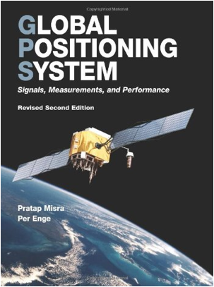
Throughout the years, I have found Pratap to be extremely dedicated to his work, and more recently to his students. These are key attributes. Academically, I can honestly say that the authoritative tome Global Positioning System: Signals, Measurements and Performance that he coauthored with, another friend and colleague, Professor Per Enge of Stanford University, is among the most dog-eared in my PNT library. This widely praised volume is often described as a “comprehensive introduction to GPS: the system, signals, receivers, measurements, and algorithms for estimation of position, velocity, and time.” And while it was originally intended as a textbook for senior or graduate-level engineering courses, it also serves remarkably well as a self-study guide for practicing engineers and as a reference tool for writers and researchers. I consider it to be one of the three PNT bibles that are a must-have in every PNT subject-matter expert’s (SME) library. (The other two are Global Positioning System: Theory and Applications, Volumes 1 and 2, by Bradford W. Parkinson and James J. Spilker, and Understanding GPS: Principles and Applications, Second Edition, by Elliott Kaplan and Christopher Hegarty.)
Revised Second Edition by Pratap Misra and Per Enge.
In recent years, Pratap Misra has been honored as both an ION and IEEE Fellow and has served as a past chairman of the ION Satellite Division. He has held numerous volunteer positions within ION, but most recently he has focused on something near and dear to his heart, the support of student programs. This is where Professor Pratap Misra is without peer. Frankly it is obvious that his students adore him, and it is due in no small part to his single-minded dedication to and concern for them.
Every time we meet, the majority of his words and thoughts concerns his students. Their welfare is always uppermost in his priority list. Inevitably, while we are attempting to conduct a quiet and private conversation or interview, we are constantly being interrupted by well-meaning students, past and present, who just want to thank Pratap for his help and support. I could fill up several pages with the technical accomplishments of Professor Pratap Misra, but none of those accomplishments, recognitions or awards mean as much to him as the love, support and success of his students. It is so obvious to anyone who pays attention that he wholeheartedly thinks of his students as and treats them just like family.
I am sure, or at least hope, we all have past professors or teachers in our lives that we remember fondly, and then there are the few or perhaps only the one that changed the course of our lives for the better. Professor Pratap Misra is one of those rare latter individuals, so deserving of the appellation — a professor that made a difference in the lives of his students. I am so proud that he deservedly won the Kepler Award and am deeply honored that I can call him my friend.
GPS-IRT Update
The Global Positioning System Independent Review Team (GPS-IRT) is now officially part of the Independent Strategic Assessment Group (ISAG) under the auspices of the Institute for Defense Analyses (IDA). For 19+ years, the GPS-IRT was a separate team within IDA that researched GPS matters with the “goal of insuring both the military and civilian communities would benefit from new GPS/PNT capabilities and services.”
As a result of this organizational change, Air Force Space Command (AFSPC) chose to formally recognize the GPS-IRT’s 19+ years of effort in support of GPS modernization.
Last Thursday, General John Hyten (USAF), the commander of Air Force Space Command, presented a commemorative plaque to Mr. Kirk Lewis, the executive director at IDA, for both the GPS-IRT and the ISAG. The plaque will be displayed with the GPS satellite on permanent display at AFSPC headquarters, in the James V. Hartinger building on Peterson Air Force Base, Colorado. The plaque contains the names of the four prestigious chairmen who led the GPS-IRT over the last 19 years, as well as the names of the members of the IRT over that same time period. Sadly, two of the chairmen and five of the members are no longer with us, but we can only hope they are looking down upon us fondly and giving us guidance of a different sort.
Until next time, happy navigating, and remember: GPS is brought to you courtesy of the United States Air Force.
Here is the accuracy and estimation game played by 208 guests at GPS World’s Leadership Dinner in Nashville, Tennessee, on Thursday evening, September 20. Take a gander at the rules that follow, and then try your skill at the nine questions.
To play fair, do not use Google or any other research, reference, or resource. Dinner guests were honor-bound not to employ their smartphones — just their smarts. You are, too.
The first six questions had known answers (at least to the gamesmasters) at the time of the dinner. The final three peered into the future, as of that evening. Two of them have since been determined. Once the Galileo question is settled, the What Do You Know Grand Winners — 10 individuals who sat and gamed together among the 21 competing tables — will be announced, and suitable tchotchkes distributed.
A special division for online contestants has been established; send your answers to [email protected]. Any entries that are too suspiciously close to the true answers will be disqualified for use of unauthorized resources.
The accounting and awarding — and all the answers — will appear on the Wide Awake Blog in the very near future. Do not touch that dial.
Game Rules
1. What Do You Know? What’s Your CEP? consists of nine quantitative questions. Answer each question as best you can — without the aid of outside sources! Then give your error range: an upper bound and a lower bound.
Answers will be graded on how close they are to the true answer, the size of the error range given, and whether that error range encompasses the true answer. The smaller your error range, the higher your potential score — but if the true answer falls outside your error range, you score zero for that question.
2. The second and third rules pertained to “play by tables” at the dinner, and are irrelevant and thus omitted here.
4. A final trifecta of three questions asks you to predict events in the future. After turning in your answers to these questions, game play concludes for the evening. A final Grand Prize to the winning table will be awarded after the last event.
A more detailed mathematical explanation of the scoring process is available at the scorer’s table, should you wish to see it.
And now, are you ready to play . . . .
What Do You Know??!!??!! What’s Your CEP??!!??
1. Estimate the distance in kilometers from Shanghai, China, to Nashville, Tennessee, along a Great Circle global route, and from that derive the number of Delta II booster rockets (used to launch GPS satellites) laid end-to-end that would cover that distance.
Upper bound ______________
Absolute answer _________
Lower bound ______________
2. Give the total area, in either square inches or square centimeters (specify which you are giving) of a rather substantial hat worn by Kate Middleton, Duchess of Cambridge, to a friend’s wedding in July of this year.
Kate Middleton
That hat!
Upper bound ______________
Absolute answer __________
Lower bound ______________
3. Peg the number of total orbiting and operating GNSS satellites, including SBAS, as of September 20, 2012.
Upper bound ______________
Absolute answer _____________
Lower bound ______________
4. Jack Daniel’s, a sour mash whiskey made in Lynchburg, Tennessee and the best-selling whiskey in the world, is known for its square bottles and black label. How many shots of whiskey does a white-oak barrel of Jack Daniel’s contain?
Jack Daniel’s barrel in the Hermitage Hotel, Nashville
Upper bound ______________
Absolute answer _____________
Lower bound ______________
5. How many of Richard Langley’s “Innovation” columns have appeared in GPS World magazine?
Upper bound ______________
Absolute answer _____________
Lower bound ______________
6. In his memoirs, Tony Blair mentions that, when he first met Queen Elizabeth II as Prime Minister of the UK, the Queen put him in his place by telling him, “You are my tenth prime minister. The first was Winston. That was before you were born.”
In a similar vein, how many individuals have served as Prime Minister (official, not acting or deputy) of Japan from the beginning of the Shōwa era under Emperor Hirohito in 1926 until today? (Note: This is the count of individual persons. A single person serving as Prime Minister several times, such as the postwar Prime Minister Shigeru Yoshida, counts only once.)
Upper bound ______________
Absolute answer _____________
Lower bound ______________
Final Trifecta
7. Predict the number of days that will elapse between the day of the combined launch of the Galileo IOV-3 and IOV-4 satellites and the day when the first satellite of that pair is declared operational. Dates are defined based on UTC. For example, if the launch should take place on the currently scheduled date of October 10, then October 11 would be 1 day, October 31 would be 21 days, and so on. If the launch occurs on a different date, we start counting from there.
Upper bound ______________
Absolute answer _____________
Lower bound ______________
8. Predict the number of U.S. states, out of 50, that go blue in the Presidential election on November 6, 2012 — that is, their electoral votes go to President Obama’s Democratic Party ticket.
Upper bound ______________
Absolute answer _____________
Lower bound ______________
9. Predict the total number of combined points scored in all three NFL football games to be played on Thanksgiving, November 22: Houston Texans vs. Detroit Lions, Dallas Cowboys vs. Washington Redskins, New England Patriots vs. New York Jets.
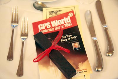
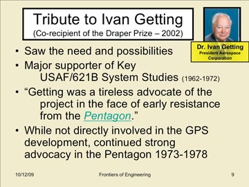
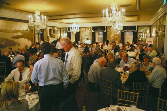
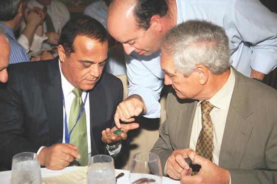
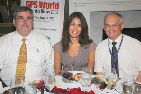
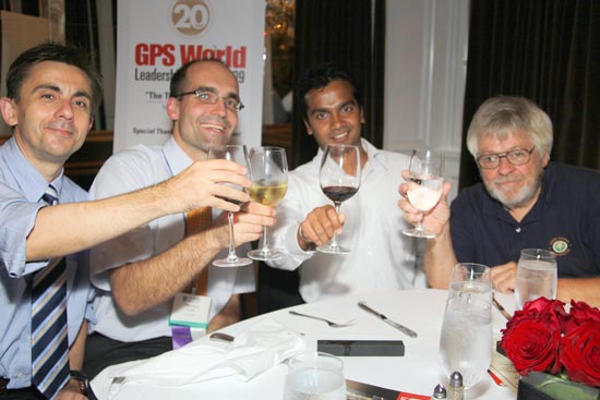
Photos from the GPS World Leadership Dinner 2009, September 24
ION GNSS 2009 Conference, Savannah, Georgia
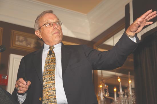
Bradford W. Parkinson, the first GPS Program Office director, chief architect, and advocate for GPS, relates “The True Story of the Origins of the Global Positioning System” and pays tribute to many of the people he worked with during that time.A slide from Parkinson’s presentation, which drew from previously classified reports as early as 1964–66. A text version of his history lesson will appear in an upcoming GPS World magazine.Keynote speaker Brad Parkinson with the evening’s hostess, publisher Kristina Panter.It’s hard to tell which shines brighter, the crystal chandeliers in Savannah’s Olde Pink House ballroom, or the many GNSS luminaries in attendance. Also sponsoring the Leadership Dinner were ITT and Spirent (Silver), and Trimble (Bronze).Greg Turetzky of SiRF Technology shows off his newest chip to Javad Ashjaee and Tom Hunter of JAVAD GNSS.
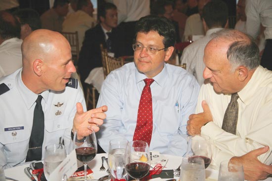
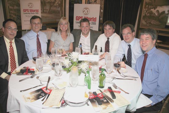
Col. David Goldstein, GPS Wing, converses with Art Gower of Lockheed Martin and Len Jacobson, Global Systems and Marketing (both members of GPS World’s Advisory Board).Lockheed Martin Space Systems was a Gold Sponsor of the dinner. From left are Todd Bender, Mike Shaw, Nancy Fitzgerald, Dan Hennessey, Bob Wright, Tom Hollenbach, and Daniel Reigh.
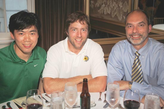
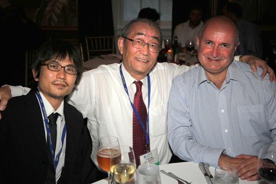
(from left) Sherman Lo, Stanford; Dennis Akos, U. Colorado/CSR; Mikel Miller, U.S. Air Force, ION president.(from left) Tomoya Shibata, Copla Corp.; Hiroshi Nishiguchi, Japan GPS Council; John Wilde, DW International.(from left) Carl Andren, ION; Donna Reay, Galileo Supervisory Authority; Hermann Ebner, European Commission, Galileo Unit.(from left) Attila Komjathy, JPL; Thomas Pany, iFen GmbH; Chaminda Basnyake, GM; Tom Nagle, GPS Wing.