Just in time for Halloween, Esri is providing a Story Map of Cities of the Dead, featuring historic and notable graveyards, cemeteries and crypts. Find out what may lurk near you…
Just in time for Halloween, Esri is providing a Story Map of Cities of the Dead, featuring historic and notable graveyards, cemeteries and crypts. Find out what may lurk near you…
Cross-Installed Hydrazine, Helium Lines Froze Thrusters
The root cause of the anomaly that sent two Galileo satellites into the wrong orbit on August 22 was a shortcoming in the system thermal analysis performed during stage design, and not an operator error during stage assembly, according to findings by an independent inquiry board.
The independent inquiry board was created by Arianespace, in conjunction with the European Space Agency and the European Commission. Its conclusions draw on data supplied by Russian partners in the program, and are consistent with the final conclusions of the inquiry board appointed by the Russian space agency Roscosmos.
The anomaly occurred during the flight of the launcher’s fourth stage, Fregat, designed and produced by NPO Lavochkin. It occurred about 35 minutes after liftoff, at the beginning of the ballistic phase preceding the second ignition of this stage.
The board’s conclusions confirm that the first part of the mission proceeded nominally, which means that the three-stage Soyuz launcher was not at fault. The inquiry board also eliminated the hypothesis that the anomaly could have been caused by the abnormal behavior of the Galileo satellites.
The scenario that led to an anomaly in the orbital injection of the satellites was precisely reconstructed, as follows:
The orbital error resulted from an error in the thrust orientation of the main engine on the Fregat stage during its second powered phase.
This orientation error was the result of the loss of inertial reference for the stage.
This loss occurred when the stage’s inertial system operated outside its authorized operating envelope, an excursion that was caused by the failure of two of Fregat’s attitude-control thrusters during the preceding ballistic phase.
This failure was due to a temporary interruption of the joint hydrazine propellant supply to these thrusters. The interruption in the flow was caused by freezing of the hydrazine.
The freezing resulted from the proximity of hydrazine and cold helium feed lines, these lines being connected by the same support structure, which acted as a thermal bridge.
Ambiguities in the design documents allowed the installation of this type of thermal “bridge” between the two lines. In fact, such bridges have also been seen on other Fregat stages now under production at NPO Lavochkin.
The design ambiguity is the result of not taking into account the relevant thermal transfers during the thermal analyses of the stage system design.
The system thermal analyses have been reexamined in depth to identify all areas concerned by this issue. The board has chosen these corrective actions for the return to flight.
Arianespace said these measures can immediately be applied by NPO Lavochkin to the stages already produced, meaning that the Soyuz launcher could be available for its next mission from the Guiana Space Center in December.
“We are looking at the resumption of Soyuz launches from the Guiana Space Center, as early as December 2014,” stated the Arianespace CEO. “The resolution of this anomaly will enable a consolidation of the reliability of Fregat, which had experienced 45 consecutive successes until this mission.”
Full Operability Set for 2020
The European GNSS Agency (GSA) and the European Commission have concluded an agreement that delegates a range of exploitation tasks for Galileo to the GSA, providing a framework and budget for the development of services and operations through 2021.
The signing of the Galileo Exploitation Delegation Agreement serves as an initial step towards the full Galileo Exploitation Phase. According to the governance structure set out in the agreement, the European Commission is responsible for the overall programme supervision, the European Space Agency (ESA) is entrusted with the deployment phase, while the GSA is responsible for the exploitation phase. The GSA’s responsibilities include:
“With Galileo, we aim to provide a tangible service to European citizens, and this Delegation Agreement ensures we have the tools and funding necessary to achieve this,” said GSA Executive Director Carlo des Dorides.
Full operability of Galileo is now scheduled for 2020, a slight revision of the previous 2018 projection.
The agreement specifically sets the actions to be implemented, the amount of funding provided, and the conditions for the overall management. The maximum current EU contribution amounts to EUR 490 million, which will cover procurement and grant activities, including the GSA-ESA working arrangements and a programme management reserve, along with related research and development activities. The financing of the full exploitation phase will be confirmed during a mid-term review before the end of 2016.
India successfully launched IRNSS-1C, the third satellite in the Indian Regional Navigation Satellite System (IRNSS), on October 16. The satellite was injected to an elliptical orbit of 282.56 x 20,670 kilometers, very close to its intended final geostationary orbit at 83 degrees East longitude.
IRNSS-1C is the third of the seven satellites constituting the space segment of the Indian Regional Navigation Satellite System. Tthe first two were launched in July 2013 and April of this year. Both are functioning satisfactorily from their designated geosynchronous orbital positions.
IRNSS is an independent regional navigation satellite system designed to provide position information in the Indian region and 1,500 kilometers around the Indian mainland. IRNSS will provide two types of services: Standard Positioning Services (SPS), provided to all users, and Restricted Services (RS), provided to authorized users. Ground stations have been established in at least 15 locations across India.
The next satellite of the constellation, IRNSS-1D, is scheduled to be launched in the coming months. The full IRNSS constellation of seven satellites is planned to be completed by 2015.
IRNSS ICD Released. In late September, the Indian Space Research Organization (ISRO) released version 1 of the IRNSS Signal in Space Interface Control Document (ICD) for the Standard Positioning Service.
The document provides information on the signals and structures of the IRNSS system, including signal modulations, frequency bands, received power levels, the data structures and their interpretations, and user algorithms.
Registration is required for ICD download access at a new IRNSS website.
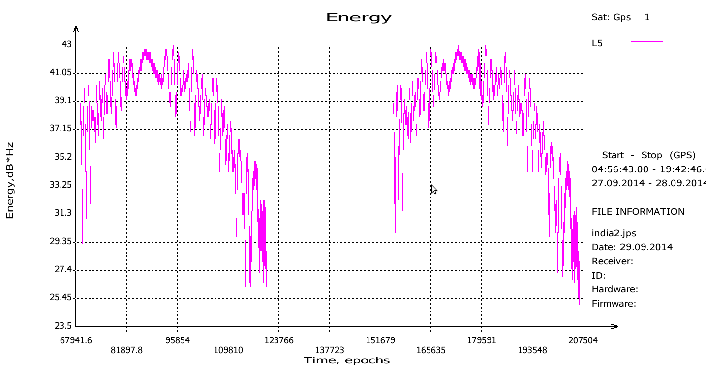
JAVAD Tracks Signal. JAVAD GNSS published a chart showing that it has tracked the IRNSS L5 signal.
Shortly after ISRO released its IRNSS Signal in Space Interface Control Document (ICD), JAVAD GNSS tracked the L5 BPSK signal from both 1A and 1B satellites. Ability to track IRNSS L5 will be added to all JAVAD L5-capable receivers in the near future, the company said.
As this magazine goes to press on October 23, the U.S. Air Force is set to launch the eighth GPS IIF satellite from Cape Canaveral Air Force Station on Wednesday, October 29. An 18-minute launch window will open at 1:21 p.m. U.S. Eastern time. If all goes well, the satellite will be accomplishing its early-orbit checkouts and beginning maneuvers towards its final orbital plane as U.S. children make their costumed Halloween rounds, collecting candy. Other Western countries celebrate All Hallows’ Eve followed by All Saints’ Day on November 1.
Ten years ago, scientists watching the skies experienced a Halloween fright of cosmic proportions, when space weather degraded GPS signals, affecting land and ocean surveys, and commercial and military aircraft navigation.
The most extreme of what became known as the Halloween Storms hit on October 30, 2003 — ten years ago today. According to the National Oceanic and Atmospheric Agency, the Earth could experience a repeat performance this Halloween, with a 35 percent chance of a major storm at high latitudes.
The U.S. Geological Survey describes the cause of the 2003 storms:
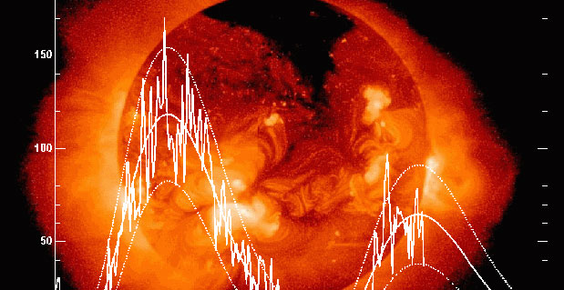
In mid-October 2003, a bundle of concentrated magnetic energy emerged from the Sun’s interior, forming a large sunspot, a site of seething activity. Enormous solar flares soon followed.
Then, on October 28, the sunspot abruptly ejected a concentrated mass of electrically conducting solar wind, flinging it out into interplanetary space toward the Earth. Less than a day later, on October 29, a geomagnetic storm was initiated as the solar wind disrupted the Earth’s protective magnetosphere.
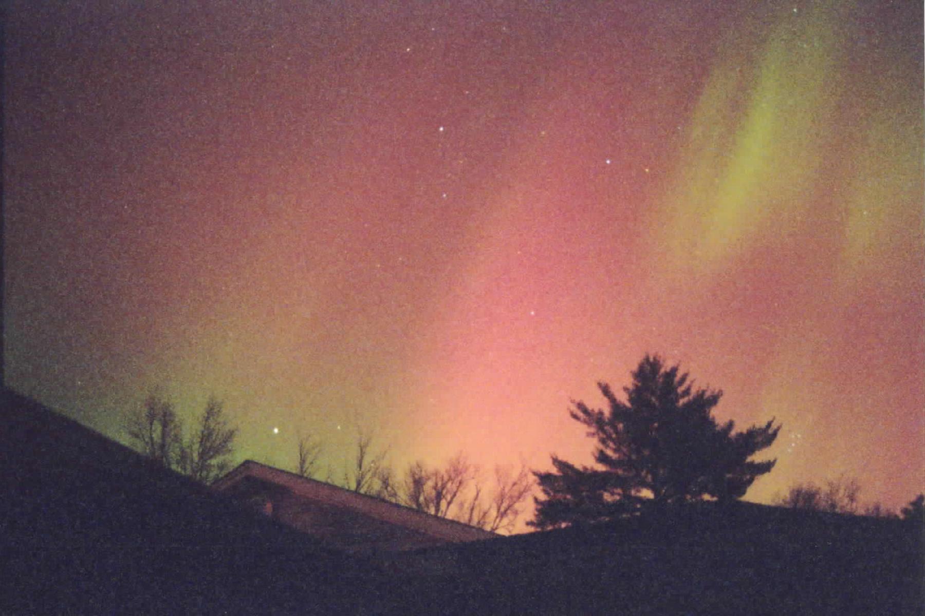
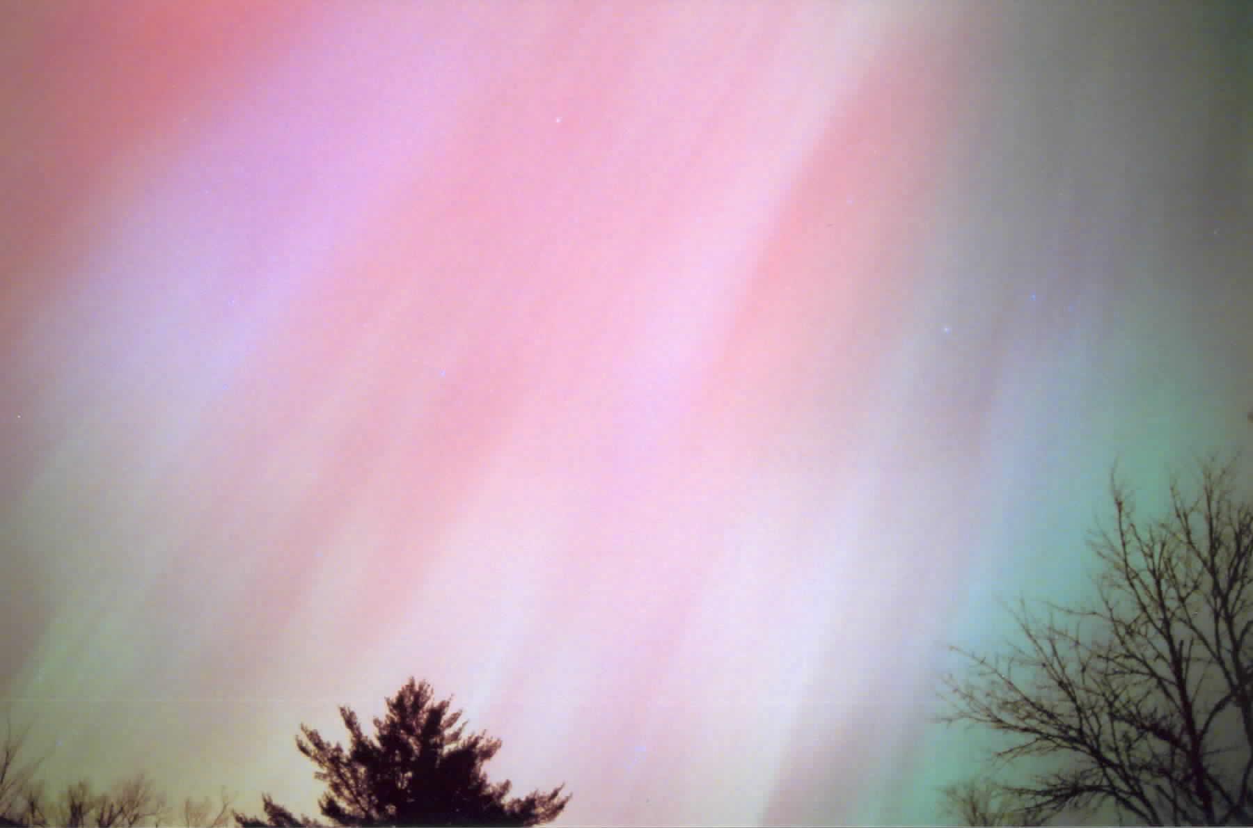
Over the next three days, the “Halloween magnetic storm” would evolve and grow to become one of the largest such storms in half a century. Magnetic storms are global phenomena, and their effects can be easily seen around the world. During the Halloween storm, for example, magnetic direction in Alaska quickly changed by more than 20 degrees. In other words, the storm was so large that it could be measured with a simple compass. The Halloween magnetic storm also produced spectacular aurora, with green phantom “northern lights” seen as far south as Texas and Florida.
“The aurora was exciting,” said Richard Langley, GPS World’s Innovation editor. “I’ve never seen a better one since.”
Langley explained the effect of the phenomenon in his introduction to the October 2004 Innovation article, “Combating the Perfect Storm: Improving Marine Differential GPS Accuracy with a Wide-Area Network.”
It was previously thought that the mid-latitude North American ionosphere was reasonably benign, with minimal storm effects of relevance for marine DGPS users. However, during ionospheric storms in May and October, 2003, [single-frequency] marine DGPS horizontal position accuracies were degraded by factors of 10–30.These degraded accuracies persisted for hours and were well beyond system tolerances specified for marine DGPS users. Such ionospheric activity is not unusual during the years following solar maximum, and is expected to persist for several years.
Langley provides background on what scientists learned from the Halloween Storms in his February 2011 Innovation column, “GNSS and the Ionosphere: What’s in Store for the Next Solar Maximum?”:
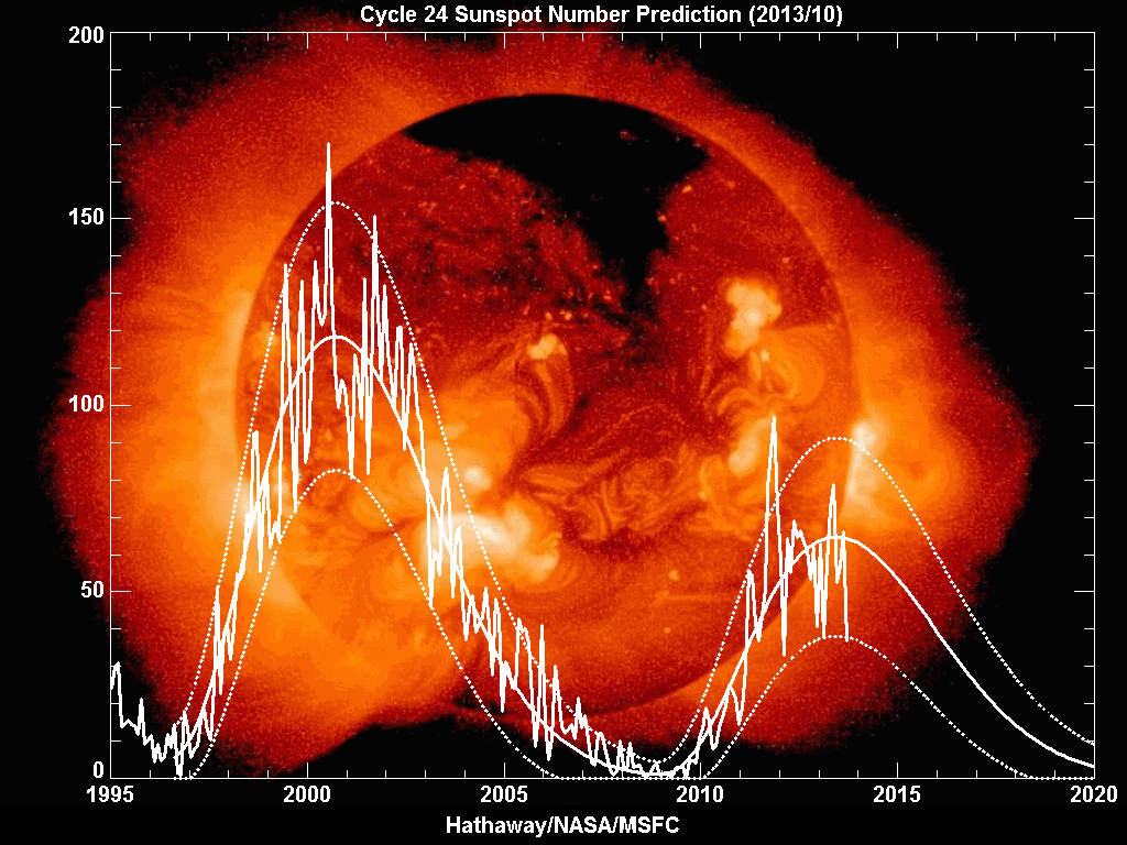
The current solar cycle is referred to as cycle 24. During the last solar cycle, cycle 23, the GNSS community was alert and aware of what could happen, and therefore many events were observed and analyzed. Among the most well-known events is a sequence of storms during October and November 2003, commonly referred to as the Halloween Storms.
The most extreme was the storm on October 30, 2003, which resulted from a CME on October 29 at 20:49 UTC, which subsequently impacted Earth’s magnetic field at 16:20 UTC on October 30 and produced a great geomagnetic storm, which lasted for many hours.
Effects on GPS positioning of this storm have been documented by the GNSS research group of the Royal Observatory of Belgium, where kinematic analyses of data from 36 GNSS stations in Europe showed position errors of more than 10 centimeters in the horizontal and up to 26 centimeters in the vertical between 21:00 and 22:00 UTC on October 30. The position errors were largest for locations in northern Europe including Sweden and Norway. The data analysis was carried out using high-quality carrier-phase data, and the processing was based on using an ionosphere-free linear combination of observations from the L1 and L2 frequencies, whereby the first-order effect of the ionosphere is removed from the results. The position errors are thus caused by mainly higher order ionospheric effects.
For navigation-grade GPS positioning, a U.S. National Atmospheric and Oceanic Administration technical memorandum reported that the Wide Area Augmentation System (WAAS) vertical error limit of 50 meters was exceeded for a period of about 11 hours on October 30, 2003. This means that, in practice, WAAS was not available for precision aircraft approaches during that time. The European Geostationary Navigation Overlay Service (EGNOS) was not transmitting during the storm, but simulations carried out later by ESA showed that the boundary regions of the EGNOS coverage area would have been especially affected by a reduction in service availability of about 20–60 percent during that day.
The simulations also showed, however, that in the center of the EGNOS coverage area (in the vicinity of northern Italy), the effect would have been much smaller with a reduction in service availability of only 5–6 percent over the day.
Such large storms are also often accompanied by displays of aurora (aurora borealis and aurora australis) at lower latitudes than normal.
Other Innovation columns assessing the ionosphere’s effect on GPS include:
