Tag: high altitude

  • EMCORE INS achieves success in CAST Navigation ultra-high-altitude flight simulation

    EMCORE INS achieves success in CAST Navigation ultra-high-altitude flight simulation

    Photo: Systron Donner
    Photo: Systron Donner

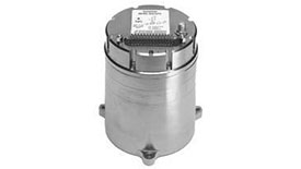
    Emcore achieved success in an ultra-high-altitude flight simulation conducted by CAST Navigation, which tested Emcore’s SDN500 inertial navigation system (INS).

    Emcore is a provider of advanced mixed-signal products that serve the aerospace & defense and broadband communications markets.CAST Navigation builds simulators for testing and validating GNSS/INS performance in high-end navigation systems.

    CAST used Emcore’s SDN500 inertial navigation system (INS) for the test, which required simulating performance at an altitude more than 24,000 meters and velocities over 600 m/s. Only a few aircraft in the world have such capabilities, including the SR-71 Blackbird, but it is not practical to participate in a test flight on the SR-71. Simulating the SDN500 INS test flight to specific customer profiles on a CAST system is straightforward and cost-effective.

    Testing began with a stationary period on the ground while the SDN500 initialized and transitioned into air-navigation mode. Then the flight trajectory entered a series of maneuvers, speed and altitude changes that provided observability for various parameters with corresponding changes in the calculated figures.

    Emcore relies on GNSS/INS simulators for hardware-in-the-loop testing to verify the expected performance of algorithms. Emcore CORE sought to validate the velocity and altitude limits of a new GNSS receiver along with the algorithm performance in a tactical-grade SDN500 system. In the final analysis, the GNSS receiver and navigation algorithm was confirmed to operate as expected throughout the operation for all three of the customer’s dynamic constraint scenarios.

    “We were extremely pleased to demonstrate how Emcore takes advantage of the functionality contained in the CAST simulator to prove-out our robust product performance in customer environments,” said David Hoyh, director of sales and marketing for navigation products, Emcore..

    “During the times when there was no valid solution from the GNSS receiver, the algorithm maintained an accurate solution using only the data from the IMU,” explained Andy Williams, senior field application engineer at Emcore who spearheaded the effort. “In addition, there was no algorithm instability or discontinuity when the GNSS receiver resumed, providing a solution to the algorithm. Throughout this entire profile, even when GNSS signal is lost, the SDN500 maintains an accurate navigation solution. This test is not possible without the synchronized GNSS radio frequency and trajectory matching IMU data provided by the CAST system.”


    Source: “A True Reference. Theory Meets Reality in Synchronized Simulation Environments,” Inside GNSS, Volume 15/Number 5, September/October 2020, Pages 28, 29, 30.

  • ESA investigates high-altitude pseudo-satellites for Earth observation

    News from the European Space Agency

    High-altitude pseudo-satellites (HAPS) are platforms that float or fly at high altitude like conventional aircraft but operate more like satellites. (Image: ESA Earth Observation Graphics Bureau)

    The European Space Agency (ESA) is considering extending its activities to a new region of the sky via a novel type of aerial vehicle, a missing link between drones and satellites.

    High-altitude pseudo-satellites, or HAPS, are platforms that float or fly at high altitude like conventional aircraft but operate more like satellites — except that rather than working from space, they can remain in position inside the atmosphere for weeks or even months, offering continuous coverage of the territory below.

    The best working altitude is about 20 kilometers, above the clouds and jet streams, and 10 kilometers above commercial airliners, where wind speeds are low enough for them to hold position for long periods.

    From such a height they can survey the ground to the horizon 500 km away, variously enabling precise monitoring and surveillance, high-bandwidth communications or back up to existing satellite navigation services.

    Several ESA directorates have teamed up to investigate their potential, explains future-systems specialist Antonio Ciccolella.

    “For Earth observation, they could provide prolonged high-resolution coverage for priority regions, while for navigation and telecoms they could shrink blind spots in coverage and combine wide bandwidth with negligible signal delay,” Ciccolella said.

    “ESA is looking into how these various domains can be best brought together.”

    “We’ve been looking into the concept for the last 20 years but now finally it’s becoming reality,” explained Earth observation specialist Thorsten Fehr.

    “That’s come about through the maturing of key technologies: miniaturised avionics, high-performance solar cells, lightweight batteries and harness, miniaturisation of Earth observation sensors and high-bandwidth communication links that can deliver competitively priced services.”

    Navigation engineer Roberto Prieto Cerdeira added, “There’s obvious potential for emergency response. They could also be employed semi-permanently, perhaps extending satnav coverage into high, narrow valleys and cities.”

    The QinetiQ-designed and Airbus-owned Zephyr-7 solar-powered unmanned aircraft holds the world flight endurance record at 14 days. (Photo: Airbus)

    European companies have already unveiled product lines. For instance, Airbus has developed the winged, solar-powered Zephyr, which in 2010 achieved a world record 14 days of continuous flight without refuelling.

    The Zephyr-S is designed to fly payloads of a few tens of kilograms for up to three months at a time, with secondary batteries employed to keep it powered and aloft overnight. A larger Zephyr-T version now in preparation will support larger payloads and power needs.

    The first flight is projected for 2021 for Thales Alenia Space’s Stratobus airship. (Artist’s rendering: Thales Alenia Space/Briot)

    Meanwhile, Thales Alenia Space is preparing the lighter-than-air Stratobus, with its first flight expected in 2021.

    The buoyant Stratobus airship can carry up to 250 kilograms, its electric engines flying against the breeze to hold itself in position, relying on fuel cells at night.

    Many other firms are also developing vehicles, payloads and services. Last month saw them gathered at ESA’s inaugural workshop, together with representatives of potential customers, including the European Defence Agency, Frontex — the EU agency tasked with Europe’s border management — and EU Copernicus environmental monitoring services.

    Airbus’s double-tailed Zephyr-T variant HAPS aircraft is designed to support larger payloads, keeping them aloft for months at a time. (Image: Airbus)

    “This was the first meeting of its kind in Europe, with more than 200 HAPS experts” explains Juan Lizarraga Cubillos, from ESA’s telecoms area.

    “We heard from them on the needs, opportunities and critical issues within the field, particularly as a complement for existing satellite services, to start preparing a future ESA programme.”

    ESA regards the vehicles as a valuable way of establishing applications that complement its satellites while also accelerating space technologies through early, high-altitude flight testing.

    The point was also made that market acceptance of HAPS would come down to their efficiency and cost-effectiveness — and the best way to show that would be through demonstration projects.

    “We have to fly them,” remarked Alvaro Rodriquez of the EU’s Satellite Centre. “The technology is there, all the ingredients are there, now it’s time to mix them into a nice recipe.”

    Thales Alenia Space’s Stratobus is topped with solar panels, powering its propellers to fly against the wind at 20 km for prolonged periods of service. (Image: Airbus)
  • ESA investigates high-altitude pseudo-satellites

    ESA investigates high-altitude pseudo-satellites

    News from the European Space Agency

    High-altitude pseudo-satellites (HAPS) are platforms that float or fly at high altitude like conventional aircraft but operate more like satellites. (Image: ESA Earth Observation Graphics Bureau)

    The European Space Agency (ESA) is considering extending its activities to a new region of the sky via a novel type of aerial vehicle, a missing link between drones and satellites.

    High-altitude pseudo-satellites, or HAPS, are platforms that float or fly at high altitude like conventional aircraft but operate more like satellites — except that rather than working from space, they can remain in position inside the atmosphere for weeks or even months, offering continuous coverage of the territory below.

    The best working altitude is about 20 kilometers, above the clouds and jet streams, and 10 kilometers above commercial airliners, where wind speeds are low enough for them to hold position for long periods.

    From such a height they can survey the ground to the horizon 500 km away, variously enabling precise monitoring and surveillance, high-bandwidth communications or back up to existing satellite navigation services.

    Several ESA directorates have teamed up to investigate their potential, explains future-systems specialist Antonio Ciccolella.

    “For Earth observation, they could provide prolonged high-resolution coverage for priority regions, while for navigation and telecoms they could shrink blind spots in coverage and combine wide bandwidth with negligible signal delay,” Ciccolella said. “ESA is looking into how these various domains can be best brought together.”

    “We’ve been looking into the concept for the last 20 years but now finally it’s becoming reality,” explained Earth observation specialist Thorsten Fehr. “That’s come about through the maturing of key technologies: miniaturised avionics, high-performance solar cells, lightweight batteries and harness, miniaturisation of Earth observation sensors and high-bandwidth communication links that can deliver competitively priced services.”

    “There’s obvious potential for emergency response,” added Navigation engineer Roberto Prieto Cerdeira. “They could also be employed semi-permanently, perhaps extending satnav coverage into high, narrow valleys and cities.”

    The QinetiQ-designed and Airbus-owned Zephyr-7 solar-powered unmanned aircraft holds the world flight endurance record at 14 days. (Photo: Airbus)

    European companies have already unveiled product lines. For instance, Airbus has developed the winged, solar-powered Zephyr, which in 2010 achieved a world record 14 days of continuous flight without refuelling.

    The Zephyr-S is designed to fly payloads of a few tens of kilograms for up to three months at a time, with secondary batteries employed to keep it powered and aloft overnight. A larger Zephyr-T version now in preparation will support larger payloads and power needs.

    The first flight is projected for 2021 for Thales Alenia Space’s Stratobus airship. (Artist’s rendering: Thales Alenia Space/Briot)

    Meanwhile, Thales Alenia Space is preparing the lighter-than-air Stratobus, with its first flight expected in 2021.

    The buoyant Stratobus airship can carry up to 250 kilograms, its electric engines flying against the breeze to hold itself in position, relying on fuel cells at night.

    Many other firms are also developing vehicles, payloads and services. Last month saw them gathered at ESA’s inaugural workshop, together with representatives of potential customers, including the European Defence Agency, Frontex — the European Union (EU) agency tasked with Europe’s border management — and EU Copernicus environmental monitoring services.

    Airbus’s double-tailed Zephyr-T variant HAPS aircraft is designed to support larger payloads, keeping them aloft for months at a time. (Image: Airbus)

    “This was the first meeting of its kind in Europe, with more than 200 HAPS experts,” said Juan Lizarraga Cubillos, from ESA’s telecoms area. “We heard from them on the needs, opportunities and critical issues within the field, particularly as a complement for existing satellite services, to start preparing a future ESA programme.”

    ESA regards the vehicles as a valuable way of establishing applications that complement its satellites while also accelerating space technologies through early, high-altitude flight testing.

    The point was also made that market acceptance of HAPS would come down to their efficiency and cost-effectiveness — and the best way to show that would be through demonstration projects.

    “We have to fly them,” said Alvaro Rodriquez of EU’s Satellite Centre. “The technology is there, all the ingredients are there, now it’s time to mix them into a nice recipe.”

    Thales Alenia Space’s Stratobus is topped with solar panels, powering its propellers to fly against the wind at 20 km for prolonged periods of service. (Image: Airbus)
  • UAV reaches new heights in Tibet

    sirius_altitude_record_2016-WIn the Himalayas, MAVinci GmbH has operated a Sirius Pro unmanned aircraft system (UAS) at an altitude of 4,800 meters above sea level (ASL).

    “Take-off altitude was 4,150 meters ASL. The flight was performed at BaSu County, ChangDu, Tibet,” the company shared in an email. “This is a new altitude record for us! Thank you to everyone who supported this mission!”

    MAVinci manufactures UAS for surveying professionals, designed to enable easy and quick surveying and documentation.

    The MAVinci Surveying Sirius Pro is manufactured in Germany. It is a fixed wing UAV with a 1.6-meter wingspan and less than 3-kilogram take-off weight.

    The Siruis Pro guarantees high precision without setting control points on the ground, according to MAVinci.

    Using a Topcon receiver and navigation system, it precisely measures the camera position for each image, making it equivalent to a control point. With the control points virtually set from the air during the flight, their coordinates calculated in real time.