Tag: iceberg

  • Seen & Heard: White giraffe, approaching iceberg

    Seen & Heard: White giraffe, approaching iceberg

    “Seen & Heard” is a monthly feature of GPS World magazine, traveling the world to capture interesting and unusual news stories involving the GNSS/PNT industry.


    Photo: Lukassek/iStock/Getty Images Plus/Getty Images
    Photo: Lukassek/iStock/Getty Images Plus/Getty Images

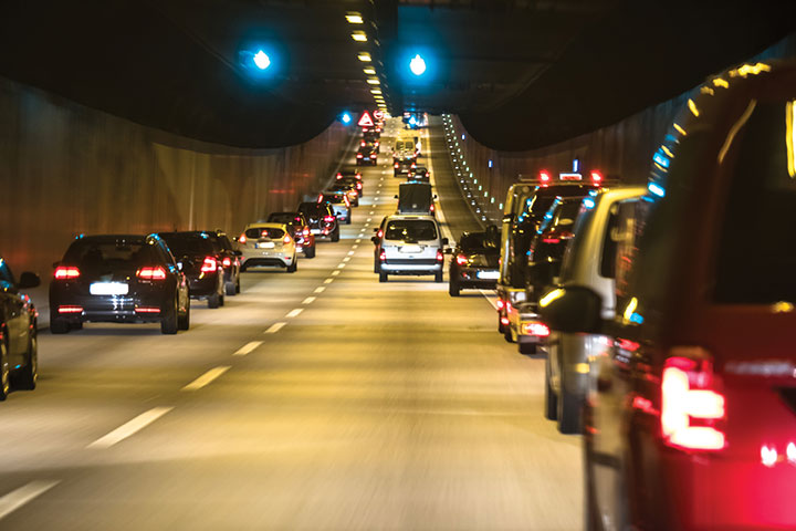
    The light at the end of the tunnel

    The city of Prague started testing a system of GNSS repeaters to prevent the loss of satellite signal in the city’s tunnels. The system, which should make life easier for drivers who rely on car navigation technology, is being tested in Prague’s Blanka tunnel. If it proves successful, the municipality wants to install the devices in other strategic locations around the city, especially at intersections as well as tunnel entries and exits.
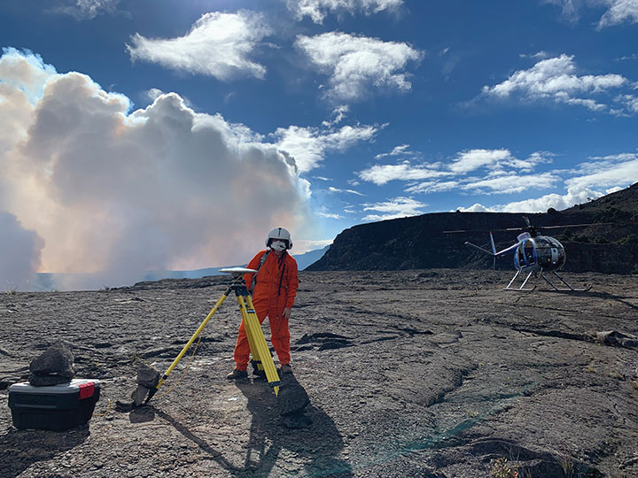

    Photo: A. Ellis/USGS
    Photo: A. Ellis/USGS

    On the hot spot

    While permanent monitoring receivers are scattered about Hawaii’s active volcano sites, additional GPS receivers are being deployed during the ongoing eruption of Kilauea. In this photo taken Dec. 21, 2020, a Hawaiian Volcano Observatory geophysicist deploys receivers on the caldera floor in Hawai‘i Volcanoes National Park to measure changes in ground motion. The gas plume from the summit eruption within Halema‘uma‘u crater is visible in the background.
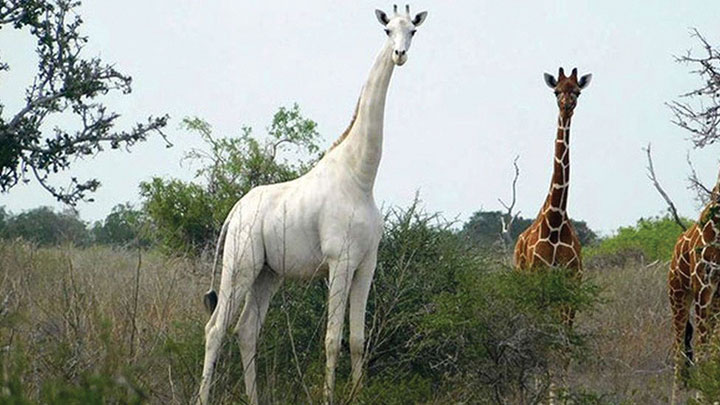

    Photo: Ishaqbini Community Conservancy
    Photo: Ishaqbini Community Conservancy

    Last but not least

    The last white giraffe known in existence now sports a GPS tracker, reports BBC News. The male giraffe has a rare genetic trait called leucism that causes the unusual color. The giraffe was tranquilized in November and the tracker placed on one of its horns. Tracking will help protect it from poachers as it grazes in Kenya’s savannah near the Somalia border. The white giraffe is alone after a female and her calf were killed by poachers in March 2020, according to Ishaqbini Hirola Community Conservancy.
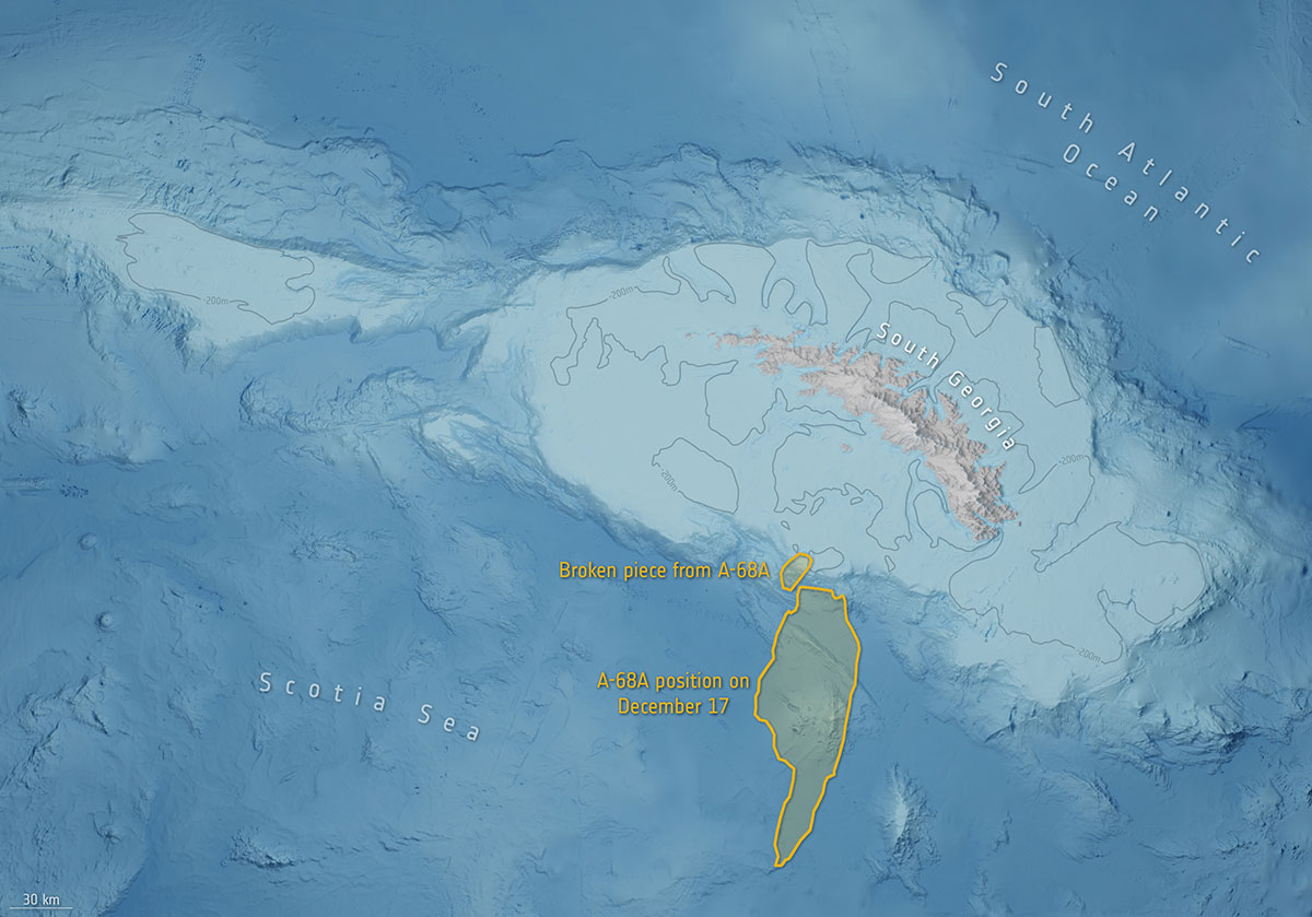
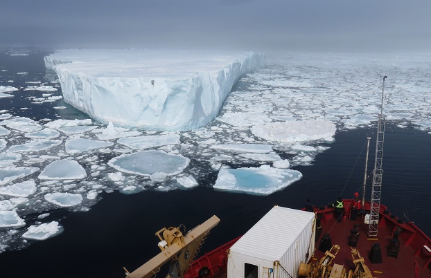
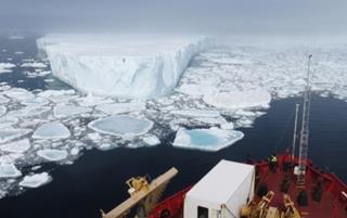

    Photo: British Antarctic Survey/ESA
    Photo: British Antarctic Survey/ESA

    The biggest loser

    In July 2017, an iceberg more than twice the size of Luxembourg broke off Antarctica’s Larsen C ice shelf and began traveling the Southern Ocean. Looming in its path is South Georgia Island, home to numerous species of wildlife threatened by the massive iceberg, designated A-68A. Europe’s Copernicus Sentinel satellites observed pieces breaking off of A-68A in December, each large enough to receive its own designation.

  • Esri explains how mapping technology is used for marine safety

    Esri’s Jesse Smith discusses how the U.S. Coast Guard’s International Ice Patrol is using Esri’s ArcGIS Enterprise platform to improve marine safety at the 2019 Esri User Conference in San Diego. Currently, the organization is using the platform to map, observe and track icebergs.

  • Frozen Assets: GeoDecisions Platform Tracks Icebergs

    Frozen Assets: GeoDecisions Platform Tracks Icebergs

    Drifting tabular icebergs viewed from the Amundsen. (Photo courtesy of Greg McCullough, University of Manitoba)
    Drifting tabular icebergs viewed from the Amundsen. (Photo courtesy of Greg McCullough, University of Manitoba)

    A Canadian expedition team used GeoDecisions’ GeoILS platform to help track icebergs during a voyage to better understand how icebergs drift. An intelligent location server using the Esri ArcGIS platform, GeoILS enables users to monitor and locate assets and facilitate quick and coordinated responses.

    GeoDecisions, an information technology company specializing in geospatial solutions, partnered with Solara Remote Data Delivery Incorporated, Canada’s Carleton University and Esri during the project.

    The FT2000IB Solara tracker. (Photo by Tom Tessier)
    The FT2000IB Solara tracker. (Photo by Tom Tessier)

    Led by University of Manitoba Scientist David Barber, the crew of Canadian Coast Guard icebreaker Amundsen sailed off the coast of Newfoundland and Labrador to research ice hazard mitigation, the effects of climate change, and polar region technology requirements. GeoILS location intelligence helped crew members visualize, analyze, and leverage project-pertinent data.

    “During the expedition, researchers and scientists used GeoILS to assess drifting through sensor monitors attached to the icebergs,” said Brian Smith, vice president of commercial solutions with GeoDecisions. “In addition to reporting and notifications, GeoILS provided the project team with maps that were tailored by selecting desired iceberg information and the geographic area of interest based on user-defined criteria.”

    GeoDecisions’ data portal was used with Iridium Solara tracking devices during the iceberg research project. Two icebergs were outfitted with FT2000IB Solara trackers, explained Derek Mueller, assistant professor and physical geography program supervisor with Carleton University.

    THE GROUND control point and beacon. (Photo by Derek Mueller)
    THE GROUND control point and beacon. (Photo by Derek Mueller)

    For each iceberg, two beacons were attached for redundancy and to determine the iceberg’s rotation. Holes were drilled and stakes inserted, then GeoDecisions Platform Tracks Icebergs the trackers attached to the stakes.

    The trackers were also used as ground control points for photogrammetry, specifically the structure from motion ranging imaging technique.

    “GeoILS and the satellite tracking beacons worked very well during this project,” Mueller said. “Thanks to our partners’ efforts, we now have a great new suite of tools for examining our data.”

    “We are excited to provide tools to scientists who are gaining critical insights into the behavior of icebergs and global climate change,” said Tom Tessier, president of Solara Remote Data Delivery Incorporated.

    The last tracker stopped transmitting on June 13. “The others ended earlier, likely because the iceberg rolled or broke up,” Mueller said.

    The data will eventually be made public on the Polar Data Catalogue.

    A representative snapshot of GeoILS’ features and range of functionality used during the Canadian iceberg expedition.
    A representative snapshot of GeoILS’ features and range of functionality used during the Canadian iceberg expedition.
  • Cold Assets: GeoDecisions Platform Used to Track Icebergs

    Cold Assets: GeoDecisions Platform Used to Track Icebergs

    This photo shows drifting icebergs from the Amundsen during research expedition. (Photo: courtesy of Greg McCullough, University of Manitoba)
    This photo shows drifting icebergs from the Amundsen during research expedition. (Photo: courtesy of Greg McCullough, University of Manitoba)

    A Canadian expedition team used GeoDecisionsGeoILS platform to help track icebergs during a voyage to better understand how icebergs drift. An intelligent location server using the Esri ArcGIS platform, GeoILS enables users to monitor and locate assets and facilitate quick and coordinated responses.

    GeoDecisions, an information technology company specializing in geospatial solutions, partnered with Solara Remote Data Delivery Incorporated, Canada’s Carleton University and Esri during the project.

    Led by University of Manitoba Scientist David Barber, the crew of Canadian Coast Guard Icebreaker Amundsen sailed off the coast of Newfoundland and Labrador to research ice hazard mitigation, the effects of climate change, and polar region technology requirements. GeoILS location intelligence helped crew members visualize, analyze, and leverage project-pertinent data.

    “During the expedition, researchers and scientists used GeoILS to assess drifting through sensor monitors attached to the icebergs,” said Brian Smith, vice president of commercial solutions with GeoDecisions. “In addition to reporting and notifications, GeoILS provided the project team with maps that were tailored by selecting desired iceberg information and the geographic area of interest based on user-defined criteria.”

    Above is a representative snapshot of GeoILS’ features and range of functionality used during the Canadian iceberg expedition.
    Above is a representative snapshot of GeoILS’ features
    and range of functionality used during the
    Canadian iceberg expedition.

    GeoDecisions’ data portal was used with Iridium Solara tracking devices during the iceberg research project. “We are excited to provide tools to scientists who are gaining critical insights into the behavior of icebergs and global climate change,” said Tom Tessier, president of Solara Remote Data Delivery Incorporated.

    Solara Field Tracker 2000.
    Solara Field Tracker 2000.

    “GeoILS and the satellite tracking beacons worked very well during this project,” added Derek Mueller, assistant professor and physical geography program supervisor with Carleton University. “Thanks to our partners’ efforts, we now have a great new suite of tools for examining our data.”