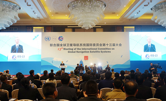
The United Nations’ International Committee on GNSS (ICG) held its 13th meeting in Xi’an, China, Nov. 4-9. Attendees included the four major GNSS: GPS (United States), GLONASS (Russia), BeiDou (China) and Galileo (Europe). Also attending were representatives from Japan, India and delegates from 16 countries and regions.
Members called for further strengthening of the interoperability and transparency of GNSS to help more countries enjoy the developments in positioning, navigation and timing, according to China Global Television Network.
On Nov. 7, China and Russia signed a cooperation agreement for BeiDou and GLONASS, stressing that the two systems begin testing service aims for countries along China’s Belt and Road.
More than 400 delegates across the world also watched the demonstration of applications based on China’s BeiDou system, which includes drones and vehicle positioning technology that could be used by self-driving cars.
The positioning system was tested on a bus with accuracy reaching millimeters, as shown in a video on this page. This technology lays the foundation for the management of urban traffic.
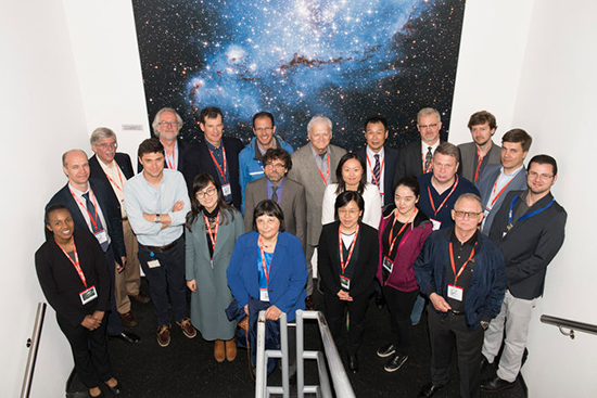
Delegates from the UN’s International Committee Global Navigation Systems (UN ICG) at the entrance to ESA’s ESTEC Test Centre, used to test the last 22 Galileo satellites. (Photo: ESA)
The UN ICG group visited ESTEC on May 16 during a meeting in the Netherlands.
News from the European Space Agency (ESA)
Members of the United Nations (UN) technical group supporting global cooperation in satellite navigation toured ESA’s technical centre in the Netherlands to see key facilities used to develop Europe’s Galileo system.
Delegates from the UN’s International Committee on Global Navigation Systems (UN ICG) met in mid-May at the nearby Galileo Reference Centre, operated by the GSA, European Global Navigation Satellite Systems Agency.
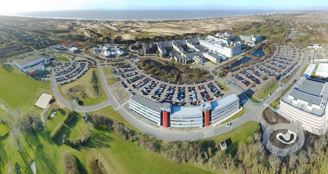
ESA, one of the founding members of the ICG in 2005, invited them to visit the agency’s European Space Research and Technology Centre, ESA’s single largest establishment and home to its Navigation Directorate.
Javier Benedicto, ESA’s Galileo program manager was joined by Rodrigo Da Costa, GSA’s Head of Exploitation, in giving the visitors a hearty welcome. “I’m honored to work with the amazing team of engineers and managers responsible for developing the Galileo system,” Benedicto said. “The laboratory and testing facilities here are very much at the heart of Galileo development.”
ESA’s Receiver Testing Facility is the historic location of the first Galileo positioning fix in 2012. (Photo: ESA)
“I’m very happy to welcome members of the UN ICG group, doing a great job in bringing navigation satellite system operators together, to share achievements and challenges and encourage interoperability – our users love our systems working together.”
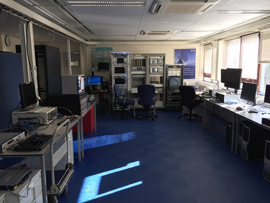
The tour began at ESA’s Receiver Testing Facility — historic location of the world’s very first Galileo positioning fix back in 2012 – equipped with a multitude of specialized satnav receivers for not only Galileo satellites but also the US GPS, Russian Glonass, Chinese BeiDou, India’s NAVIC and Japanese QZSS systems, together with augmentation systems such as Europe’s own European Geostationary Navigation Service, EGNOS. The signals from all these systems can also be recorded to very high fidelity for subsequent investigation or reuse.
Lab simulation systems can recreate all these outputs in combination to test receiver systems across a huge range of scenarios, such as amid interference induced by a solar storm, or to see how receivers cope while flying, or even in orbit.
Smartphone receivers can be assessed with simulated augmentation from cellular network stations, wifi mapping or inertial navigation, while simulating their user’s continuous motion. The flexibility the facility’s simulators offer also allows early testing of enhancements planned for next decade’s ‘Galileo Second Generation’ satellites.
“Our aim is to go closer to the market, and how they’re doing things because how current services are being exploited is very important for developing the next generation,” said Olivier Smeyers of ESA’s Commercial User Segment Section.
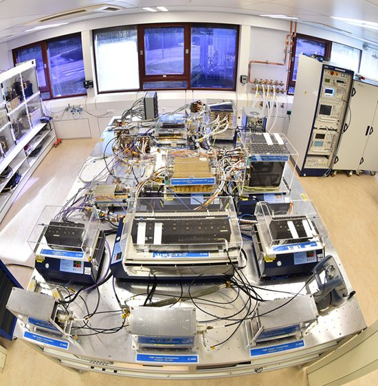
This table in ESA’s Galileo Payload Laboratory comprises a replica Galileo In-Orbit Validation satellite payload (other than its atomic clocks, which are housed separately nearby). Kept in cleanroom conditions at ESTEC in the Netherlands, it is employed for ground-based testing or anomaly investigation. (Photo: ESA)
Next came the Galileo Processing Centre, which provides ESA with continuous monitoring of Galileo services. It functions independently from the rest of the global Galileo infrastructure, to allow independent assessment of its performance, down to individual satellites and the onboard atomic clocks at the heart of the system — working closely with facilities such as the Galileo Time Validation Facility in Spain and the Galileo Control Centres in Germany and Italy.
The group was also shown ESA’s Time and Metrology Facility: an ensemble of six high-performance atomic clocks sufficiently stable to monitor the nanosecond-scale performance of Galileo System Time, and since 2012 maintaining their own timescale called UTC (ESTC), employed in turn to help set Coordinated Universal Time (UTC) — the world’s global time.
The cleanroom environment of the Galileo Payload Laboratory contains the same atomic clocks flown aboard Galileo satellites with the rest of its navigation payload, used to replicate any performance anomalies identified in orbit and make early tests of Galileo Second Generation design improvements.
“ESA is a very active member of UN ICG,” commented Rafael Lucas Rodriguez of ESA’s Galileo Services Engineering Unit and tour organizer. “We’re currently co-chairing an ICG working group on system performance enhancement and supporting the European Commission and GSA on all Galileo-related technical matters discussed at the committee.”
An aerial view of ESTEC. The Erasmus building is at front right. The T building (home to ESA’s Galileo team) is in the foreground.
By Li Wang, Director of the International Cooperation Center, China Satellite Navigation Office
By adhering to the principles of independence, openness, compatibility, and gradualness, China is steadily accelerating the construction and development of the BeiDou Navigation Satellite System.
The BeiDou System already provides continuous and reliable Full Operational Services to most parts of the Asia-Pacific region. Its positioning, navigation, and timing performance keeps improving, while the deployment for a global constellation is also making progress. The BeiDou System and its products, which are compatible with other navigation satellite systems, have been gradually applied in many sectors and industries related to the national economy and to entering the mass market.
As one of the four core GNSS service providers, BeiDou has always made unswerving efforts to exchange, coordinate, and cooperate with other organizations, system providers, and users.
BeiDou has been actively engaged in international affairs on the platform of the United Nations, such as participation in related activities held by the International Committee on Global Navigation Satellite Systems (ICG), and coordinated affairs under the framework of the International Telecommunication Union (ITU). It has also pushed forward the integrated applications of BeiDou and other navigation satellite systems in the fields of civil aviation, maritime traffic, mobile communication, and so on.
In order to provide better services for global users, the BeiDou system has carried out exchanges and coordination with the other navigation satellite systems. It has established cooperative mechanisms with GPS and GLONASS, and respectively signed the Joint Statement of U.S.-China Civil Global Navigation Satellite Systems (GNSS) Cooperation, as well as the Memorandum of Understanding between China and Russia on Cooperation in the Field of Satellite Navigation. Furthermore, the cooperation between the BeiDou and Galileo systems has also been included into the China-EU 2020 Strategic Agenda for Cooperation.
Potential areas for cooperation may include compatibility and interoperability, GNSS applications, policies and standards, international GNSS service performance monitoring and assessment, and so on.
Meanwhile, the BeiDou System continues carrying out the BeiDou/GNSS Application Demonstration & Experience Campaign (BADEC) and has negotiated with related countries to jointly establish BeiDou/GNSS Centers. Those centers will implement BeiDou/GNSS popularization, exhibition, application demonstration, and user experience activities, as well as system performance testing and assessment, academic exchanges, training, and R&D, to jointly promote the compatibility and interoperability among the multiple navigation satellite systems, boost the spread of technologies, and improve satellite navigation applications and industrial development..
In 2015, China will continue this effort, launching four to five next-generation BeiDou Navigation Satellites (MEO and IGSO) for testing and verification of new technologies.The BeiDou System with global coverage will completely be established by around 2020. This will enable provision of continuous, stable, and reliable satellite navigation services for global users.
Global navigation satellite systems and related industries are going through an unprecedented revolution. Under such an environment, compatibility and interoperability among systems, and integration of multiple industries, will be the tendencies of future, which will definitely promote wide applications of GNSS in broadening fields. During such a process, the BeiDou System with distinctive characteristics will abide by the objective of “serve the world and benefit mankind,” undertaking the responsibility and obligation to work together with other systems to provide better services for global users.
Li Wang is the director of the International Cooperation Center, China Satellite Navigation Office.
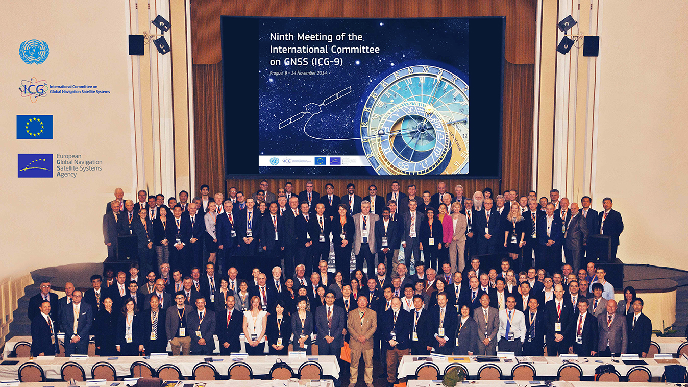
The European GNSS Agency (GSA) hosted the ninth meeting of the International Committee on Global Navigation Satellite Systems (ICG) in November at its headquarters in Prague, Czech Republic. The event is an opportunity for GNSS providers to present the status and future plans for their systems, and an opportunity for ICG members, associate members, and observers to provide updates on recent developments with regard to GNSS services and applications.
Representatives from the world’s leading global and regional GNSS programs were invited to provide the assembly with a “state of play” for their respective systems. Joining GPS, GLONASS, BeiDou, IRNSS/GAGAN, and QZSS was Galileo, represented by Christian Siebert, Head of Unit, Galileo and EGNOS: Applications, Security and International Cooperation, DG Enterprise and Industry, European Commission.
A Secure Foundation
The key message coming from Prague was that, despite the launch anomaly in August, the Galileo program has a secure foundation for moving forward. For instance, it has been given a stable seven-year perspective, a substantial budget, and a new exploitation-driven governance scheme. In terms of budget, the European Commission has allocated €1.930 billion for deployment and €3 billion for exploitation — with an additional €1.580 billion allocation for European Geostationary Navigation Overlay Service (EGNOS) exploitation.
The new governance scheme is based on a recently announced agreement between the European Commission and the GSA; the agreement delegates a range of exploitation tasks for Galileo to the GSA. Serving as an initial step towards the full Galileo Exploitation Phase, the GSA’s responsibilities now include:
provision and marketing of the services;
management, maintenance, continuous improvement, evolution and protection of the space and ground infrastructure;
research and development of receiver platforms with innovative features in different application domains;
development of future generations of the system;
cooperation with other GNSS;
all other required activities to ensure the development and smooth running of the system.
This new budget and governance structure ensures the Galileo program’s stability for the next seven years, according to a GSA press release. The agency will progressively manage exploitation activities as delegated by the European Commission, which serves as the program’s supervisor.
At the same time, the European Space Agency (ESA) will continue its role for system design and development.
A Range of Successes
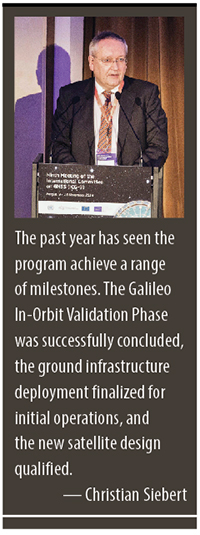
“The past year has seen the program achieve a range of milestones,” said Siebert. “The Galileo In-Orbit Validation Phase was successfully concluded, the ground infrastructure deployment finalized for initial operations, and the new satellite design qualified.”
Even with the satellite launch anomaly that left two satellites in the wrong orbit, the ESA just announced that one of these satellites will soon make a series of maneuvers as a prelude to its health being confirmed. The aim is to raise the lowest point of its orbit — its perigee — to reduce the radiation exposure from the Van Allen radiation belts surrounding Earth, as well as put it into a more useful orbit for navigation purposes. If the operation is successful, the second satellite will follow suit.
As to the cause of the anomaly itself, Siebert said Arianespace has established an inquiry board to investigate, and the European Commission and ESA continue to analyze the best options for recovering the initial mission to the best possible extent. A new launch sequence will be confirmed in the near future.
That being said, the deployment plan for the Galileo constellation is secured, with 26 satellites ordered (four IOV and 22 FOC) and launcher service contracts for the full constellation signed with Arianespace. As to the new satellite design, production proceeds at a good pace, with full operational capability (FOC) satellites being built by OHB Systems and navigation payloads provided by Surrey Satellite Technology Ltd.
In terms of services, the Search and Rescue Forward Link Alert Service successfully tested the networked ground segment last April, and positioning accuracy exceeds expectations.
As to the Commercial Services Demonstrator, the main objective of the demonstrator was to test and characterize the high accuracy and authentication performance obtainable with the Galileo Commercial Service. The first results are extremely promising, with high accuracy already demonstrated through PPP information transmitted via E6B and used to enhance both Galileo and GPS.
Siebert noted that the ongoing Receiver Test Campaign supports manufacturers to ensure that Galileo is well implemented in chipsets and receivers. To accomplish this, the program continues to develop dialogs with the user/receiver segment to understand the market situation and follow up adoption of Galileo.
Looking Ahead
With this secure foundation, looking towards 2015 and beyond, Galileo is set to deliver a reliable, high-quality service to the world, according to EC and ESA spokespersons presenting at the ICG. “With its substantial budget and exploitation-focused governance scheme, it will continue to evolve and introduce innovative features,” Siebert affirmed.
Next steps for the program include a gradual introduction of the early phase of service delivery, which will rely heavily on interaction with users. Early services will be run with continued infrastructure deployments. The program will soon conduct a service validation campaign, along with finalizing the Commercial Service definition and developing a long-term service plan.
“This service plan will be aligned with the trend of most user communities moving towards service levels based on a multi-constellation approach,” concluded Siebert. “Knowing this, it is crucial to continue to improve signal compatibility and interoperability of the Galileo service with other providers and cooperate on building multi-constellation programs.”
The United Nations is spotlighting the benefits of satellite navigation and its contribution to the betterment of humankind as part of the observance of World Space Week — an annual global celebration of the contributions of space science and technology to humanity.
The theme of this year’s World Space Week is Space: Guiding Your Way. It highlights the benefits of satellite navigation to society, which Simonetta Di Pippo, director of the UN Office for Outer Space Affairs (UNOOSA), said are of “great importance” to her office. UNOOSA also functions as the Executive Secretariat to the International Committee on Global Navigation Satellite Systems (ICG), which promotes voluntary cooperation on civil satellite-based positioning navigation, timing and value-added services.
Proclaimed by the UN General Assembly in 1999, World Space Week, observed each year during the week of October 4-10, aims to provide unique leverage in space outreach and education; educate people around the world about the benefits that they receive from space; encourage greater use of space for sustainable economic development; demonstrate public support for space programs; excite young people about science, technology, engineering, and math; and foster international cooperation in space outreach and education.
The dates recall the launch on October 4, 1957, of the first artificial satellite, Sputnik I, and the entry into force, on October 10, 1967, of the Treaty on Principles Governing the Activities of States in the Exploration and Use of Outer Space including the Moon and Other Celestial Bodies.
Ideas for educators and youth groups to focus on satellite navigation include geocaching, building model satellites, and using Google Earth. “Imagine a world without navigation satellites to guide planes, ships and cars and not to forget: us with our location-based mobile phone applications!” the guide states. “And navigation satellites not just accurately pinpoint our position on the planet, it also provides time signals to keep clocks in sync, which is critically important for global trading and many other time critical sectors. In times of disaster navigation satellites help rescuers quickly find spots where people need help. Using Geographic Information Systems (GIS) we can compare maps before and after things changed. And GNSS satellites are important to help you planning your trips and tell you where it will rain and where it will shine!”
Galileo Growth, Constellation Updates, and Jamming
I used to spend quite a lot of time in Munich working on a multi-national, multi-role fighter aircraft program, so returning for this year’s Munich Satellite Navigation Summit stirred some good memories for me.
Held in the opulent Residenz Muenchen March 25-27, the conference always has a special atmosphere that these historic 1385 surroundings convey to the attendees. The former royal palace of Bavarian monarchs, the whole complex has ten courtyards and 130 rooms. The summit was held in the Max-Joseph Hall, which took a little bit of work to find at first, wandering around the huge complex. One wing of the building hosts a theater, and the mainhall is the primary concert venue for the Bavarian Radio Symphony Orchestra. Overall, this is a delightful setting.
Munich is in the Southern German state of Bavaria, and Bavaria has taken a real interest in the promotion and success of Galileo; witness the extensive Bavarian booth at recent European and North American GNSS conferences. Germany has, of course, been one of the principle nations providing significant funding for Galileo from its inception.
Ilse Aigner
So with this backdrop, the summit brings together people involved with GNSS from around the world to report on the current status of GNSS and to relate how their participation in satellite navigation has progressed. And, of course, Europe, Germany, Bavaria and the European GNSS industry, which is now recognized around the world, all take the opportunity to present their capabilities and successes.
The plenary session on the first evening covered GNSS, Earth Observation (EO) and Telecommunications — with the panel headed by Ilse Aigner, Bavarian State Minister of Economic Affairs and Media, Energy and Technology — an extensive mandate, even for a state-certified engineer who used to work for Eurocopter.
Dr. Merith Niehuss, speaking at the opening of the summit. (copyright: Munich Satellite Navigation Summit).
The host of the summit is actually the University of the German Army in Munich, and we received a warm welcome from two leading professors: Dr. Bernd Eissfeller and Dr. Merith Niehuss, the president. The theme of the summit was to move from implementation to utilization, and in typical European form, all parties were looking to shower potential users with funded solutions to problems of which users are not yet aware — so users clearly need government-provided education, pilot projects and funding. Not exactly a North American concept, where we tend to encourage users to buy our innovative stuff by demonstrating how it can save them money or earn them more revenue.
The European Commission, ESA, DLR, European GNSS Agency (GSA), Airbus, OHB, and Telespazio were also represented. The minister did indeed associate with and praise the local area, claimed 1,000 jobs created related to Galileo through an incubation center at Oberpfaffenhofen, and declared Bavarian support for satellite navigation.
Other important things mentioned by the panel at the plenary included an €11B budget for Galileo/EGNOS and Copernicus (EO project) under the Horizon 2020 program, and an intent to declare Early Service for Galileo before the end of this year with two or three dual Galileo satellite launches — the first two FOC (production) SVs should go to the European launch center in Kourou in April in preparation for launch around June. I heard in a corridor that launches may be planned for June, October and December, but an EU spokesman later said that there would only be two launches this year. OHB now has the contract to build 22 FOC Galileo SVs, each with a design life of 14 years, and they are bullish on their ability to deliver on time and budget.
The program continued the following day with constellation updates from GPS, Galileo, Beidou and the UN International Committee on GNSS (ICG) — GLONASS delegates were notably absent. There was much speculation that they declined to attend due to the Crimean situation, and one U.S. delegate even inferred that they were “uninvited.”
Constellation Updates
GPS: It’s estimated that there are ~2B GPS receivers in use, and there may be ~10B by 2020. A return on investment (ROI) analysis is currently underway, but a rough guess is that costs are in the tens of billions, while annual returns are of the order of $60-100B/year. Another IIF satellite (SV) launched last month, bringing the total to five SVs transmitting L1, L2C and L5, with seven more to come, and multiple launches are expected this year. There are 30 operational SVs on orbit, signal performance significantly exceeds the specs, and consistent, dependable performance has been provided for more than 20 years.
Galileo: First fix was achieved March 12, 2013, with four SVs, two (maybe three?) launches of two SVs each planned for 2014, and early operational capability to be declared by end of this year. €7B in funding is provisioned for 2014-2020, with 16-24 operational ground stations, Commercial Service (CS) planned by 2016 (more on this later), and a long-term evolution plan being worked up during this year.
BeiDou: Fourteen SVs are on orbit — five GEO, four MEO and five Inclined Geosynchronous Orbit (IGOS) satellites, providing dual-frequency services. Thirty total SVs are planned, and the intent is to provide open, compatible, interoperable signals with other GNSS free of charge. There was not much other news to report, other than that China intends to invest significantly in BeiDou to keep improving services.
United Nations ICG: Nine nations and European Union = International Committee on GNSS (ICG), with 20 other associate and observer States. Activities include GNSS compatibility/interoperability, GNSS enhancements, information sharing, and reference frames, timing and applications — lots of upcoming meetings and activities.
Regional and Augmentation Updates
WAAS: Phase IV is underway with GEO replenishment begun, introduction of L5 to replace L2, and replacement of obsolete component parts. One hundred GIII receivers were ordered with L1/L2C and L5 capability for delivery by September this year — and have capacity to also add Galileo. GIII receivers have already been fielded in six locations as part of initial integration testing. The Safety computer will also be upgraded starting this year. 3,912 LP/LPV approaches have been approved, of which 3,379 LPVs serve 1,667 airports. GBAS CAT I is progressing with four U.S. airport installations. System design approval began in January this year, and United Airlines has begun equipping over 90 B737/B787 for GPS approach and landing. Alternative Positioning, Navigation and Timing (APNT) investigations are underway (as a backup to GPS) with a hybrid DME-pseudolite configuration currently favored. Stanford University subsequently presented this and other concepts.
EGNOS: A €1.58B budget has been approved, and EGNOS V3 evolution is underway, with L1/L5 and GEO (SES 5 and Astra 5B) replenishment, a requirement to expand East and West and to the North to provide full coverage to all EU States.
About 100 EGNOS LPV approaches are approved — this year, it’s hoped to add 150 more.
QZSS: The operational concept has been proven with the first IGOS SV (Michibiki), so Japan is moving forward quickly to add another three SVs (3xIGOS and 1xGEO) and ultimately would like to have a total of seven SVs in orbit providing QZSS services. L1/L1C/L2C/L5 signals are identical to GPS, and L1s/L5s are augmentation signals, while L6 is proposed to be similar to Galileo E6, providing centimeter-level PPP-type service. QZSS essentially is intended to provide higher elevation satellites to improve urban navigation in dense cities.
IRNSS: Coverage extends 1500 km beyond India. The target is <20-meter accuracy, and signals are in L5 and S band and can be used independently or in dual-frequency combinations. A second IRNSS-1B GEO satellite is scheduled to launch on April 4.
GAGAN: The Indian SBAS was commissioned and certified in February this year with a number of ground stations, redundant uplinks and two on-orbit GSAT 8 and 10 GEOs. Gagan is now qualified to provide RNP0.1 (navigation accuracy to 0.1 miles).
QZSS and Japan’s Space Policy
This session provided some detail on how changes in Japan’s Basic Space Law has lead to efforts to expand the use of space and derive further economic benefits that this provides.
Munich Highlights
A collection of examples of Bavarian GNSS innovations followed in a very interesting session led off by an overview of Business Incubation Centers and their collaboration with government agencies and research centers. Small business start-ups are apparently encouraged to apply during four annual time-slots, and receive two years’ incubation support and cash incentives. This has lead to 81 new ventures and has apparently been the source of the 1,000 new jobs mentioned by the Minister of Economic Affairs. The annual European Satellite Navigation Competition and Galileo Masters competition have also generated a whole bunch of ideas and concepts (8,000), some of which have found support through this incubation process.
Airbus Defence gave a short overview of the testing work it accomplished in supporting the first Galileo fix and has prepared several vehicle test platforms, ready to take the next phase of Galileo testing to the streets in realistic, real-world environments.
DLR provided insights into a number of its activities, namely:
Iono mapping
Signal distortion
Multipath
Jammer mitigation – adaptive antenna and processing
GNSS repeaters – how they can become unintentional jammers
Spoofer and Multipath inbvestigations
Antenna designs
GNSS evolution – Maser and clock combination benefits
Army University of Munich discussed radio science experiments in the Solar System and experiments using Mars Express (above) in polar orbit around Mars and resulting measurements of the moon Phobos. Internal and external outreach efforts with numerous organizations were also mentioned.
IFEN provided more down-to-Earth information on the on-going activities at the GATE ground-based pseudolite range, which has enabled realistic outdoors testing of Galileo receivers, well in advance of signals from orbiting satellites. Recent testing has now been able to include the four operating Galileo SVs on orbit with GATE pseudolite signals. GATE will continue to evolve over the next few years to keep up as more Galileo orbital signals come on-line.
Fraunhofer presented information on its 40-channel GPS/Galileo/GLONASS chip-receiver (above) – claiming 1-meter accuracy, low-cost, robust reliable position solution, small form-factor and low-power. Following PRS test-bed development efforts, Fraunhofer has now received a contract to also deliver 20 pre-operational Galileo PRS receivers for use in initial pilot projects.
GNSS Interference
Vidal Ashkenazi, in his inimitable form, lead a panel discussion on interference, jamming (in particular Personal Privacy Devices, or PPD) and spoofing, and coaxed his panel members to provide a whole bunch of information on what’s being done, mitigation capabilities and potential enforcement. Unlike all the other sessions, Vidal’s panel members didn’t use presentations, but rather responded to wide-ranging questions on the subject from the session chair.
David Turner, representing the U.S. State Department, indicated that the ICG will meet shortly in Geneva hosted by the International Telecommunication Union (ITU) to focus on interference, jamming and mitigation. The recourse that nations have for use of PPDs by their people is the law — jammers are illegal, sale and purchase of them is illegal — however, Internet sales are very difficult to police. So detection and mitigation are required to find and shut them down. Dave’s presentation on the GPS.gov website indicates that the ICG is working on an education program for states to inform about GNSS sensitivity to interference and the threat to critical infrastructure if they are allowed to operate. The ICG also has a task force on detection, reporting and systems development.
ISRO indicated that PPD jammers in India are restricted, but permitted for gatherings such as at churches where personal safety may be an issue. Ground-based detection is needed, as well as stronger legal protection that may well prohibit use of PPDs altogether.
Japan Aerospace Exploration Agency (JAXA) indicated that it is working on “signal proofing” for QZSS.
BeiDou said it is building a monitor network in China that will detect jamming.
There was a general discussion on whether receiver manufacturers should be mandated to make receivers that are resilient to jamming – many thought that there have already been significant advances in that direction by manufacturers. The normal approach would be to develop requirements with industry, agency and user inputs, publish them, and call up the requirements in equipment specifications. In the U.S., the Department of Homeland Security is seeking an approach to detection and location.
Legal Impacts of Personal Privacy Devices (PPDs)
While the audience may have had high hopes that the legal eagles could come up with some magic prevention and prosecution solution, the next session was more of a legal background briefing without any concrete conclusions (quite similar to other discussions I’ve had with some lawyers in the past, actually).
The first briefing was from the European Commission/European Union, who indicated that the EU doesn’t own the frequency rights to Galileo (Oh Oh…). They have to operate through a member state, which gets the rights through the International Telecommunication Union (ITU) and then licenses use to the EU — the bottom line being that EU enforcement of jamming protection laws maybe be difficult, as the legal framework only exists at the national level for each state. The EU is trying to get recognition under another class of ITU membership.
EU regulations were presented that state that GNSS re-transmitters can only be operated legally by governments or government contractors. Or can be used indoors for indoor navigation, but only for emergency services at fixed sites which are pre-approved. Pseudolites can only be operated indoors, and there should be no interference to other systems. Jammers are forbidden and cannot be placed on the market for sale.
Eurocontrol had a lot to say about the impact on aviation navigation infrastructure and receivers on aircraft. Existing ground nav aids have limitations, the worldwide equipment infrastructure is becoming quite old — aviation has generally moved away to GNSS and inertial based navigation and uses ground navaids as backup. There is a conflict between regulating GNSS heavily for aviation and how people want to use it in the commercial world. We may have to consider a trade-off between heavily restricted GNSS operations, and wide open commercial GNSS applications.
David Sobel, from Electronic Frontier Foundation in the U.S., presented the contrary case for individual privacy. His argument is that sale of tracking devices is unregulated and can readily be purchased, so people may presumably use them to track others, thereby infringing their privacy. So why shouldn’t people be able to “defend their privacy” by use of PPDs?
Say an employer insists that a vehicle you are driving have a tracking device so he knows where you are. Isn’t the driver also justified in trying to protect his privacy? Since the police in the U.S. can no longer place tracking equipment on suspect vehicles without a warrant, tracking appears to be down to private individuals or companies, who it would appear, have the legal ability to attach tracking devices under most circumstances. So the argument goes that if people have a legitimate concern about privacy, there should be acceptable provisions to allow them to disrupt tracking.
If there is a service such as road tolling, there is an incentive for people to avoid these costs. So systems should be robust enough to avoid disruption. Enforcement is a problem — should police chase people they suspect have jammers, or should they rather chase criminals or help and protect citizens? Mitigation systems need testing, so to test these systems there has to be jamming transmission — which needs to be controlled and regulated. Restricting the import of bad devices into a country might be desired, but the manufacturing countries don’t tend to want to restrict exports as exports help their economy. Again, the argument seems to be that of personal privacy over potential risks and damages to society.
No solutions, but a healthy discussion of views from a legal perspective.
Precise Point Positioning (PPP)
The group discussing PPP options consisted of the GSA (charged with exploitation of Galileo services), several principle industry service providers of PPP, and the federal agency, which provides PPP-like services in Germany.
The GSA presented its ideas concerning the provision of high-accuracy PPP corrections over the Galileo E6 signal – the so-called Commercial Service (CS). The intent, however, would not be to disrupt the commercial marketplace. Nevertheless, GSA is proposing a public-funded service to be sold to users within a market that is already well served by commercial worldwide service providers who charge users for cm-level PPP service.
And while Trimble made a polite presentation on the many levels of capabilities of its TerraSat services, as did Veripos and to some extent Fugro, it was clear that the commercial providers are not eager to find competition in their market from a government entity. NovAtel also chimed in on this conflict as it will be involved in Veripos/TerraStar, following its acquisition by Hexagon. Fugro appeared to be interested in acquiring rights to distribute CS on behalf of GSA.
The German Federal agency promoted open data, source and standards from the IGS network to which it contributes: IGS is supported by numerous national agencies around the world. Orbit and clock PPP service is available 24/7 from multiple sources. However, the service is offered on a best efforts basis without a service guarantee, and cannot achieve the accuracies or convergence times of commercial services.
I talked subsequently with Michael Ritter, CEO of NovAtel, to learn the background to the Veripos/TerraStar acquisition. It’s clear that providing PPP services means added value to NovAtel when they sell receivers with PPP capability, so they will quickly discontinue offering Omnistar subscriptions and will shortly launch NovAtel Correct, offering Veripos (marine) and TerraStar (land) PPP subscription services. NovAtel is making significant inroads in the agriculture segment, and they see PPP service as an essential element of this and other businesses. The acquisition was worth something on the order of $200 million, so there is a vested interest in making these services pay and discouraging GSA entry into this market. Veripos will continue supplying other GNSS OEM receiver manufacturers — notably Septentrio, who use TerraStar services, now also NovAtel, and potentially another major GNSS manufacturer.
Future of GNSS in User Segment
Chaired by Greg Turetzky of Intel, this session opened the third day of the Summit. The presenters offered their concepts for current and future GNSS equipment and systems.
Stanford University outlined its work with FAA on an alternate PNT system to be used as a back-up to GNSS. It used to be that GNSS systems were designed to overcome space-weather effects and faults in equipment design or manufacture — nowadays, there are “bad guys” out there and we need to “protect, toughen and augment” these systems. Antennas can be built that impart a specific signature to the signals they transmit, and this may aid in finding and prosecuting the bad guys, but the main focus of work is development of a hybrid system using Distance Measuring Equipment (DME) and a pseudolite.
Tests have demonstrated good performance, and these prototype efforts could lead to aviation requirements (MOPS) development by 2018 and deployment by 2020.
Septentrio has been involved in Galileo since it began and was the first company with Galileo receivers. Nowadays, they have receivers fielded in multiple commercial applications, including machine control, maritime, aviation, automation, and measurement, delivering accuracies from a meter down to a centimeter. They will add E6 to their AsteRx family of multiple-channel, multi-frequency, multi-constellation receivers, and have developed a number of hardware and software mitigation techniques to combat jamming, interference and multipath, and to integrate receivers with inertial units for aiding.
Furuno is interested in resilient PNT for marine applications, and has examined the use of eLoran as an alternative to GPS, but has moved towards a system of radar beacons that detect radar pulses from passing ships and transmit their positions, enabling position determination. In tests, accuracies of around 2 meters have been obtained with two beacons.
Quascom’s approach is to add firewalls inside receivers, which toughen the processing and prevent distortion of position information. Quascom believes this will be necessary until authentication can be added into the GNSS system itself, so that any data received is validated and is known to be good.
Chris Rizos from the University of New South Wales, Australia, drew attention to the “holes” that exist in GNSS, and reviewed a number of possible “Band-Aid” fixes, such as Wi-Fi especially for indoor location. However, his solution seems to be to establish terrestrial networks transmitting GNSS-like signals.
Eurocontrol indicated that aircraft currently use inertial and DME extensively as a back-up to GNSS navigation. By 2030, there will be multiple constellations, and dual-frequency use should become commonplace in aviation, so GNSS navigation should be much more robust. Aircraft approaches are required to be in conformance with Required Navigation Performance (RNP), so would it be possible to develop RNP procedures for DME and inertial to be used as back-up during approaches in the event GNSS is disrupted?
To conclude the session, Airbus provided a “starter course” overview on inertial systems – how they work, the range of different types available, what they can achieve, costs, strengths and weaknesses and integration with GNSS.
The summit continued with subsequent sessions on:
Space technologies and users
GNSS monitoring of Earth and disaster management
Copernicus – Earth Observation
GNSS Education
Unfortunately, my deadline didn’t allow me to attend these equally interesting presentations.
There is also a manufacturers’ exhibit area at the summit that just fits into a couple of corridors near the main hall – around 20 booths. I talked with several of the manufacturers, including Spirent who has launched its latest GSS9000 multi-frequency-constellation simulator, with a four-fold increase in system iteration rate over the previous model. Exhibitors appeared to be pleased to be at the summit and by the level of interest shown by the attendees.
So, as this year’s Munich Summit concludes, where does this leave us? We’ve learned some new things about several GNSS topics and heard some interesting new concepts. Europe appears to be now focused on users and applications, to ensure there is market growth and use of Galileo. What stands out for me is the contrast between how European governments go about GNSS and how North America and the commercial world does the same thing without as much direct influence. This is nothing new, of course, it’s just the European way…
The opening plenary session of the Munich Satellite Navigation Summit is convening as this column goes to the electronic press for distribution. Coverage of these top-level system briefings before a select international GNSS audience in Munich will appear in two e-newsletters next week, The European GNSS and Earth Observation Report (EAGER), and in a shortened form via the Navigate! Weekly.
Until then, here’s an update on the CNAV debate in the United States and wider system-operator background from two recent meetings.
CNAV So Far. In the closing hours of 2013, a departing U.S. Cabinet under-secretary for Transportation dropped a verbal bomb on the Pentagon, in the form of a communiqué expressing concern about reliability of the new civil navigation message (CNAV) signal scheduled to emanate in April from select GPS satellites on orbit. Subsequent explosions were detected in halls from Washington to Colorado and Los Angeles.
Meanwhile, one semi-public organization communicated to its members that it finds nothing disturbing about the plan, set to take effect sometime in the coming month.
IGS Steps Forth on CNAV. The International GNSS Service, a voluntary federation of more than 200 worldwide agencies that pool resources and permanent GPS and GLONASS station data to generate precise GPS and GLONASS products, issued a statement to its members and participating institutions in March. “We are confident that the IGS network is not at risk due to this change, and it is a welcomed step towards GPS modernization.”
The communiqué from the Infrastructure Committee went on to say that “This event is considered innocuous to the stability of the receiver network since during a limited GPS CNAV test campaign in June 2013 the IGS network was not affected, only a very specific receiver problem was detected by the IGS Multi-GNSS Experiment, which was informed to the GPS ground segment and addressed.
“Most modern receivers can track L2C and L5 and the CNAV messages, but the decoded messages should not be used by the receivers. The traditional L1 NAV messages (LNAV) will continue to be transmitted as usual and thus the receiver navigation files, birds, etc., will continue unaffected. Older receivers will be completely unaffected as they do not track L2C or L5.
“In any case IGS Station Operators and Station Network Managers are advised to keep an eye on receivers and on their data outputs during the start of the CNAV activation. Just in case something strange is observed please stop data submission and notify the IGS (Network Coordinator, Infrastructure Committee) so that we may investigate the issues quickly. In case of doubt with your own equipment please contact the receiver manufacturer and inform the IGS.”
PNT Advisory Board Airing. Prior to the appearance of the CNAV letter from the departing deputy secretary, the U.S. PNT Advisory Board heard a report in early December from Air Force Space Command on said implementation plan for the GPS CNAV message on L2C and L5. The minutes of that meeting were recently released.
The minutes relay the gist of General Whelan’s CNAV remarks as: “CNAV has been under discussion for a considerable time. Currently, L2C and L5 signals are being transmitted, but without a navigation message. AFSPC is working hard to activate these messages as soon as possible. One of the reasons for the delay is that additional time was needed to complete testing prior to activation. Testing began in late summer 2013 and, based on initial test results, a way ahead has been plotted. . . . Current plans are to begin initial broadcasting in the spring of 2014. CNAV uploads will occur twice weekly. The signal will meet GPS Standard Positioning System (SPS) standards, but may not achieve current accuracy levels until full implementation in late 2014.
“CNAV live-sky testing occurred in June [2013] and was conducted in cooperation with civil, industry, and international partners. The two-week test series included independent assessment and verification. The tests identified four errors that required action. The first, which was addressed in real time, related to implementation of the test series. The second required improvement to the tools suite, which should be totally integrated into the ground segment by December 2014. The third and fourth errors required patches to satellite software. All four issues are now regarded as closed.”
A subsequent presentation to the PNT Advisory Board from a Department of Transportation spokesperson did not directly mention CNAV, according to the meeting minutes, but did include this reminder on civil signal monitoring:
“DOT is responsible for performance monitoring of GPS civil signals. The International Committee on GNSS’s (ICG’s) transparency principle states that ‘Every GNSS provider should publish documentation that describes the signal and system information, the policies of provision, and the minimum levels of performance offered for its open service.’ Currently, this is only done on GPS L1 C/A signals. Performance standards for L2C and L5 have not yet been established. The crucial function of signal/service monitoring is to verify that commitments to GNSS performance are being met. Additionally, monitoring improves the situational awareness for GNSS operators, and provides assurance that any civil service failure is detected and resolved promptly.”
Other Global Developments. The International Committee on GNSS (ICG) held a meeting of its Working Group A on Compatibility and Interoperability, in November 2013 in Dubai, United Arab Emirates. A brief summary of those proceedings is now available.
The notes evidence steady, deliberate organizational and international progress on collaboration between system providers of GNSS signals.
Among new presentations to the body came several from Russia. Viktor Kashenko, Russian Federation, presented on the “Prospects for Status and Development of GLONASS System Space Complex,” an update on the GLONASS space segment noting that there is a full constellation of GLONASS-M satellites. CDMA signals at L1 and L2 are expected to be available beginning around 2016 or 2017.
Grigory Stupak, Russian Federation, followed with a presentation titled “SDCM Present Status and Future GLONASS Signals Development.” There are currently 22 SDCM ground stations around the world with a goal of creating seamless coverage throughout Russia with LPV-200 capability. The U.S. asked a question about whether SDCM provides corrections for other constellations in addition to GLONASS. The Russian Federation explained that SDCM currently augments both GLONASS and GPS, but additional constellations could be added in the future.
Oleg Denissenko, Russian Federation, discussed the goals of the GNSS Monitoring and Assessment System being developed in Russia and identified a list of parameters to be monitored by the international systems.
Xurong Dong from China gave the status of the International GNSS Monitoring & Assessment Service for OS (iGMAS). Initial operational capability (IOC) is expected in June 2014. Ten tracking stations have been installed so far, and 25 additional stations are expected to be added in the future. A signal quality monitoring station has also been established in China and a new 40-meter antenna is expected to be installed in 2014.
Jeffrey Auerbach from the U.S. State Department presented on outcomes of the second Interference Detection and Mitigation (IDM) April 2013 workshop. The European Union noted that they are conducting a survey of professional users in Europe about privacy concerns, and perceptions and understandings of interference and jamming.
Stanislav Kizima, Russian Federation, provided an overview of the International IDM system concept and recommended the creation of an IDM system database server to be used for monitoring GNSS facilities. He suggested identifying formalized data exchange formats for IDM. A question was asked about whether something like this already exists in Russia. Kizima responded that Russia does have an active system for monitoring interference, but not specifically for GNSS. There are some issues with the existing system because GNSS is not listed as source of interference and the technical facilities are not able to analyze parameters specific to GNSS. Hence the need for development of specific GNSS monitoring facilities. Tom Stansell from the U.S. responded that cell phones could be enabled to become individual detectors of GNSS interference, and the interference source location could be determined this way. This technique is known as crowdsourcing. Kizima noted that cell phones give information on signal power, but not measurement equipment.
China continued the session on spectrum protection with a presentation by Weimin Zhen on a proposal to develop a template for GNSS interference detection and reporting. He suggested that a generic template specific to reporting GNSS interference be developed.
Upcoming principal WG-A related meetings:
WG-A Inter-session Meeting, Geneva, Switzerland, possible dates July 16-18, 2014)