Tag: INRIX

  • INRIX Traffic app learns driver’s itinerary, preferences

    INRIX Traffic app learns driver’s itinerary, preferences

    INRIX Inc., a connected car services and movement analytics company, has released a redesigned version of INRIX Traffic for iOS and Android.

    INRIX Traffic is a next-generation navigation and traffic app that learns user preferences to take the guesswork out of driving. The app integrates with a user’s calendar and learns their driving habits to create a personalized itinerary that includes automatic alerts, anticipated trips, favorite destinations and preferred routes.

    Screengrab: INRIX IncAvailable worldwide now in the Apple App Store and Google Play, INRIX Traffic learns routines and preferences as users go about their day. INRIX Traffic adds favorite places automatically instead of requiring users to spend time inputting destinations such as home, work or school.

    Based on learned activities, it creates a daily, driver-specific itinerary of anticipated trips, as well as frequent and preferred routes. By accessing calendar information on a mobile device, the app also adds events with addresses to the daily driving itinerary.

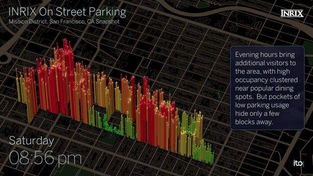
    Unlike other driving apps that can provide inaccurate traffic and incidents based purely on consumer input, INRIX Traffic uses a massive crowd-sourced network of more than 275 million connected cars and devices to offer accurate map and real-time information.

    INRIX Traffic proactively monitors road conditions to alert drivers of ideal departure times, changes to arrival times and optimal routes to frequent or scheduled destinations based on real-time traffic.

    “We designed INRIX Traffic with one specific vision: To help drivers move through their daily lives as quickly and efficiently as possible. The app uses our advanced traffic science to make even routine trips easier,” said Bryan Mistele, president and CEO, INRIX. “Users want an app that is accurate, personalized and smart enough to work proactively for them — so we’ve integrated several highly advanced technologies into one all-encompassing app.”

    INRIX Traffic uses the crowd-sourced and free OpenStreetMap (OSM) for map data. By leveraging the power of user-generated content around the world, OSM can quickly adapt to the ever-changing road network. Using OSM enables INRIX to bring a high-quality map and turn-by-turn navigation to users at no cost and without advertisements. In addition to reporting incidents along their route including accidents, police activity and road hazards, INRIX Traffic users can send map feedback directly from the app.

    INRIX Traffic is powered by the same technologies the company delivers to its automotive customers such as Audi, BMW, Lexus, Mercedes-Benz and Porsche. These connected car services include real-time and predictive traffic, off-street parking information and drive-time alerts. INRIX will continue integrating features from its product portfolio into future versions of INRIX Traffic.

    INRIX Traffic is available in eight languages in 16 countries across North America and Europe, including Canada, France, Germany, Spain, United Kingdom and United States, with additional countries coming soon.

    The app is built on Autotelligent, the company’s new software development kit and integrated cloud platform that provides machine learning and route monitoring. Autotelligent can be integrated into products in multiple industries such as automotive, enterprise and mobile.

  • Omnitracs Unveils Next-Generation Navigation Solution

    Omnitracs-logoOmnitracs LLC has added Omnitracs Navigation to its portfolio of solutions. Omnitracs Navigation uses Big Data collected from more than 250,000 customers contributing more than four billion data points. The company terms Omnitracs Navigation the “next generation of navigation solutions” — it provides critical information to drivers through a user-friendly interface, with fast, near real-time updates and extensive fleet configuration options.

    Omnitracs Navigation delivers critical information drivers need in a meaningful and distraction-free way, enabling them to be time efficient, stress free and safe while navigating.

    Omnitracs Navigation provides fleets and drivers with the following features:

    • Data Publishing — All of the data is stored onboard with Omnitracs as the data publisher. Updates are sent to the unit automatically as the data changes so that the unit is always current. By leveraging traditional data (such as posted speed and traffic light locations) combined with real-time data (including current traffic and weather conditions), and Big Data (how a particular road is used at a certain time, and “black spot” high frequency accident zones), Omnitracs Navigation delivers a more consistent, predictable and accurate plan for maximizing the road network.
    • Actionable Data — Data is pulled from Omnitracs telematics units to build statistical models that create an enhanced, truck-preferred network that is constantly pushing new and actionable data to drivers. More than turn-by-turn instructions, the tool is constantly updated to ensure that drivers have a better and safer navigation experience.
    • Driver Community — Omnitracs Navigation has a closed-loop feedback mechanism, which brings driver feedback into the data-editing process and gives them an opportunity to improve their navigation experience, along with the navigation experience of fellow drivers. The loop is closed by informing the driver of how his or her feedback was used, leading to improved driver satisfaction and retention by acting as the driver’s trusted advisor.

    “Navigation has evolved with the advent of smartphones and GPS devices, and the days of folded paper road maps are gone,” said Rick Turek, chief navigation scientist at Omnitracs. “However, we know that current and hybrid systems aren’t yet perfected and still struggle in keeping data current. Imagine not knowing that a new road has opened up or that a road’s name has changed; these are the types of things that can easily frustrate drivers. Omnitracs Navigation is the next-generation navigational solution that delivers current and actionable data so that drivers can do their jobs more safely and efficiently.”

    Omnitracs Navigation leverages the proven technologies of HERE and INRIX. HERE Map Content contributes rich, automotive-grade data that enables large semi fleets to navigate across the U.S. and Canada. Through this partnership, Omnitracs provides precise turn-by-turn navigation, as well as enhanced resource tracking and route optimization.

    INRIX will provide real-time traffic and historic traffic profiles, along with travel time and incident alerts, for every major road type including highways, arterials and city streets.  INRIX combines information from connected vehicles and other public and private sources to provide accurate real-time traffic that covers more than five million miles in 42 countries. Omnitracs Navigation will launch with INRIX Traffic XD Profiles, followed by real-time traffic and incidents.

  • Phones Allow Surreptitious Geo-Tracking

    Phones Allow Surreptitious Geo-Tracking

    Janice Partyka
    Janice Partyka

    Not everyone wants to be located. Consumers think they have the ability to turn off the tracking ability of their phones. But can they? More about that later. In other news, there are good reasons why Nokia’s HERE mapping is still on the selling block. And blind people are using a no-tech version of a widely used location positioning method that doesn’t need canes.

    The controls that phone makers have devised to enable consumers to opt out of being located have a big hole. Android-based phones are giving app makers free access to phone data that can be used to surreptitiously geolocate devices. The data comes from an unlikely source: power consumption, and no consent is needed.

    The technique, called PowerSpy, was developed by researchers at Stanford and Rafael, Israel’s defense research group, and gathers a phone’s power usage history. Simplistically, the location of the phone is tracked by using the phone’s battery consumption to determine the distance of a phone to a cell tower. The further the distance, or the greater the obstacles blocking the tower, the more power is consumed by the battery. The researchers say they can take into account phone usage battery drain and filter out the noise created by focusing on long-term trends.

    At its current level of development, the PowerSpy method requires the snoop to have driven a route (war driving) to identify its power consumption pattern. With tests conducted in San Francisco, the method worked with 90 percent accuracy to identify a correct route from seven choices. The team is working on using the data to detect unknown routes that have not been previewed.

    How would the hypothetical stalker, crook or unethical mobile advertiser get access to this data? They would entice a person to download an app. The smoke screen app might be a game or a productivity app that is quietly slurping up the power consumption data.

    Here Today, Not Gone Tomorrow? Wouldn’t you think that Nokia would by now have clinched a deal to sell the mapping division? Given its mapping debacle, Apple was on the top of everyone’s list as a buyer, but apparently the company didn’t even participate in the bidding, and instead is committed to further development of its self-built mapping database. Contenders — Facebook, Baidu, Tencent and Uber — seem to have dropped out of the competition. Left is a consortium of German automakers — BMW, Daimler and Volkswagen — who feel that they should get a better deal with no other buyers in sight. It is a double-edged sword, as they also worry that if the highly accurate maps are acquired by tech firms, the car makers will lose a competitive advantage in the fight for supremacy of the automated vehicle. High-precision mapping is critical to the success of the auto OEMs.

    Who Will Win Connected Vehicles? Follow the Money. Investors who want a piece of the connected vehicle action are placing bets on the tech companies, not the auto OEMs. Many blue chip and small companies are seeing healthy gains in price. Sensor chip makers, car infotainment and telecom companies are some of the winners. With the surge of connectivity required in the Internet of Things, networking technology will also do well.

    E911 Innovations. While regulations are in place for eventually requiring technology to automatically identify the location of indoor E911 calls, dispatchers don’t yet have that capability. Callers can be inside a large complex, like a dormitory or hotel, and if they are unable to speak or identify their location, response is hampered. Smart911 from Rave Mobile Safety is sending dispatchers floor plans of buildings to help in rescue efforts. The maps are automatically sent with the 911 call and have already been credited with quicker responses.

    Quick Business News. Uber acquired Microsoft’s geo-imagery team and assets, known at BIT (Bing Imagery Technologies), which is based in Boulder. Microsoft didn’t need this technology as it had already outsourced Bing Maps technology to Nokia HERE. Telecommunication Systems (TCS) purchased location-based technology and intellectual property from Loctronix. The purchase will further TCS in developing indoor-location technologies. Denmark has become the first country to use real-time traffic data across a national network. Denmark will use GPS probe data managed by INRIX for congestion management. The Internet of Things relies on multitudes of sensors and a new start-up, Sense360, has built a platform to manage that data.

    No-Tech Location Technology. Daniel Kish was a particularly helpful kid who made deliveries for his mom to homes outside of his neighborhood. What is unusual is that Kish is blind and uses echolocation to “see” the space around him. He clicks his tongue to ascertain the unique echoes of his surroundings, starting by identifying areas of high or low density, such as tall buildings, squat houses or open space. And in a version of drive testing, blind users like Kish first walk a neighborhood with a sighted guide and remember the signature echoes. Whether it is solely by ear or with a big computer algorithm like PowerSpy, pattern mapping can be effective.


  • New INRIX Service Helps Drivers Find Parking

    New INRIX Service Helps Drivers Find Parking

    BMW driver interface concept for how INRIX On-Street Parking might be integrated into navigation systems in BMW Connected Drive vehicles. Color coded bars indicate probability of open street parking ranging from green (lots of spaces) to red (not likely to have an open space).
    BMW driver interface concept for how INRIX On-Street Parking might be integrated into navigation systems in BMW Connected Drive vehicles. Color coded bars indicate probability of open street parking ranging from green (lots of spaces) to red (not likely to have an open space).

    Everyone who has ever been frustrated circling the block in search of parking has wished for a solution that could quickly lead them to that elusive spot. INRIX is launching a new service aimed at addressing this problem by helping drivers quickly find on-street parking. BMW will be the first automaker to include the service for its cars, in its ConnectedDrive autos.

    INRIX On-Street Parking answers key questions for drivers including:

    • Where can I park?With availability updated hourly, quickly identify streets with the best chances of finding a parking spot.
    • How much will parking cost? Information on pricing, parking/permit restrictions, policy rules (free vs. paid times/days).
    • Is there a garage or lot nearby? When on-street parking is unavailable, drivers can be directed to one of more than 80,000 off-street parking locations in Europe and North America. The service provides pricing and availability information, ability to compare locations by distance and price as well as locate the nearest entrance.

    BMW and INRIX demonstrated INRIX On-Street Parking in a BMW i3 at the Telematics Automotive 2015 conference, showing how location, local rules and pricing, real-time traffic, transactions and mobile data can be analyzed through the INRIX platform to show which streets have available parking.

    “As we continue to connect cars to smarter cities, INRIX On-Street Parking fills a critical gap that addresses the growing challenge of traffic and parking in our cities worldwide,” said Bryan Mistele, President and CEO, INRIX.  “And looking ahead to a time when autonomous cars are a reality, this service enables vehicles that drive themselves to park themselves now as well.”

    Visualization showing INRIX On-Street parking occupancy by block for key neighborhoods in downtown San Francisco. Color coded bars indicate probability of open street parking ranging from green (lots of spaces) to red (not likely to have an open space).
    Visualization showing INRIX On-Street parking occupancy by block for key neighborhoods in downtown San Francisco. Color coded bars indicate probability of open street parking ranging from green (lots of spaces) to red (not likely to have an open space).

    Initially available in Seattle; Vancouver, B.C.; San Francisco; Amsterdam; Cologne and Copenhagen, the service will expand to cover 23 cities by the end of the year.

    Experts estimate up to 30 percent of traffic in congested urban areas where street parking is in high demand results from drivers  looking for parking. A global survey of commuters in 20 international cities found that nearly 6 out of 10 drivers have abandoned their search for a parking space at least once, and drivers often spend an average of nearly 20 minutes in pursuit of a coveted spot. Further, an analysis by Frost & Sullivan found that drivers waste an average of 55 hours per year searching for parking, costing consumers and local economies nearly $600 million in wasted time and fuel.

    Smarter Parking Information

    With more than half of the world’s population living in our largest cities, transportation agencies are increasingly turning to intelligent parking solutions to better manage parking inventory and improve urban mobility. INRIX On-Street Parking provides cities with a scalable, cost-effective and immediate way to manage parking inventory as well as improve traffic in urban areas, INRIX said.

    On-Street Parking to cities includes:

    • Real-time Information. Goes beyond one-time snapshots of parking availability, allowing cities to see how parking inventory changes based on time of day, day of week, price and during special events or holidays.
    • Less reliance on road-side counters and costly sensorsOffers a faster, more cost-effective way for cities to manage parking. The service goes beyond current smart parking technologies because it also works on roads without smart meters or sensors and outside of hours requiring payment.
    • Better insight for urban planning. With a comprehensive understanding of parking inventory usage citywide, urban planners can gain insights that help them improve parking conditions and locations, and better locate special purpose lanes for bicycles and public transit on city streets.
    • Calibrate demand pricing models. Provides insight into how pricing fluctuations impact demand in real-time. Cities can optimize pricing to maximize use of available inventory citywide.

    Automakers, mobile app providers and public sector agencies interested in learning more can register for a Webinar scheduled for June 17 at 8 a.m. EDT where INRIX will outline use cases, technical specifications and benefits in greater detail.

  • Crowdsourcing Indoor Positioning, Connected Vehicle News

    Janice Partyka
    Janice Partyka

    One of the marvels of the decade is crowdsourcing. This month I look at crowdsourcing for indoor-location positioning and report findings on GPS in smartphones that provide reliable earthquake warnings. Google has had some issues with mapping crowdsourcing, leading to the temporary suspension of Map Maker. If Google can’t block inappropriate content, it does give pause.

    Next, I look at connected cars. Since this fall, four out of nearly 50 self-driving cars driving throughout California have gotten into accidents. With connected vehicles about to start popping out of dealerships, the legality of hands-free driving is belatedly being examined. And, last, INRIX has released an analytics platform that will use the massive data coming from connected vehicles.

    Crowdsourcing Indoors. Crowdsourcing has worked for mapping, but what about for indoor location? Sensewhere thinks it can work. The company’s indoor positioning technology learns Wi-Fi mapping through crowdsourcing. The premise is that it gets better over time, with each user’s device adding to the Sensewhere database. For instance, Sensewhere’s ability to determine the location of an office door from the building’s lobby will improve with each trip down the corridor. Although other systems may be more accurate, Sensewhere requires no infrastructure. The company claims accuracy of 10 meters or better.

    Sensewhere’s solution doesn’t require the Wi-Fi mapping labor that companies like Skyhook initially undertook. Skyhook engaged in “wardriving,” a peculiar term defined by Wikipedia as “the act of searching for Wi-Fi wireless networks by a person in a moving vehicle, using a portable computer, smartphone or personal digital assistant (PDA).” The term “wardriving” originated from “wardialing,” popularized by the 1983 film War Games in which the lead character, played by Matthew Broderick, has his computer automatically dial phone numbers in search of modems, perhaps the precursor to robocalling.

    Crowdsourcing for Earthquakes? The GPS in smartphones can detect the earliest signs of a quake with at least a magnitude of 7. The challenge is to distinguish an earthquake from the usual bouncing and jarring every cell phone encounters. Scientists at the U.S. Geological Survey found that if 103 phones in a defined vicinity record the same displacement, there is an overwhelming likelihood that a quake is occurring. The amount of forewarning is very small and maybe only a few seconds, but it could be enough time for a surgeon to retract a scalpel or a person to take cover.

    Is Automated Hands-Free Driving Legal? Given the batch of vehicles with automated driving about to land this year and next, you’d think that the answer would be a resounding yes. But it isn’t clear. Only one state, New York, requires drivers to have one hand on the wheel at all times. The law was enacted in 1967 without the impetus of connected vehicles. A handful of states have legalized automated driving in certain instances. It would be more practical for the federal government to step in to avoid a patchwork of regulation. The automotive industry and other boosters would argue that if automated driving isn’t specifically prohibited, it is legal. However, “drivers” of automated vehicles could find themselves ticketed by police, who could deem hands-free driving as “reckless driving.”

    Tapping Big Data from Connected Vehicles. Where you go in your car and what you do in it will be used by INRIX in its new Insights analytics platform. Over the years, INRIX has transformed itself from a purveyor of traffic data to a sophisticated driving and traffic analytics player. The platform will use data from connected vehicles for urban planning, retail site selection and advertising usage, leveraging real-time GPS from a network of 250 million vehicles and devices. INRIX introduced InsightsTrips, a data-as-a-service application for understanding population movement across a metropolitan area.   InsightsVolume provides information on how many vehicles typically pass a location.

    Android Mascot Defacing Apple’s Logo. Not even Google is impervious to spam attacks and obscene edits. Google has temporarily disabled its crowdsourcing map editing tool, Map Maker. The tool, especially important in countries that lack detailed maps, allows maps to be updated with new geographical features and roads. In April, Google improved its spam detection system in response to escalating hacking, but the company’s efforts were not enough. One recent misdeed was the renaming of a business located near the White House to “Edwards Snow Den,” a play on Edward Snowden. However, the prank that seemed to precipitate Google taking Map Maker offline was an image of the Android mascot urinating on an Apple logo that appeared on a map.

    The Android mascot could have used the crowdsourced app Sit or Squat to find a more appropriate venue. Crowdsourcing knows few boundaries.

  • Pitney Bowes, INRIX Join on Location Intelligence for Traffic

    Pitney Bowes Inc. has entered into a multi-year partnership with INRIX, Inc., provider of traffic information and driver services, to deliver advanced location intelligence solutions through the company’s traffic intelligence platform.

    By integrating location capabilities with traffic analysis, INRIX and Pitney Bowes will enhance the driving experience of today’s connected drivers, the companies said. By delivering this information through INRIX’s mobile app, users are empowered to make better location-based decisions in real-time.

    “Pitney Bowes’ location intelligence solutions can add compelling new capabilities to the existing products of mobile-oriented companies such as INRIX,” said James Buckley, Senior Vice President and General Manager, Location Intelligence, Pitney Bowes. “Our products help unearth non-obvious relationships between specific locations to improve the customer experience and drive loyalty.”

    INRIX has designed a leading traffic intelligence platform that uses smart data and advanced analytics to solve transportation issues worldwide. The company uses a unique approach called “smart crowd-sourcing” that analyzes real-time traffic speed and incident data from a wide variety of public and private traffic sources ranging from road sensors and up-to-the-minute traffic speeds and community reports crowd-sourced from millions of vehicles and mobile devices throughout the day. Whether through an in-car or smartphone navigation application, a local newscast or the company’s INRIX Traffic app, INRIX offers up-to-the-minute traffic information and other driver services to help more than 150 million drivers save time, fuel and money.

    Pitney Bowes Location Intelligence solutions merge organizational data with location data to provide users with the capability to make more informed decisions. For INRIX, this technology compiles and correlates addresses with coordinates from a mobile device to establish real-time location or a desired destination. Combining that with other data such as specific traffic flow, demographics and behavior patterns, users can uncover key points of interest by accessing Pitney Bowes advanced location search. For example, if a consumer is planning to visit a popular department store in a specific region, the technology makes it possible to suggest a relevant restaurant recommendation for lunch, based on the data that is collected about user preferences, convenience, proximity and projected traffic patterns.

    “INRIX had a number of compelling reasons to partner with Pitney Bowes,” said Scott Sedlik, Vice President, Product Planning and Market Development for INRIX. “Our customers are looking to make real-time decisions using location data, and Pitney Bowes has the most comprehensive suite of offerings to fulfill that need. Other key reasons for teaming include a strong customer focus and alignment with our own strategic goals and approach.”

  • Missing Plane, New Mapping Abilities, and GPS Jamming

    As the tragedy of Malaysia Airlines Flight 370 riveted our attention, many sprang into action. More than two million volunteers scoured online satellite images for signs of the plane via Tomnod, a crowdsourcing project of DigitalGlobe.

    Volunteers like Robert Wilkinson are asked to view satellite photos and tag any signs of wreckage, rafts, oil spills and other objects that may be of interest. “It took me the first hour to understand that I was looking at waves or tidal pools rather than debris or anything useful to the search,” said Wilkinson. “After that, I might have seen one or two things that I couldn’t explain, but I tagged them appropriately.”

    All images that are tagged are reviewed by special algorithms before being viewed by experts. Tomnod reported that more than 650,000 objects had been tagged, and the maps had been viewed more than 98 million times.

    Calls on Flight 370. This month, the Internet was full of questions about mobile communications and the missing Malaysia airplane. People didn’t understand why passengers on board the flight hadn’t made mobile emergency calls. On September 11, 2001, it was widely recalled, some passengers were able to make phone calls from the hijacked planes. Flight 370 was likely too high or going too fast to enable phones to register with cell towers. Experts say that planes flying above 5-10,000 feet would have difficulty making connections. Radar analysis estimated that the plane may have been flying as low as 12,000 feet or as high as 45,000 feet. On 9/11, passengers made calls when the plane was low or used satellite air phones available in business class.

    GPS and Football. Security at places where large crowds congregate is always a concern. At last month’s Super Bowl, GPS devices tracked and monitored the team vehicles. To protect the GPS, a product from Exelis was used to detect and locate GPS interference sources to protect critical GPS signal-dependent infrastructure. Eight sensors were positioned in an array pattern to detect and locate any jamming sources.

    Lost in Space. Google’s Project Tango is showcasing a prototype phone brimming with software and sensors that creates a 3D map of the environment. A select group of developers has been given the device and are expected to create innovative applications, including navigation by sight. We do know that one of these devices will be heading to the International Space Station and will be part of a project to enable robots to explore the inside and outside of the craft. The terrestrial uses of the device will include being able to map the interior of a house (the sofa goes where?), navigate through complicated buildings, provide accessibility for those with impaired vision, and emergency response. Project Tango may find interesting uses with 3D printing, which is riding a wave of interest.

    GPS and LED Lights. Philips has been demonstrating an indoor location-based shopping service based on location positioning from LED lighting infrastructure. The system works by using lighting fixtures that form a dense network that not only provides light, but also acts as a positioning grid. Each fixture is identifiable and able to communicate its position to an app on a shopper’s smart device. ByteLight is another company with LED indoor location technology. Wi-Fi and Bluetooth low-energy (BLE) beacons are more established for indoor positioning.

    Truck Market on the Move. Market demand remains strong for mobile resource management (MRM) devices, particularly among local fleets, reports C.J. Driscoll & Associates. “Manufacturers of light and heavy commercial vehicles are becoming increasing involved with telematics,” says Clem Driscoll. “Heavy truck manufacturers are primarily focused on enabling remote vehicle diagnostics.” Many of the large MRM companies are establishing added offices around the world.

    Awkward Timing. INRIX is launching Russia’s first comprehensive traffic information and driver services platform. Russia has many challenges including difficult traffic conditions. The service, available on Audi cars, was developed through an exclusive partnership with Russia’s navigation services provider cdcom. INRIX XD Traffic in Russia provides real-time traffic and incident information covering more than 236,000 kilometers of roadways across 55 cities.

  • Audi Adds INRIX Park Service Globally

    Drivers looking for parking account for up to a third of all traffic in major cities, according to INRIX, a provider of traffic information, directions, driver services, apps, and tools to car makers and other businesses. The company’s proudct Park Service provides drivers with continuously updated pricing, hours, and availability information for participating off-street parking locations in North America and Europe.  The service will be available immediately with all active Audi connect accounts. In the U.S. market, the service brings new benefits to more than 100,000 Audi models on the road today.

    More than 18,000  parking locations in the U.S. and 42,000 more across Europe participate in the program. With the INRIX Park, Audi connect customers gain the ability to easily compare rates, gauge proximity to their destination and get turn-by-turn directions to parking entrances. The roster of available parking destinations will continue to grow as data on the locations and available spaces builds.

    “Together with Audi we’re making it easier to get new integrated navigation services in your vehicle than it is to update your smartphone,” said Bryan Mistele of INRIX. “With drivers looking for parking accounting for up to a third of all traffic in our cities, INRIX Park demonstrates how new data driven services can help drivers save time and frustration on the road.”

    RELATED LINKS: 

  • New INRIX Traffic App for iPhone and iPad Helps Drivers Avoid Gridlock

    INRIX, a provider of traffic information and driver services, has introduced a new app for the iPhone and iPad that helps drivers take control of their commute and avoid traffic. The company said that INRIX Traffic helps cut the cost of gridlock with the following features:

    • Fastest Routes to Home and Work: Drivers can easily decide which route is the best choice to get around traffic, as the app analyses the effect accidents, sporting events, concerts, and other events have on traffic to deliver the fastest routes with the least delay.
    • Recommended Departure and Travel Times: The INRIX Traffic Forecast Slider shows drivers the best options for avoiding frustrating delays now and in the future.
    • Share INRIX Arrival Times: Users can send their INRIX Arrival Time instantly to any contact with just a few taps.
    • Personalized Traffic Alerts: Drivers can tune their app to alert them to accidents and other incidents causing delays along their route.

    “We’re putting 100 million traffic reporters into the palm of your hand,” said Kevin Foreman, INRIX vice president of Consumer Applications. “Our latest release helps drivers never be late again.”

    The new INRIX Traffic App is available as a free, ad-free download for iPhone; iPad and iPod Touch from the Apple App Store.

  • Telmap Selects INRIX Traffic Information for Mobile Location Companion Service

    Telmap announced that Telmap will use INRIX’s real-time, historical and predictive traffic information in its Mobile Location Companion service worldwide.

    According to the announcement, the partnership is expected to enhance the navigation experience and increase usage by allowing Telmap users to enjoy best in class routing through better alternative routes that take into consideration real-time traffic and will result in reduced travel time and more accurate estimated time of arrival (ETA). These improvements will be driven by INRIX’s breakthrough traffic analytics that accurately measure the speed of travel and estimate travel times for routes covering both major motorways and secondary roads, which is powered by the largest crowd-sourced traffic community in the world. INRIX’s traffic data coverage combined with the coverage of recently acquired ITIS Holdings offers Telmap users unprecedented coverage in 30 countries.

    “Telmap’s goal is to provide its millions of users with an excellent and the quickest possible navigation experience. We evaluated several traffic data providers and INRIX’s excellent aggregation and technological capabilities, extensive coverage, and focus on traffic as their main product, will enable us to present the best traffic available in the world today”, said Motti Kushnir, Telmap Chief Marketing Officer.

    “Telmap are a strategically important customer to INRIX,” said Stuart Marks, Senior Vice President of INRIX Europe. “Our efforts to combine the immediacy of community traffic reporting with our existing data will result in the delivery of critical information to the driver in a much more timely manner than available from other services today.”

    Telmap reports that INRIX traffic information will be integrated into the Telmap Mobile Location Companion by the end of the year.

  • INRIX Expands the Largest Traffic Network in Europe

    INRIX announced it has expanded its European real-time traffic coverage to 18 countries making it the largest traffic network in Europe. With the launch of real-time traffic information in Ireland, Hungary, Poland and Slovenia since February, INRIX traffic services now cover more than 1 million kilometers of motorways, city streets and secondary roads, throughout Europe — more than 2X the amount of real-time road coverage of its nearest competitor.

    “Whether driving across town or across borders, European customers uniquely benefit from INRIXs ability to reliably help drivers avoid traffic congestion wherever their travels take them,” said General Manager of INRIX Europe Dr. Hans-Hendrik Puvogel. “Through our expanded coverage, continuous technology innovation in support of standards like TPEG over IP, and growing customer base, we’re proving to the market everyday why we’re the best provider of quality traffic services across Europe.”

    In a separate announcement today, INRIX introduced a breakthrough in the delivery of traffic information called TPEG Connect. Based on the new encoding and transmission standard for traffic and travel information developed by the Transport Protocol Experts Group (TPEG), INRIX TPEG Connect provides automakers and navigation application providers with the ability to optimize payloads and bandwidth for delivering richer real-time and predictive traffic flow, incident, and location-based services like weather conditions on the road to devices using TPEG over IP. By providing delta support that can reduce data payloads by up to 50 percent on each message request, INRIX TPEG Connect helps OEMs and consumers save on connectivity costs by reducing data consumption in ways that ensures only the most location-relevant real-time information is delivered to the device.

    “TPEG Connect provides the industry with a better way to deliver pan-European traffic information that enables the delivery of more dynamic traffic and traveler information at less cost both to the OEM as well as the consumer,” said INRIX Vice President of Product Management Ken Kranseler, “By making the standard production for use over IP, INRIX TPEG Connect removes key technical and commercial hurdles for our customers accelerating the delivery of next generation of traffic applications and driver services that will improve mobility for millions of people worldwide.”

    According to the announcement, INRIX delivers the broadest and most accurate real-time traffic information through its distinctive Smart Driver crowd-sourced traffic information network and Total Fusion data analytics technologies. The company offers real time traffic information today in the following European countries:

    Austria
    Belgium
    Denmark
    Finland
    France
    Germany
    Hungary
    Italy
    Ireland
    Luxembourg
    The Netherlands
    Norway
    Poland
    Spain
    Sweden
    Switzerland
    Slovenia
    United Kingdom

    INRIX also announced an agreement with road safety products and services company Coyote Systems to provide real-time traffic information in future Coyote products. As Coyote’s preferred global provider of traffic information, INRIX and Coyote will work together to apply each other’s expertise in user-generated content for the development of future products and services.

  • INRIX Announces INRIX Traffic! and INRIX Traffic! Pro Availability for iPad

    INRIX announced the upcoming release of a new iPad version of INRIX Traffic!, its popular app for commuters.

    Using the MDK (mobile developer kit), INRIX completed development of an iPad optimized version of its popular INRIX Traffic! and INRIX Traffic! Pro app in less than 2 weeks. Coming later this month to the iPad App Store, INRIX Traffic! is a free app that provides real-time traffic, traffic forecast, speed trap, accident and incident information for all major cities and roads across the U.S. and Canada. Winner of a 2010 MacWorld Best of Show Award, INRIX Traffic! Pro is available as an in-app upgrade to the free app that provides motorists with the added benefit of always knowing the fastest route, best time to leave, travel time and ETA for any destination.

    “Our mobile apps and tools have helped companies like Ford and providers of 8 of the top 10 most popular GPS smartphone navigation apps get to market fast with new traffic-powered navigation services,” said INRIX President and CEO Bryan Mistele. “Bill’s experience helps us transform our unique consumer insights into new features that extend beyond INRIX Traffic! to apps that empower our partners and customers to deliver consumer experiences that make navigation more useful every day.”