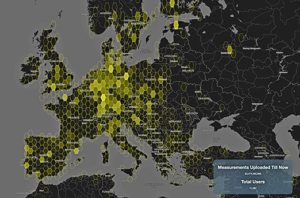
This graphic represents measurements uploaded via the CAMALIOT app by thousands of volunteers. (Image: ESA)
More than 11,000 people around Europe and the world have turned their smartphones into GNSS monitoring tools by downloading the CAMALIOT app, so far delivering more than 53 billion measurements of meteorology and space weather patterns to researchers, according to the European Space Agency (ESA).
ESA asks CAMALIOT volunteers to leave their smartphones by a window each night with GNSS on. The phones record small variations in satellite signals, gathering data for machine-learning analysis. More than 50 smartphone models with dual-frequency receivers can use the app.
CAMALIOT was developed through ESA’s Navigation Innovation and Support Programme (NAVISP) with the support of the agency’s Navigation Science Office through its GNSS Science Support Centre. The combination of GNSS data, smartphone access and machine learning in support of science is a priority research line of ESA’s Navigation Science Office.
GNSS signals undergo scintillation as they pass through irregular plasma patches in the ionosphere. This electrically charged upper atmospheric layer is continuously changing, influenced by solar activity, geomagnetic conditions and the local time of day. Dual-frequency GNSS receivers can compensate for this effect by comparing their two frequencies.
As these signals head to Earth, they are also modified by the amount of water vapor in the lower atmosphere, helping to forecast rainfall in particular.
“Fixed satnav stations already monitor these effects, but these smartphone-based measurements are boosting our coverage hugely. We’re very gratified by all the support we’ve received,” said Vicente Navarro, ESA navigation engineer. ”These results will then undergo a Big Data machine-learning analysis, seeking out previously unseen patterns in both Earth and space weather.”
Formally known as the Application of Machine Learning Technology for GNSS IoT Data Fusion project, CAMALIOT is run by a consortium led by ETH Zurich in collaboration with the International Institute for Applied Systems Analysis.
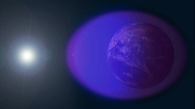
The ionosphere is shown in purple and not-to-scale in this image. (Image: NASA’s Goddard Space Flight Center/Duberstein)
Researchers have developed a new mathematical model to more accurately capture how ionospheric scintillation interferes with GNSS signals, reports EOS.
The new model uses a Markov chain. The model’s parameters were drawn from data on actual signal disruptions caused by ionospheric scintillation above Hong Kong on March 2, 2014. The researchers compared its predictions with real-world data and found it accurately emulated the timing and duration of the actual signal disruptions and did so more accurately than an earlier model that did not use a Markov chain approach.
Citation: “Markov Chain-Based Stochastic Modeling of Deep Signal Fading: Availability Assessment of Dual-Frequency GNSS-Based Aviation Under Ionospheric Scintillation” by Andrew K. Sun, Hyeyeon Chang, Sam Pullen, Hyosub Kil, Jiwon Seo, Y. Jade Morton and Jiyun Lee, Published in Space Weather, June 24, 2021. https://doi.org/10.1029/2020SW002655
The team’s findings also suggest that dual-frequency GNSS signals can significantly counteract the disruptive effects of strong scintillation, specifically for aircraft navigation.
In the future, this new modeling approach could be extended to improve understanding of other effects of ionospheric scintillation on GNSS signals, as well as their effects at other latitudes.
The University of Nottingham is working with Brazilian and European Union (EU) partners to solve atmospheric interference problems that hamper satellite-based positioning in equatorial countries like Brazil.
The research network will support the advancement of precision agriculture, which aims to make crop farming practices cheaper, greener and more efficient using satellite positioning and remote sensing.
These technologies rely on GNSS (such as GPS and Galileo) to obtain centimeter-accurate coordinates on Earth. Farmers then use this real-time precise data to optimize fertilizer use, to steer driverless machinery and for soil mapping to maximize crop production in a bid to feed a rising world population.
Despite its revolutionary potential, precision agriculture adoption rates in countries on equatorial regions such as Brazil are hindered by ionospheric scintillation in the Earth’s upper atmosphere.
Ionospheric scintillation affects the integrity, availability and accuracy of satellite positioning. Specifically, it causes interference with the propagation of satellite signals as they pass through the ionosphere, making it difficult for GNSS receivers to lock onto satellites and track their signals. This results in not only large errors but sometimes to service outages.
“The strong signal fluctuations that characterize ionospheric scintillation are caused by the irregular behavior of the ionosphere that is typical of the equatorial latitudes, affecting most of the Brazilian territory, hence the importance of the bilateral collaboration in the PEARL network,” said project leader Marcio Aquino from the Nottingham Geospatial Institute at the University.
The PEARL network, which is funded by the European Commission’s INCOBRA project, aims to tackle this problem head on to ensure high-accuracy positioning by satellite is robust and achievable in real time in Brazil.
“Solutions arising from the research will have a positive impact not only in Brazil but in the whole of Latin America, due to its geographical location near the equator and corresponding disruptive ionospheric effects,” Aquino said. “It could play a pivotal role in promoting the uptake of satellite-based positioning and the broad acceptance of the new EU system Galileo, paving the way for service implementation in other similarly affected parts of the world, such as southern China, India, Indonesia and Malaysia.”
Research and industrial partners from both Europe and Brazil will come together on the seven-month initiative to develop strategies to map the causes of ionospheric scintillation and specialized algorithms to model and mitigate their effects on satellite-based positioning.
These strategies will be part of a large Brazil-EU collaborative proposal to be submitted to the forthcoming H2020 SPACE-EGNSS call due out in October 2018.
Network members include small to medium enterprises in Europe and Brazil that are keen to incorporate new solutions that will improve their satellite-based services.
The PEARL network encompasses:
University of Nottingham, UK; Sao Paulo State University and Universidade do Estado de Mato Grosso, Brazil.
National Institute of Geophysics and Volcanology and SpacEarth Technology (an SME), Italy.
Space Research Centre of Polish Academy of Sciences, Poland.
Three small and medium-sized enterprises (SMEs): Geo++, Germany, and Alezi Teodolini and MC Engenharia Ltd, Brazil.
The European Commission funds the INCOBRA project to increase and enhance Research and Innovation cooperation activities between Brazil and the European Union. PEARL is one of INCOBRA’s bilateral R&I cooperation networks, led by the University of Nottingham, addressing one of INCOBRA’s priority areas, namely bio-economy, food security and sustainable agriculture.
According to the latest issue of the GSA GNSS market report (issue 5, 2017), revenue for GNSS device sales in precision agriculture will grow to nearly €3 billion by 2025, quadrupling from €750 million in 2013 (based on GNSS receiver sales to just this market segment).