Tag: IP68

  • Septentrio expands AsteRX SB3 line with base station receiver

    Septentrio expands AsteRX SB3 line with base station receiver

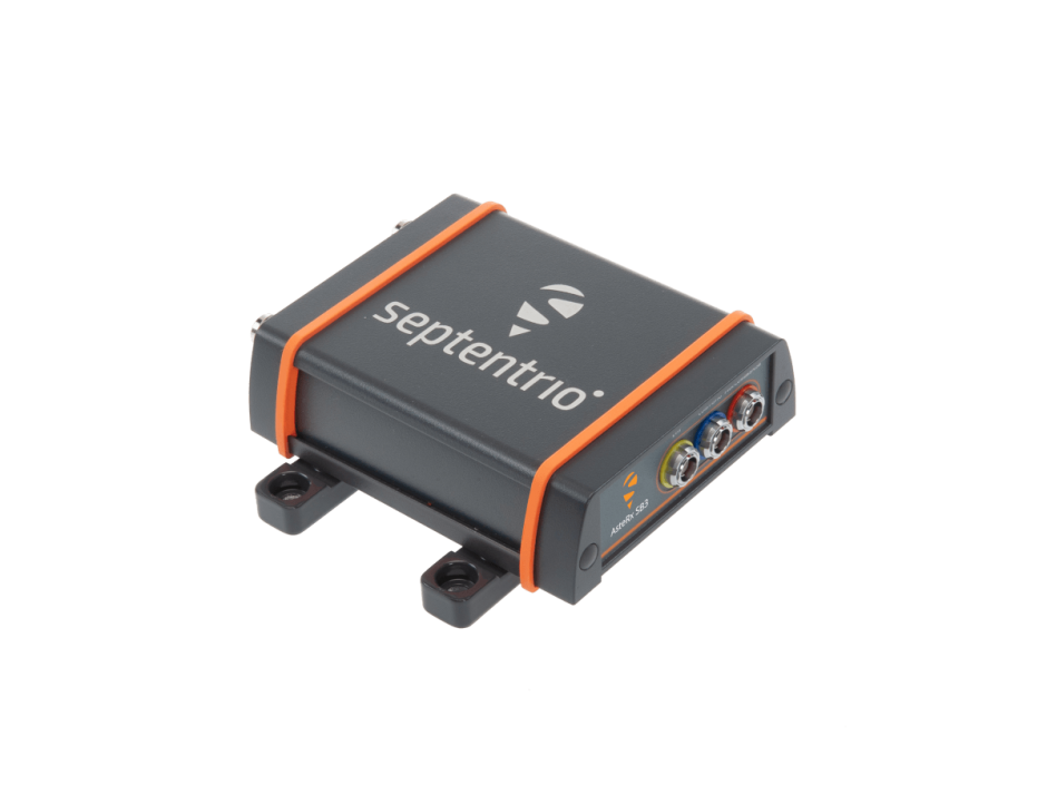
    Septentrio, a leader in high-precision GNSS positioning solutions, introduced the AsteRx SB3 ProBase, the latest generation of GPS/GNSS base station receivers, designed for the creation of top-quality measurements for RTK and differential corrections.

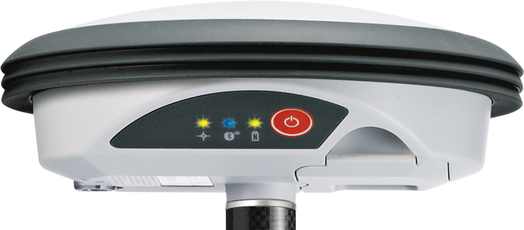
    The AsteRx SB3 ProBase is an IP68-housed GNSS base station receiver, featuring the latest quad-constellation GNSS technology for the best quality measurements. The new ruggedized receiver complements the SB3 receiver family: the AsteRx SB3 Pro, rover receiver, the AsteRx SB3 Pro+ rover and base receiver and the AsteRx SB3 CLAS, dedicated to the Japanese market.

    “Customers often look for a simple, high-quality and easy-to-integrate base station to set up local high precision RTK or to densify their network and the AsteRx SB3 ProBase is the perfect solution,” said Silviu Taujan, Product Manager at Septentrio. “Thanks to its configuration flexibility and monitoring capabilities it is extremely easy to deploy and configure the SB3 ProBase. Plus, it comes with our industry-leading GNSS+ technologies, including anti-jam and anti-spoofing technology (AIM+) for unbeatable robustness and reliability.”

    AsteRx SB3 products are pin-to-pin compatible with Septentrio’s popular AsteRx SB ProDirect receiver and with the recently released AsteRx SBi3 GNSS/INS system, making it simple to change receivers.

    Photo: Septentrio
    Photo: Septentrio
  • Rugged IP68 GPS Handhelds and Field Computers Launched

    Rugged IP68 GPS Handhelds and Field Computers Launched

    The GAGAN-enabled Sxtreo GN11.
    The GAGAN-enabled SXtreo GN11.

    Stesalit today announced the availability of the SXtreo range of rugged GPS handhelds for survey, industrial use, and field work under extreme conditions such as agriculture, forestry, roads, security and construction.

    The SXtreo series of mobile devices are rated IP-68, meaning they are waterproof, dust proof, shockproof, and are coupled with built-in mobile GIS applications. Long battery life allows GPS data collection for a full work day, without the need for recharging. The GNSS devices come with full-size USB port for connecting devices.

    Stesalit is based in India, and the SXtreo gives that country an affordable option to take geotagged photos and conduct waypoint surveys. The design and conceptualization of SXtreo is a result of the in-house R&D effort of Stesalit. The road towards the birth of SXtreo is presented in the video:

    The GAGAN-enabled SXtreo GN series of rugged GNSS field computers and PDAs comes with a full keypad and large five-inch sunlight-readable screen for field data entry in large forms. These models are designed for GPS data collection and asset management, socioeconomic surveys, mapping, agriculture, logistics, forestry, public transportation, construction and security.

    The SXtreo WP 60 and WP61 devices have all the features of a smartphone.

    The Sxtreo WP 61 rugged smartphone.
    The SXtreo WP 61 rugged smartphone.

    SXtreo handheld’s Android and embedded Linux-based open-source secured operating systems are compatible with a range of sector-specific applications designed by Stesalit.

    • SXgeo is specially designed for waypoint, routes, and track surveys. The added advantage from the similar existing applications is that one can capture geotagged photos and transfer the survey data through GPRS.
    • SXsurvey is a complete suite for comprehensive survey management. With the features of SXgeo, one can also create large forms dynamically in the devices for survey data collection.
    • SXfield is specifically built for the field workers and employees working away from office like road construction, oil, gas and other utility services, logistics and distribution chains, FMCG, consumer and white good companies with large sales networks, operations and maintenance organizations with large service networks, and security organizations including police.
    • The integrated application SXagro is a geospatial agriculture decision-support system in use by agriculture universities and state agriculture departments.

    In addition, the SXtreo range of IP68 rugged smartphones is compatible with most of the off-the-shelf mobile software applications.

  • Leica Zeno GG03 SmartAntenna for GIS Asset Collection Earns IP68 Certification

    Leica Zeno GG03 SmartAntenna for GIS Asset Collection Earns IP68 Certification

    Photo: Leica Zeno GG03 SmartAntennaWith its recent Ingress Protection (IP) certification, the Leica Zeno GG03 SmartAntenna is now an IP68-certified SmartAntenna for GIS applications. IP68 represents the top rating for protection against dust, moisture and water. Meeting the tough standards for Ingress Protection (IP) makes the Leica Zeno GG03 a rugged GNSS SmartAntenna for GIS asset collection and management tasks.

    The upgradable Leica Zeno GG03 SmartAntenna is designed for organizations that require a compact and lightweight device for accurate and reliable positioning. The robust design of the Zeno GG03 brings further advantages when collecting GIS assets by offering reliable and rugged operation in extreme environments, even after continued exposure to water and dust.

    “The Leica Zeno GIS series is used all over the world in the most demanding environments,” said Product Manager Johannes Hotz. “The IP68 rating further underlines the quality and robustness of the Leica Zeno GG03. The industry-leading GNSS performance and an unmatched ultra-rugged design is a big win for our customers in the field.”