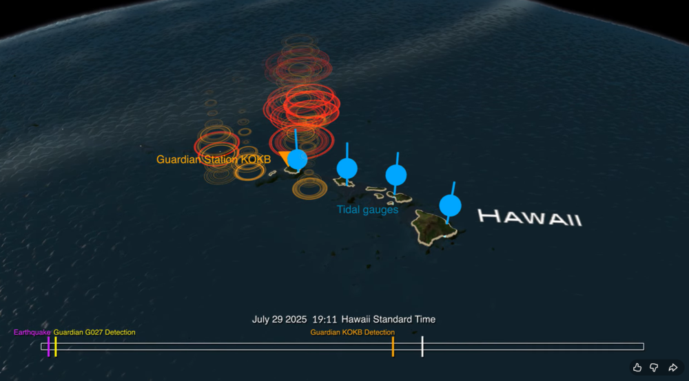
A new data visualization illustrates how an experimental NASA technology can provide extra lead time to communities in the path of a tsunami. Called GUARDIAN (GNSS Upper Atmospheric Real-time Disaster Information and Alert Network), the software detects slight distortions in satellite navigation signals to spot hazards on the move.
The animation breaks down a real-life case study: 2025’s massive Kamchatka earthquake and the tsunami that it sent racing across the Pacific and towards Hawaii at more than 500 mph (805 kph).
The visualization shows the magnitude 8.8 earthquake (seen in purple) strike off the Russian coast on July 29, 2025, triggering the tsunami. The red, orange, yellow, and green ringlets represent real-time readings from ground stations tracking GPS and other navigational satellite signals. The disturbances were spotted by GUARDIAN’s artificial intelligence-powered detection algorithms as soon as eight minutes after the earthquake.
For the next several hours, signs of the tsunami were picked up by GUARDIAN across the Pacific Ocean in near real time. The system flagged an incoming wave off the coast of Kauai some 32 minutes before it made landfall and was detected by tide gauges (shown in blue).
The results highlight GUARDIAN’s potential to augment existing early warning systems, said Camille Martire, one of its developers at NASA’s Jet Propulsion Laboratory in Southern California.
Currently, determining whether an earthquake generated a tsunami remains a challenge. Forecasters rely on seismic data and computer simulations to make their best prediction, then wait for pressure sensors attached to the ocean floor to confirm a passing wave. Those sensors work well but are expensive and thinly dispersed. Gaps in coverage remain. And in those gaps, warning time disappears.
The GUARDIAN approach is complementary and cost effective because it monitors existing data from GPS and other constellations that make up the Global Navigation Satellite System. It’s also free to access, though for now best suited to analysts trained to interpret its findings.
How GUARDIAN works
All day, every day, geopositioning constellations transmit radio signals to ground stations around the globe. On the ground, the data is refined to sub-decimeter (less than 10 centimeters) positioning accuracy by JPL’s Global Differential GPS System. Before the signals get there, however, they must travel through an electrically charged skin of plasma called the ionosphere.
Solar storms and other space weather can wreak electrical mayhem in the ionosphere, and so can events on Earth. Tsunamis and earthquakes, by displacing large amount of air at Earth’s surface, unleash pressure waves that can slightly perturb the radio signals coming down from satellites. While systems are in place to correct for this “noise,” GUARDIAN considers it a useful signal.
Currently, GUARDIAN scours data from more than 350 GNSS ground stations around the Pacific Ring of Fire, a hotbed for the ocean’s deadliest waves. And the system is not confined to tsunamis. Earthquakes, volcanic eruptions, missile tests, spacecraft reentries, meteoroid splashdowns — anything that produces a large rumble on Earth is potentially fair game. While the Kamchatka event didn’t cause widespread damage to people or property, it showed how the next time disaster strikes, NASA science could give communities a few more minutes to act.
GUARDIAN is being developed at JPL by the GDGPS project, which is partially supported by NASA’s Space Geodesy Project.
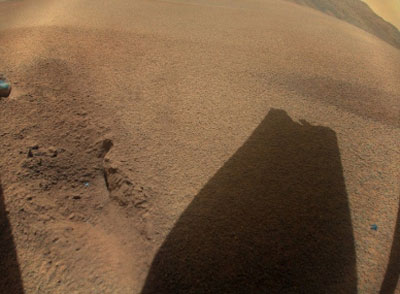
NASA’s Ingenuity took this picture on Jan. 18, 2024. The sand-dune, rock-less area where Ingenuity last showing the shadow of its damaged rotor blade. (Image: NASA)
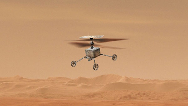
It appears that the little extraterrestrial drone that could has come a cropper on Mars and now will not be flying again – it is permanently grounded. The Jet Propulsion Lab (JPL) crew managing Ingenuity was running a regular scouting trip over a featureless sand-dune area on Dec. 22, 2023. Suddenly, the UAV’s visual navigation system malfunctioned, which led to a hard emergency landing.
When the autonomous navigation system did not have any landmarks to match its digital reference map, it reverted to an emergency landing. Maybe the poor guy should have had a few moments to gather its airborne wits and to come down softly, but alas at the same time the connection with the rover was lost, he dove for cover and broke a chunk off at least one of the counter-rotating blades. This now apparently prevents further take-offs. Mars’ atmosphere is only 1% as dense as Earth’s, so those rotors need all their designed lift capabilities to grab enough ‘air’ and get the 4 lb helicopter airborne. The flight control system may be unable to cope with the resulting compromised lift profile. Either way Ingenuity’s flying days are over, according to NASA.
Conceptual design for the Sample Recovery Helicopters (Image: Aerovironment/ NASA/ JPL)
Ingenuity completed 72 flights over the course of three years, surpassing its original 30-day mission to prove the possibility of a miniature, autonomous helicopter flight on Mars. After its initial four flights, NASA and JPL chose the UAV to scout out safe paths for the Perseverance rover from an airborne perspective.
All is not lost for Ingenuity, however. AeroVironment, the UAV manufacturer that co-developed Ingenuity with NASA/JPL, has been awarded another contract to design and develop two prototype ‘sample-return’ helicopters for NASA’s next major Mars expedition.
Building on Ingenuity’s design, the new UAV will have wheels and a grappling contraption to pick up sample tubes, which could assist in the Mars sample recovery mission. Perseverance is currently expected to be the lead in transferring cached sample tubes to the new Sample Retrieval Lander for return to Earth, but the new helicopters provide a different backup option on Mars for pick-up and transport of the tubes.
Back here on Earth, the latest tragic news from the Middle East — the UAV attack on the US Tower 22 military outpost in Jordan which cost three soldiers their lives and injured at least 34 others — appears to have been due to a lack of defensive capability. Earlier news releases indicated that the kamikaze UAV had arrived at the same time as the expected return of a U.S. UAV from the base, implying that defenses may have been taken down temporarily. It now seems that there was little active defense to prevent the attack.
The attacking UAV reportedly came in very low, and the base was unable to track its approach. The base is said to have defensive signal jamming capabilities, but without radar visibility of the UAV and knowing an attack was in progress, the jammers may have been ineffective or inactive.
Tower 22 was thought of as a low-risk-of-attack U.S. base, perhaps supporting another U.S. base in Syria with logistics, so no active drone suppression system had been provisioned. This assessment, and those for similar bases in the area and around the world, may perhaps have to be revised and sufficient active defenses may need to be installed.
While U.S. and Ukrainian forces deal with attacking drones, Iran has unveiled its latest addition to its arsenal of one-way killer unmanned aircraft.
Image: Iranian Military Media
Iran displayed the Shahed-238 in public in November 2023, so there may have already been enough time to get some of these very fast-flying vehicles through the manufacturing process and begin deliveries to Russia and Iranian proxy agents. The advantage of jet-power is of course significant speed over propeller-driven variants, while the range may be significantly less for the same fuel capacity. The disadvantage for the United States and Ukraine is that most fielded conventional UAV detection radars have difficulty seeing fast targets in time to activate and aim defensive weapons.
The situation for Ukraine and the United States in the Middle East appears to be worsening as large numbers of Iranian-supplied and locally manufactured kamikaze UAVs are pumped into the war zone and ‘hot spots’ in the Middle East.
It is sad that Mars aerial views may be limited as Ingenuity seems to be permanently grounded, and the Middle East doesn’t sound too safe to be hanging around in either! Further escalation of prices might be expected, too, as a good part of the volume of cargo ships settle into sailing around Africa. Let’s look for better news in the coming months.
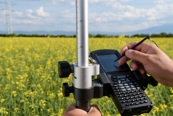
In this issue’s cover, a man with a backpack lidar unit, a GNSS receiver and a tablet computer is surveying in a complex and challenging urban setting. That same lidar unit also can be mounted on a UAV. One of the contributors to this month’s cover story describes the role of aerial photogrammetry in the architecture, engineering and construction (AEC) industry. Satellite navigation, remote sensing, mapping software, a great variety of platforms, and ever more powerful handheld computers — those are the key ingredients in today’s ecosystem of geospatial technologies. The current generation of surveying equipment has more than halved fieldwork in the past two decades while greatly improving the quality of the data collected.
The AEC industry relies on surveyors to be “a bridge between the existing landscape and the design landscape,” said another contributor to our cover story. Unlike traditional boundary surveying, he explained, surveying for AEC requires consideration of a detailed 3D world. It also involves many more stakeholders and much greater liability.
The tight integration of GNSS, inertial systems, lidar sensors and 360° spherical imagery into mobile mapping systems makes 3D modeling possible and traditional GNSS or optical measurement instruments obsolete. However, while inertial systems are invaluable to bridge brief gaps in the availability and reliability of GNSS signals, they are far from the panacea they are sometimes claimed to be, as Brad Parkinson reminds us in an interview with Dana Goward, also in this issue.
Surveying for AEC requires at least centimeter accuracy. The challenges of surveying in urban settings include urban canyons that occult signals and create multipath, traffic and multiple layers of underground, ground-level and above-ground infrastructure.
Beyond the construction phase, 3D survey data is increasingly used to create digital twins of buildings, which facilitate their operation and maintenance throughout their life cycle and help lower their carbon footprint. Once they have completed an initial survey, surveyors often set control to be used for machine control — the theme of our cover story in next month’s issue.
In this issue we also:
• Inaugurate a “letters to the editor” section to make more room for debate in the GNSS/PNT community on the critical issues it faces.
• Report on a Jet Propulsion Laboratory study of the impact on the ionosphere of the enormous volcanic eruption in Tonga and the beginnings of a GNSS-based early warning system for natural hazards.
• Continue our series of articles on GNSS constellations, with an update from Japan’s QZSS constellation.
• Feature three studies: one on real-time simulator testing using an NMEA data stream, one on the first transmission of L1C/B signals by QZSS, and one on self-driving cars in major metropolitan areas.
All these advances, however, are threatened when GPS is threatened. Earlier in the month, three members of our editorial advisory board comment on the recent threat to GPS satellites by the Russian government.
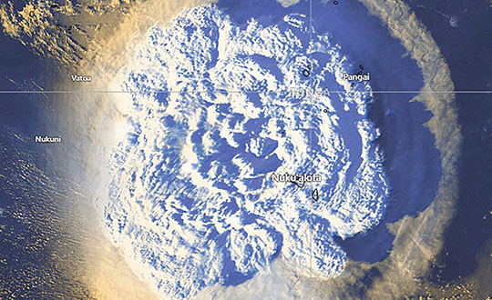
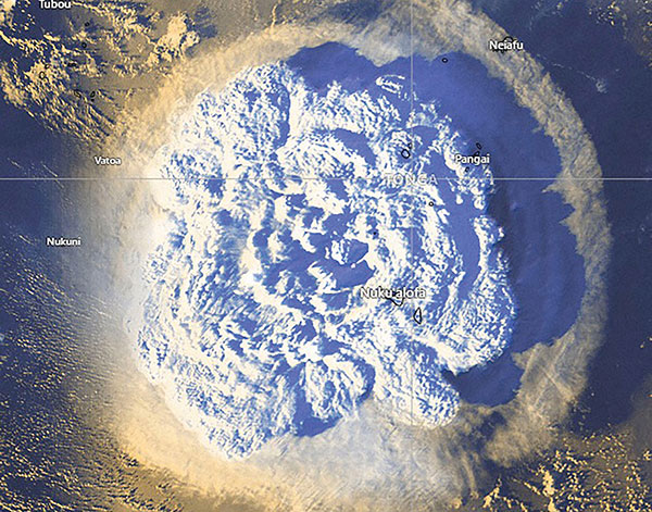
On Jan. 15, Hunga-Tonga-Hunga-Ha’apai, an uninhabited volcanic island on the Tongan archipelago in the South Pacific Ocean, erupted with spectacular force, churning ocean waters halfway across the globe.
GNSS engineers also detected its effects hundreds of miles above, in the ionosphere. The GNSS community is now moving from such after-the-fact detection to real-time monitoring using NASA’s Global Differential GPS (GDGPS) system, according to a team with the Tracking Systems and Application Section at NASA’s Jet Propulsion Laboratory (JPL) in Southern California.
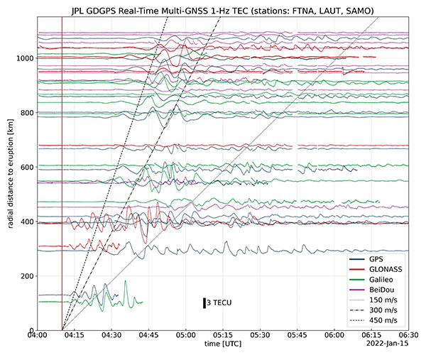
“We monitored, in real time, four GNSS satellite constellations from numerous stations around the world using the GDGPS network. In particular, the three stations closest to the volcano, in Samoa, Fiji and Tahiti,” said postdoctoral associate Leo Martire. “We could see extremely high and strong signals in the ionosphere, which is very unusual. As a function of radial distance from the eruption, the first detected ionospheric perturbation likely originated directly from the explosion. Then we see patterns propagating at increasing distances at different radial propagation speeds.”
Monitoring such events adds information to the catalog of signals from natural hazards, pointed out Siddharth Krishnamoorthy, a research technologist who manages JPL’s GUARDIAN near-real-time tsunami warning system, currently under development. “That is useful because, in the future, if you want to be able to spot natural hazards and issue alerts, you need to know what the signal looks like. There have been reports of a tsunami in Tonga due to this event, so we will look at potential tsunami-induced signatures in the ionosphere. We are trying to get to a place where we pick up a signal like this and we are able to say, ‘This is a tsunami propagating at this speed and in this direction.’”
Chart: Jet Propulsion Laboratory
Before being detected in the ionosphere, signals from natural hazards must travel all the way from the surface. For tsunamis, this usually takes more than 10 to 20 minutes, but the volcanic eruption only took a couple of minutes to reach the ionosphere because it shot straight up. “We do not know yet, based on observations, how exactly different events on the surface caused by natural hazards couple with the atmosphere,” said research technologist Panagiotis Vergados. “Every event is unique in its spectral properties.”
The event did not affect the quality of GDGPS’s GNSS positions or orbits, because dual-frequency measurements remove significant ionospheric effects. “Instead of looking at the direct effects on the position of our available reference stations, which is what our traditional real-time monitoring does and which was basically negligible, imagine the links from each of those stations to a dozen or more satellites,” said Larry Romans, GDGPS chief technologist. “Every time one of those many links pierces the ionosphere, we can monitor that signal for ripples as waves go by. So, this is an incredibly powerful method for seeing disturbances, just in terms of the density of data. It is very complementary to position-based natural-hazards monitoring because the data is much richer.”
In addition to volcanoes and tsunamis, several other natural events, such as earthquakes and very large thunderstorms, also produce these effects. “These natural forcings cause large-scale, low-frequency pressure perturbations that tend to travel up and be visible in the ionosphere,” Krishnamoorthy said. “There are also perturbations of the ionosphere due to events from outside the Earth, such as solar flares or bolide impacts.”
Many of these perturbations start from the troposphere, which ranges between 10 km and 15 km in altitude — including hurricanes, which overshoot gravity waves all the way to the ionosphere, and thermal tides that have been observed to go all the way up to 600 km, said Vergados. “There are also geomagnetic storms and sub-storms that, during electron precipitation, can change the ionization of the ionosphere. So, the coupling can happen from either below or above or simultaneously, and then the effect can be dramatically enhanced.”
Most of the perturbations that come from below are of a pressure nature — that is, they start out as mechanical waves — while most of those that come from above are electromagnetic. “Aside from nuclear explosions, very large chemical ones, such as the 2020 Beirut explosion, also cause a signature on the ionosphere because they create very large pressure waves,” Krishnamoorthy said.
Photo: Tonga Meteorological Services, Government of Tonga
To get the best measurements of Earth’s atmosphere, you sometimes have to leave it. This November, the Sentinel-6 Michael Freilich spacecraft will do just that.
News from the Jet Propulsion Laboratory
When a satellite by the name of Sentinel-6 Michael Freilich launches this November, its primary focus will be to monitor sea-level rise with extreme precision. But an instrument aboard the spacecraft will also provide atmospheric data that will improve weather forecasts, track hurricanes and bolster climate models.
“Our fundamental goal with Sentinel-6 is to measure the oceans, but the more value we can add, the better,” said Josh Willis, the mission’s project scientist at NASA’s Jet Propulsion Laboratory in Southern California. “It’s not every day that we get to launch a satellite, so collecting more useful data about our oceans and atmosphere is a bonus.”
A U.S.-European collaboration, Sentinel-6 Michael Freilich is one of two satellites that compose the Copernicus Sentinel-6/Jason-CS (Continuity of Service) mission. The satellite’s twin, Sentinel-6B, will launch in 2025 to take over for its predecessor. Together, the spacecraft will join TOPEX/Poseidon and the Jason series of satellites, which have been gathering precise sea-level measurements for nearly three decades. Once in orbit, each Sentinel-6 satellite will collect sea-level measurements down to the centimeter for 90% of the world’s oceans.
JPL-developed instrument
Meanwhile, they’ll also peer deep into Earth’s atmosphere with GNSS-RO to collect highly accurate global temperature and humidity information. Developed by JPL, the spacecraft’s GNSS-RO instrument tracks radio signals from navigation satellites to measure the physical properties of Earth’s atmosphere. As a radio signal passes through the atmosphere, it slows, its frequency changes, and its path bends. Called refraction, this effect can be used by scientists to measure minute changes in atmospheric physical properties, such as density, temperature, and moisture content.
The precise global atmospheric measurements made by Sentinel-6 Michael Freilich will complement atmospheric observations by other GNSS-RO instruments already in space. Specifically, the National Oceanic and Atmospheric Administration’s National Weather Service meteorologists will use insights from Sentinel 6’s GNSS-RO to improve weather forecasts.
Also, the GNSS-RO information will provide long-term data that can be used both to monitor how our atmosphere is changing and to refine models used for making projections of future climate. Data from this mission will help track the formation of hurricanes and support models to predict the direction storms may travel. The more data we gather about hurricane formation (and where a storm might make landfall), the better in terms of helping local efforts to mitigate damage and support evacuation plans.
The Sentinel-6 Michael Freilich spacecraft undergoes tests at its manufacturer Airbus in Friedrichshafen, Germany, in 2019. The white GNSS-RO instrument can be seen attached to the upper left portion of the front of the spacecraft. (Photo: Airbus)
A brief history of radio occultation
Radio occultation was first used by NASA’s Mariner 4 mission in 1965 when the spacecraft flew past Mars. As it passed behind the Red Planet from our perspective, scientists on Earth detected slight delays in its radio transmissions as they traveled through atmospheric gases. By measuring these radio signal delays, they were able to gain the first measurements of the Martian atmosphere and discover just how thin it was compared to Earth’s.
By the 1980s, scientists had started to measure the slight delays in radio signals from Earth-orbiting navigation satellites to better understand our planet’s atmosphere. Since then, many radio occultation instruments have been launched; Sentinel-6 Michael Freilich will join the six COSMIC-2 satellites as the most advanced GNSS-RO instruments among them.
“The Sentinel-6 instrument is essentially the same as COSMIC-2’s. Compared to other radio occultation instruments, they have higher measurement precision and greater atmospheric penetration depth,” said Chi Ao, the instrument scientist for GNSS-RO at JPL.
GNSS-RO basics
The GNSS-RO instrument’s receivers track navigation satellite radio signals as they dip below, or rise from, the horizon. They can detect these signals through the vertical extent of the atmosphere — through thick clouds — from the very top and almost all the way to the ground. This is important, because weather phenomena emerge from all layers of the atmosphere, not just from near Earth’s surface where we experience their effects.
“Tiny changes in the radio signal can be measured by the instrument, which relate to the density of the atmosphere,” said Ao. “We can then precisely determine the temperature, pressure, and humidity through the layers of the atmosphere, which give us incredible insights to our planet’s dynamic climate and weather.”
With the help of JPL’s GNSS-RO principal investigator Chi Ao and NOAA’s National Weather Service meteorologist Mark Jackson, this video explains how the GNSS-RO instrument aboard Sentinel-6 Michael Freilich will be used by meteorologists to improve weather forecasting predictions. (Credit: NASA/JPL-Caltech)
But there’s another reason why probing the entire vertical profile of the atmosphere from orbit is so important: accuracy. Meteorologists typically gather information from a variety of sources – from weather balloons to instruments aboard aircraft. But sometimes scientists need to compensate for biases in the data. For example, air temperature readings from a thermometer on an airplane can be skewed by heat radiating from parts of the aircraft.
GNSS-RO data is different. The instrument collects navigation satellite signals at the top of the atmosphere, in what is close to a vacuum. Although there are sources of error in every scientific measurement, at that altitude, there’s no refraction of the signal, which means there’s an almost bias-free baseline to which atmospheric measurements can be compared in order to minimize noise in data collection.
And as one of the most advanced GNSS radio occultation instruments in orbit, said Ao, it will also be one of the most accurate atmospheric thermometers in space.
More on the mission
Copernicus Sentinel-6/Jason-CS is being jointly developed by the European Space Agency (ESA), the European Organisation for the Exploitation of Meteorological Satellites (EUMETSAT), NASA, and the National Oceanic and Atmospheric Administration (NOAA), with funding support from the European Commission and support from France’s National Centre for Space Studies (CNES).
The first Sentinel-6/Jason-CS satellite that will launch was named after the former director of NASA’s Earth Science Division, Michael Freilich. It will follow the most recent U.S.-European sea-level observation satellite, Jason-3, which launched in 2016 and is currently providing data.
NASA’s contributions to the Sentinel-6/Jason-CS mission are three science instruments for each of the two Sentinel-6 satellites: the Advanced Microwave Radiometer, the GNSS-RO, and the Laser Retroreflector Array. NASA is also contributing launch services, ground systems supporting operation of the NASA science instruments, the science data processors for two of these instruments, and support for the international Ocean Surface Topography Science Team.
Association recognizes key role the agency has played in furthering GPS.
The GPS Innovation Alliance (GPSIA), an organization dedicated to furthering GPS innovation, creativity and entrepreneurship, commends NASA — the U.S. National Aeronautics and Space Administration — on its momentous 60th anniversary. GPSIA celebrates the occasion by recognizing the vital role NASA has played in furthering and facilitating the growth of GPS around the world.
NASA has long been an integral supporter of GPS technologies, from its origins in the first space shuttle program, to the launch of the International Space Station (ISS), to the recent announcement of plans to develop an artificial intelligence-based GPS for space.
Throughout its history, NASA has played a critical role in the success of expanding GPS systems. NASA manages the Navigator GPS receiver, developed by its Goddard Space Flight Center, which has pushed GPS satellites out of lower earth orbit and beyond to enable high altitude applications and track weaker and more rural GPS signals with increased accuracy.
The Global Differential GPS System (GDGPS), a network of more than 350 GPS monitoring stations from 200 contributing organizations in 80 countries developed and operated by NASA’s Jet Propulsion Laboratory, provides an unparalleled combination of real time positioning accuracy and availability and acts as the largest network providing global, multiply-redundant, real time coverage of all GPS satellites at all times.
“GPS contributes immeasurable value to our economy and is used in almost every industry sector,” said NASA Administrator Jim Bridenstine. “It is crucial for our way of life on Earth — the way we communicate, navigate, conduct banking transactions, and so much more rely on our GPS systems. As NASA looks to its future endeavors in exploration and discovery, GPS will remain a cornerstone of technology to accomplish its missions. NASA looks forward to its continued work with the GPS Alliance.”
With the establishment of the National Executive Committee for Space-Based Positioning, Navigation, and Timing in 2004 and other governing bodies since, NASA has also acted as a thought leader on policy trends in the field, advising on and advocating for protections of GPS , one of the world’s most important and ubiquitous public resources.
“The alliance, on behalf of its members and the GNSS industry, congratulates NASA on six decades of cutting-edge innovation and wishes the agency continued success for many decades to come,” said J. David Grossman, executive director of the GPS Innovation Alliance. “As one of the most recognizable technologies in the world, GPS supports navigation, public safety, financial transactions and utilities and varied industries worldwide. We applaud NASA for its unwavering commitment to scientific innovation and to GPS around the globe, now and in the future.”
The GPS Innovation Alliance recognizes the ever increasing importance of GPS and other GNSS technologies to the global economy and infrastructure and is firmly committed to furthering GPS innovation, creativity and entrepreneurship. The GPS Innovation Alliance seeks to protect, promote and enhance the use of GPS.
Michael M. Watkins has been appointed director of the Jet Propulsion Laboratory and vice president at Caltech, the Institute announced. Watkins is the Clare Cockrell Williams Centennial Chair in Aerospace Engineering and director of the Center for Space Research at the University of Texas at Austin.
Watkins has written for GPS World about the GRACE project, which uses GPS and a microwave ranging system to map Earth’s gravitational fields.
Watkins will formally assume his position on July 1. He succeeds Charles Elachi, who will retire on June 30 and move to the Caltech faculty.
Watkins is an internationally recognized scientist and engineer. Before assuming his current position at the University of Texas in 2015, he worked at JPL for 22 years, where he held leadership roles on some of NASA’s highest-profile missions.
Watkins served as mission manager and mission system manager for the Mars Science Laboratory Curiosity Rover; led review or development teams for several missions including the Cassini, Mars Odyssey, and Deep Impact probes; and was the project scientist leading science development for the GRAIL moon-mapping satellites, the GRACE Earth science mission, and the GRACE Follow-on mission, scheduled for launch in 2017. He last served at JPL as manager of the Science Division, and chief scientist for the Engineering and Science Directorate.
“He has been one of the early pioneers of using GPS for very high-precision geodetic applications including precise orbit determination, precise point positioning, mapping of mass variability using high precision gravity field measurements, to name only a few of his major accomplishments in geodesy,” said JPL senior researcher Attila Komjathy, who was one of the first to investigate the use of GPS signals to study the ionosphere.
GPS and microwave ranging. GRACE (the Gravity Recovery and Climate Experiment) maps the Earth’s gravity fields by making accurate measurements of the distance between the two satellites, using GPS and a microwave ranging system. It provides scientists from all over the world with an efficient and cost-effective way to map the Earth’s gravity fields with unprecedented accuracy. The results from this mission have revealed detailed information about the distribution and flow of mass within the Earth and it’s surroundings.
The gravity variations that GRACE studies include: changes due to surface and deep currents in the ocean; runoff and ground water storage on land masses; exchanges between ice sheets or glaciers and the oceans; and variations of mass within the Earth. Another goal of the mission is to create a better profile of the Earth’s atmosphere.
Michael Watkins (Photo: NASA/JPL-Caltech)
“Michael’s record of successful mission leadership and impressive management skills quickly distinguished him as a leading candidate for this position,” said Caltech president Thomas F. Rosenbaum, the Sonja and William Davidow Presidential Chair and professor of physics. “As JPL director, Michael will build upon the laboratory’s outstanding achievements in planetary exploration and Earth science, strengthening the connections between Caltech’s campuses and partnering with NASA to deliver highly complex and nuanced missions.”
“I’ve known Mike Watkins for more than 20 years now,” Elachi said. “Mike has played important and varying roles in a number of important JPL areas. His intimate knowledge of the lab and staff, combined with his highly diversified set of skills and knowledge base in science and engineering, will serve JPL very well in the years to come.”
A committee composed of Caltech trustees, faculty, senior administrative leaders, and a member of the JPL executive council conducted an extensive search and recommended Watkins to Caltech’s president.
Watkins holds a bachelor’s degree, master’s degree, and Ph.D. in aerospace engineering from The University of Texas at Austin. He has published broadly in both engineering and science, contributed more than 100 conference presentations, and has served on the boards of numerous international scientific and engineering societies.
“JPL has such a talented and deeply committed staff,” said Watkins. “It is a privilege to have this opportunity to lead the laboratory to even greater discoveries. I look forward to working with my colleagues on campus and across NASA to forge new directions in space exploration and Earth science.”
GPS World article:
“Instrument of GRACE: GPS augments gravity measurements,” GPS World, 14(2), 16-28, 2003 (C. Dunn et al.).
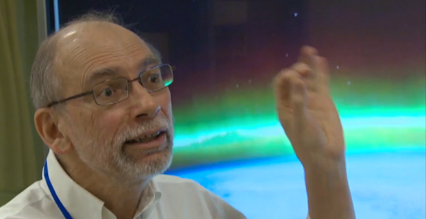
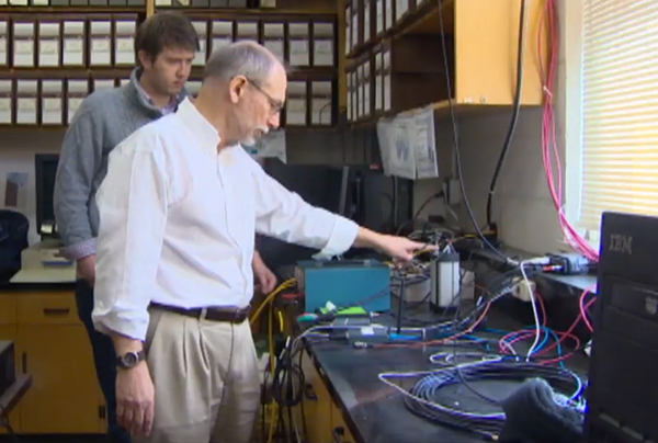
Langley, a professor at the University of New Brunswick, is working with the Jet Propulsion Laboratory in California to better understand how the ionosphere is disturbed by a variety of phenomena including solar outbursts and other natural hazards such as tsunamis. They are using the signals from GPS satellites to probe the ionosphere with the signals being picked up by receivers both on the ground and in low-Earth-orbiting satellites. The research could help find ways to mitigate ionospheric interference to GPS signals themselves as well as to other types of radio communications.
“GPS satellites are much higher than the ionosphere,” Langley told CBC News reporter Shane Fowler. “So the signals from the satellites have to come down through the ionosphere to receivers on or near the Earth’s surface. And as they come down through the ionosphere they get a little distorted. When you see auroras in the sky, that’s when you can tell the ionosphere is a bit disturbed. The average consumer may not notice these variances, but high-precision applications, like for scientific applications, we actually always see the effect of the ionosphere.”
Screen capture from CBC news video.
The research could also help develop early-detection systems for tsunamis. “The energy from that water displacement actually propagates up all the way into the atmosphere, all the way to the ionosphere,” Langley told CBC. “It basically moves around the electrons up there and GPS signals coming down from the satellites, through the ionosphere, pick up those small variations. It has the potential to save a lot of lives.”
Solar flares can also affect GPS signals. The Carrington Event, a solar storm in 1859, knocked out some of Earth’s telegraph systems. “The effect on the Earth’s magnetic field was so strong that currents were set up,” Langley told the CBC. “Those currents were so strong that telegraphs could run without batteries. There was enough current from this disturbance that it could run the telegraphs. And in some cases there was too much and rumour has it started small fires. Luckily we haven’t had one of those again; it seems to be a one-in-100-year, or a one-in-a-200-year, event.”
Editor’s note: GPS World Innovation editor Richard Langley has co-authored a study, described below, exploring how irregularities in Earth’s upper atmosphere can distort GPS signals, an important step toward mitigation.
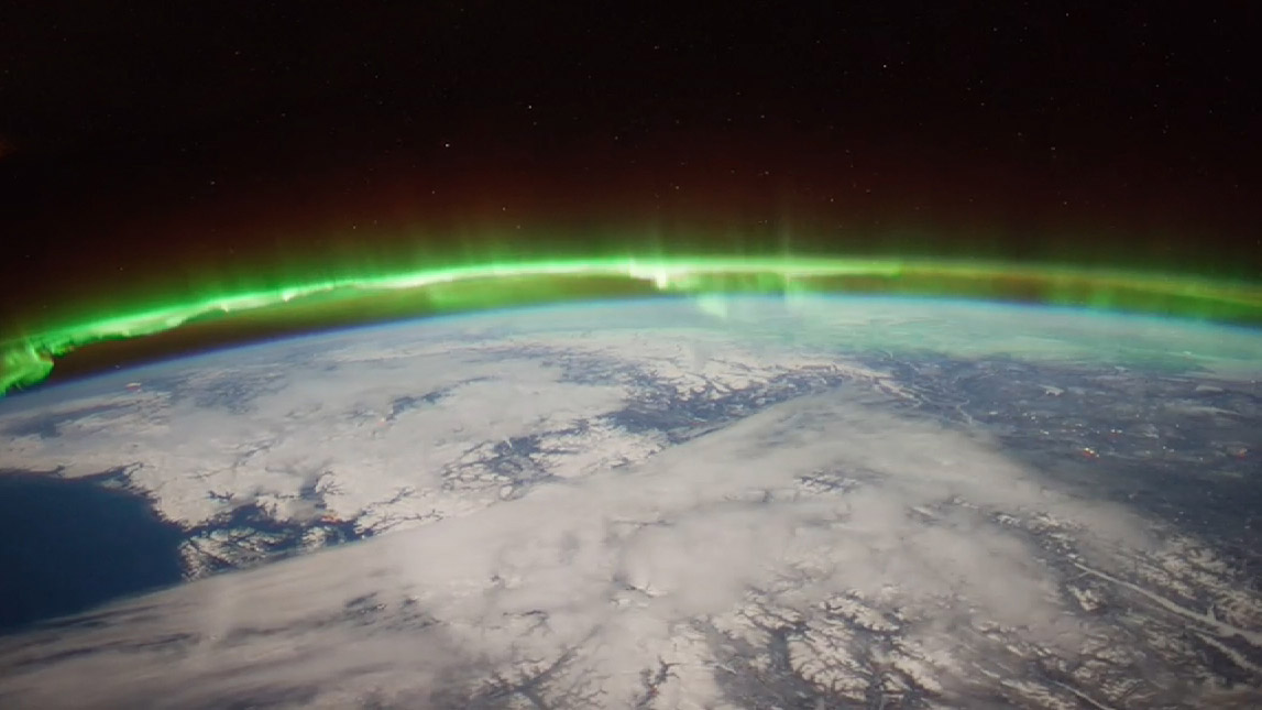
The Aurora Borealis viewed by the crew of Expedition 30 on board the International Space Station. The sequence of shots was taken on February 7, 2012 from 09:54:04 to 10:03:59 GMT, on a pass from the North Pacific Ocean, west of Canada, to southwestern Illinois. Image Credit: NASA/JSC
News from the Jet Propulsion Laboratory
When you don’t know how to get to an unfamiliar place, you probably rely on a smartphone or other device with a GPS module for guidance. You may not realize that, especially at high latitudes on our planet, signals traveling between GPS satellites and your device can get distorted in Earth’s upper atmosphere.
Researchers at NASA’s Jet Propulsion Laboratory (JPL), Pasadena, Calif., in collaboration with the University of New Brunswick in Canada, are studying irregularities in the ionosphere, a part of the atmosphere centered about 217 miles (350 kilometers) above the ground that defines the boundary between Earth and space. The ionosphere is a shell of charged particles (electrons and ions), called plasma, that is produced by solar radiation and energetic particle impact.
The new study, published in the journal Geophysical Research Letters, compares turbulence in the auroral region to that at higher latitudes, and gains insights that could have implications for the mitigation of disturbances in the ionosphere. Auroras are spectacular multicolored lights in the sky that mainly occur when energetic particles driven from the magnetosphere, the protective magnetic bubble that surrounds Earth, crash into the ionosphere below it. The auroral zones are narrow oval-shaped bands over high latitudes outside the polar caps, which are regions around Earth’s magnetic poles. This study focused on the atmosphere above the Northern Hemisphere.
“We want to explore the near-Earth plasma and find out how big plasma irregularities need to be to interfere with navigation signals broadcast by GPS,” said Esayas Shume. Shume is a researcher at JPL and the California Institute of Technology in Pasadena, and lead author of the study.
If you think of the ionosphere as a fluid, the irregularities comprise regions of lower density (bubbles) in the neighborhood of high-density ionization areas, creating the effect of clumps of more and less intense ionization. This “froth” can interfere with radio signals including those from GPS and aircraft, particularly at high latitudes.
The size of the irregularities in the plasma gives researchers clues about their cause, which help predict when and where they will occur. More turbulence means a bigger disturbance to radio signals.
“One of the key findings is that there are different kinds of irregularities in the auroral zone compared to the polar cap,” said Anthony Mannucci, supervisor of the ionospheric and atmospheric remote sensing group at JPL. “We found that the effects on radio signals will be different in these two locations.”
The researchers found that abnormalities above the Arctic polar cap are of a smaller scale — about 0.62 to 5 miles (1 to 8 kilometers) — than in the auroral region, where they are 0.62 to 25 miles (1 to 40 kilometers) in diameter.
Why the difference? As Shume explains, the polar cap is connected to solar wind particles and electric fields in interplanetary space. On the other hand, the region of auroras is connected to the energetic particles in Earth’s magnetosphere, in which magnetic field lines close around Earth. These are crucial details that explain the different dynamics of the two regions.
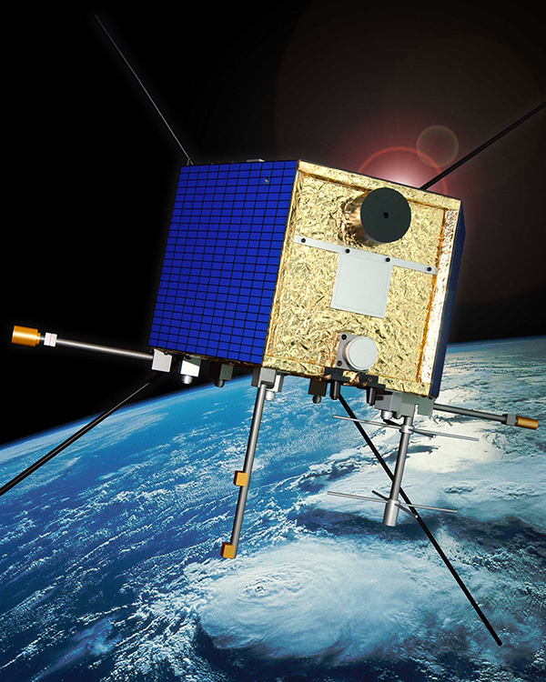
CAScade, Smallsat and IOnospheric Polar Explorer (CASSIOPE) is a made-in-Canada small satellite from the Canadian Space Agency. It is comprised of three working elements that use the first multi-purpose small satellite platform from the Canadian Small Satellite Bus Program. Image Credit: Canadian Space Agency
To look at irregularities in the ionosphere, researchers used data from the Canadian Space Agency satellite Cascade Smallsat and Ionospheric Polar Explorer (CASSIOPE), which launched in September 2013. The satellite covers the entire region of high latitudes, making it a useful tool for exploring the ionosphere.
The data come from one of the instruments on CASSIOPE that looks at GPS signals as they skim the ionosphere. The instrument was conceived by researchers at the University of New Brunswick.
“It’s the first time this kind of imaging has been done from space,” said Attila Komjathy, JPL principal investigator and co-author of the study. “No one has observed these dimensional scales of the ionosphere before.”
The research has numerous applications. For instance, aircraft flying over the North Pole rely on solid communications with the ground; if they lose these signals, they may be required to change their flight paths, Mannucci said. Radio telescopes may also experience distortion from the ionosphere; understanding the effects could lead to more accurate measurements for astronomy.
“It causes a lot of economic impact when these irregularities flare up and get bigger,” he said.
NASA’s Deep Space Network, which tracks and communicates with spacecraft, is affected by the ionosphere. Komjathy and colleagues also work on mitigating and correcting for these distortions for the DSN. They can use GPS to measure the delay in signals caused by the ionosphere and then relay that information to spacecraft navigators who are using the DSN’s tracking data.
“By understanding the magnitude of the interference, spacecraft navigators can subtract the distortion from the ionosphere to get more accurate spacecraft locations,” Mannucci said.
Other authors on the study were Richard B. Langley of the Geodetic Research Laboratory, University of New Brunswick, Fredericton, New Brunswick, Canada; and Olga Verkhoglyadova and Mark D. Butala of JPL. Funding for the research came from NASA’s Science Mission Directorate in Washington. JPL, a division of the California Institute of Technology in Pasadena, manages the Deep Space Network for NASA.