Tag: Kenya

  • IBM advances geospatial AI to address climate change

    IBM advances geospatial AI to address climate change

    Image: IBM/NASA
    Image: IBM/NASA

    IBM, a global technology provider, has released its latest geospatial artificial intelligence (AI) initiative to address climate change. These efforts involve collaborations across various regions and uses advanced AI models designed for geospatial applications. 

    Central to these initiatives is IBM’s geospatial foundation model, developed jointly with NASA. These models aim to generate environmental insights and solutions related to climate change. Unlike traditional AI models, these use a vast amount of climate-relevant data to accelerate the analysis of various environmental aspects that are affected by climate change. 

    “AI foundation models utilizing geospatial data can be a game-changer, allowing us to better understand and address climate-related events with unprecedented speed and efficiency,” said Alessandro Curioni, IBM fellow and vice president of Accelerated Discovery. 

    Analyzing urban heat islands in UAE 

    IBM and the Mohamed Bin Zayed University of Artificial Intelligence (MBZUAI) have partnered to map urban heat islands in Abu Dhabi using a fine-tuned version of IBM’s geospatial foundation model. The goal of the project is to understand the impact of local landscapes on temperature anomalies, the company said. The initial results show a decrease in heat island effects, which can provide valuable insights for future urban design strategies. 

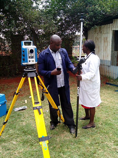
    Reforestation and water sustainability in Kenya 

     In partnership with Kenya’s Special Envoy for Climate Change, Ali Mohamed, IBM is supporting the National Tree Growing and Restoration Campaign. The initiative aims to plant 15 billion trees by 2032, particularly in critical water tower areas affected by deforestation. IBM’s geospatial model powers a digital platform to track tree planting activities, aiding local efforts in restoring forests and measuring carbon sequestration impact.  

    Elevating climate resiliency in the UK 

    In collaboration with the Science and Technology Facilities Council (STFC) and Royal Haskoning DHV, IBM is developing AI-driven tools for climate risk assessment in the UK. These tools will focus on assessing weather impacts on aviation operations, the company said. Additionally, the TreesAI research project aims to map areas suitable for tree planting to mitigate surface water flooding and offer urban developers a digital planning platform.  

    IBM extends collaboration with NASA for weather forecasting 

    IBM and NASA have partnered to develop an AI foundation model dedicated to weather and climate applications. The collaboration aims to enhance the accuracy and speed of weather forecasting, predict wildfire conditions and understand meteorological phenomena. IBM researchers will work closely with NASA to train and validate this model, IBM said.  

  • ComNav helps bring GNSS benefits to Africa

    ComNav helps bring GNSS benefits to Africa

    ComNav Technology Ltd. is providing GNSS technology to Africa for projects in land mapping, continuously operating reference station (CORS) construction, precision agriculture and other fields, according to a Feb. 11 article in People’s Daily, the largest newspaper in China.

    Every day, thousands of users in Africa are using GNSS products, the newspaper stated, highlighting specifically the use of China’s BeiDou satellite navigation system. For instance, CORS using ComNav GNSS/BeiDou receivers have been built in 11 sub-Saharan African countries, including Kenya and Uganda.

    Uganda. To meet the demand for high-precision GNSS, the government of Uganda purchased ComNav’s real-time kinematic (RTK) receivers to build its own CORS. Thirty stations have been built so far, creating the most advanced CORS network in East Africa. Its high-precision spatial and temporal information supports land mapping, mining, vehicle management and meteorological monitoring, among other industries.

    In 2015, Mulindwa David, chairman of the Uganda Surveying Association, and others visited the Shanghai headquarters of ComNav to learn about its high-precision products and technologies. After training, David and others mastered basic RTK operation and learned simple maintenance.

    David used to carry heavy optical equipment every day, but now he only needs to hold a BeiDou receiver to process the relevant data, which has greatly improved his work efficiency and accuracy. “It took at least three days to survey a dozen kilometers of road with optical equipment,” he said. “With BeiDou high-precision receivers, only 10 hours is enough.”

    The Uganda CORS network. (Image: ComNav)
    The Uganda CORS network. (Image: ComNav)

    Burkina Faso. In response to the COVID-19 outbreak, the Burkina Faso government decided to build a hospital for infectious diseases. In April 2021, it used ComNav GNSS high-precision technology to provide survey data for the hospital’s construction. The land security and topographic surveying tasks were completed in six days, half the time scheduled, said Augustin Bamouni, secretary-general of the country’s national surveying association.

    A surveyor in Burkina-Faso surveys the site of a new hospital for infectious diseases. (Photo: ComNav)
    A surveyor in Burkina-Faso surveys the site of a new hospital for infectious diseases. (Photo: ComNav)

    Tunisia. The China-Arab BeiDou/GNSS Center is located in the Ghazara Science Park in northern Tunis, the capital of Tunisia. Inaugurated in 2018, it is China’s first overseas BeiDou center, providing satellite navigation training, test evaluation and technical research for African and Arab countries. On average, the center receives real-time data from more than 12 BeiDou satellites at once.

    The center will help Tunisia and other African countries train professionals in GNSS technology to support development of the digital economy, according to Amiri Khalil, state secretary in charge of scientific research at Tunisia’s Ministry of Higher Education.

    China-Arab Beidou/GNSS Center is in Tunis, Tunisia. (Photo: ComNav)
    China-Arab BeiDou/GNSS Center is in Tunis, Tunisia. (Photo: ComNav)

    China-Africa Forum. The first China-Africa BeiDou System Cooperation Forum was held in November 2021 in Beijing to encourage cooperation between China and Africa and promote use of BeiDou. Four cases from ComNav Technology were described in the forum’s document citing application scenarios of BeiDou in Africa.

    ComNav Technology has deepened its cooperation with Africa since China’s Belt and Road Initiative began in 2013. Besides providing products and technologies, ComNav arranged employees to go abroad to provide technical support, traveling to Cameroon, Nigeria, Mali, Zambia, and other African countries. Despite the pandemic, ComNav continues to provide professional service and training both in person and remotely.

  • Seen & Heard: White giraffe, approaching iceberg

    Seen & Heard: White giraffe, approaching iceberg

    “Seen & Heard” is a monthly feature of GPS World magazine, traveling the world to capture interesting and unusual news stories involving the GNSS/PNT industry.


    Photo: Lukassek/iStock/Getty Images Plus/Getty Images
    Photo: Lukassek/iStock/Getty Images Plus/Getty Images

    The light at the end of the tunnel

    The city of Prague started testing a system of GNSS repeaters to prevent the loss of satellite signal in the city’s tunnels. The system, which should make life easier for drivers who rely on car navigation technology, is being tested in Prague’s Blanka tunnel. If it proves successful, the municipality wants to install the devices in other strategic locations around the city, especially at intersections as well as tunnel entries and exits.


    Photo: A. Ellis/USGS
    Photo: A. Ellis/USGS

    On the hot spot

    While permanent monitoring receivers are scattered about Hawaii’s active volcano sites, additional GPS receivers are being deployed during the ongoing eruption of Kilauea. In this photo taken Dec. 21, 2020, a Hawaiian Volcano Observatory geophysicist deploys receivers on the caldera floor in Hawai‘i Volcanoes National Park to measure changes in ground motion. The gas plume from the summit eruption within Halema‘uma‘u crater is visible in the background.


    Photo: Ishaqbini Community Conservancy
    Photo: Ishaqbini Community Conservancy

    Last but not least

    The last white giraffe known in existence now sports a GPS tracker, reports BBC News. The male giraffe has a rare genetic trait called leucism that causes the unusual color. The giraffe was tranquilized in November and the tracker placed on one of its horns. Tracking will help protect it from poachers as it grazes in Kenya’s savannah near the Somalia border. The white giraffe is alone after a female and her calf were killed by poachers in March 2020, according to Ishaqbini Hirola Community Conservancy.


    Photo: British Antarctic Survey/ESA
    Photo: British Antarctic Survey/ESA

    The biggest loser

    In July 2017, an iceberg more than twice the size of Luxembourg broke off Antarctica’s Larsen C ice shelf and began traveling the Southern Ocean. Looming in its path is South Georgia Island, home to numerous species of wildlife threatened by the massive iceberg, designated A-68A. Europe’s Copernicus Sentinel satellites observed pieces breaking off of A-68A in December, each large enough to receive its own designation.

  • Kenya maps mines with Correlator3D

    The Kenyan government will be using SimActive’s Correlator3D to map mining activities. The software will be used to generate orthomosaics, contour lines and digital terrain models of fluorspar mines in the Kerio valley in Kenya.

    The Directorate of Resource Surveys & Remote Sensing (DRSRS) under the Ministry of Mining in Kenya chose the software.

    “The DRSRS provides the Ministry of Mining with spatial information, processing hundreds of images to visualize settlements affected by mining activities to advise the Government of Kenya on compensation plans,” said Charles Situma, deputy director of the project. “SimActive’s availability of experts internally allows us to receive tailored solutions to our requests, further expediting our processing.”

    “We are proud to have Kenya as another of our many government users,” said Dr Philippe Simard, President of SimActive. “Correlator3D provides the diverse tools and processing power required for intensive mining applications.”

  • Kenya Land Survey Efforts Aided with Spectra Precision Equipment

    Kenya Land Survey Efforts Aided with Spectra Precision Equipment

    Photo: Kenya Department of Surveys The Kenya Department of Surveys has acquired eight Spectra Precision Focus 30 total stations and an additional eight Epoch 50 GNSS receivers as part of an ongoing major effort to adjudicate land and prepare deeds, according to Spectra Precision.

    Until recently, 67 percent of Kenya had yet to be adjudicated even as the work was supposed to be completed within 20 years after it was commissioned in 1957 by the British colonial government, according to the Lands Cabinet Ministry of Kenya. To rectify the problem, the government of President Uhuru Kenyatta two years ago began a major new push to produce three million titles by 2017. So far, the Land Surveys Department reports that 800,000 title deeds had been prepared and are being distributed.

    Oakar Services Ltd., an East Africa geospatial firm, provided the consulting services that led to the Department of Land Survey’s purchase of the Spectra Precision total stations and GNSS receivers.

  • On the Edge: Making Peace: Surveyor’s GPS Device Serves as Mediator in Kenyan Land Dispute

    By Noah Kertich

    Early morning on February 2, 2011, I went to work in my job as a road surveyor in the Bungoma District of Kenya. Here, land disputes are common, though the government is trying to reduce the conflicts by issuing land titles and certificates.

    I carried with me a small handheld GPS, the Magellan Explorist 100. While I was using it, a stout man in early fifties approached me and introduced himself as a surveyor, too. He was very interested in the way I was walking around with the “gadget,” trying to locate a control point. He asked me how the gadget worked. I explained it to him, showing him how its easy to use in general boundary surveys. He was satisfied, and we exchanged contacts and parted.

    A month later, he called me for help. When I asked him what was wrong, he told me there were a group of land owners, or members, who were about to kill each other in a dispute over a 128-acre farm they had bought. These members had each contributed money to buy a single parcel with the intention of subdividing it fairly. They were engaged in a disagreement about the boundaries and the subdivision of the farm. The gentleman asked me if I could take a survey of the farm sometime in the next few days. Concerned about the conflict, I answered, “Yes, in hours not days.” Still, it wasn’t until two days later that he could assemble the members of the disputed farm and called me to mark the boundaries for them.

    I arrived at the farm with my Magellan GPS and my laptop. To my dismay, I found that some of the members were armed with crude weapons, ready to fight each other. I asked them to be peaceful and wait for just a few hours while I surveyed the site.
    I started picking the boundary corners of the farm all around the permiter. I was through with that task in less than 35 minutes. This parcel of land was to be divided into 18 pieces. I uploaded the data manually to my laptop, then I did the subdivision using AutoCAD Land Development 2000.

    After two hours and fifteen minutes, I called the members and told them to ready themselves to be shown the boundaries of their property.

    I walked around the property with them, guided by my handheld GPS, to each boundary beacon. After one and a half hours, the warring members were shaking hands and laughing, saying “So, it was that easy!”

    The dispute had ended, and was solved peacefully. My small Magellan Explorist 100 acted as a peace mediator.


    Noah Kertich is a surveyor with H Young Construction EA Ltd., which is under contract with the World Bank in conjunction with the government of Kenya. Kertich graduated from the Kenya Institute of Surveying and Mapping in 2004 and received a diploma in photogrammetry and GIS from Icaros Geosystems, Israel, in 2008.

  • On the Edge: Sharing GNSS Wealth

    Workshop participants from Cote d’Ivoire and Kenya assemble a Mindstorm robot to trial autonomous navigation.
    Workshop participants from Cote d’Ivoire and Kenya assemble a Mindstorm robot to trial autonomous navigation.

    By Patricia Doherty

    Last year I helped coordinate a three-week workshop for 50 scientists from 15 African countries, introducing the basics of GPS for applications with socioeconomic benefits and scientific exploration. Held in Trieste, Italy, the workshop was quite successful, producing new initiatives on the African continent. We repeat the workshop next month, 
April 6–24, again in Trieste.

    Since the 2009 training, regional GNSS workshops have taken place in Nigeria, Egypt, Kenya, and Ethiopia. We have initiated scientific collaborations with universities in Nigeria, Kenya, Zambia, Egypt, and Uganda, deploying GPS receivers at each institution, with the understanding that the data will ultimately be shared within Africa and the world.

    This effort is a way to share with Africa and Africans the wealth that GNSS has brought to the developed world.

    Africa’s 2006 Science and Technology Plan of Action states Africa’s commitment to develop and use science and technology for socio-economic transformation and full integration into the world economy. The leading problems that continue to cripple much of Africa include hunger, extreme poverty, erosion of natural resources, and natural disasters. GNSS can help address these problems and ultimately meet the plan’s goals. Specifically, GNSS applications can increase food security, manage natural resources, provide efficient emergency location services, improve surveying and mapping, and provide greater precision and safety in land, water, and air navigation systems. GNSS also has applications in scientific study including space weather, geophysics, geography, geology, ecology, and biology.

    Workshop participants included professors and graduate students from Cote d’Ivoire, Egypt, Ethiopia, Ghana, Kenya, Morocco, Nigeria, Uganda, and Zambia. The more than 25 lecturers came from the United States, Europe, and Africa.

    Edge-2The workshop integrated formal lectures with hands-on practice in GNSS architecture, signal structure, hardware design, state-of-the-art applications, and scientific exploration. An on-site computer laboratory enabled participants to perform positioning calculations; use mapping and surveying software; plan a precision farming procedure; and analyze atmospheric and ionospheric data — all from GPS measurements. In addition, participants built Lego Mindstorm robots to demonstrate autonomous navigation.

    One of the benefits of this program was that scientists and engineers from the United States had opportunities to discuss common interests with African scientists and engineers. Many research programs utilize GPS ground- and space-based measurements. Unfortunately, studies over the African region have not been possible due to the lack of dependable long-term measurements. This workshop opened the door to establishing a base of measurements for joint studies with our African colleagues.

    Many lecturers remarked that this was the most enriching teaching experience of their careers. The African participants said that they learned a great deal and were very appreciative of the opportunity to participate in this program.

    Workshop sponsors include Boston College’s Institute for Scientific Research (where I work), the Abdus Salam International Center for Theoretical Physics in Trieste (where my colleague and workshop co-director Sandro Radicella is head of the Radiopropagation Laboratory), Institute of Navigation, Federal Aviation Administration, Air Force Research Laboratory, National Aeronautics and Space Administration, United Nations Office for Outer Space Affairs, National Science Foundation, Trimble, and NovAtel.

    To learn more about the workshop, participate, or contribute, please contact Patricia.Doherty @ bc.edu