The importance of sensors, whether they be incorporated in cute dog robots or autonomous vehicles, is gaining more traction.
At September’s Custom Electronic Design and Installation Association (CEDIA) Expo, Sony Electronics President and COO Mike Fasulo told GPS World that its foundation sensors are going into autonomous vehicles, drones, agricultural solutions and other platforms.
“A lot of people also don’t know that more than half of the hardware in most smartphones is ours,” Fasulo said. “These sensors we are working on do things you and I can’t do. They can assess sunlight and darkness. They can put a safety cocoon around a vehicle.”
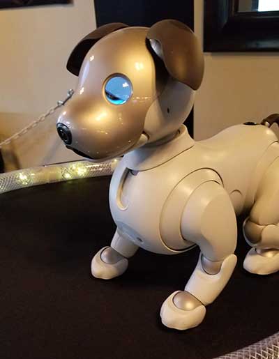
The Aibo robot dog uses artificial intelligence to mimic a real puppy’s behavior. (Photo: Kevin Dennehy)
At the conference, Sony displayed a nearly $3,000 Aibo dog robot, which has many of the same sensors that go into many of the company’s other products, including its venerable camera line. Aibo has facial recognition technology and uses artificial intelligence to mimic a real puppy’s behavior.
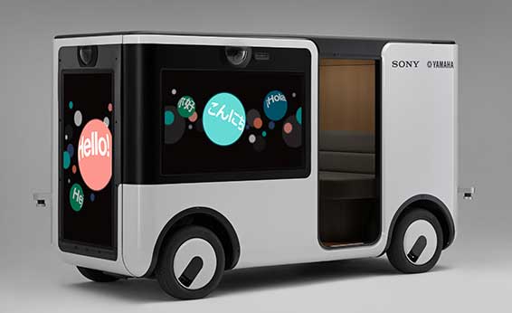
Sony sensors seem to be a cornerstone in several new announcements. Less than two months ago, Sony and Yamaha Motor Co. announced the joint development of the SC-1 Sociable Cart, a small autonomous vehicle that will be deployed to golf courses, amusement parks and commercial facilities, the company said.
The SC-1, which is not for sale, features five seats, replaceable batteries, front and rear scope of view thanks to image sensors, an innovative vehicle design, and other improvements over an original prototype vehicle.
In addition to the image sensors, the vehicle has ultrasonic sensors and a two-dimensional laser detection and ranging (lidar) system, the company said. These sensors allow the vehicle to gather cloud travel data for safe-driving analysis.
Sony is working with Japan’s NTT Docomo to test the vehicle’s 5G mobile technologies for remote-controlled functions, the company said.
Geotab leverages sensor data
Sony and Yamaha Motor plan to roll out the SC-1 later this year in Japan. (Photo: Sony/Yamaha Motor)
Canada-based Geotab has made big announcements this year, although the huge one is from the U.S. government to equip more than 200,000 vehicles with its telematics systems.
While that contract itself is massive, the company believes the more than 2 billion data points gathered each day, from millions of Geotab-equipped vehicles on the road, is the real valuable commodity.
The data gathered with the company’s connected-car technology can help companies and governments assess how their fleets are operating, said Mike Branch, Geotab vice president of data and analytics.
Branch, who leads a team of 40 employees, said the company uses the data to help cities assess road impediments — not only road quality. This includes analyzing ABS activation to look at black ice or other hazards. “While weather companies can only estimate conditions, we have sensors in vehicles that can give hyperlocal reports and ground truth,” he said. “People consistently slamming on their brakes in one area is an example [of aggregative data].”
Back in the day, which is less than 10 years ago, all that many companies expected from their fleet management systems was to let them know where their drivers were, by using GNSS and mapping technology. Today, the sensors — and data provided by them — allow managers to assess dangerous driving areas, save on fuel costs by rerouting trucks and compare routes throughout the United States, not just in big cities, Branch said.
In the smart cities space, Branch said that Geotab is working with municipalities for fuel intersection insight mapping. “This means if 20 vehicles, or even just two, are stopped at an intersection, our sensors can detect the wait times,” he said. “The big thing for us is looking at this smart-city deployment to leverage organic data in a private manner.”
Because of the nature of data procurement, privacy is big topic for the company, Branch said. “We treat it with high importance. Our view is that the data is owned by the customer,” he said. “They have full access to it. We will go through it, aggregately, so we can improve our customer’s experience.”
Keeping OBD port secure
The future of open on-board diagnostic (OBD) vehicles — and procuring secured and open data from them — is a concern for Geotab, Branch said.
“We have a full port safety committee with the goal of security and access to the port,” he said. “We believe in open access to this port. This gets to be a concern with mixed-fleet Fords, Mercedes, BMW and others as the data can slow down the port at any time.”
Branch said the company does not want to remove the entrepreneur, who is interested in working with the port in a safe manner. “We work with the OEMs on the future of telematics not just by pulling the data from our device, but pulling it from their feed,” he said.
Branch said that technology may make the port dongle obsolete in five to 10 years, but until then, the company has created an ecosystem to enable the use of the data. “There is going to be an aftermarket as cars are lasting an average of 11 years,” he said.
Barcelona’s Fira center hosted Mobile World Congress, a gathering of 105,000 industry participants.
By Kevin Dennehy Contributing Editor for LBS
The big takeaway from this year’s Mobile World Congress was the interest in location data from a growing number of vendors. Although still a small footprint in the cavernous halls of Barcelona’s Fira center, at least 33 companies displayed products and services related to indoor location, which was more than past years, said Bruce Krulwich, Grizzly Analytics founder and chief analyst.
“There are also more major multinational companies that are exhibiting indoor location, including Phillips, Panasonic and Cisco,” he said. “The growth in the area is clear.”
This year’s MWC also featured four different applications of indoor technology, Krulwich said.
“The MWC app included mapping and navigation based on Pole Star’s technology and also proximity marketing and notifications based on MOCA [customer engagement software],” he said. “The security staff had a security management system based on Situm technology,” he said. “The smart badges at the entrances used [Bluetooth low energy] to detect the phone moving through the turnstile.”
Rise of Ultrasonic
Ultrasonic sound was prominent, Krulwich said. “In the past there was a single company, MTI, using ultrasonic sound for positioning, but this year three new players are using ultrasonic: Marvelmind for highly accurate positioning, Yap for proximity and Prontoly for selective content and communication,” he said. “If the technology is effective in real-world deployments, it may be a big step forward in increasing accuracy using existing phone technologies.”
Modulated LED lighting, also known as visible light communication, is receiving more interest. “Phillips was demonstrating a solution in that space this year,” Krulwich said. “I2Cat also returned with an LED solution, and Oledcomm is a new entrant in that space.”
Although beacon prices have gone down, the key is indoor positioning’s scalability and solution maturity. “Many of the solutions shown at MWC addressed scalability, including Estimote with self-mapping beacons, indoo.rs with SLAM-based automated configuration and Situm with infrastructure-free positioning,” Krulwich said. “The solution maturity is evident from the number of full commercial deployments (not trials) by companies like Pole Star and indoo.rs,” he said.
Another trend is the increasing numbers of high-accuracy systems.
“Quuppa has shown highly accurate positioning at MWC for several years,” Krulwich said. “But this year they were joined by powerhouse Phillips and by newcomer Marvelmind. All three showed centimeter-level accuracy with very fast response, each with a very different technology.”
Samsung press conference had hundreds of journalists in attendance at MWC.
Indoor Location
The lack of indoor location vendor participation at January’s National Retail Federation BIG Show in New York is a cause for concern, Krulwich said.
“Indoor location has been expected to cross the chasm for years, and it’s still stuck among early adopters,” he said. “But recent improvements in accuracy and in the maturity of the solutions, with easier configuration and integration into back-end systems, should lead to more full commercial deployments and then larger adoption in retail. It is also important to note that retail is not the only application of indoor location. Asset tracking and customer analytics are both growing. We also see a growth in the number of companies developing practical solutions on top of existing technologies, such as MOCA, Qualigon and xAd.”
Quest for Data
Companies that aggregate location data found increased interest at MWC.
Teralytics, which processes data points using predictive algorithms, provides human behavior information based on location. The company is working with not only wireless carriers, but governments and others on smart-city initiatives worldwide, said Luciano Franceschina, Teralytics co-founder and CTO. “We are already working with different verticals, and not just the telco verticals themselves, who are using the location analytics. A top transportation planner in Germany scrutinized our system for a year and now uses it to plan and decide what infrastructure investments to make.”
The company is collecting billions of data points, and aggregating geolocation and demographics to assess human behavior globally. This allows a retailer to assess where to build the next store, or how much capacity a train line should handle. For municipal planners, the data shows what transit system stops are being used more than others, Franceschina said.
Virtual reality goggles were big again at MWC.
Other markets for Teralytics’ data are tourism, retail, hedge funds and automotive, said Lisa Peterson, Teralytics vice president.
“That could be location data that allows auto[makers] to use to see driver behavior,” she said. “A company like Marriott could see why their silver members aren’t upgrading to gold, because they can see their hotel usage patterns. The can see these consumer traits and target their members with better offers.”
The acquisition of location data is more reliable that research methods used by such companies as Gallup, which still uses phone surveys and other antiquated methods, Peterson said.
IoT Growing
Comtech Telecommunications showed off its Location Studio platform that allows customers to build or enhance cloud-based embedded and hybrid LBS applications. The platform includes modular suites with indoor and outdoor positioning, geolocation, fraud detection, maps, search, routing, navigation, real-time messaging and analytics, the company said.
The rise of Internet of Things (IoT) and location hasn’t surprised Comtech.
“My team moved into IoT because it’s impacting a lot of new areas,” said Keith Bhatia, Comtech senior vice president. “IoT objects come down to how cheap you can make the connection and make the device available during the early stages. The momentum is there.
However, the hype that every device will be connected is just not price feasible.”
Comtech is looking for that location price sweet spot when it comes to IoT, Bhatia said. “We are seeing a pull for cheap location. We are seeing significant strides from last year to this year.”
Location company PoLTE partnered with ACS at MWC. ACS will use PoLTE’s LTE-based location tracking to allow business in the manufacturing, industrial and transportation industries to track assets, goods, workers and devices.
PoLTE, which delivers location services both indoors and outdoors, said that while Wi-Fi, Bluetooth and GPS have deficiencies when tracking LTE devices, its system leverages native cellular signals to geolocate 4G and 5G devices. PoLTE uses an advanced radar location technique to transform reference signals in LTE transmissions into precise location.
The company started focusing on LTE positioning nearly seven years ago, said Russ Markhovsky, PoLTE founder.
“Customers are going to be able to embed the available service into platforms and devices next year,” Markhovsky said. “We are undergoing trials and proofs of concepts and are connected to wireless operator’s network test platforms.”
The location information derived from PoLTE’s network is valuable to retailers and others who track a consumer’s spending habits, said John Dow, PoLTE president and chief operating officer
“LTE works everywhere,” he said. “You can track a user’s behavior when they went to Walmart, then went home,” he said. “It’s not a Swiss-cheese approach, as there is persistent location information. Retailers can receive decision-making data that is valuable compared to what’s out there today.”
Other Tech Finds IoT Location Niche
Another technology that is gaining traction with IoT companies is low power, wide area (LoRa) that leverages time difference of arrival (TDOA) triangulation to calculate the position of a device. One company, France-based Actility, says the system works with three gateways that receive data from a device, timestamps it and forwards it to a geolocation solver.
The Actility network geolocation solver collects the timestamps to estimate the device’s position using triangulation. However, a precise time-synchronization mechanism, usually using GPS, is necessary to achieve nanosecond precision time measurement.
“The number of agriculture and tracking applications are growing [for LoRa technology]. We are showing its applicability around Barcelona with a geofence, without GPS, through TDOA time stamping through different gateways,” said Christophe Francois, Actility senior vice president, marketing and digital. “Actility provides a different type of location services in that companies sometimes don’t need to know when the asset is not moving. This might mean to see if an asset like valuable copper in a yard is still there. You don’t need GPS to do that.”
Data Playing Large Role in Fleet Market
Geotab sees continued growth in 5G rollouts and data as key drivers to its European fleet transport market strategy, said Colin Sutherland, Geotab executive vice president, sales and marketing.
“Telefónica has been a great partner here [in Europe]. We continue to try to keep a pulse on the market over here and evangelize our data-centric telematics and 5G enablement,” he said. “We are also very focused on cyber security to keep cars and trucks safe on the road.”
Sutherland says he believes 2019–22 will see continued growth in the fleet market, with focus on data.
“Back in the day, companies focused on either a diagnostic bundle, or a GPS-based [fleet management] bundle,” he said. “What will happen in our industry is a growth of bundled software. There will be a lot of data play with the new business models and suite-specific applications, including data sharing.”
Observations from MWC
Conference organizers estimated more than 105,000 attendees went to MWC this year. Last year, I said Barcelona was getting too small for the conference, which is has turned into a mini-CES. This year was slightly larger, with the requisite traffic jams, high taxi cab prices, crazy high hotel room prices, unreal crowds and lines. One organizer took offense to my criticism of this huge growth, saying that I had no solutions. Well, yeah, though I love Barcelona as a venue, maybe it’s time to move it to a larger city?
MWC touts itself as the mobile event of the year. Barcelona crows that it is the most tech-savvy town in Europe. How can that be if Uber and Lyft aren’t even allowed and the alternative is long lines with price-gouging taxis? As a reporter with Asian heritage, I get the business, literally, when I get into a cab (read: inflated prices).
The high cost of hotel rooms has forced companies to use Airbnb and other sites to get lodging. Sad thing is that lodging may be in Badalona or Sitges, which require long train rides and eat up precious conference time. Again, maybe it’s time to either move it, or talk to city officials about getting more rooms in town.
Despite all of my criticism about the show, it still is one where you can meet people, network and manage the huge halls, which are positioned in one large building. You can’t do that at CES anymore as meetings and exhibits are spread over the convention center and various hotels. You may never see an executive or contact again after one meeting at CES, but MWC still has the feel that you can still rub elbows with some of the bigwigs at either the Fira or offsite meetings and receptions.
Global navigation satellite system (GNSS) technology found its way into products ranging from autonomous vehicles to wearables at this year’s Mobile World Congress in Barcelona, Spain.
One company says it is tailoring a GNSS receiver chip to meet the demands of mobile devices that require high levels of speed and position accuracy. Thalwil, Switzerland-based u-blox said its new low-power UBX-M8230-CT GNSS receiver chip can not only be used for smartwatch development, but for tracking people, animals and assets.
“The highlight of the chip is that it has much better balance, while maintaining the accuracy of a traditional, full-power receiver,” said Florian Bousquet, u-blox market development manager. “It can work in the most difficult urban canyon environments. It works well in sports watches, smartwatches, activity trackers and other wearables — and just about anything portable that has a battery.”
Bousquet said the chip, in what the company calls a Super-E mode, uses GPS with either GLONASS or BeiDou. This mode allows batching location data on the chip, which reduces power consumption, he said.
Bousquet said the chip is available now, in an evaluation kit, for around $120. He said the chip will be manufactured in volume this summer.
It took u-blox a year-and-a-half to develop the GNSS chip, Bousquet said. “It took time for our development team to optimize the system and field test the infrastructure to make sure the product performed in different scenarios and environments.”
Another company, Racelogic, exhibited its LabSat 3 Wideband GNSS simulator, which is used by u-blox and others to help test and develop products. Some applications include drones, autonomous vehicles, survey equipment, personal monitoring devices, aerospace and end-of-the-line product testing, the company said.
The newer L2C, L5 and L1C signals give companies the opportunity to develop products that are compatible with new receivers as they come to market, said Mark Sampson, LabSat product/sales manager.
The company also showed off its SatGen v3 simulator software that allows users to create a data file to be replayed on the LabSat GNSS simulator. The software allows companies to define a complicated route, and then import it into the software.
Company tests eCall and ERA-GLONASS modules
Both the European Union (EU) and Russian Federation are requiring governments to have intelligent telematics-based safety systems. In case of a serious accident, these systems automatically call for local medical services.
Technology to meet the requirements of eCall and ERA-GLONASS include an antenna, GNSS receiver, crash sensors and other components.
To reproduce end-to-end and standard-compliant testing of the eCall and ERA-GLONASS modules, Rohde & Schwarz offers two products. One is the CMW-KA094 eCall application software. The other is the CMW-KA095 extension for ERA-GLONASS to simulate a public safety answering point (PSAP) to emulate a cellular network in a lab.
“It’s pretty important testing because of the safety of life. We have set up implementation of it in our labs,” said Christian Hof, Rohde & Schwarz senior product manager for mobile radio testers.
CMW500 simulator by Rohde & Schwarz. Photo: Rohde & Schwarz
During testing, governments and companies can use the CMW500 platform, which identifies Internet of Things (IoT) and mobile communications devices’ IP connection security issues, Hof said.
The company believes, since many IoT platforms are proprietary as standardization is still in progress, security gaps are frequently reported.
Spirent rolls out new simulator
Spirent Communications displayed its Elevate IoT Device Test Solution, a new cellular test designed to support IoT applications. These applications include end-to-end cloud server connectivity, security-vulnerability assessment and battery-life measurement.
The new unit is available through the company’s Spirent Elevate platform, which addresses areas affected when designing 3G, LTE and new narrowband wireless technologies for IoT devices.
Overall, Spirent is finding many use cases and applications in the IoT and mobile industry.
“We are finding that smaller companies developing software and services want to test GNSS, but don’t have the capabilities to do so. These could include small projects such as people and pet trackers,” said Simon Loe, Spirent’s head of marketing solutions and services. “We are trying to democratize the technology. Another trend we are seeing is growing importance on GNSS in network timing.”
Not everything is about drab simulation. Far from it. Spirent last year teamed with Aston Martin Racing to evaluate automotive technologies on the 2016 V8 Vantage GTE race cars.
This includes the accuracy and performance of GPS receivers and interference monitoring, said Julian Kemp, Spirent product manager, custom solutions.
Antenna market for IoT, autonomous vehicles robust
Taoglas is offering GNSS antennas that support IoT products, unmanned aerial vehicles (UAVs) and future autonomous vehicles, said Ronan Quinlan, company co-founder.
The company is offering lightweight antennas for mass-market unmanned UAVs, which had a growing presence at Mobile World Congress this year.
The future markets for Taoglas will be in connected and autonomous vehicles, Quinlan said. “We found out years ago that we missed out on the rise of 2G, but we did not miss the rise of 4G. The advent of 5G and GNSS will lead to the development of the autonomous vehicle,” he said.
Antenna costs associated with the rise of autonomous vehicles will have to be reduced, Quinlan said. “Some antennas that were $100 solutions have to go down to $20 solutions once they get into a car,” he said.
In other Mobile World Congress news:
Fraunhofer IIS displayed its Enhanced Voice Services (EVS), the Third Generation Partnership Project (3GPP) communication protocol designed specifically for voice over LTE (VoLTE) services.
Telit said it is expanding its relationship with Tele2 on Pan-European long-term evolution (LTE) IoT connectivity services. Telit and Tele2 now offer custom data plans with predictable pricing, no hidden fees or roaming charges for high bandwidth IoT applications, the company said. Services include video monitoring, digital signage or real-time asset tracking.
A: Similar to airplanes with an autopilot feature, the key issues that must be addressed in autonomous vehicles are redundancy and reliability of systems and appropriate, timely signals to the operator. One key area where this is required is the location of the vehicle. Autonomous location systems have to take into account areas where GPS works fine — but may suffer from an outage — and where GPS does not work, such as in urban canyons.
Jane Macfarlane Chief Scientist, Head of Research HERE
A: Autonomous vehicles face two key challenges. The first is enabling the vehicle to see beyond its sensors. Autonomous vehicles are composed of two functions: sensing the local environment and controlling the vehicle to operate in the sensed environment. This model must be extended to include the larger environment using cloud-delivered map information informed by a connected vehicle fleet. The second is building intelligence that allows autonomous vehicles to share the road safely with human drivers.
A: The development of autonomous vehicle sensors, artificial intelligence and software is advancing rapidly. Technology is being tested in open-road environments — and in bad weather. Component costs are falling as technology companies and automakers eye specific rollout dates. What could slow this developing industry is bad press, and the resulting government regulation, from a high-profile cyber security breach or an incident like a partially autonomous car getting into a fatal crash.
In what was 2015’s largest location-industry deal, three German luxury auto manufacturers completed the purchase of HERE. But that wasn’t the only recent acquisition as location-based services provider TeleCommunication Systems, or TCS, was bought by Comtech Telecommunication Corp. Both deals indicate the growing, and continued growth, of location services going forward into 2016.
Three German automakers are now in the location business following the finalization of a $2.8 billion deal to buy Nokia’s HERE digital mapping company last week. Audi, BMW and Daimler are now equal owners of HERE following quick regulatory approval.
While some say there was much Nokia-driven hype about who was bidding on HERE, including Uber and Baidu, ultimately others breathed a sigh of relief that automotive companies, not Google, bought the digital mapping pioneer.
The deal, which was originally announced in early August, shows the continued value of accurate maps to the automotive industry as it transitions for connected to autonomous vehicles. In addition, the number of big suitors interested in HERE shows the rise in the potential and real market for location-based services in both smartphones and connected vehicles.
Many of the early suitors balked at HERE’s early price tag, estimated to be more than $4 billion. Uber, which some felt would be a good match for HERE because of their autonomous vehicle intentions, decided to go in another direction, buying mapping company deCarta.
While it’s too early to analyze the consequences of the deal, some analysts say it will be interesting to see if the new owners keep the mapping giant neutral to not alienate future clients.
It remains to be seen whether its competitor, TomTom, which also has been talked about as an acquisition target, should stay as an independent company or form its own consortium.
Nokia purchased HERE, the former Navteq, for $8 billion in 2007. The sale of HERE is part of Nokia’s transformation as it completes its $16.6 billion acquisition of Alcatel-Lucent, which is expected to close early next year.
In another big deal since our last column, Annapolis, Md.-based TeleCommunication Systems was acquired by Comtech Telecommunication Corp. for $430.8 million deal. The deal is expected to close in March 2016.
TCS was one of the first companies to do it all in the consumer location space, buying entities in automotive navigation and also making inroads in the fleet management and indoor positioning/9-1-1 space. The company most recently was developing location technology for mobile, or m-health markets.
Cyber Security Big Connected Vehicle Concern in 2015
As we review the past year, one of the biggest connected vehicle trends in 2015 was when cyber security became real for the automakers, said Jon Allen, Booz Allen Commercial Solutions principal.
“Just as automakers are increasingly demonstrating the power of automation, their momentum is challenged by researchers showing they really can hack into vehicles. While there are engineering challenges ahead to realize the full potential of autonomy, the priority in automotive is to protect the trust of customers and regulators as autonomous capabilities are further developed,” he said. “That puts cyber at the top of the agenda.”
2016, OEMs will need to further embrace a security mindset, Allen said. “These [cyber risk] issues are solved by designing, engineering and testing your vehicle to meet defined standards. But cyber risk has an outside variable you can’t control: cyber threat actors. This means you’re not just engineering a solution — you’re fighting an adversary,” he said.
Allen said that automakers need to identify a single leader to champion vehicle cyber security, supporting them up with an integrated, cross-functional team. “That includes experts from safety, privacy, IT, legal, engineering, manufacturing, customer service and supply chain,” he said.
Autonomous vehicles tout a safety record that far surpasses today’s cars, but a cyber incident has potential to reverse that claim, Allen said. The “doomsday” scenario is attacking multiple vehicles over the air to “brick” multiple platforms, but this may be an unlikely near-term scenario, he said.
“The near-term attacks will be motivated by money. That’s why many of the largest hacks were designed to exploit personal and financial information,” Allen said.
At a Colorado Space Roundup meeting in Denver last week, Thad Allen, former Coast Guard commandant and now executive vice president at Booz Allen Hamilton, said that there won’t be a “cyber Pearl Harbor” as the government and civilian entities should have had plenty of warning it was coming. Allen, who was in Denver working on the GPS Operational Control System, or OCX, also said that it would be catastrophic if the GPS infrastructure was compromised.
“If someone does something to disrupt GPS, it will affect everyone,” said Allen, who oversaw the Hurricane Katrina and Deepwater Horizon oil spill operations.
Indoor Positioning’s Big Story in 2015: Consumer Appliances?
While there were several significant tests and infrastructure rollouts, at least one analyst says the rise of indoor positioning in consumer appliances was huge. Bruce Krulwich, Grizzly Analytics founder, said that such companies as Move ‘n See are putting location chips into electronic devices.
Move ‘n See also has a camera robot, called Pixio, which follows a person moving around a sports field or other indoor site. “What’s huge about this is not the product itself — it’s hard to tell whether it will appeal to the masses or only a niche market–but I believe that it’s the first in a new trend of electronic products that enhance their capabilities by incorporating indoor location technology,” he said.
In other location news:
CalAmp Corp. said it made a $113 million offer for LoJack Corp., which is a pioneer in car theft-recovery using location technology. According to published reports, CalAmp has made three cash offers for Lojack in the past 14 months. LoJack’s car recovery systems use location technology, which seems to be a great fit for CalAmp, which offers fleet tracking software.
It’s been a good run. After eight-and-a-half years, this is my last Wireless LBS Insider column. Many thanks to Alan Cameron and Tracy Cozzens, both seasoned journalists, who steered me on the right course over the years. I will be at CES in a freelance role next month and will continue to operate my autonomous vehicle conference, Driverless.
Reasons Cited Include Privacy, Lack of Retail Support
Kevin Dennehy
Google Here, a proposed beacon-based location service operating within Google Maps, was reportedly cancelled due to a concern by Alphabet CEO Larry Page’s that it would be too invasive by the users of his mapping service. When the location industry has such a dominant player pull out of a nascent, and potentially lucrative, proximity service, does it mean that consumers will now have to wait for a full-scale rollout? Google will remain a major player with its Google Maps app, but where does it go from there?
Citing privacy issues and lack of retail partners for support, Google scraped its Google Here location service that would have used the company’s Maps technology to send notifications to users when they entered a specific location.
In a recent Fortune article, Alphabet CEO Larry Page said the company killed the project because it was too invasive to consumers, and the company was uncertain whether retail partners could have helped to roll out the service. Besides being in conflict with an existing location Here name (such as the former Nokia, and now German consortium, mapping service), the service included partnerships with retailers — and would have been available to more than 350 million Android users earlier this year.
Google makes money off of advertising through its Maps app, but the Fortune article said that the proposed Here location service would have made it even more valuable to advertisers.
So what does the location industry make of one of the largest players not rolling out a location service? To at least one analyst, it’s a “so what” report considering Google in July rolled out a new agnostic beacon service called Eddystone. “Somewhat curiously, the company appears to be moving forward with location-based advertising under the guise of the Eddystone project, so beacons and their use in location-based advertising seem still of interest — just not beacons combined with messaging that might make Google Maps an uncontrollable nag about shopping opportunities,” said Mike Dobson, Telemapics president.
Eddystone, a new format for Bluetooth Low Energy beacons, works with Google’s Android operating system along with Apple’s iOS and other platforms that connect through BLE.
Overall, Dobson believes that Google is approaching middle-age in terms of corporate development. “It is both developing a conscience about how its services really operate, as well as imposing economic constraints limiting how much the company is willing to spend to determine whether a potential market might be a big hit,” he said. “More specifically, it is my opinion that Google is slowly reining in the spending on new innovations for Google Maps, as well as the expenses associated with supporting the lakes in the data reservoir associated with their mapping product. Google may have finally realized that maintaining spatial data is expensive and a cost that is never going to decrease.”
Dobson also said that the Google Here program was going to be an expensive proposition. “My understanding of the Google Here program was that Google would provide the beacons and infrastructure and control delivery of the service through Google Maps. That’s a lot of beacons and associated support — in other words, more money,” he said. “Conversely, Eddystone appears to offer a standardized, industry-supported approach that is beneficial for Google and companies interested in testing the concept.”
Dobson said the name “Here” could have caused problems for Google. “Two other issues crossed my mind when I heard the news of the cancellation. First, who at Google forgot trademark law and thought they could combine the name of the well-known mapping company Here with Google?” he said. “Second, if I owned an application as successful as Google Maps is on mobile phones, I sure would not want to push my users to consider switching to a less-invasive mapping app. You know, that Larry Page guy sure seems to know his Alphabet.”
Big Competitors Getting into Beacons, with Huge Market Expected
Recent Allied Business Intelligence reports indicate that BLE beacon shipments will exceed 400 million units by 2020. While optimistic, and only five years away, ABI said that pure beacon shipment revenues will break $1 billion this year.
Google’s July entry into the location-beacon space is significant, if not surprising, to heat up the location market. However, competition is fierce as Apple, Facebook and Twitter now have dedicated BLE resources.
The location-beacon market is heating up as Gimbal, the Qualcomm spin-off company, installed approximately 1,300 BLE beacons in areas at South by Southwest. Gimbal said it was making its technology available to enable any BLE device to act as a dedicated location beacon.
Google plans to improve its own products and services through the Eddystone beacon technology, according to a company blog. Earlier this year, the company launched beacon-based transit notifications in Portland that enable users to get faster access to schedules for specific locations.
With rise in commercial location-based beacon technology comes a cross-over movement in public safety markets. TeleCommunication Systems, which bought Loctronix in July, is developing the indoor public safety and emergency market, along with Longmont, Colo.-based Intrado.
As detailed in last month’s Wireless LBS Insider column, beacons and Wi-Fi seem to be the lead technologies in use for emergency indoor location. Intrado installed 65 Apple iBeacons at the Washington Convention Center to showcase its developing indoor positioning technology at the APCO trade show.
It’s not all about beacons in this proximity/contextual location market. The analytical data derived from the beacon information will grow into a huge market. As we reported this summer, a new location analytics product is hitting the market in a more and more crowded indoor-positioning field.
Such companies as Cloud4Wi, with its Fogsense product, is tailored to retail outlets, coffee shops, restaurant chains and shopping malls with presence analytics and location-based services.
The device, which contains Broadcom’s WICED chip, features BLE technology in the new version in (the fourth quarter), said Elena Briola, Cloud4Wi’s chief marketing officer. The new BLE version will enable Apple iBeacon and location-aware mobile applications, the company said.
TCS’ Matt Vincent poses with public safety gear that includes Taoglas Storm Antenna at APCO.
It is refreshing to see nascent technology such as indoor location being used to enable accurate emergency services response. That’s what’s going on right now as beacons, Wi-Fi and other technology that works inside, where GPS doesn’t work, is being tested nationwide by companies hoping for government adoption. With new FCC regulations that are finally trying to keep up with commercial location products, it may be a reality soon. What really drove location into wireless handsets was the 1990s FCC regulations — will they now drive indoor positioning?
GSI Labs’ John Martin holds indoor beacon at APCO.
WASHINGTON — The same technology that allows consumers to find products indoors will allow emergency personnel to locate people in trouble in the coming years, said officials at the Association of Public-Safety Communications Officials (APCO) annual meeting here, held Aug. 16-19.
Companies are using existing commercial technologies, also used by retailers to determine customer preferences, to provide indoor location in combination with the National Emergency Address Database. This provides public-safety answering points, or PSAPs, accurate addresses and positions to dispatch emergency services to allow first responders to find people on specific floors and in rooms, not huge areas.
Beacons and Wi-Fi seem to be the lead technologies in use for emergency indoor location. Longmont, Colo.-based Intrado installed 65 Apple iBeacons at the Washington Convention Center to showcase its developing indoor positioning technology.
“Old 9-1-1 technology was just a dot on the map. Now people are saying, ‘how can Starbucks can find me, but 9-1-1 can’t?’” said John Snapp, Intrado senior technical officer.
Another company, TeleCommunication Systems, is getting into the indoor public safety market with its LocatE9-1-1 product that leverages the company’s indoor location engine, or ILE. The ILE connects to multiple databases that can be used during a 9-1-1 call to determine what location information is available for the wireless device.
“Deep inside buildings, location technology often fails us. Sometimes emergency workers have to rely on verbal information [from people at the scene],” said Tim Lorello, TCS senior vice president and chief marketing officer. “We are a location aggregator. However, we do know location won’t be deployed everywhere, but there are multiple technologies tied to Wi-Fi hotspots, barometric pressure and Bluetooth.”
In addition to government agencies, wireless carriers are taking notice of the indoor positioning capabilities for public safety. At APCO, GSI Labs, a 20-year-old business, was in the AT&T booth displaying its codeBlue-911 beacon system. “We think that for bigger venues such as warehouses and stores, this is a great public safety tool. The [Bluetooth Low Energy] beacons have about 20-to-50-foot accuracy, depending on the battery,” said GSI Labs’ John Martin. “A security company is looking at using the beacons to monitor employees during the night.”
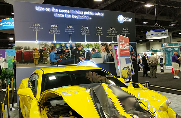
OnStar booth features wrecked car to portray emergency messaging capabilities at APCO.
FCC Still at Forefront of Location Accuracy Requirements
In an address at the conference, FCC Chairman Tom Wheeler said that the agency has taken steps to increase the reliability of the nation’s 9-1-1 system. “Uber can pinpoint [a potential customer]. We won’t tolerate 9-1-1 failures,” said Wheeler, who also called for a national maps database.
Some people newer to the location industry don’t remember it was the enhanced 9-1-1 FCC rules that drove the installation of GPS into cell phones in the mid-1990s. In several presentations at APCO, it was noted that more than 80 percent of all emergency calls are made with a wireless device, not landline.
The FCC announced new rules this year that require wireless operators to provide dispatchable location within 50 meters with these new deadlines and conditions: 40 percent of all wireless 9-1-1 calls within 2 years; 50 percent within 3 years; 70 percent within 5 years; and 80 percent within 6 years.
If anyone doesn’t think the FCC is the 800-pound regulatory gorilla for location, then they have missed the LightSquared GPS signal interference saga. According to published reports, LightSquared has hired Reed Hundt, former FCC chairman, as an attorney representing the company.
LightSquared, which is trying to emerge from bankruptcy, has been seeking FCC approval to transfer its spectrum licenses to its new entity. The company is trying to see if the GPS interference issues can be resolved.
In other APCO news, Time Machines rolled out its TM 2000A timing device that costs $499.95. The big deal about the timing device is the price — which has many of the same features that competitors offer for more than $5,000, said Doug Ehlers, Mindshare by CSS president, a sister company of Time Machines, who also said the company is expanding its distribution in Europe.
Gimbal Partners with Do It Outdoors Media
While emergency networks are getting big, the commercial networks are continuing to make inroads with advertising agencies and partners. Location and proximity-based marketing company Gimbal recently partnered with Do It Outdoors Media in a deal that will use Gimbal’s beacon technology.
Gimbal said that Do It Outdoors Media, which is the largest national mobile billboard and field marketing company, will create a smartphone campaign that provides proximity-based consumer offers to opt-in users.
Beacons will be placed in Do It Outdoors Media’s mobile billboard units, which are owned and operated by the company. In addition, there will be product placement on Segways, jet packs, brand ambassador teams and other marketing sites.
Gimbal says that when a consumer enters into a beacon zone, which is effective from 50 meters away, content will be delivered through a push notification within an advertiser’s or a third-party mobile app.
In other location news:
While a small trade show for a focused group of government communication professionals, APCO drew 5,700 attendees, with 282 exhibitors. Conference organizers said it was the highest attended show in seven years.
An updated version of the former GPS-Wireless conference will take place Dec. 2-3 at the Crowne Plaza San Francisco Airport Hotel. The conference, Location IoT, will focus on new markets for M2M and the Internet of Things. Topics will include indoor location markets, connected vehicles and many others. Two hosted networking receptions are included. Contact me, Kevin Dennehy, at kdennehy @g psworld.com for more information.
The value of accurate maps is not lost on the automotive industry as it transitions from connected cars to automated vehicles. Three German automakers are rumored to be making a multibillion-dollar investment in Nokia’s HERE mapping division. If the deal goes through as expected by late July, Nokia, which purchased HERE (then called Navteq) for $8 billion in 2007, will have spurned several deep-pocket suitors.
Although not officially confirmed, Nokia’s HERE digital mapping service is set to be purchased by a German auto consortium of Daimler, BMW and Volkswagen’s Audi unit, according to published sources.
Estimates of the deal place it in the $2.7 billion to more than $3 billion range. The potential sale puts to rest industry concern that Google or another giant non-automotive entity would make the winning bid for a company with increasing importance to connected and autonomous vehicles.
Either way, it’s too early to analyze what exactly are the consequences if the German consortium closes the deal with Nokia, said Thilo Koslowski, Gartner vice president and analyst. “In order to justify the purchase price of the acquisition, it will be in the interest of any acquiring party to keep Nokia HERE’s future role as neutral as possible in order not to alienate other clients,” he said. “I could imagine that contractually the acquiring party might be tied to serving these other clients for a least a certain time. If that doesn’t happen, and the deal would be ‘exclusive,’ then it would certainly boost the appeal of other map data providers and encourage new players to emerge.”
If the deal goes through, the German consortium plans to invite such other automotive companies as Fiat Chrysler, Ford, Renault, Toyota and General Motors, according to the Wall Street Journal.
Another take on the potential agreement could be whether car companies have to weigh the pluses and minuses of to join the consortium — or map competitor TomTom needs to consider whether it has more to gain from remaining independent or creating its own consortium, said Roger Lanctot, strategy analytics associate director, global automotive practice.
Industry old-timers may remember the bitter rivalry between Navteq (formerly Navigation Technologies) and Tele Atlas (formerly Etak). This rivalry has remained, even though the names have changed and the location industry has evolved dramatically since 2007, when both Navteq and Tele Atlas were bought by Nokia and TomTom, respectively, in multibillion-dollar deals.
The bidding war for HERE began in April, when Nokia purchased Alcatel Lucent to transition from the location industry. In addition to the German auto consortium, Uber and Chinese technology provider Baidu, Google and Apple were said to be potential buyers. However, Google’s purchase of HERE would have been disruptive to the auto industry, Lanctot wrote in a LinkedIn column. “Google buying HERE would drive the entire industry into the arms of TomTom while removing the leverage-ability of a map duopoly. Google buying both TomTom and HERE would annihilate billions of dollars in research and development activity by car makers seeking to create a truly driver-oriented browsing experience intended to enhance safety,” he wrote.
Mike Dobson, TeleMapics president, who writes about digital maps at www.telemapics.com, recently said that Uber was playing with fire by bidding on HERE because they were clearly concerned about autonomous vehicles. “Within 10 years, Uber will be producing its own fleet of [autonomous vehicles]. While owning a map company might be beneficial to them, they might be better off licensing map databases,” he said.
Uber, which bought mapping company deCarta and Microsoft’s Bing Maps, ultimately withdrew from the bidding war for Here.
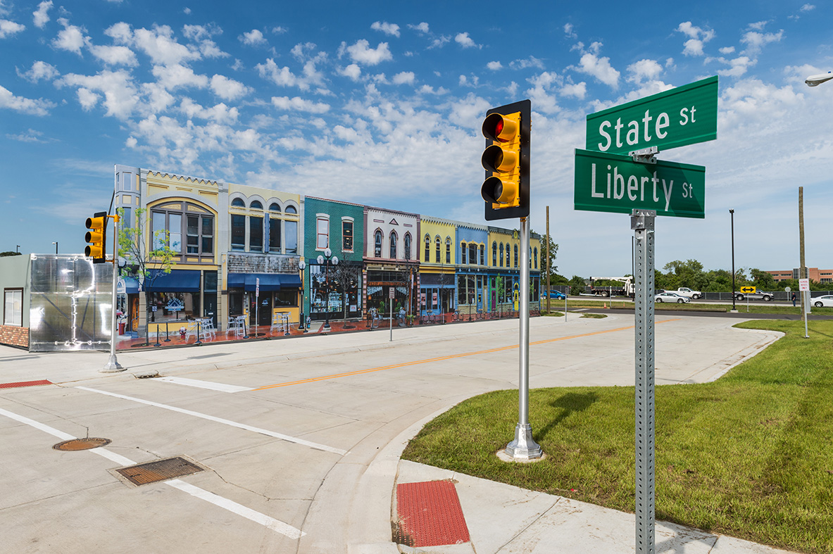
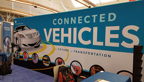
City Built for Autonomous Testing Unveiled in Michigan
A 32-acre simulated city recently opened to test how self-diving cars will perform in the future. The $10 million facility, called Mcity and located on the north campus of the University of Michigan, was created by the school’s Mobility Transformation Center and the Transportation Research Institute.
With all the bells and whistles — a bridge, a tunnel, traffic circle, etc. — the facility will rival anything existing, if it hasn’t already surpassed it, in Silicon Valley or Pittsburgh, which seem to be the centers of gravity for the nascent autonomous vehicle industry.
Mcity, which was a government-industry partnership, plans to “lay the foundations for a commercially viable ecosystem of connected and automated mobility,” said a university press release. [Editor’s note: It is refreshing to see the “commercially viable” thrown in there by an academic institution.]
Another key goal is to implement a connected and automated mobility system on the streets of southeastern Michigan by 2021. The MTC is developing deployments of more than 20,000 cars, trucks and buses across southeastern Michigan, serving as testbeds for evaluating consumer behavior and exploring market opportunities, the university said.
At the same time as the Mcity announcement, also in Ann Arbor, the Automated Vehicle Symposium, which is the largest autonomous vehicle conference, was being held at a local hotel. While the conference had such keynote speakers as Google’s Chris Urmson, and sponsors that included Denso and Uber, it still has the feel of this government/academic/technical conference — not unlike TRB or ITS America.
In fact, like many government meetings, the afternoon “breakout sessions” were closed off to the press. This leads to the question, with so many new, and expensive, autonomous vehicle conferences springing up, why isn’t there a single panel on the future worldwide market opportunity?
In other location news:
IndoorAtlas signed a $3 million deal with South Korea’s SK Planet, a subsidiary of SK Telecom, to target the e-commerce market. IndoorAtlas’ investors include ST Planet and Chinese technology provider Baidu, which made a $10 million investment in the company.
Nokia’s HERE mapping and location services business is developing a new global standard for contactless transport ticketing payments using Near Field Communications-enabled mobile phones. HERE announced the formation of the Open Mobile Ticketing Alliance, or OMTA, to help consumers purchase public transit ticket using a mobile app.
HERE competitor TomTom continues to be a major force in vehicle monitoring and location, recently announcing its telematics division broke 500,000 subscribers. Overall, the company serve 36,000 customers, primarily in the European fleet market.
Chris Urmson, Google, speaks at ITS America on the future of the self-driving car.
Plus: Resurgence in indoor location-based marketing, ITS America annual meeting report
Autonomous vehicle technology has made industry-smart people pause and think what the consequences will be if cars and other platforms drive themselves. Will there be a huge increase in traffic when everyone decides to call their cars to grab a loaf of bread at a store? Many of these topics were discussed at the ITS America annual meeting held in Pittsburgh May 31-June 3. In other location news, there seems to be a resurgence in location-based marketing and indoor positioning conferences, leading one to believe that large retailers are finally taking notice.
By Kevin Dennehy
Kevin Dennehy
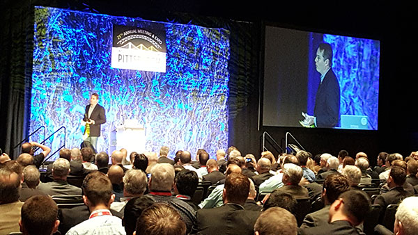
PITTSBURGH — Chris Urmson, Google’s self-driving cars director, told autonomous vehicle proponents what they wanted to hear during his keynote presentation at the recent Intelligent Transportation Society of America’s annual meeting here. He told them that self-driving vehicles will cut down on the 33,000 U.S. traffic deaths each year (“the equivalent of a 737 falling out of the sky five days a week,” he said) and save time and productivity wasted.
Urmson also said his goal, and his team’s goal, at Google was to ensure son doesn’t have to get a driver’s license, a trend that has become popular with urbanized youth.
The message was upbeat and timely for the crowd of government and university transportation attendees. However, liability issues continue to surround autonomous vehicle development.
“In the end, you are always going to have that guy with the ’57 Chevy in his garage. How do you make the autonomous vehicle work with it? It’s akin to the horse and car,” said Ken Leonard, U.S. Transportation Department ITS Joint Program Office director.
Urmson said he has had “long conversations with insurance companies.” He said that insurance companies are trying to accurately assess risk, and while the model may change, money will still flow, just through a different path.
One ITS America panel discussed security and privacy issues surrounding connected and autonomous vehicles. One panelist said that while privacy may be dead, security is the real big deal with recent reports indicating that cars’ electronics can be compromised.
Others believe it’s going to take more time than Google’s assertion that autonomous vehicles will be on the road in five years. “Lessons from the past temper our optimism. While air bags were patented in 1953, and were introduced on luxury models in the 1970s, it wasn’t until the 1990s before there were big penetrations,” said James Anderson, Rand Corp. senior behavioral scientist. “Key takeaways are automaker opposition about the liability [of new technology] and lack of consumer support.”
The ITS America show floor before the crowds arrive.
Anderson said that yes, the lives saved will be a big driver of autonomous vehicles, but congestion will increase, making way for super commuting. “Public transit will also go through big changes. An economic disruption will occur — do you know how much New York City makes from parking alone?” he said. “Safety doesn’t sell in the early stages, as many benefits don’t go directly to the user.”
Steve Bayless, ITS America vice president of technology, said the solution is not to kill all the lawyers, as there will be continued liability surrounding new in-car technology. “Embedded devices were developed at a time when they were not connected, but the environment has shifted around systems,” he said. “The systems are usually vulnerable because there are poor requirements. Companies have no explicit security policy, or it is poorly specified, or specified too late after design and development.”
Uber Gets Into Autonomous Game
The ITS America’s closing keynote speaker was Uber’s head of global public policy, Corey Owens, who said that one of the best cases for autonomous vehicles was the lack of use by consumers of their cars. “In some areas, owning a car is non-negotiable. But how little these cars are used — as many as 95 percent stand idle,” he said.
Uber announced that Google former head of mapping, Brian McClendon, is joining the company as it develops its own navigation, mapping and transportation systems.
It’s no secret that Uber is targeting continued autonomous vehicle interest, as it created an Advanced Technologies Center in Pittsburgh. It was also rumored that it was a bidder, with Baidu, to buy Nokia’s HERE digital mapping company. (See more on Baidu in Janice Partyka’s June blog.)
One major company trying to find its way into connected vehicles, Xerox, exhibited at ITS America in the show’s Entrepreneurial Village. Xerox has installed its smart parking products in such systems as LA Express Park, ParkyIndy and others.
Xerox has partnered with the University of Michigan Transportation Research Institute in Ann Arbor for testing connected and autonomous vehicles. The company is working with automotive OEMs on electronic tolls, parking, mobile payment and other projects, said David Cummins, Xerox senior vice president and managing director of parking and mobility solutions.
The U.S. Department of Transportation booth at ITS America focused on the connected car.
Cummins moderated a panel where small companies talked about new technologies and applications like cities without bus stops where a bus is continually moving to the riders on demand.
In terms of autonomous vehicle use, Cummins envisions an increase in ride-sharing over the next 5-10 years in urban areas. “Initially, there will be a spike in congestion [from autonomous vehicles]. But ultimately, there will be less car ownership,” he said.
Thoughts on ITS America’s Annual Meeting
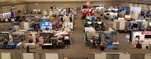
ITS America celebrated its 25th annual meeting in Pittsburgh to an enthusiastic crowd of 2,000 attendees and 125 exhibitors. However, I am not sure if this conference has grown at all, despite claims it had the largest attendance last year (co-located with the larger, and more private-company-friendly, ITS World Congress in Detroit).
Despite two decades of rhetoric that it is a private-public partnership, the meeting has the feel of a government and university gathering with a few private companies thrown in who want to do business with them. This is a sad thing, as ITS America has embraced the future of autonomous vehicles with excellent speakers.
Having the meeting in the Bay Area next summer will be a good start to altering the perception that ITS America’s annual meeting is just a government show to “show-the-flag” for private companies.
Mid-Year Report on Indoor Location
Earlier this month, executives attended the Place Conference in New York to get an update on indoor location markets and technology for store chains, large department stores and malls. It was also a chance for technology vendors to show new capabilities that have recently reached the market, said Bruce Krulwich, Grizzly Analytics president, who has authored a report on 150 indoor positioning companies.
Krulwich said, as the year reaches it’s the halfway point, new and more accurate systems are hitting the market. “This includes LED lighting-based systems from Acuity and GE Lighting, and proprietary radio technologies from companies like Quuppa, all of which deliver accuracy of around 10 centimeters with very fast response,” he said. “Some companies, including New York-based Spreo, are improving the quality using standard approaches, like beacons and motion sensing. They are achieving strong accuracy and responsiveness through software improvements. At the same time, hardware-based indoor location technologies, such as Ireland-based DecaWave’s chip and other UWB systems, are coming to market inside highly innovative consumer devices.”
Going forward, the biggest challenge is moving from the lab to the real world, Krulwich said. “Deployments such as Game Stop stores and Taubman malls are great moves in this direction,” he said.
In other location industry news:
Note to meeting organizers: Do your due diligence to ensure conference dates don’t overlap. Having two major transportation conferences on the same week was challenging to attend: ITS America Annual Meeting and Telematics-Detroit.
The brass at Nokia continue to court a consortium of German car makers to buy its HERE navigation business, according to Bloomberg. The consortium, which consists of Audi, BMW and Daimler, is hung up on the price tag of $4.5 billion — and the deadline for bidders has passed, according to the story.